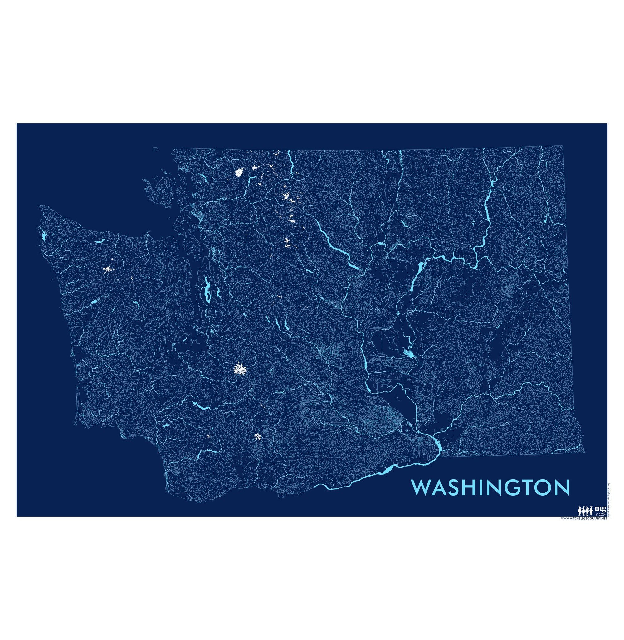
Washington Rivers (19 x 13 inch)
$24.00
13 inch by 19 inch flat wall map, printed on heavy fine paper. Packed and shipped flat.
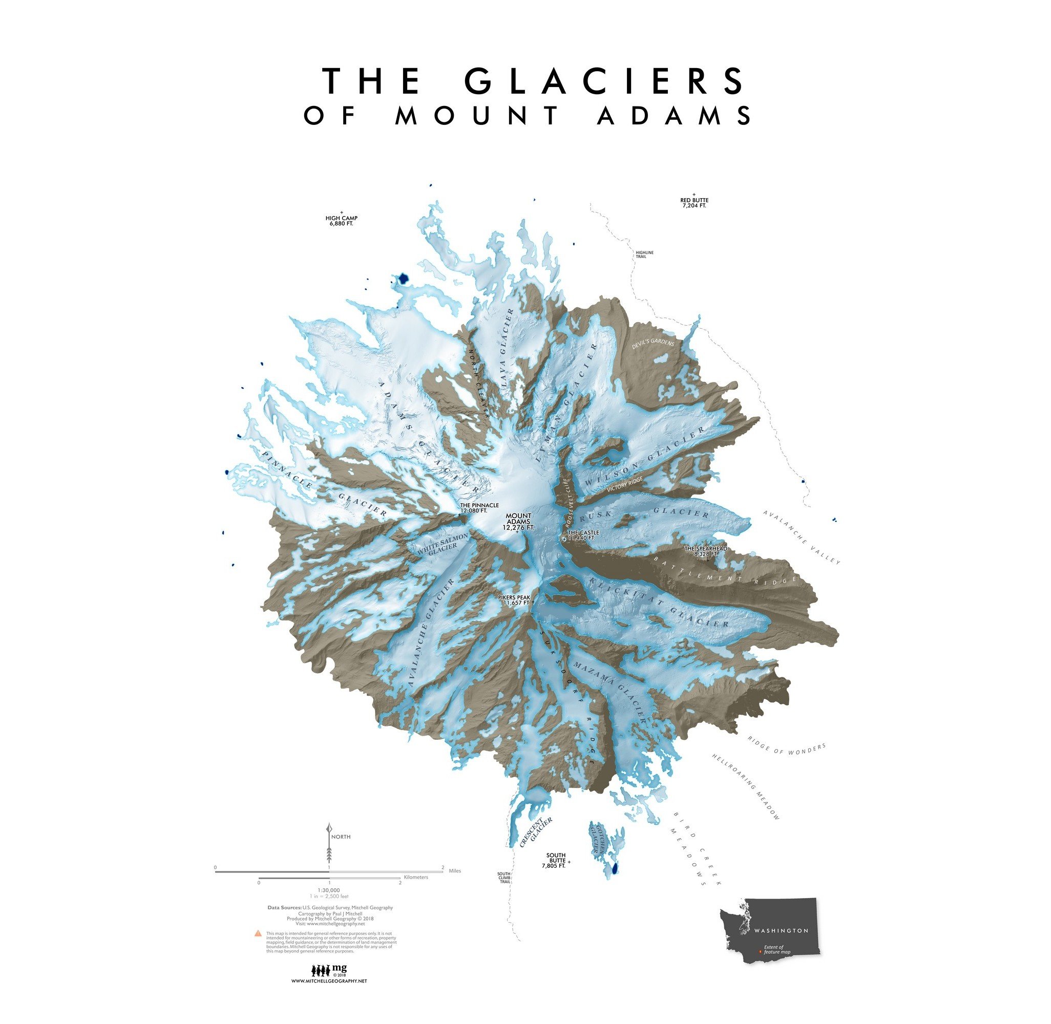
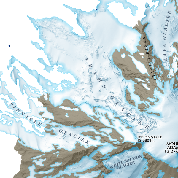
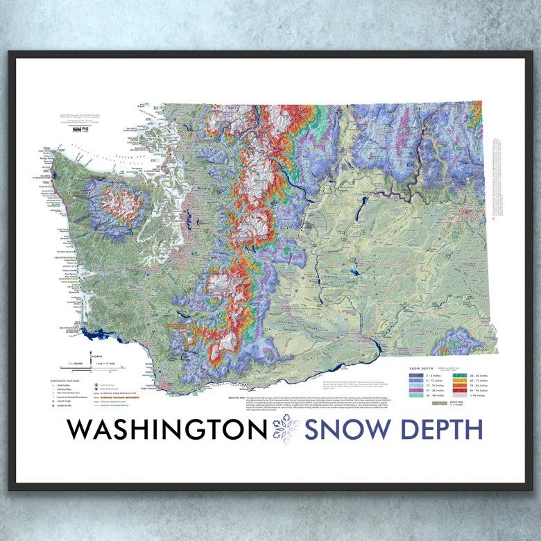
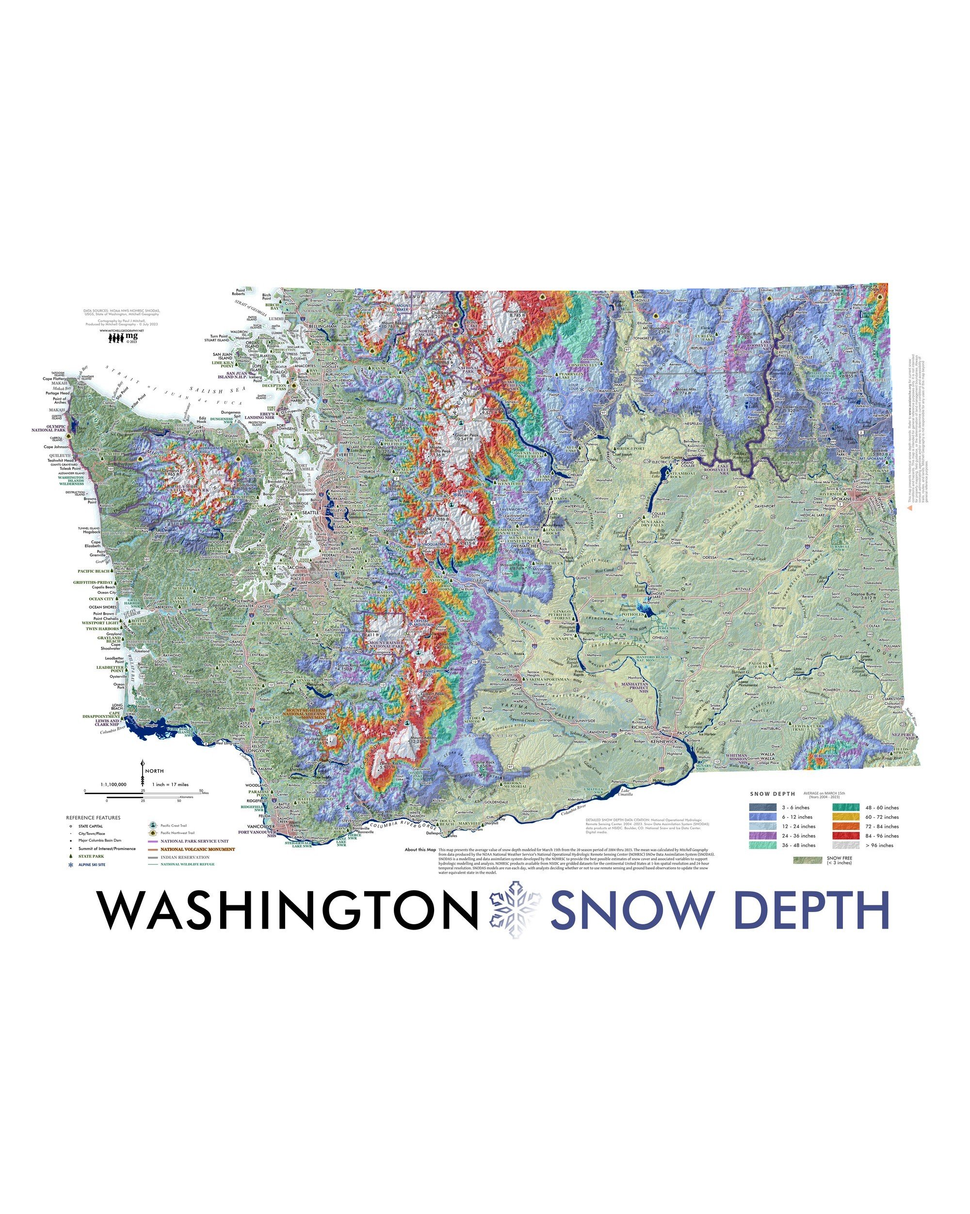
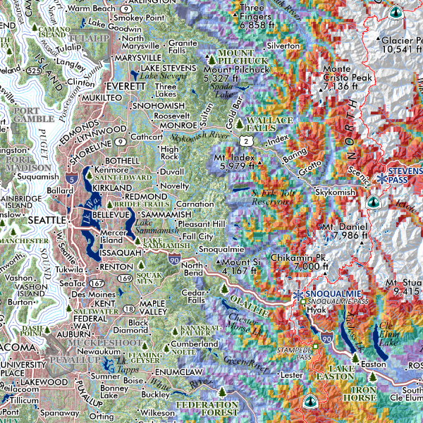
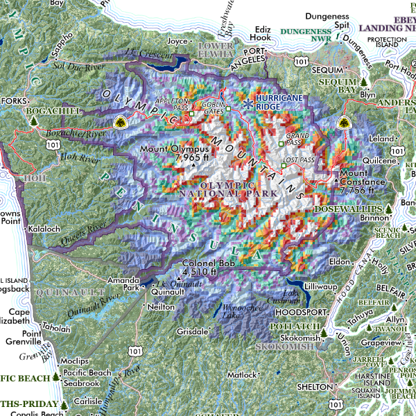
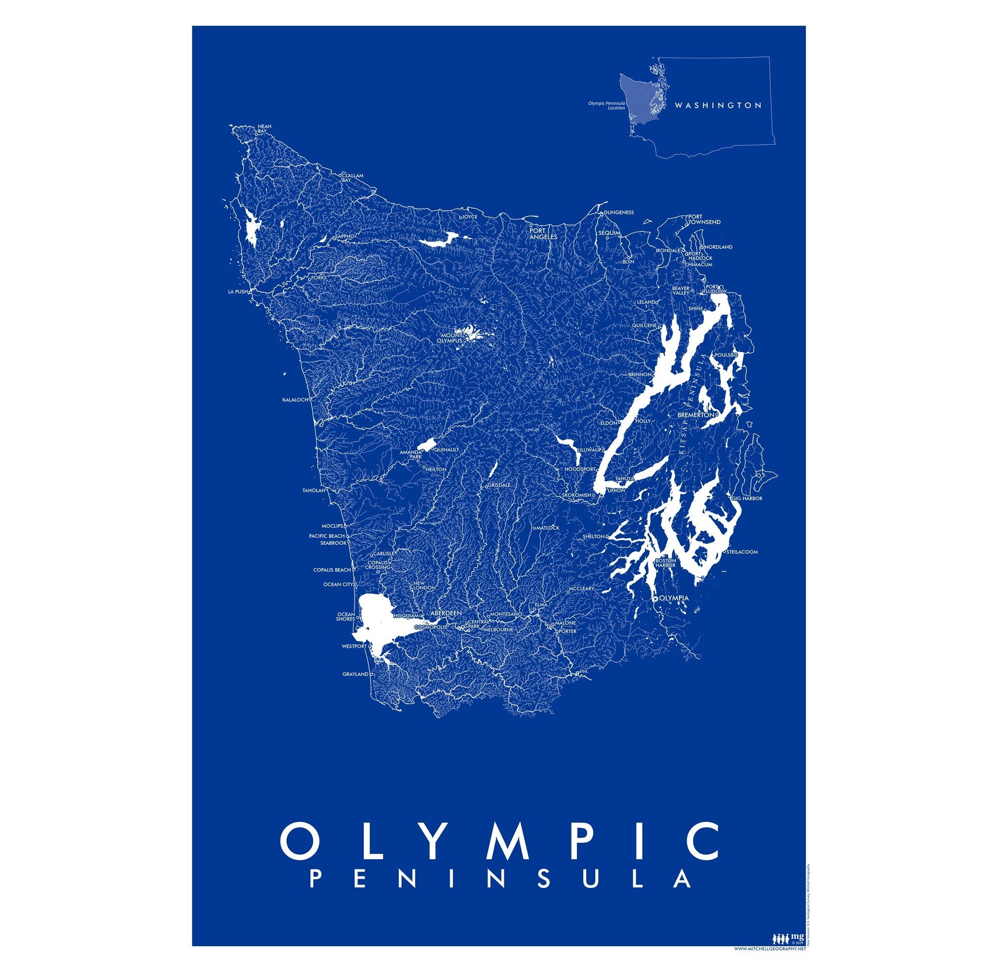
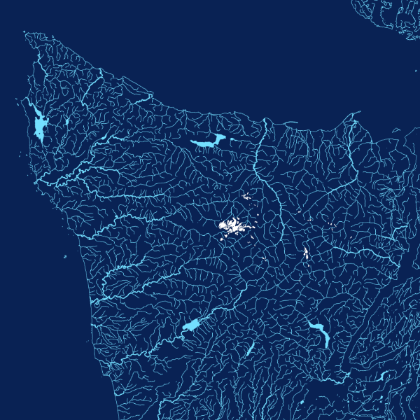
Washington State Rivers. Small surface hydrology graphic map including rivers, streams, lakes, reservoirs, and glaciers/snowfields (in white).
Quantity:
13 inch by 19 inch flat wall map, printed on heavy fine paper. Packed and shipped flat.
Washington State Rivers. Small surface hydrology graphic map including rivers, streams, lakes, reservoirs, and glaciers/snowfields (in white).

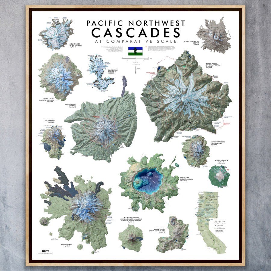
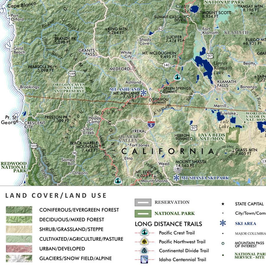
PNW Cascades (24 in x 20 in)
$34.00
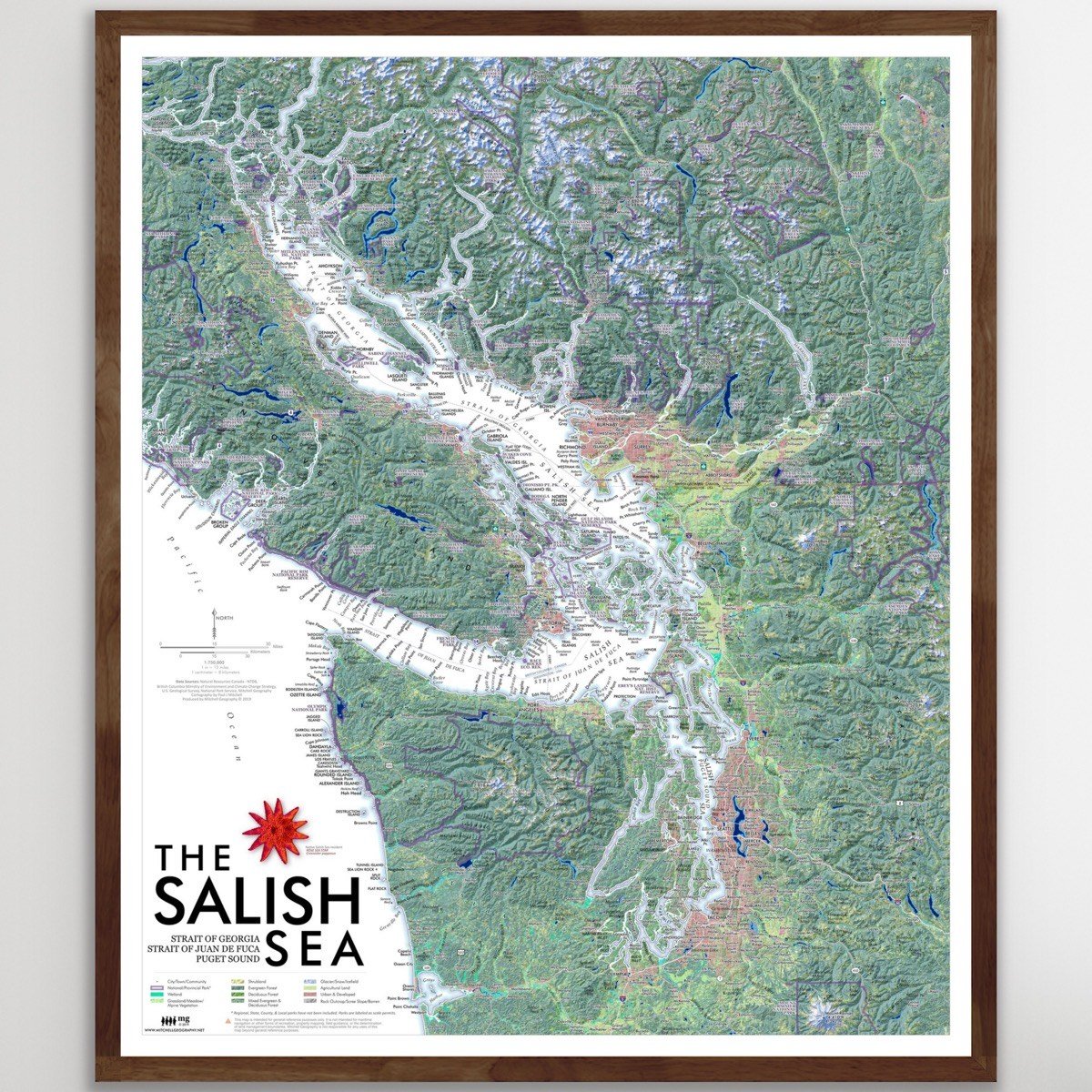
Salish Sea (24 in x 20 in)
$34.00
13 inch by 19 inch flat wall map, printed on heavy fine paper. Packed and shipped flat.
Washington State Rivers. Small surface hydrology graphic map including rivers, streams, lakes, reservoirs, and glaciers/snowfields (in white).