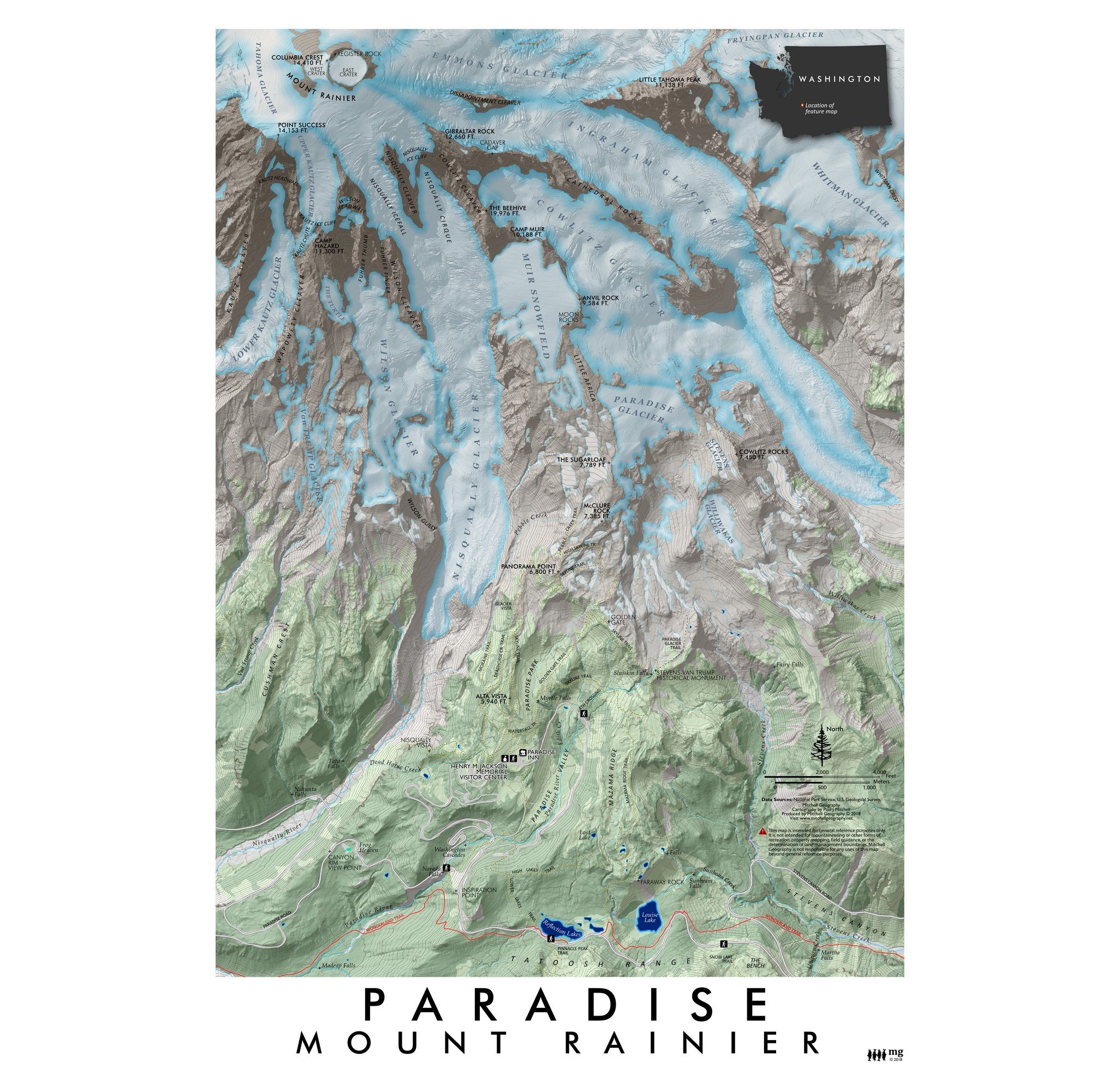
Image 1 of 5
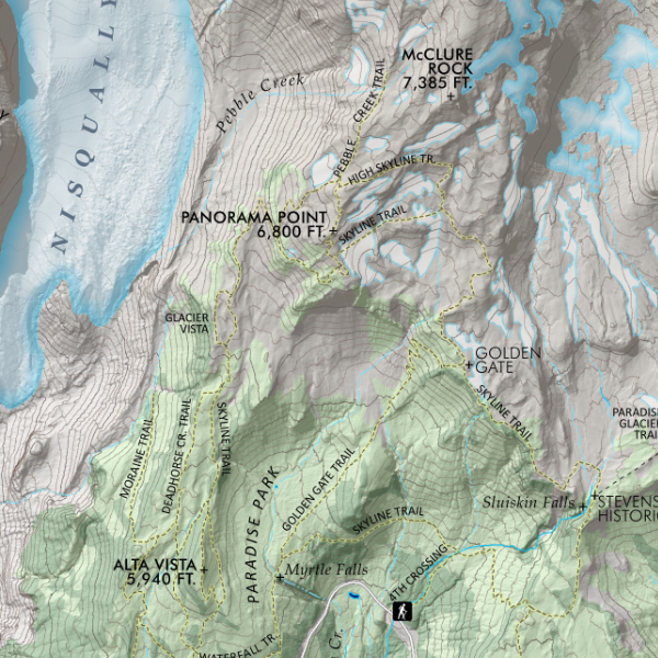
 Image 2 of 5
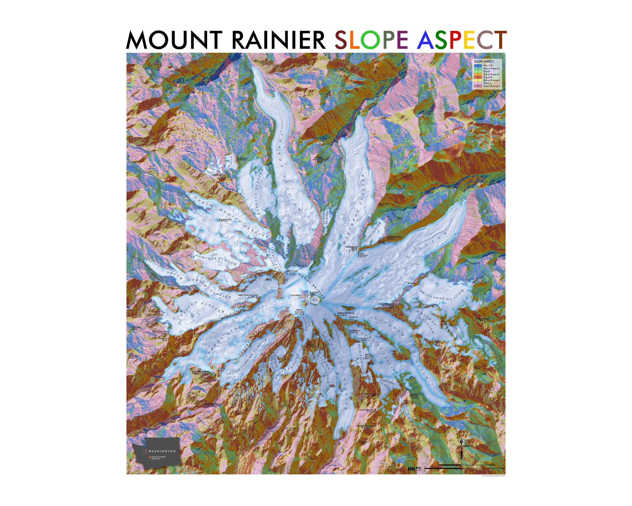
 Image 3 of 5
 Image 4 of 5
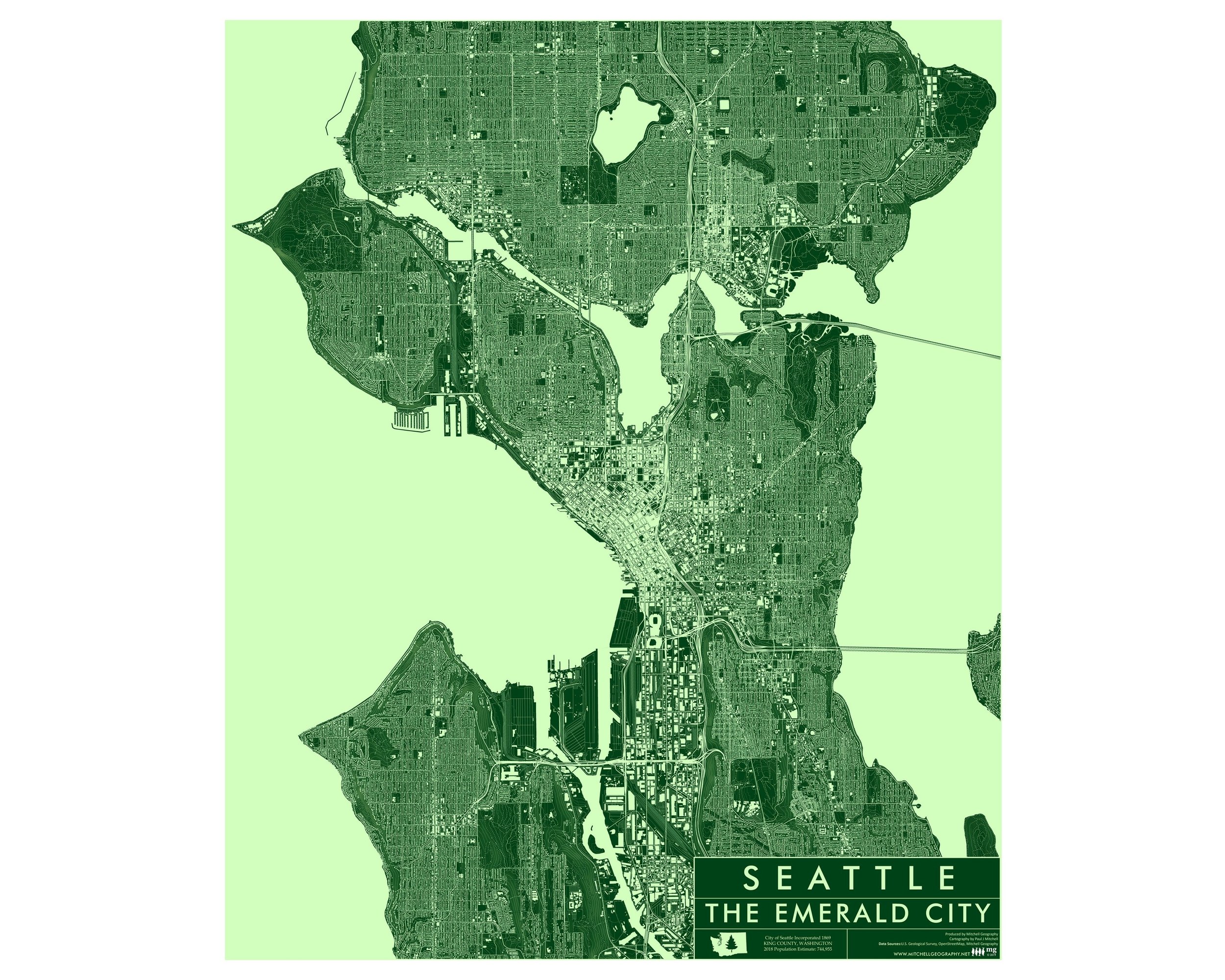
 Image 5 of 5
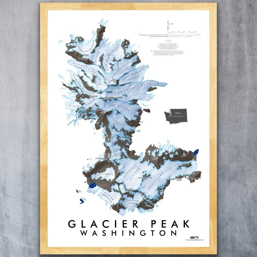
1:72,000
13 inch by 19 inch flat wall map, printed on heavy fine paper. Packed and shipped flat.
Feature vicinity map of the North Cascades Mount Baker (Komo Kulshan) and Mount Shuksan landform complex. Summits, glaciers, USFS trails, trailheads, lakes, rivers/streams, and the Mount Baker Ski Area features (lifts/slopes) are included for reference. Hannegan Pass Trail is the uppermost extent (top of page) while Schriebers Meadow is at the bottom. Map is rotated 53 degrees to fit these features within a portrait printing format. North is generally toward the upper left corner.