
Featured Products
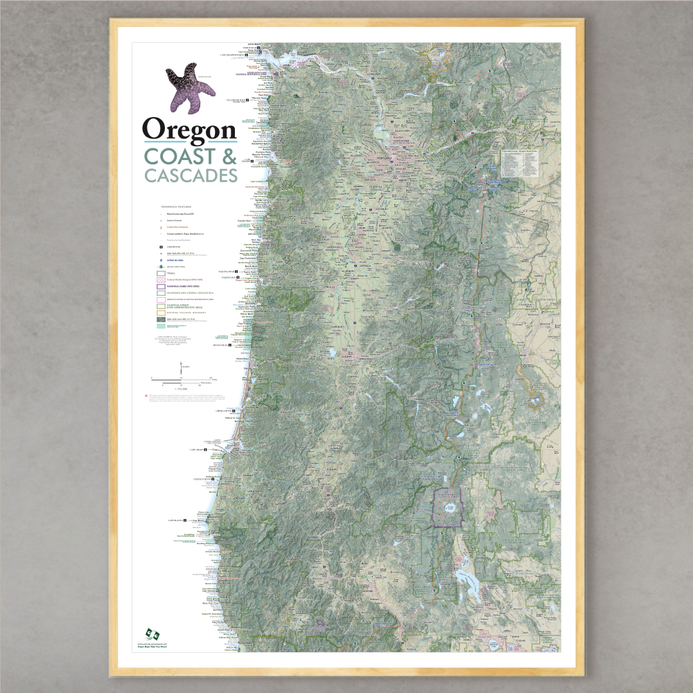
1:725,000
28 inch x 20 inch — flat wall map, printed on a heavy fine paper — shipped rolled.
Oregon Coast & Cascades Map. Detailed general reference map of the Oregon coast and Oregon’s Cascade Range, in essence Western Oregon. The map extent stretches inland and eastward to include Bend, Redmond, Klamath Falls, and The Dalles as well as most communities along the US 197 to 97 highway routes.
Reference features labeled as scale permits, include:
Named Places, Communities, Towns, Cities
Coastal Places of Interest
Summits of Interest
Interstate, Highway, and Major Road systems
Coastal Landforms: Lighthouses, Bays, Islands, Capes, Headlands, Beaches, Prominent Sea Stacks and Shore Rocks
Landforms: Mountain Ranges, Valleys
State Park Site/Area (OR, CA, & WA): Park, Recreation Site, Natural Area, Historic Site, Ecological Area/Site
Alpine Ski Areas
Pacific Crest Trail
Tribal Lands
USFWS National Wildlife Refuges
National Park Units (Lewis & Clark, Crater Lake, etc)
Wilderness Areas (Federally Designated)
US Forest Service Administrative Areas
Oregon Dunes National Recreation Area
National Volcanic Monuments (St Helens, Newberry)
Oregon Marine Reserve & Protected Area

Colorado Mountain Ranges map. Flat wall map, printed on a heavy fine paper — ships rolled.
TWO VERSIONS (both versions include ranges and high points mapped, labeled, and listed in the legend)
STATE version - 1:1,085,000 map scale - landscape orientation, 28 inch width x 20 inch height (map of the entire state)
CORE version - 1:700,000 map scale - portrait orientation, 20 inch width x 28 inch height (map of the core mountain area)
This is a taxonomic styled and statewide general reference map of Colorado’s primary mountain systems and subranges (including associated range high points labeled), as well as other basin and plains landform features. The Core extent map includes the Front Ranges west to and including Grand Mesa.
Packed with details considering it’s scale and sheet size - you will need good map reading skills to fully enjoy the fine print and occasionally small typefaces.
Featuring Colorado’s many mountain ranges and primary subranges — all delineated, colored and keyed to a detailed legend that identifies range and sub-range high point names and elevations in feet. Other landform features such as the plains, mountain parks, open slopes, plateaus, and foothill features are also classed and keyed within the legend (high points of these features are noted as appropriate). An inset map portrays the generalized parent landforms.
Fall 2026 Update:
CORE version now available zoomed into the Rocky Mountains area (i.e. better detail of the mountain ranges).
Spring 2025 Update:
Increased hash line weight for smaller ranges to increase readability (Never Summer Range, Mummy Range, Indian Peaks, Ruby Range, Needle Ranges, Ten Mile Range)
Corrected Pikes Peak symbology
Added Lake City ski area label
Reference features include:
City/Town/Community place names
Feature Summits
Fourteeners
Fourteener range high points
Other Prominent Summits
Non-fourteener range high points
State Parks
Alpine Ski Areas
Colorado Trail route
Continental Divide Trail route
National Park/Monument
National Wildlife Refuge
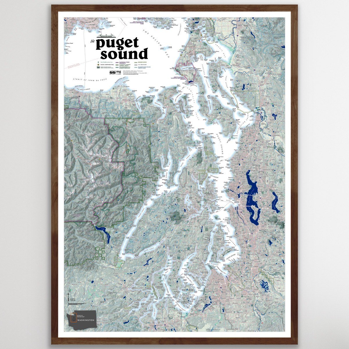
TWO SIZES
• 28 inch x 20 inch flat wall map. 1:235,000 scale (i.e. more detail) Shipped tubed.
• 19 inch x 13 inch flat wall map. 1:350,000 scale (i.e. less detail). Packed and Shipped flat.
• 19 inch x 13 inch flat wall map. 1:350,000 scale COLOR YOUR OWN MAP version also available!
Puget Sound, Washington State. Regional overview and general reference map of the complex inlets, harbors and channels that comprise Washington State’s Puget Sound. The 28 x 20 inch version is highly detailed, the 13 x 19 version is generalized with less detail. (Please view the comparison detail image to see the difference -- all other images are of the detailed 28 x 20 inch map - TYPEFACES ARE THE SAME SIZE IN PRINT).
Detailed annotations, labeling, and map features include:
Populated place and locale names
Ferry routes (primary routes)
Prominent summits and high points
Waterbodies: inlets, bays, harbors, passages, lakes, reservoirs of notable size
Coastal landforms: capes, headlands, islands
Olympic National Park & other National Park/Preserve units within the map extent
Olympic National Forest
USFS designated wilderness
Washington State Trust Land
State Park/State Recreation Areas
County and local parks/recreation areas (only prominent local parks are labeled)
Reservations
U.S. Military Bases
Pacific Northwest Trail route
Interstate and major highways are labeled with shield numbers (local arterials and roads and not labeled due to the scale limitations)
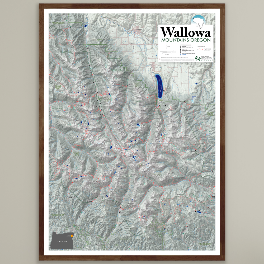
1:80,000
28 inch by 20 inch flat wall map, printed on heavy fine paper. Shipped rolled in a tube.
Second Edition July 2026.
Wallowa Mountains, Oregon Map. My Wallowas map is centered upon the high alpine core and adjacent access sites/trailheads. Please note this map does not include the furthest western portions of the Eagle Cap Wilderness (the map extent is further detailed below).
This second edition map features a larger sheet size and improved scale for legibility and trip planning purposes. The non-motorized trail network of the Eagle Cap Wilderness is labeled with rich detail including trail names, trail segment mileage, and elevations at trail junctions, trailheads, and prominent passes. 500 ft elevation contours are labeled throughout the map extent; summits, landforms, lakes, basins, rivers & streams, and special features are also labeled for reference.
Again please note, this version is centered upon the higher elevation alpine and mountain lake areas and associated access points of the Eagle Cap Wilderness located in the Wallowa-Whitman National Forest — the following trailhead/access areas are mapped:
NORTH ACCESS/TRAILHEADS
Huckleberry Mountain
Lostine River corridor
NORTHEAST & EAST ACCESS/TRAILHEADS
Hurricane Creek
Wallowa Lake
McCully
Salt Creek Summit/Redmont/Wing Ridge
Tenderfoot
Lick Creek
Twin Lakes & Fish Lake Area
SOUTH & WEST ACCESS/TRAILHEADS
Clear Creek & Trail Creek
Cornucopia
East Eagle/Little Kettle Creek
Main Eagle
West Eagle Meadows
***NOT MAPPED***: the lower elevation western portions of the Eagle Cap, including the lower Minam River, lower Bear Creek, and North Catherine Creek areas; this includes Sand Pass, Moss Springs, Buck Creek, and the various Horse Ranch, and Little Minam River trailheads and access sites. Though these sites are not mapped, their associated trails typically pick up on the map within a few miles as they approach the alpine vicinities (e.g. the Minam River Trail is mapped from it’s headwaters to the junction with the North Minam Trail - 8 miles upstream from Red’s Horse Ranch)
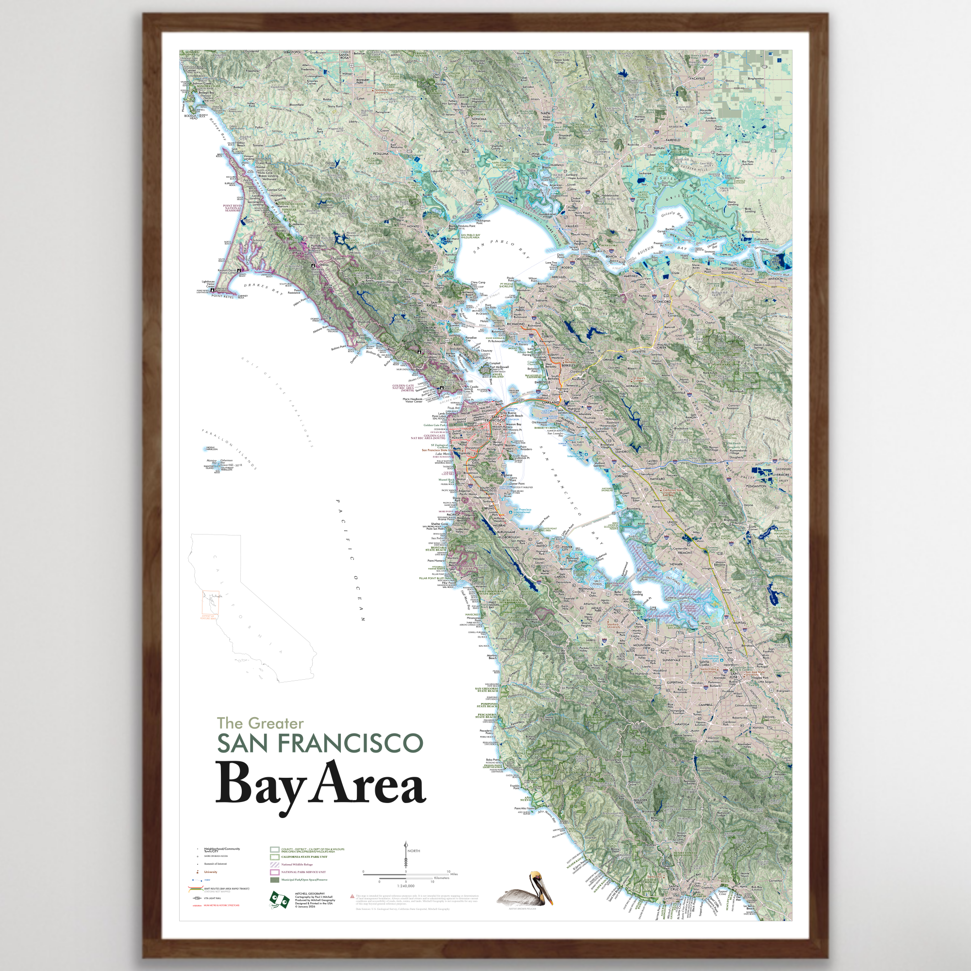
1:240,000
28 inch x 20 inch — flat wall map, printed on a heavy fine paper — shipped rolled.
Greater San Francisco Bay Area map. This is a detailed regional general reference wall map centered on the San Francisco, Oakland, and San Jose metropolitan areas. The expansive extent ranges in the North from Bodega Bay, Sonoma, Napa, Vacaville to Santa Cruz in the South — Antioch and Livermore edge out the east, while the Middle and Eastern Farallon Islands are pictured on the western edge.
Reference features labeled as scale permits, include:
Neighborhoods, Communities, Towns, Cities
Interstates, Highways, Arterials, and Rural Connections
Coastal Features: Bays, Islands, Capes
Surface Hydrology: Rivers, Streams, Lakes, Reservoirs
Shore, Coastal, Beach Access Sites
Local Rail Transit Routes: BART, VTA, MUNI Streetcars
Landforms: Summits of Interest with Elevations, Ridges, Peninsulas, Valleys, etc
Transit Ferry Routes and Terminals
Major Public and Private Universities
Municipal Parks and Preserves (labeled as scale permits)
County, Regional, and Special District Open Spaces, Preserves, Watershed Lands, and Wildlife Areas
California State Parks & State Beaches, California Fish and Wildlife Areas
Golden Gate National Recreation Area (Marin Headlands, Presidio, Lands End, Ocean Beach, Milagra Ridge, Sweeney Ridge, Rancho Corral de Tierra, and the Phleger Estate sites)
Point Reyes National Seashore
Muir Woods National Monument
USFWS National Wildlife Refuges: Don Edwards NWR, San Pablo Bay NWR
Trail routes of Point Reyes National Seashore and the Golden Gate NRA (local trails are not included)
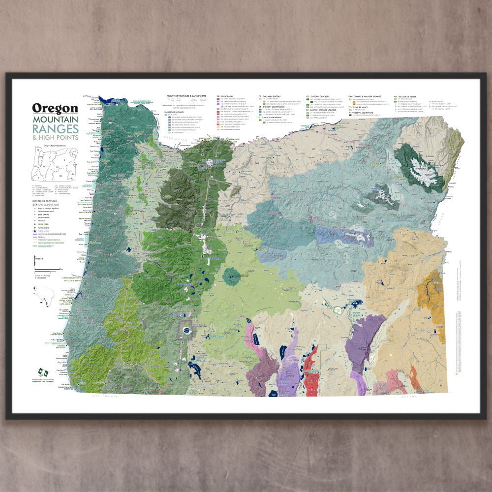
1:1,050,000
28 inch by 20 inch flat wall map, printed on heavy fine paper. Shipped rolled in a tube.
Oregon Mountain Ranges and High Points Map. Featuring 41 of Oregon’s mountain ranges and sub-ranges (including Willamette Valley hill ranges) mapped, delineated, colored and keyed to a detailed legend that identifies range and sub-range high point names and elevations in feet. High points are both featured within the map and listed in legend classes. Other slopes, basins, valleys, are also classed and keyed within the legend.
Also included for reference: the Pacific Crest Trail route, alpine and subalpine land areas, towns, cities, places, other summits of interest, landforms, alpine ski areas, Oregon State Parks, National Park units, tribal lands, National Wildlife Refuges, the Newberry Volcanic Monument, and Oregon Marine Reserves.
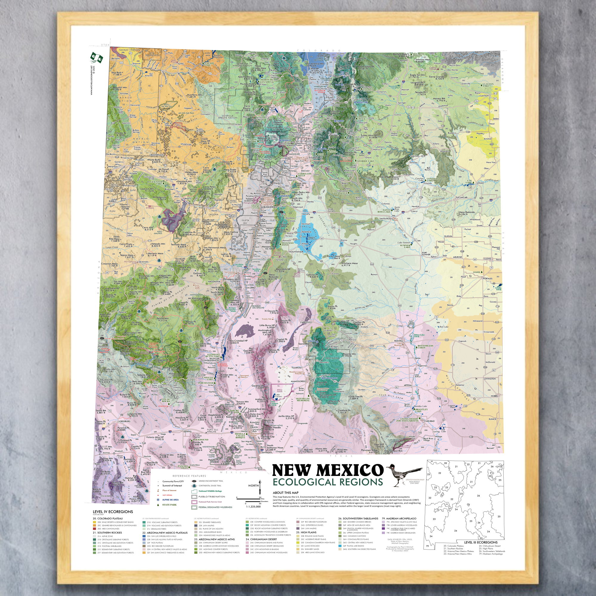
1:1,225,000
20 inch x 24 inch — flat wall map, printed on a heavy fine paper — shipped rolled.
New Mexico Ecological Regions map (ecoregions map). A re-symbolization of the EPA's Level IV ecoregions for the landscapes of New Mexico. Includes inset New Mexico Level III reference map for context. Level IV classes are symbolized and listed individually in the key for the feature map.
Reference features include:
City/Town/Community place names
Pueblo/Tribe/Nation boundaries
Summits and High Points of Interest
State Parks
Alpine Ski Areas
Hot Springs
Other Features of Interest
Grand Enchantment Trail route
Continental Divide Trail route
National Park/Monument
National Wildlife Refuge
Federal Designated Wilderness
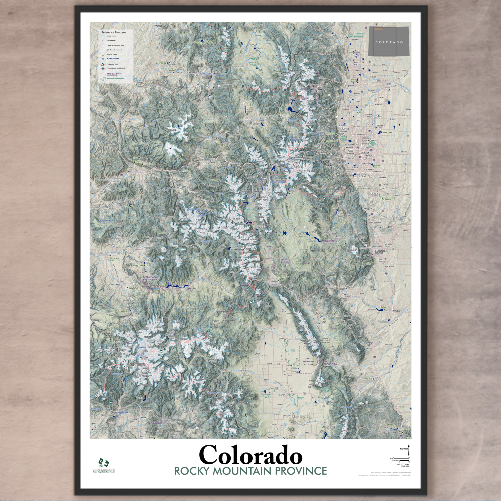
1:700,000
20 inch (wide) x 28 inch (height)— flat wall map, printed on a heavy fine paper — ships rolled.
Colorado Rocky Mountain Province Map. This is the general reference companion to my Colorado Mountain Ranges “core” extent map. Featuring a land cover tinted shaded relief and prominent snow-capped alpine zones (from the US EPA ecoregion dataset), the Rocky Mountain Province map features many of the same labels and attributes of the Mountain Ranges map.
Reference features include:
City/Town/Community place names
Feature Summits
Fourteeners
Other Prominent Summits
Mountain Passes of Interest
State Parks
Alpine Ski Areas
Colorado Trail route
Continental Divide Trail route
National Park/Monument
National Wildlife Refuge
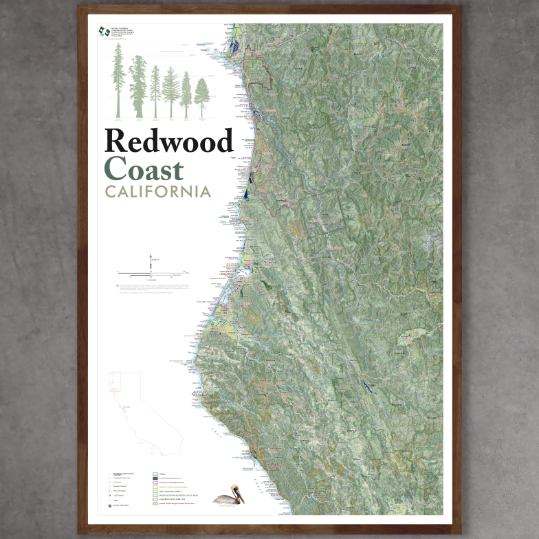
1:350,000
28 inch x 20 inch — flat wall map, printed on a heavy fine paper — shipped rolled in a 3 inch x 21 inch tube.
Redwood Coast California Map. This is a detailed regional general reference wall map of California’s most northern coast area — roughly stretching from Sinkyone Wilderness in the south to Smith River in the north. It is intended to feature the area where old growth Coast Redwood habitat and related old growth Coast Redwood parks exist. (Yes, there are other Redwood related parks outside of this extent, but these are the locations of the largest old growth trees, groves, and parks with public access).
The expansive map extent contains all of the northern Coast Redwood related State Parks, the Redwood National & State Parks vicinity, the Humboldt & Arcata Bays area (Eureka & Arcata), Humboldt Redwoods State Park & Avenue of the Giants, and the Lost Coast Region (Lost Coast Headlands area, King Range Wilderness, Sinkyone Wilderness). The interior extent ranges east to includes portions of the Six Rivers, Trinity, Klamath, and Mendocino National Forests, and many of the large interior designated wilderness’ including the Siskiyou Wilderness, Marble Mountain Wilderness, Trinity Alps, Yolla Bolly-Middle Eel, and more). Tribal lands include the Yurok, Hoopa Valley, Round Valley and more.
A comparative graphic of large California tree types is included in the legend area.
Reference features labeled as scale permits, include:
Neighborhoods, Communities, Towns, Cities
Highways, Arterials, and Secondary Rural/USFS Connections
Trails (USFS, NPS, State Parks, Municipal, PCT, Lost Coast) — trails are mostly unlabeled due to the regional scale of the map.
Coastal Features: Bays, Islands, Capes
Surface Hydrology: Rivers, Streams, Lakes, Reservoirs
Shore, Coastal, Beach Access Sites
Redwood National Park
California State Parks, State Beaches, and other accessible state lands
USFS National Forests (portions of): Six Rivers, Trinity, Klamath, Mendocino
Federal Designated Wilderness: Siskiyou, Red Buttes, Russian (small portions), Marble Mountain, Trinity Alps (western half), Chancelulla, Mount Lassic, North Fork (Eel), Yolla Bolly-Middle Eel, King Range).
Bureau of Land Management lands and special management areas such as Lacks Creek, Headwaters Forest Reserve, King Range Wilderness, Lost Coast Headlands)
Wildlife Areas (USFWS National Wildlife Refuge, California State Wildlife Areas)
Places of Interest (e.g. Sumêg Village, Tall Trees Grove, Avenue of the Giants, Cal Poly Humboldt)
Lighthouses
Mountains and Summits of Interest
Lookouts
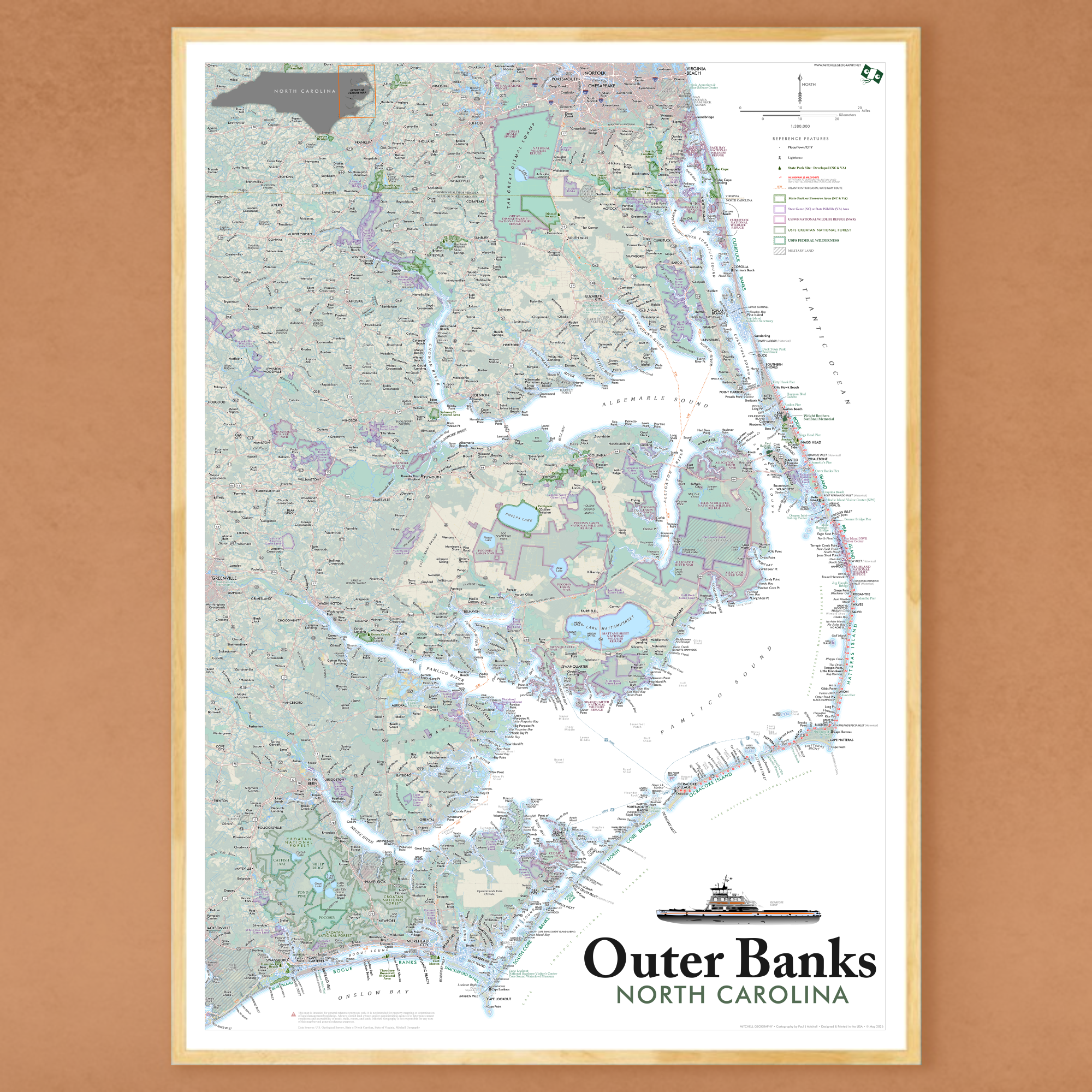
1:380,000
28 inch x 20 inch — flat wall map, printed on a heavy fine paper — shipped rolled in a 3 inch x 21 inch tube.
Outer Banks, North Carolina map. Detailed general reference wall map featuring the Outer Banks, Pamlico Sound, Albemarle Sound and a wide extent of northeast North Carolina; the map also extends north to capture the Virginia section of the Currituck Banks Peninsula. From north to south, coastal peninsulas and islands include: Virginia Beach, Knotts Island, Currituck Banks, Bodie Island, Roanoke Island, Pea Island, Hatteras Island, Ocracoke Island, North Core Banks, Middle Core Bank, South Core Banks, Shackleford Banks, Harkers Island, Carrot Island, Bogue Banks (Emerald Isle), Bear Island, Onslow Beach. Inland the map reaches west to Greenville & New Bern, and south to portions of Camp Lejeune and Jacksonville. Major Sounds and Coastal Rivers mapped include: Pamlico Sound, Albemarle Sound, Currituck Sound, Croatan Sound, Core Sound, Back Sound, Bogue Sound, North Landing River, Pasquotank River, Perquimans River, Chowan River, Roanoke River, Alligator River, Pamlico River, Tar River, Pungo River, Bay River, Neuse River, North River, Newport River, White Oak River.
Mapped Reference Features include:
Places/Towns/Cities
Coastal Features; Islands, Capes, Necks, Headlands, notable Shoals, Inlets, Harbors, Bays, Hammocks, Swashes, Marshes, Swamps, notable Sandbars, notable Beaches, select paleo (historical) Inlets
Ferry Routes and Terminals
Atlantic Intracoastal Waterway routes (ICW)
NC Highway 12 mile points from the Wright Memorial Bridge at Kitty Hawk/Southern Shores south to Ocracoke Village (miles 1 through 86, bridge and ferry miles are not labeled).
Lighthouses
Public Piers of Interest
Features of Interest: notable Museums, Parks, Bridges, Visitor Centers, Universities, etc.
Wright Brothers National Memorial
Fort Raleigh National Historic Site
Cape Hatteras National Seashore (generalized extent labeled)
Cape Lookout National Seashore (generalized extent labeled)
State Park Developed Sites (site locations)
State Parks and State Nature Preserves/Areas (area extents)
State Game Areas (NC) & State Wildlife Management Areas (VA)
US FWS National Wildlife Refuges (NWR)
Croatan National Forest
Croatan National Forest - Designated Federal Wilderness areas
DOD Lands
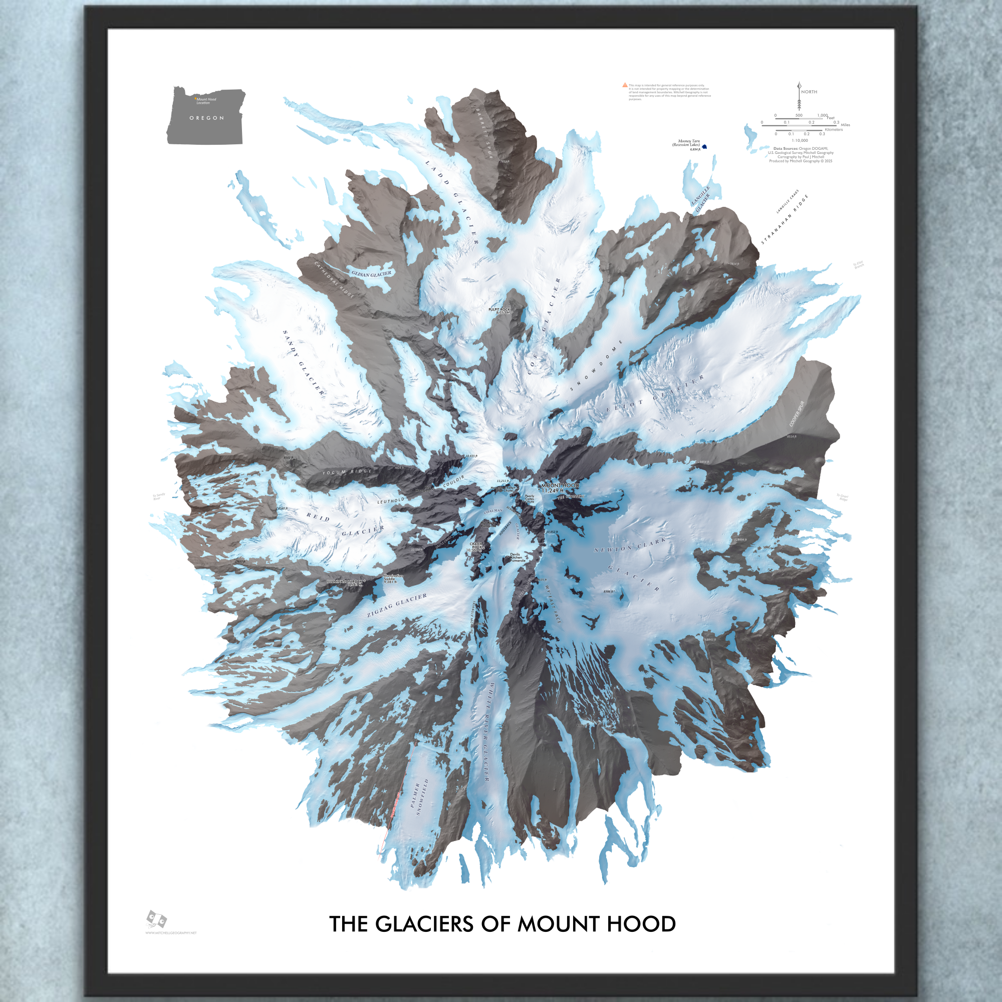
1:10,000
20 inch x 24 inch — flat wall map, printed on a heavy fine paper — shipped rolled.
Mount Hood Glaciers, Oregon. My most recent detailed feature map of Mount Hood’s Glaciers — differing only slightly in artistic style and scale from my most detailed 1:9,000 Hood Summit map.
Generally depicting elevations over 7,500 ft and based upon Oregon DOGAMI’s detailed LiDAR elevation model, my visually prominent mid-summer seasonal glacier and snowfield extent is derived at 1:2,000 from the same LiDAR model and corrected to aerial imagery. Landforms and provincial feature names of chutes, faces, snowfields, etc are included.
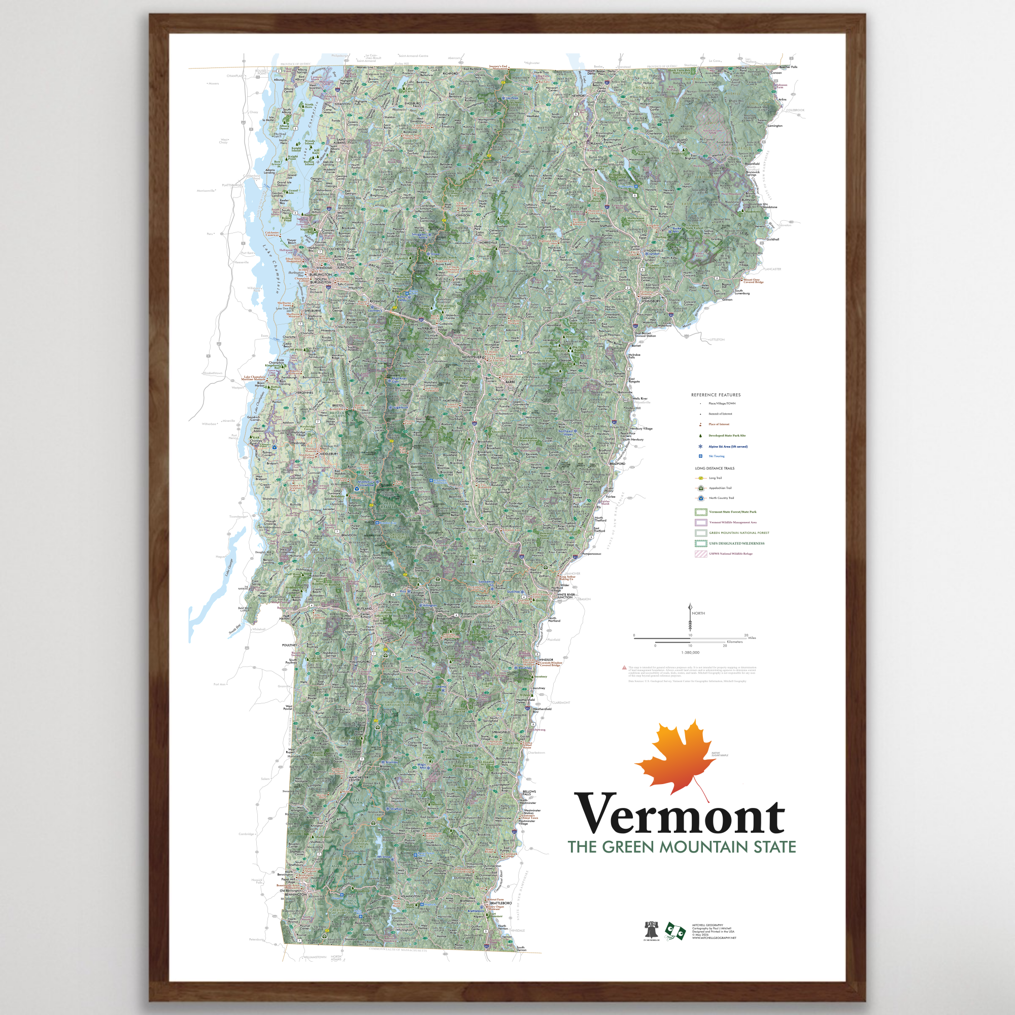
1:380,000
28 inch x 20 inch — flat wall map, printed on a heavy fine paper — shipped rolled.
State of Vermont general reference map. Produced May 2026. This is my most detailed general reference map of Vermont (my birth state!).
Reference features labeled as scale permits, include:
Places, Villages, Towns, Cities
Summits of Interest
Unique Places of Interest (e.g. a selection of museums, universities and colleges, waterfalls, historic sites, and more)
Developed State Park Sites
Alpine Ski Areas (public lift served sites)
Ski Touring Sites (Select locations, as of 2026 that are maintained and easily located, where you can skin up & ski down)
Highways, Arterials, and Secondary Rural Connections
Surface Hydrology: Rivers, Streams, Lakes, Reservoirs
Notches & Gaps
The Long Trail
Appalachian Trail
North Country Trail
Vermont State Forest Lands
Vermont State Park Lands
Vermont Wildlife Management Area Lands
USFS Green Mountain National Forest Lands (formally the Finger Lakes & Green Mountain NF)
USFS Federally Designated Wilderness Areas
Bristol Cliffs
Breadloaf
Joseph Battell
Peru Peak
Big Branch
Lye Brook
Glastenbury
George D Aiken
US Fish & Wildlife Service Refuges
Silvio O Conte
Missisquoi
*Most town forests, non-profit organizations, and land trust lands are not mapped.
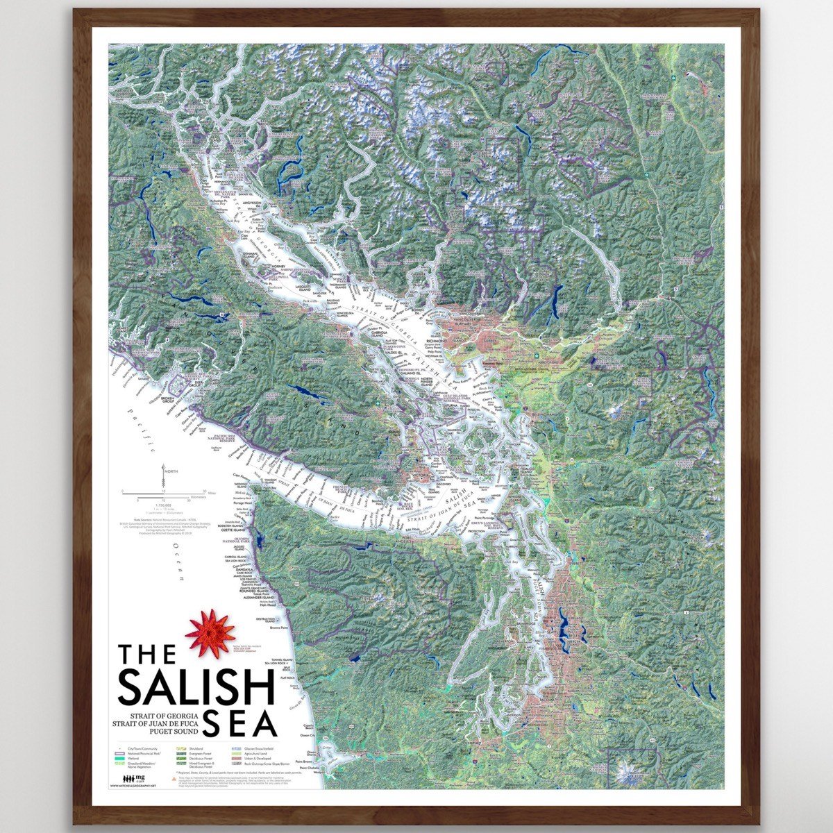
1:750,000
20 inch x 24 inch — flat wall map, printed on a heavy fine paper — shipped rolled.
Detailed regional map of the Salish Sea, comprised of the Strait of Georgia, Strait of Juan de Fuca, and the Puget Sound. Place names, cities, prominent landforms, and national/provincial parts are labeled and delineated as scale permits.
****Errata Corrections Update March 18, 2020
CORRECTED — The I-90 interstate label at Snoqualmie Pass was incorrectly labeled as I-5. A few label placements were nudged to fix minor overlaps.
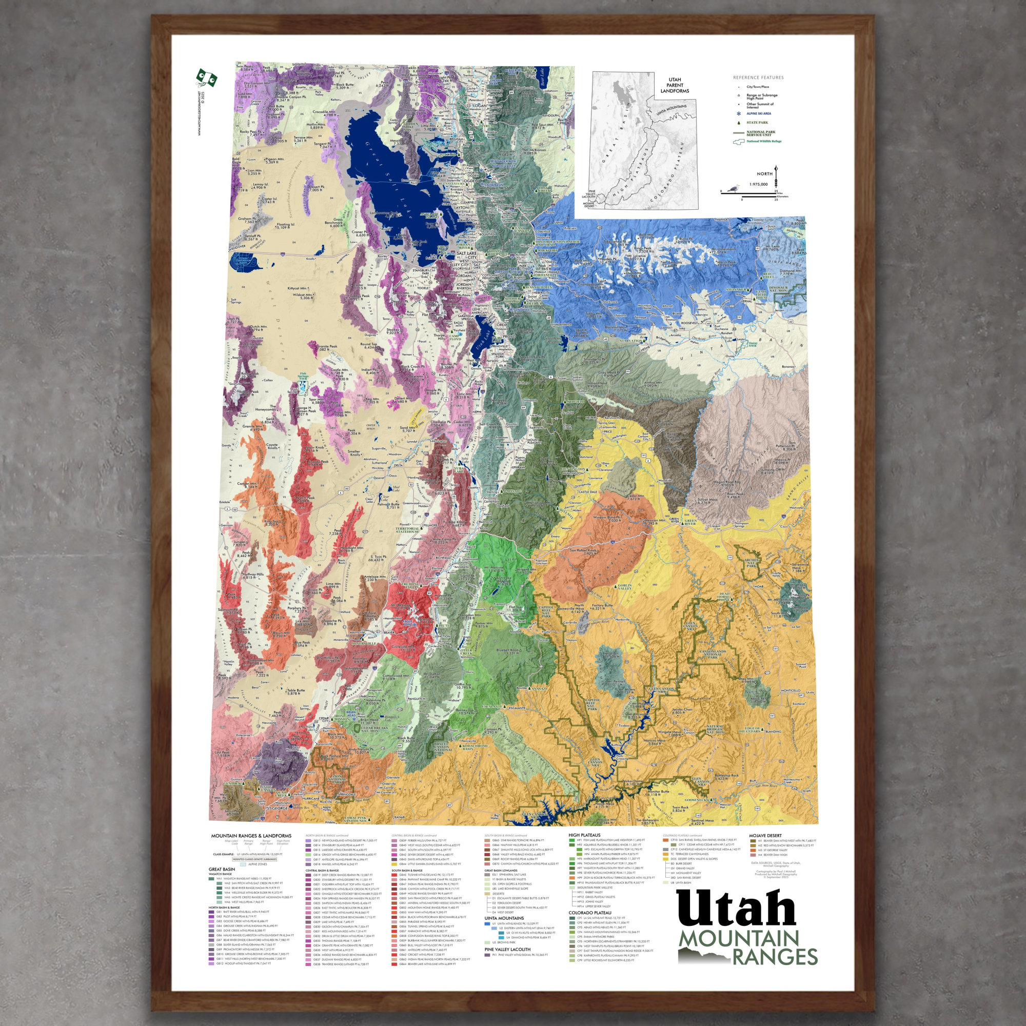
1:975,000
28 inch x 20 inch — flat wall map, printed on a heavy fine paper — shipped rolled.
Utah Mountain Ranges map. This is a taxonomic styled and statewide general reference map of Utah’s primary mountain range systems, subranges, and other landforms. 103 unique ranges & uplands have been delineated and associated high points mapped across Utah’s parent landforms: the Great Basin, Uinta Mountains, Colorado Plateau, Utah’s High Plateaus, the Pine Valley Laccolith, and the Mojave Desert. Additional valleys, basins, deserts, and canyonlands have also been delineated and classed. Packed with details considering it’s scale and sheet size - you will need good map reading skills to fully enjoy the fine print and occasionally small typefaces. This map is cross-walked with the Colorado Mountain Ranges map, though the scale differs in print size.
The expansive legend area lists range & subrange names, range high point names and elevations - all classed with a unique map code and listed in descending order of elevation.
Reference features include:
City/Town/Community place names
Range High Points & Other Summits of Interest
State Parks
Alpine Ski Areas
National Park Service Units (NPS managed National Parks and National Monuments)
National Wildlife Refuges
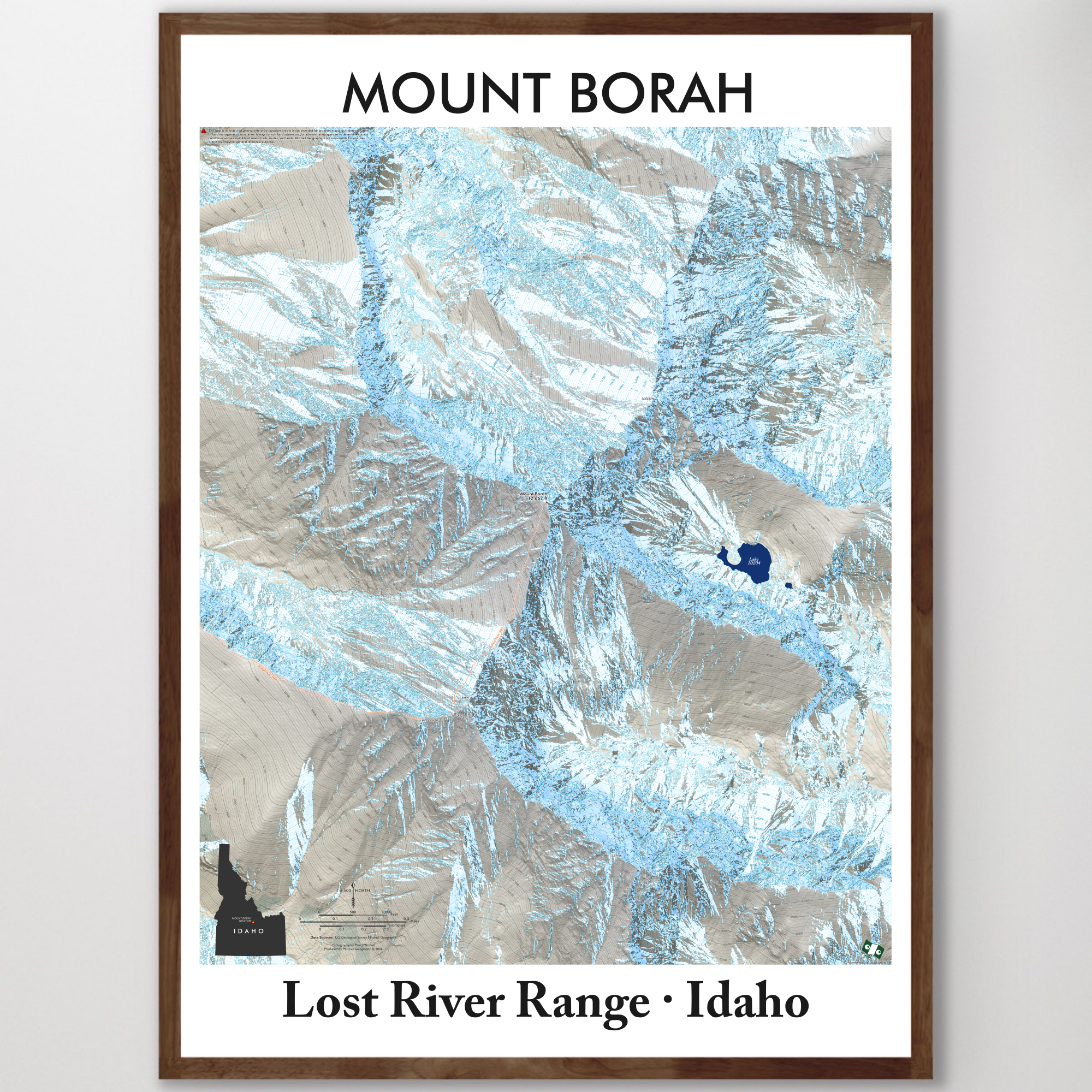
1:6,500
28 inch (height) by 20 inch (width) flat wall map, printed on heavy fine paper. Shipped rolled.
Mount Borah, Idaho Map.
Highly detailed map of the summit alpine vicinity of Mount Borah - Idaho’s 12,662 foot state high point located in the austere and massive Lost River Range. The majority of this map extent is the landforms over 10,000 feet in elevation. The primary trail route is features with named features, contour intervals labeled, and a richly detailed late spring seasonal snowfields.
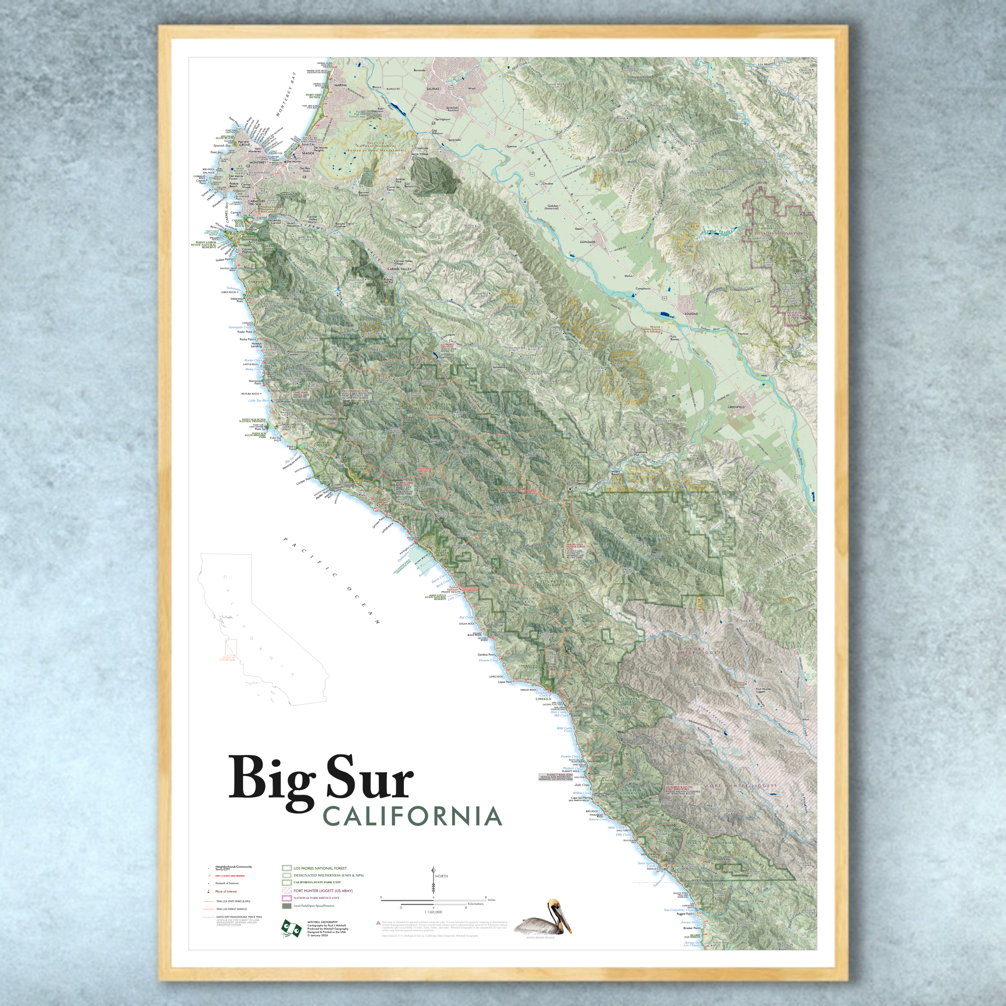
1:160,000
28 inch x 20 inch — flat wall map, printed on a heavy fine paper — shipped rolled.
Big Sur California map. This is a detailed regional general reference wall map centered of the Big Sur region on California’s central coast. The coastal extent stretches from Monterey Bay in the North to Arroyo De Los Chinos in San Luis Obispo County (i.e. 87 miles of Highway 1 in Monterey County and the northern 7 miles in San Luis Obispo County). Interior features include Salinas Valley, Los Padres National Forest, Ventana Wilderness, Fort Hunter Liggett (US Army).
Included cities and vicinities: Marina, Seaside, Monterey, Pacific Grove, Pebble Beach, Carmel-by-the-Sea, Carmel Valley, Big Sur, Posts, Lucia, Esalen/Slates Hot Springs, Plaskett/Gorda. Interior Salinas Valley: Salinas, Gonzales, Soledad, Greenfield.
Included CA State Parks: Monterey State Beach, Carmel River State Beach, Point Lobos, Garrapata, Point Sur, Andrew Molera, Pfeiffer Big Sur, Julia Pfeiffer Burns, Limekiln, Hearst San Simeon (the most northern coastal section - miles 68-70 SLO County)
*NOTE ON ROADS WITHIN FORT HUNTER LIGGETT : Nacimiento-Fergusson Road, Mission Road, Jolon Road, and Milpitas Road are the only travel routes mapped within the US Army’s Fort Hunter Liggett. On the southern end, South Coast Ridge Road is only mapped to the USFS Lottie Potrero Trail.
Reference features labeled as scale permits, include:
Neighborhoods, Communities, Towns, Cities
Highways, Local Arterials, and Public Access Roads (including Nacimiento-Fergusson Road)
Coastal Features: Bays, Islands, Capes
Surface Hydrology: Rivers, Streams, Lakes, Reservoirs
Shore, Coastal, Beach Access Sites
Landforms: Summits of Interest with Elevations, Ridges, Valleys, etc
Places of Interest: Henry Miller Library, Esalen Institute, Missions (Carmel, Soledad, San Antonio)
Regional Parks (labeled as scale permits)
California State Parks & State Beaches
Los Padres National Forest
Ventana Wilderness
Silver Peak Wilderness
Pinnacles National Park & Hain Wilderness
Trails: Los Padres National Forest, California State Parks, Pinnacles National Park
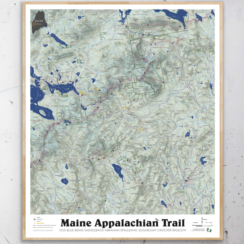
1:130,000
24 inch x 20 inch — flat wall map, printed on a heavy fine paper — shipped rolled.
A much larger Western Maine Mountains (printable digital download) is also now available.
Nominally this is a regional AT section map for a portion of Western Maine -- but it is also loaded with detailed annotations/trails/lands of the surrounding communities. For a bit I lived in Farmington, Maine and spent many days hiking around the area in particular Tumbledown, Little Jackson, and Mt Blue. So this map is intended to capture both the AT section and the many other amazing spots so close-by.
This is perhaps my favorite section of the entire AT (which I thru-hiked in 2005)… featuring the stretch from Old Blue to the Bigelow Range: Bemis, Saddleback, Saddleback Junior, Mt Abraham, Spaulding, Sugarloaf, Crocker Mtn, and the full length of the Bigelow Preserve, ending at the Carry Ponds. The map also includes detailed annotations and labels of the regional towns of Farmington, Weld, Wilton, New Vineyard, New Portland, Strong, Phillips, Kingfield, Carrabassett Valley, Stratton/Eustis, Rangeley, Oquossoc, Kennebago Lake, Byron, Andover and the northern tips of Rumford/Mexico.
Labeled for reference -- trails (e.g. the AT, Fly Rod Crosby, Maine Huts & Trails, Maine BPL), trailheads, alpine ski slopes (Saddleback, Sugarloaf, Black Mtn., Titcomb Mtn.), landmarks (Wire Bridge, Wilhelm Reich Museum, etc.), place names, summits with elevations, rivers, lakes, ponds, highway and road names. Fee owned public lands -- the National Park Service's Appalachian Trail Corridor and Maine BPL (Bureau of Parks and Lands) preserves (e.g. Bigelow) are mapped and labeled including the very recent Cascades addition along the Orbeton and Perham Streams (non-profit conserved lands are not mapped, though some of their trails are included). Fee sites included are labeled accordingly.

1:1,225,000
20 inch x 24 inch — flat wall map, printed on a heavy fine paper — shipped rolled.
New Mexico State Map. A general reference map of New Mexico with detailed annotation of place names, landforms, and an environmental/conservation interest including wilderness areas, parks, and long distance trail routes (i.e. Grand Enchantment Trail & the Continental Divide Trail).
Reference features include:
City/Town/Community place names
Pueblo/Tribe/Nation boundaries
Summits and High Points of Interest
State Parks
Alpine Ski Areas
Hot Springs
Other Features of Interest
Grand Enchantment Trail route
Continental Divide Trail route
National Park/Monument
National Wildlife Refuge
Federal Designated Wilderness

1:6,850,000
28 inch x 20 inch flat wall map. Shipped tubed.
Long Distance Trails of the Conterminous United States. This national overview map of the conterminous lower 48 states features 70 long distance trails (included trails are listed below). This selection is intended to map the popular, proven, managed, and navigable trails that primarily require foot travel touching upon a journey or wilderness experience. The Triple Crown Trails (AT, CDT, PCT) are symbolized separately in red. Places, interstate highways, national park units (scale dependent), hydrology, states, landforms, and significant regional high points are labeled for reference. The legend features trail miles and state locations of all the included trails.
Inspired by my 2005 Appalachian Trail, 2007 Newfoundland ECT, and 2011 Colorado Trail thru-hikes - I’d wanted to put all the trails I’ve continued to daydream about on one map (and without the historic NPS routes that aren’t really walkable, yet often appear on other similar national trail maps). I also wanted to include some of the renowned shorter trails and loops that deliver a similar wilderness end-to-end experience yet without the serious time commitments (think of the Wonderland Trail, the Beaten Path, the Pemigewasset Loop, the Four Pass Loop, Eagle Rock Loop, Cactus to Clouds, etc). So this map features a balanced collection of these types of trails, as well as an attempt to map trails in each region of the lower 48 states.
There are a number of other proposed routes, new trails, and extensions to existing trails under development that with gained popularity perhaps can be included in a later edition. Some existing routes have also been excluded in cases of extensive gaps and connectivity issues (e.g. Bay Area Ridge Trail, Palmetto Trail, East Coast Greenway).
Included Trails:
TRIPLE CROWN
Appalachian Trail
Continental Divide Trail
Pacific Crest Trail
ADDITIONAL TRAILS
American Discovery Trail
Arizona Trail
Baker Trail
Bay Circuit Trail
Beaten Path, The
Benton MacKaye Trail
Black Creek Trail
Blue Mountains Trail
Boundary Trail (Washington)
Buckeye Trail
C&O Canal Trail
Cactus to Clouds
Centennial Trail (South Dakota)
Cohos Trail
Colorado Trail
Columbia Plateau (Washington)
Couer d'Alenes, Trail of the
Cowboy Trail
Cumberland Trail
Eagle Rock Loop
Empire State Trail
Finger Lakes Trail
Florida Trail
Foothills Trail
Four Pass Loop
George S. Mickelson Trail
Grafton Notch Loop
Grand Enchantment Trail
Great Allegheny Passage
Hayduke Trail
High Sierra Trail
Ice Age Trail
Idaho Centennial Trail
John Muir Trail
Katy Trail
Kettle Crest
Knobstone Trail
Lone Star Trail
Long Path
Long Trail
Lost Coast Trail
Maah Daah Hey Trail
Mountains to Sea
New England Trail
Northcountry Trail
Northville-Placid Trail
Oregon Desert Trail
Ouachita Trail
Ozark Highlands Trail
Ozark Trail
Pacific Northwest Trail
Palouse to Cascades
Paul Bunyan State Trail
Pawnee Buchanan Loop
Pemigewasset Loop
Pinhoti Trail
Ruby Crest Trail
Sheltowee Trace
Superior Hiking Trail
Tahoe Rim Trail
Teton Crest Trail
Timberline Trail
Toyaibe Crest Trail
Trans-Catalina Trail
Uinta Highline Trail
Wapack Trail
Wonderland Trail
1:1,180,000 scale
28 inch x 20 inch — flat wall map, printed on a heavy fine paper — shipped rolled.
Idaho Mountain Ranges Map, Second Edition - Produced February 2026, Printed March 2026
Second Edition Updates
• NEW larger 28 inch x 20 inch sheet size
• NEW 1:1,180,000 scale resulting in a larger print and increased readability.
• Edited all annotations for clarity, reduced clutter, and increased readability.
• Edited and cross-walked Southeast Basin & Range region symbology and range classes with the new Utah Mountain Ranges map.
• Added alpine and subalpine class symbology to infer exposed summit areas and associated landforms.
Featuring Idaho’s many mountain ranges, named sub-ranges of any significance — all delineated, colored and keyed to a detailed legend that identifies range and sub-range high point names and elevations in feet. Other uplands, plateaus, basins, valleys, and lowlands are also classed and keyed within the legend.
Also included for reference: towns, cities, places, special features, hot springs (only the familiar ones thou, not your favorite secret ones!), alpine ski areas, state park sites, wilderness areas (with a subtly hashed boundary line), national park sites, wild and scenic river segments, the Idaho Centennial Trail Route, and a nice rich terrain and hillshade.