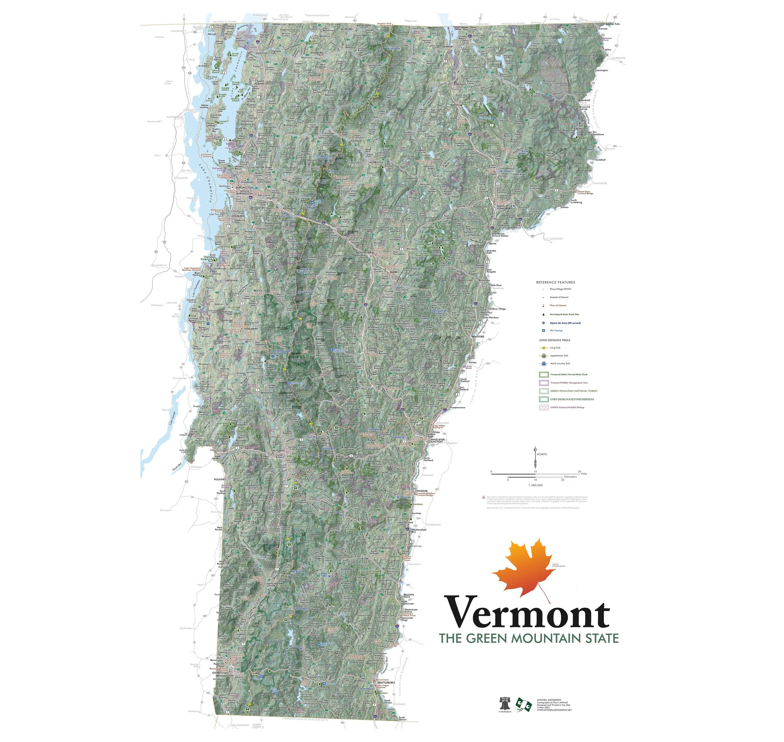
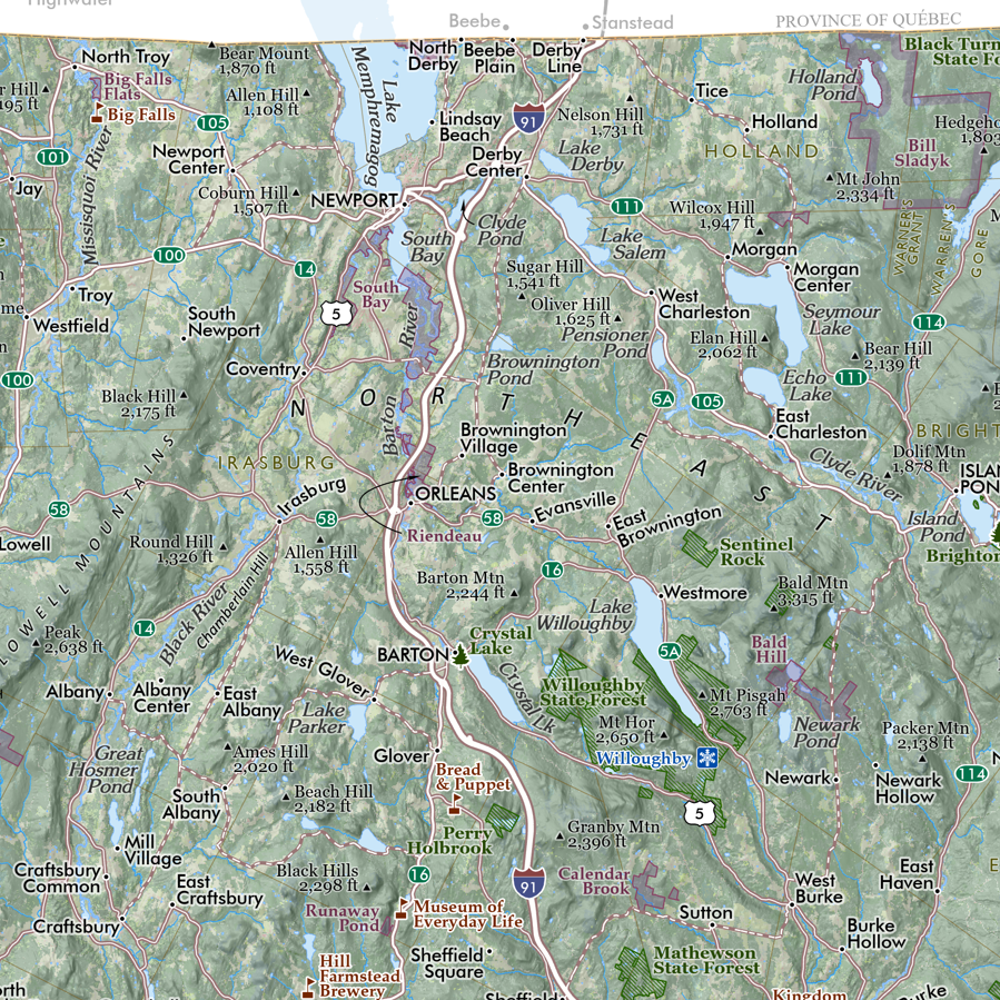
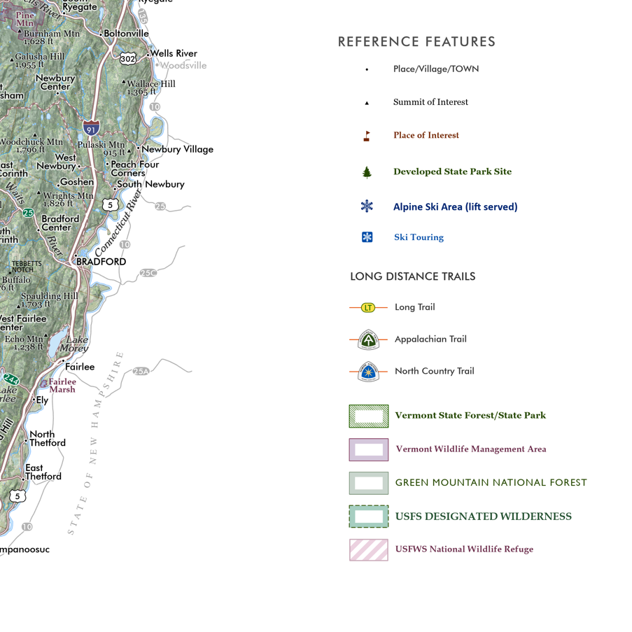
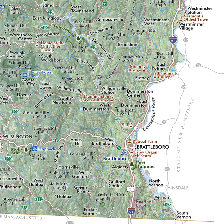
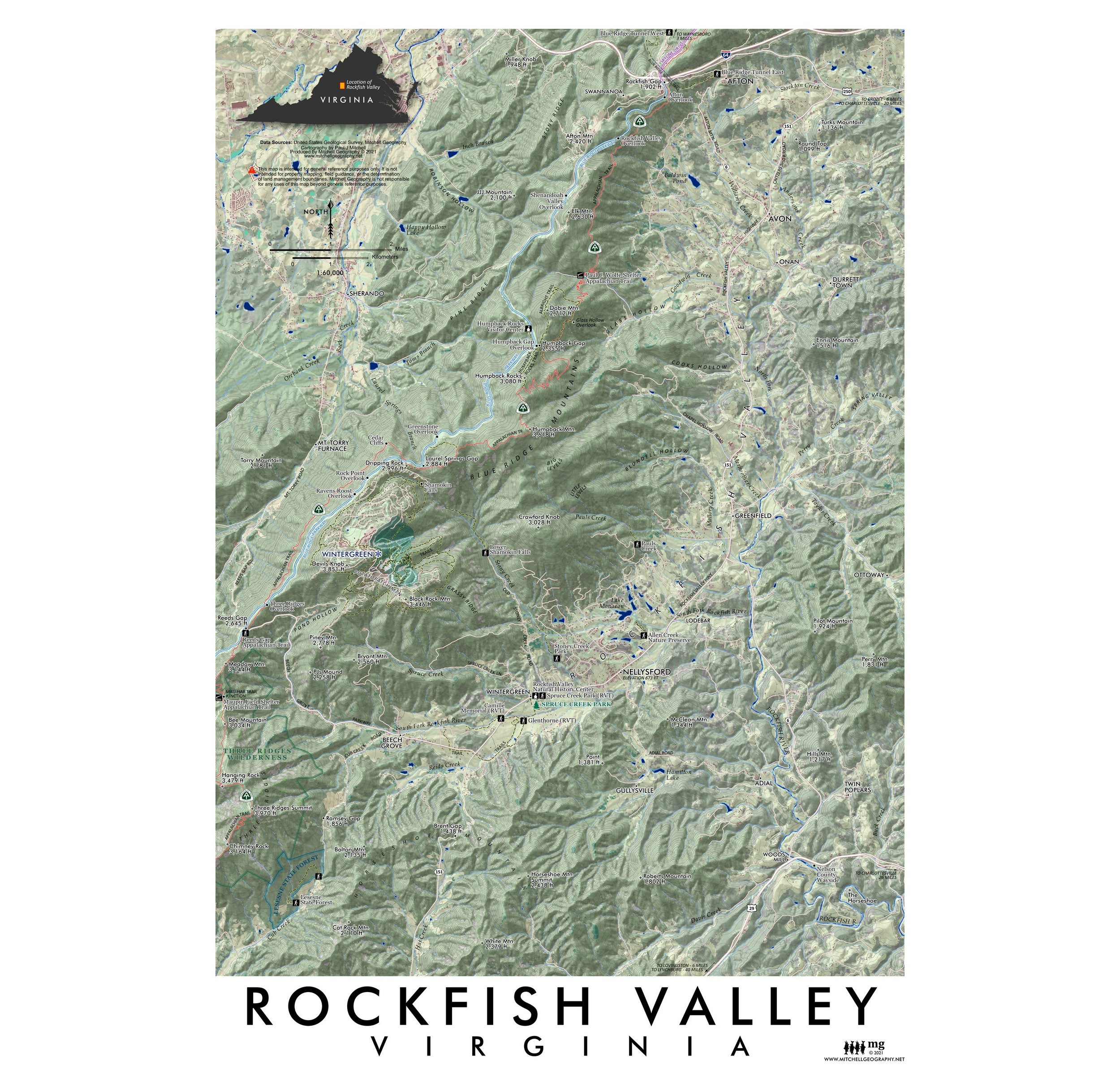
28 inch x 20 inch — flat wall map, printed on a heavy fine paper — shipped rolled.
Greater San Francisco Bay Area map. This is a detailed regional general reference wall map centered on the San Francisco, Oakland, and San Jose metropolitan areas. The expansive extent ranges in the North from Bodega Bay, Sonoma, Napa, Vacaville to Santa Cruz in the South — Antioch and Livermore edge out the east, while the Middle and Eastern Farallon Islands are pictured on the western edge.
Neighborhoods, Communities, Towns, Cities
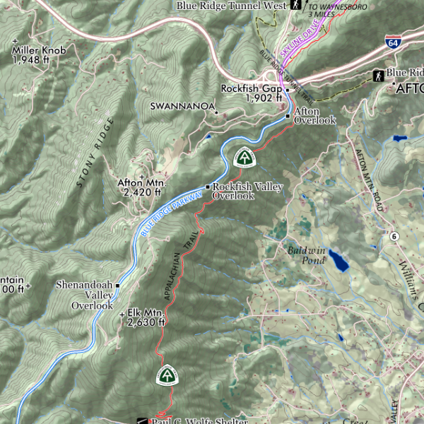
Interstates, Highways, Arterials, and Rural Connections
Coastal Features: Bays, Islands, Capes
Surface Hydrology: Rivers, Streams, Lakes, Reservoirs
Shore, Coastal, Beach Access Sites
Local Rail Transit Routes: BART, VTA, MUNI Streetcars
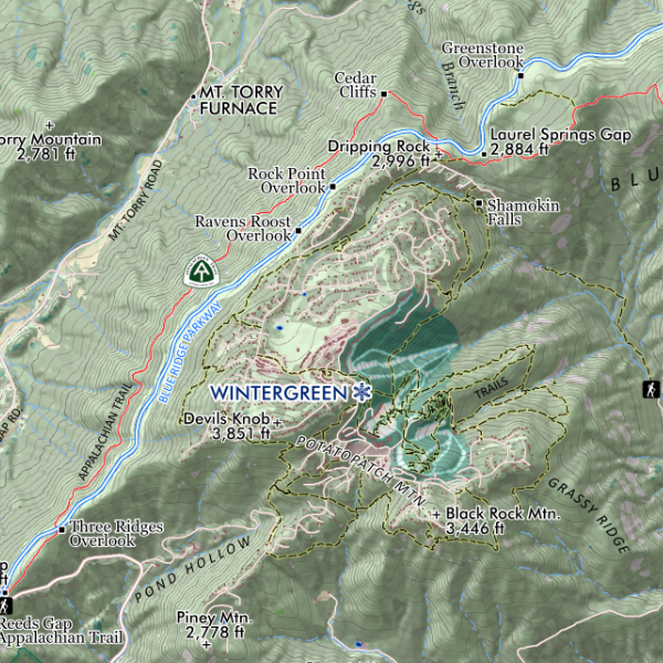
Landforms: Summits of Interest with Elevations, Ridges, Peninsulas, Valleys, etc
Transit Ferry Routes and Terminals
Major Public and Private Universities
Municipal Parks and Preserves (labeled as scale permits)
County, Regional, and Special District Open Spaces, Preserves, Watershed Lands, and Wildlife Areas
California State Parks & State Beaches, California Fish and Wildlife Areas
Golden Gate National Recreation Area (Marin Headlands, Presidio, Lands End, Ocean Beach, Milagra Ridge, Sweeney Ridge, Rancho Corral de Tierra, and the Phleger Estate sites)
Point Reyes National Seashore
Muir Woods National Monument
USFWS National Wildlife Refuges: Don Edwards NWR, San Pablo Bay NWR
Trail routes of Point Reyes National Seashore and the Golden Gate NRA (local trails are not included)

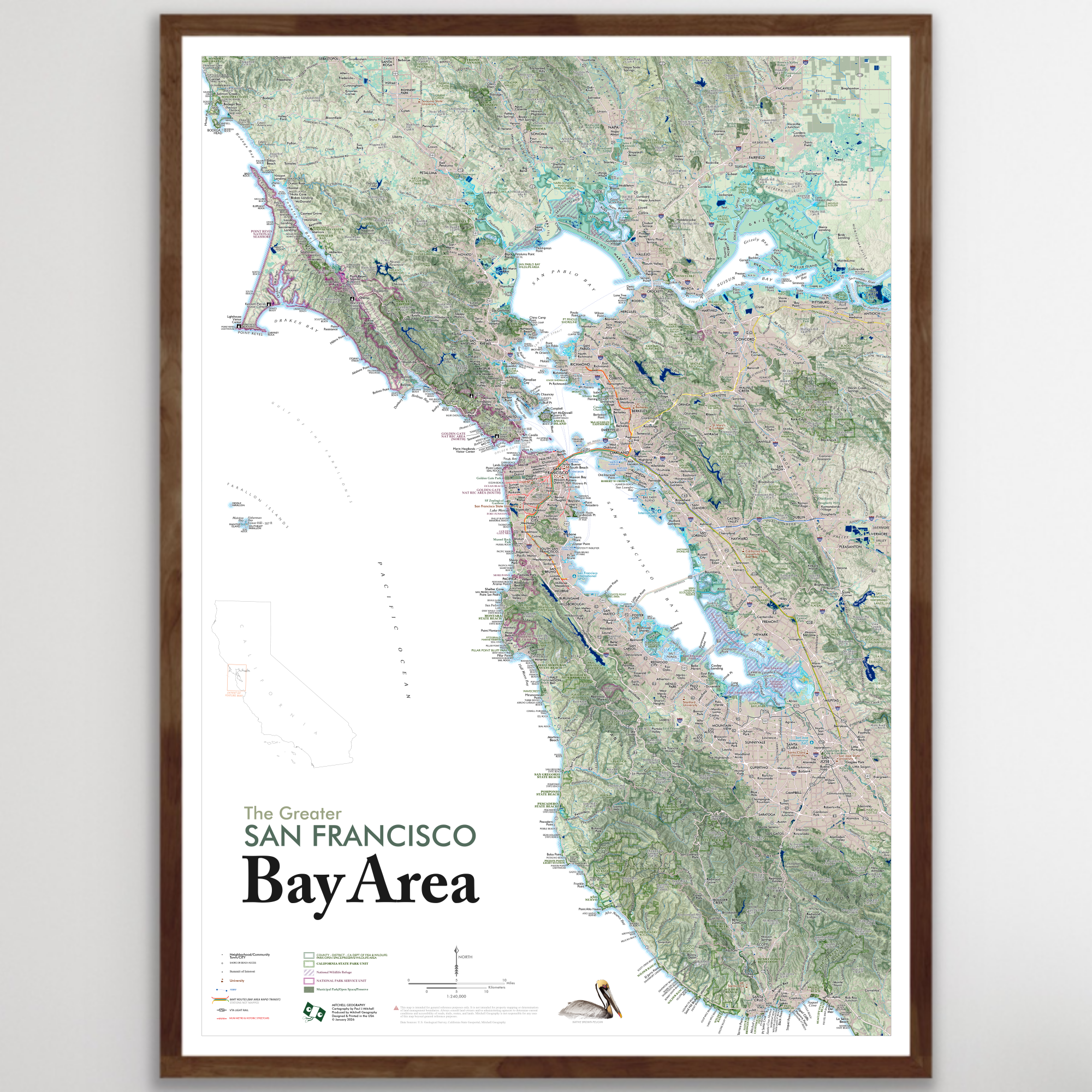 Image 1 of 17
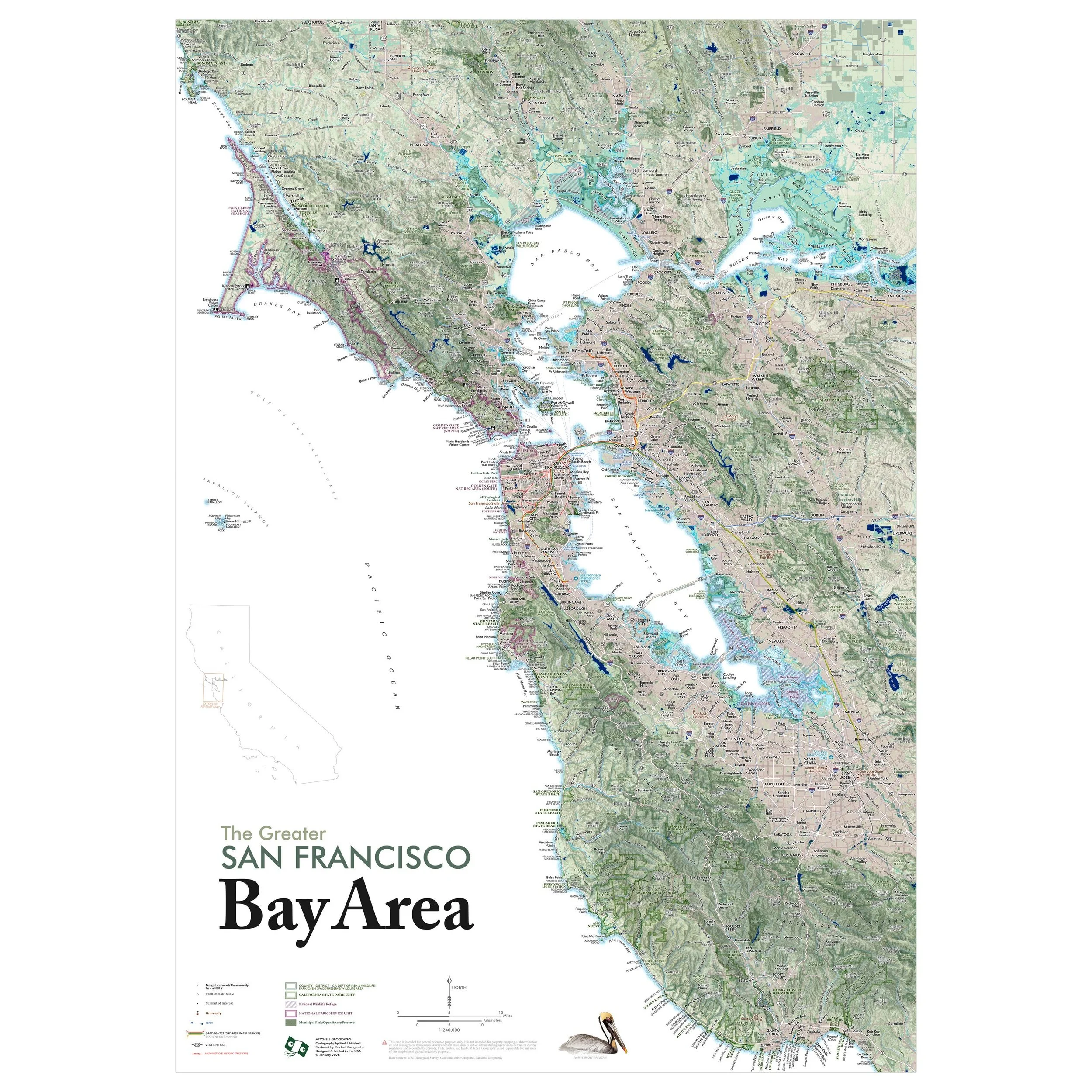 Image 2 of 17
 Image 3 of 17
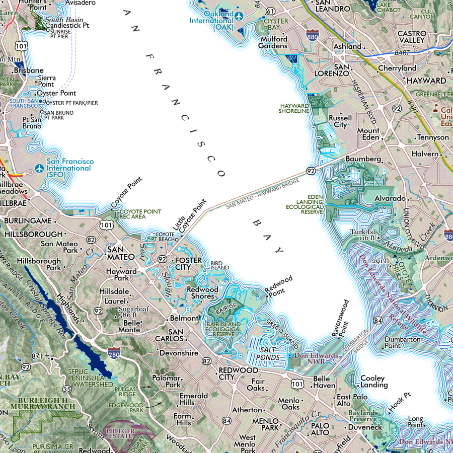 Image 4 of 17
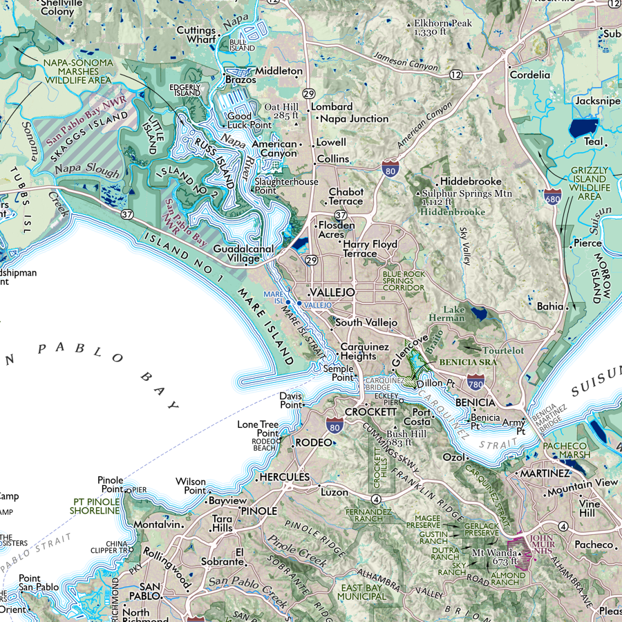 Image 5 of 17
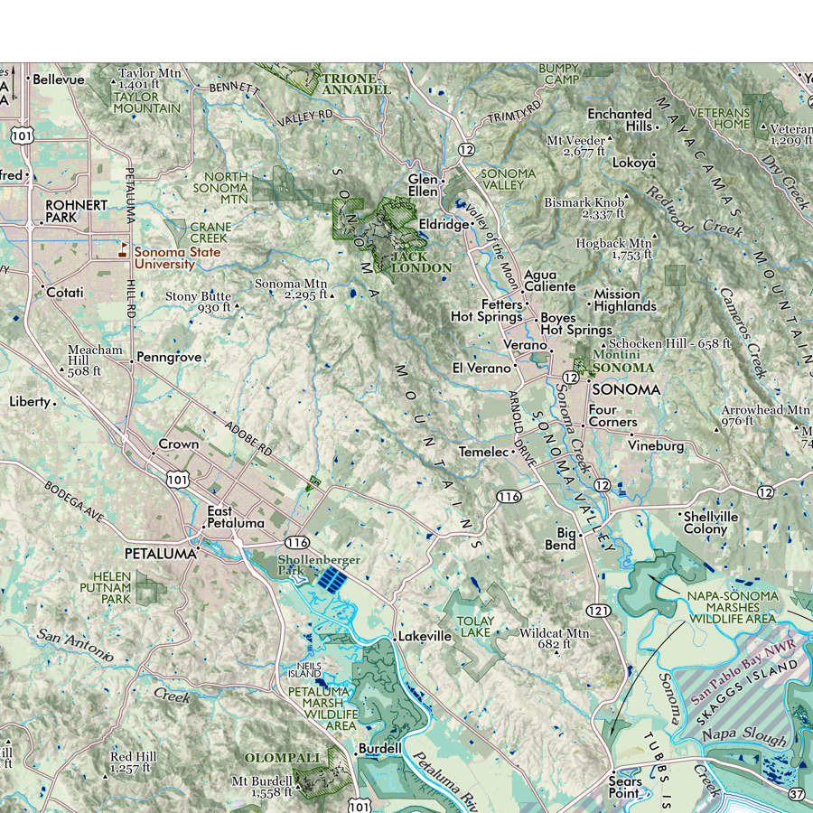 Image 6 of 17
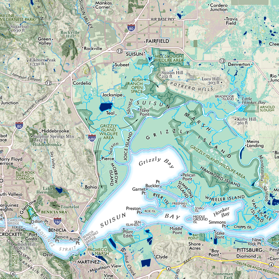 Image 7 of 17
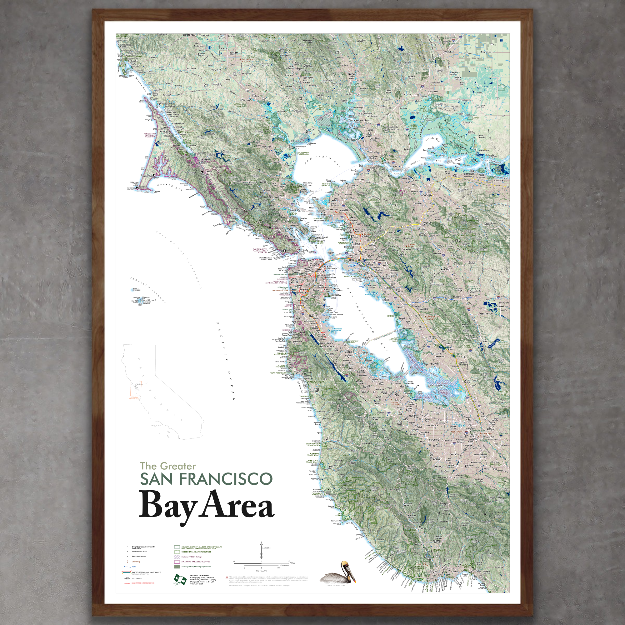 Image 8 of 17
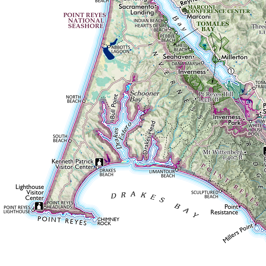 Image 9 of 17
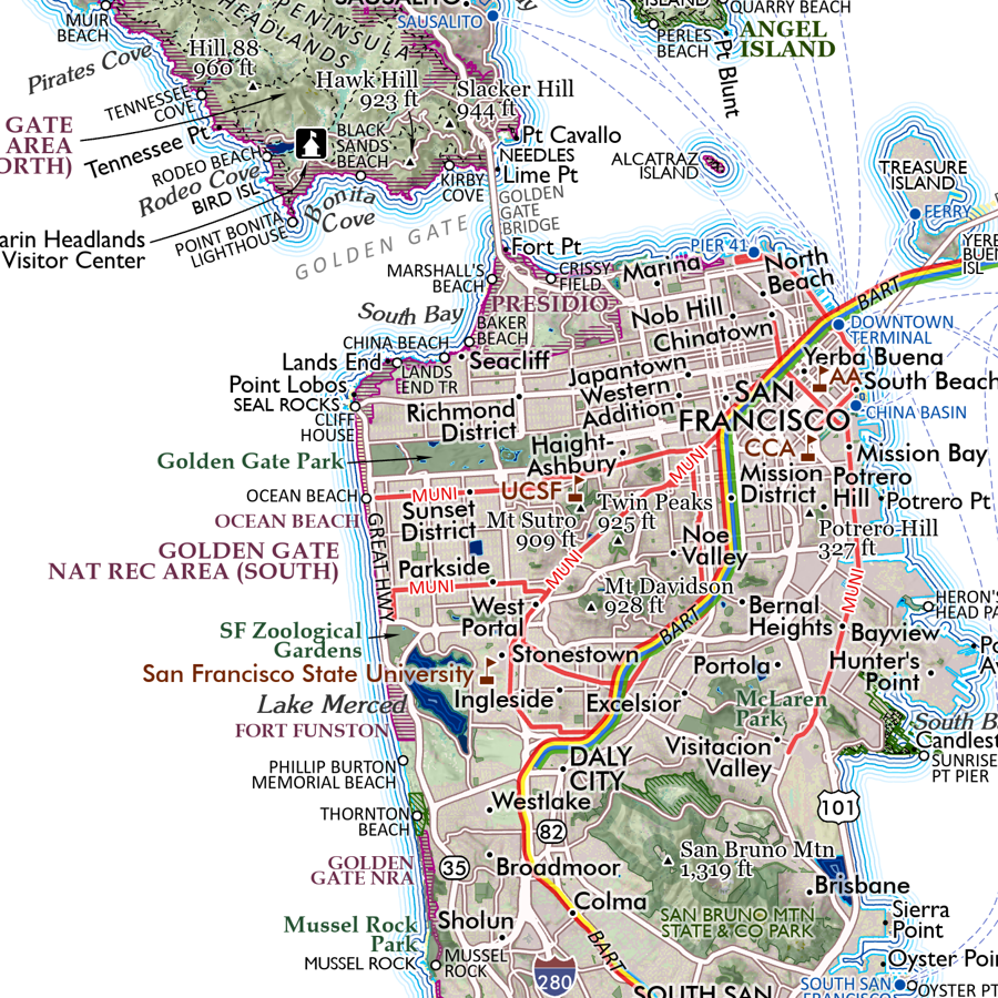 Image 10 of 17
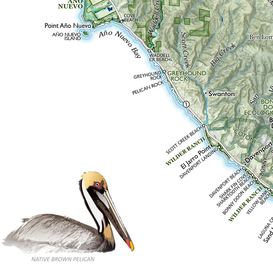 Image 11 of 17
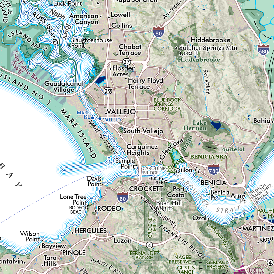 Image 12 of 17
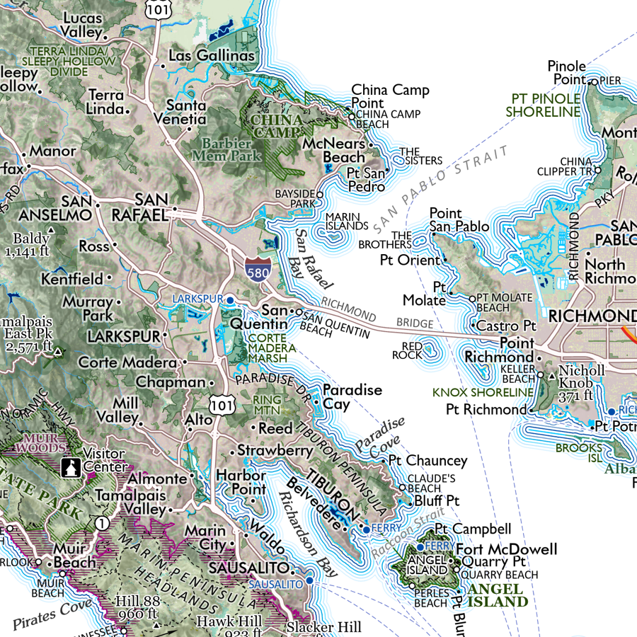 Image 13 of 17
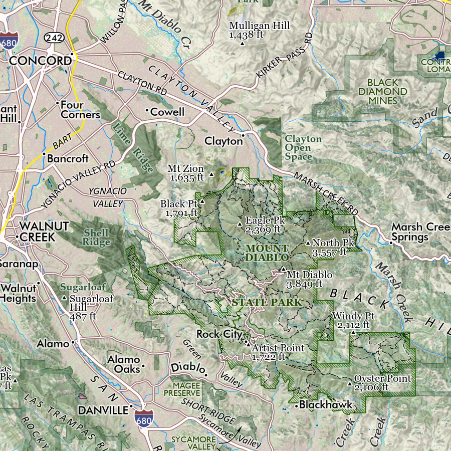 Image 14 of 17
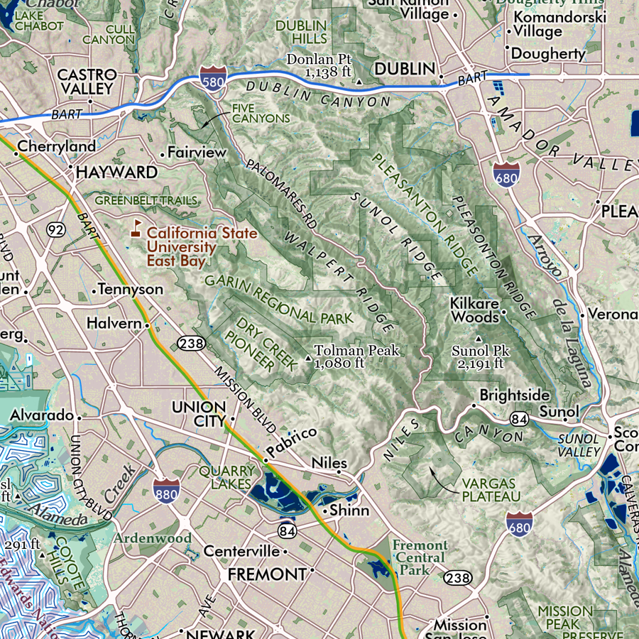 Image 15 of 17
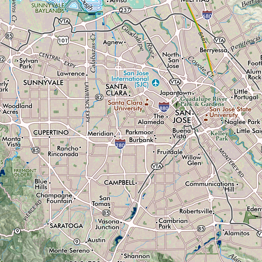 Image 16 of 17
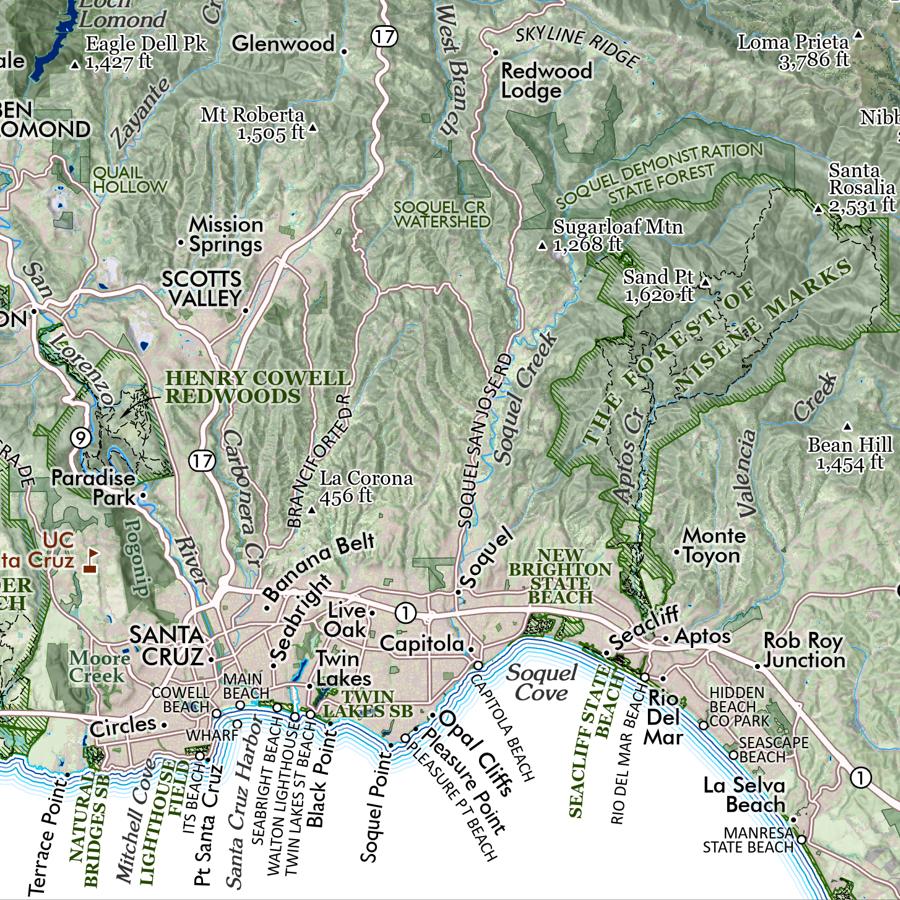 Image 17 of 17

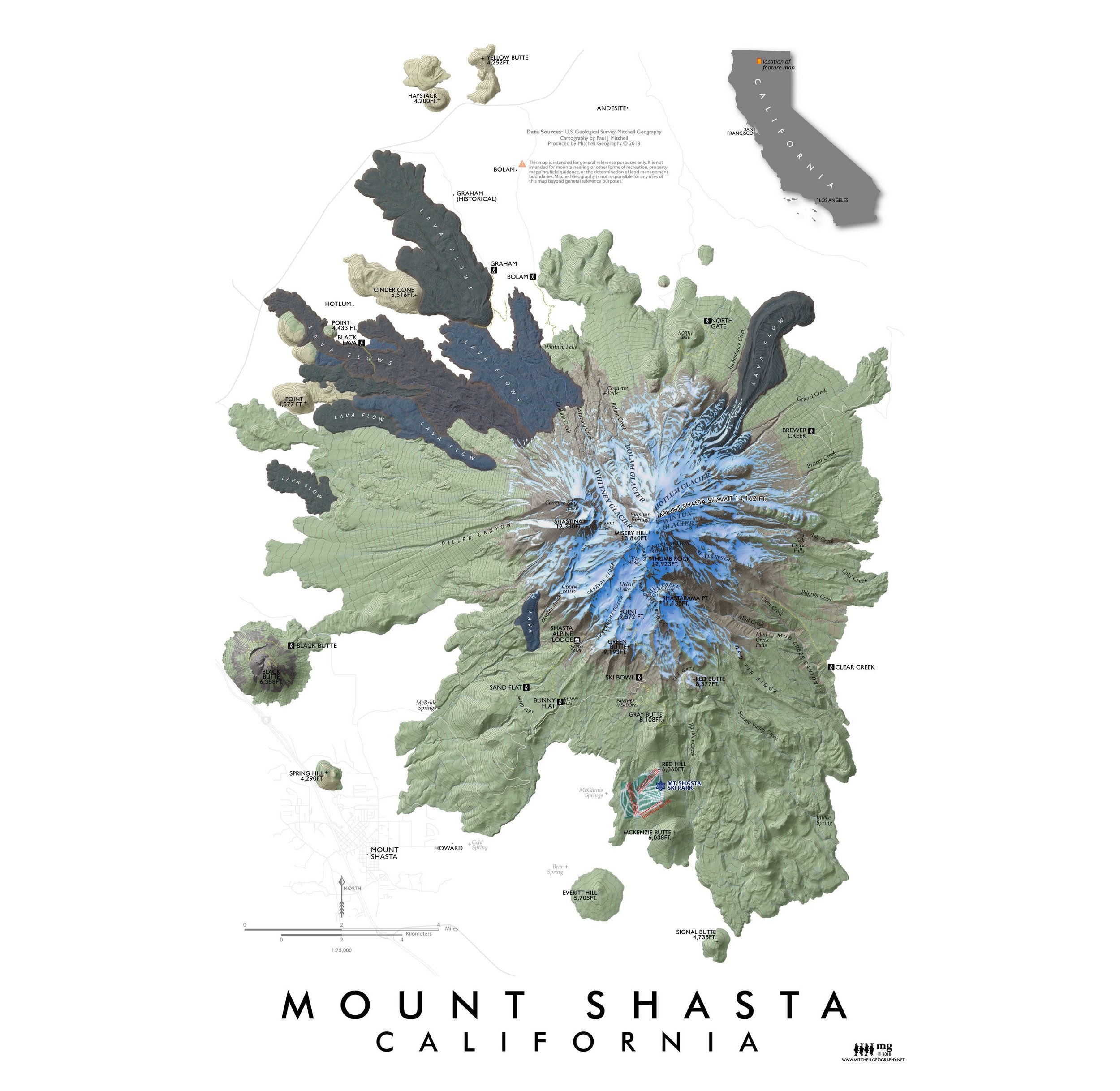
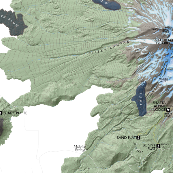
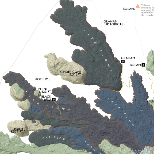
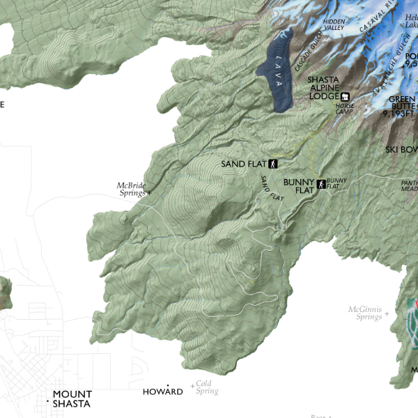
![Mount Shasta [California] (19 in x 13 in)](https://images.squarespace-cdn.com/content/v1/64dfe5c447627a1ab4b29d07/1695043610630-IP3HJXGI31ZW28EVU10V/Shasta1319_framed.JPG)