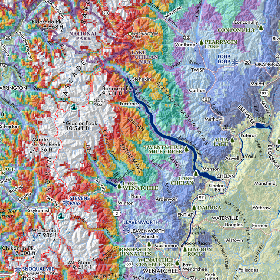
1:350,000
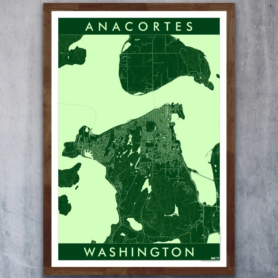
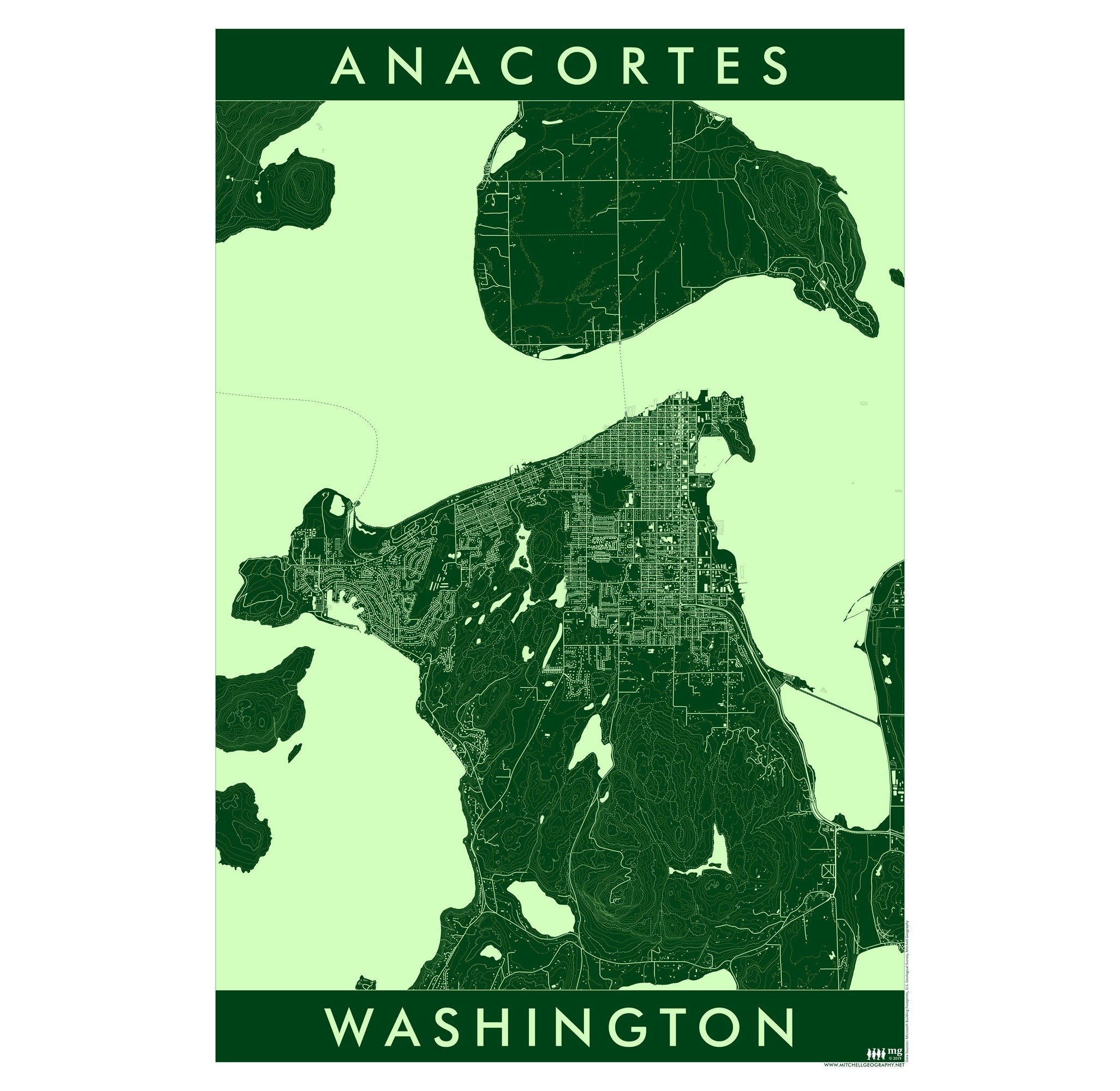
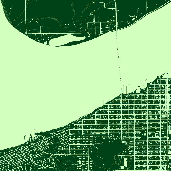
13 inch by 19 inch flat COLOR YOUR OWN wall map, printed on 100 lb acid-free eggshell finished cover stock. Packed and shipped flat.
Puget Sound General Reference COLOR YOUR OWN map*. Ever wanted to make your own map? Challenge yourself by coloring in this blank Puget Sound general reference map. Precise linework, place names, and point features guide and educate your sense of geography for the Puget Sound region. This is an elemental version of my Puget Sound Map, which you may also use as a guide to coloring your own map.
Printed on a 100 lb acid-free eggshell finished cover stock - this product is suitable and intended for watercolor, colored pencils, and various forms of markers. The map line work and labels are printed with a toner which will repel water based paints leaving readable labels and features after you’ve painted or colored over the map.
*This product is the paper sheet only. Paint, pencils, markers, etc are not included — you supply your chosen color set!
Highways, major roads, surface hydrology and populated places are included for geographic reference.
Additional thematic reference features include:
Populated place and locale names
Ferry routes (primary routes)
Prominent summits and high points
Waterbodies: inlets, bays, harbors, passages, lakes, reservoirs of notable size
Coastal landforms: capes, headlands, islands
Olympic National Park & other National Park/Preserve units within the map extent
Olympic National Forest
USFS designated wilderness
State Park/State Recreation Areas
Reservations
U.S. Military Bases
Pacific Northwest Trail route
Interstate and major highways are labeled with shield numbers (local arterials and roads and not labeled due to the scale limitations)
1:350,000
13 inch by 19 inch flat COLOR YOUR OWN wall map, printed on 100 lb acid-free eggshell finished cover stock. Packed and shipped flat.
Puget Sound General Reference COLOR YOUR OWN map*. Ever wanted to make your own map? Challenge yourself by coloring in this blank Puget Sound general reference map. Precise linework, place names, and point features guide and educate your sense of geography for the Puget Sound region. This is an elemental version of my Puget Sound Map, which you may also use as a guide to coloring your own map.
Printed on a 100 lb acid-free eggshell finished cover stock - this product is suitable and intended for watercolor, colored pencils, and various forms of markers. The map line work and labels are printed with a toner which will repel water based paints leaving readable labels and features after you’ve painted or colored over the map.
*This product is the paper sheet only. Paint, pencils, markers, etc are not included — you supply your chosen color set!
Highways, major roads, surface hydrology and populated places are included for geographic reference.
Additional thematic reference features include:
Populated place and locale names
Ferry routes (primary routes)
Prominent summits and high points
Waterbodies: inlets, bays, harbors, passages, lakes, reservoirs of notable size
Coastal landforms: capes, headlands, islands
Olympic National Park & other National Park/Preserve units within the map extent
Olympic National Forest
USFS designated wilderness
State Park/State Recreation Areas
Reservations
U.S. Military Bases
Pacific Northwest Trail route
Interstate and major highways are labeled with shield numbers (local arterials and roads and not labeled due to the scale limitations)

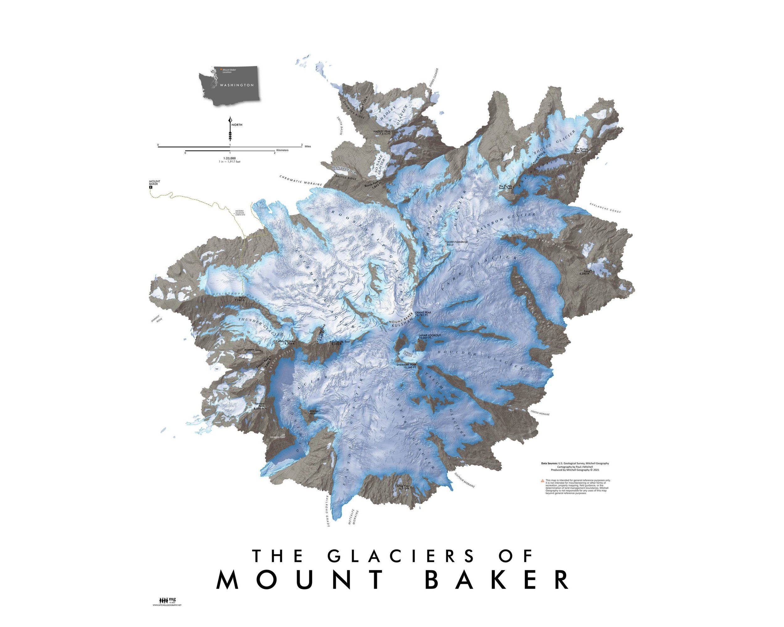
 Image 1 of 8
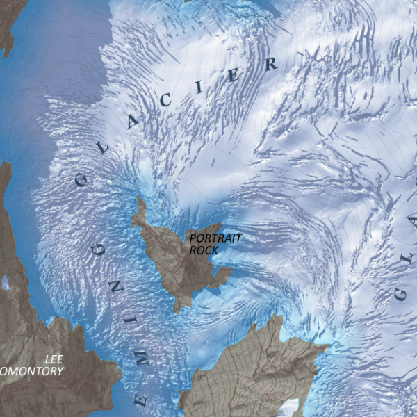
 Image 2 of 8
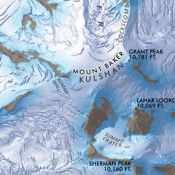
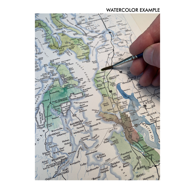 Image 3 of 8
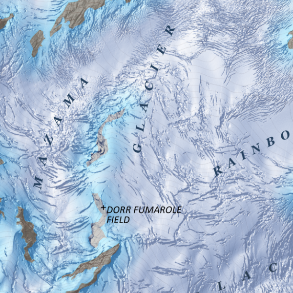
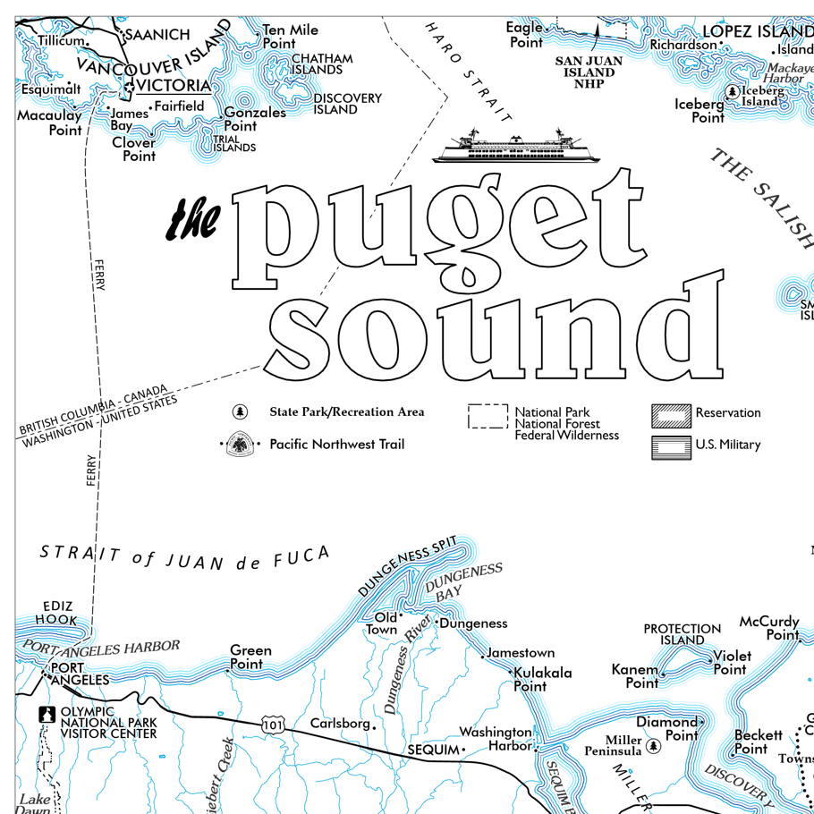 Image 4 of 8
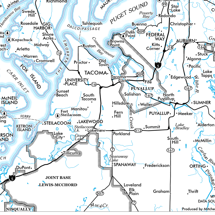 Image 5 of 8
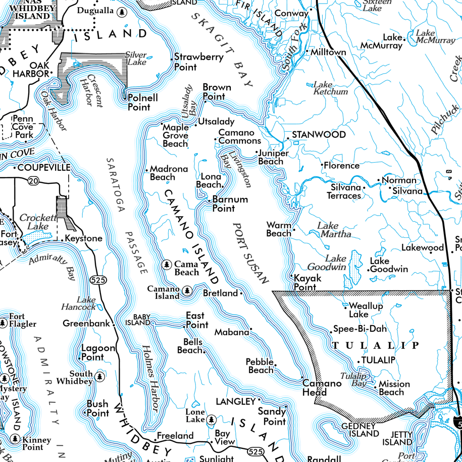 Image 6 of 8
 Image 7 of 8
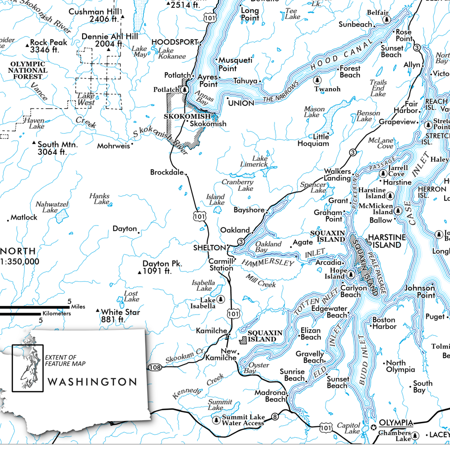 Image 8 of 8