1:80,000
28 inch by 20 inch flat wall map, printed on heavy fine paper. Shipped rolled in a tube.
Second Edition July 2026.
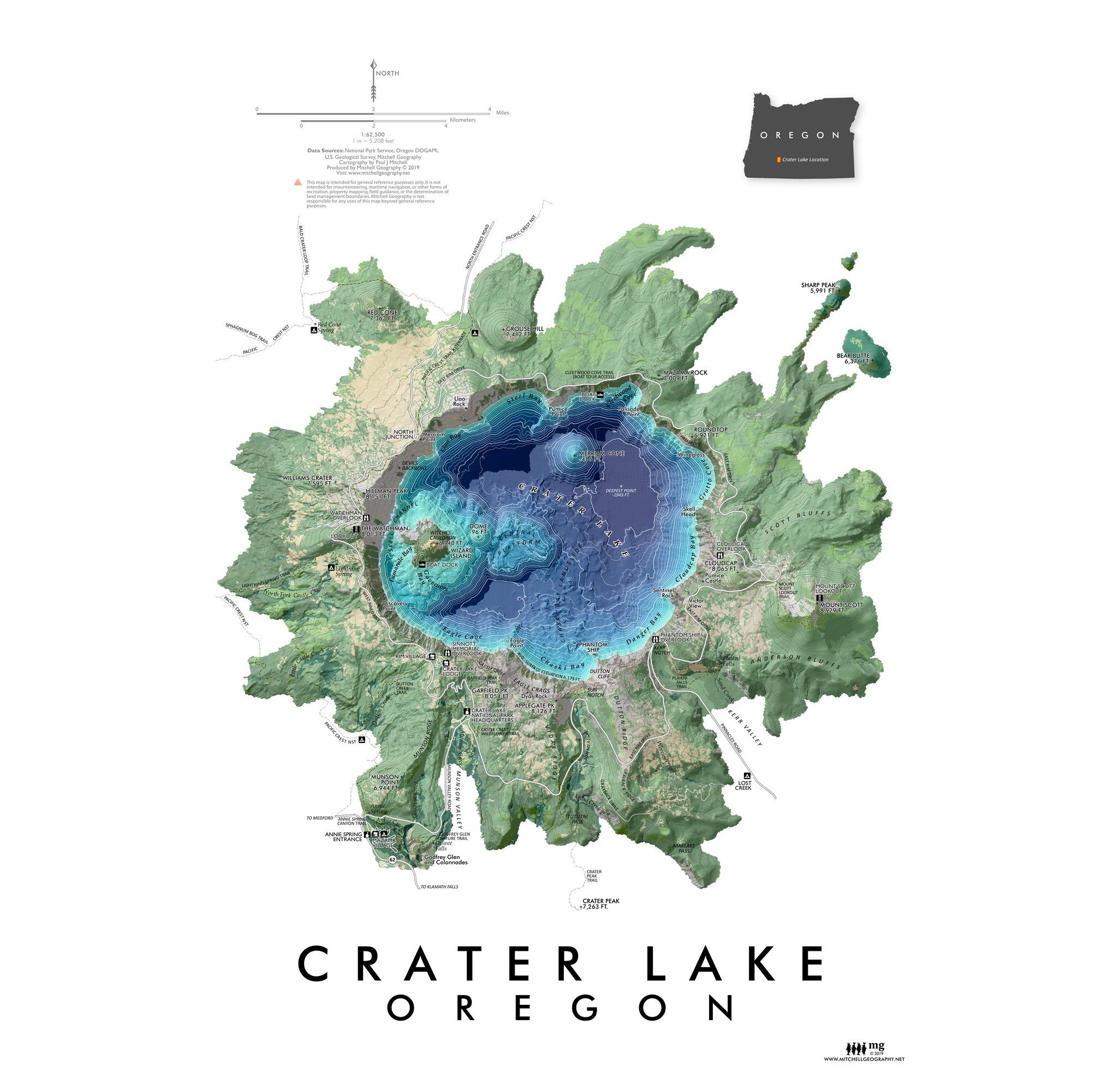
Wallowa Mountains, Oregon Map. My Wallowas map is centered upon the high alpine core and adjacent access sites/trailheads. Please note this map does not include the furthest western portions of the Eagle Cap Wilderness (the map extent is further detailed below).
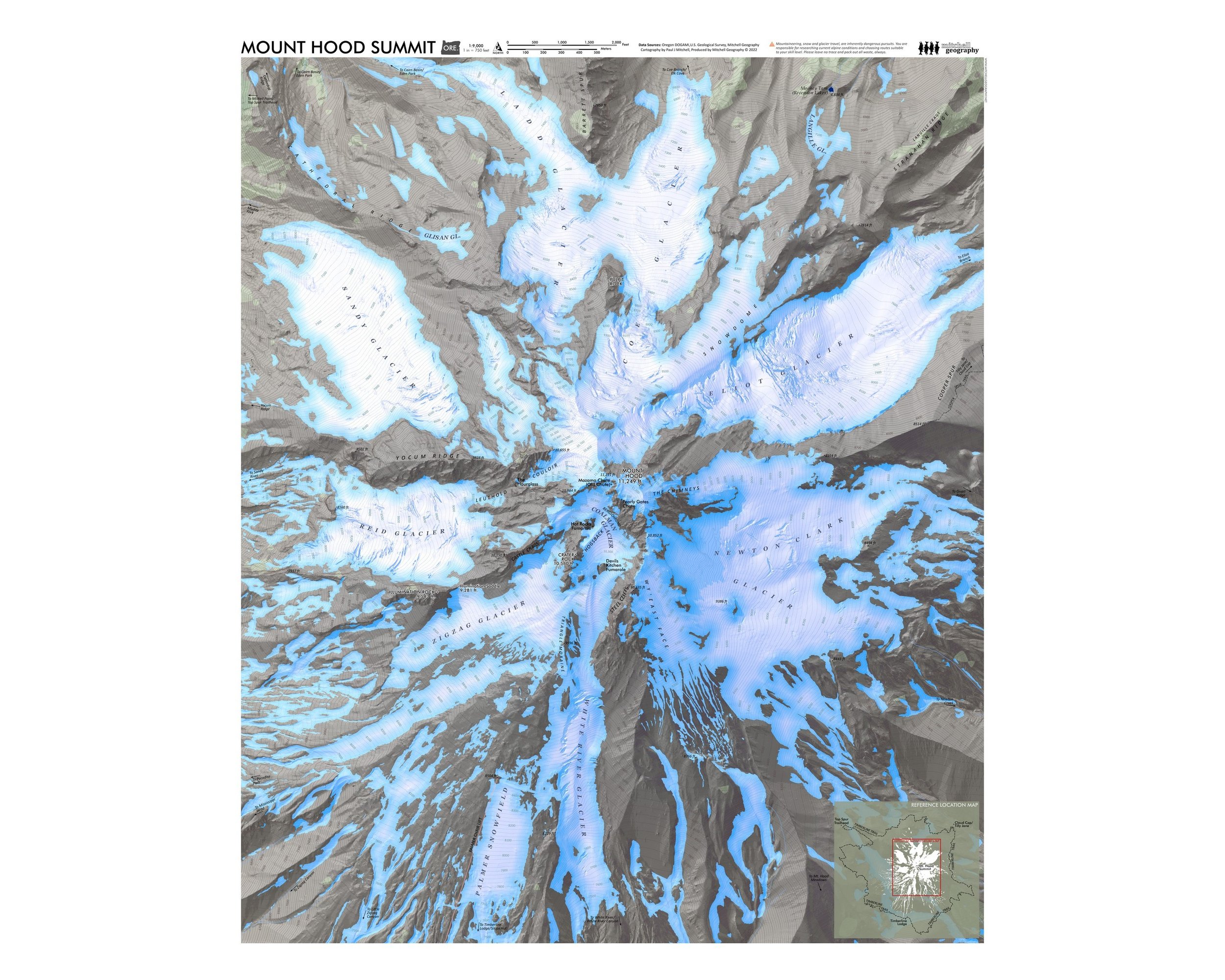
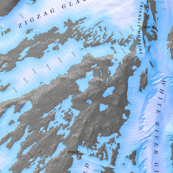
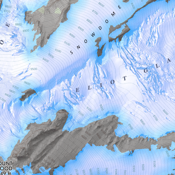
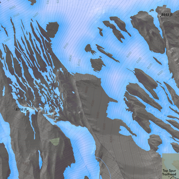
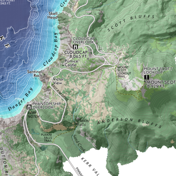
This second edition map features a larger sheet size and improved scale for legibility and trip planning purposes. The non-motorized trail network of the Eagle Cap Wilderness is labeled with rich detail including trail names, trail segment mileage, and elevations at trail junctions, trailheads, and prominent passes. 500 ft elevation contours are labeled throughout the map extent; summits, landforms, lakes, basins, rivers & streams, and special features are also labeled for reference.
Again please note, this version is centered upon the higher elevation alpine and mountain lake areas and associated access points of the Eagle Cap Wilderness located in the Wallowa-Whitman National Forest — the following trailhead/access areas are mapped:
NORTH ACCESS/TRAILHEADS
Huckleberry Mountain
Lostine River corridor
NORTHEAST & EAST ACCESS/TRAILHEADS
SOUTH & WEST ACCESS/TRAILHEADS
***NOT MAPPED***: the lower elevation western portions of the Eagle Cap, including the lower Minam River, lower Bear Creek, and North Catherine Creek areas; this includes Sand Pass, Moss Springs, Buck Creek, and the various Horse Ranch, and Little Minam River trailheads and access sites. Though these sites are not mapped, their associated trails typically pick up on the map within a few miles as they approach the alpine vicinities (e.g. the Minam River Trail is mapped from it’s headwaters to the junction with the North Minam Trail - 8 miles upstream from Red’s Horse Ranch)
1:80,000
28 inch by 20 inch flat wall map, printed on heavy fine paper. Shipped rolled in a tube.
Second Edition July 2026.
Wallowa Mountains, Oregon Map. My Wallowas map is centered upon the high alpine core and adjacent access sites/trailheads. Please note this map does not include the furthest western portions of the Eagle Cap Wilderness (the map extent is further detailed below).
This second edition map features a larger sheet size and improved scale for legibility and trip planning purposes. The non-motorized trail network of the Eagle Cap Wilderness is labeled with rich detail including trail names, trail segment mileage, and elevations at trail junctions, trailheads, and prominent passes. 500 ft elevation contours are labeled throughout the map extent; summits, landforms, lakes, basins, rivers & streams, and special features are also labeled for reference.
Again please note, this version is centered upon the higher elevation alpine and mountain lake areas and associated access points of the Eagle Cap Wilderness located in the Wallowa-Whitman National Forest — the following trailhead/access areas are mapped:
NORTH ACCESS/TRAILHEADS
Huckleberry Mountain
Lostine River corridor
NORTHEAST & EAST ACCESS/TRAILHEADS
SOUTH & WEST ACCESS/TRAILHEADS
***NOT MAPPED***: the lower elevation western portions of the Eagle Cap, including the lower Minam River, lower Bear Creek, and North Catherine Creek areas; this includes Sand Pass, Moss Springs, Buck Creek, and the various Horse Ranch, and Little Minam River trailheads and access sites. Though these sites are not mapped, their associated trails typically pick up on the map within a few miles as they approach the alpine vicinities (e.g. the Minam River Trail is mapped from it’s headwaters to the junction with the North Minam Trail - 8 miles upstream from Red’s Horse Ranch)

 Image 1 of 11
 Image 2 of 11
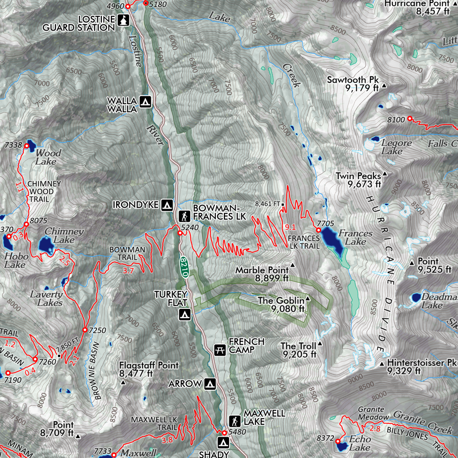 Image 3 of 11
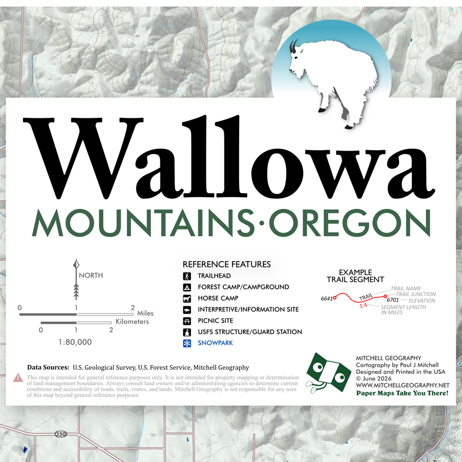 Image 4 of 11
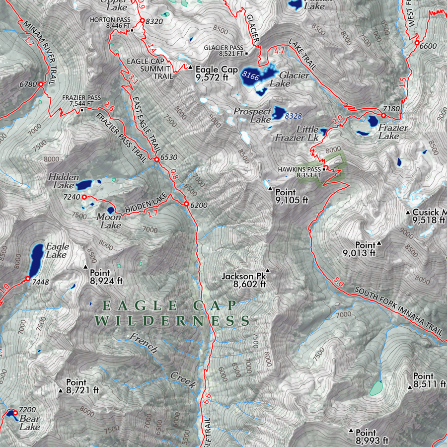 Image 5 of 11
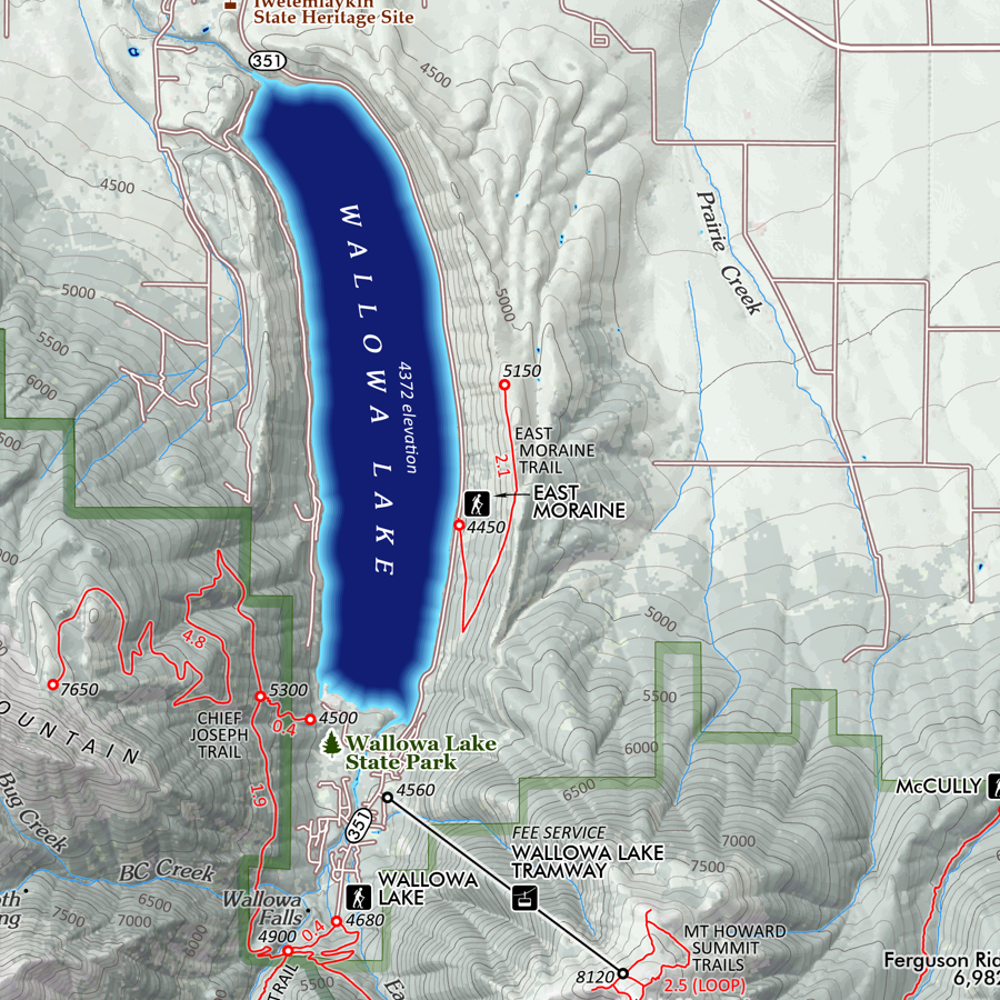 Image 6 of 11
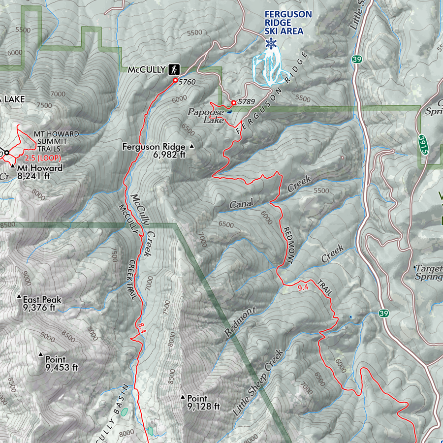 Image 7 of 11
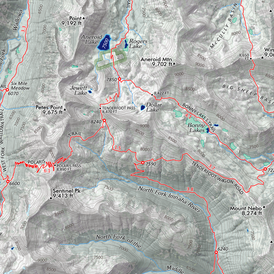 Image 8 of 11
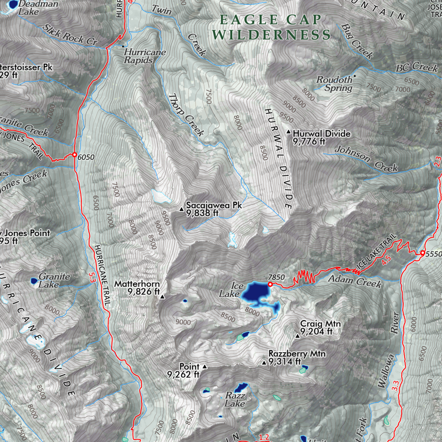 Image 9 of 11
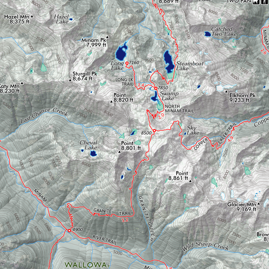 Image 10 of 11
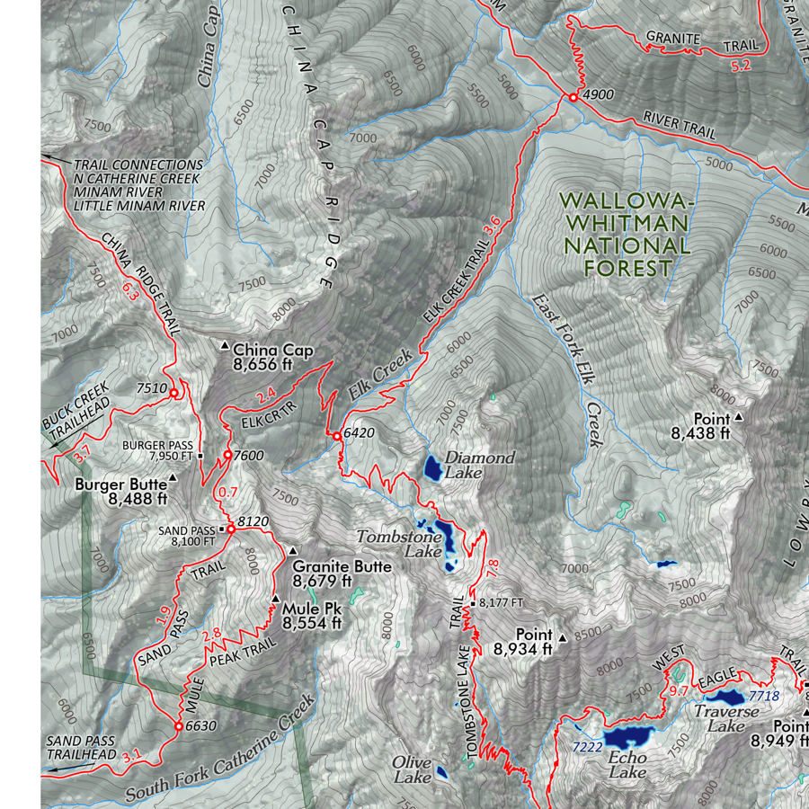 Image 11 of 11