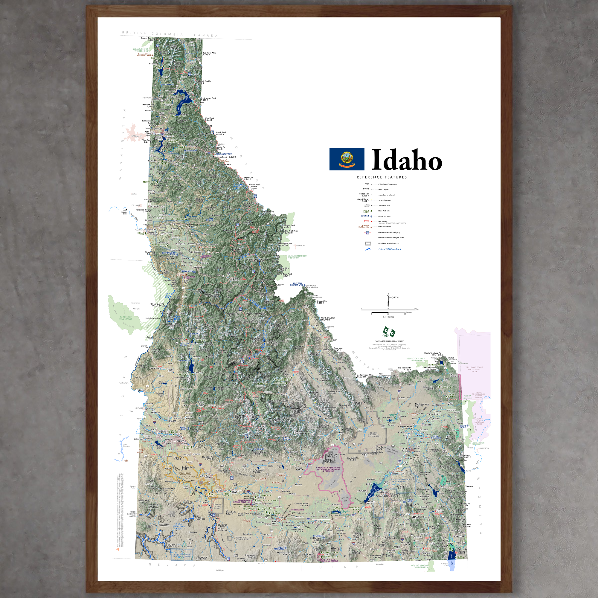
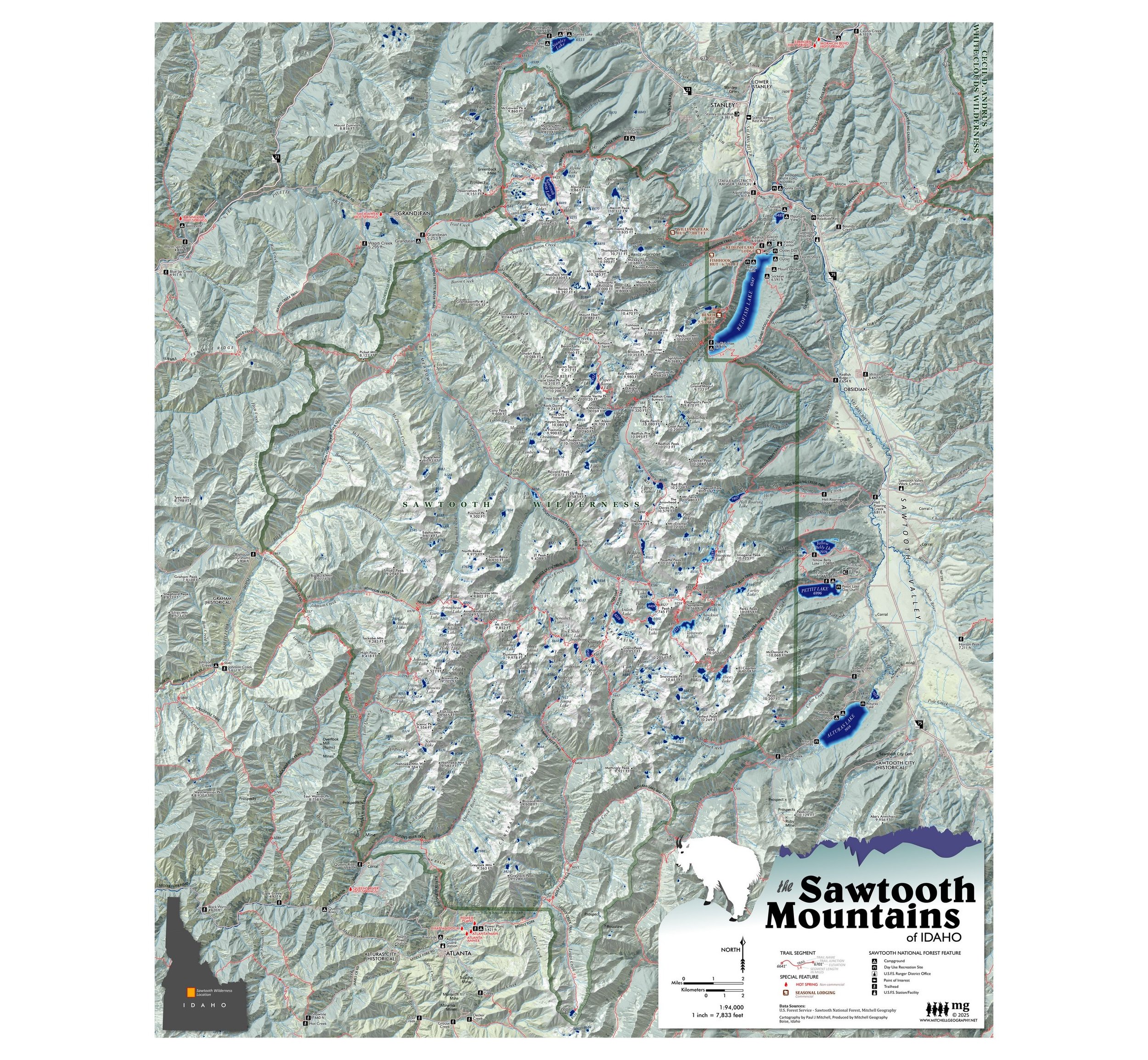
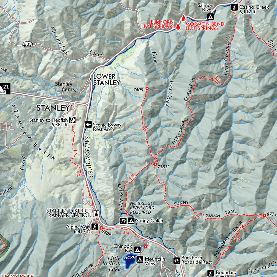
1:6,500
28 inch (height) by 20 inch (width) flat wall map, printed on heavy fine paper. Shipped rolled.
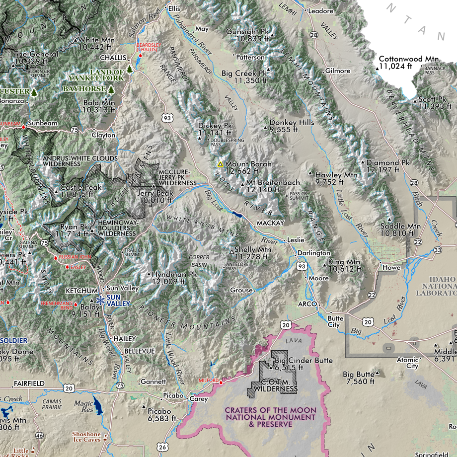
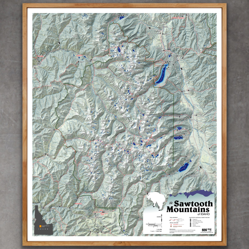
Mount Borah, Idaho Map.
Highly detailed map of the summit alpine vicinity of Mount Borah - Idaho’s 12,662 foot state high point located in the austere and massive Lost River Range. The majority of this map extent is the landforms over 10,000 feet in elevation. The primary trail route is features with named features, contour intervals labeled, and a richly detailed late spring seasonal snowfields.
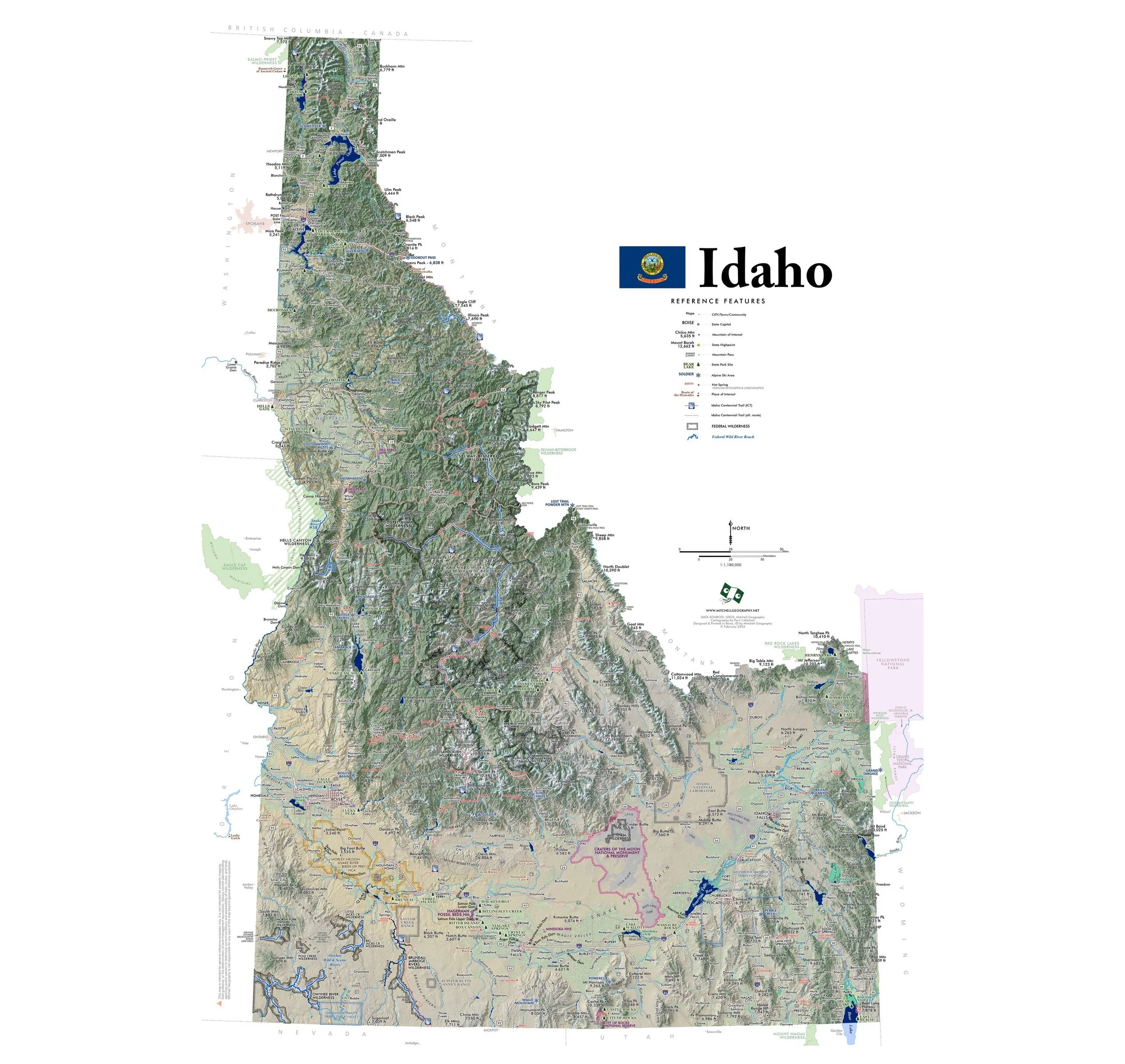
1:6,500
28 inch (height) by 20 inch (width) flat wall map, printed on heavy fine paper. Shipped rolled.
Mount Borah, Idaho Map.
Highly detailed map of the summit alpine vicinity of Mount Borah - Idaho’s 12,662 foot state high point located in the austere and massive Lost River Range. The majority of this map extent is the landforms over 10,000 feet in elevation. The primary trail route is features with named features, contour intervals labeled, and a richly detailed late spring seasonal snowfields.

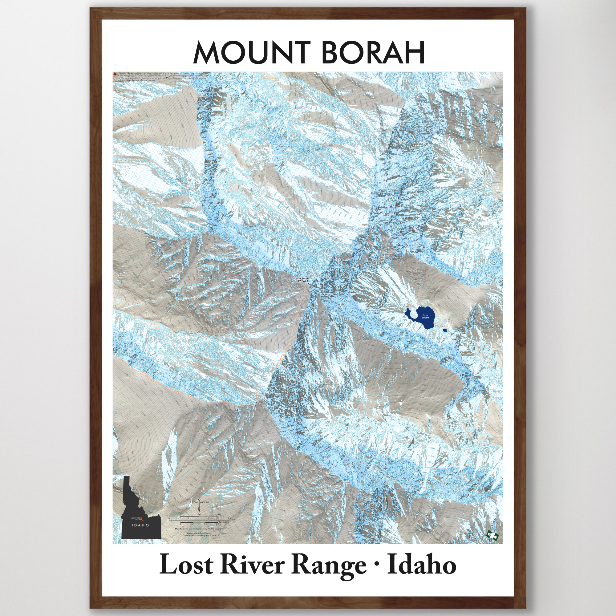 Image 1 of 6
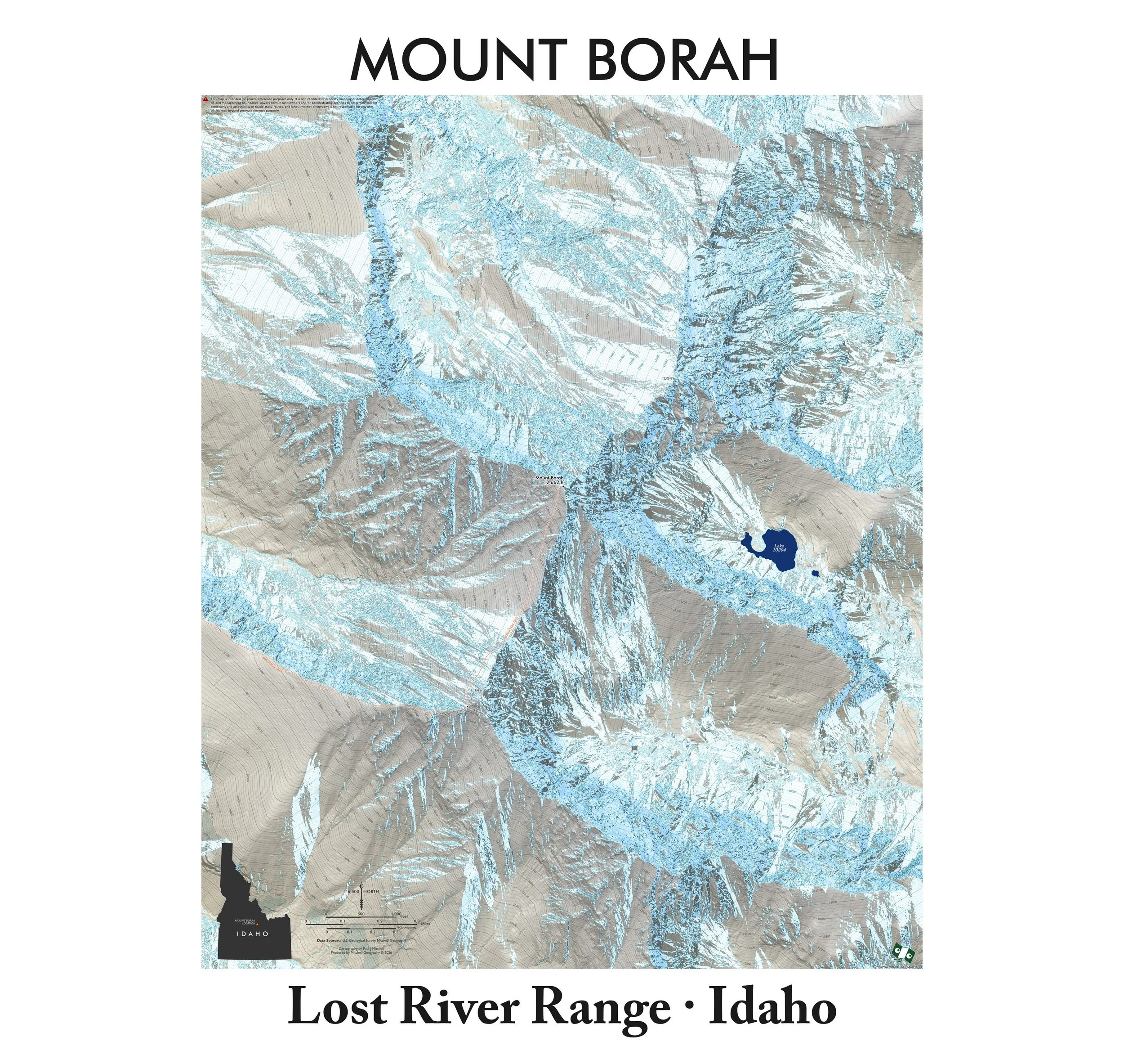 Image 2 of 6
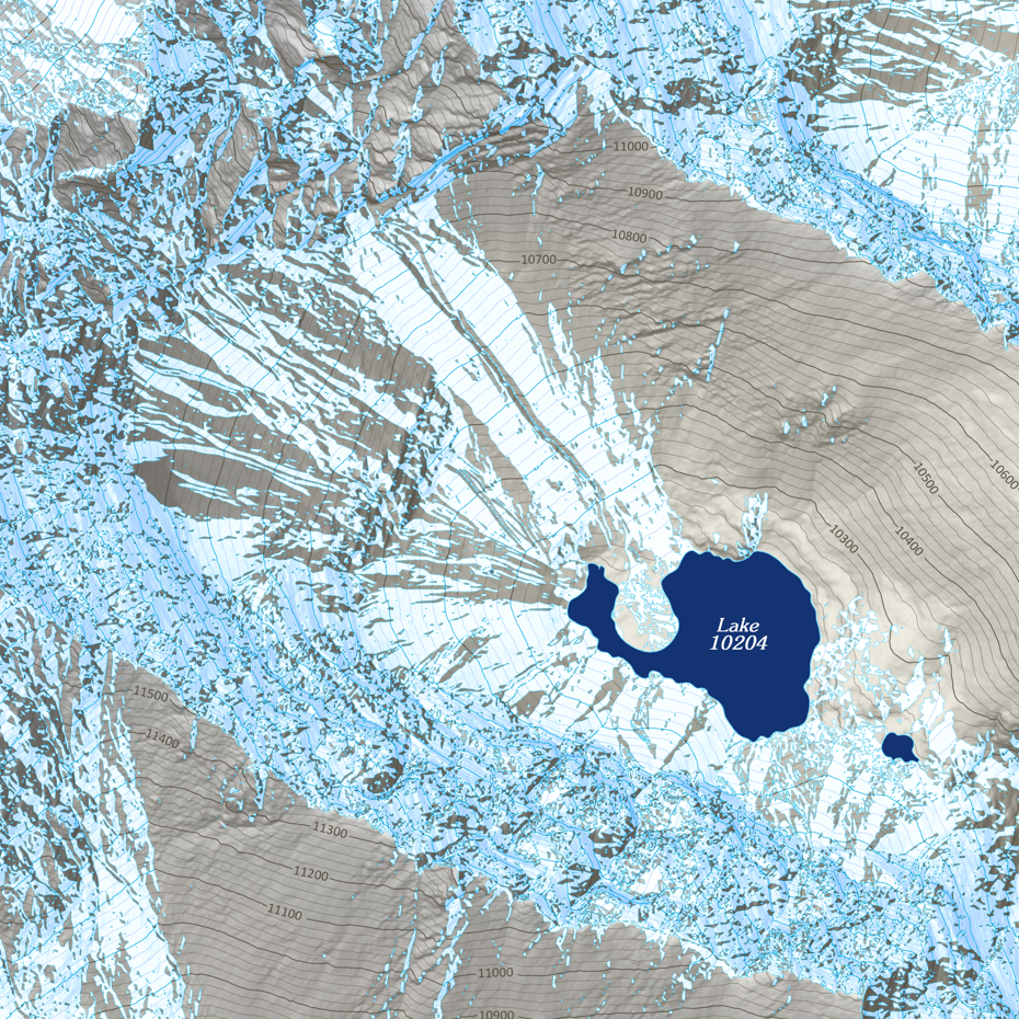 Image 3 of 6
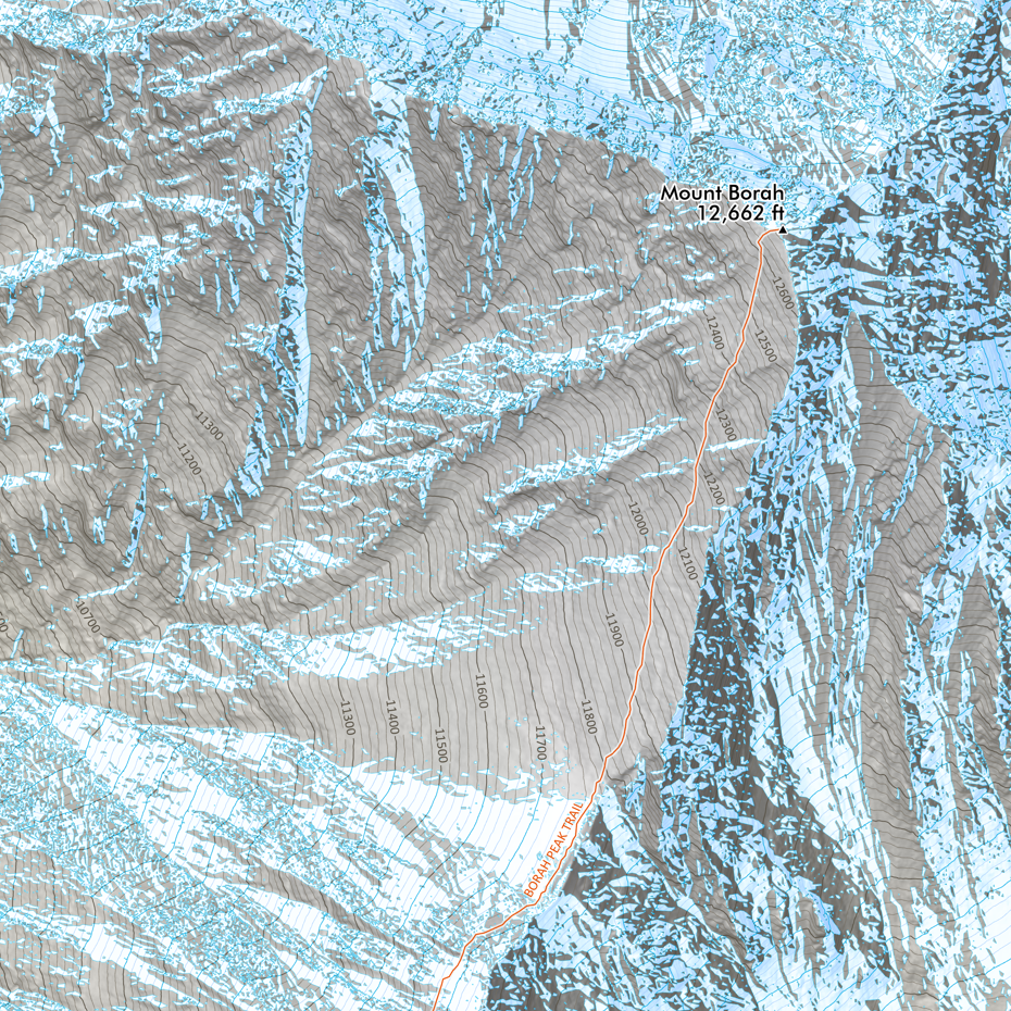 Image 4 of 6
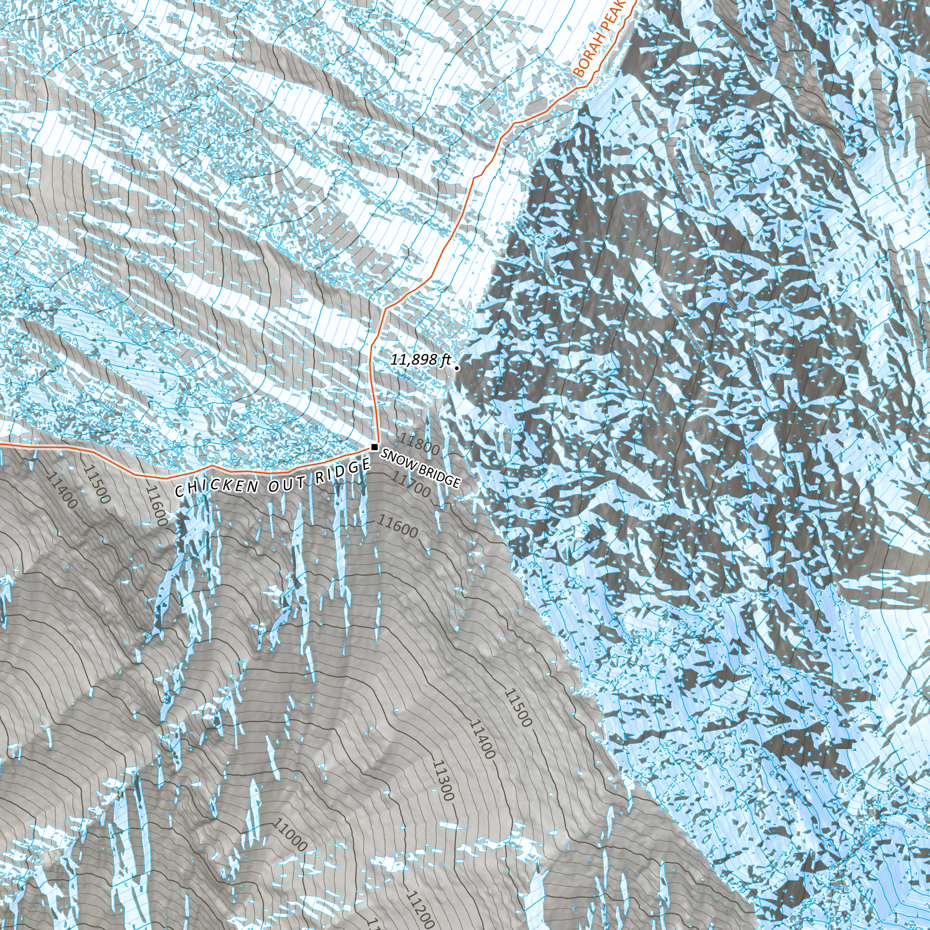 Image 5 of 6
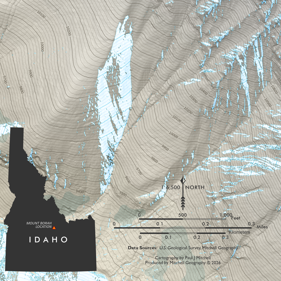 Image 6 of 6