1:380,000
28 inch x 20 inch — flat wall map, printed on a heavy fine paper — shipped rolled in a 3 inch x 21 inch tube.
Outer Banks, North Carolina map. Detailed general reference wall map featuring the Outer Banks, Pamlico Sound, Albemarle Sound and a wide extent of northeast North Carolina; the map also extends north to capture the Virginia section of the Currituck Banks Peninsula. From north to south, coastal peninsulas and islands include: Virginia Beach, Knotts Island, Currituck Banks, Bodie Island, Roanoke Island, Pea Island, Hatteras Island, Ocracoke Island, North Core Banks, Middle Core Bank, South Core Banks, Shackleford Banks, Harkers Island, Carrot Island, Bogue Banks (Emerald Isle), Bear Island, Onslow Beach. Inland the map reaches west to Greenville & New Bern, and south to portions of Camp Lejeune and Jacksonville. Major Sounds and Coastal Rivers mapped include: Pamlico Sound, Albemarle Sound, Currituck Sound, Croatan Sound, Core Sound, Back Sound, Bogue Sound, North Landing River, Pasquotank River, Perquimans River, Chowan River, Roanoke River, Alligator River, Pamlico River, Tar River, Pungo River, Bay River, Neuse River, North River, Newport River, White Oak River.
Mapped Reference Features include:
Places/Towns/Cities
Coastal Features; Islands, Capes, Necks, Headlands, notable Shoals, Inlets, Harbors, Bays, Hammocks, Swashes, Marshes, Swamps, notable Sandbars, notable Beaches, select paleo (historical) Inlets
Ferry Routes and Terminals
Atlantic Intracoastal Waterway routes (ICW)
NC Highway 12 mile points from the Wright Memorial Bridge at Kitty Hawk/Southern Shores south to Ocracoke Village (miles 1 through 86, bridge and ferry miles are not labeled).
Lighthouses
Public Piers of Interest
Features of Interest: notable Museums, Parks, Bridges, Visitor Centers, Universities, etc.
Wright Brothers National Memorial
Fort Raleigh National Historic Site
Cape Hatteras National Seashore (generalized extent labeled)
Cape Lookout National Seashore (generalized extent labeled)
State Park Developed Sites (site locations)
State Parks and State Nature Preserves/Areas (area extents)
State Game Areas (NC) & State Wildlife Management Areas (VA)
US FWS National Wildlife Refuges (NWR)
Croatan National Forest
Croatan National Forest - Designated Federal Wilderness areas
DOD Lands
1:380,000
28 inch x 20 inch — flat wall map, printed on a heavy fine paper — shipped rolled in a 3 inch x 21 inch tube.
Outer Banks, North Carolina map. Detailed general reference wall map featuring the Outer Banks, Pamlico Sound, Albemarle Sound and a wide extent of northeast North Carolina; the map also extends north to capture the Virginia section of the Currituck Banks Peninsula. From north to south, coastal peninsulas and islands include: Virginia Beach, Knotts Island, Currituck Banks, Bodie Island, Roanoke Island, Pea Island, Hatteras Island, Ocracoke Island, North Core Banks, Middle Core Bank, South Core Banks, Shackleford Banks, Harkers Island, Carrot Island, Bogue Banks (Emerald Isle), Bear Island, Onslow Beach. Inland the map reaches west to Greenville & New Bern, and south to portions of Camp Lejeune and Jacksonville. Major Sounds and Coastal Rivers mapped include: Pamlico Sound, Albemarle Sound, Currituck Sound, Croatan Sound, Core Sound, Back Sound, Bogue Sound, North Landing River, Pasquotank River, Perquimans River, Chowan River, Roanoke River, Alligator River, Pamlico River, Tar River, Pungo River, Bay River, Neuse River, North River, Newport River, White Oak River.
Mapped Reference Features include:
Places/Towns/Cities
Coastal Features; Islands, Capes, Necks, Headlands, notable Shoals, Inlets, Harbors, Bays, Hammocks, Swashes, Marshes, Swamps, notable Sandbars, notable Beaches, select paleo (historical) Inlets
Ferry Routes and Terminals
Atlantic Intracoastal Waterway routes (ICW)
NC Highway 12 mile points from the Wright Memorial Bridge at Kitty Hawk/Southern Shores south to Ocracoke Village (miles 1 through 86, bridge and ferry miles are not labeled).
Lighthouses
Public Piers of Interest
Features of Interest: notable Museums, Parks, Bridges, Visitor Centers, Universities, etc.
Wright Brothers National Memorial
Fort Raleigh National Historic Site
Cape Hatteras National Seashore (generalized extent labeled)
Cape Lookout National Seashore (generalized extent labeled)
State Park Developed Sites (site locations)
State Parks and State Nature Preserves/Areas (area extents)
State Game Areas (NC) & State Wildlife Management Areas (VA)
US FWS National Wildlife Refuges (NWR)
Croatan National Forest
Croatan National Forest - Designated Federal Wilderness areas
DOD Lands

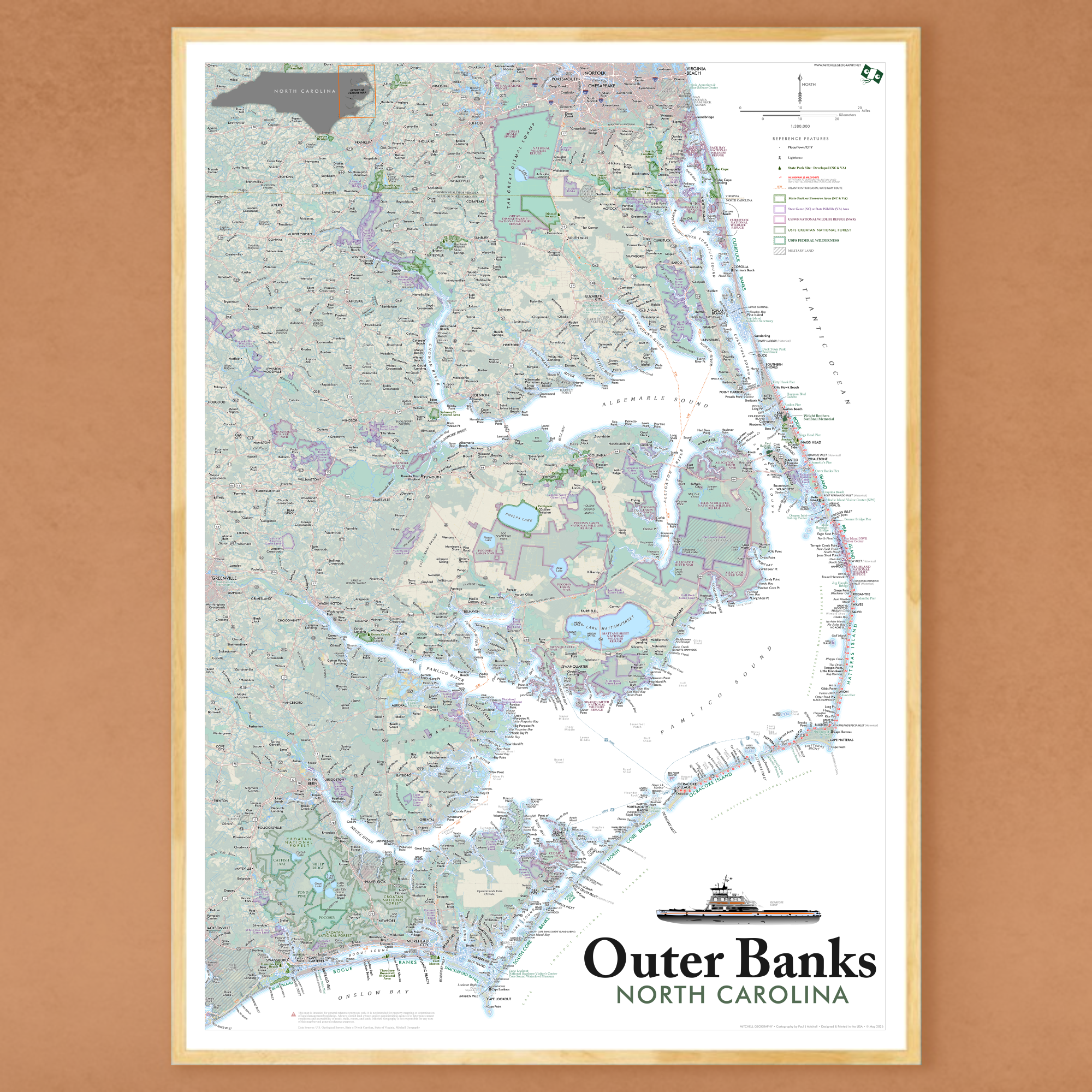 Image 1 of 13
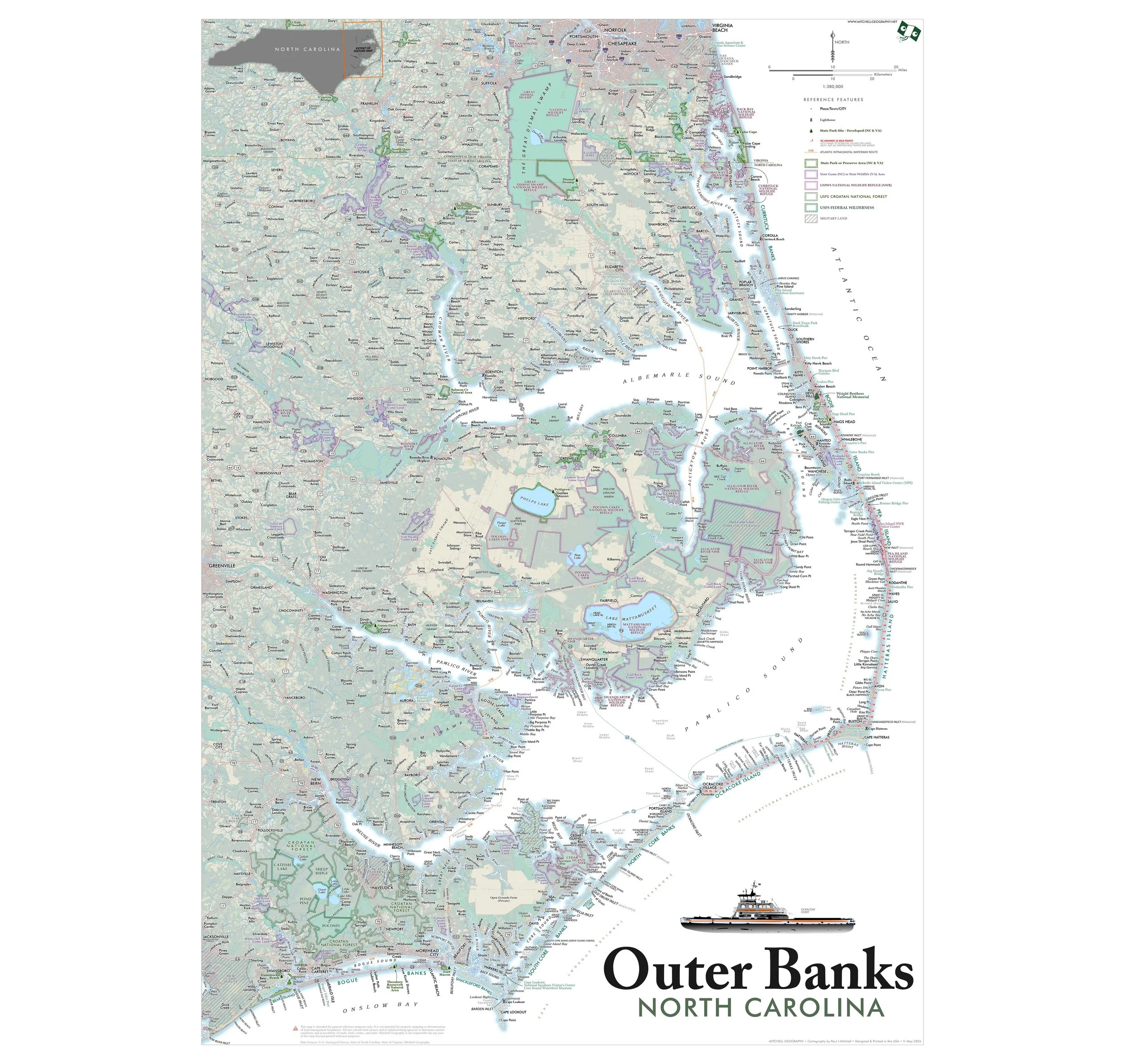 Image 2 of 13
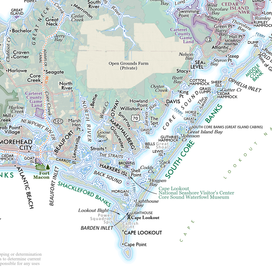 Image 3 of 13
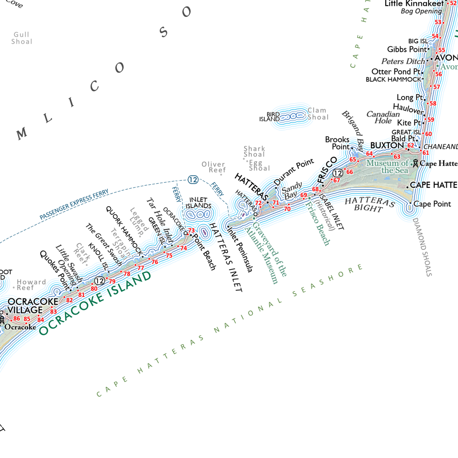 Image 4 of 13
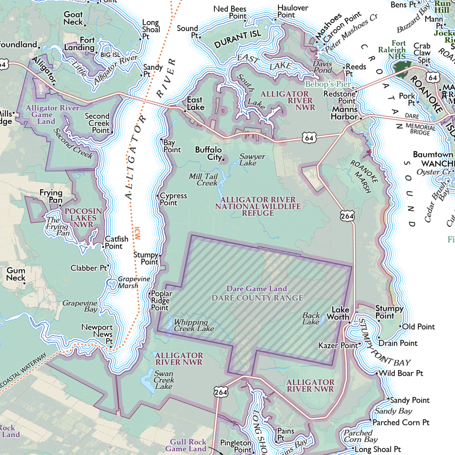 Image 5 of 13
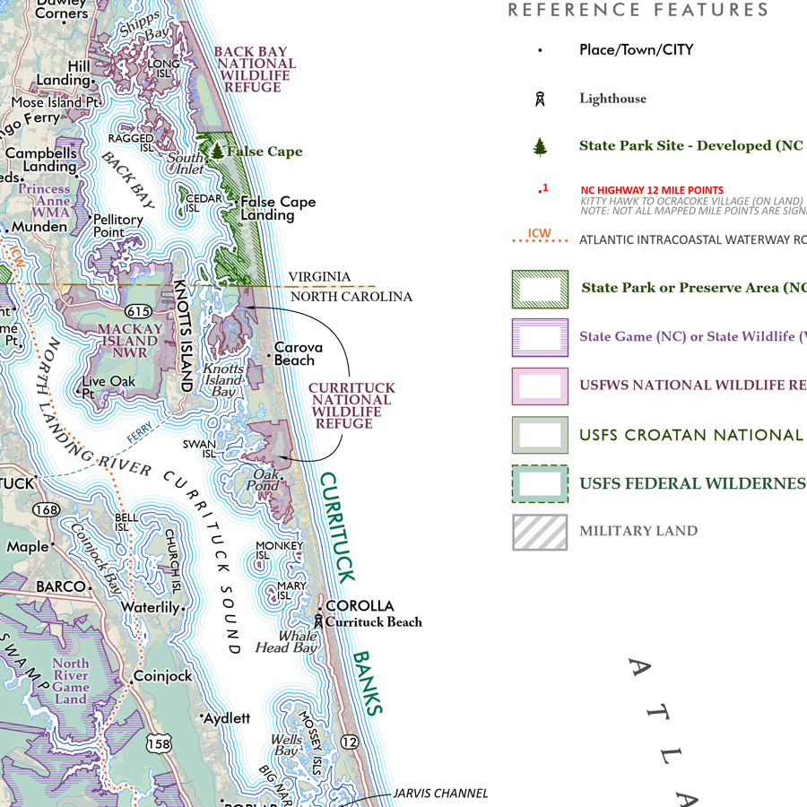 Image 6 of 13
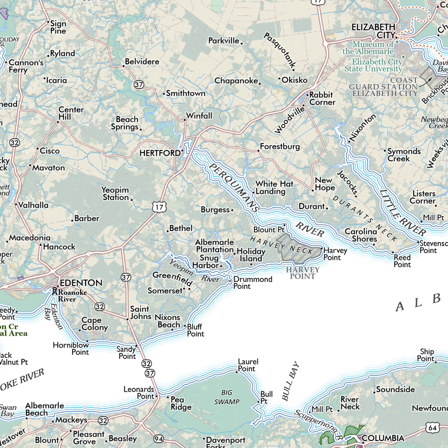 Image 7 of 13
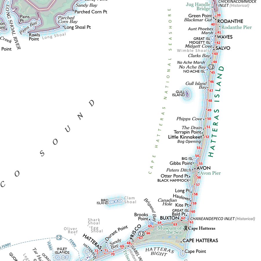 Image 8 of 13
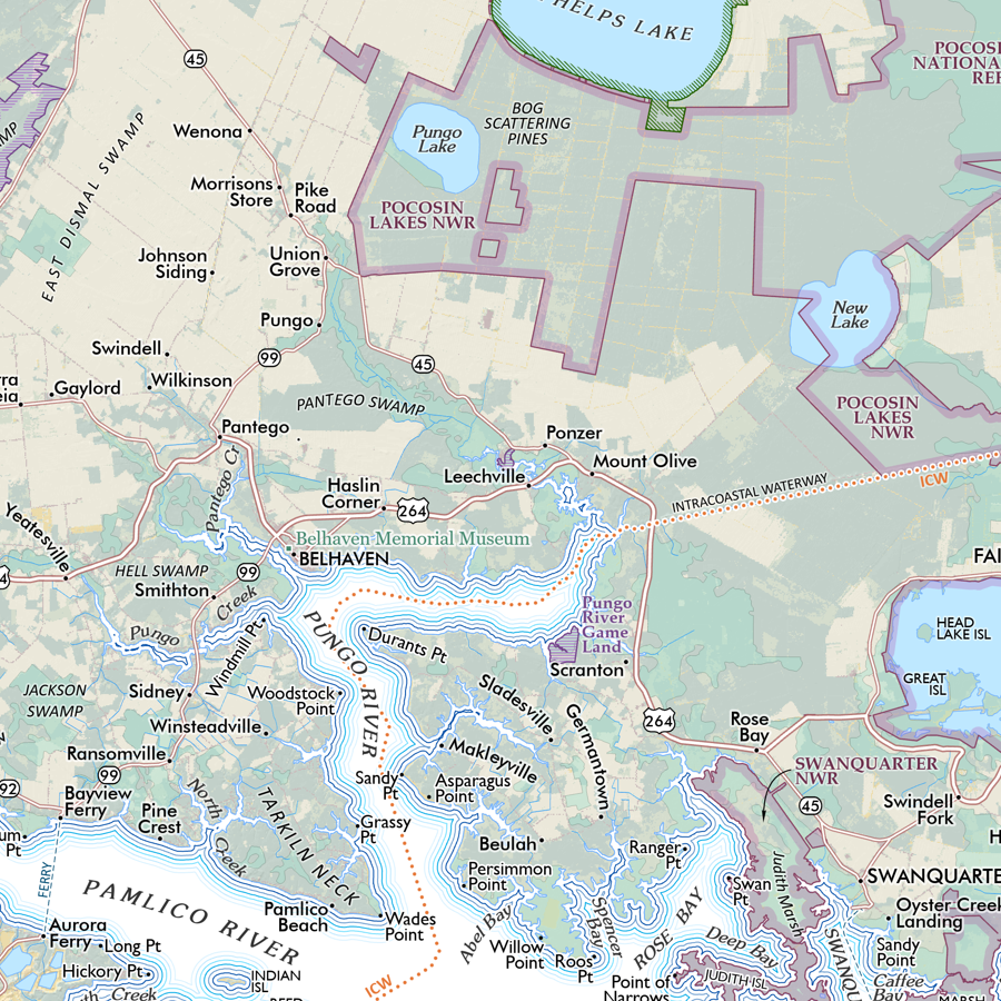 Image 9 of 13
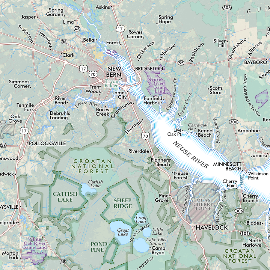 Image 10 of 13
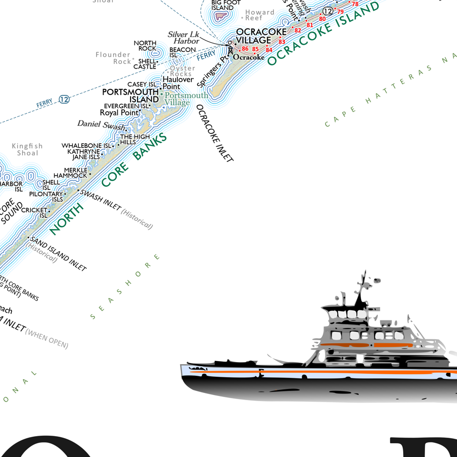 Image 11 of 13
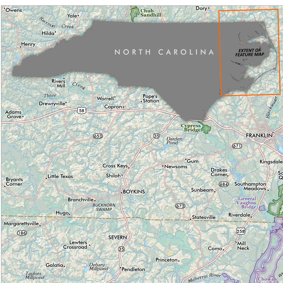 Image 12 of 13
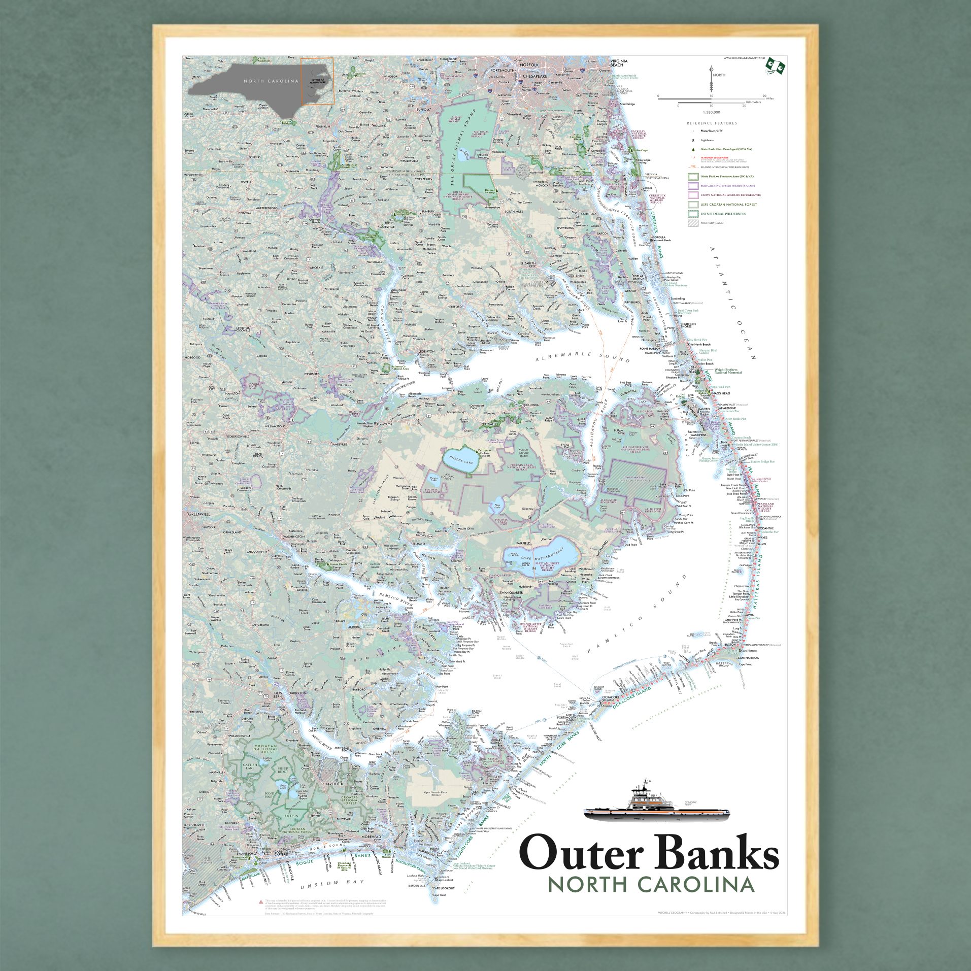 Image 13 of 13