1:380,000
28 inch x 20 inch — flat wall map, printed on a heavy fine paper — shipped rolled.
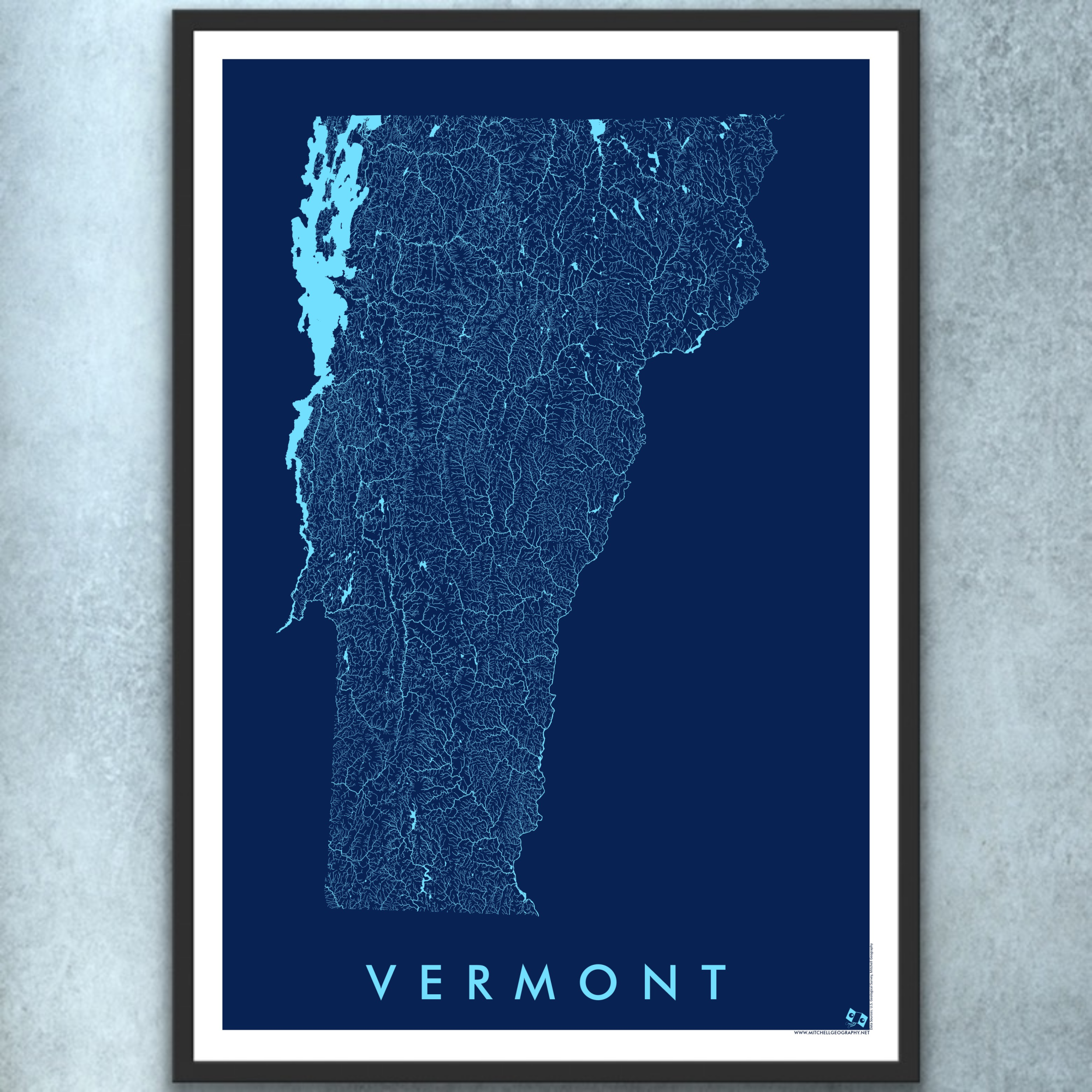
State of Vermont general reference map. Produced May 2026. This is my most detailed general reference map of Vermont (my birth state!).
Reference features labeled as scale permits, include:
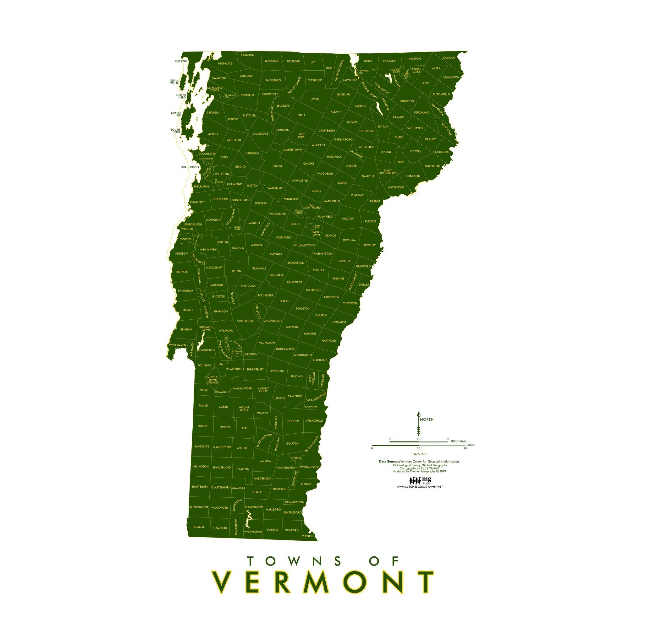
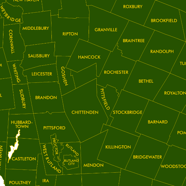
Places, Villages, Towns, Cities
Summits of Interest
Unique Places of Interest (e.g. a selection of museums, universities and colleges, waterfalls, historic sites, and more)
Developed State Park Sites
Alpine Ski Areas (public lift served sites)
Ski Touring Sites (Select locations, as of 2026 that are maintained and easily located, where you can skin up & ski down)
Highways, Arterials, and Secondary Rural Connections
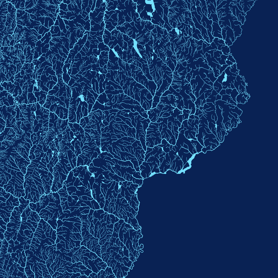
Surface Hydrology: Rivers, Streams, Lakes, Reservoirs
Notches & Gaps
The Long Trail
Appalachian Trail
North Country Trail
Vermont State Forest Lands
Vermont State Park Lands
Vermont Wildlife Management Area Lands
USFS Green Mountain National Forest Lands (formally the Finger Lakes & Green Mountain NF)
USFS Federally Designated Wilderness Areas
Bristol Cliffs
Breadloaf
Joseph Battell
Peru Peak
Big Branch
Lye Brook
Glastenbury
George D Aiken
US Fish & Wildlife Service Refuges
*Most town forests, non-profit organizations, and land trust lands are not mapped.
1:380,000
28 inch x 20 inch — flat wall map, printed on a heavy fine paper — shipped rolled.
State of Vermont general reference map. Produced May 2026. This is my most detailed general reference map of Vermont (my birth state!).
Reference features labeled as scale permits, include:
Places, Villages, Towns, Cities
Summits of Interest
Unique Places of Interest (e.g. a selection of museums, universities and colleges, waterfalls, historic sites, and more)
Developed State Park Sites
Alpine Ski Areas (public lift served sites)
Ski Touring Sites (Select locations, as of 2026 that are maintained and easily located, where you can skin up & ski down)
Highways, Arterials, and Secondary Rural Connections
Surface Hydrology: Rivers, Streams, Lakes, Reservoirs
Notches & Gaps
The Long Trail
Appalachian Trail
North Country Trail
Vermont State Forest Lands
Vermont State Park Lands
Vermont Wildlife Management Area Lands
USFS Green Mountain National Forest Lands (formally the Finger Lakes & Green Mountain NF)
USFS Federally Designated Wilderness Areas
Bristol Cliffs
Breadloaf
Joseph Battell
Peru Peak
Big Branch
Lye Brook
Glastenbury
George D Aiken
US Fish & Wildlife Service Refuges
*Most town forests, non-profit organizations, and land trust lands are not mapped.

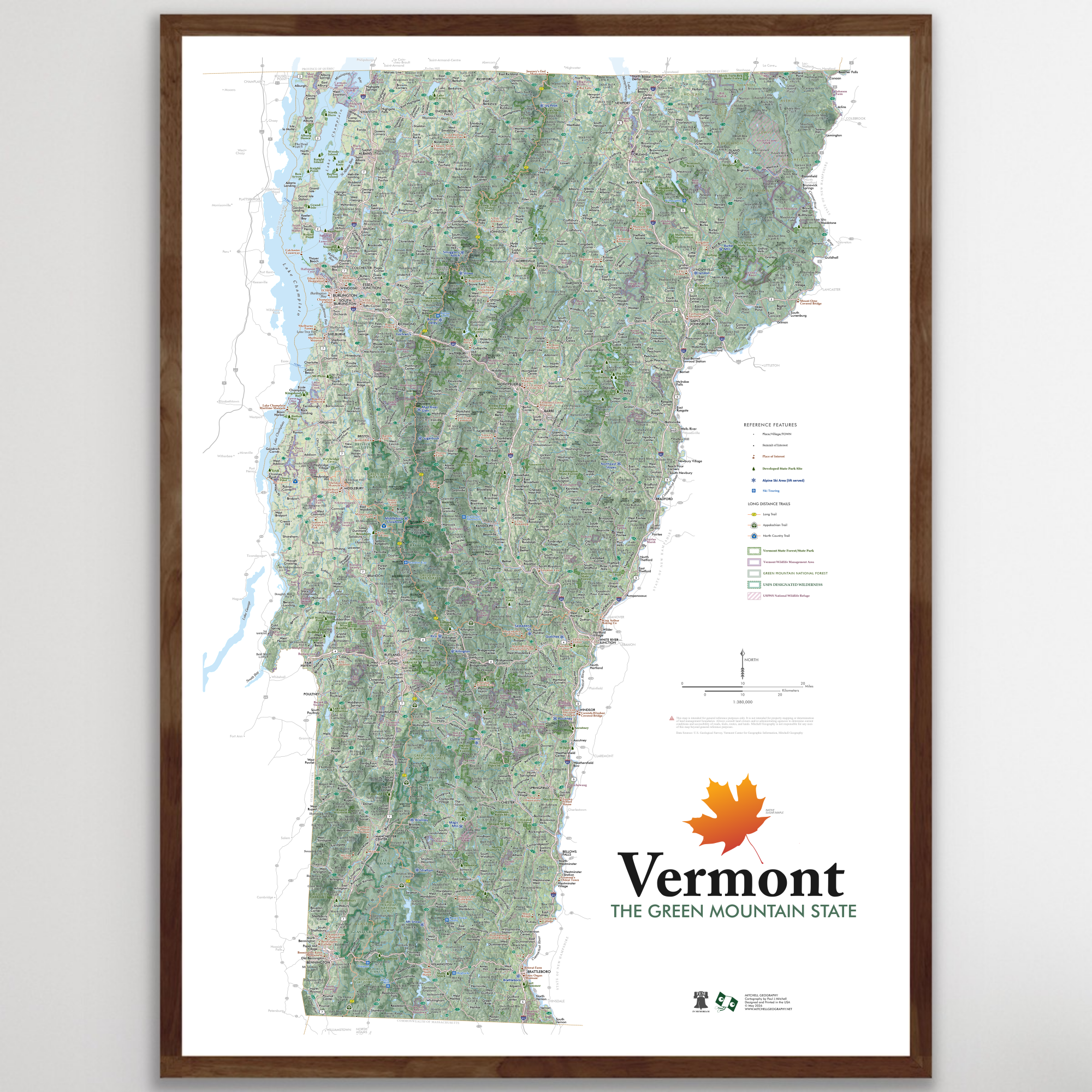 Image 1 of 10
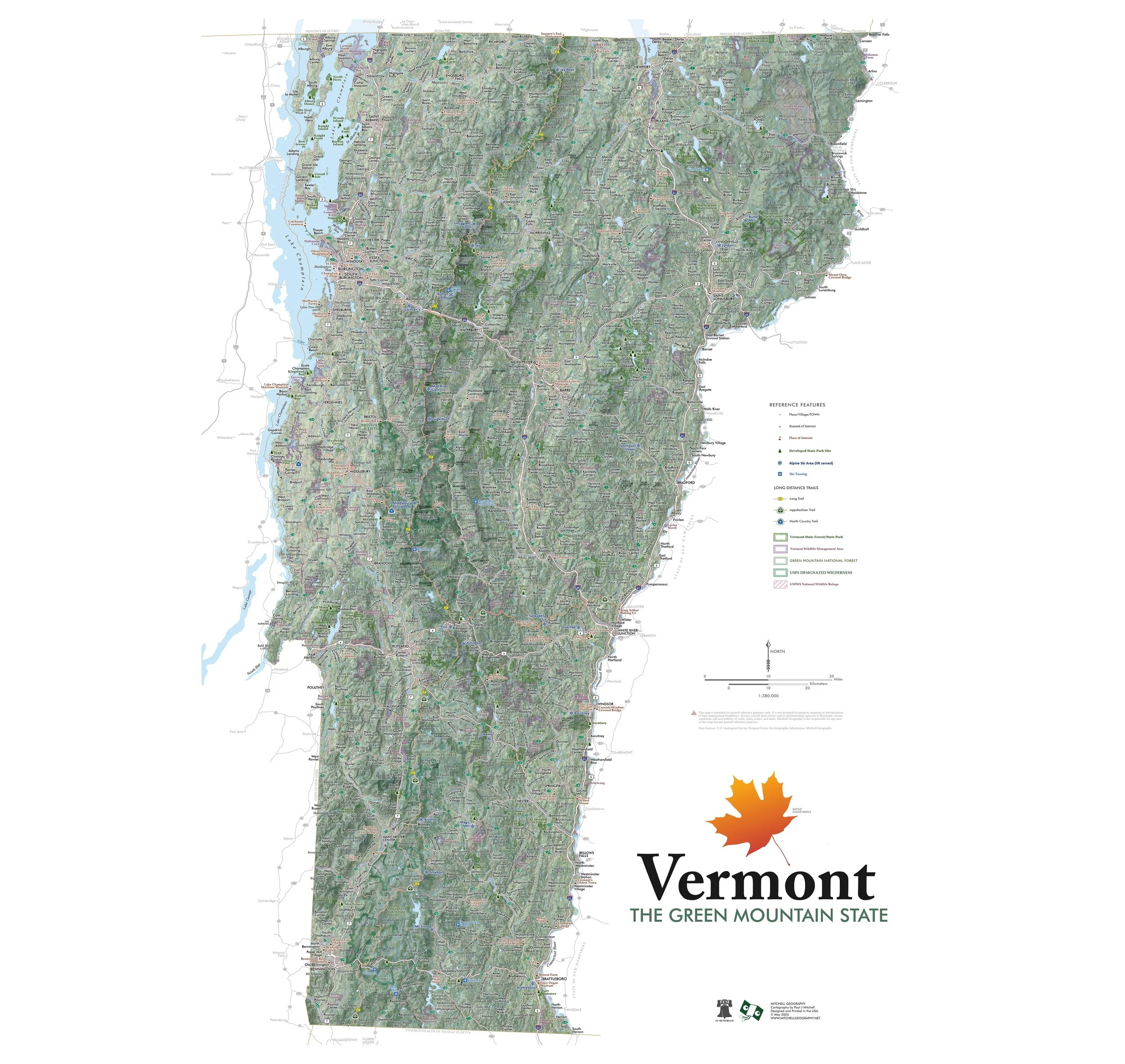 Image 2 of 10
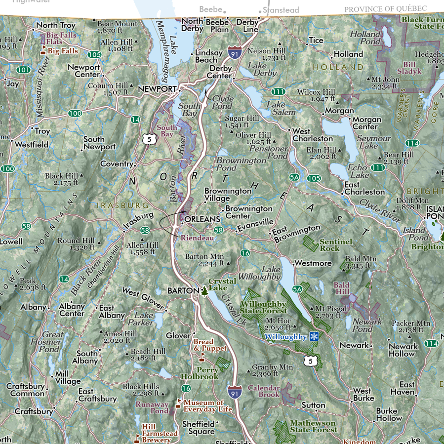 Image 3 of 10
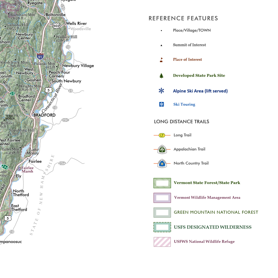 Image 4 of 10
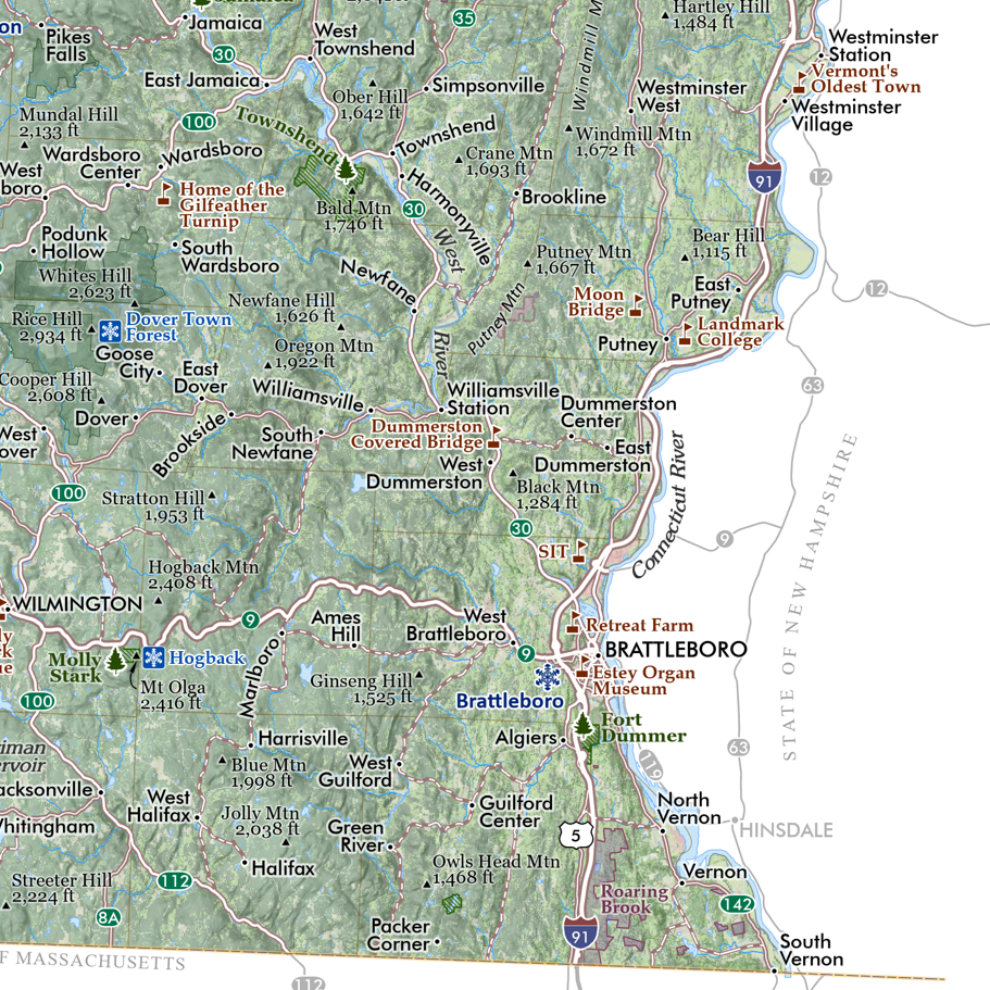 Image 5 of 10
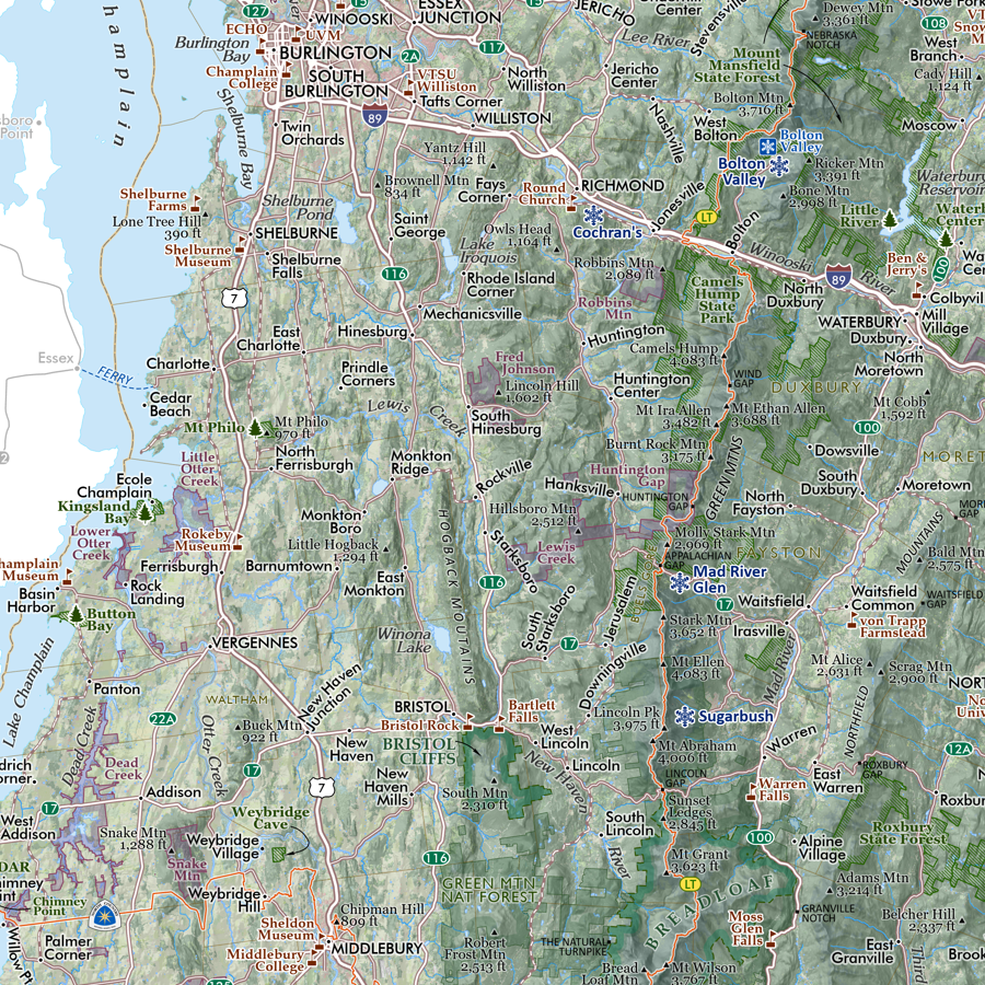 Image 6 of 10
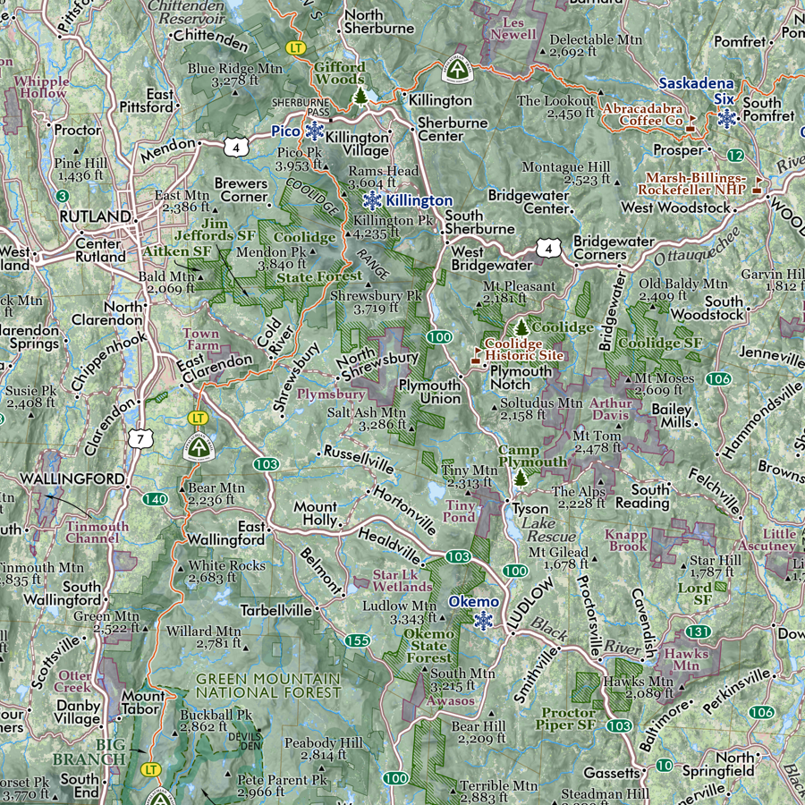 Image 7 of 10
 Image 8 of 10
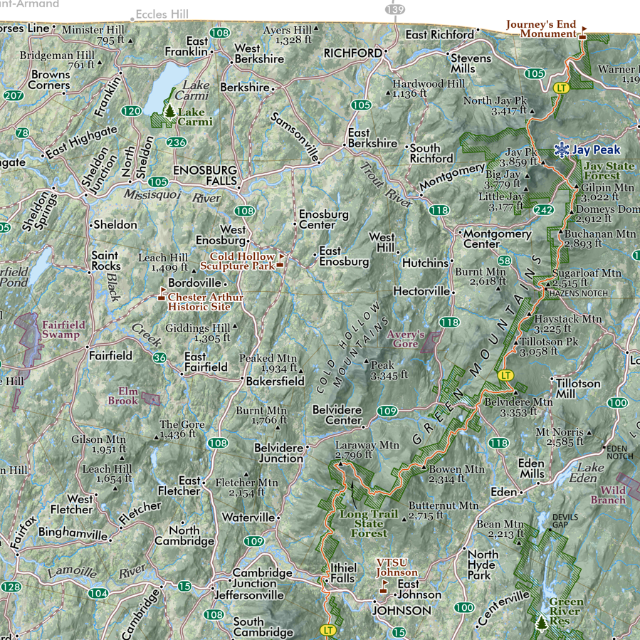 Image 9 of 10
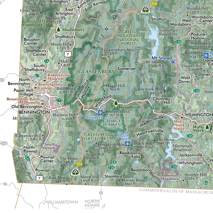 Image 10 of 10