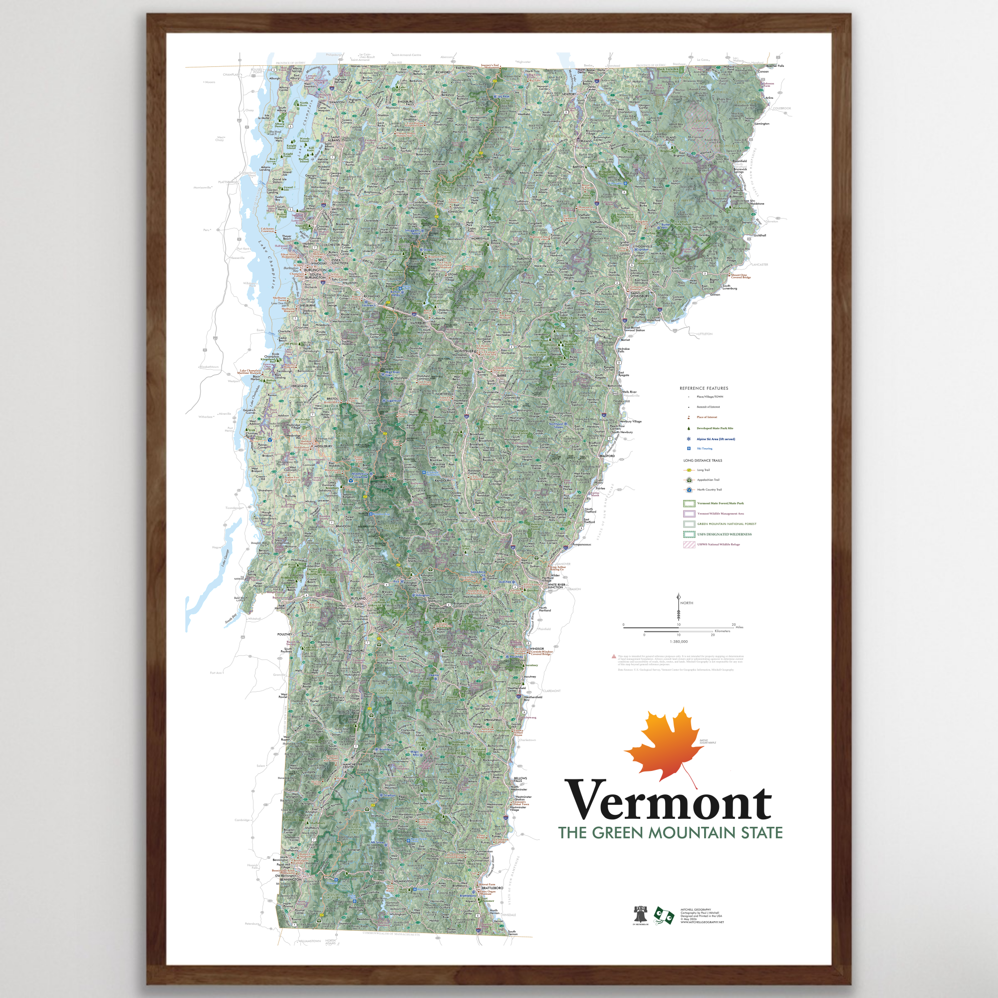
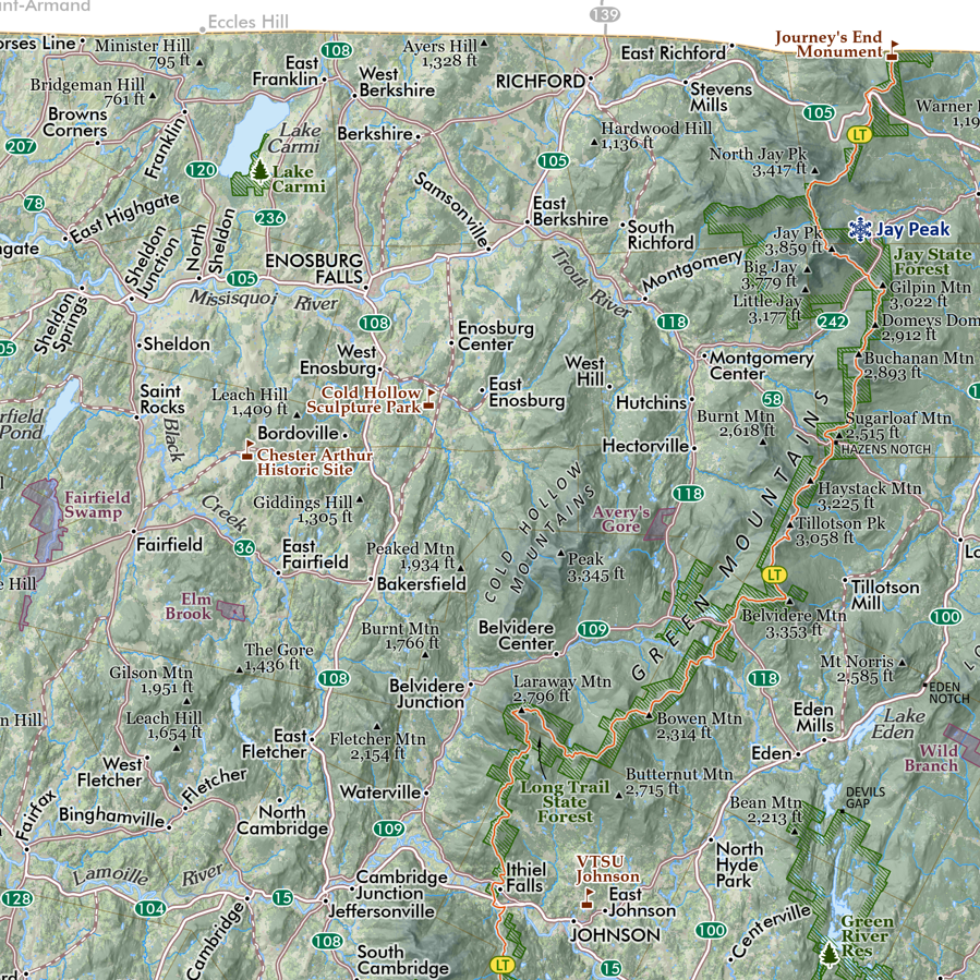
 Image 1 of 3
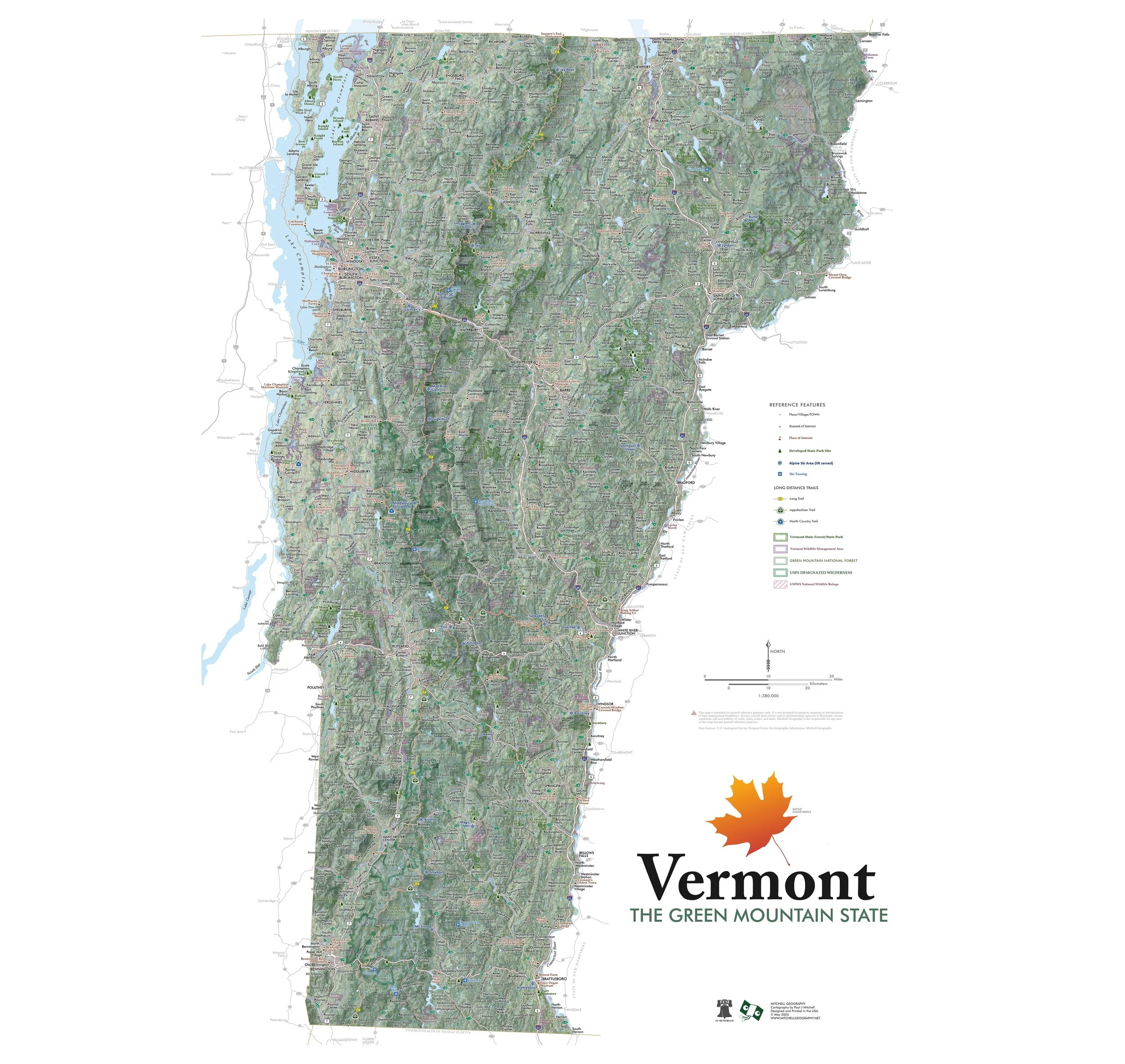
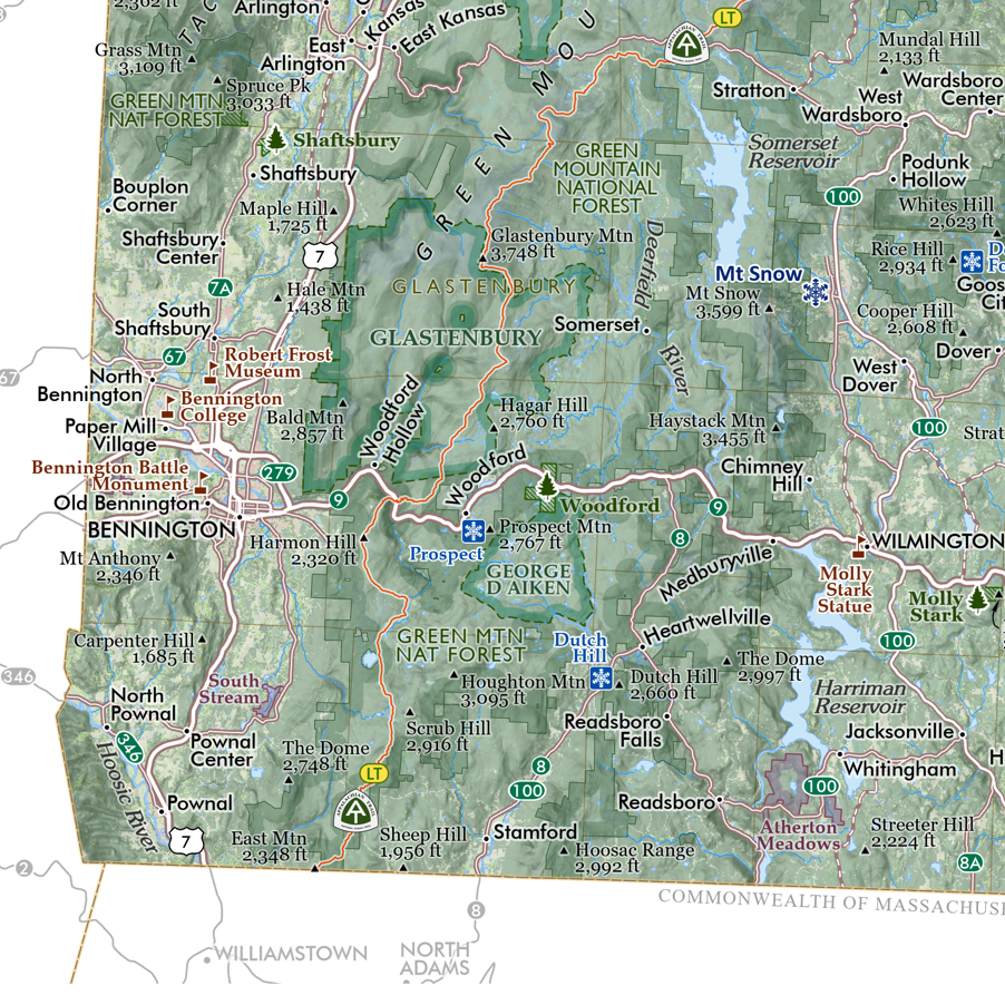
 Image 2 of 3
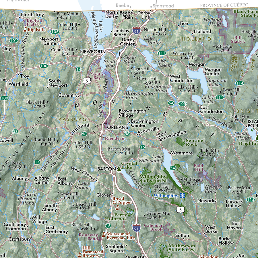
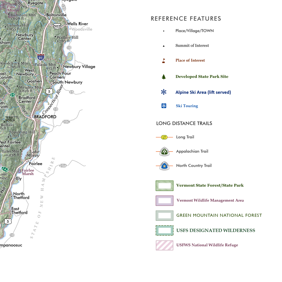
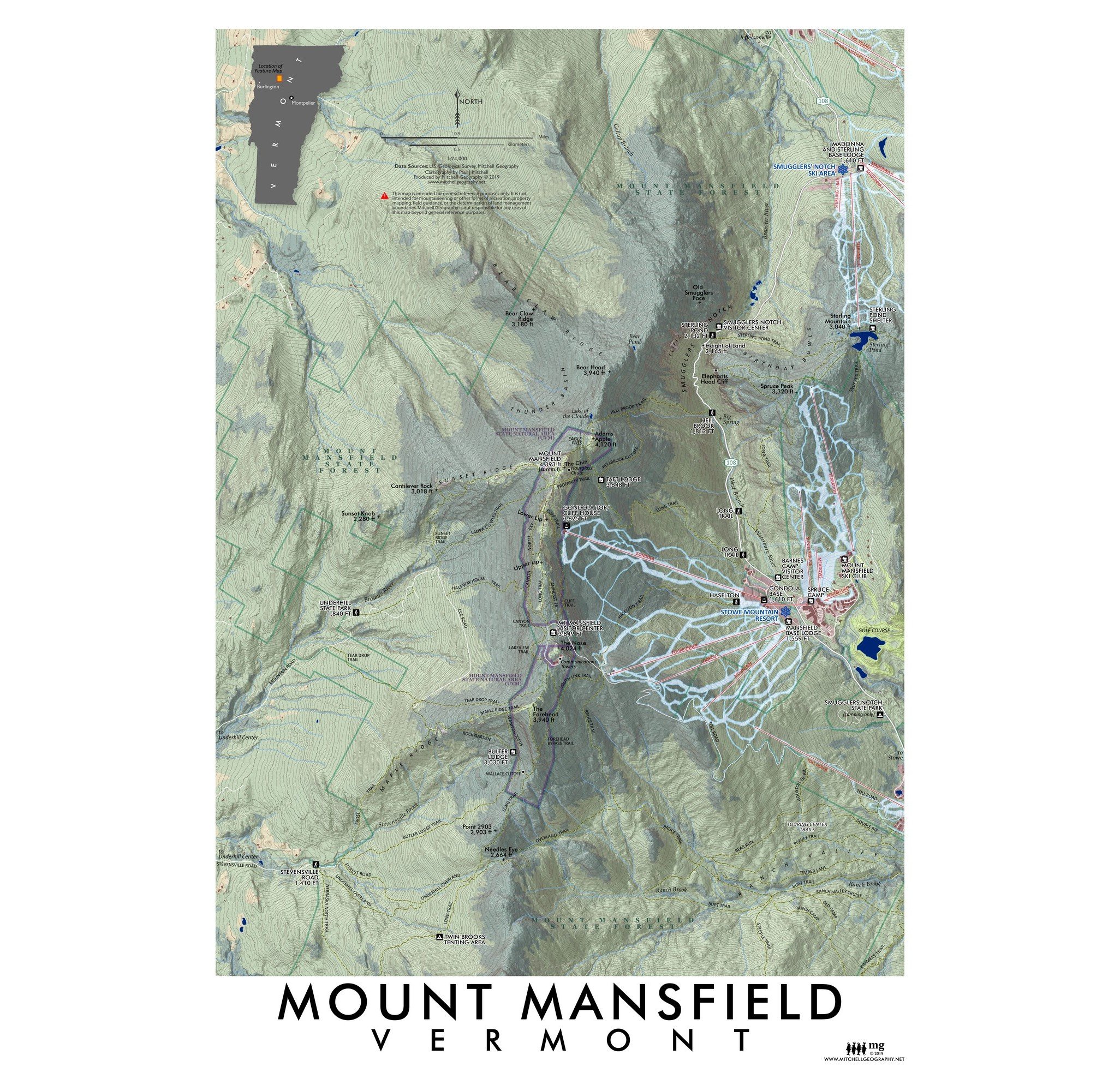
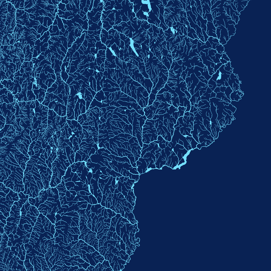 Image 3 of 3
13 inch by 19 inch flat wall map, printed on heavy fine paper. Packed and shipped flat.
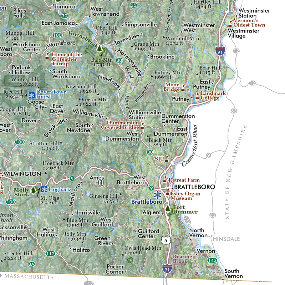
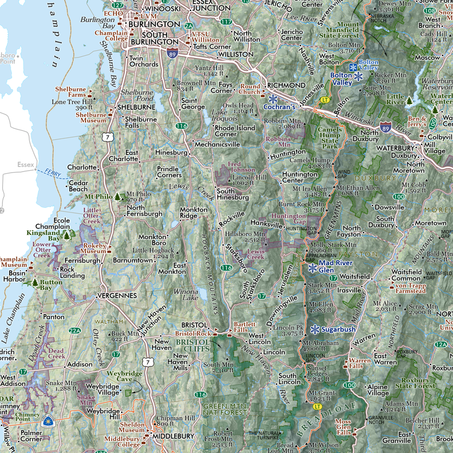
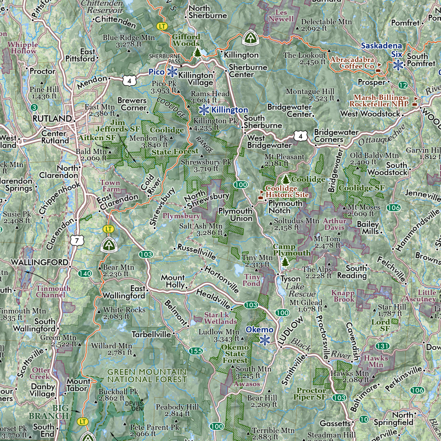
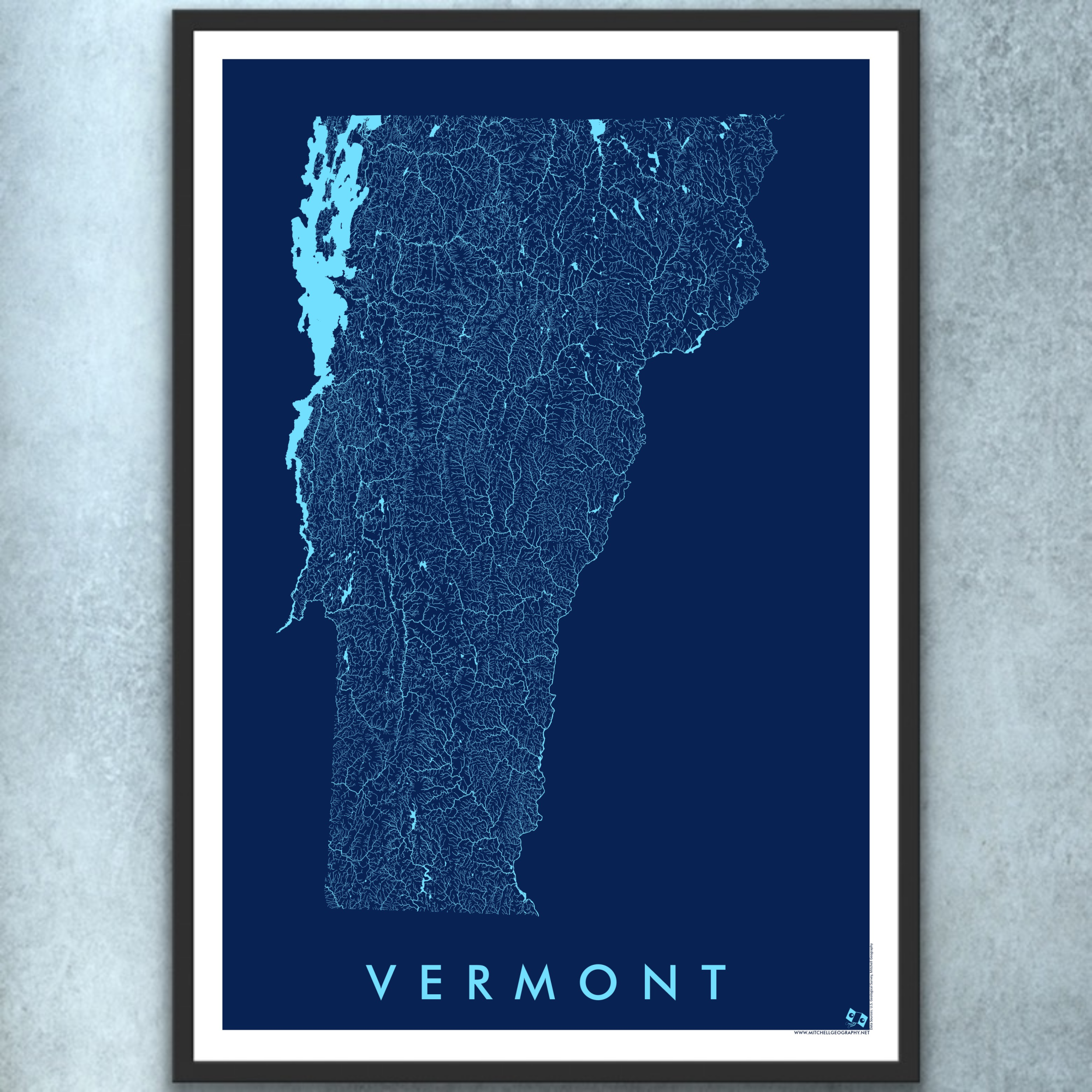
Vermont Rivers and Surface Hydrology map. A graphic art style map depicting surface hydrology including rivers, streams, lakes and reservoirs. (Dear Vermont, where I was born)
*October 2025 update — added the full area of border waterbodies, i.e. the Connecticut River and Lake Champlain. Line weights of the rivers and streams have been symbolized to reflect stream order.
13 inch by 19 inch flat wall map, printed on heavy fine paper. Packed and shipped flat.
Vermont Rivers and Surface Hydrology map. A graphic art style map depicting surface hydrology including rivers, streams, lakes and reservoirs. (Dear Vermont, where I was born)
*October 2025 update — added the full area of border waterbodies, i.e. the Connecticut River and Lake Champlain. Line weights of the rivers and streams have been symbolized to reflect stream order.