1:130,000
24 inch x 20 inch — flat wall map, printed on a heavy fine paper — shipped rolled.
A much larger Western Maine Mountains (printable digital download) is also now available.
Nominally this is a regional AT section map for a portion of Western Maine -- but it is also loaded with detailed annotations/trails/lands of the surrounding communities. For a bit I lived in Farmington, Maine and spent many days hiking around the area in particular Tumbledown, Little Jackson, and Mt Blue. So this map is intended to capture both the AT section and the many other amazing spots so close-by.
This is perhaps my favorite section of the entire AT (which I thru-hiked in 2005)… featuring the stretch from Old Blue to the Bigelow Range: Bemis, Saddleback, Saddleback Junior, Mt Abraham, Spaulding, Sugarloaf, Crocker Mtn, and the full length of the Bigelow Preserve, ending at the Carry Ponds. The map also includes detailed annotations and labels of the regional towns of Farmington, Weld, Wilton, New Vineyard, New Portland, Strong, Phillips, Kingfield, Carrabassett Valley, Stratton/Eustis, Rangeley, Oquossoc, Kennebago Lake, Byron, Andover and the northern tips of Rumford/Mexico.
Labeled for reference -- trails (e.g. the AT, Fly Rod Crosby, Maine Huts & Trails, Maine BPL), trailheads, alpine ski slopes (Saddleback, Sugarloaf, Black Mtn., Titcomb Mtn.), landmarks (Wire Bridge, Wilhelm Reich Museum, etc.), place names, summits with elevations, rivers, lakes, ponds, highway and road names. Fee owned public lands -- the National Park Service's Appalachian Trail Corridor and Maine BPL (Bureau of Parks and Lands) preserves (e.g. Bigelow) are mapped and labeled including the very recent Cascades addition along the Orbeton and Perham Streams (non-profit conserved lands are not mapped, though some of their trails are included). Fee sites included are labeled accordingly.

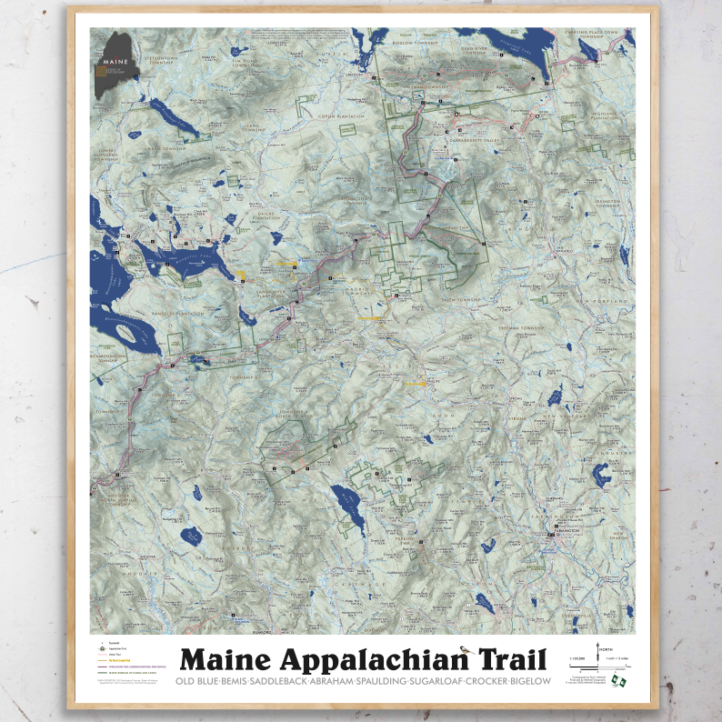 Image 1 of 11
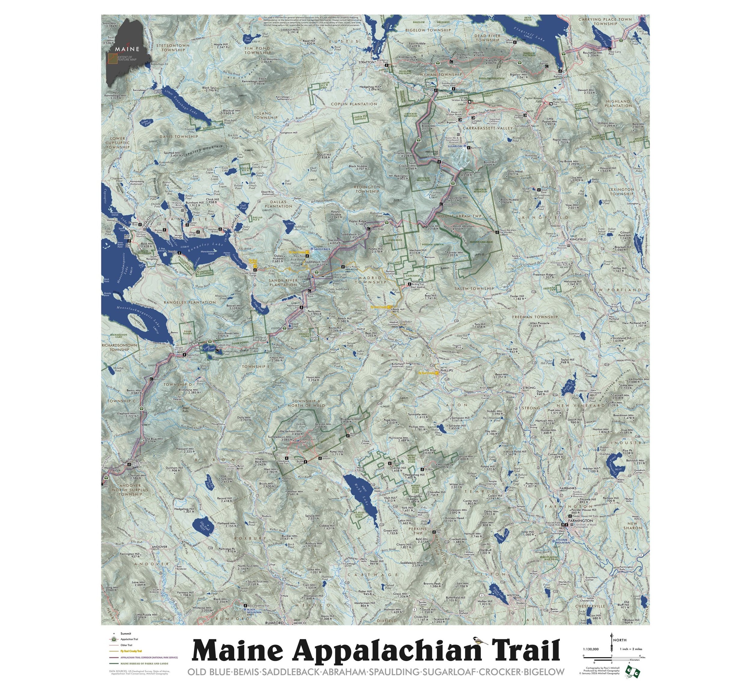 Image 2 of 11
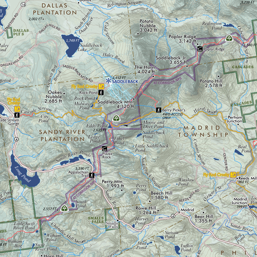 Image 3 of 11
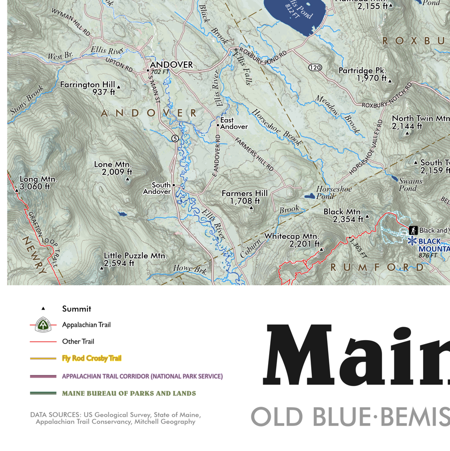 Image 4 of 11
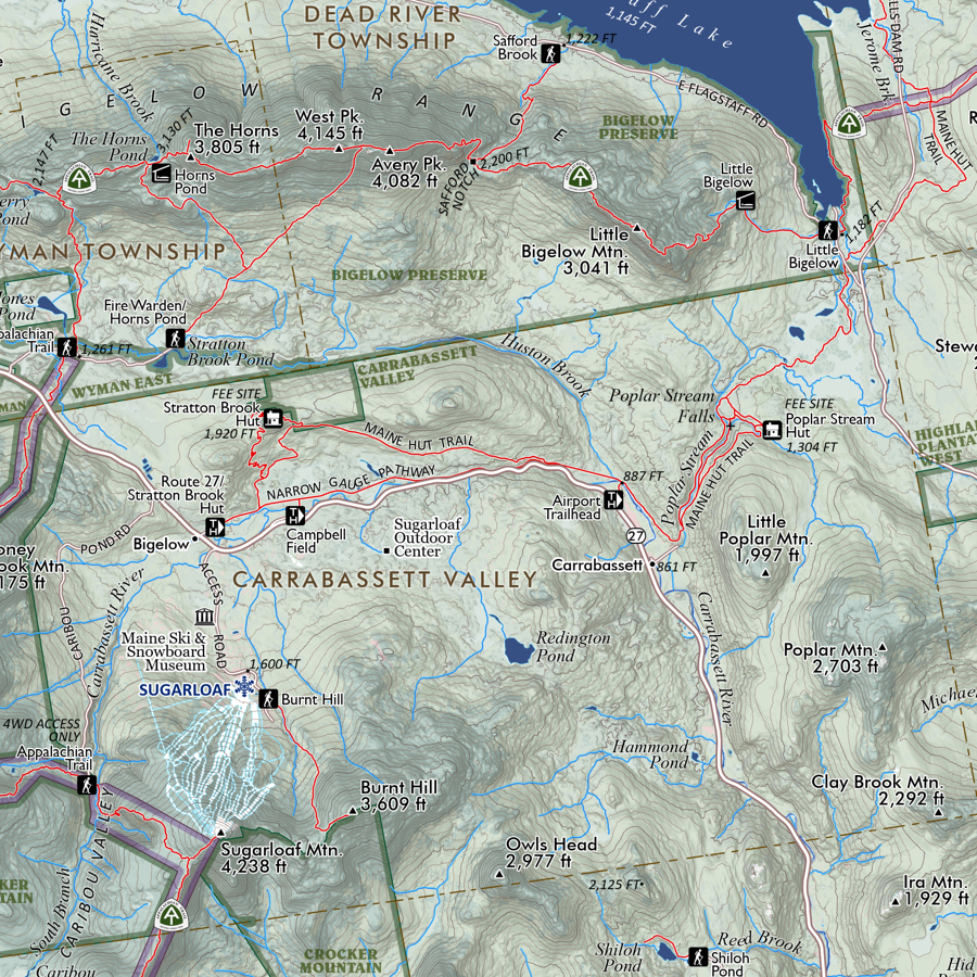 Image 5 of 11
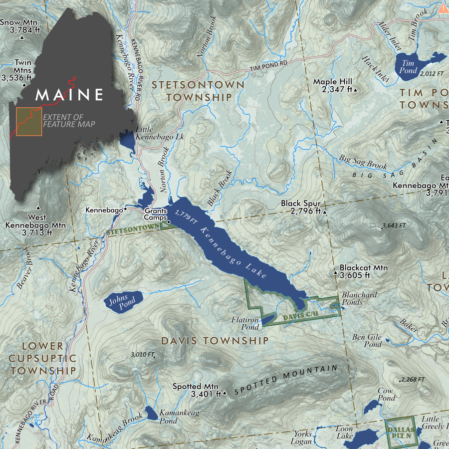 Image 6 of 11
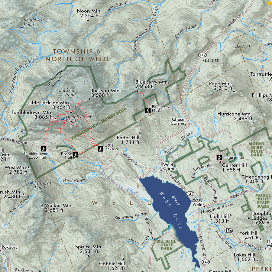 Image 7 of 11
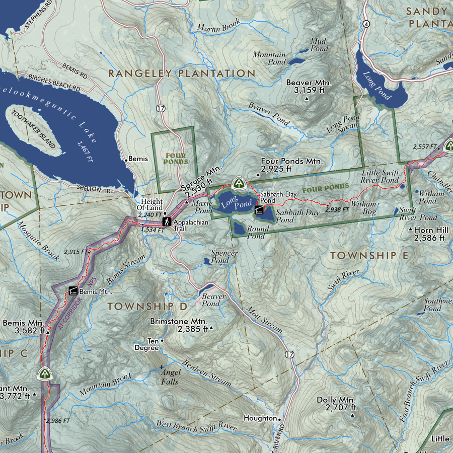 Image 8 of 11
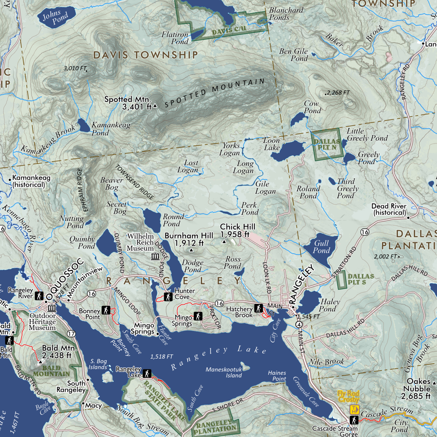 Image 9 of 11
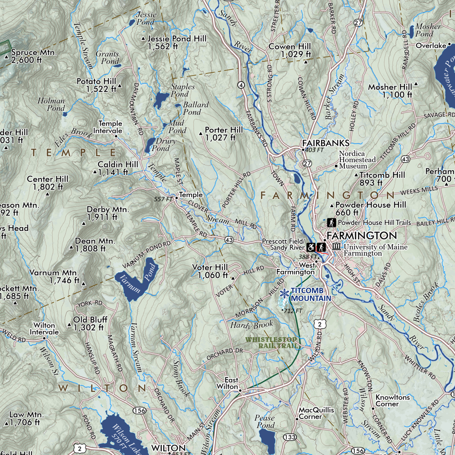 Image 10 of 11
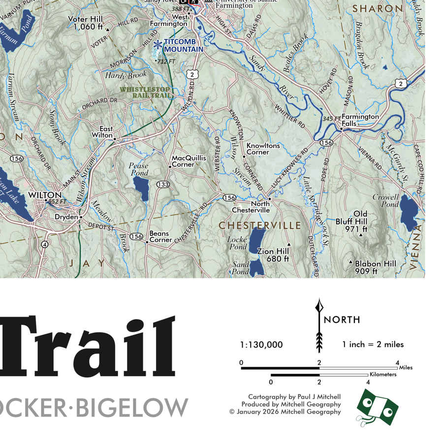 Image 11 of 11