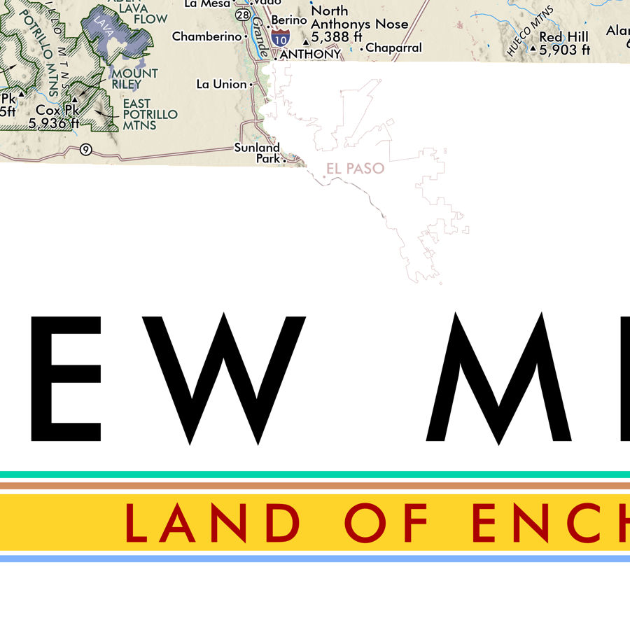
1:975,000
28 inch x 20 inch — flat wall map, printed on a heavy fine paper — shipped rolled.
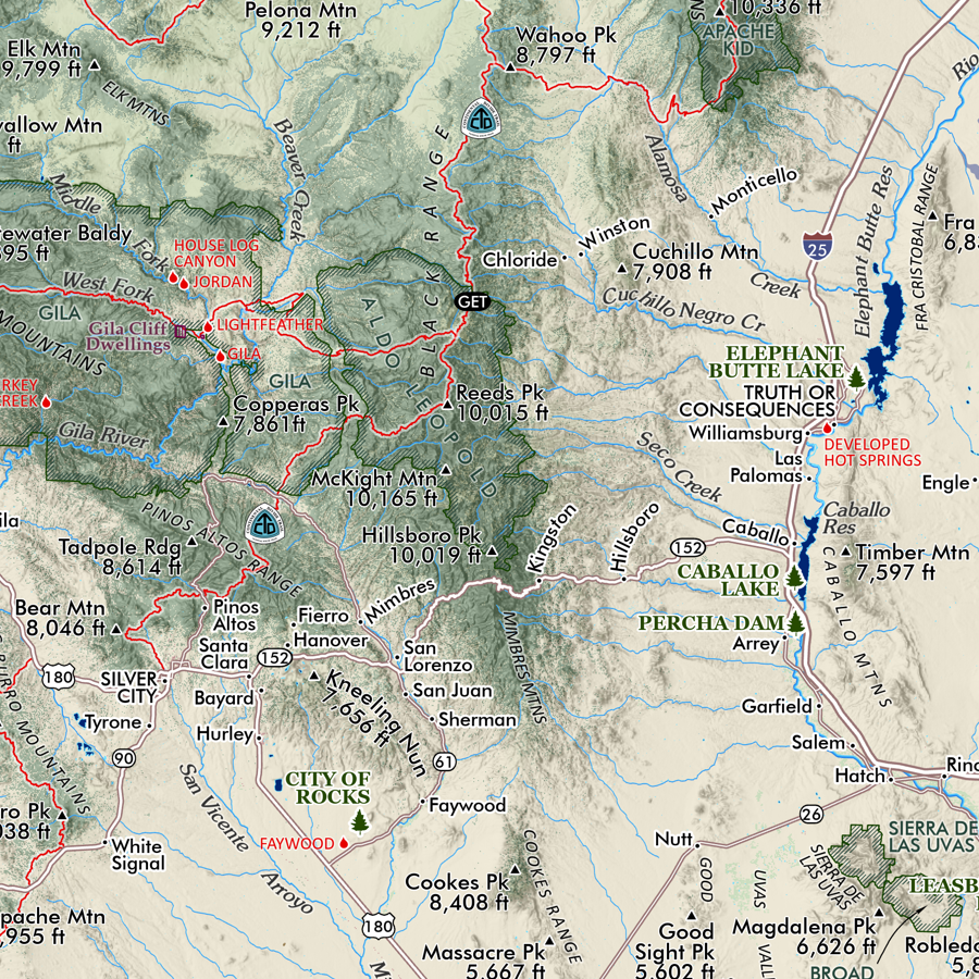
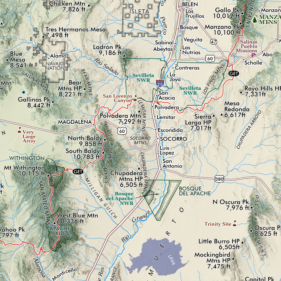
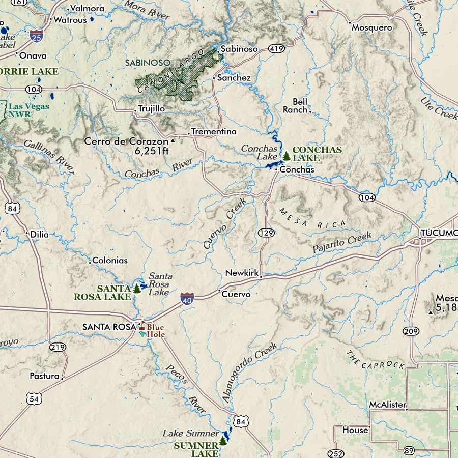
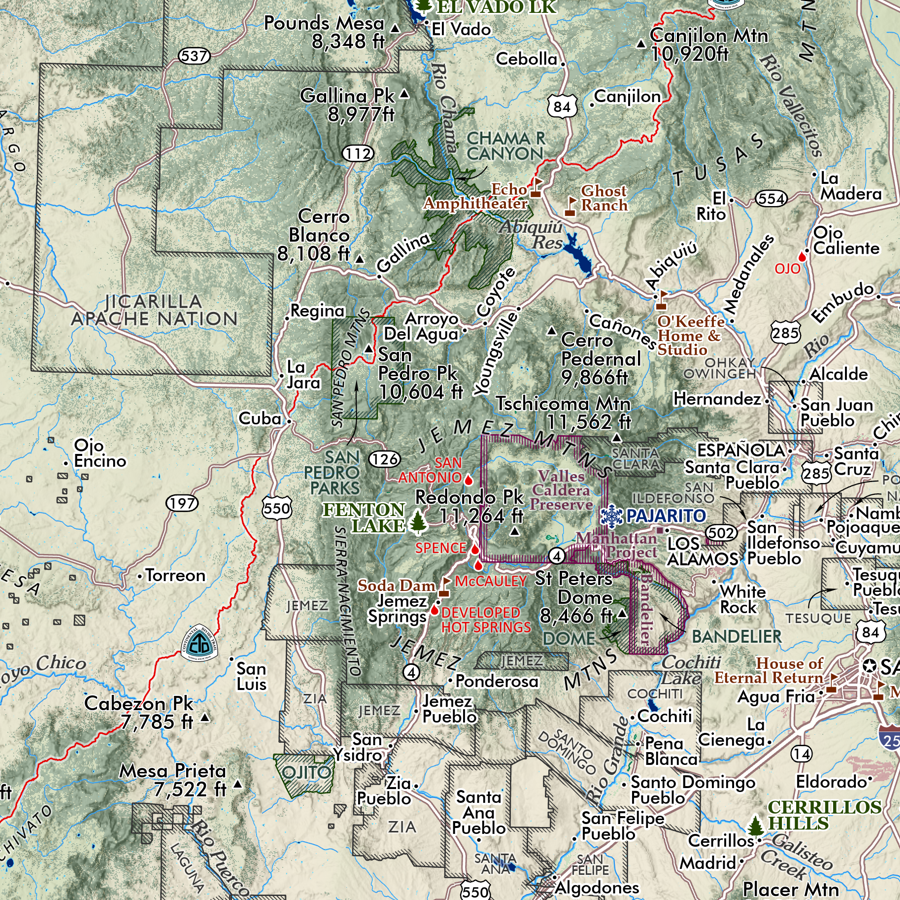
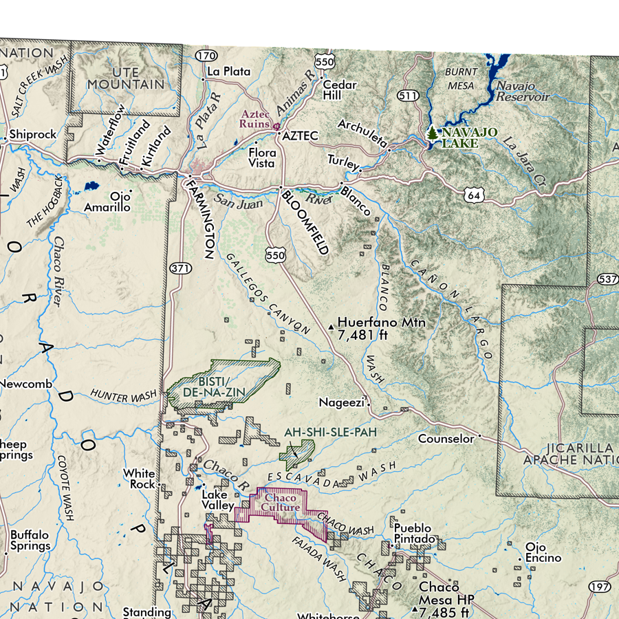
Utah Mountain Ranges map. This is a taxonomic styled and statewide general reference map of Utah’s primary mountain range systems, subranges, and other landforms. 103 unique ranges & uplands have been delineated and associated high points mapped across Utah’s parent landforms: the Great Basin, Uinta Mountains, Colorado Plateau, Utah’s High Plateaus, the Pine Valley Laccolith, and the Mojave Desert. Additional valleys, basins, deserts, and canyonlands have also been delineated and classed. Packed with details considering it’s scale and sheet size - you will need good map reading skills to fully enjoy the fine print and occasionally small typefaces. This map is cross-walked with the Colorado Mountain Ranges map, though the scale differs in print size.
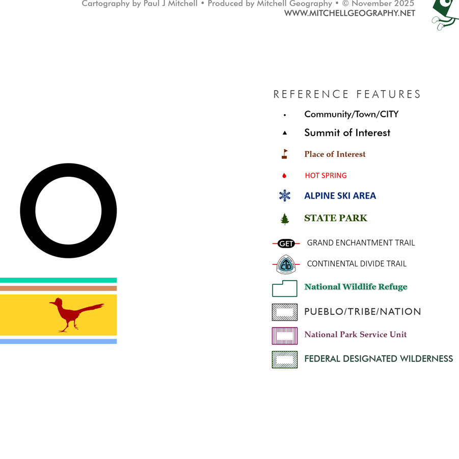
The expansive legend area lists range & subrange names, range high point names and elevations - all classed with a unique map code and listed in descending order of elevation.
Reference features include:
City/Town/Community place names
Range High Points & Other Summits of Interest
State Parks
Alpine Ski Areas
National Park Service Units (NPS managed National Parks and National Monuments)
National Wildlife Refuges
1:975,000
28 inch x 20 inch — flat wall map, printed on a heavy fine paper — shipped rolled.
Utah Mountain Ranges map. This is a taxonomic styled and statewide general reference map of Utah’s primary mountain range systems, subranges, and other landforms. 103 unique ranges & uplands have been delineated and associated high points mapped across Utah’s parent landforms: the Great Basin, Uinta Mountains, Colorado Plateau, Utah’s High Plateaus, the Pine Valley Laccolith, and the Mojave Desert. Additional valleys, basins, deserts, and canyonlands have also been delineated and classed. Packed with details considering it’s scale and sheet size - you will need good map reading skills to fully enjoy the fine print and occasionally small typefaces. This map is cross-walked with the Colorado Mountain Ranges map, though the scale differs in print size.
The expansive legend area lists range & subrange names, range high point names and elevations - all classed with a unique map code and listed in descending order of elevation.
Reference features include:
City/Town/Community place names
Range High Points & Other Summits of Interest
State Parks
Alpine Ski Areas
National Park Service Units (NPS managed National Parks and National Monuments)
National Wildlife Refuges

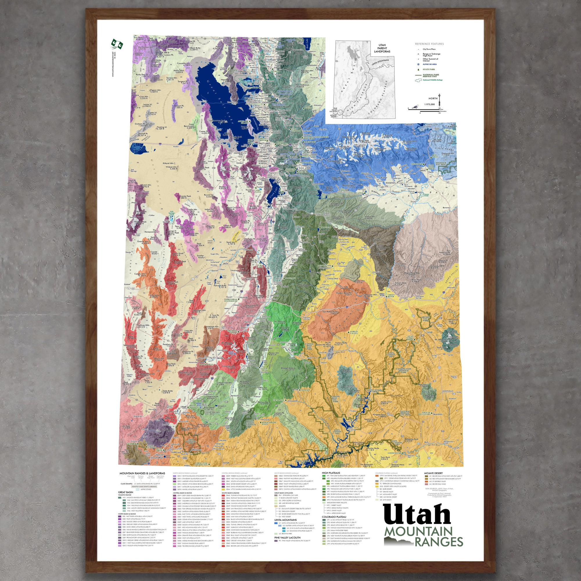 Image 1 of 9
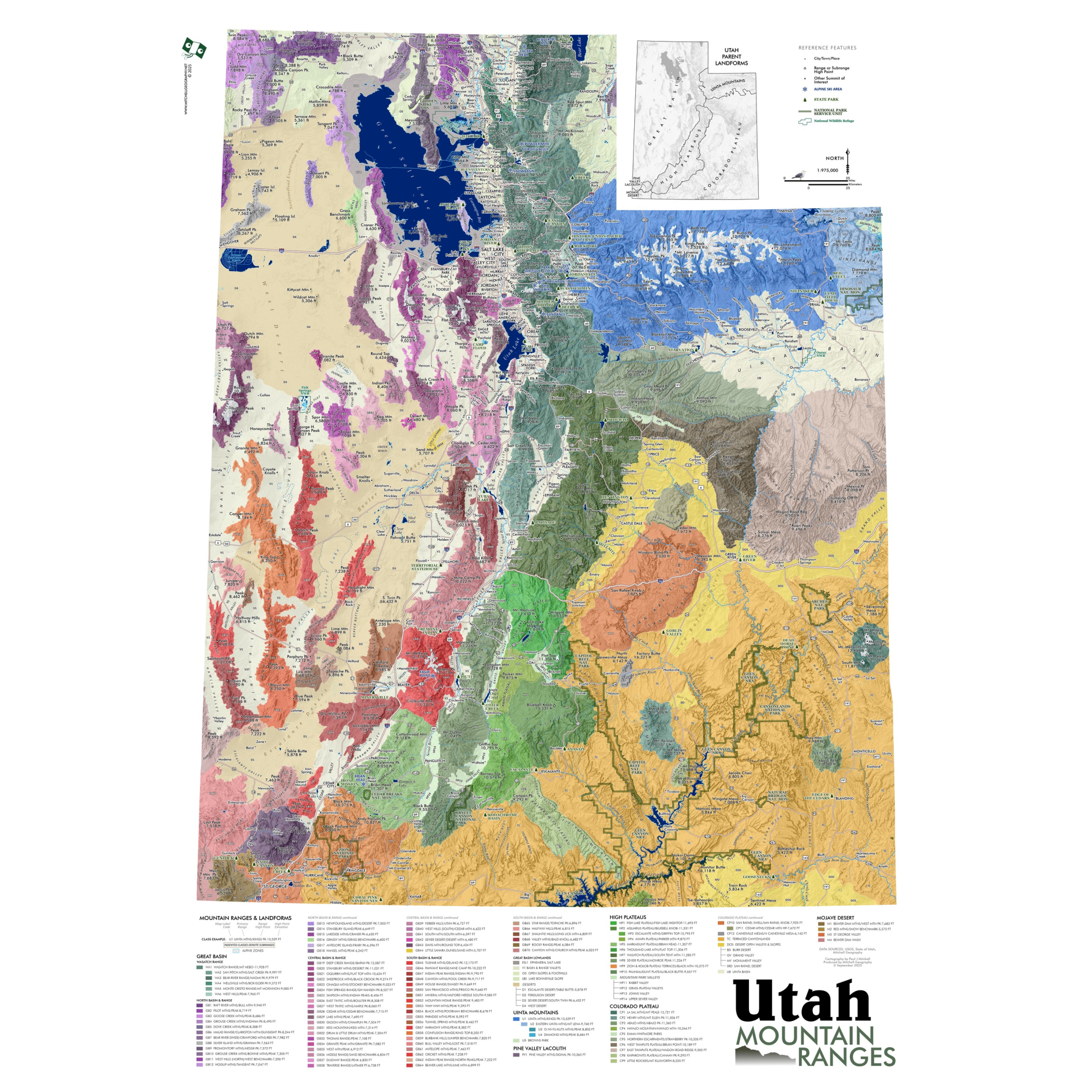 Image 2 of 9
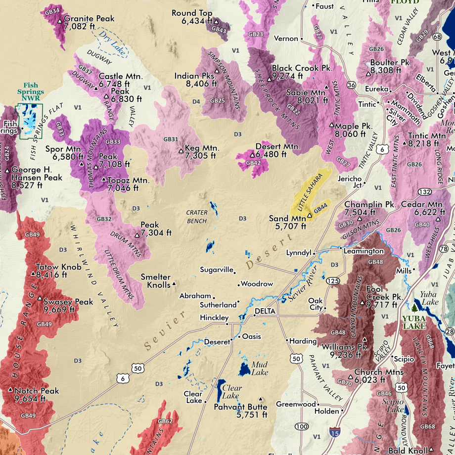 Image 3 of 9
 Image 4 of 9
 Image 5 of 9
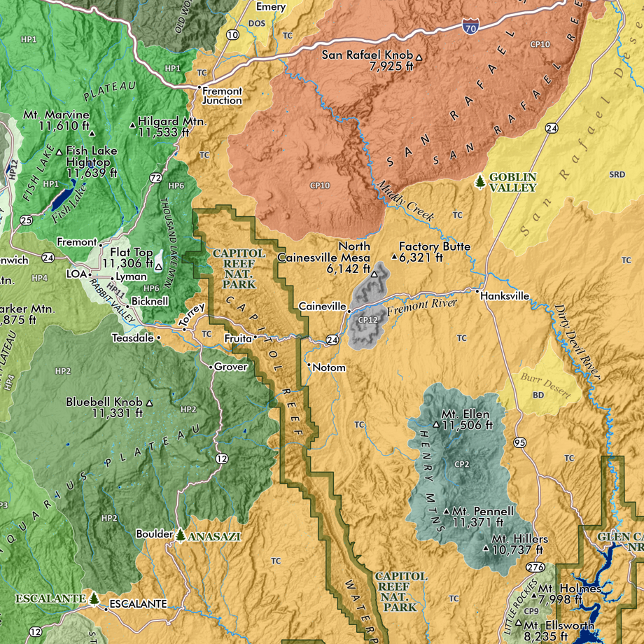 Image 6 of 9
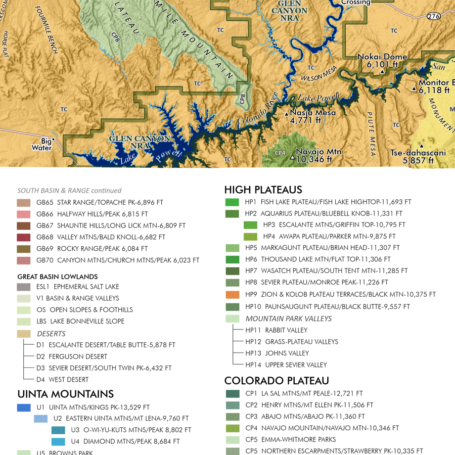 Image 7 of 9
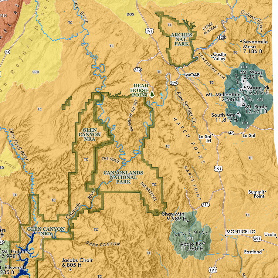 Image 8 of 9
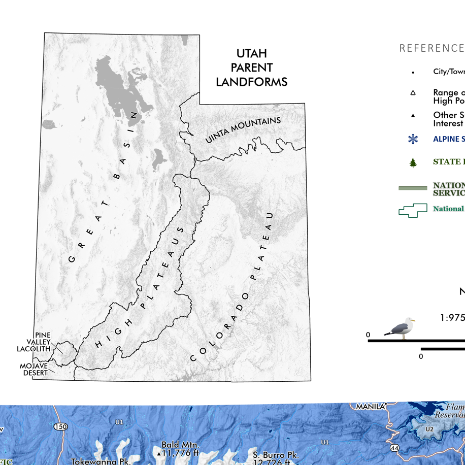 Image 9 of 9