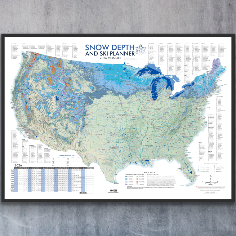
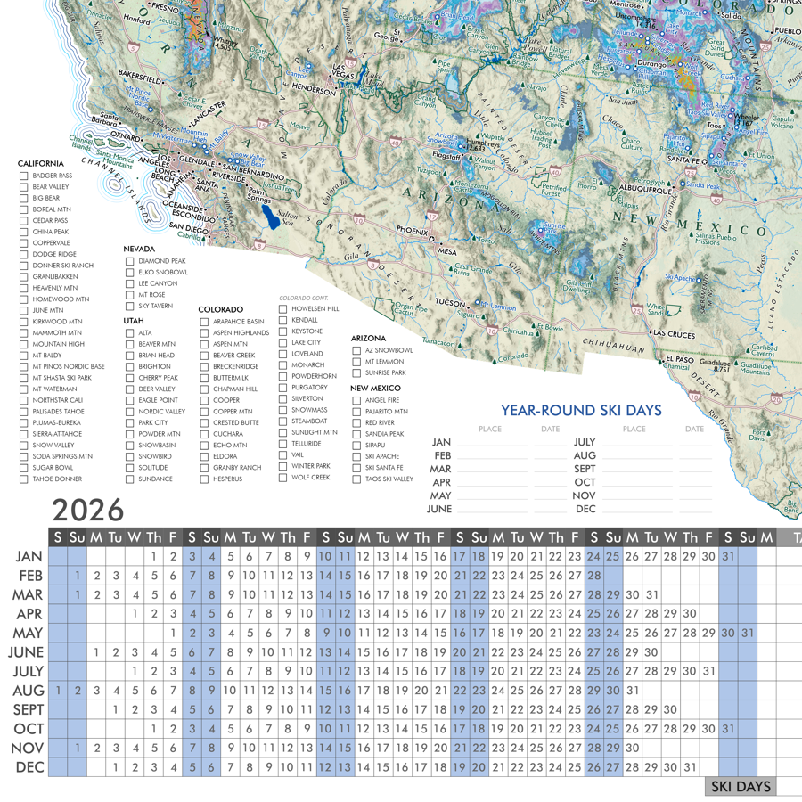
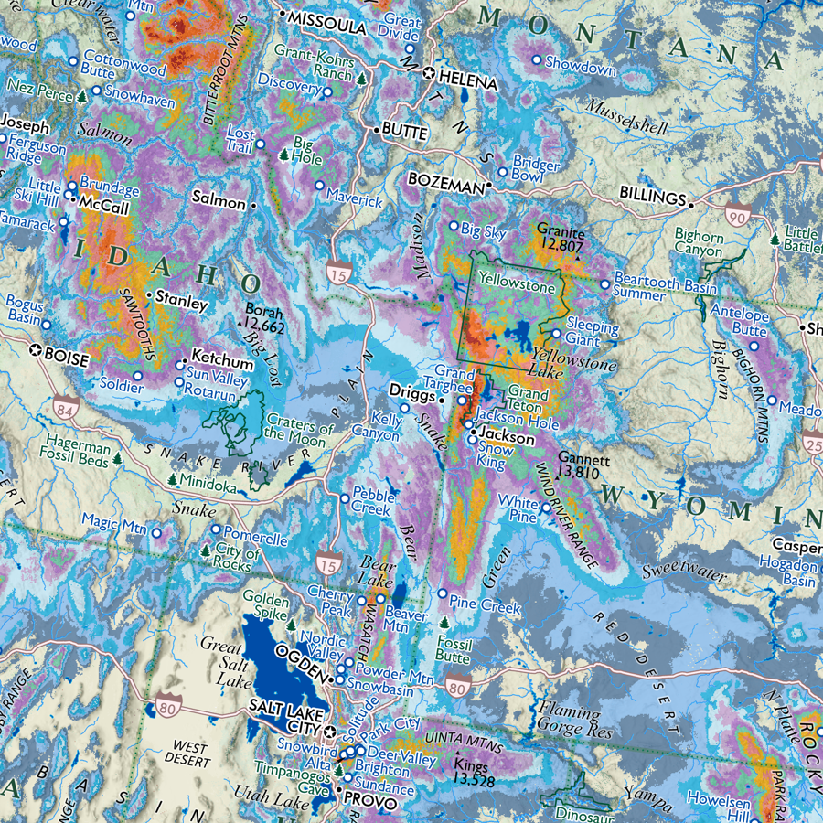
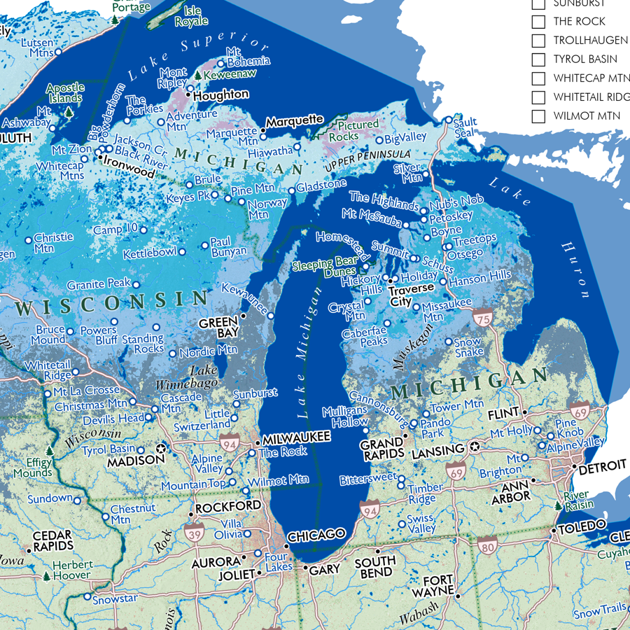
1:160,000
28 inch x 20 inch — flat wall map, printed on a heavy fine paper — shipped rolled.
Big Sur California map. This is a detailed regional general reference wall map centered of the Big Sur region on California’s central coast. The coastal extent stretches from Monterey Bay in the North to Arroyo De Los Chinos in San Luis Obispo County (i.e. 87 miles of Highway 1 in Monterey County and the northern 7 miles in San Luis Obispo County). Interior features include Salinas Valley, Los Padres National Forest, Ventana Wilderness, Fort Hunter Liggett (US Army).
Included cities and vicinities: Marina, Seaside, Monterey, Pacific Grove, Pebble Beach, Carmel-by-the-Sea, Carmel Valley, Big Sur, Posts, Lucia, Esalen/Slates Hot Springs, Plaskett/Gorda. Interior Salinas Valley: Salinas, Gonzales, Soledad, Greenfield.
Included CA State Parks: Monterey State Beach, Carmel River State Beach, Point Lobos, Garrapata, Point Sur, Andrew Molera, Pfeiffer Big Sur, Julia Pfeiffer Burns, Limekiln, Hearst San Simeon (the most northern coastal section - miles 68-70 SLO County)
*NOTE ON ROADS WITHIN FORT HUNTER LIGGETT : Nacimiento-Fergusson Road, Mission Road, Jolon Road, and Milpitas Road are the only travel routes mapped within the US Army’s Fort Hunter Liggett. On the southern end, South Coast Ridge Road is only mapped to the USFS Lottie Potrero Trail.
Reference features labeled as scale permits, include:
Neighborhoods, Communities, Towns, Cities
Highways, Local Arterials, and Public Access Roads (including Nacimiento-Fergusson Road)
Coastal Features: Bays, Islands, Capes
Surface Hydrology: Rivers, Streams, Lakes, Reservoirs
Shore, Coastal, Beach Access Sites
Landforms: Summits of Interest with Elevations, Ridges, Valleys, etc
Places of Interest: Henry Miller Library, Esalen Institute, Missions (Carmel, Soledad, San Antonio)
Regional Parks (labeled as scale permits)
California State Parks & State Beaches
Los Padres National Forest
Ventana Wilderness
Silver Peak Wilderness
Pinnacles National Park & Hain Wilderness
Trails: Los Padres National Forest, California State Parks, Pinnacles National Park

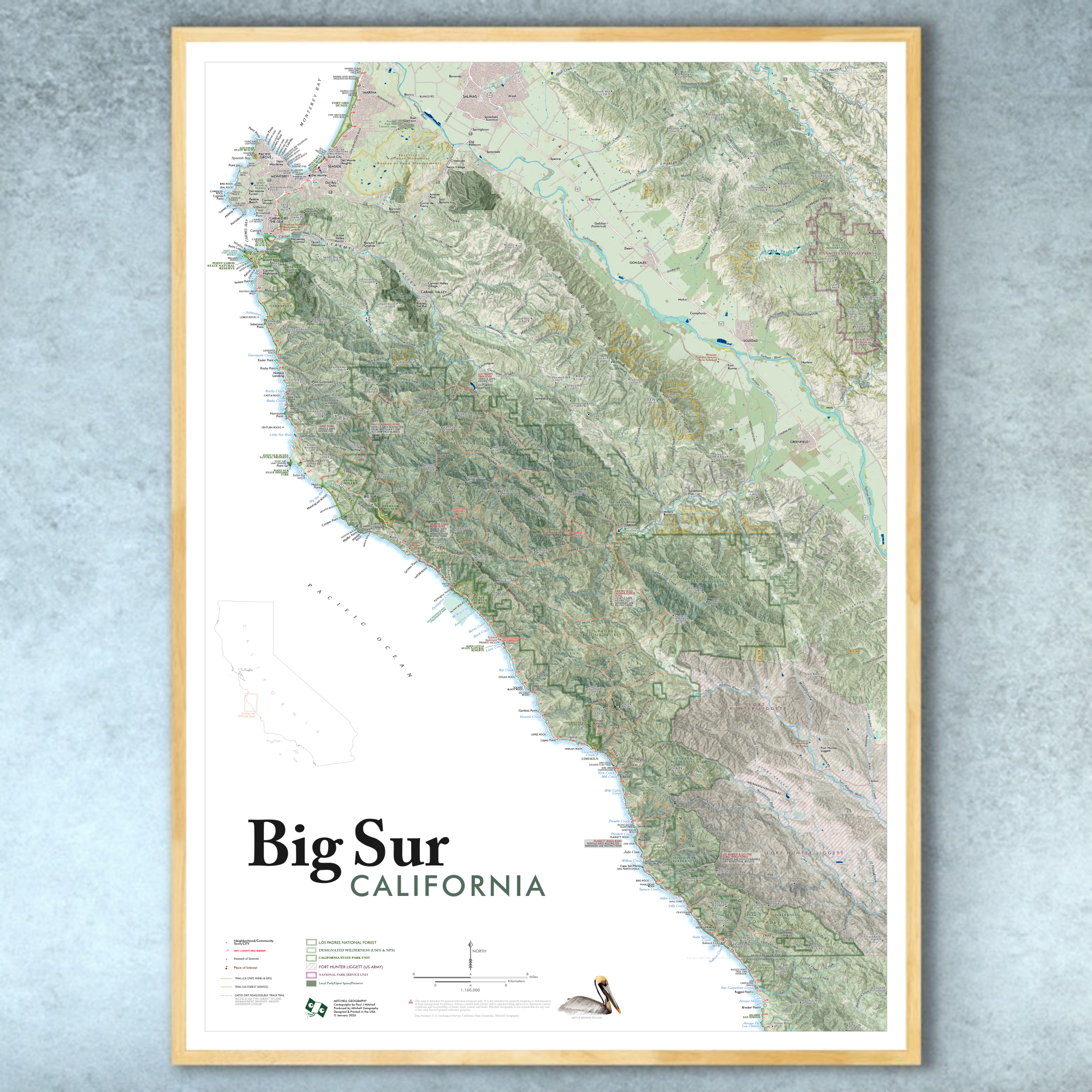 Image 1 of 13
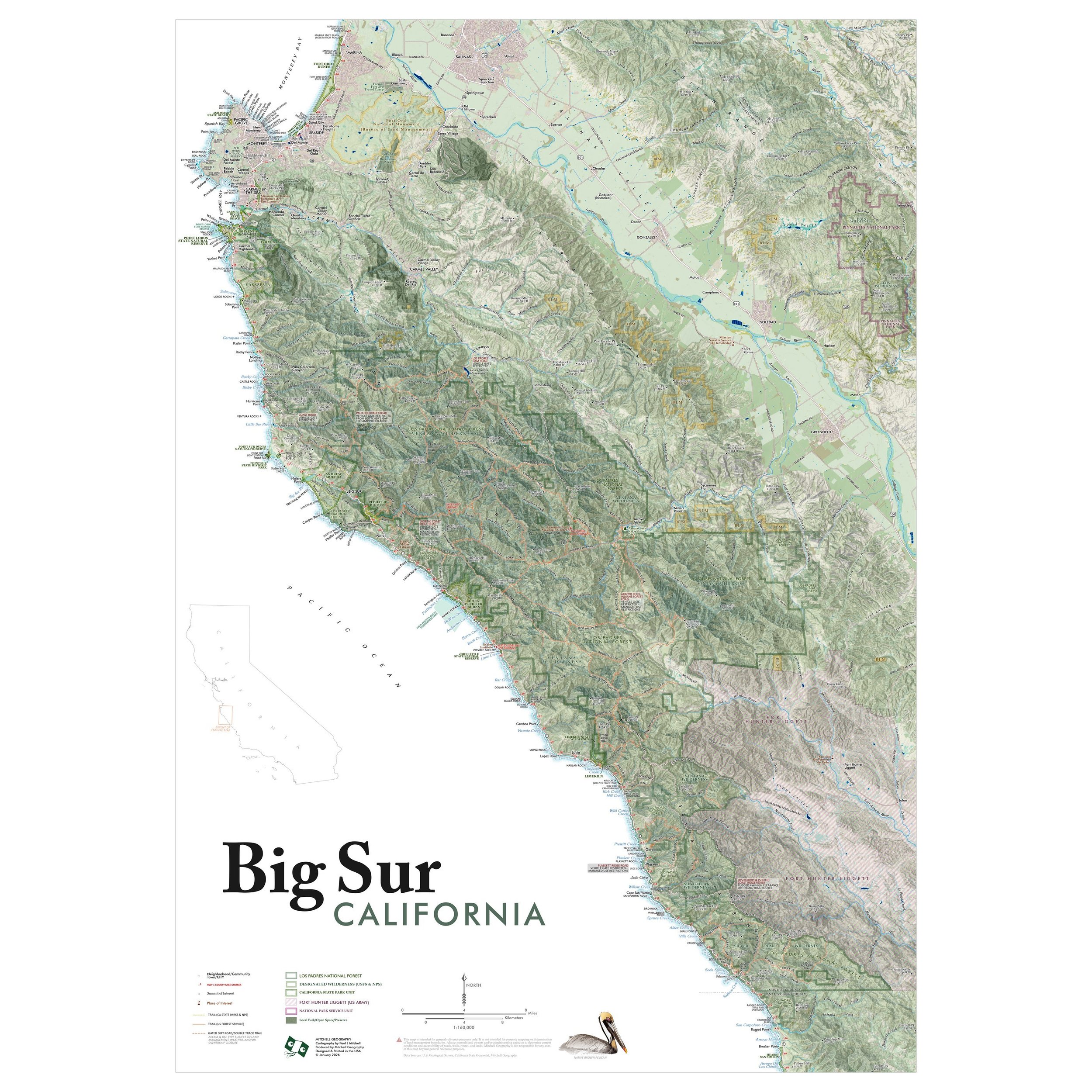 Image 2 of 13
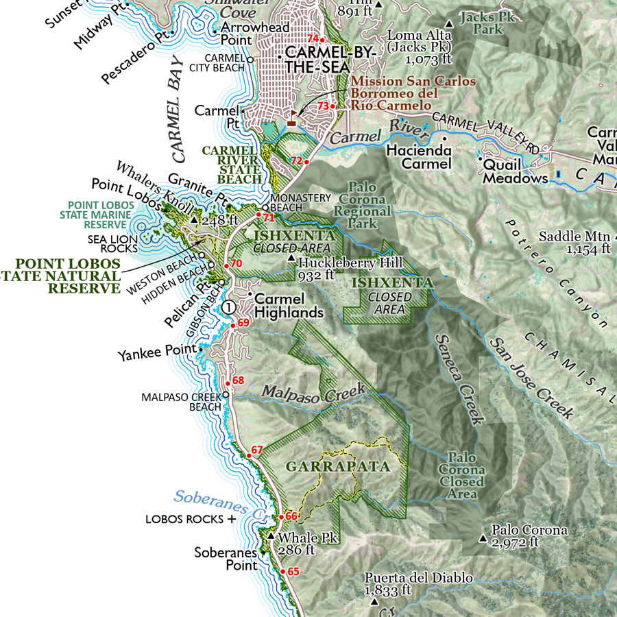 Image 3 of 13
 Image 4 of 13
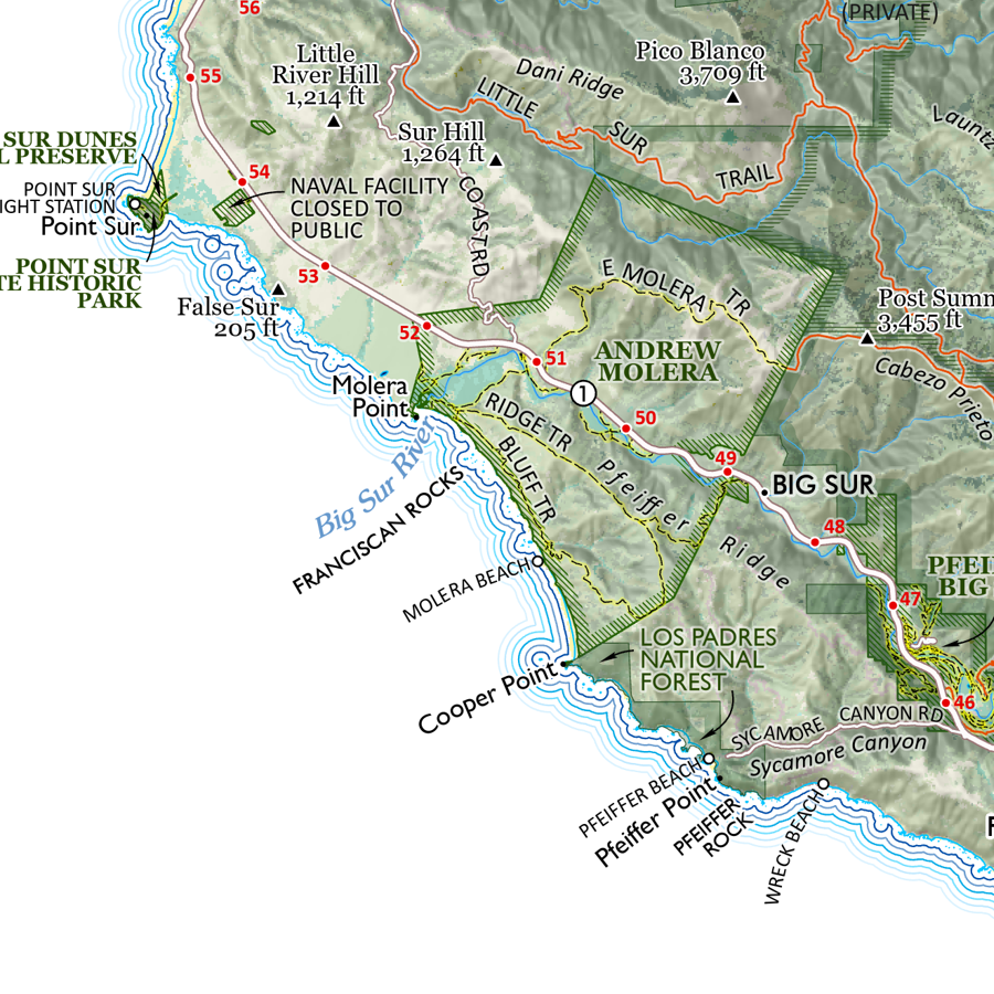 Image 5 of 13
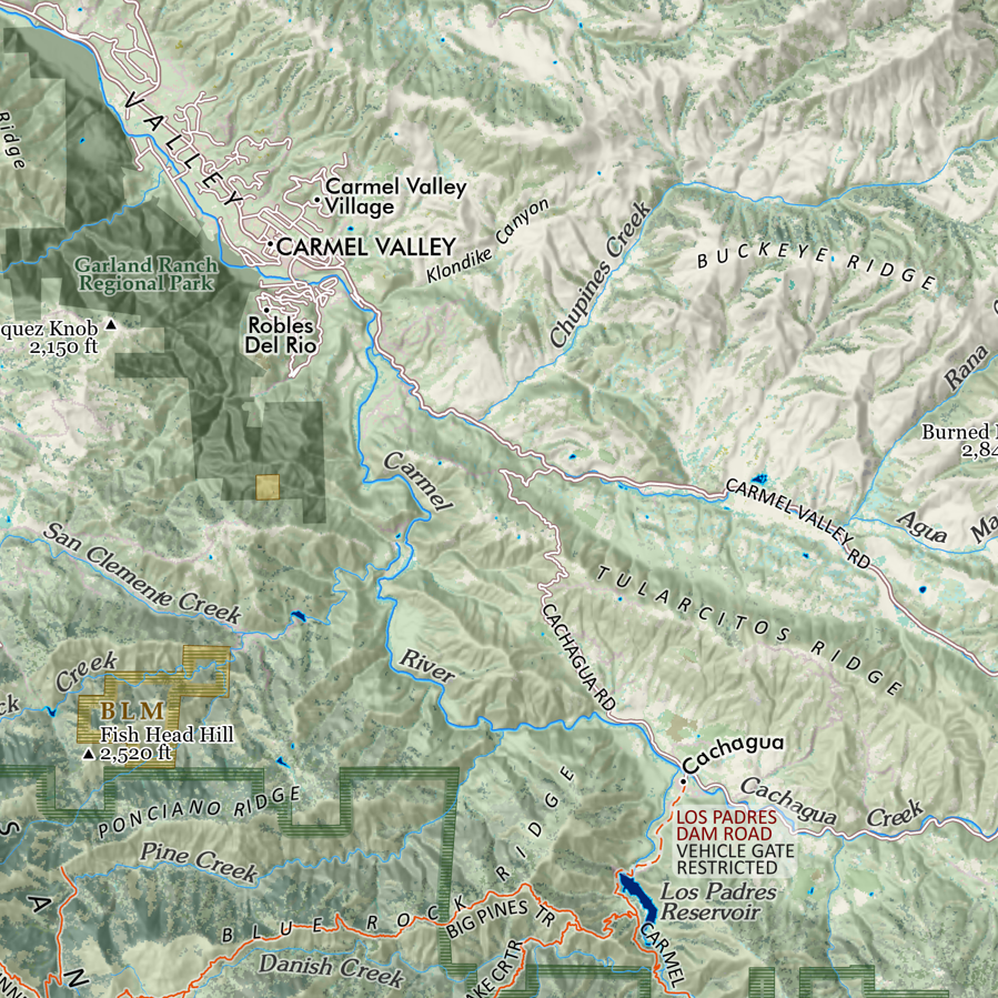 Image 6 of 13
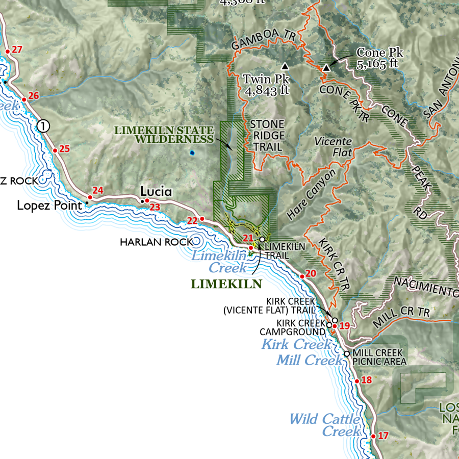 Image 7 of 13
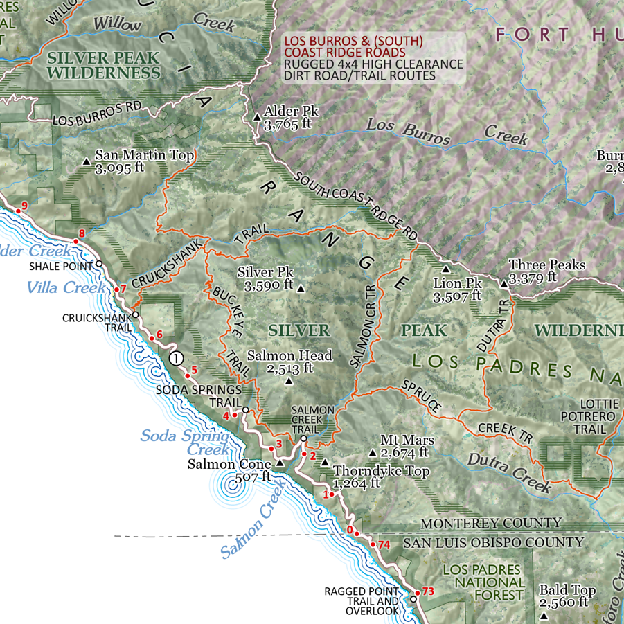 Image 8 of 13
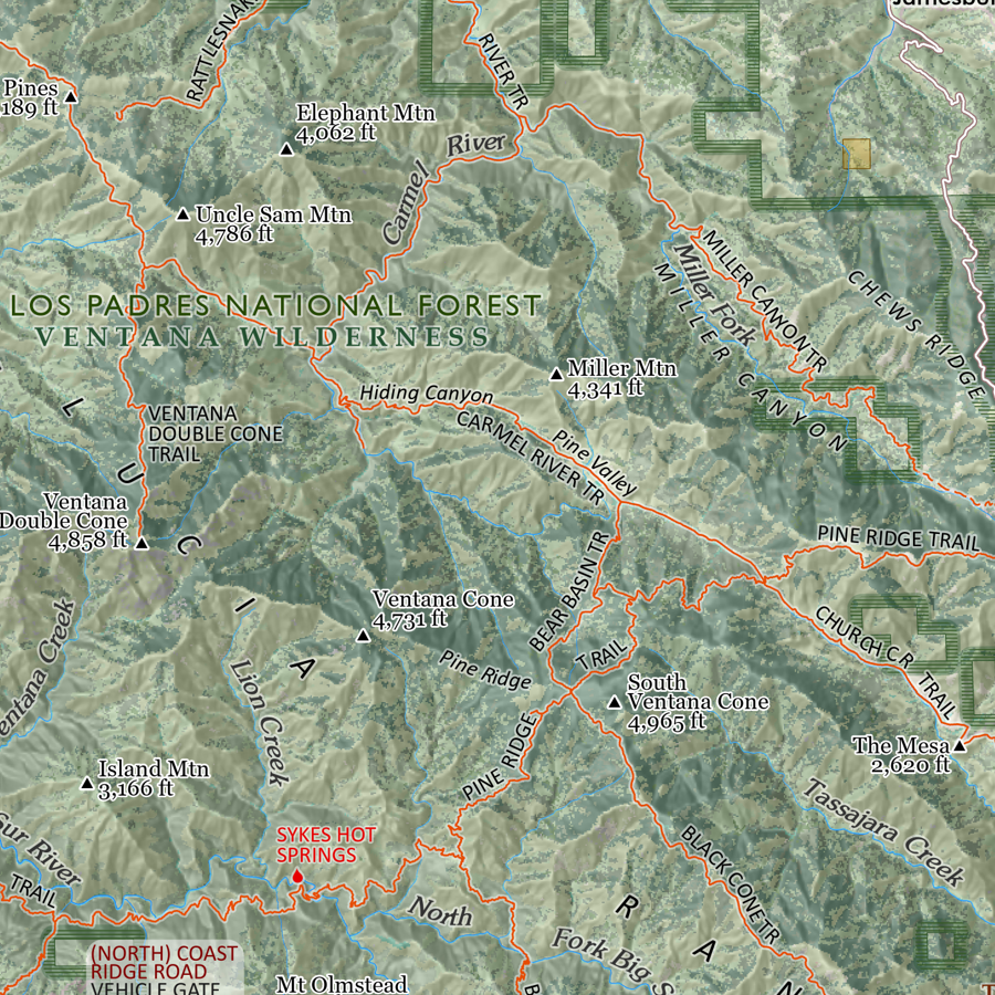 Image 9 of 13
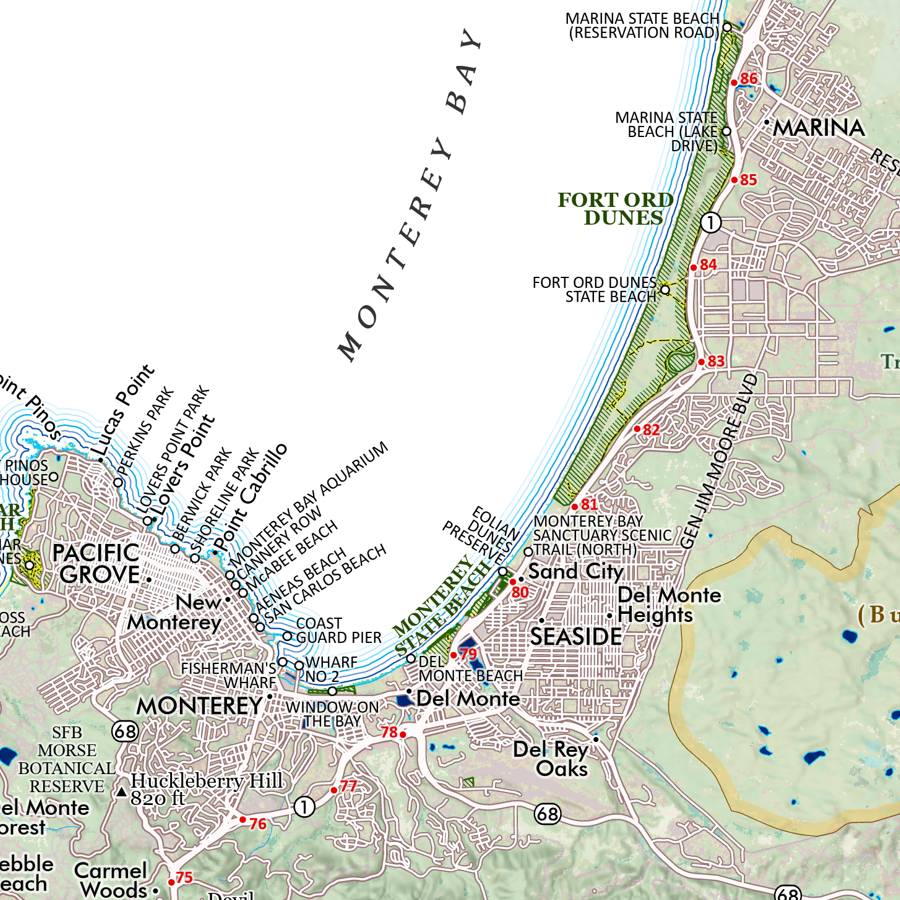 Image 10 of 13
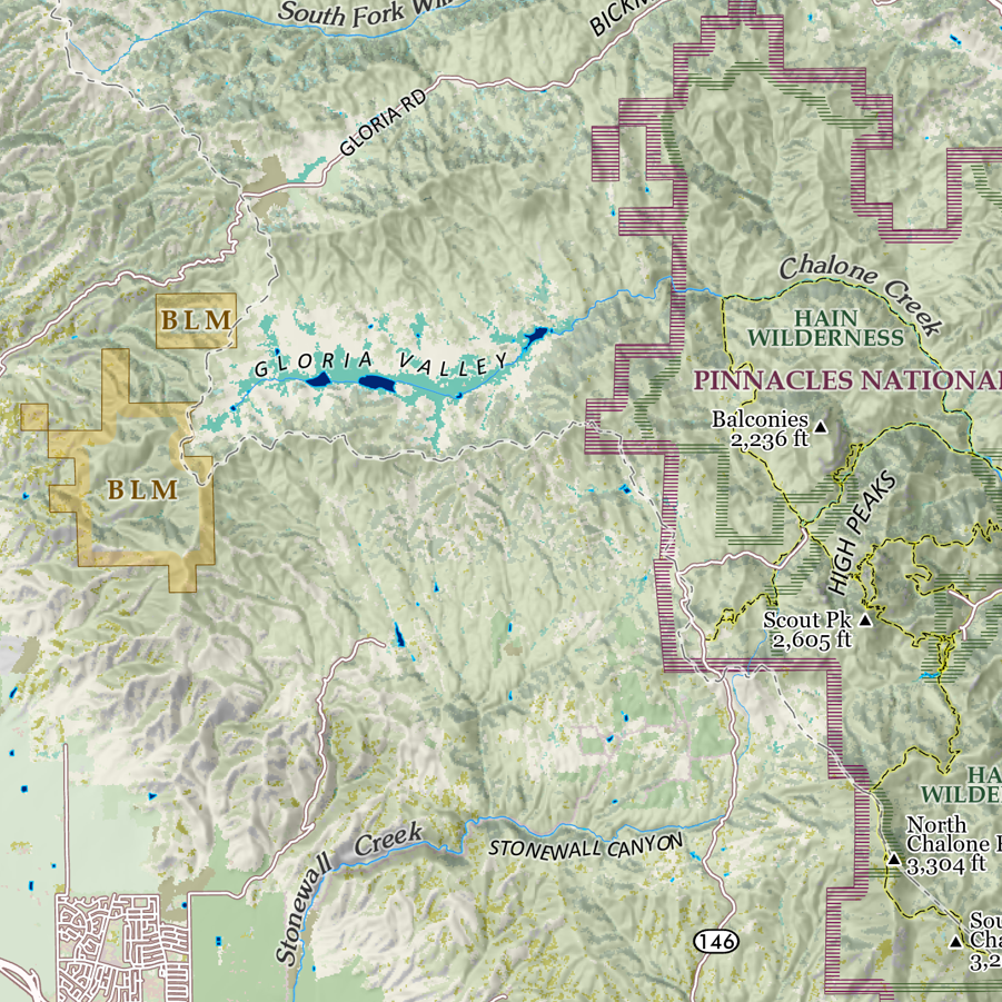 Image 11 of 13
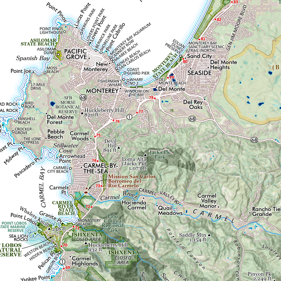 Image 12 of 13
 Image 13 of 13