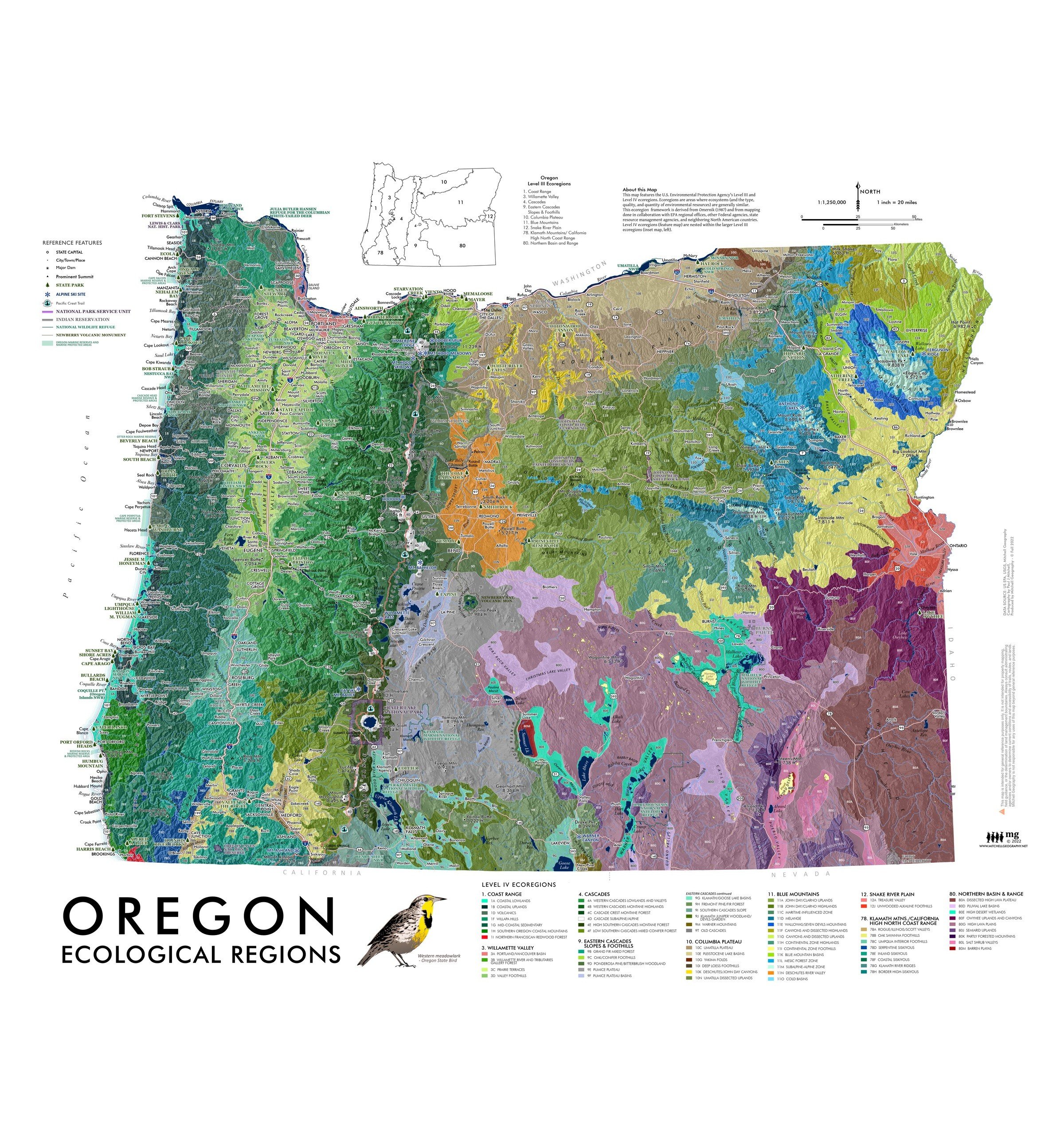
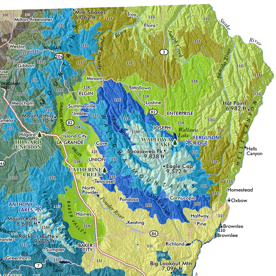
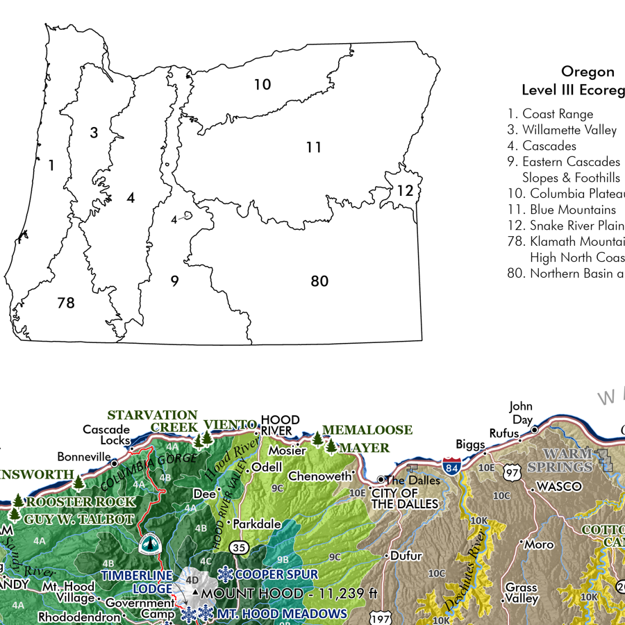
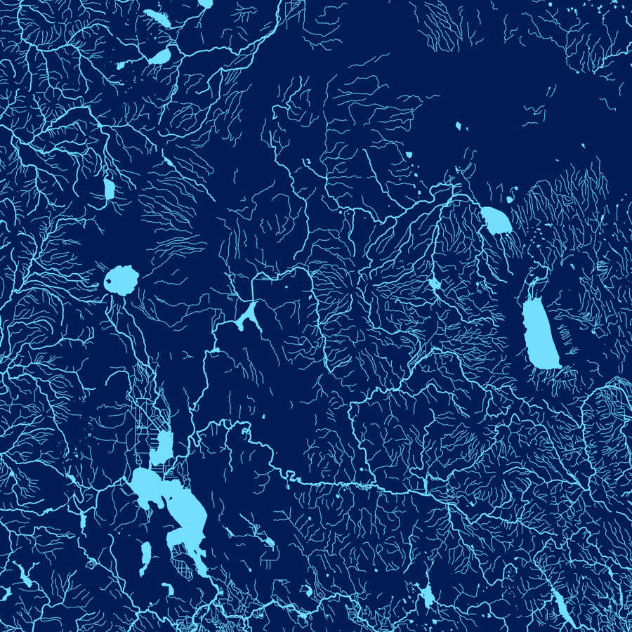
Image 1 of 5
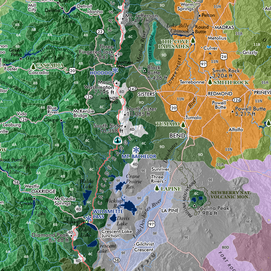
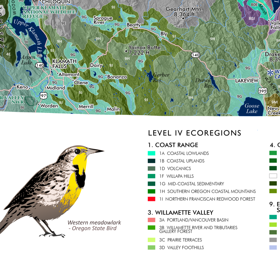
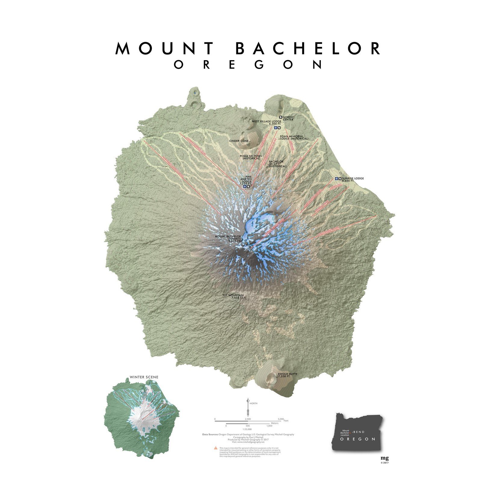
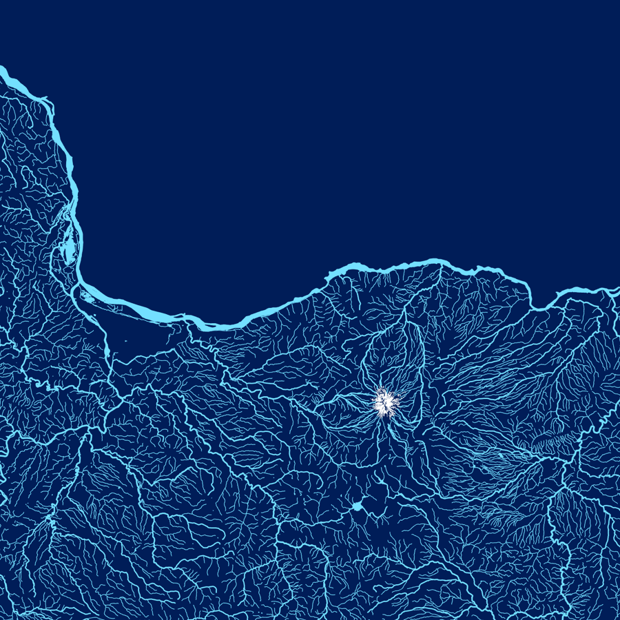
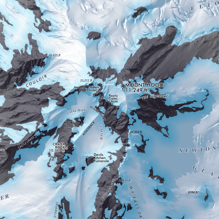 Image 2 of 5
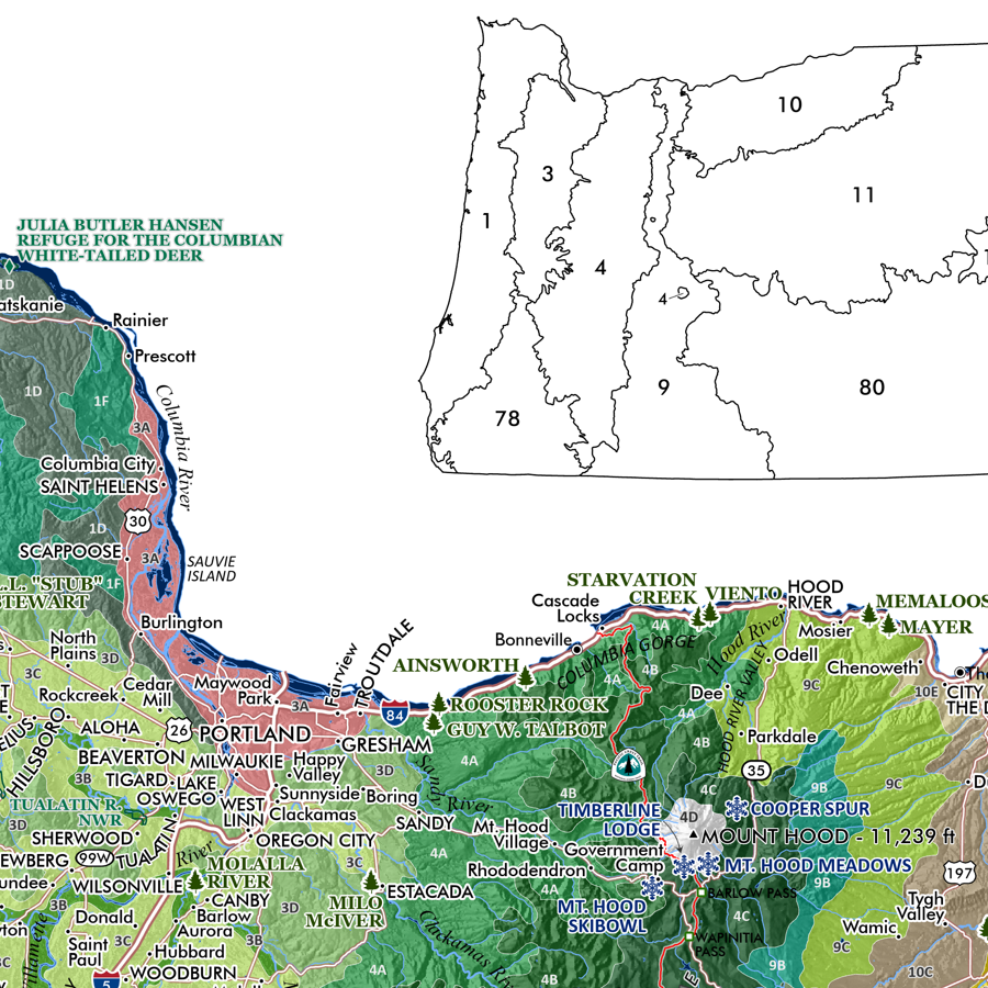
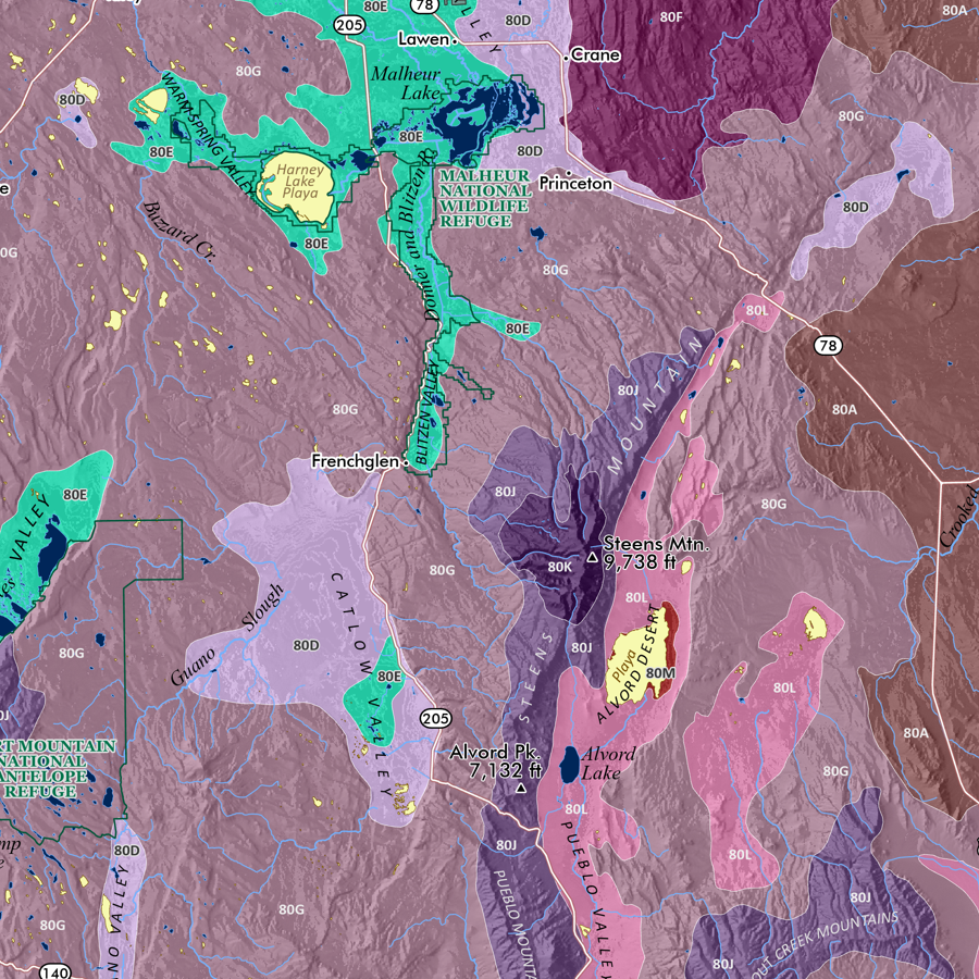
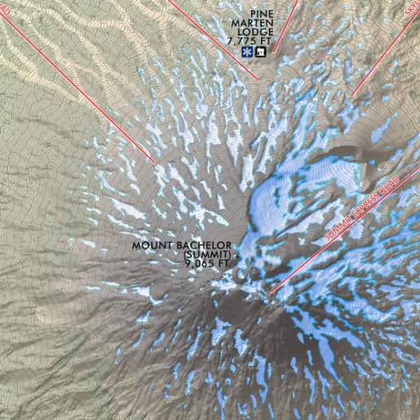
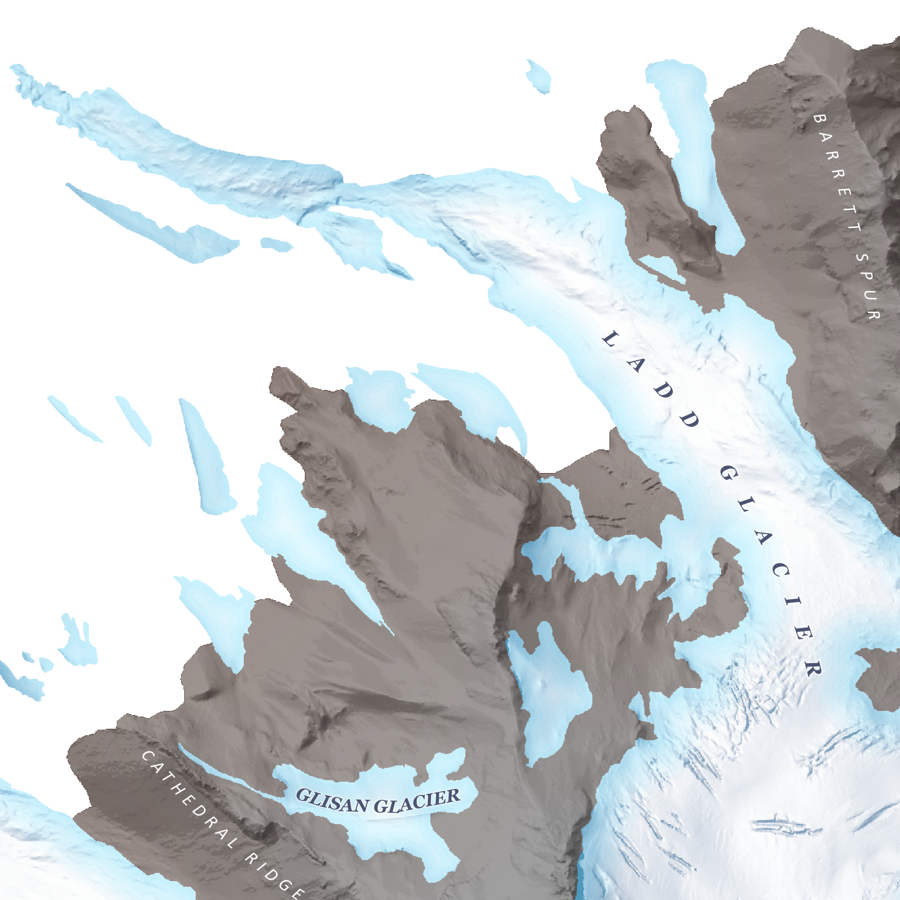 Image 3 of 5
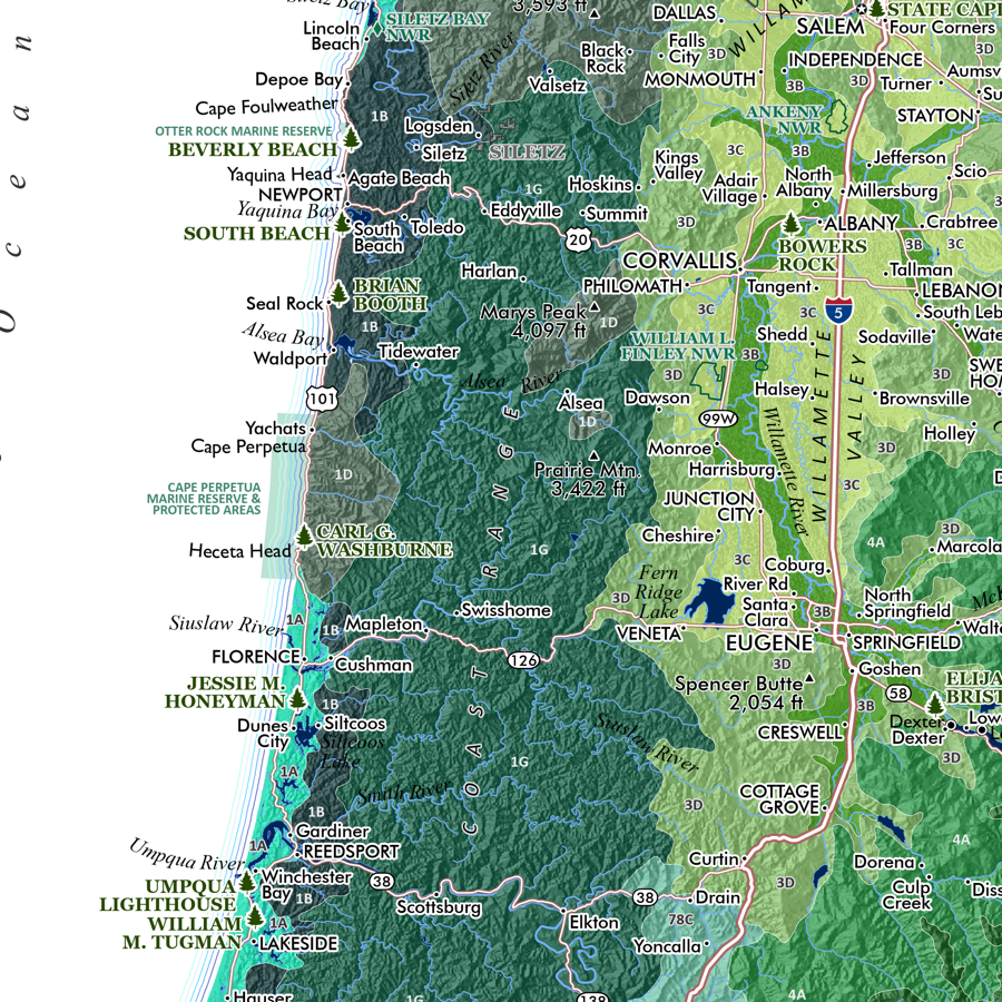
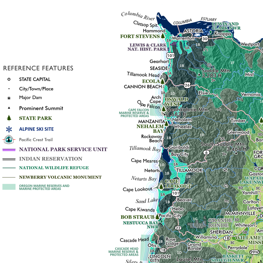
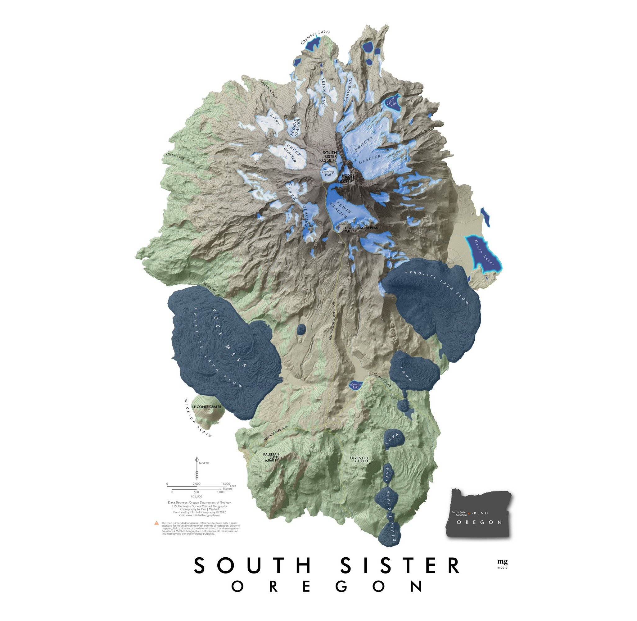
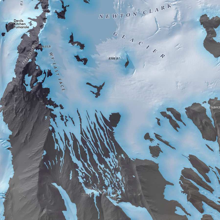 Image 4 of 5
 Image 5 of 5
1:10,000
20 inch x 24 inch — flat wall map, printed on a heavy fine paper — shipped rolled.
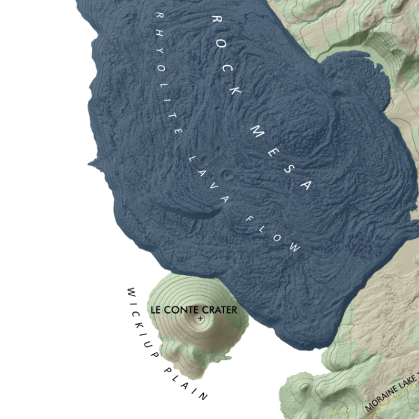
Mount Hood Glaciers, Oregon. My most recent detailed feature map of Mount Hood’s Glaciers — differing only slightly in artistic style and scale from my most detailed 1:9,000 Hood Summit map.
Generally depicting elevations over 7,500 ft and based upon Oregon DOGAMI’s detailed LiDAR elevation model, my visually prominent mid-summer seasonal glacier and snowfield extent is derived at 1:2,000 from the same LiDAR model and corrected to aerial imagery. Landforms and provincial feature names of chutes, faces, snowfields, etc are included.
1:10,000
20 inch x 24 inch — flat wall map, printed on a heavy fine paper — shipped rolled.
Mount Hood Glaciers, Oregon. My most recent detailed feature map of Mount Hood’s Glaciers — differing only slightly in artistic style and scale from my most detailed 1:9,000 Hood Summit map.
Generally depicting elevations over 7,500 ft and based upon Oregon DOGAMI’s detailed LiDAR elevation model, my visually prominent mid-summer seasonal glacier and snowfield extent is derived at 1:2,000 from the same LiDAR model and corrected to aerial imagery. Landforms and provincial feature names of chutes, faces, snowfields, etc are included.