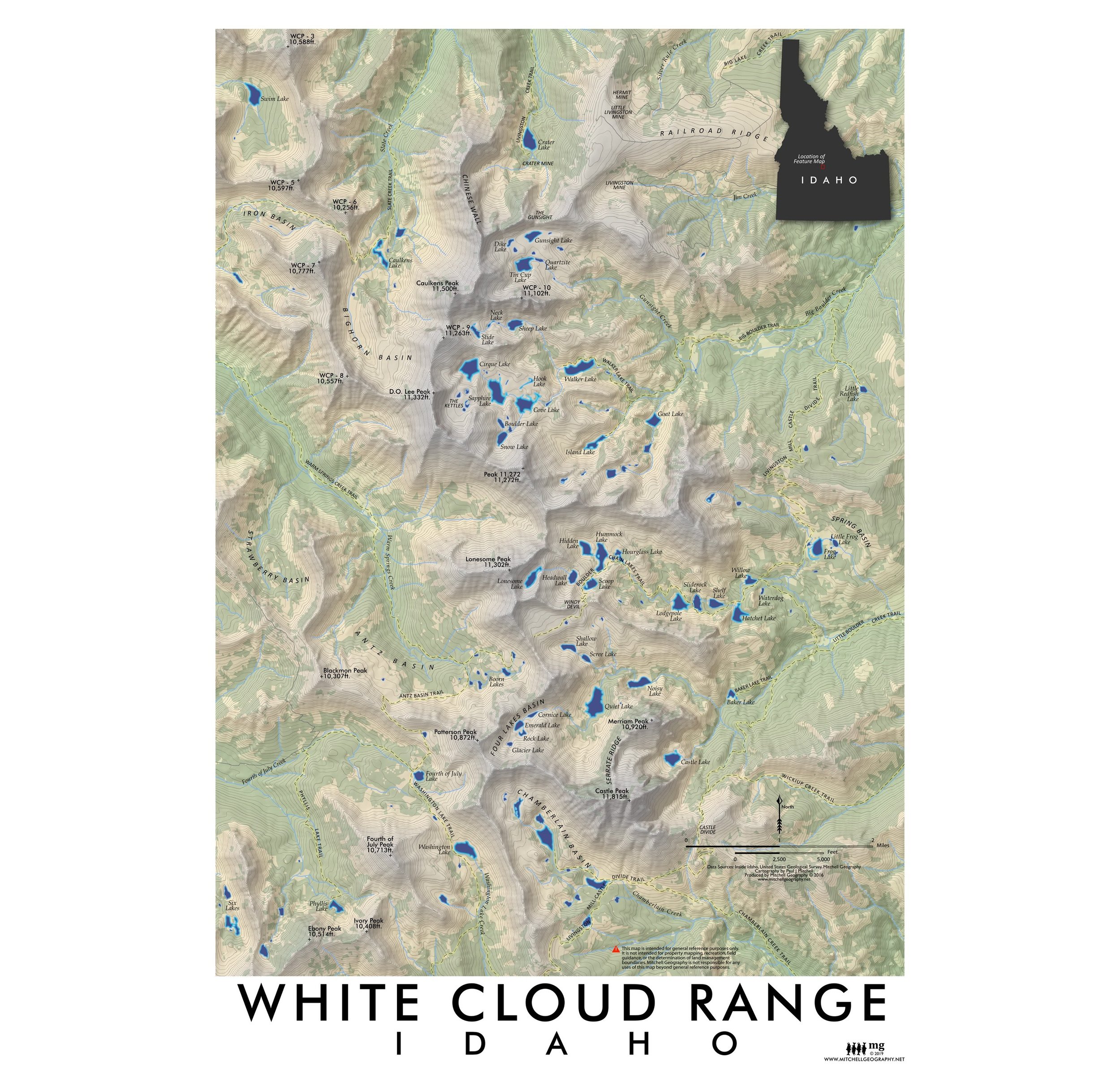
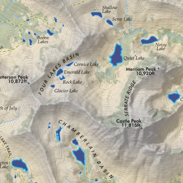
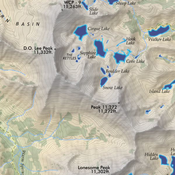
1:1,180,000 scale
28 inch x 20 inch — flat wall map, printed on a heavy fine paper — shipped rolled.
Idaho Mountain Ranges Map, Second Edition - Produced February 2026, Printed March 2026
Second Edition Updates
• NEW larger 28 inch x 20 inch sheet size
• NEW 1:1,180,000 scale resulting in a larger print and increased readability.
• Edited all annotations for clarity, reduced clutter, and increased readability.
• Edited and cross-walked Southeast Basin & Range region symbology and range classes with the new Utah Mountain Ranges map.
• Added alpine and subalpine class symbology to infer exposed summit areas and associated landforms.
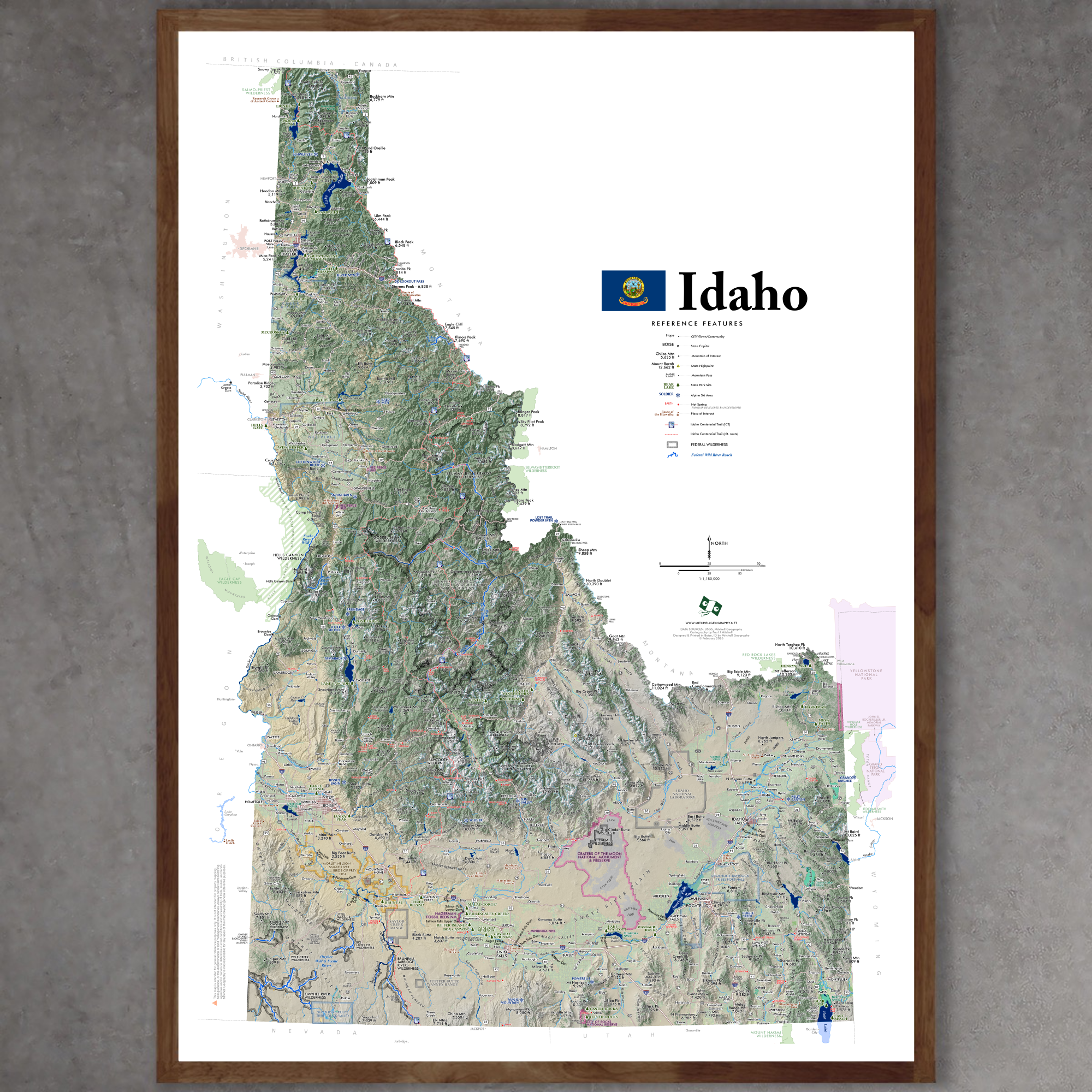
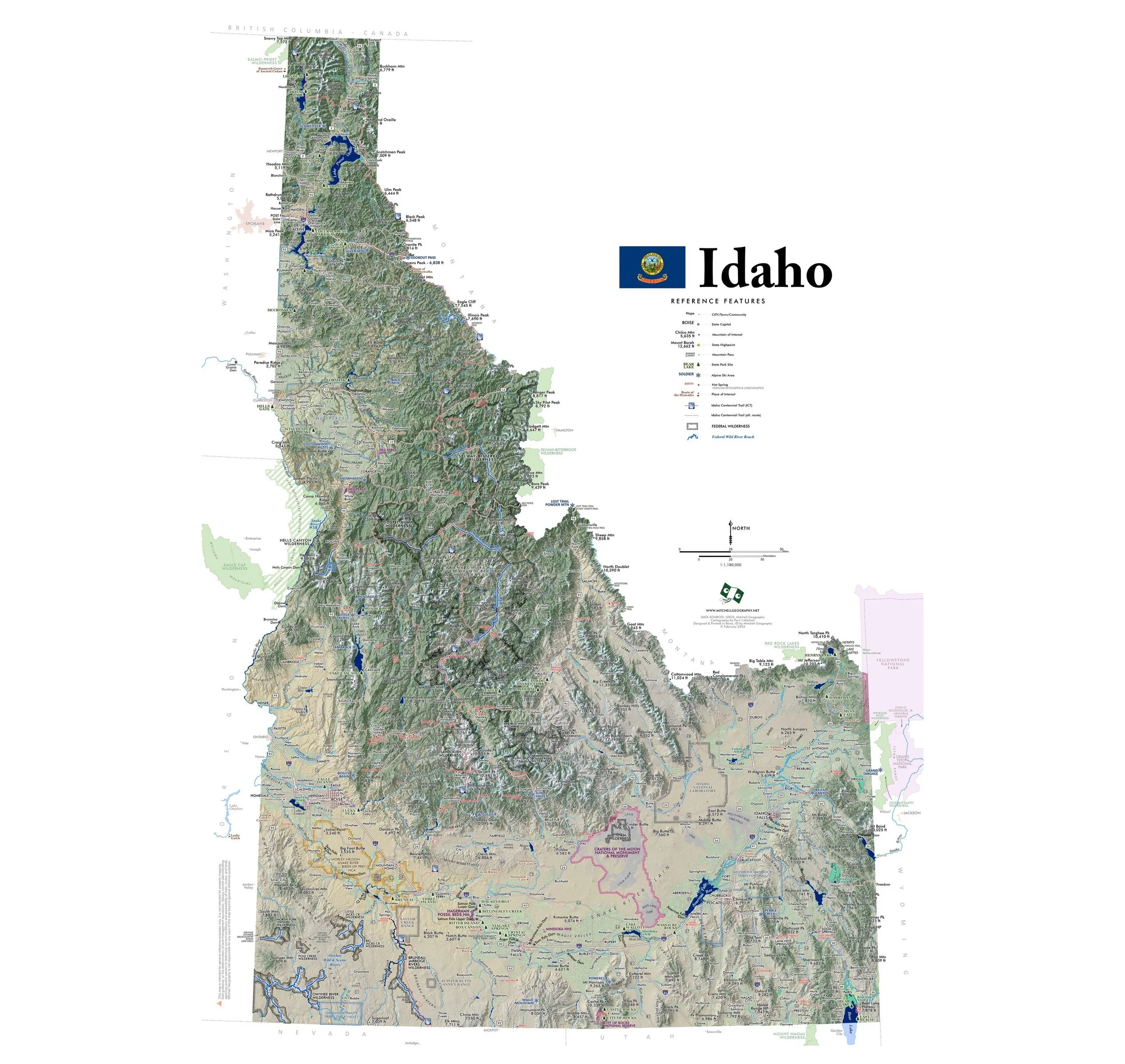
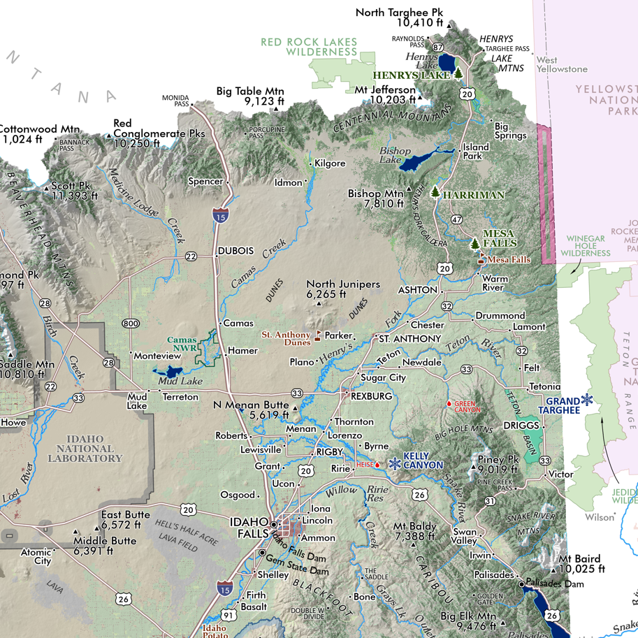
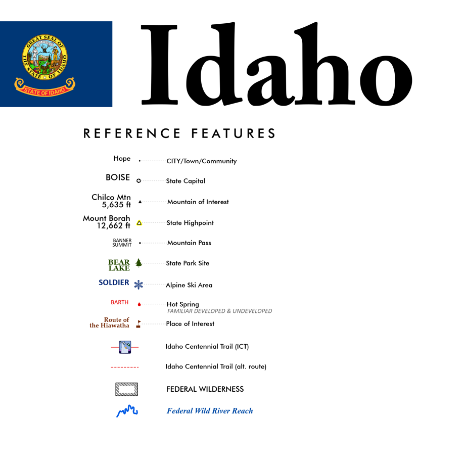
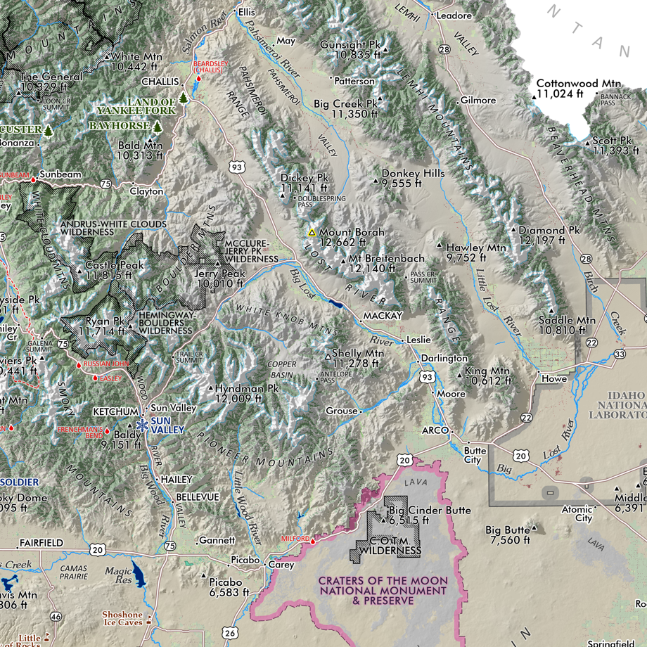
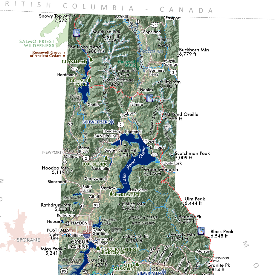
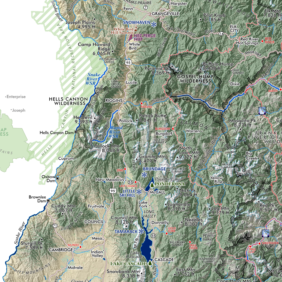
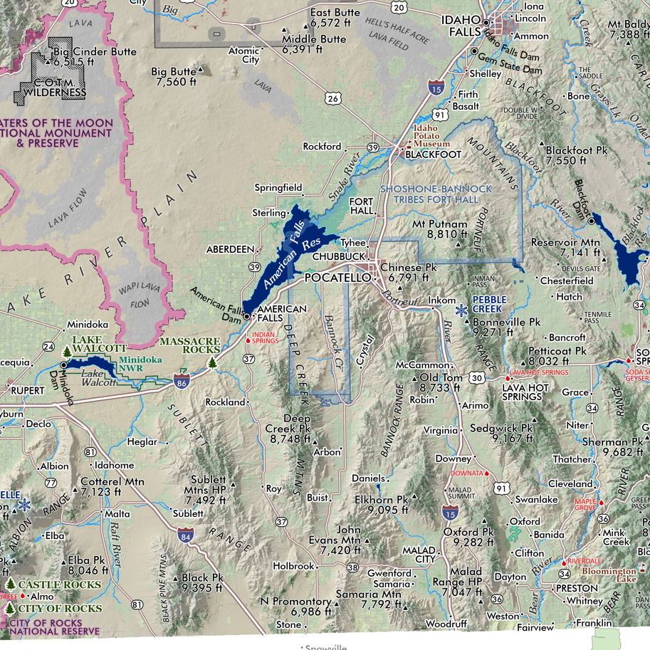
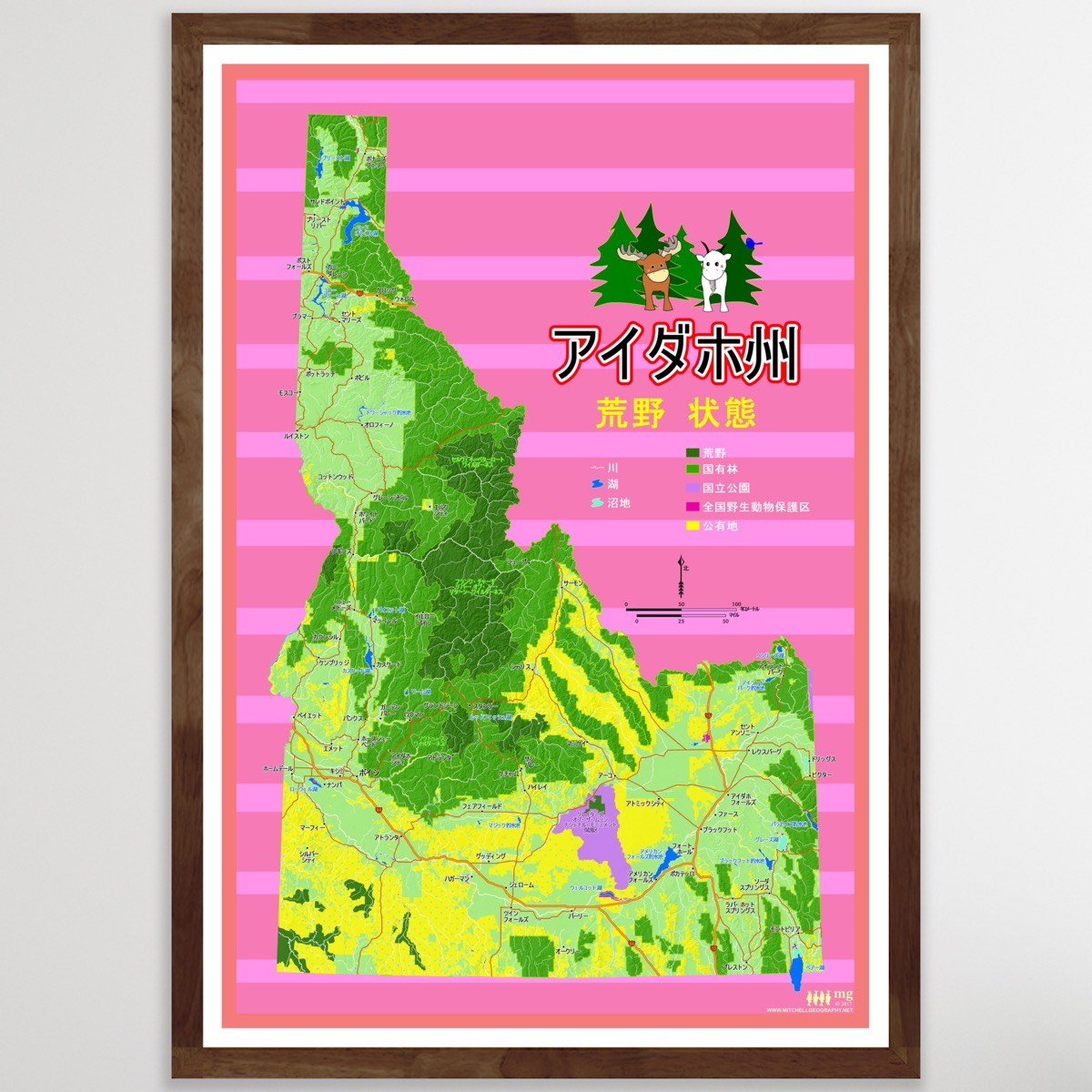
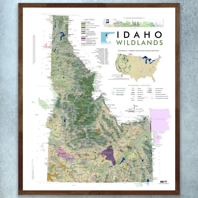
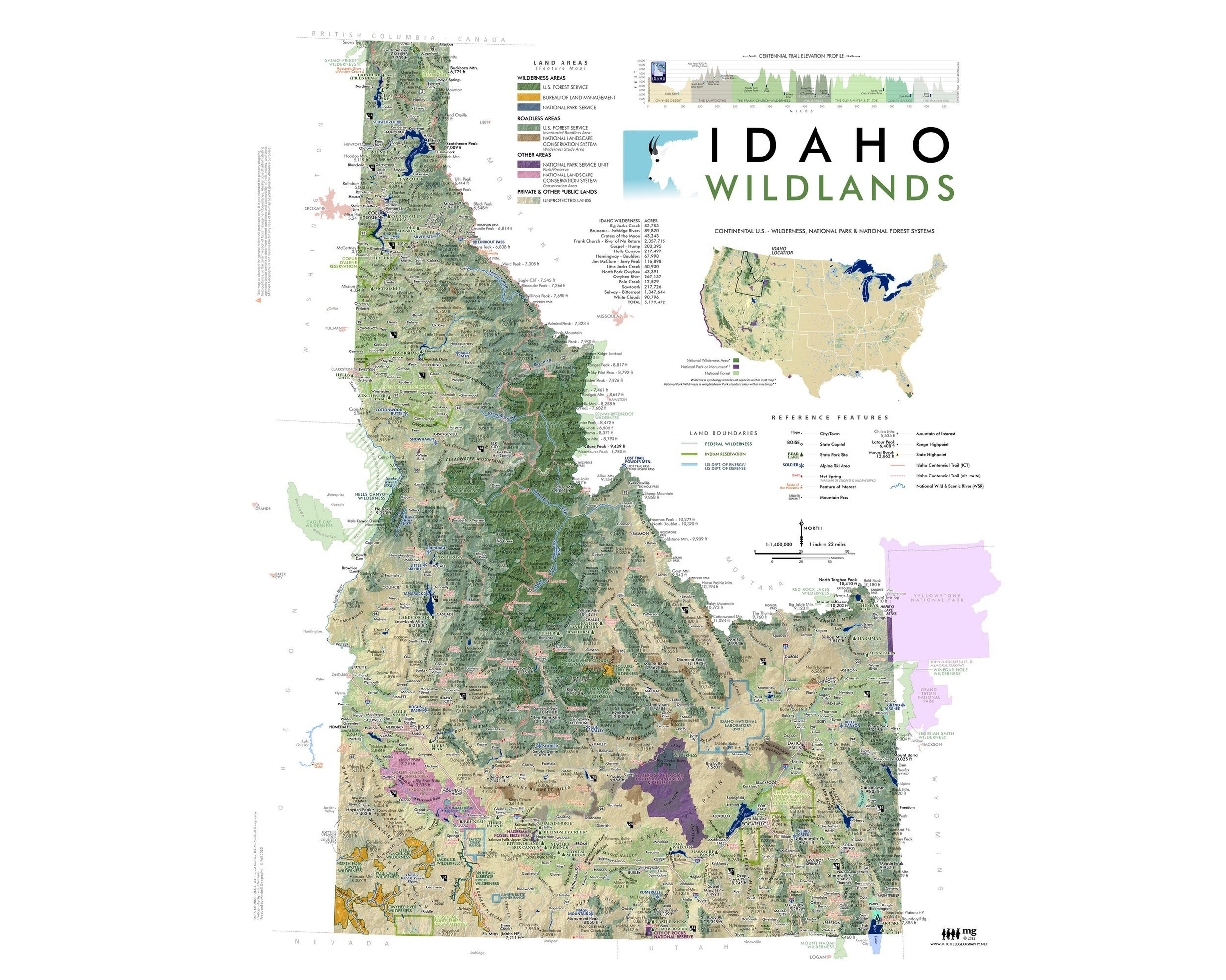
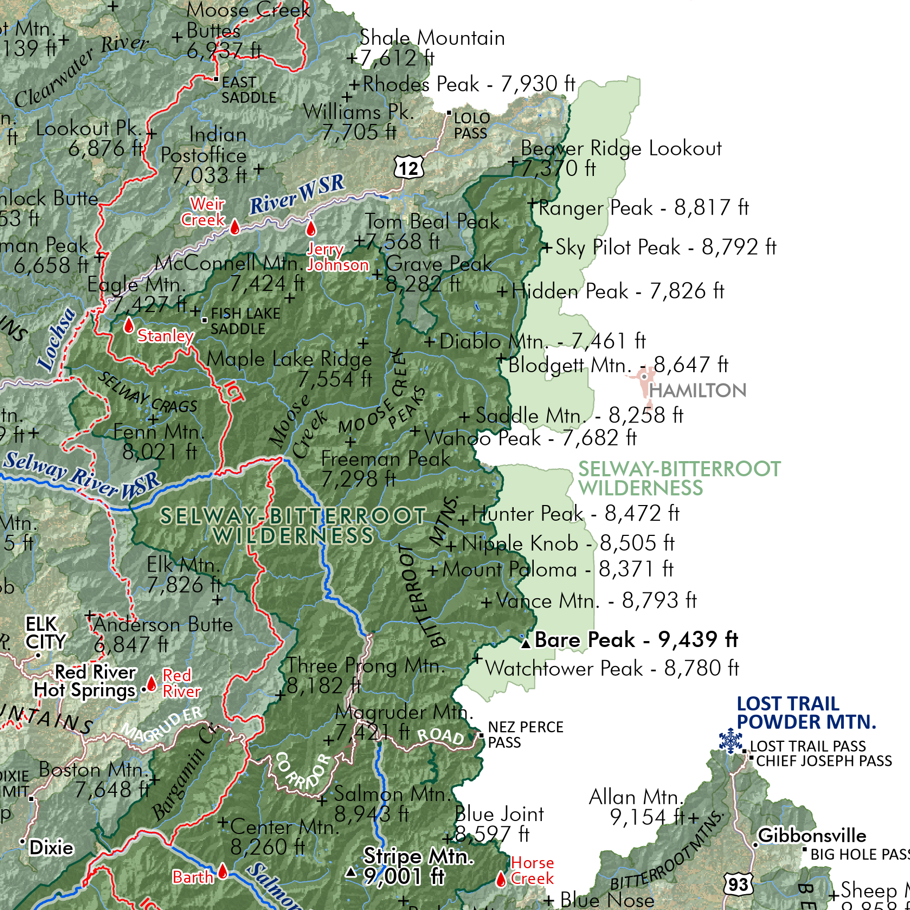
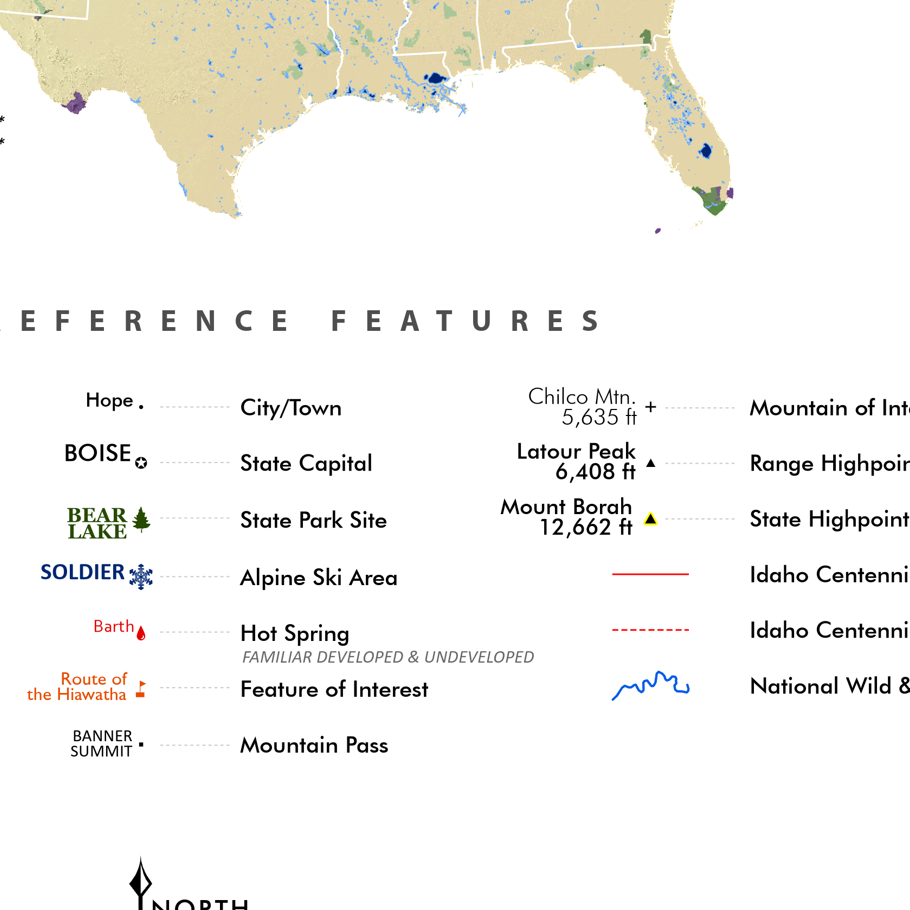
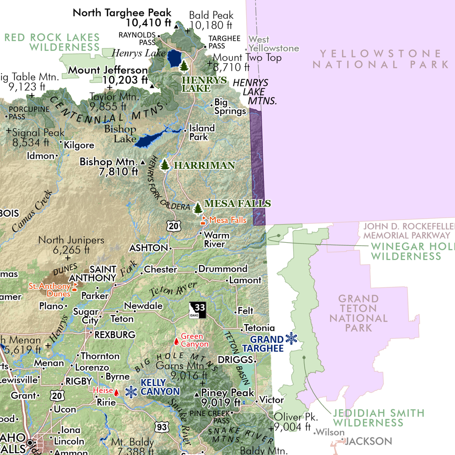
Featuring Idaho’s many mountain ranges, named sub-ranges of any significance — all delineated, colored and keyed to a detailed legend that identifies range and sub-range high point names and elevations in feet. Other uplands, plateaus, basins, valleys, and lowlands are also classed and keyed within the legend.
Also included for reference: towns, cities, places, special features, hot springs (only the familiar ones thou, not your favorite secret ones!), alpine ski areas, state park sites, wilderness areas (with a subtly hashed boundary line), national park sites, wild and scenic river segments, the Idaho Centennial Trail Route, and a nice rich terrain and hillshade.
1:1,180,000 scale
28 inch x 20 inch — flat wall map, printed on a heavy fine paper — shipped rolled.
Idaho Mountain Ranges Map, Second Edition - Produced February 2026, Printed March 2026
Second Edition Updates
• NEW larger 28 inch x 20 inch sheet size
• NEW 1:1,180,000 scale resulting in a larger print and increased readability.
• Edited all annotations for clarity, reduced clutter, and increased readability.
• Edited and cross-walked Southeast Basin & Range region symbology and range classes with the new Utah Mountain Ranges map.
• Added alpine and subalpine class symbology to infer exposed summit areas and associated landforms.
Featuring Idaho’s many mountain ranges, named sub-ranges of any significance — all delineated, colored and keyed to a detailed legend that identifies range and sub-range high point names and elevations in feet. Other uplands, plateaus, basins, valleys, and lowlands are also classed and keyed within the legend.
Also included for reference: towns, cities, places, special features, hot springs (only the familiar ones thou, not your favorite secret ones!), alpine ski areas, state park sites, wilderness areas (with a subtly hashed boundary line), national park sites, wild and scenic river segments, the Idaho Centennial Trail Route, and a nice rich terrain and hillshade.

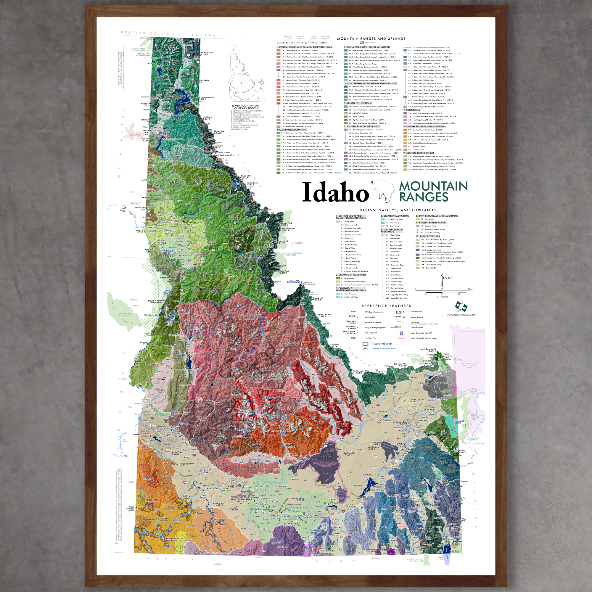 Image 1 of 12
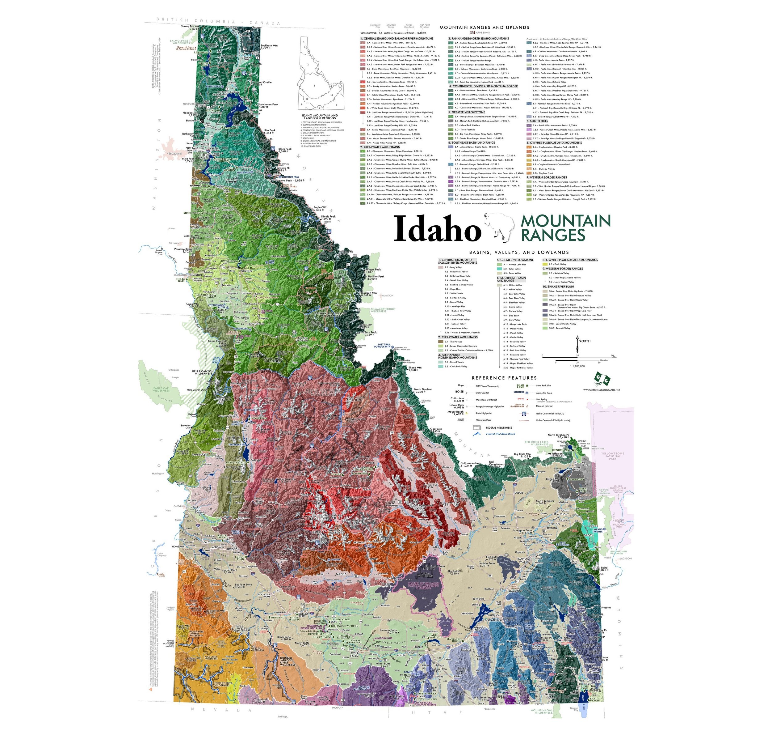 Image 2 of 12
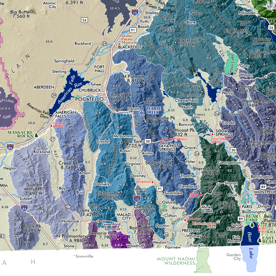 Image 3 of 12
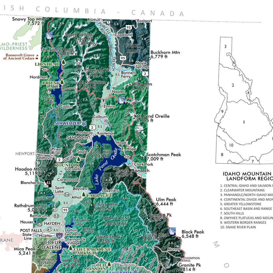 Image 4 of 12
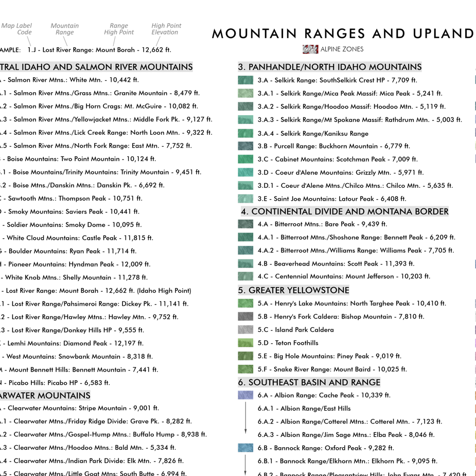 Image 5 of 12
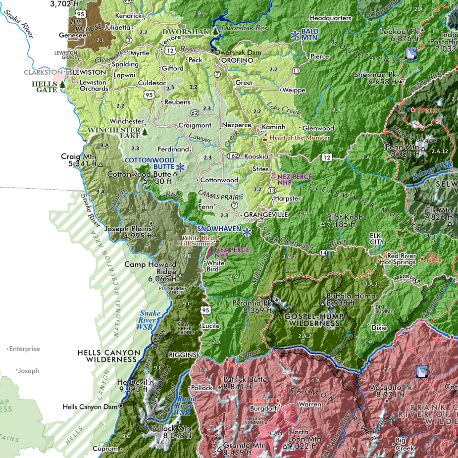 Image 6 of 12
 Image 7 of 12
 Image 8 of 12
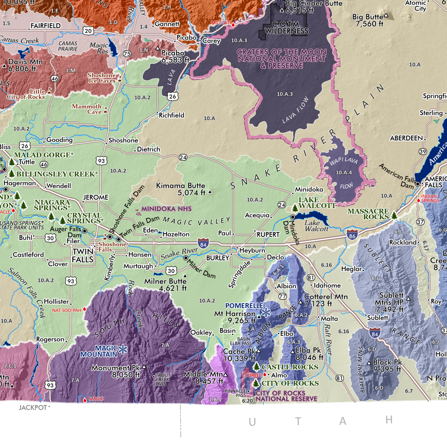 Image 9 of 12
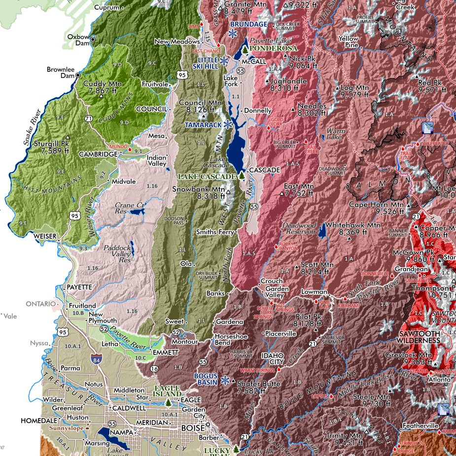 Image 10 of 12
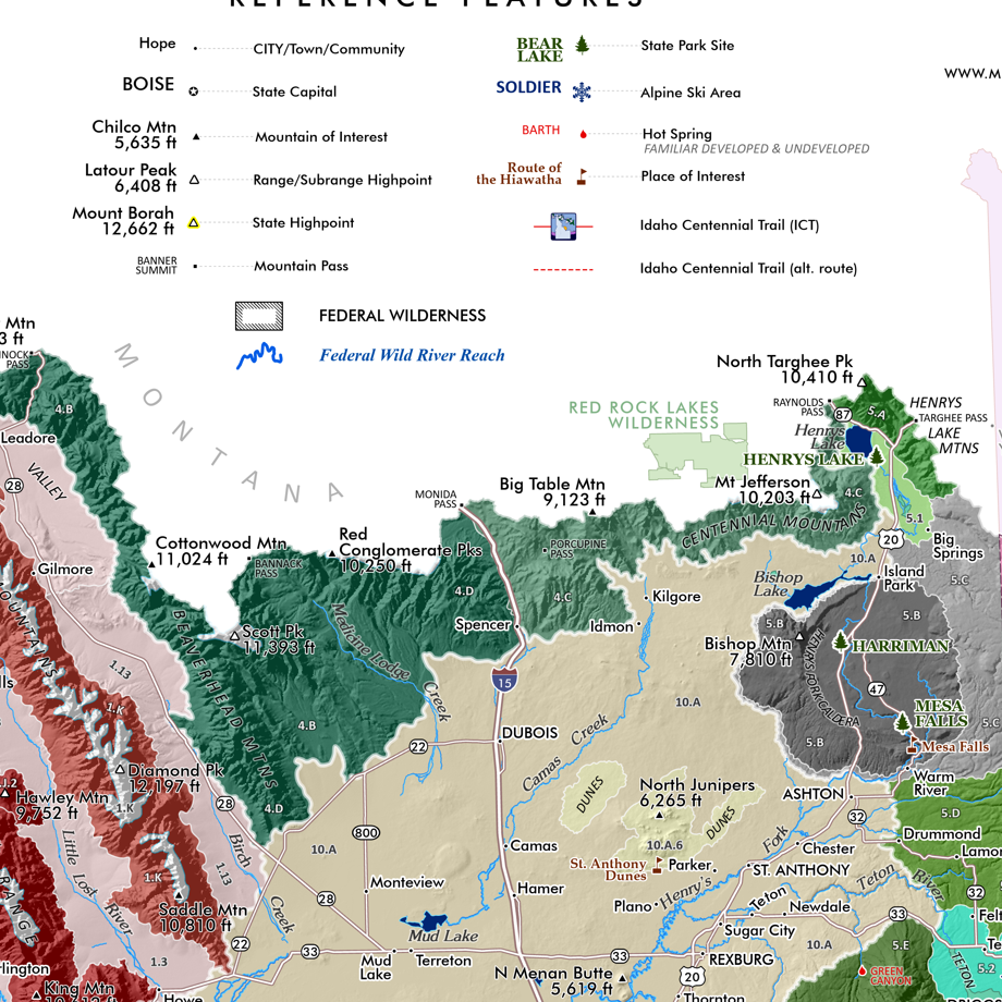 Image 11 of 12
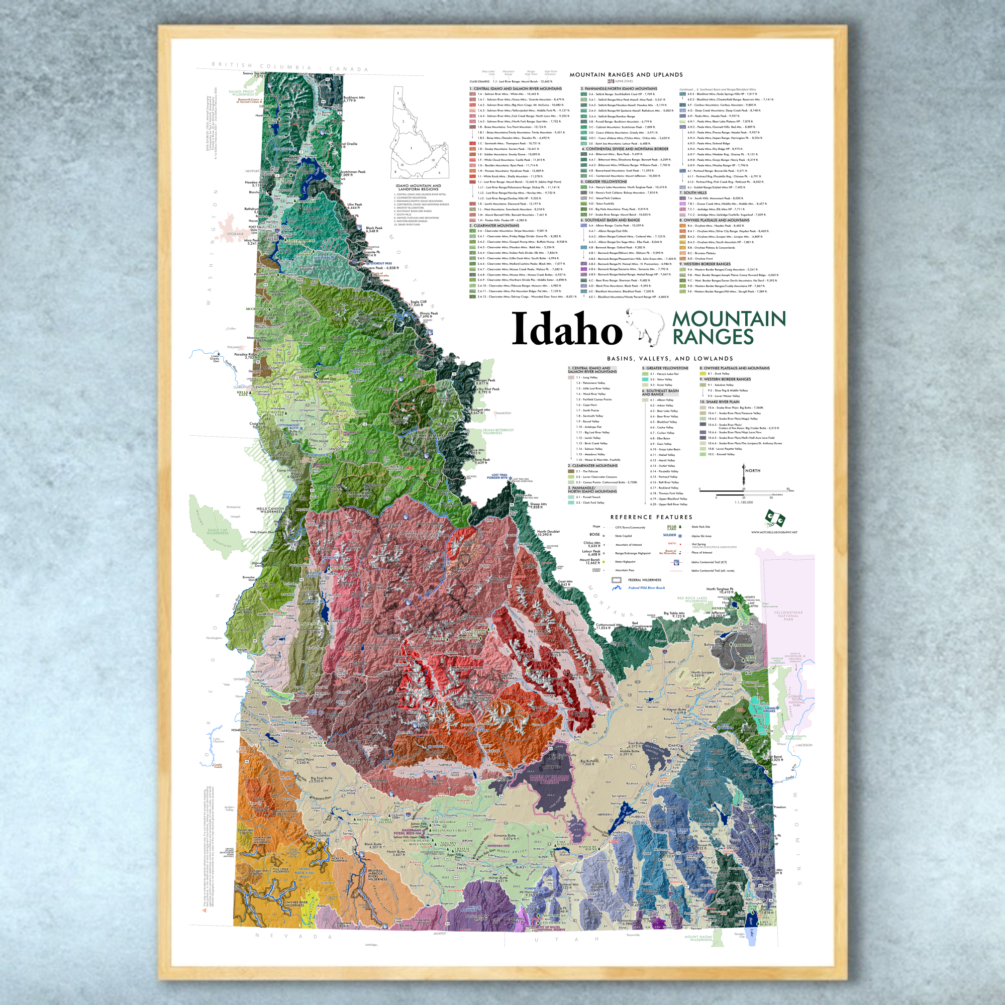 Image 12 of 12