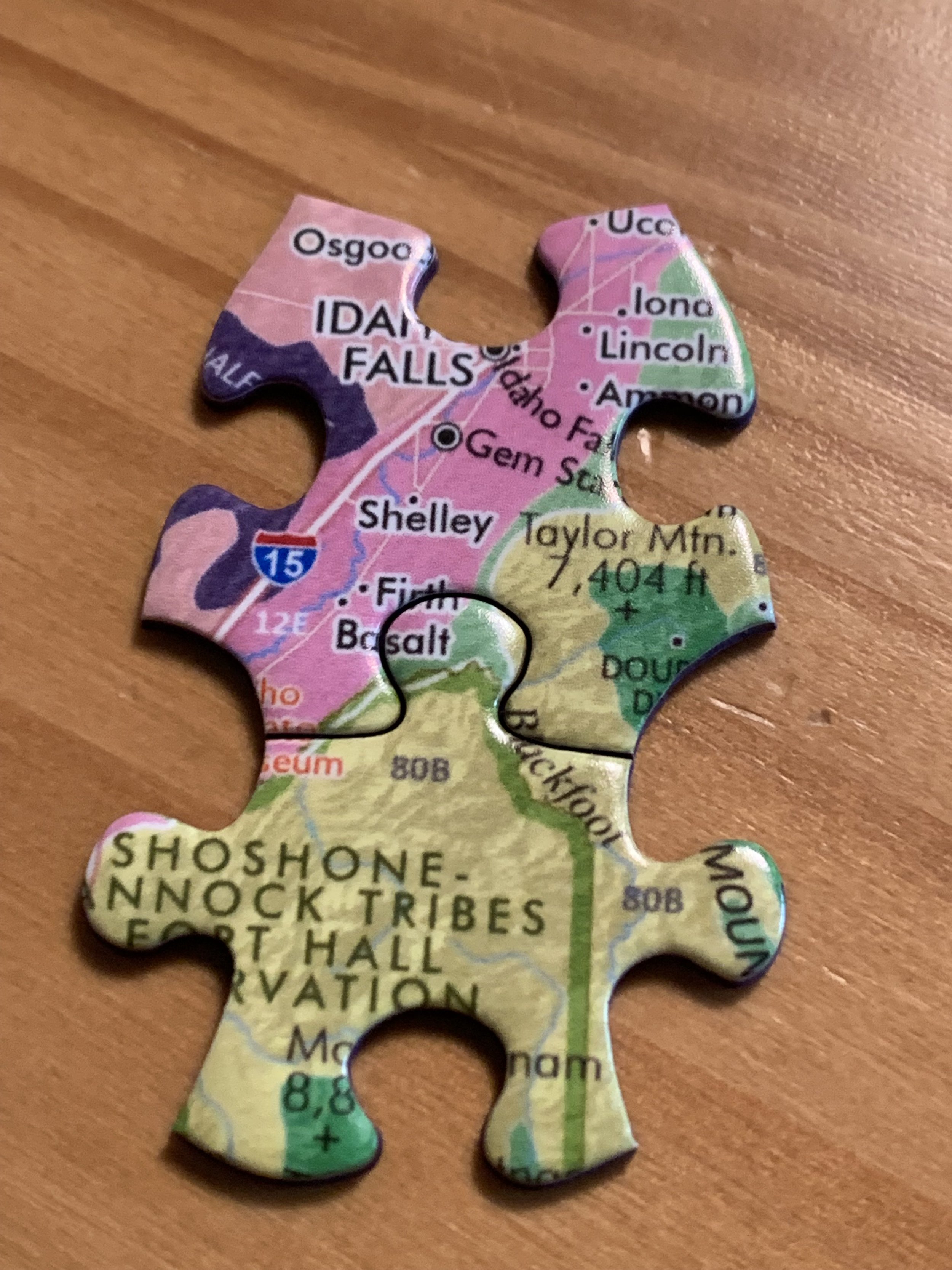
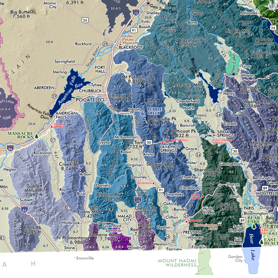
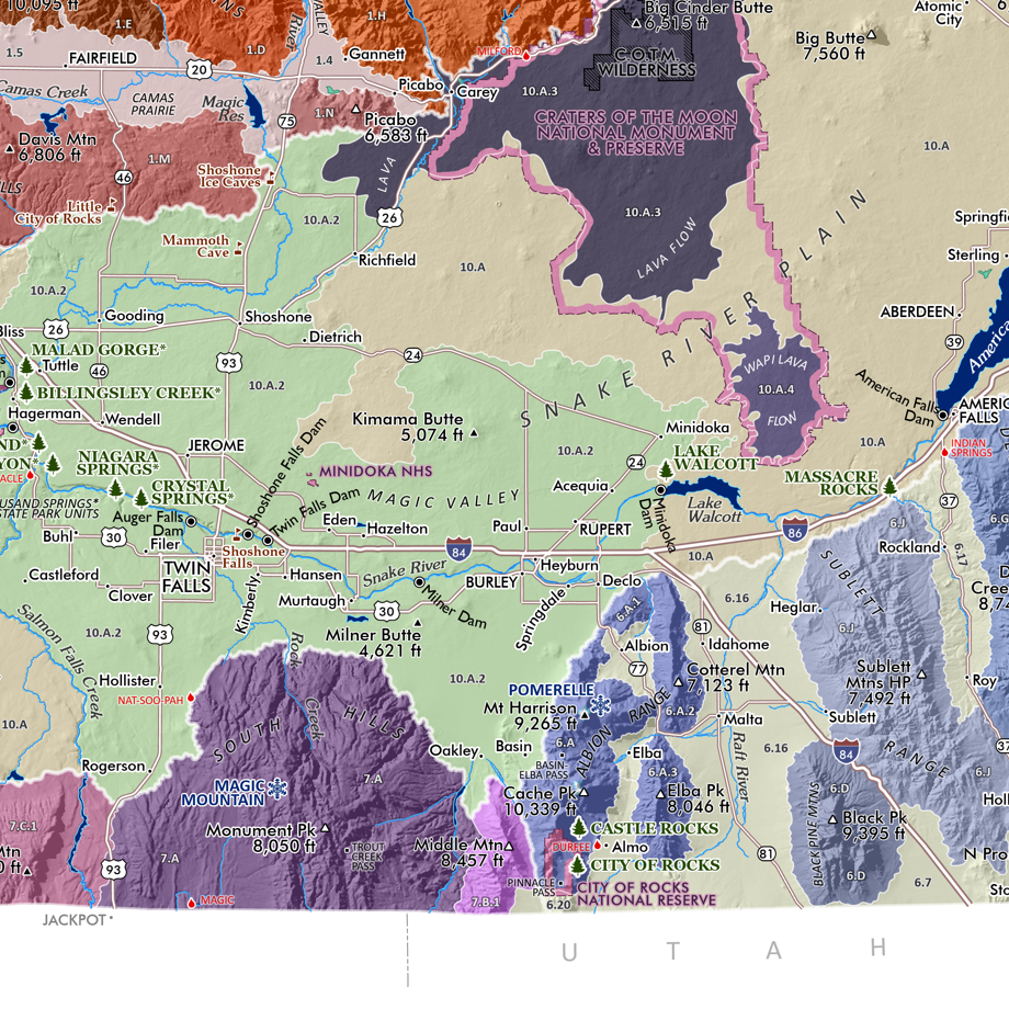
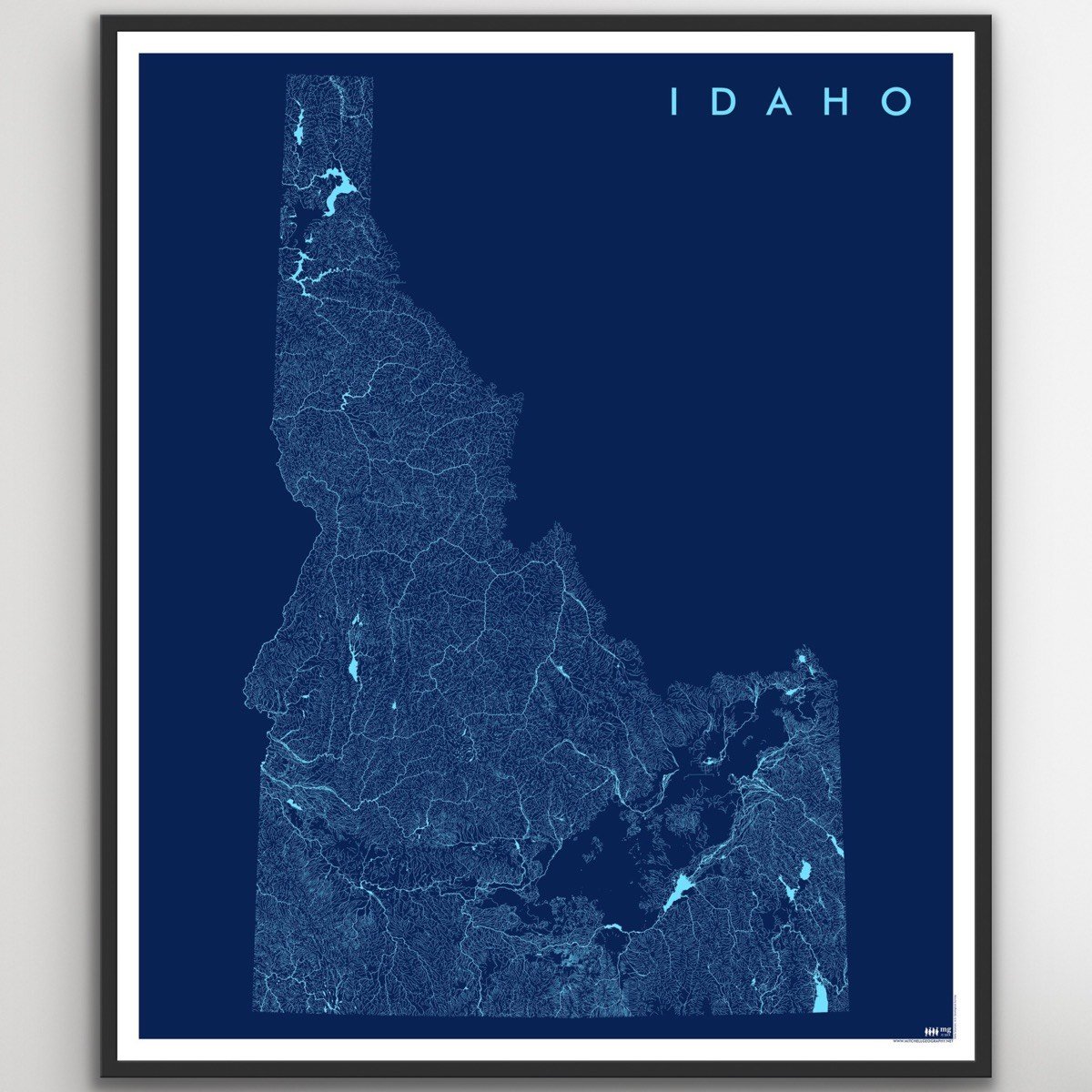
Image 1 of 4
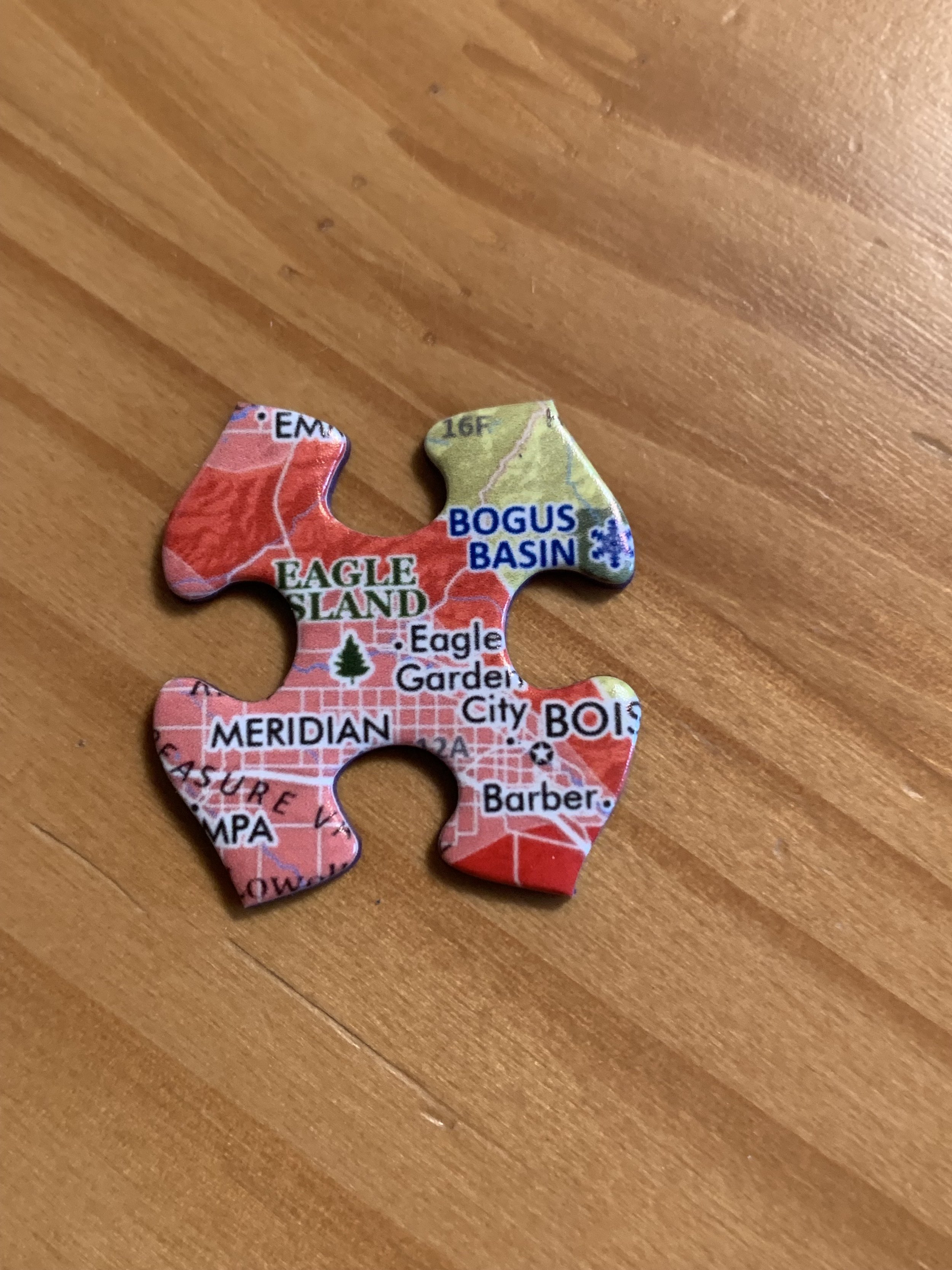
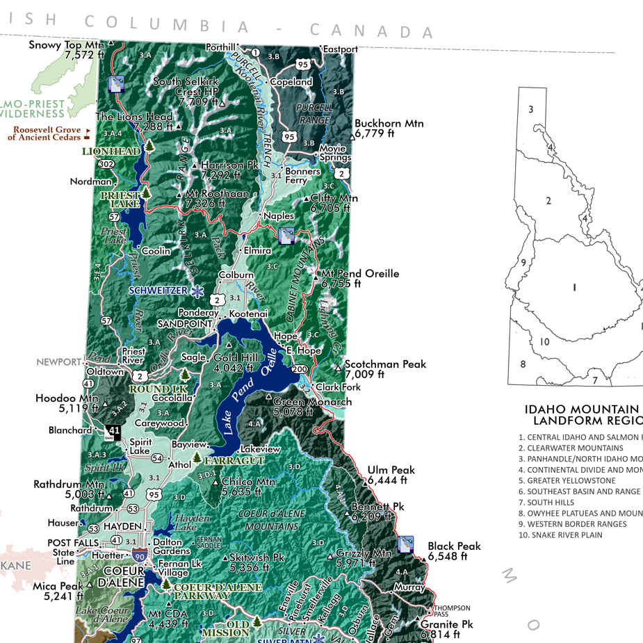
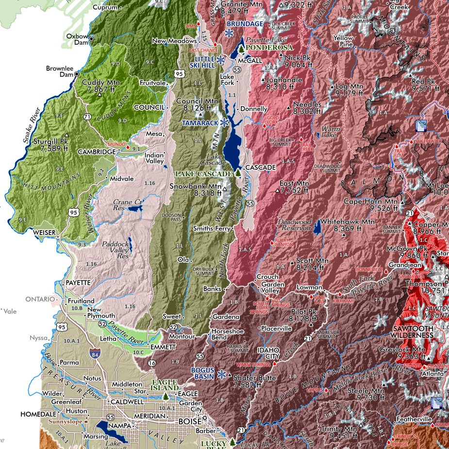
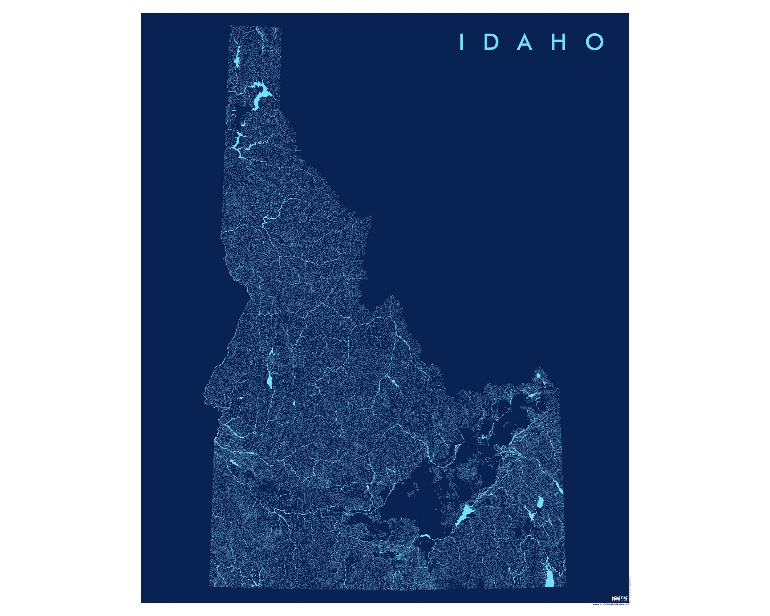
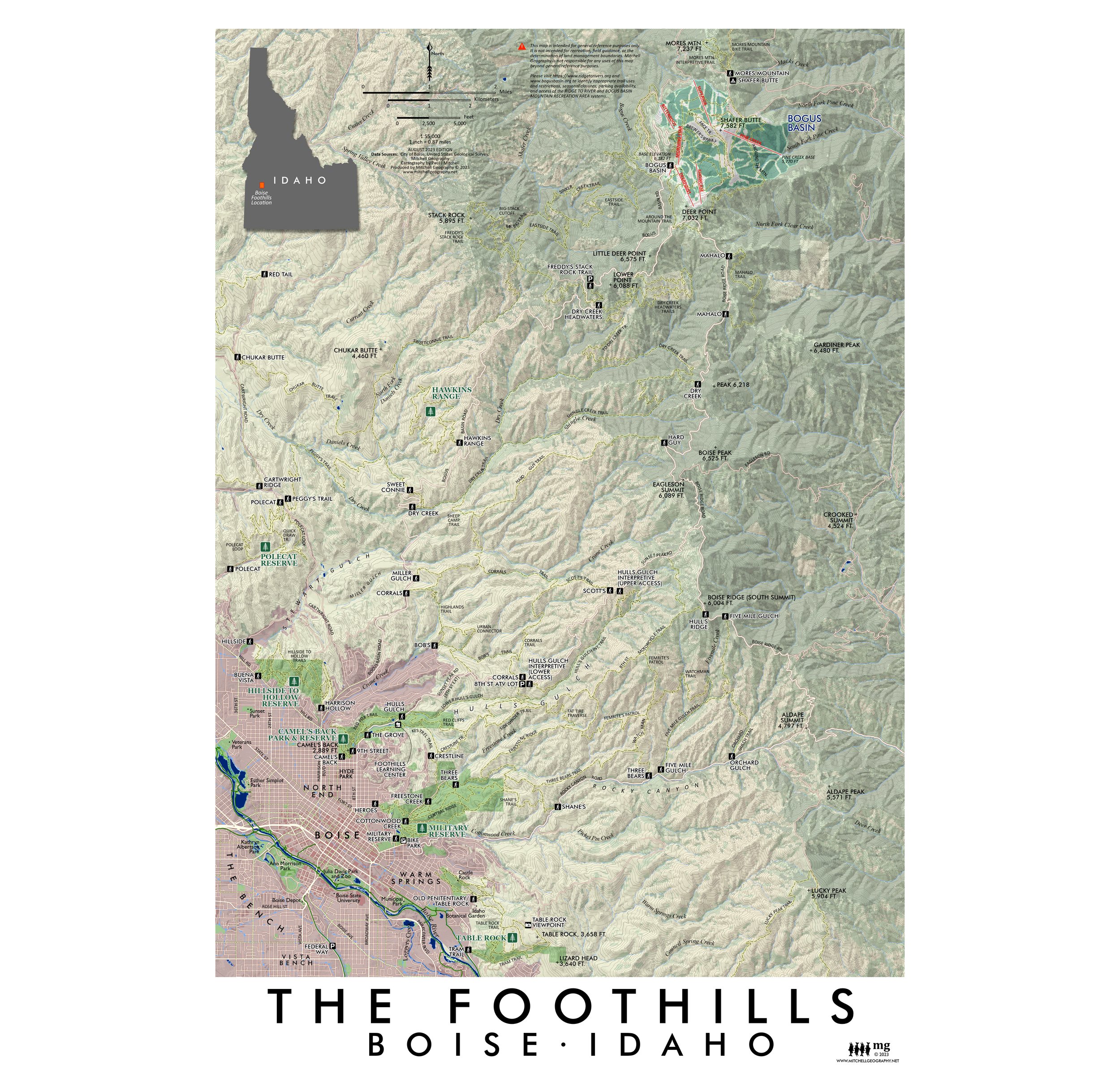 Image 2 of 4
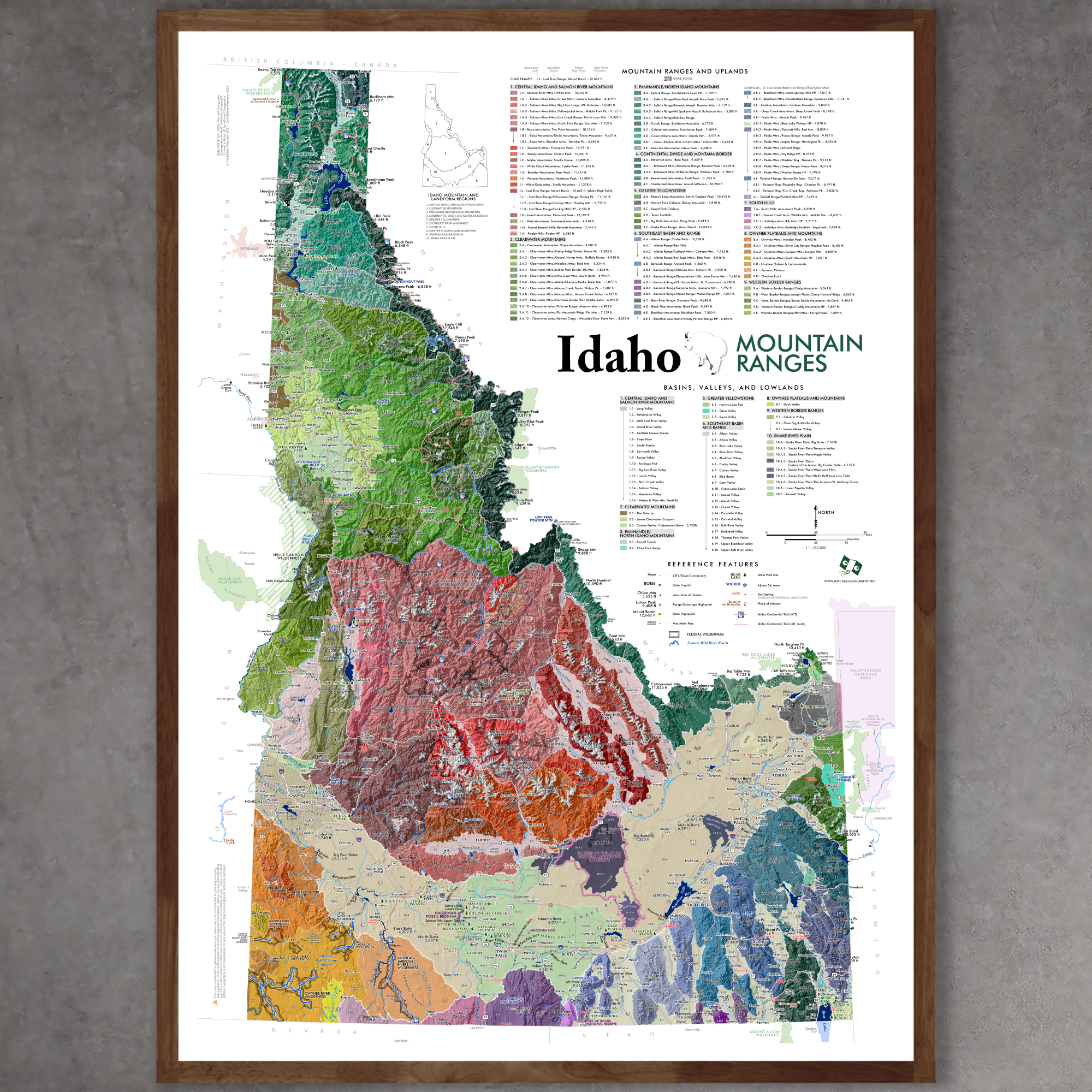
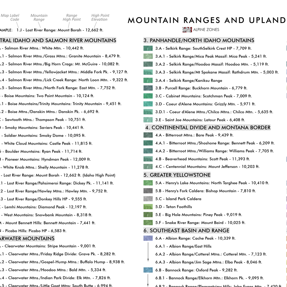
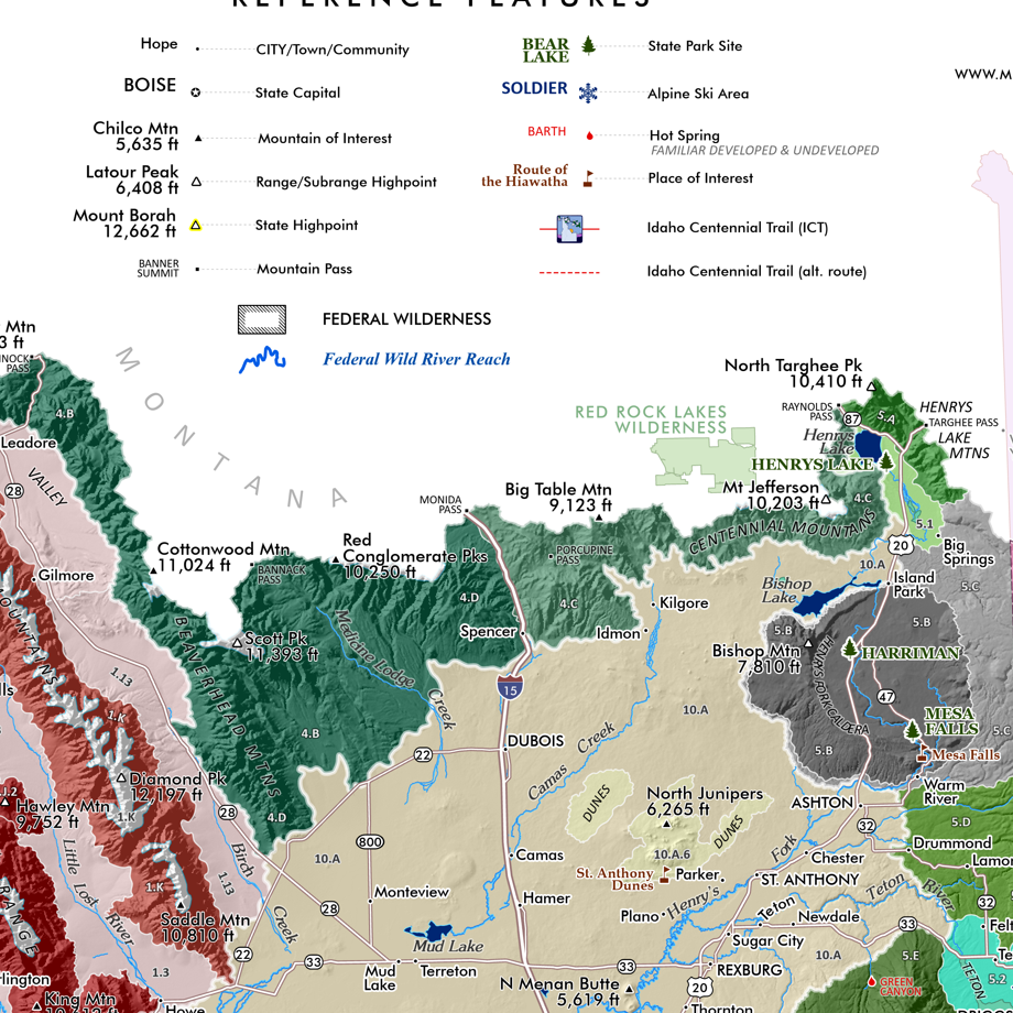
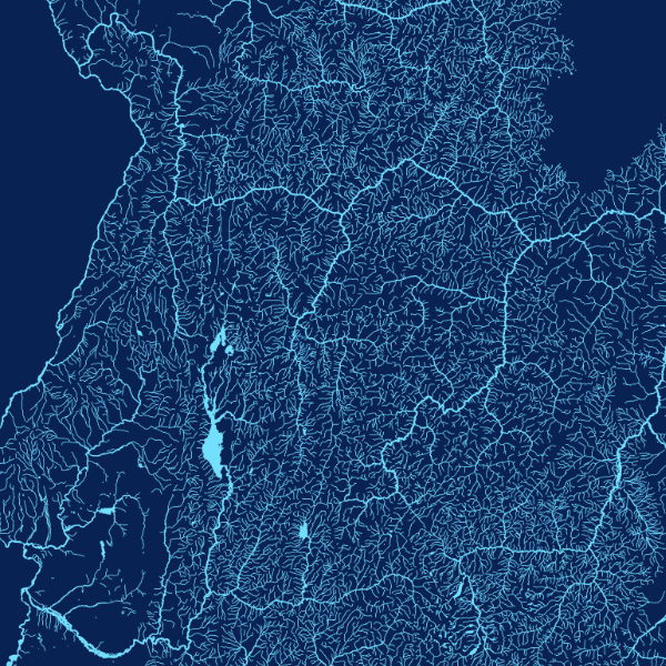
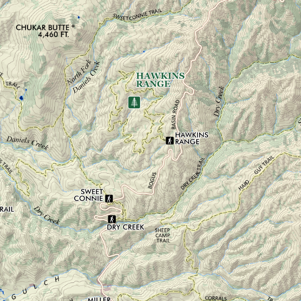 Image 3 of 4
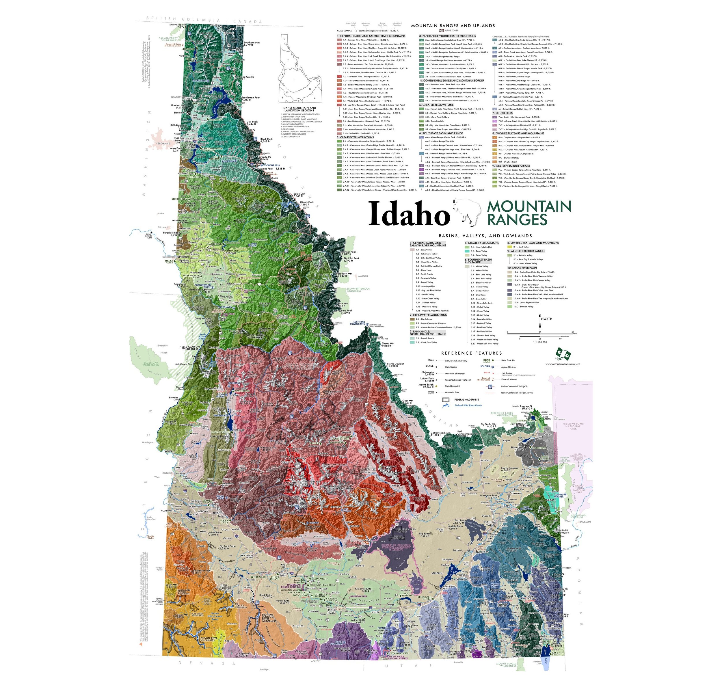
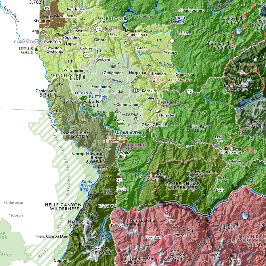
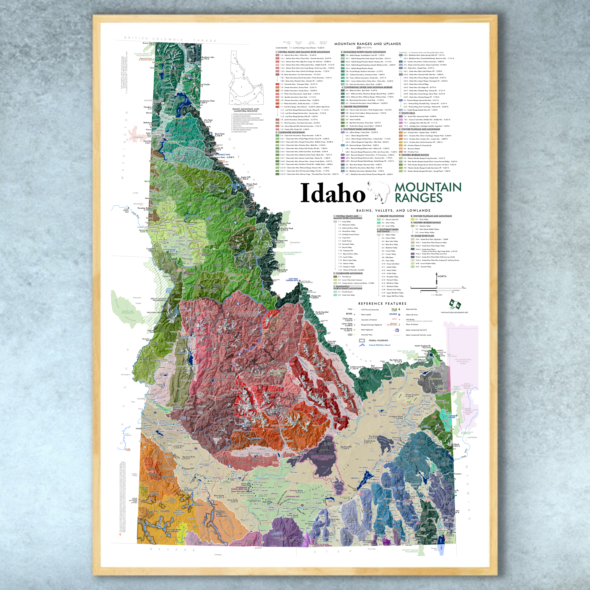
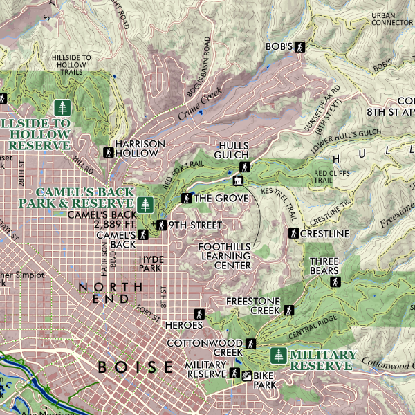 Image 4 of 4
1:55,000
13 inch x 19 inch flat poster wall map, printed on heavy fine paper. Packed and shipped flat.
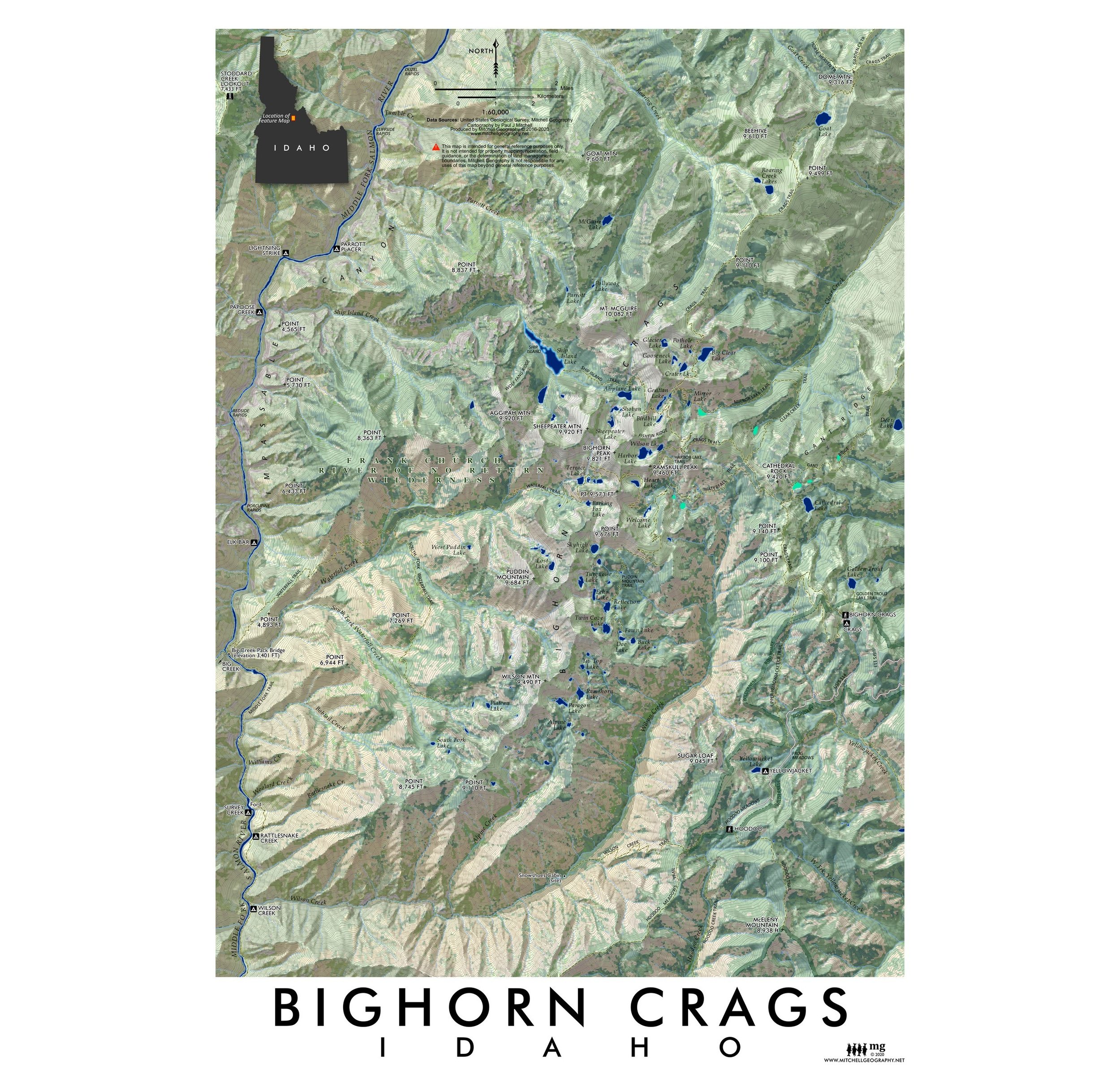
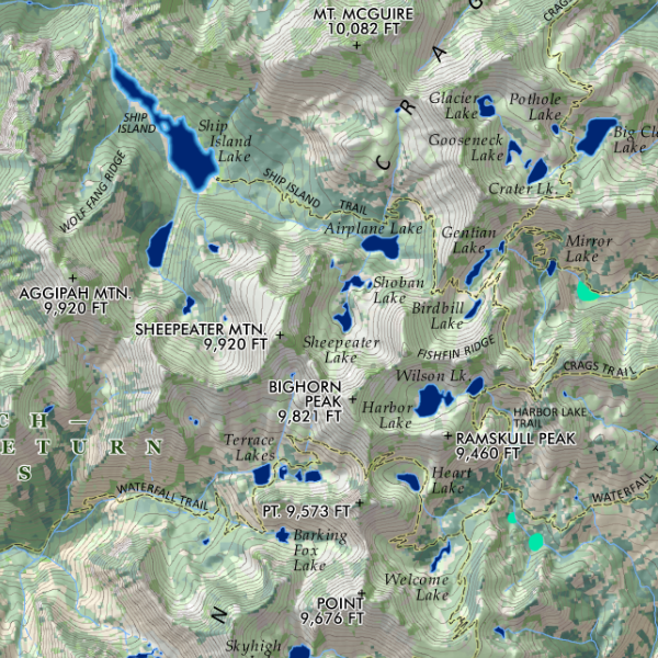
Overview map of Boise’s central Foothill’s area — the extent includes from City center/Table Rock in the south, northward to Bogus Basin, all Rocky Canyon Trails in the east to the Red Tail/Chukar Butte trailheads off Cartwright. Includes all of Polecat Gulch, Harrison to Hollow Trails, Camel’s Back, Fort Boise Military Reserve, Hulls Gulch, Rocky Canyon, Ridge Road, Stack Rock, Dry Creek, Corals, and all of Bogus Basin/Mores Mtn trails.
Not included: Homestead, Highland Valley, Lucky Peak trails, Eagle trails, Seaman’s Gulch, Hidden Springs.
*Update August 2023 — added Heroes Trail, Hawkins Range, and the eastern segment of Cartwright Ridge visible within map extent.
1:55,000
13 inch x 19 inch flat poster wall map, printed on heavy fine paper. Packed and shipped flat.
Overview map of Boise’s central Foothill’s area — the extent includes from City center/Table Rock in the south, northward to Bogus Basin, all Rocky Canyon Trails in the east to the Red Tail/Chukar Butte trailheads off Cartwright. Includes all of Polecat Gulch, Harrison to Hollow Trails, Camel’s Back, Fort Boise Military Reserve, Hulls Gulch, Rocky Canyon, Ridge Road, Stack Rock, Dry Creek, Corals, and all of Bogus Basin/Mores Mtn trails.
Not included: Homestead, Highland Valley, Lucky Peak trails, Eagle trails, Seaman’s Gulch, Hidden Springs.
*Update August 2023 — added Heroes Trail, Hawkins Range, and the eastern segment of Cartwright Ridge visible within map extent.