1:125,000
20 inch x 24 inch — flat wall map, printed on a heavy fine paper — shipped rolled.
Comparative taxonomic style map graphic featuring of the major American Cascade peaks from Lassen in the South to Baker in the North. A nifty location map in the lower right includes the PCT.
1:125,000
20 inch x 24 inch — flat wall map, printed on a heavy fine paper — shipped rolled.
Comparative taxonomic style map graphic featuring of the major American Cascade peaks from Lassen in the South to Baker in the North. A nifty location map in the lower right includes the PCT.

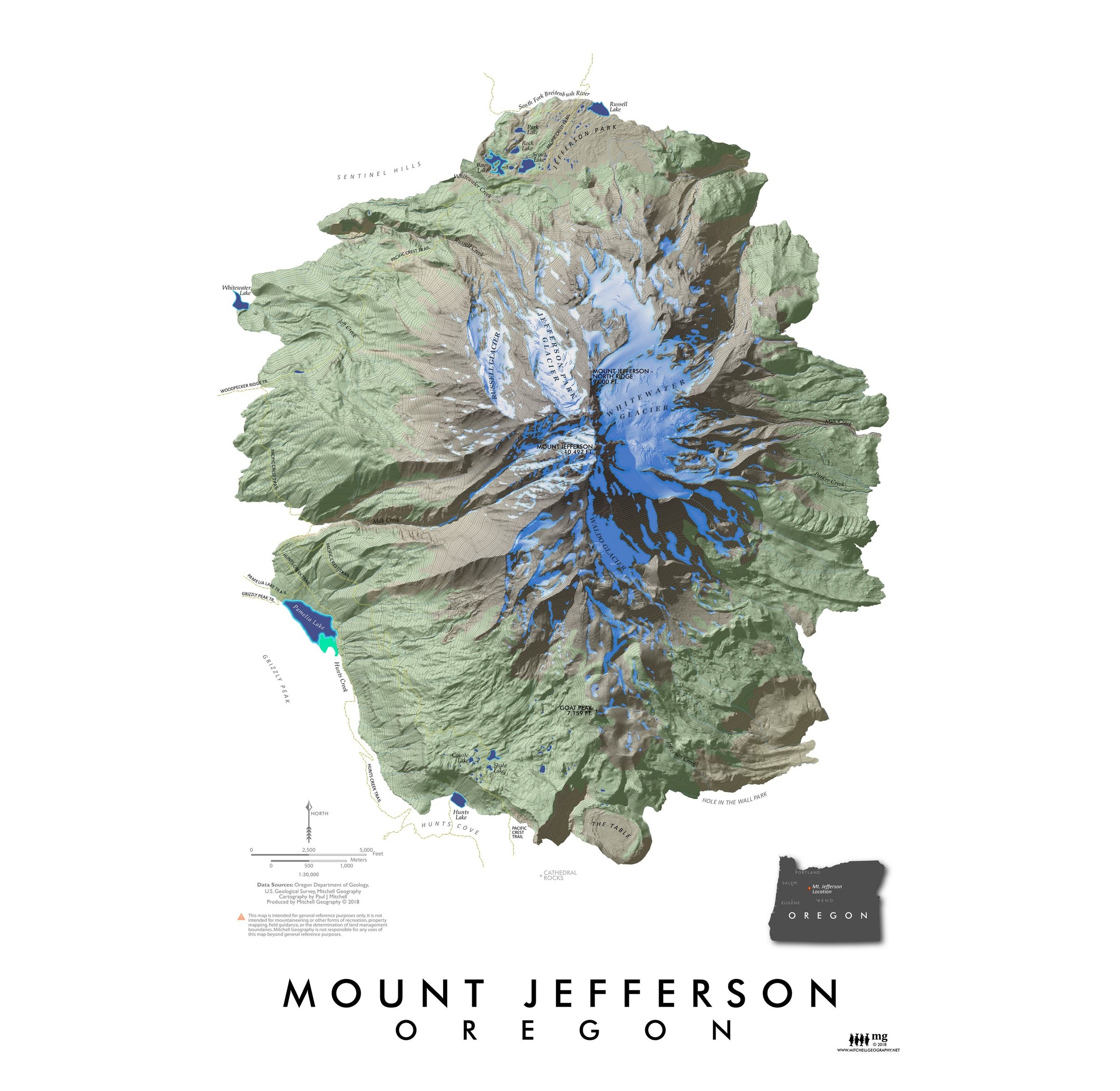
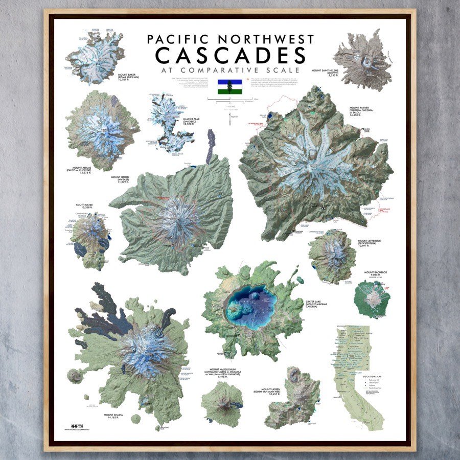 Image 1 of 11
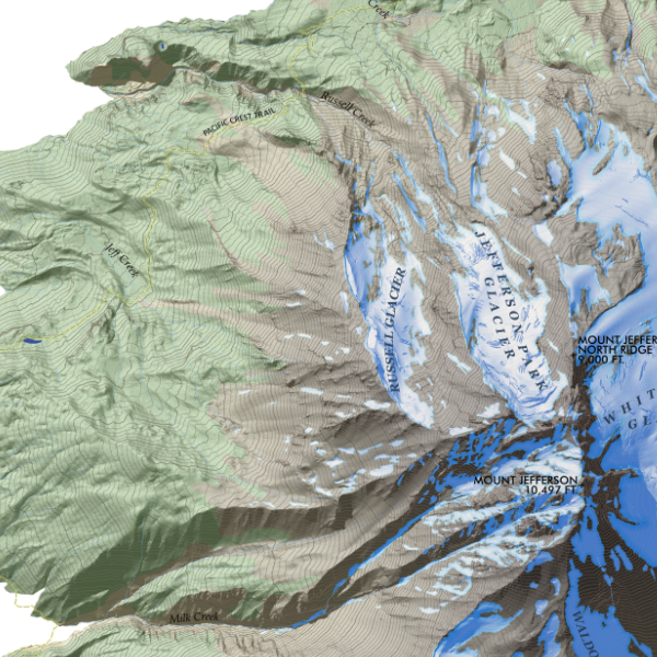
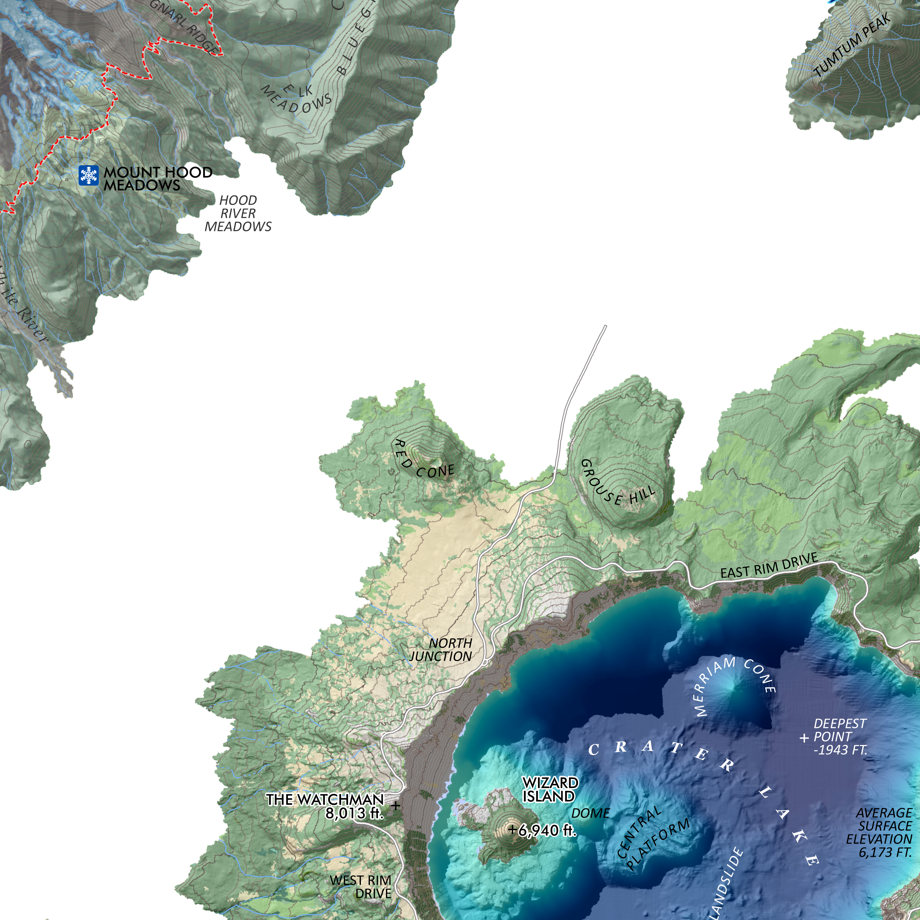 Image 2 of 11
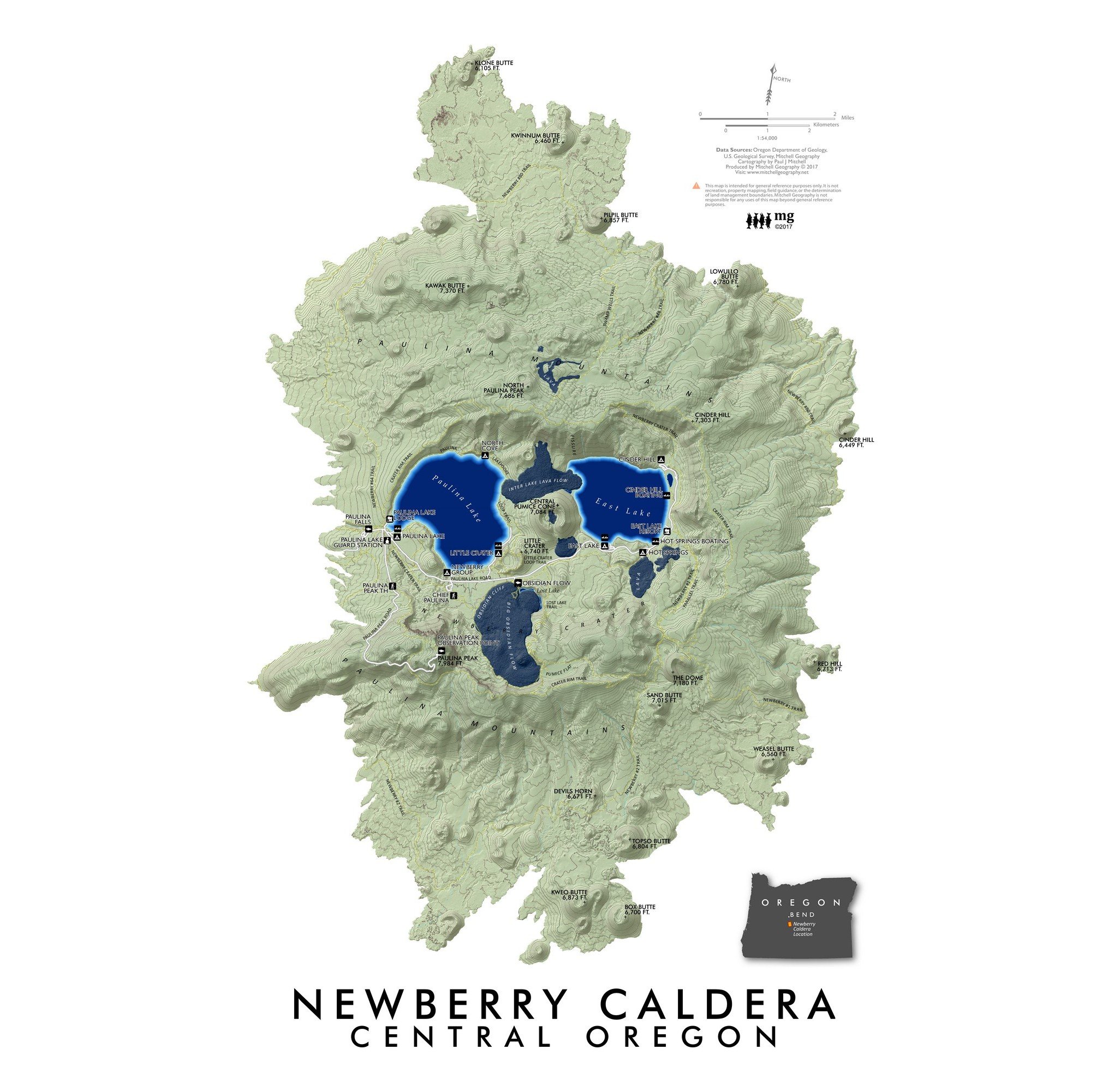
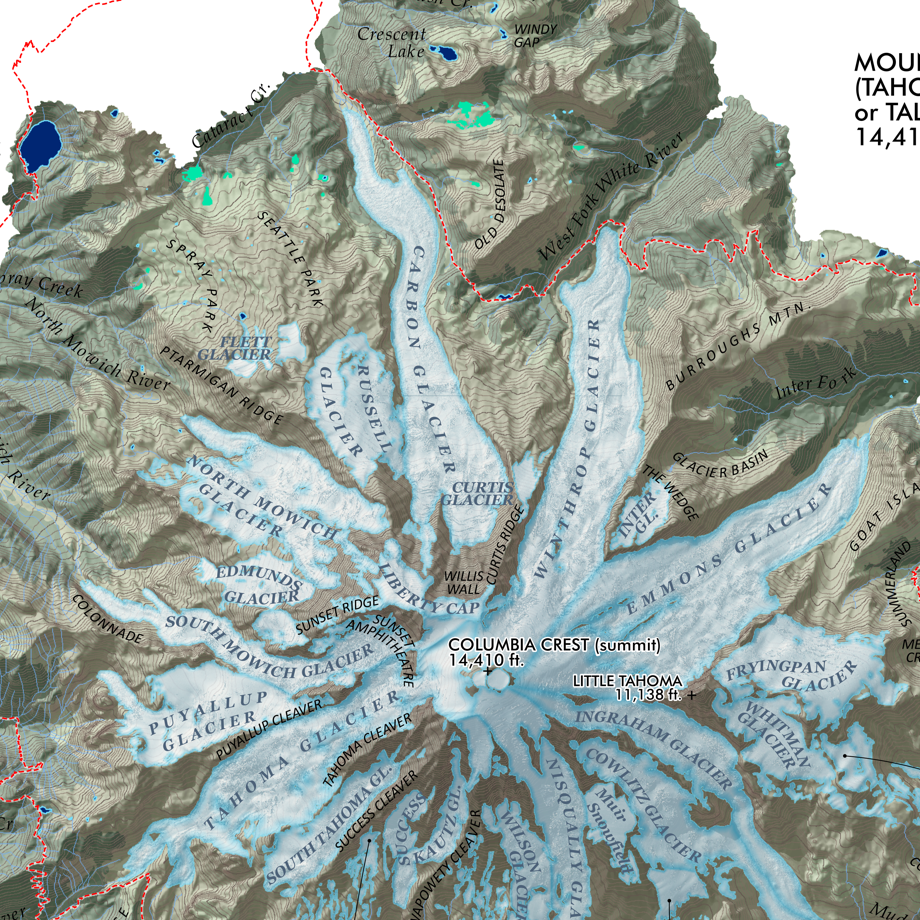 Image 3 of 11
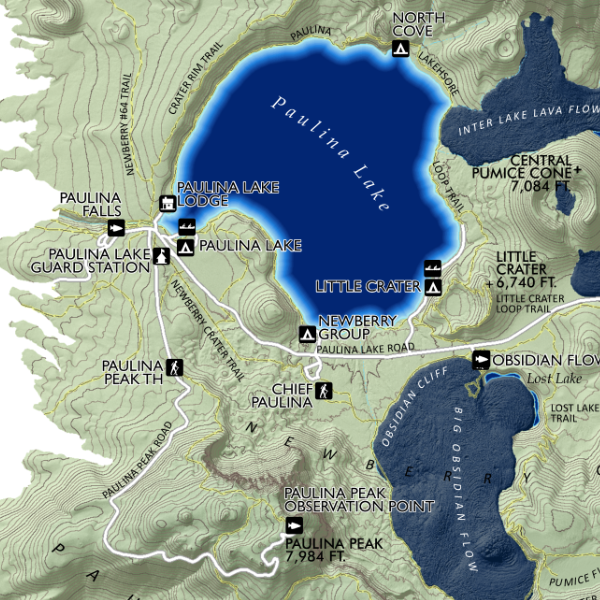
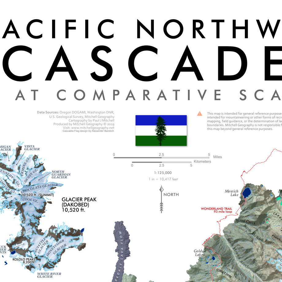 Image 4 of 11
 Image 5 of 11
 Image 6 of 11
 Image 7 of 11
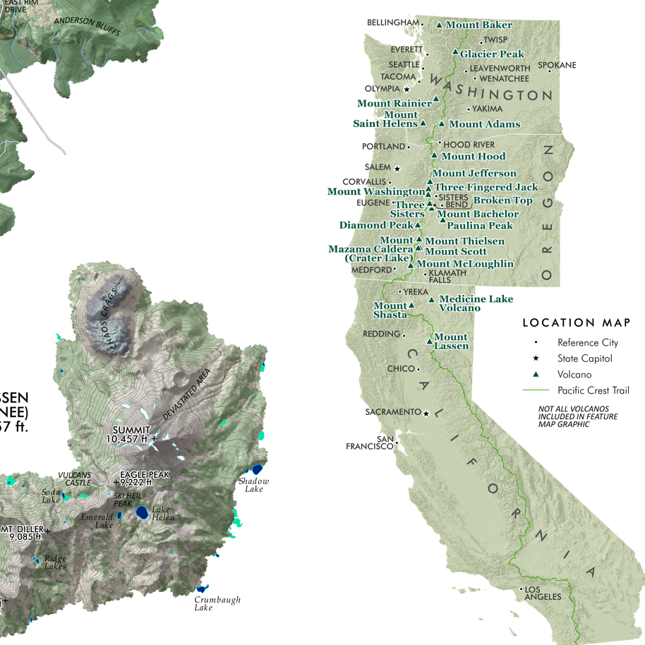 Image 8 of 11
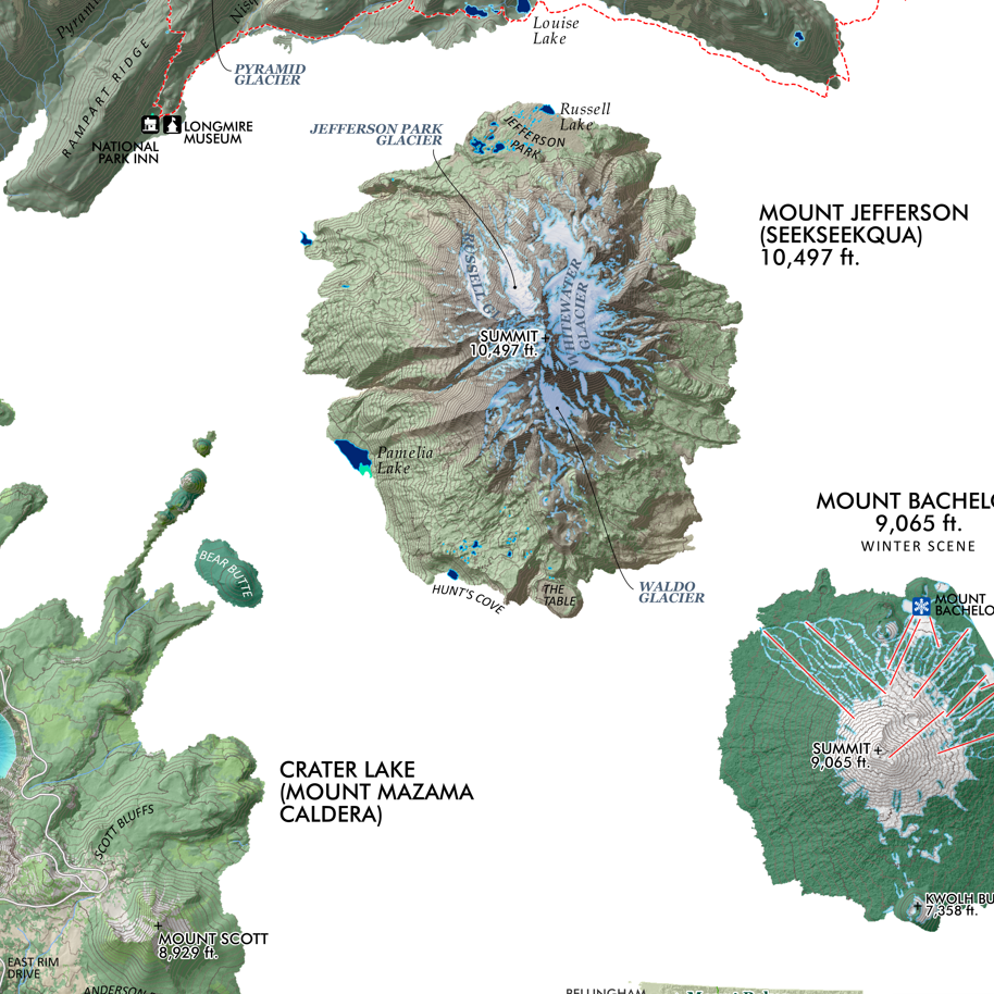 Image 9 of 11
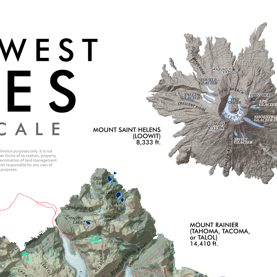 Image 10 of 11
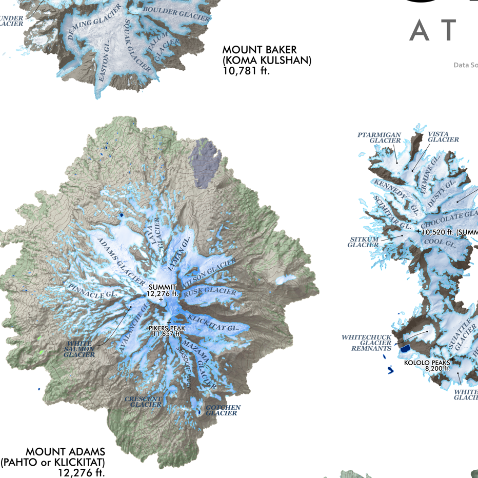 Image 11 of 11