1:1,400,00 // 1 inch = 22 miles
Idaho Wildlands and Snow Depth GEOFOLD. Two sided folded touring and reference map, printed on a nice 80 lb coated paper (NOT waterproof and NOT tearproof).
Folded 4.5 x 9 inches, unfolded 18 x 27 inches. Shipped in mailer envelope, uninsured, by USPS stamped mail. Includes two unique and rarely represented thematic statewide maps of Idaho: wildlands and snow depth. Four additional inset maps are found on the cover flaps: annual precipitation, elevation ranges, Wild & Scenic Rivers distribution, and a County license plate code map for the ever curious. Along with these 6 maps in total, a pictorial quick reference guide to Idaho’s four anadromous trout and salmon is pictured and an end-to-end elevation profile of the Idaho Centennial Trail is found on the Wildlands feature map.
The same Idaho Wildlands and Idaho Snow Depth maps may be also purchased as a flat 20 x 24 inch wall map printed on a fine heavy paper here.

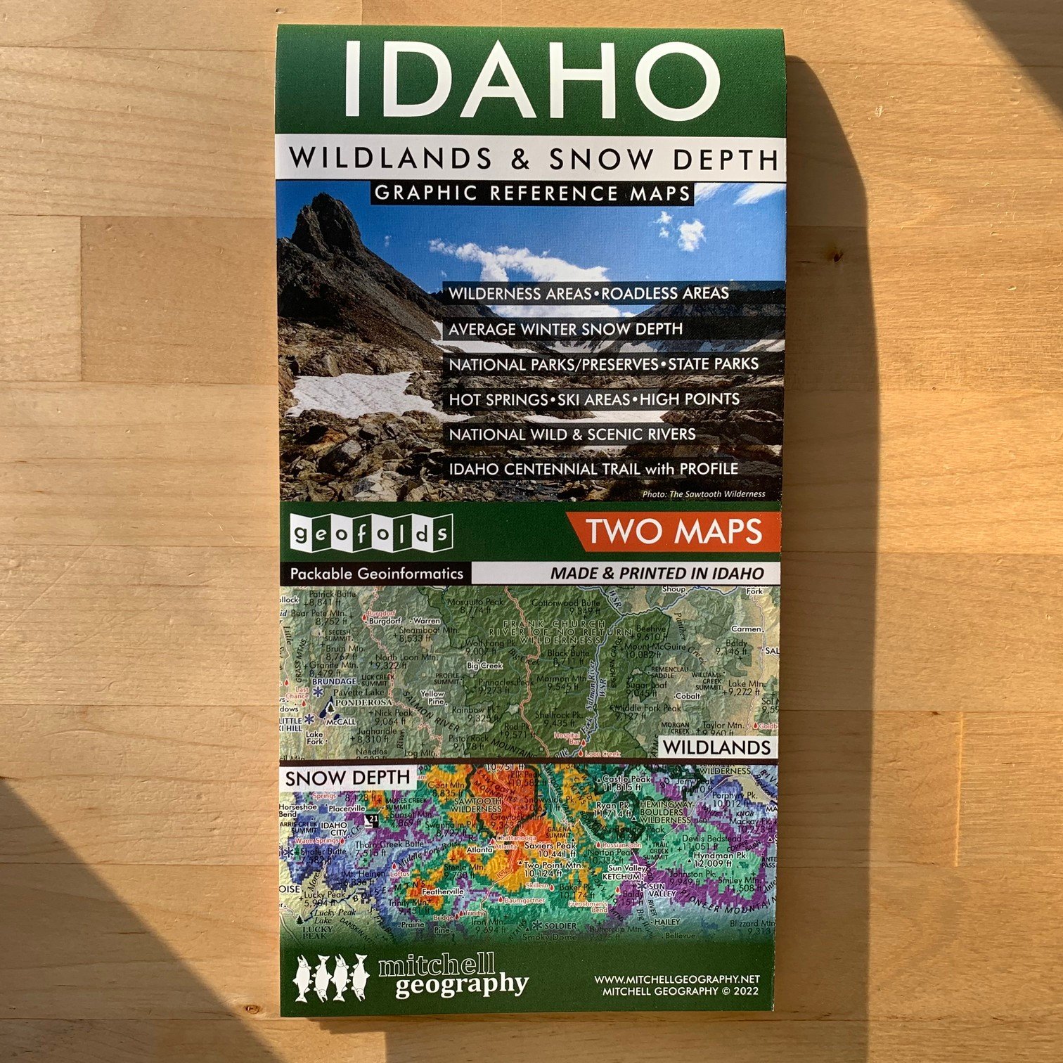 Image 1 of 10
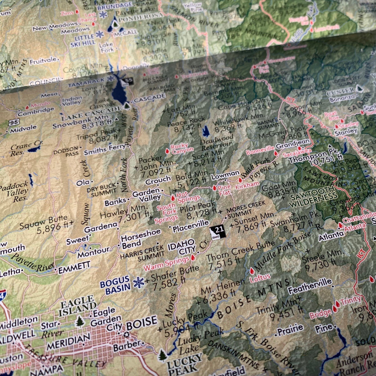 Image 2 of 10
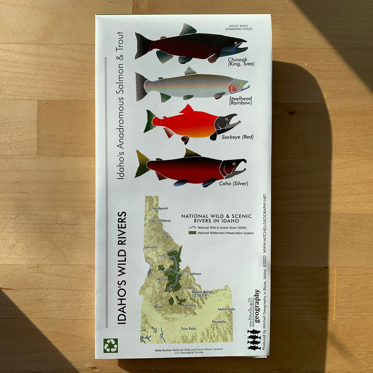 Image 3 of 10
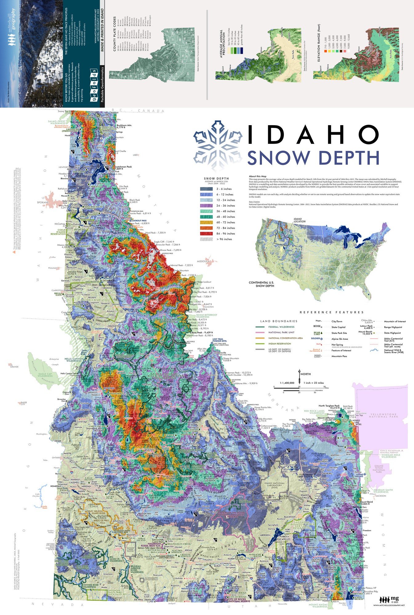 Image 4 of 10
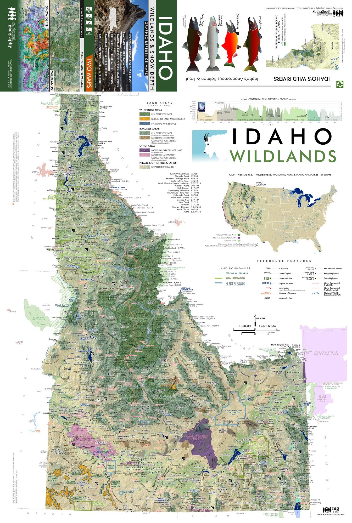 Image 5 of 10
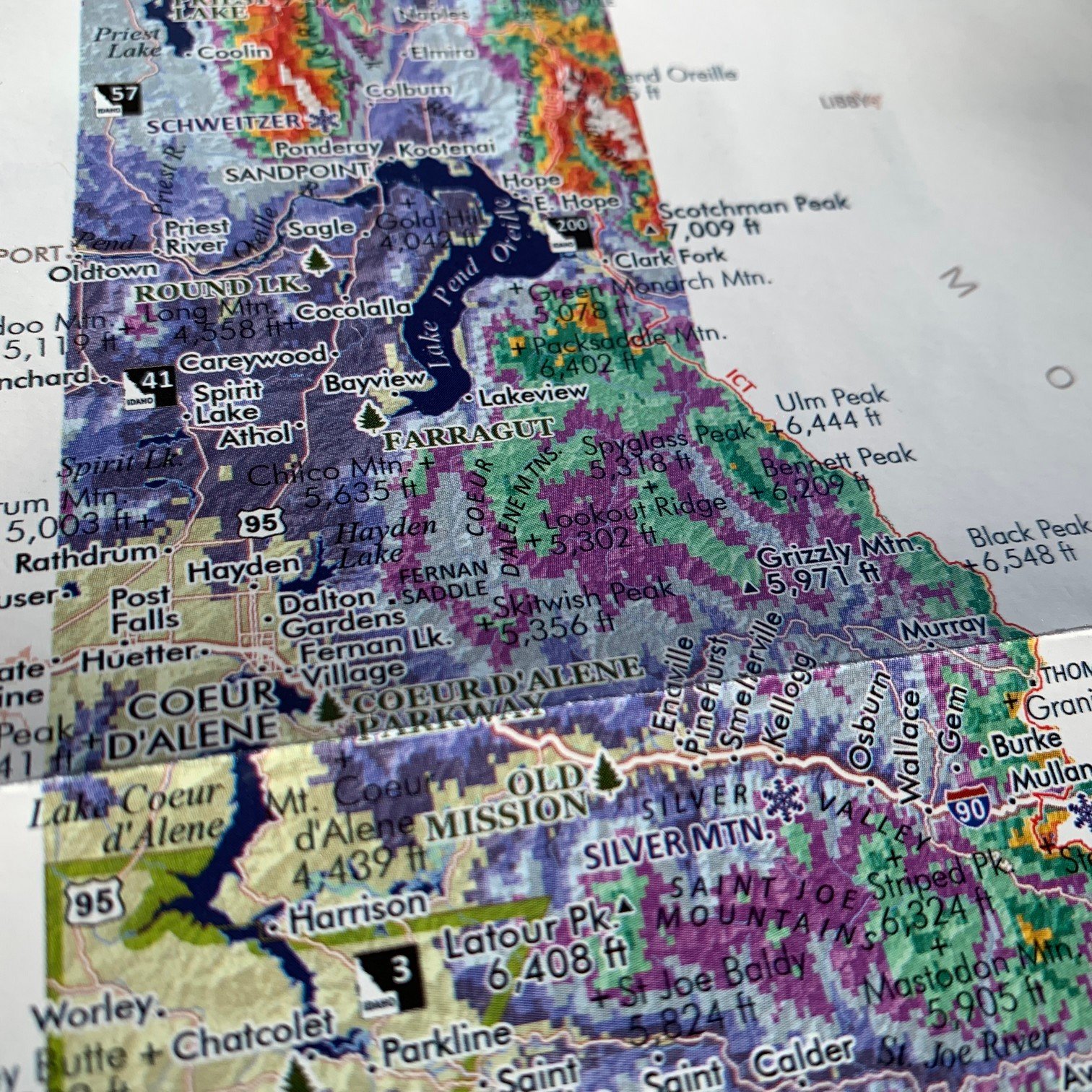 Image 6 of 10
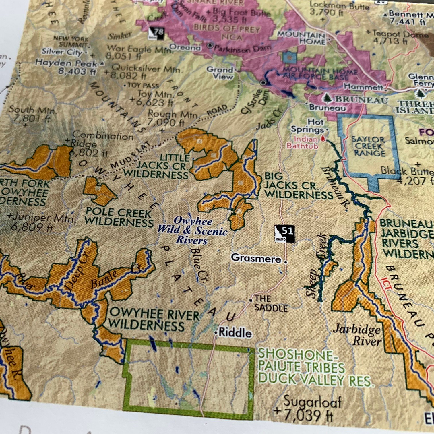 Image 7 of 10
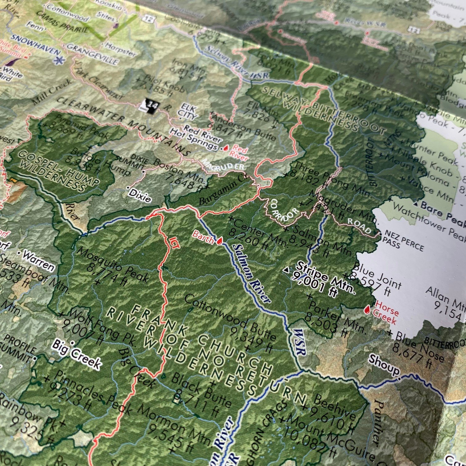 Image 8 of 10
 Image 9 of 10
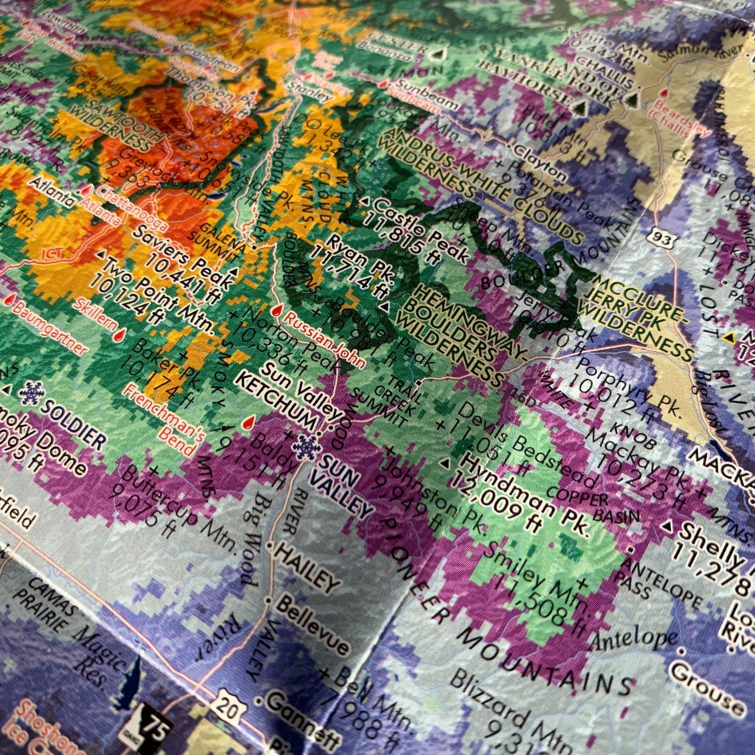 Image 10 of 10