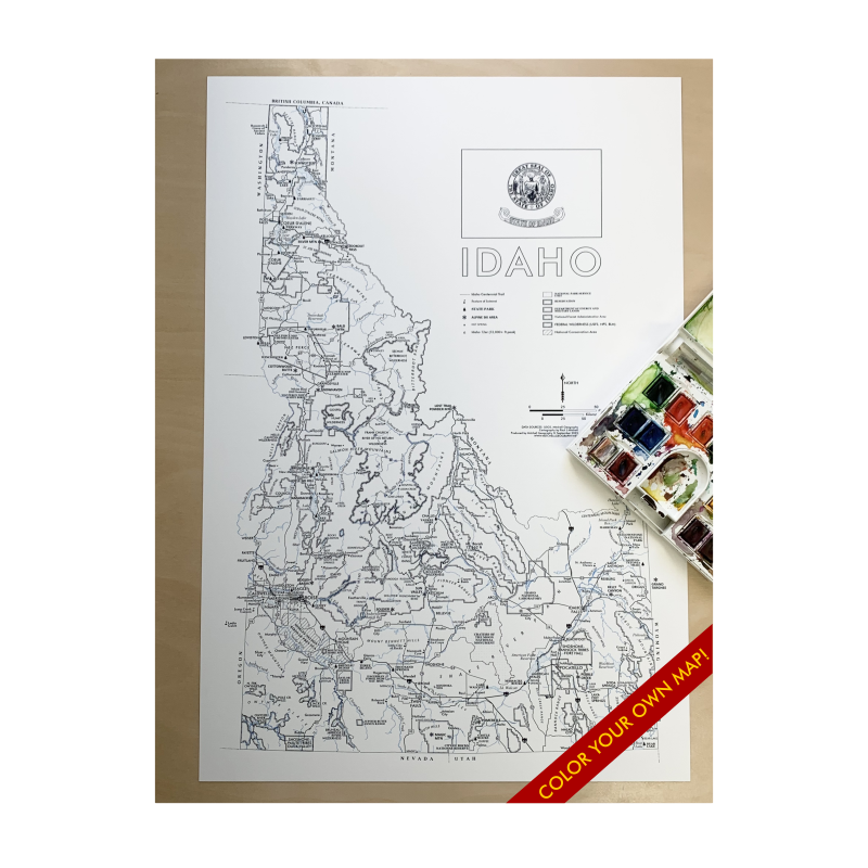
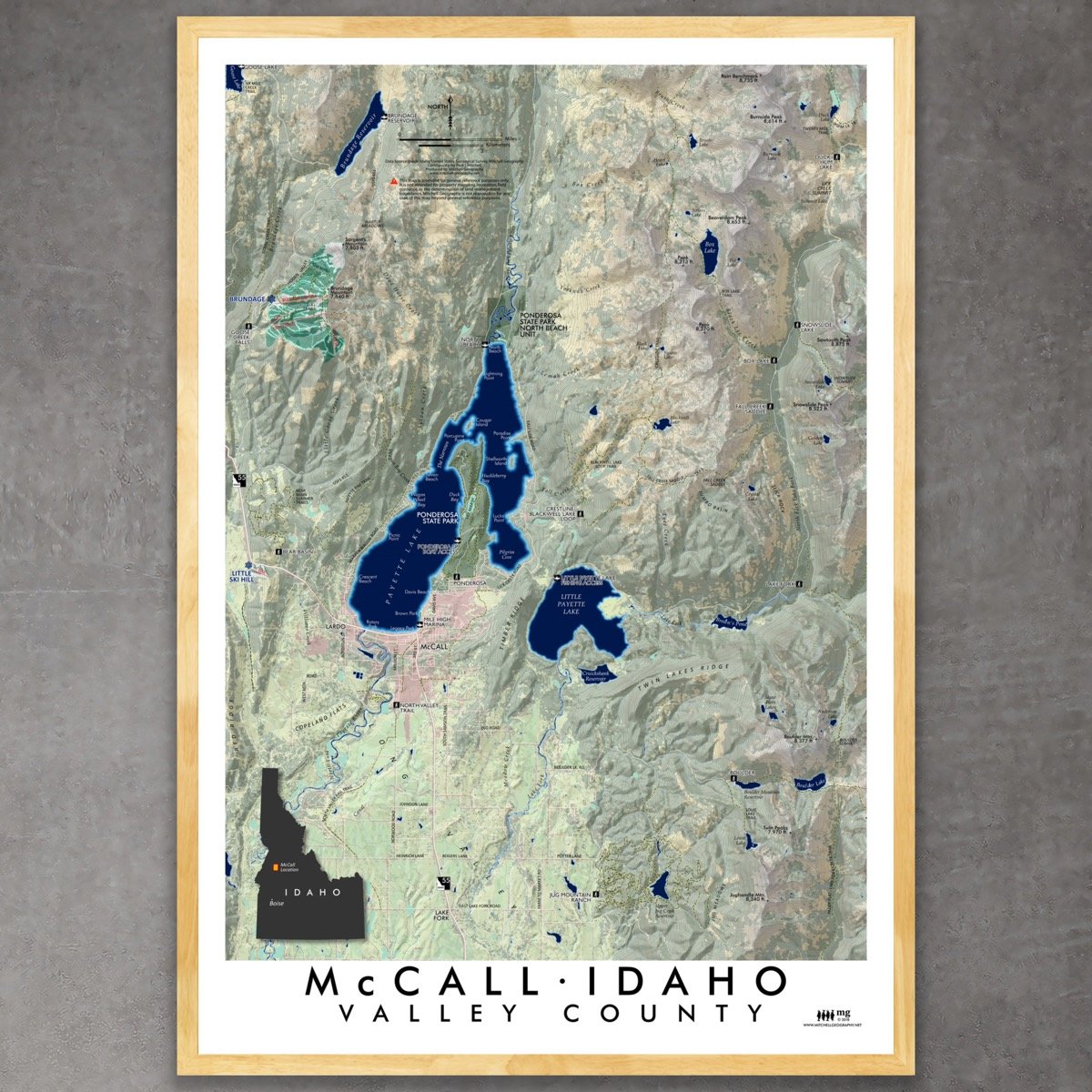
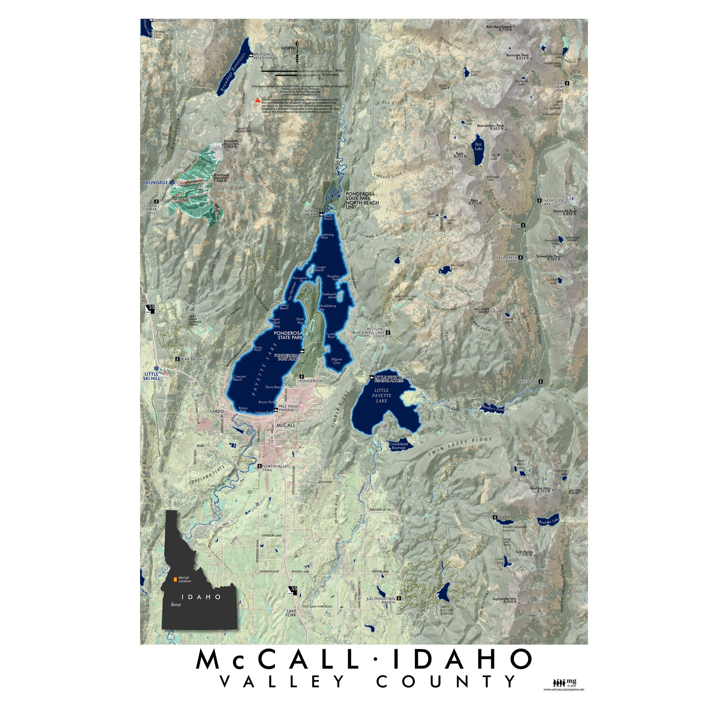
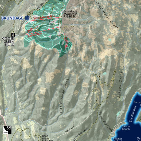
1:1,760,000
13 inch by 19 inch flat wall map, printed on heavy fine paper. Packed and shipped flat.
A larger 28 × 20 inch Idaho General Reference Map is also available.
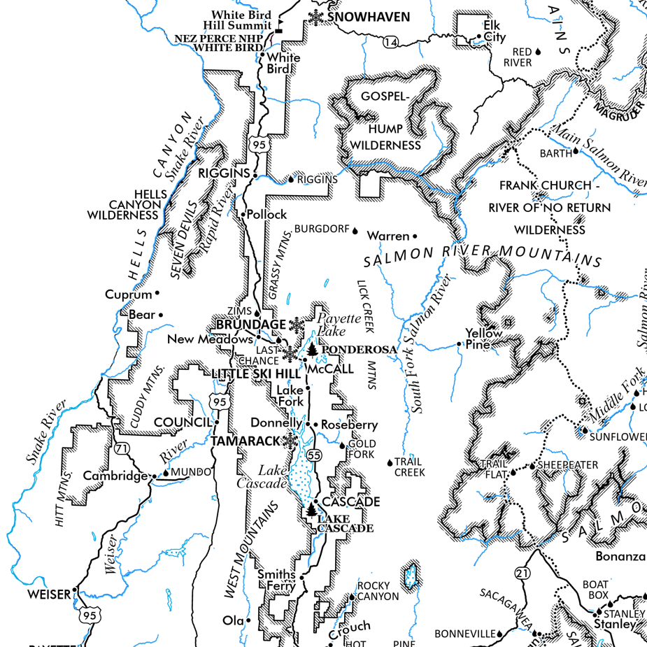
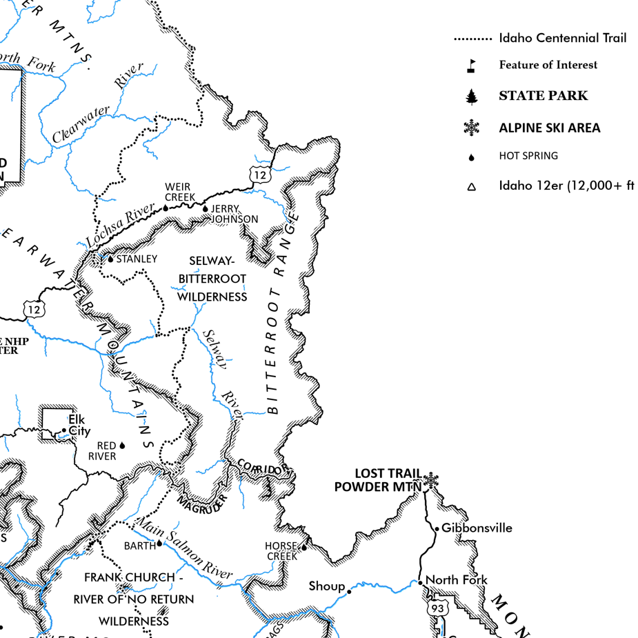
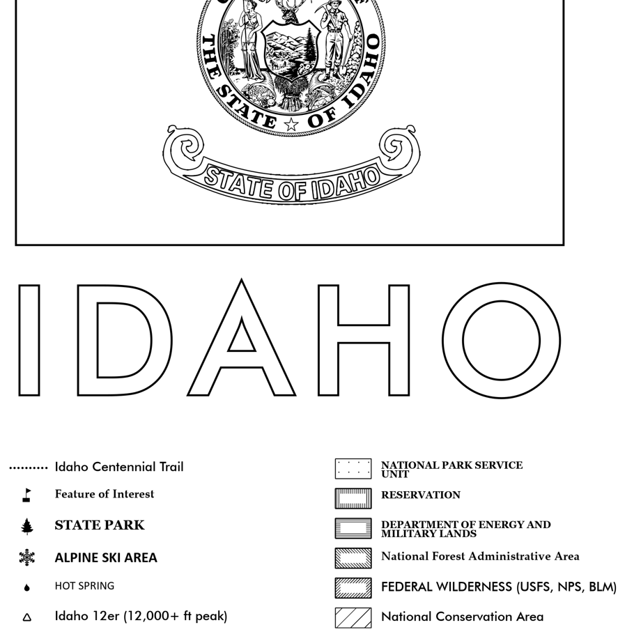
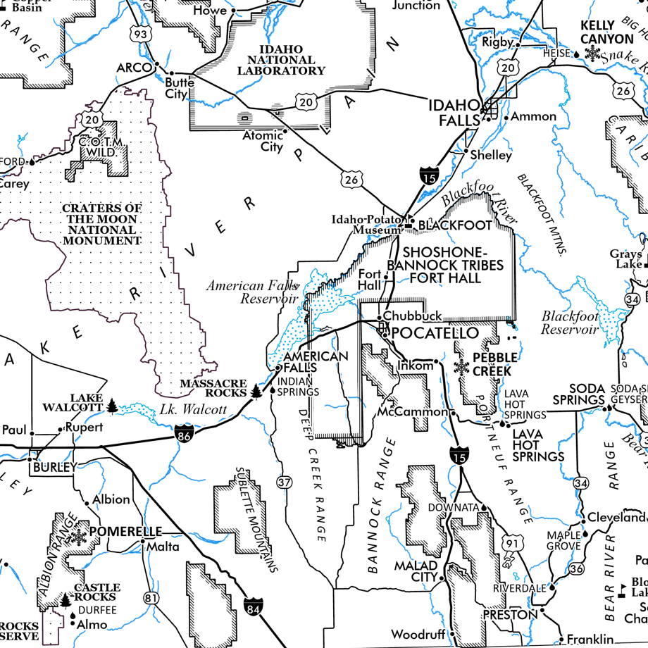
Idaho General Reference map. This is my most detailed small format wall map with a nice range of place based point features of interest over a colorful public lands and land use basemap that includes reservations, federally designated wilderness, roadless areas (USFS & BLM), National Forest administrative areas, National Park Service units, Military, DOE lands, and the Birds of Prey national conservation area. Highways, major roads, surface hydrology and populated places are included for geographic reference.
Thematic reference features include:
Idaho Centennial Trail
Designated Wild River Reaches
Special Features of Interest
State Parks
Alpine Ski Areas
Hot Springs
Idaho 12er’s (12,000+ ft peaks) [only Mt Borah is labeled of the 12er’s
NPS Units
USFS National Forest Administrative Areas
Federal Wilderness (USFS, NPS, BLM)
USFS Roadless Areas
BLM Roadless Areas
Birds of Prey National Conservation Area
Military Lands
DOE Lands (INL)
Reservations
1:1,760,000
13 inch by 19 inch flat wall map, printed on heavy fine paper. Packed and shipped flat.
A larger 28 × 20 inch Idaho General Reference Map is also available.
Idaho General Reference map. This is my most detailed small format wall map with a nice range of place based point features of interest over a colorful public lands and land use basemap that includes reservations, federally designated wilderness, roadless areas (USFS & BLM), National Forest administrative areas, National Park Service units, Military, DOE lands, and the Birds of Prey national conservation area. Highways, major roads, surface hydrology and populated places are included for geographic reference.
Thematic reference features include:
Idaho Centennial Trail
Designated Wild River Reaches
Special Features of Interest
State Parks
Alpine Ski Areas
Hot Springs
Idaho 12er’s (12,000+ ft peaks) [only Mt Borah is labeled of the 12er’s
NPS Units
USFS National Forest Administrative Areas
Federal Wilderness (USFS, NPS, BLM)
USFS Roadless Areas
BLM Roadless Areas
Birds of Prey National Conservation Area
Military Lands
DOE Lands (INL)
Reservations

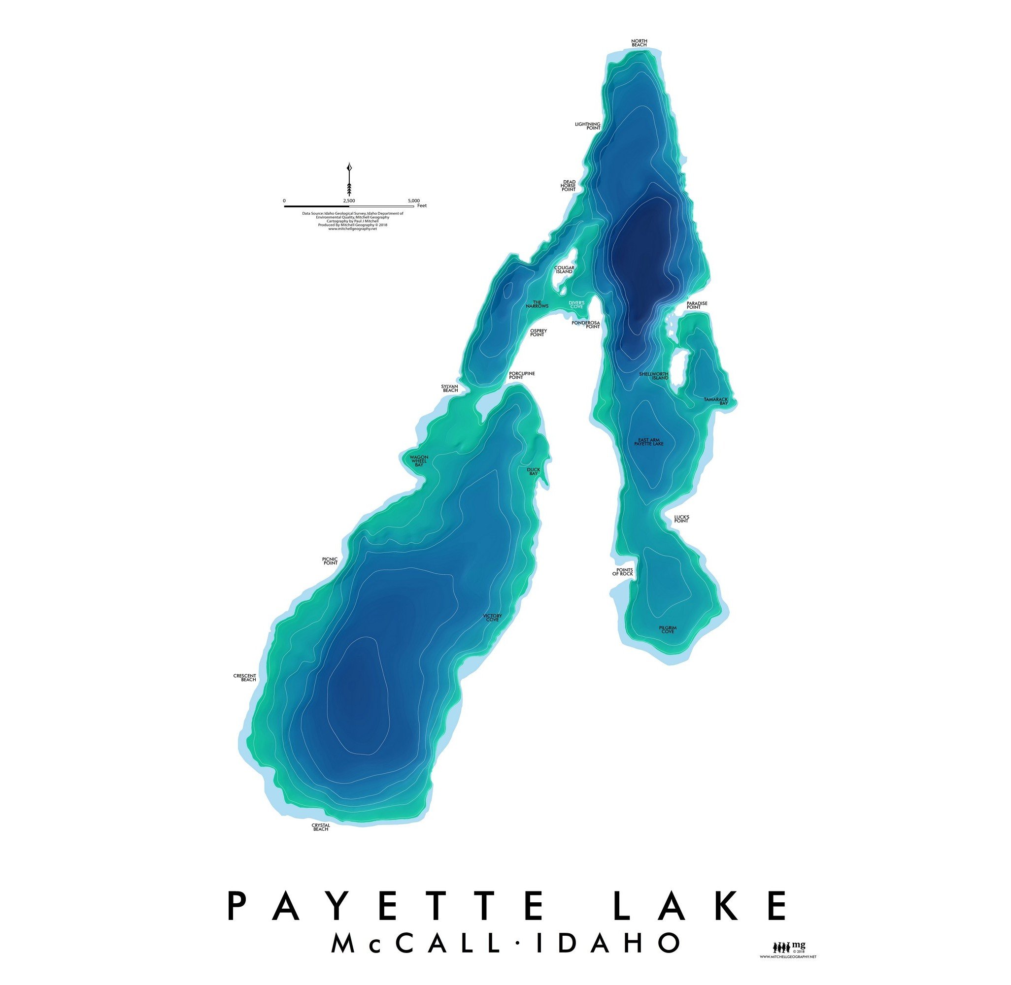
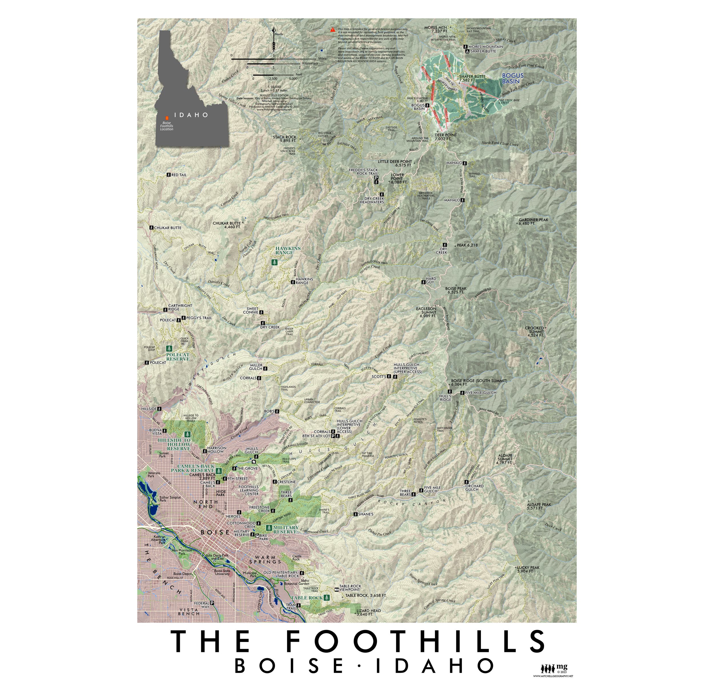
 Image 1 of 7
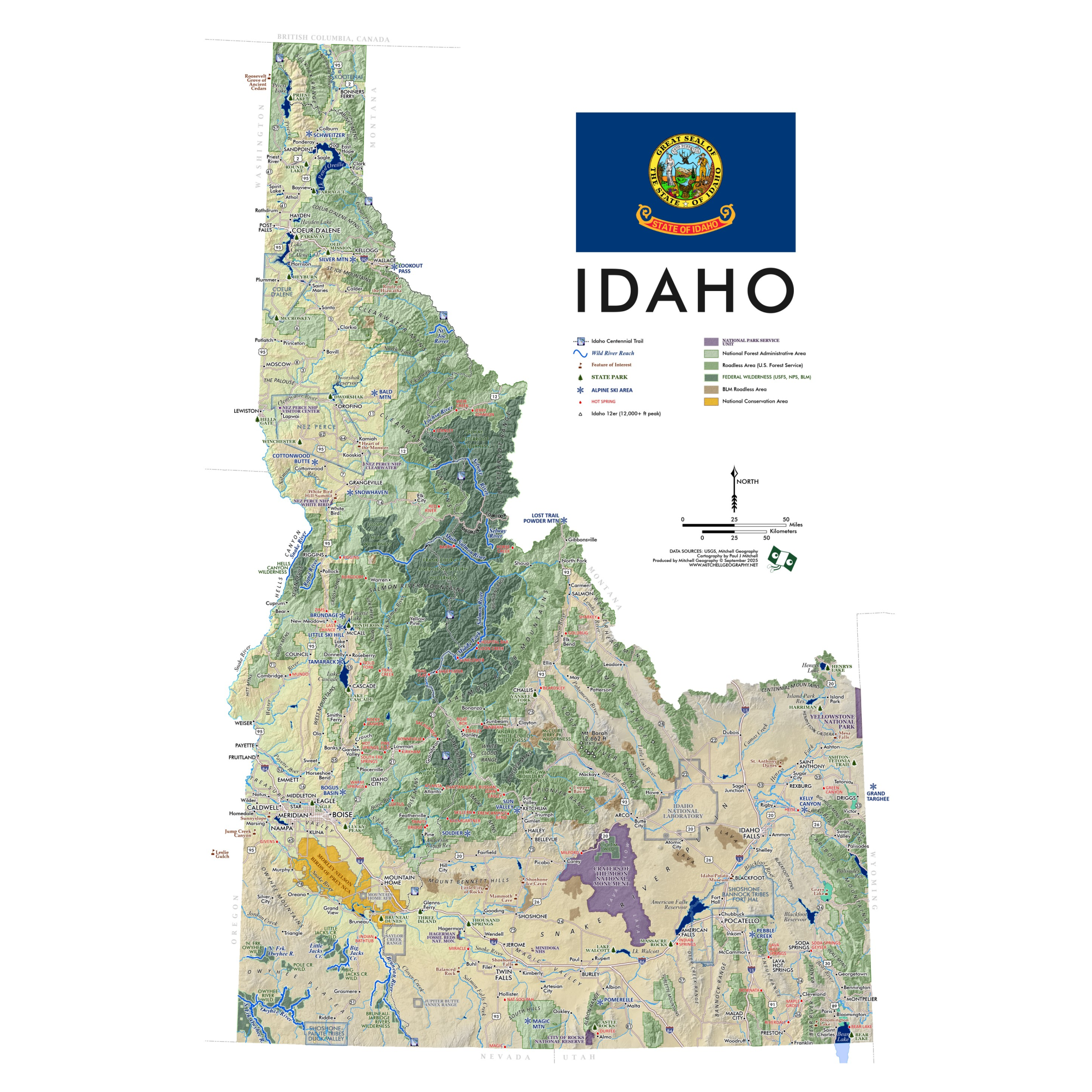 Image 2 of 7
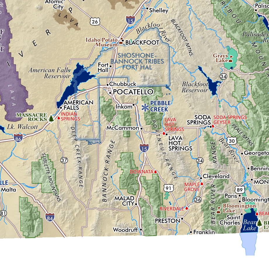 Image 3 of 7
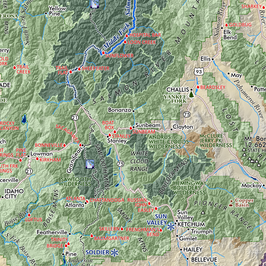 Image 4 of 7
 Image 5 of 7
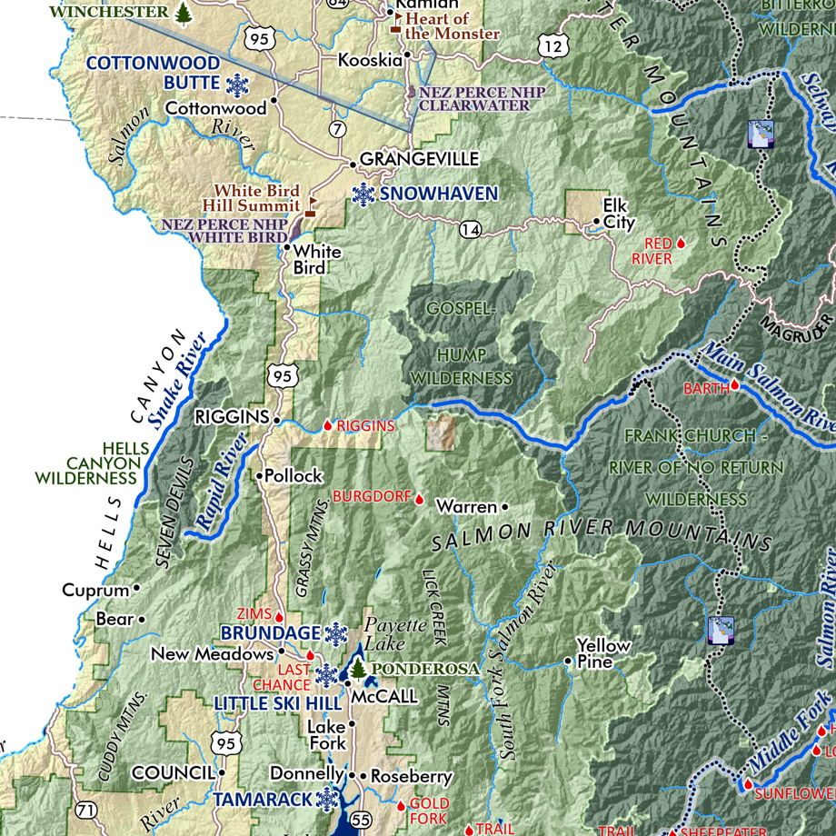 Image 6 of 7
 Image 7 of 7