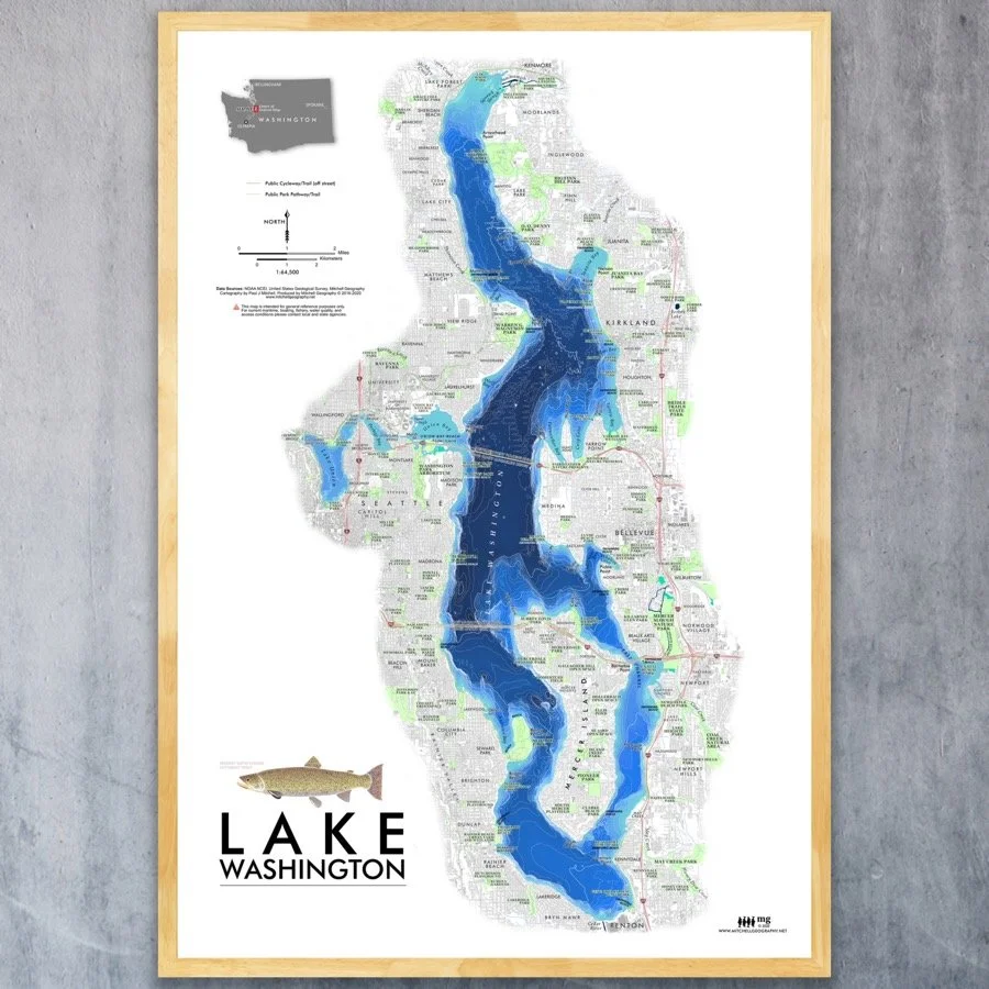
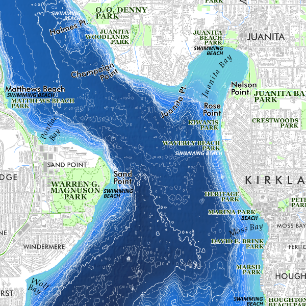
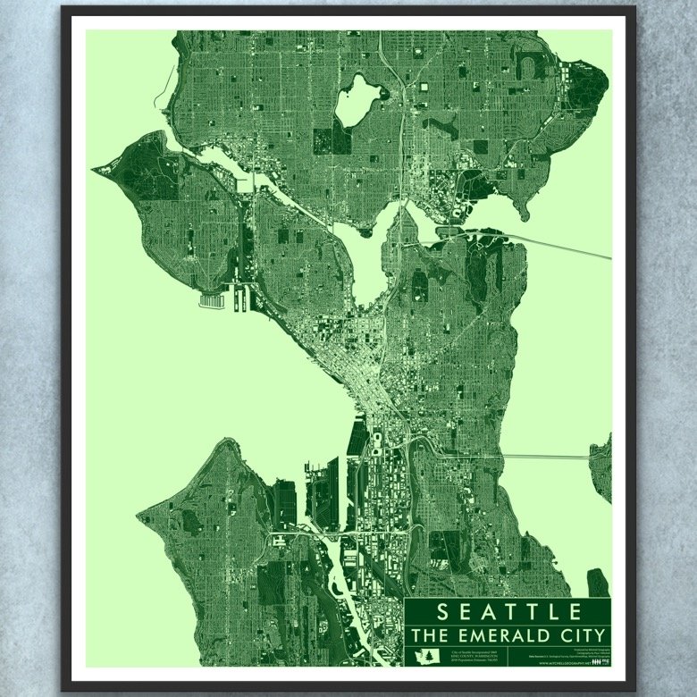
CLOSE OUT Lake Washington (19 in x 13 in)
CLOSE OUT SALE
1:64,500
13 inch by 19 inch flat wall map, printed on heavy fine paper. Packed and shipped flat.
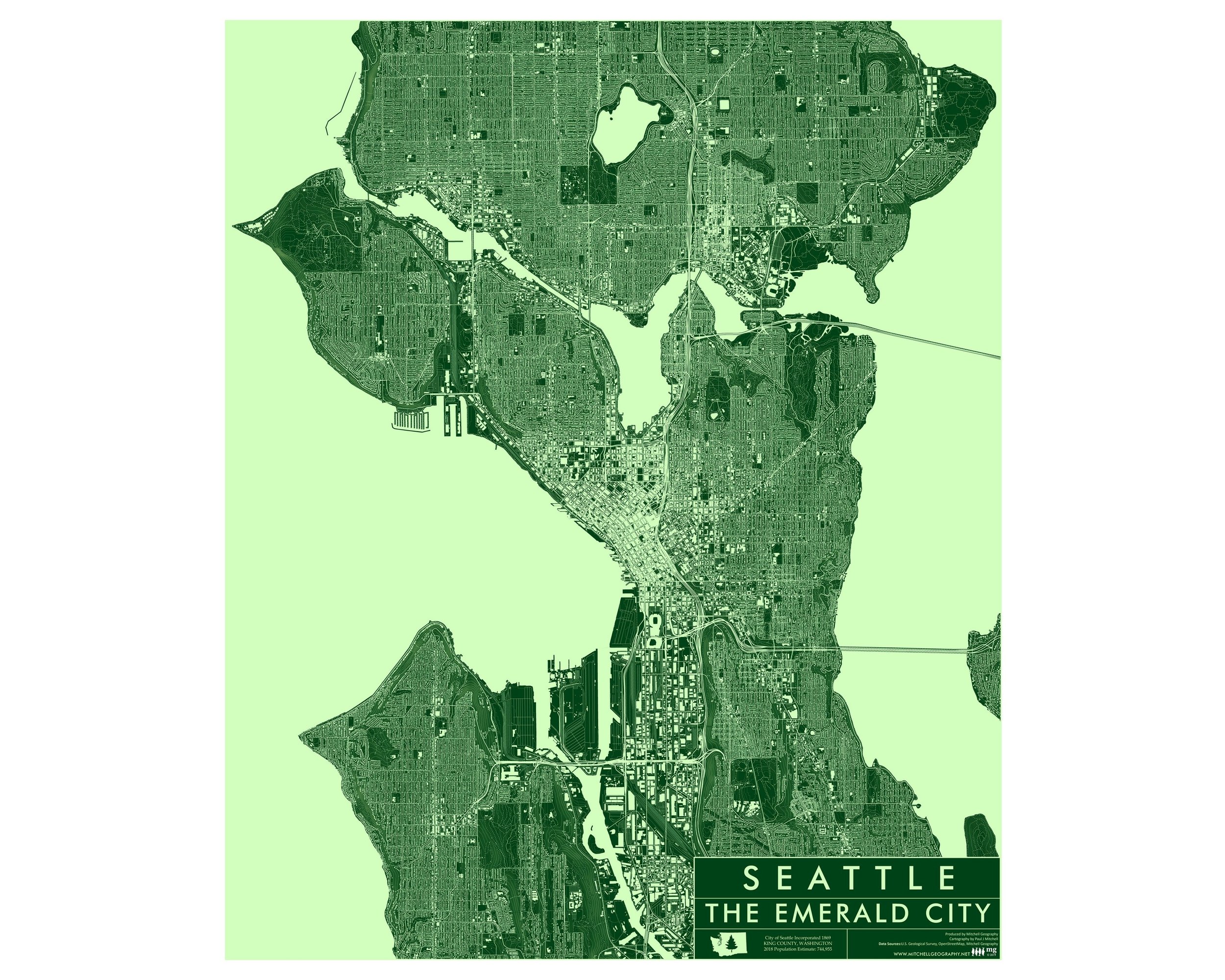
Lake Washington, Seattle, Washington. Feature vicinity map of Lake Washington and it’s surroundings. Lake features (bays/capes/points/beaches), parks, park trails, off street bicycle paths/trails, building footprints, neighborhood and incorporated places, bridges, and bathymetric NOAA model (contour depths not labeled) are all included for reference.
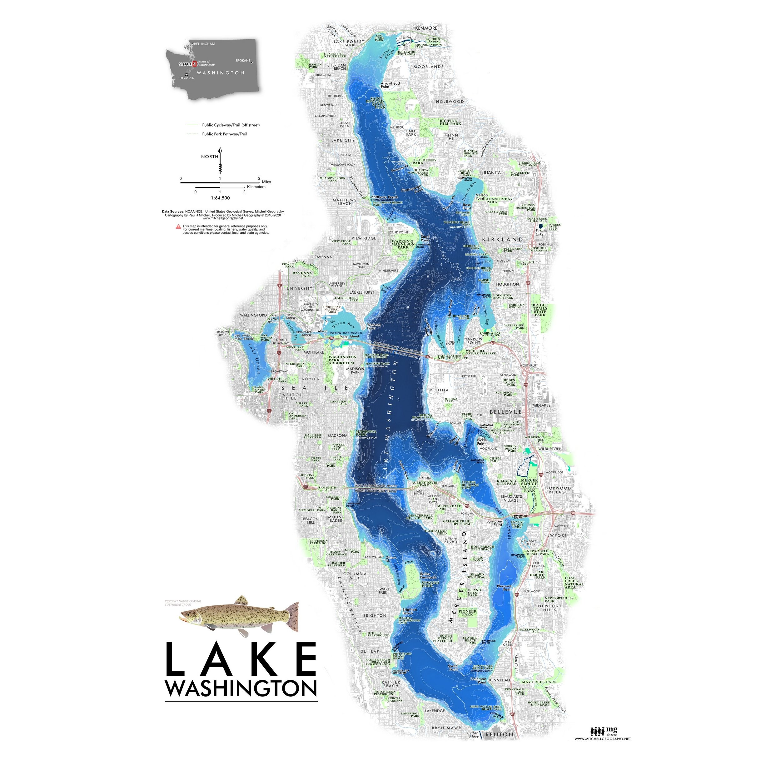
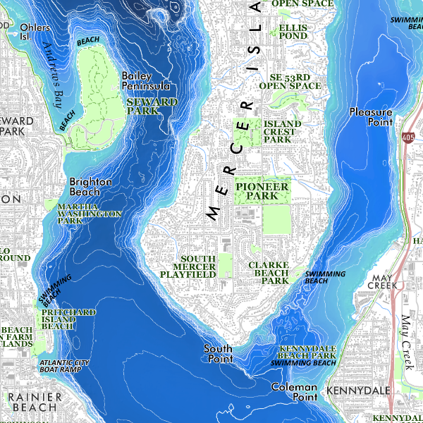
CLOSE OUT SALE
1:64,500
13 inch by 19 inch flat wall map, printed on heavy fine paper. Packed and shipped flat.
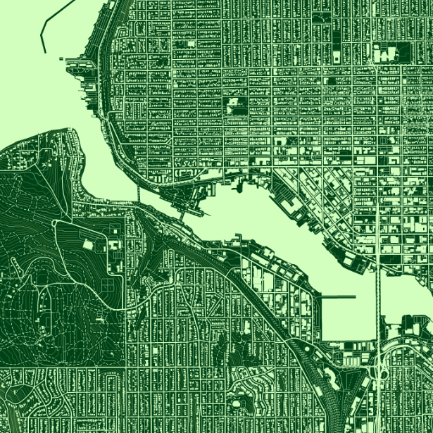
Lake Washington, Seattle, Washington. Feature vicinity map of Lake Washington and it’s surroundings. Lake features (bays/capes/points/beaches), parks, park trails, off street bicycle paths/trails, building footprints, neighborhood and incorporated places, bridges, and bathymetric NOAA model (contour depths not labeled) are all included for reference.
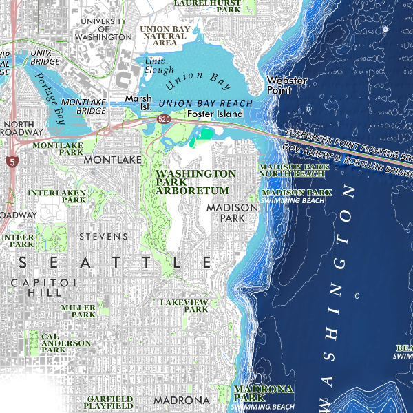
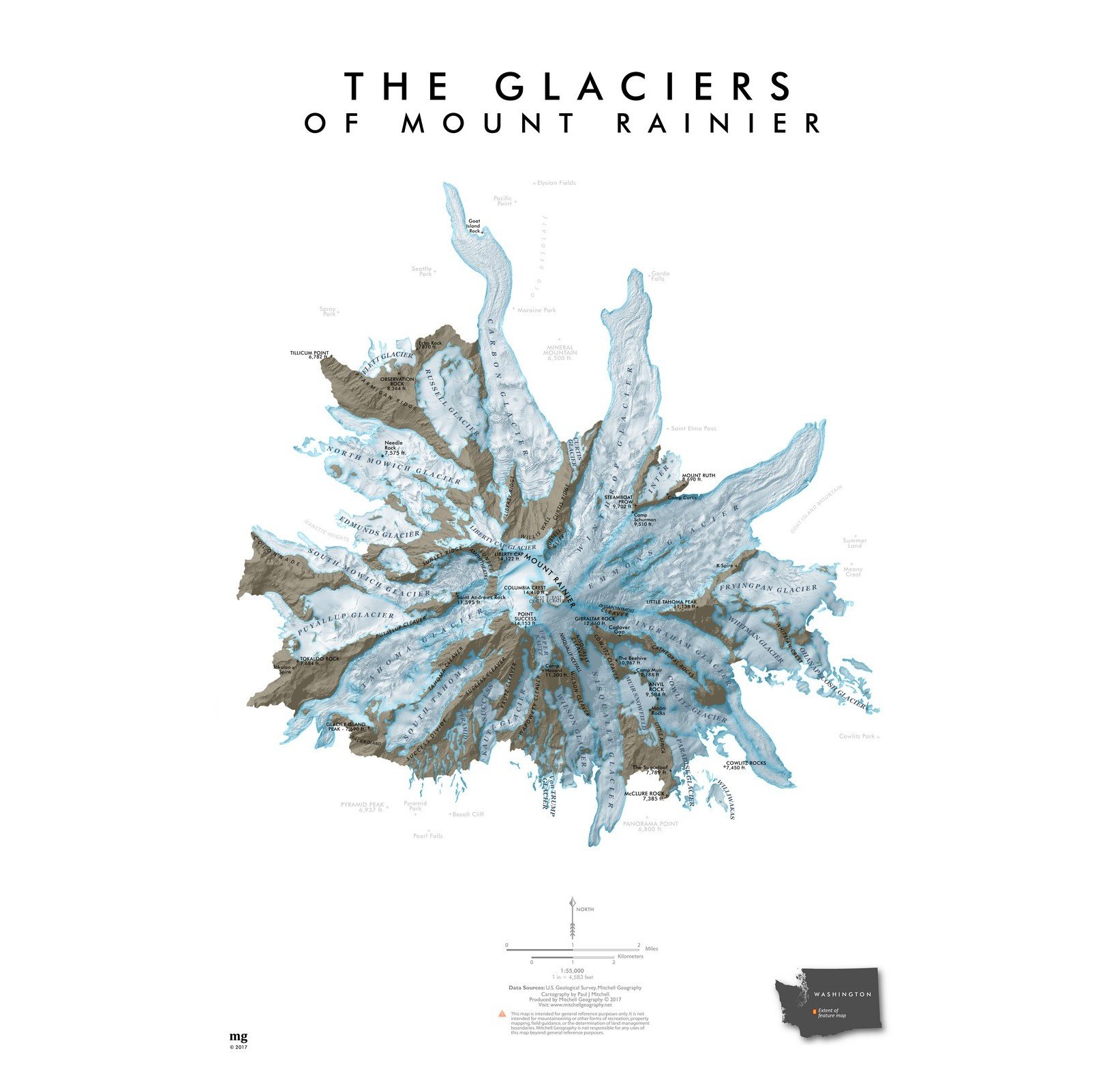
CLOSE OUT SALE
1:64,500
13 inch by 19 inch flat wall map, printed on heavy fine paper. Packed and shipped flat.
Lake Washington, Seattle, Washington. Feature vicinity map of Lake Washington and it’s surroundings. Lake features (bays/capes/points/beaches), parks, park trails, off street bicycle paths/trails, building footprints, neighborhood and incorporated places, bridges, and bathymetric NOAA model (contour depths not labeled) are all included for reference.


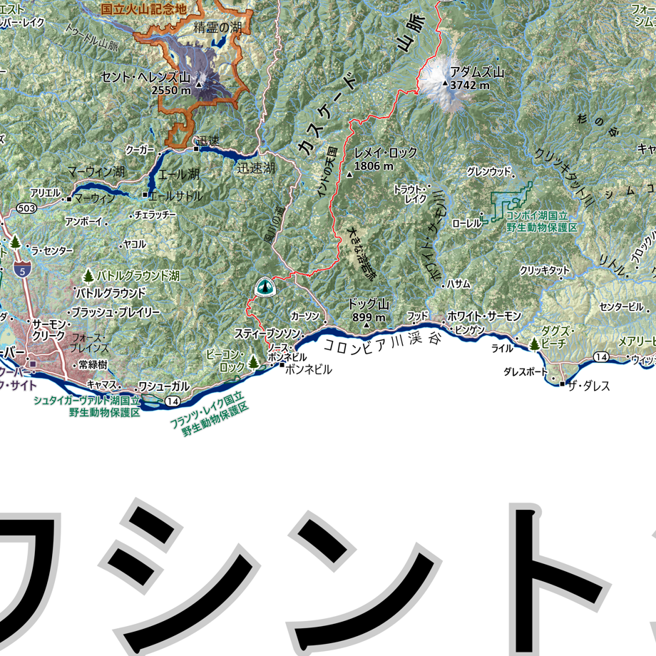
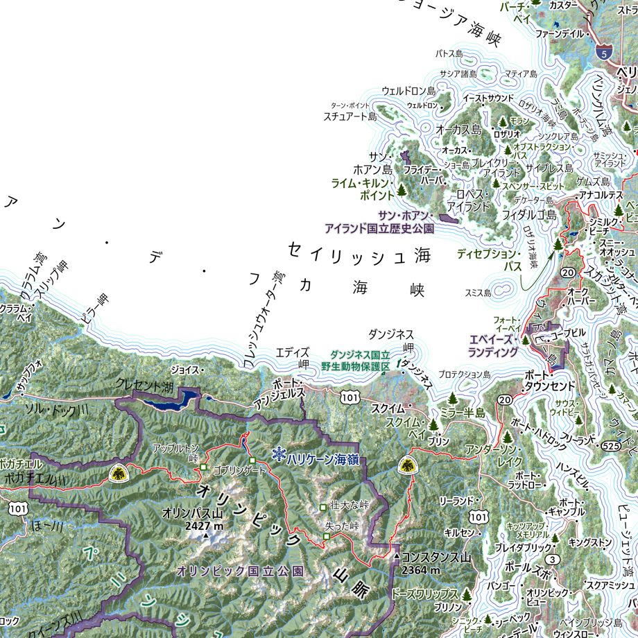
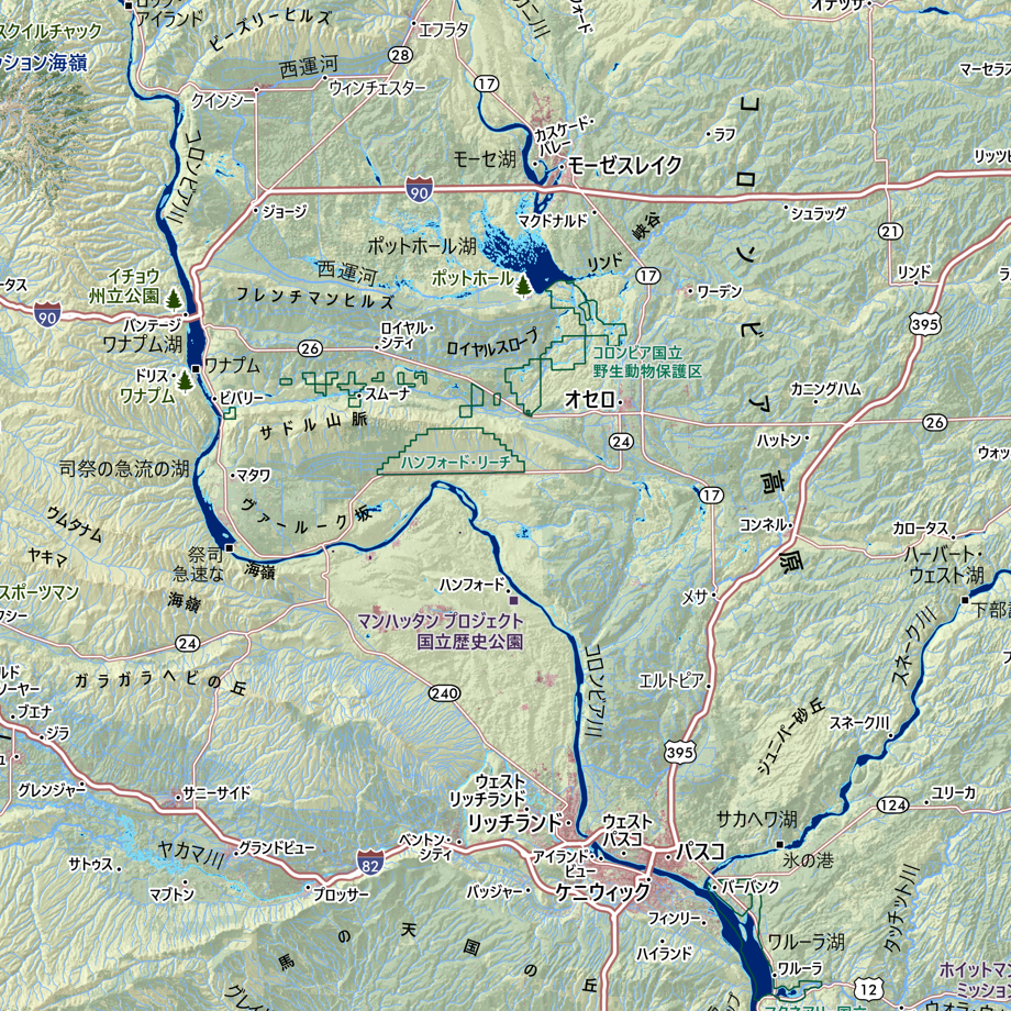
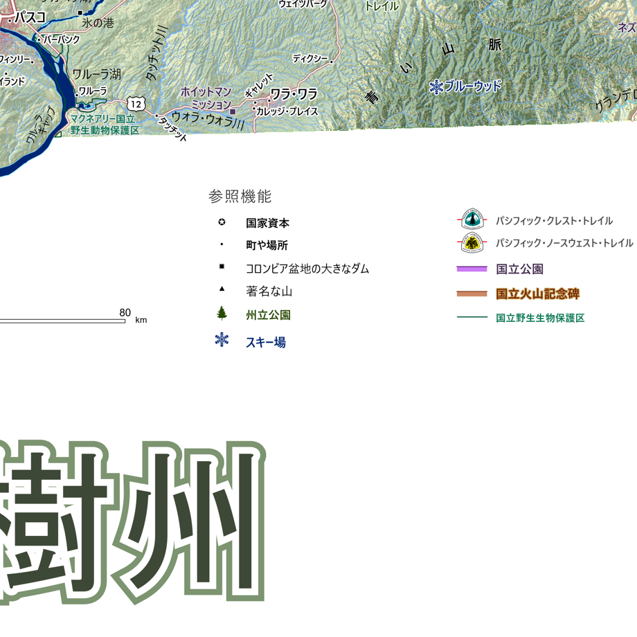
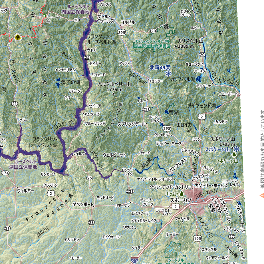
![Washington [Japanese language] (24 in x 20 in)](https://images.squarespace-cdn.com/content/v1/64dfe5c447627a1ab4b29d07/1694699282568-VV2KAVQ0SIU2BF6VIE2J/WA_JA_framed.JPG)