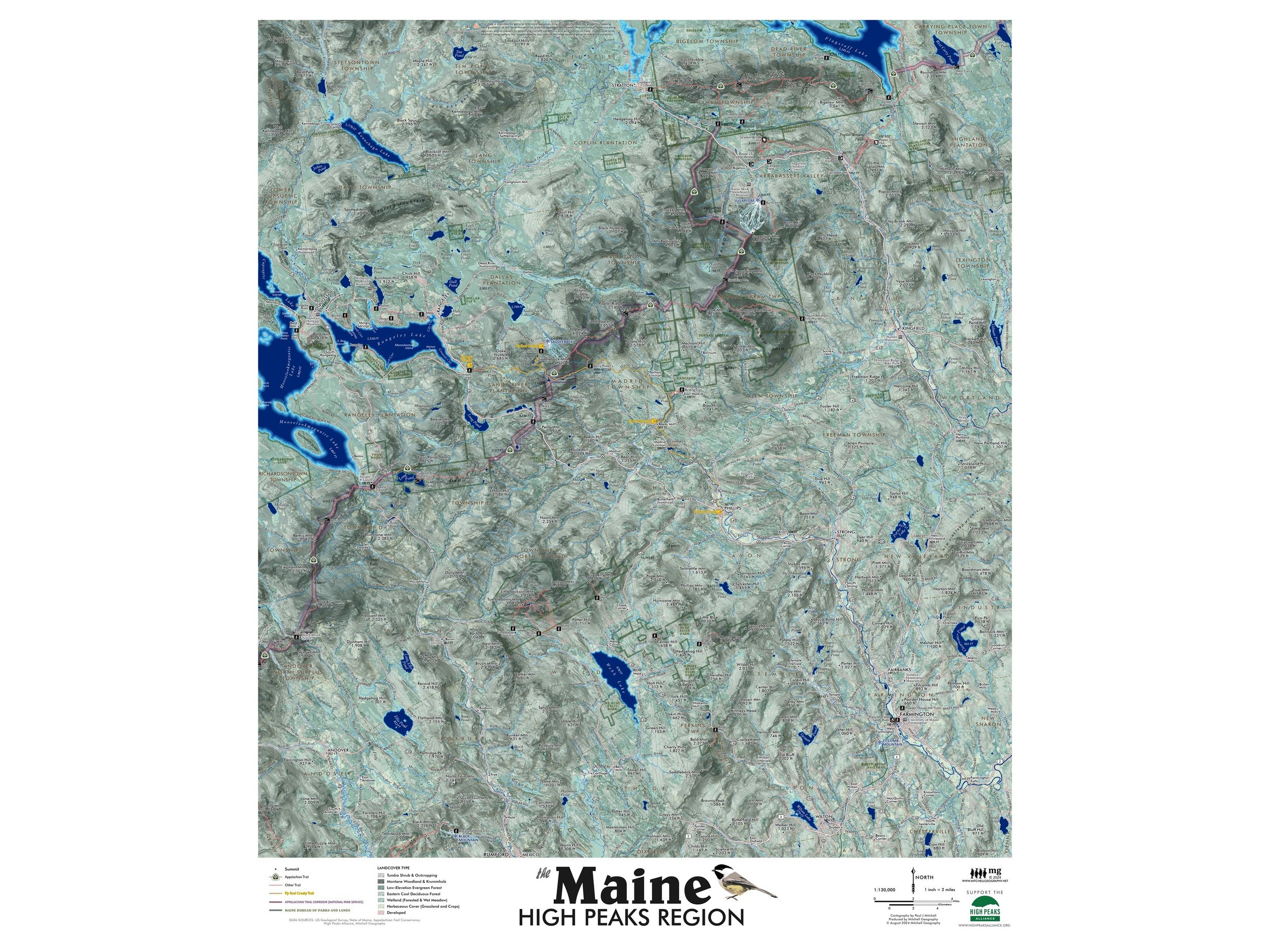
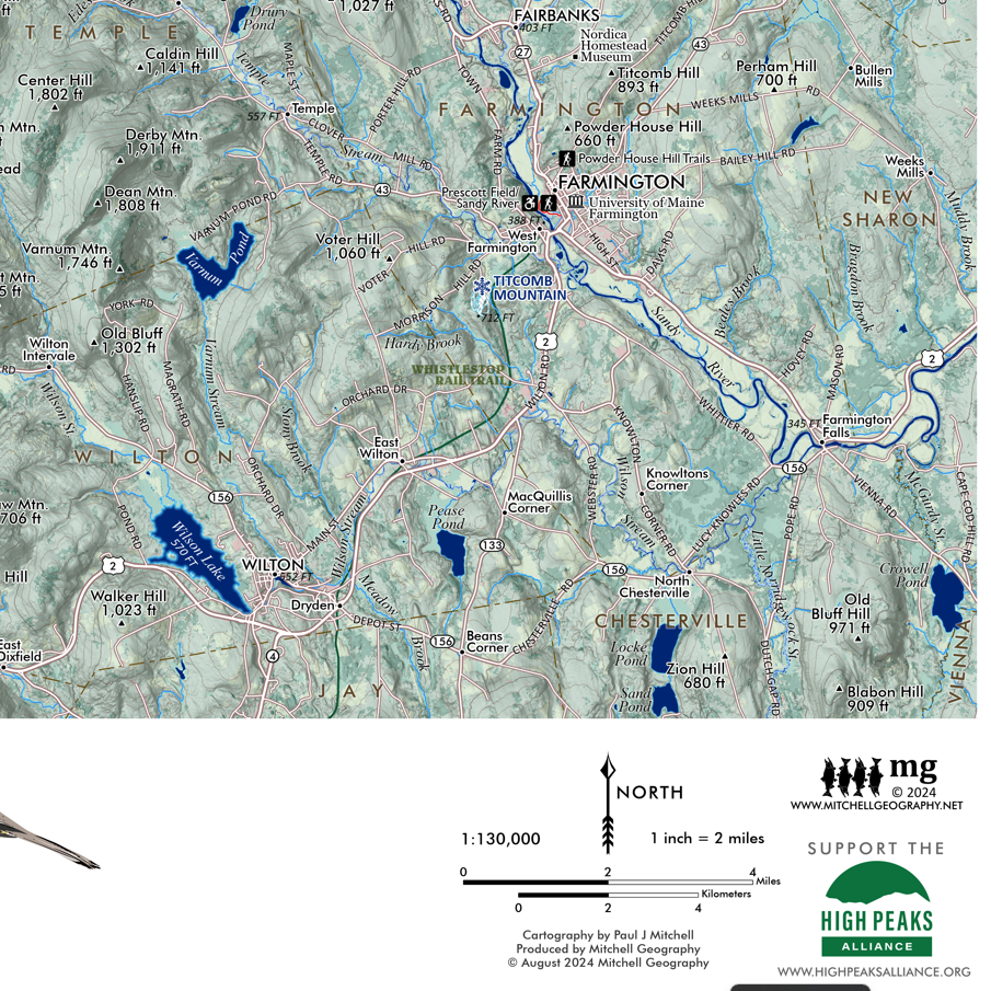
1:130,000
24 inch x 20 inch — flat wall map, printed on a heavy fine paper — shipped rolled.
A much larger Western Maine Mountains (printable digital download) is also now available.
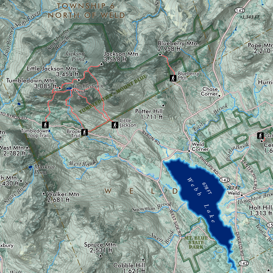
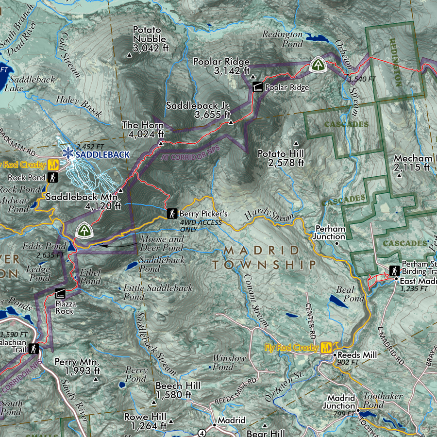
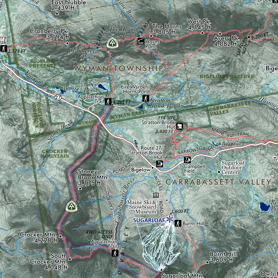
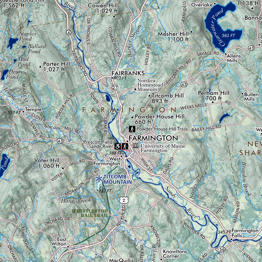
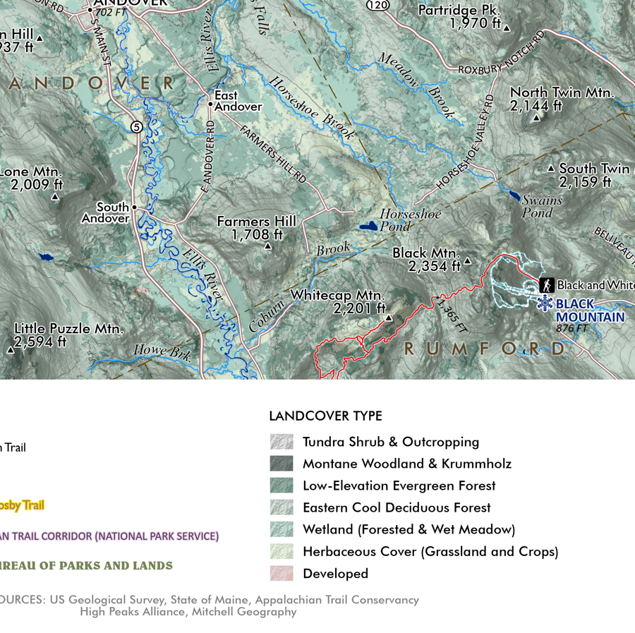
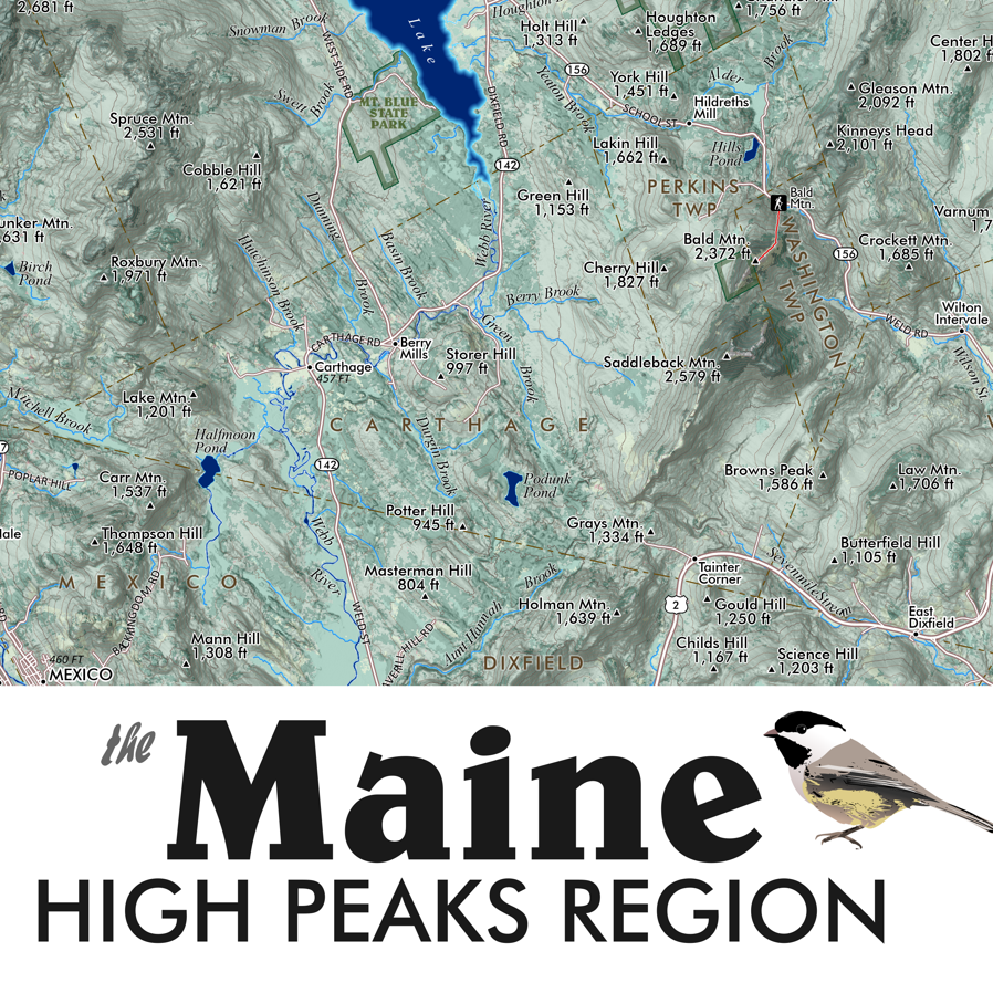
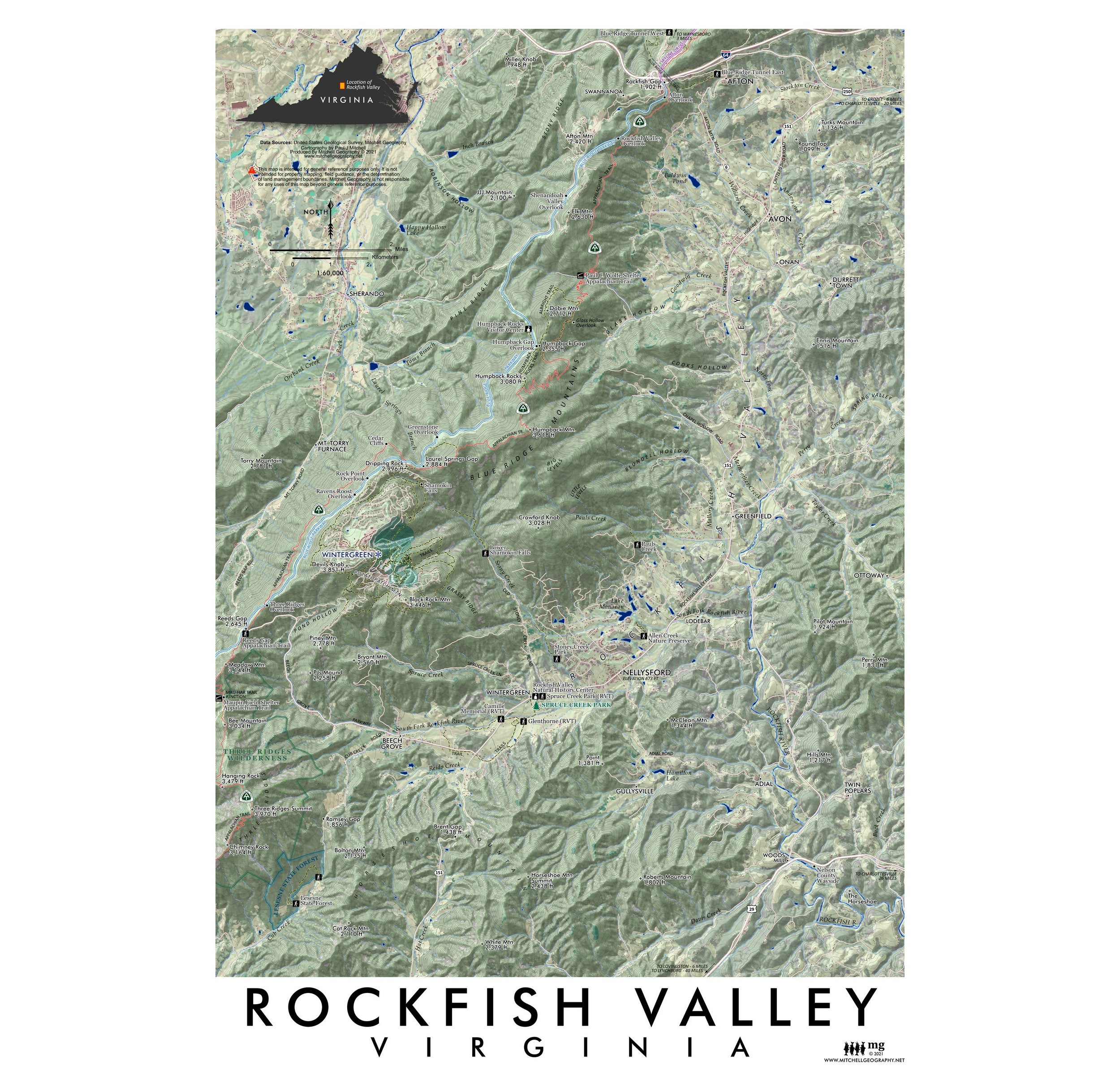
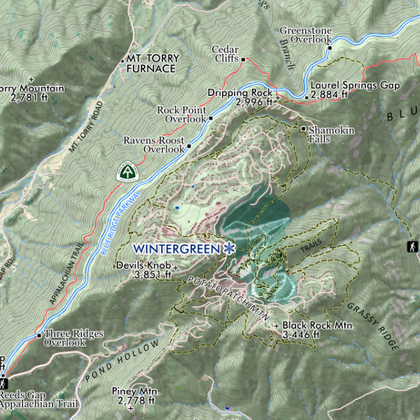
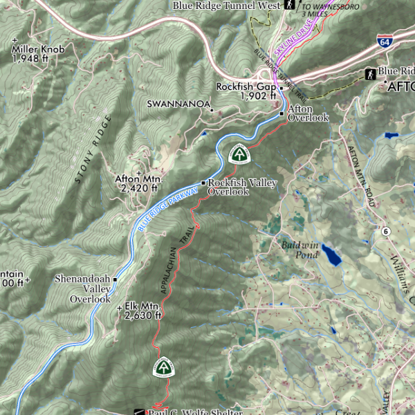
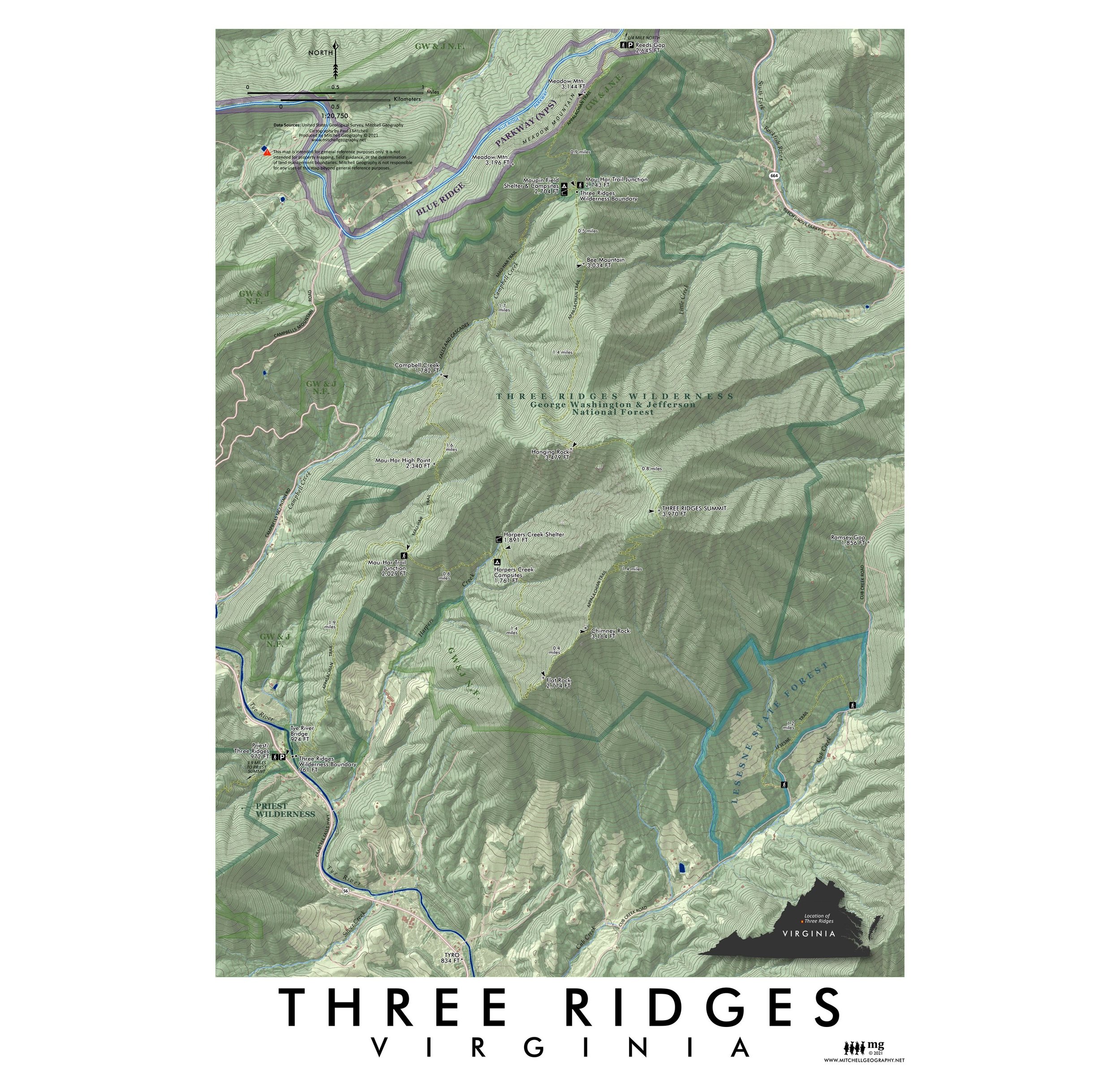
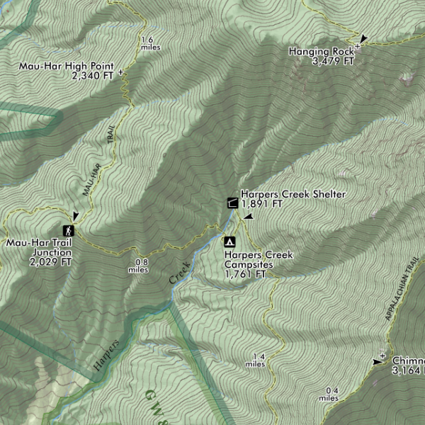
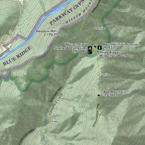
The Maine High Peaks region. Feature overview and general reference map of the High Peaks area in Western Maine. This extent includes the section of the Appalachian Trail north of Andover from Old Blue/Elephant/Bemis > Saddleback > Mt. Abraham > Sugarloaf > The Crockers > the Bigelow Range and ending at the Carry Ponds. Centered upon the Saddleback and Tumbledown/Weld area the extent also includes the regional towns of Farmington, Wilton, New Vineyard, New Portland, Strong, Phillips, Kingfield, Carrabassett Valley, Stratton/Eustis, Rangeley, Oquossoc, Kennebago Lake, Byron, Andover and the northern tips of Rumford/Mexico.
The shaded relief base layer includes a generalized land cover class differentiating the montane spruce/fir & krummholz from lower elevation vegetation types. Labeled for reference -- trails (e.g. the AT, Fly Rod Crosby, Maine Huts & Trails, Maine BPL), trailheads, alpine ski slopes (Saddleback, Sugarloaf, Black Mtn., Titcomb Mtn.), landmarks (Wire Bridge, Wilhelm Reich Museum, etc.), place names, summits with elevations, rivers, lakes, ponds, highway and road names. Fee owned public lands -- the National Park Service's Appalachian Trail Corridor and Maine BPL (Bureau of Parks and Lands) preserves (e.g. Bigelow) are mapped and labeled including the very recent Cascades addition along the Orbeton and Perham Streams (non-profit conserved lands are not mapped, though some of their trails are included). Fee sites included are labeled accordingly.
1:130,000
24 inch x 20 inch — flat wall map, printed on a heavy fine paper — shipped rolled.
A much larger Western Maine Mountains (printable digital download) is also now available.
The Maine High Peaks region. Feature overview and general reference map of the High Peaks area in Western Maine. This extent includes the section of the Appalachian Trail north of Andover from Old Blue/Elephant/Bemis > Saddleback > Mt. Abraham > Sugarloaf > The Crockers > the Bigelow Range and ending at the Carry Ponds. Centered upon the Saddleback and Tumbledown/Weld area the extent also includes the regional towns of Farmington, Wilton, New Vineyard, New Portland, Strong, Phillips, Kingfield, Carrabassett Valley, Stratton/Eustis, Rangeley, Oquossoc, Kennebago Lake, Byron, Andover and the northern tips of Rumford/Mexico.
The shaded relief base layer includes a generalized land cover class differentiating the montane spruce/fir & krummholz from lower elevation vegetation types. Labeled for reference -- trails (e.g. the AT, Fly Rod Crosby, Maine Huts & Trails, Maine BPL), trailheads, alpine ski slopes (Saddleback, Sugarloaf, Black Mtn., Titcomb Mtn.), landmarks (Wire Bridge, Wilhelm Reich Museum, etc.), place names, summits with elevations, rivers, lakes, ponds, highway and road names. Fee owned public lands -- the National Park Service's Appalachian Trail Corridor and Maine BPL (Bureau of Parks and Lands) preserves (e.g. Bigelow) are mapped and labeled including the very recent Cascades addition along the Orbeton and Perham Streams (non-profit conserved lands are not mapped, though some of their trails are included). Fee sites included are labeled accordingly.