1:1,250,000
20 inch x 24 inch — flat wall map, printed on a heavy fine paper — shipped rolled.
Second Edition July 2026.
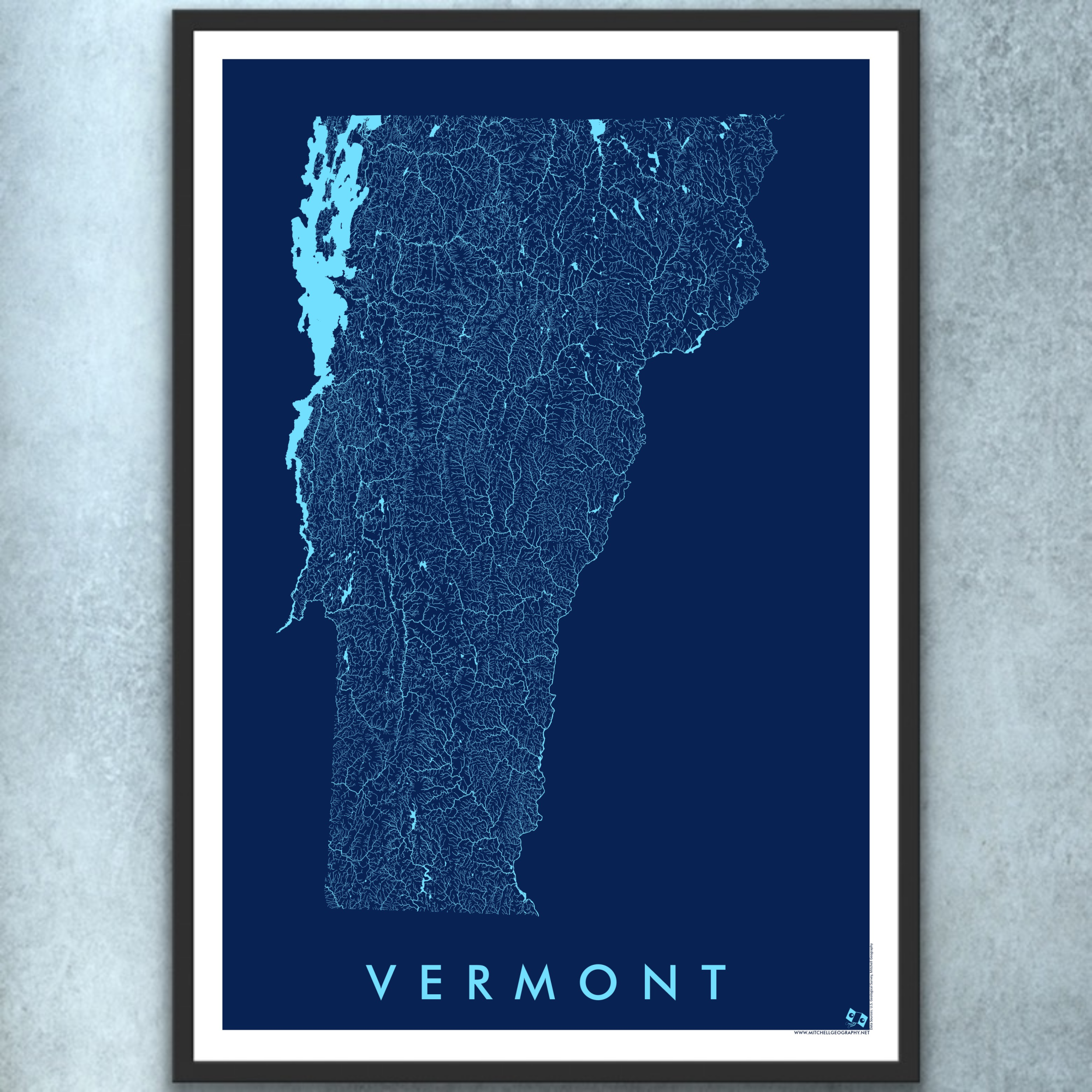
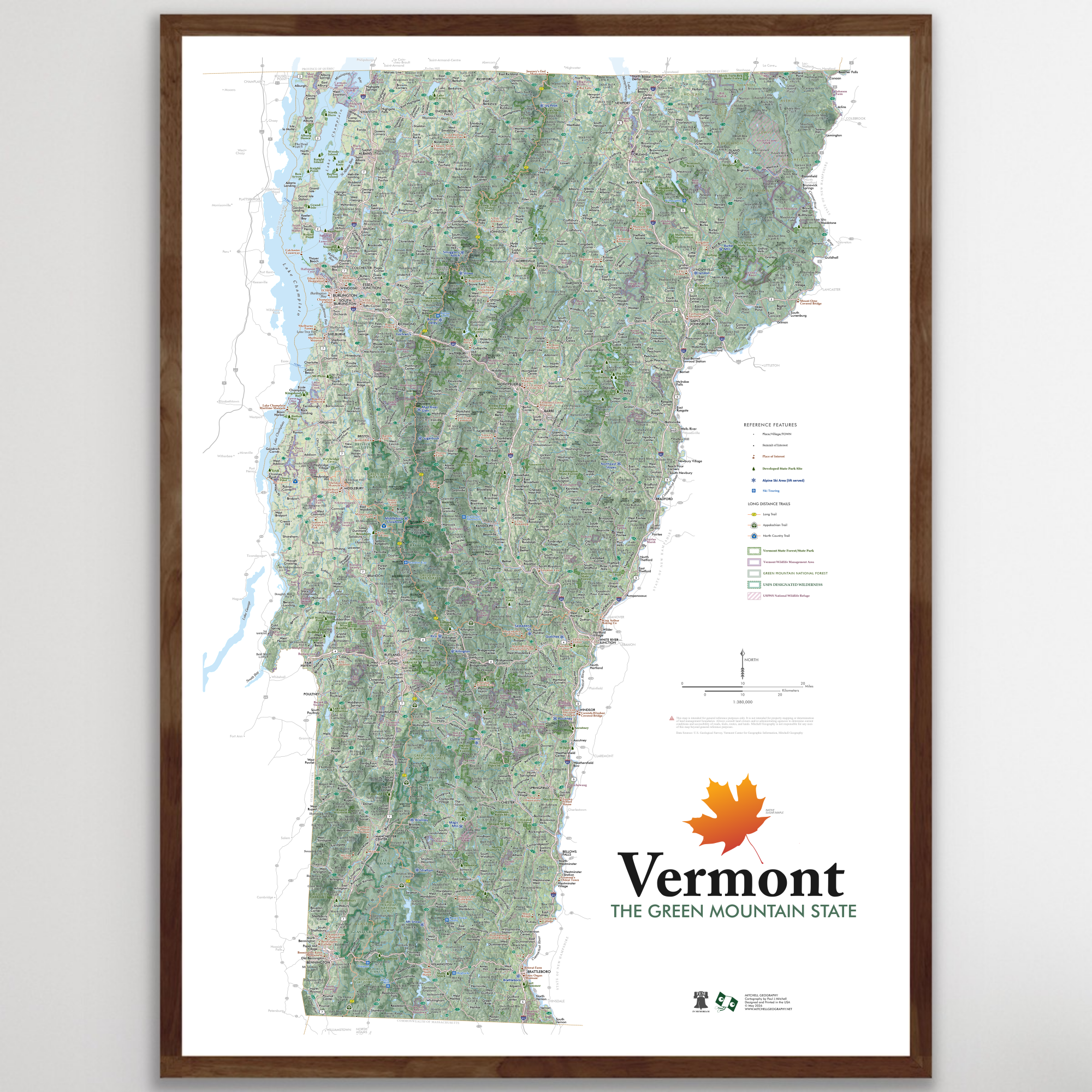
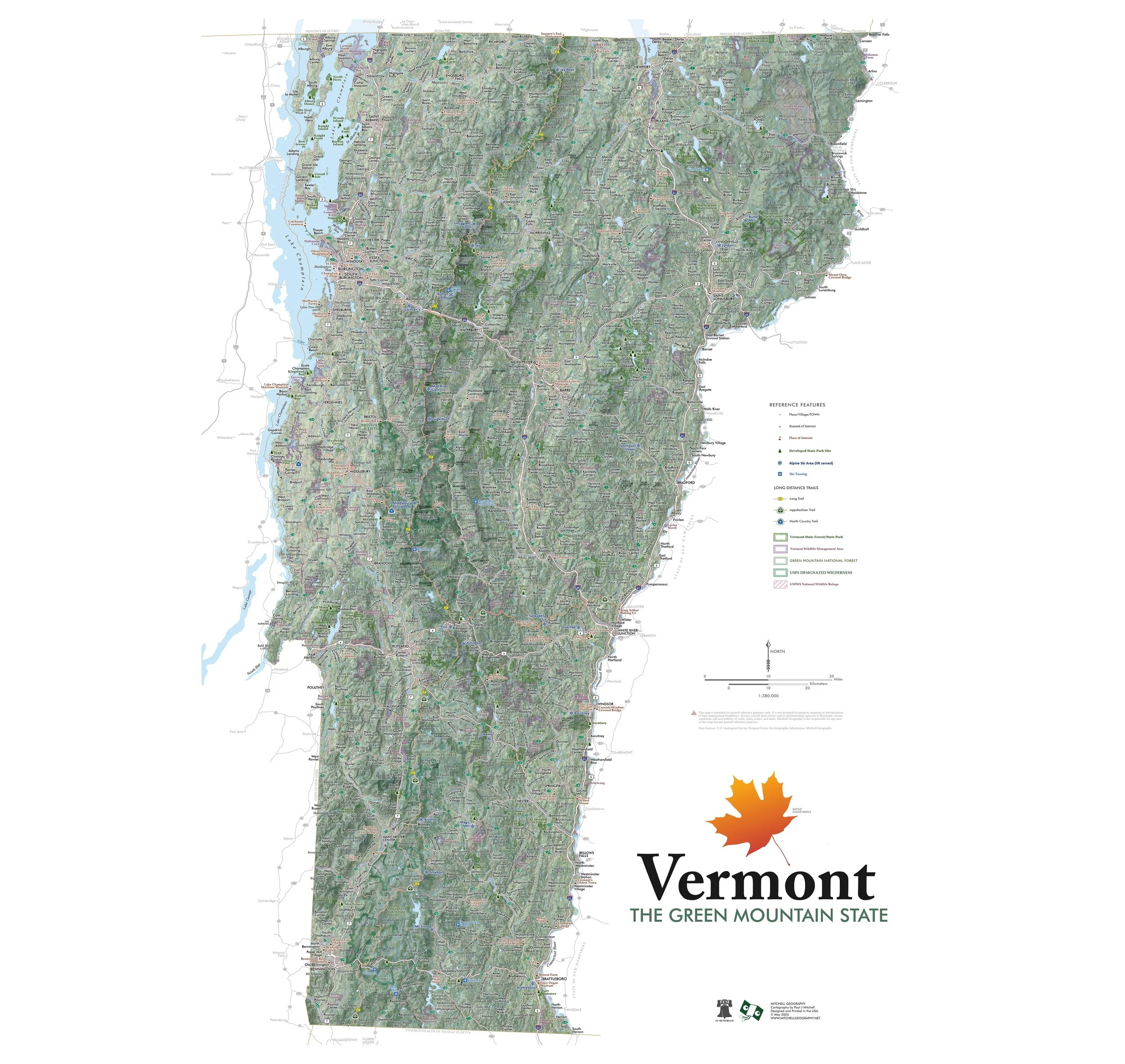
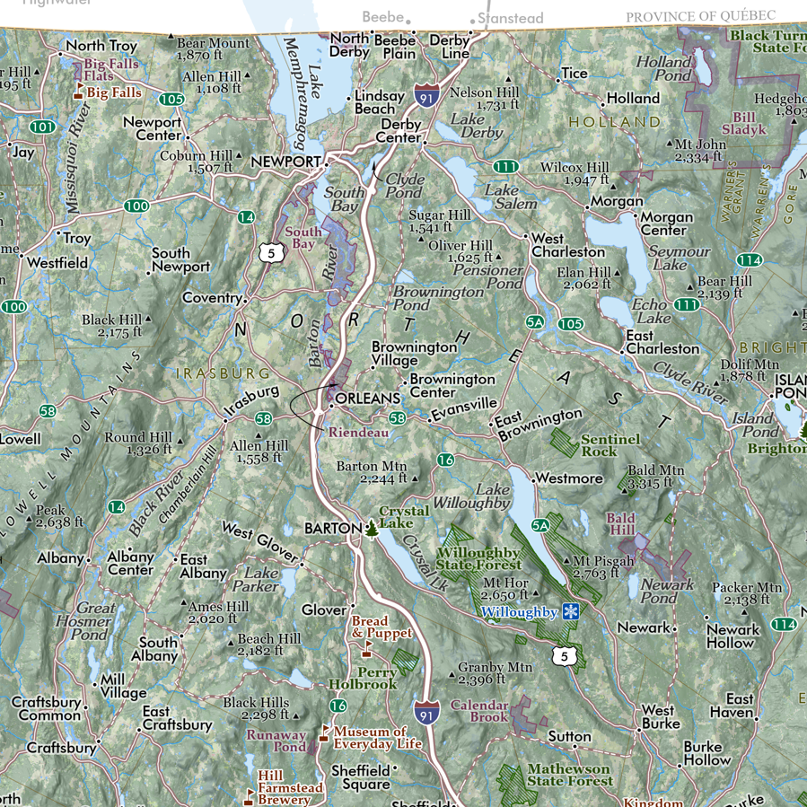
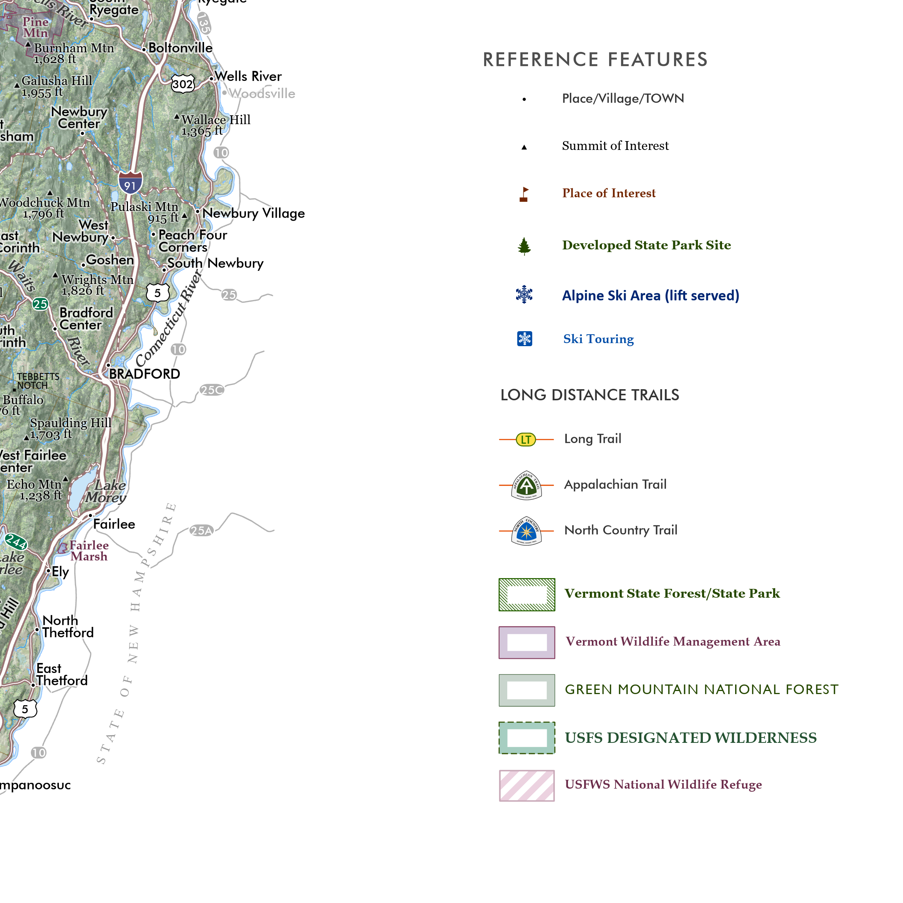
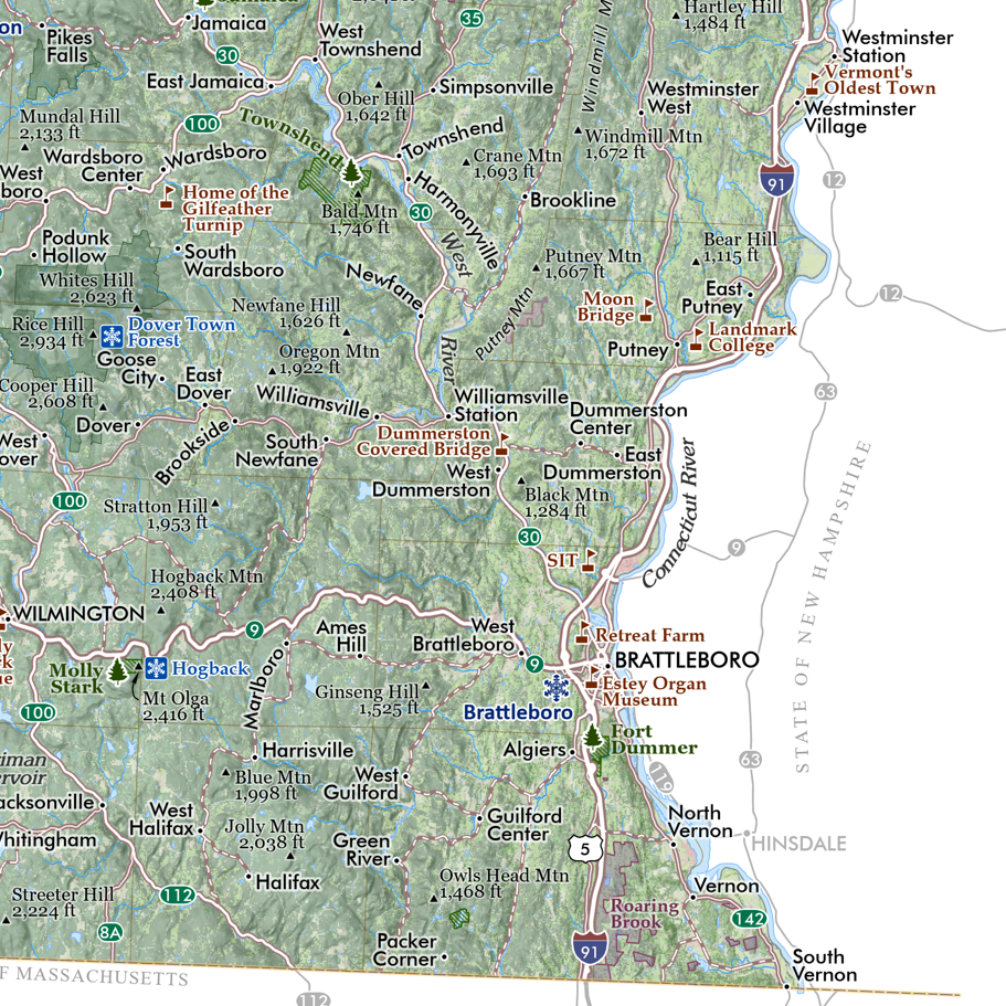
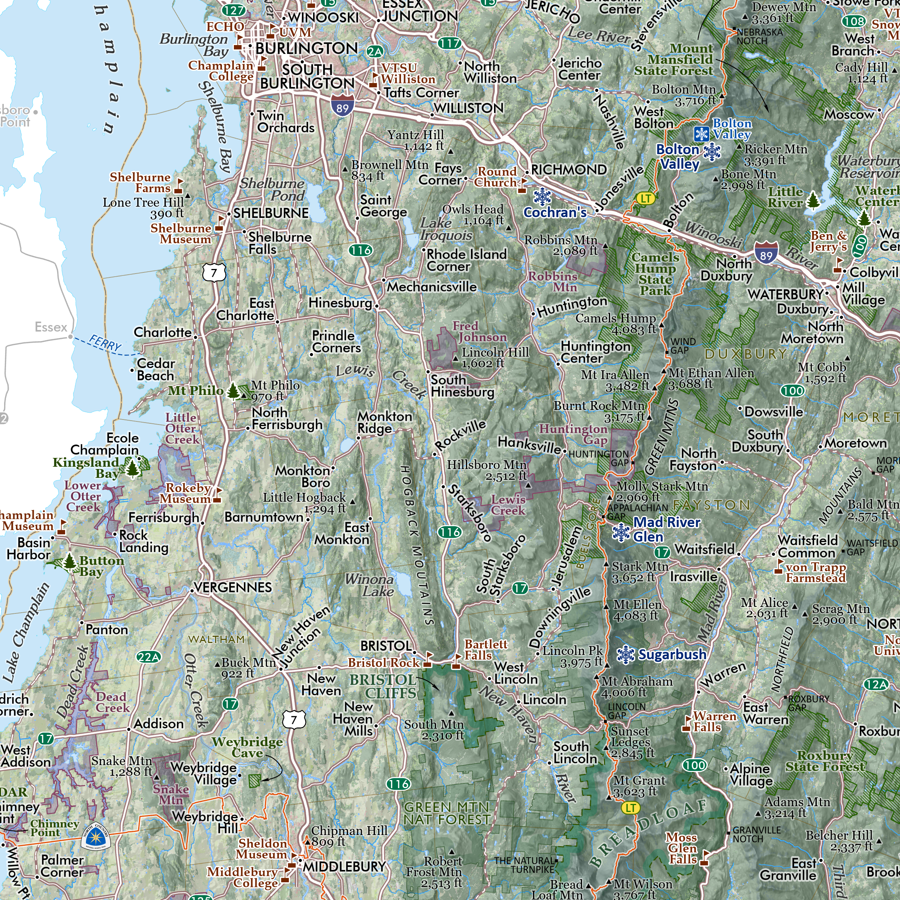
Minnesota Ecological Regions map. A re-symbolization of the EPA's Level IV ecoregions for the landscapes of Minnesota. Includes inset Minnesota Level III reference map for context. Level IV classes are symbolized and listed individually in the key for the feature map. Detailed reference labels includes cities/towns/places, state parks, highways/major roads, prominent lakes, large landforms of significance, National Park units (e.g. Voyageurs), National Forests (e.g. Superior, Chippewa), Federal Wilderness (e.g. Boundary Waters Canoe Area Wilderness), National Wildlife Refuges, State Parks (e.g. Gooseberry Falls), and non-motorized Minnesota State Trails (e.g. CJ Ramstad - North Shore).
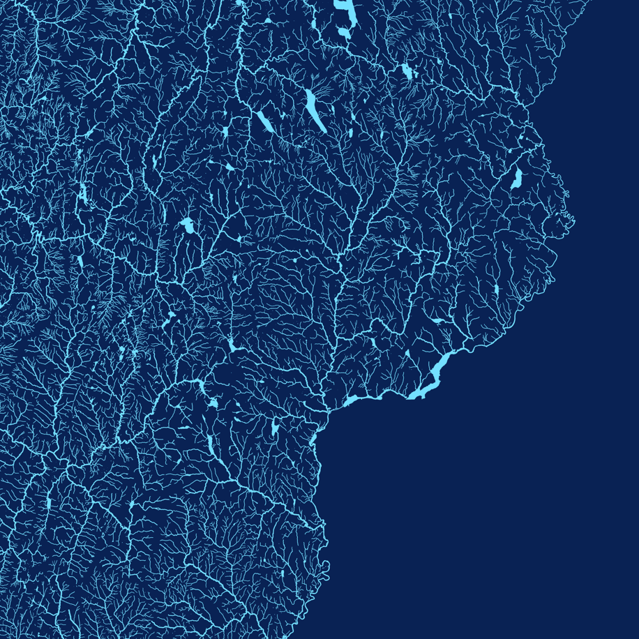
Second Edition (July 2026) updates include improved legibility from lightened stroke on place name labels and a change to classic light blue for the lakes and waterbodies.
1:1,250,000
20 inch x 24 inch — flat wall map, printed on a heavy fine paper — shipped rolled.
Second Edition July 2026.
Minnesota Ecological Regions map. A re-symbolization of the EPA's Level IV ecoregions for the landscapes of Minnesota. Includes inset Minnesota Level III reference map for context. Level IV classes are symbolized and listed individually in the key for the feature map. Detailed reference labels includes cities/towns/places, state parks, highways/major roads, prominent lakes, large landforms of significance, National Park units (e.g. Voyageurs), National Forests (e.g. Superior, Chippewa), Federal Wilderness (e.g. Boundary Waters Canoe Area Wilderness), National Wildlife Refuges, State Parks (e.g. Gooseberry Falls), and non-motorized Minnesota State Trails (e.g. CJ Ramstad - North Shore).
Second Edition (July 2026) updates include improved legibility from lightened stroke on place name labels and a change to classic light blue for the lakes and waterbodies.

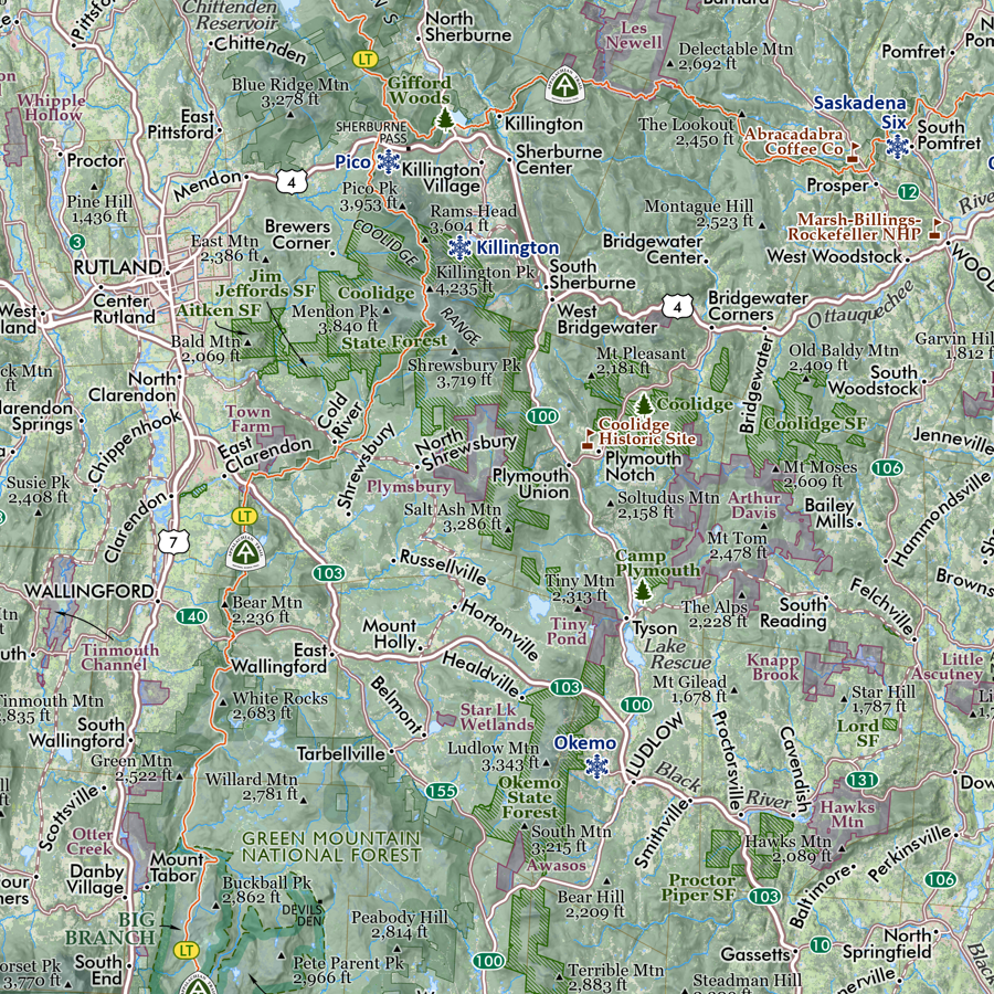
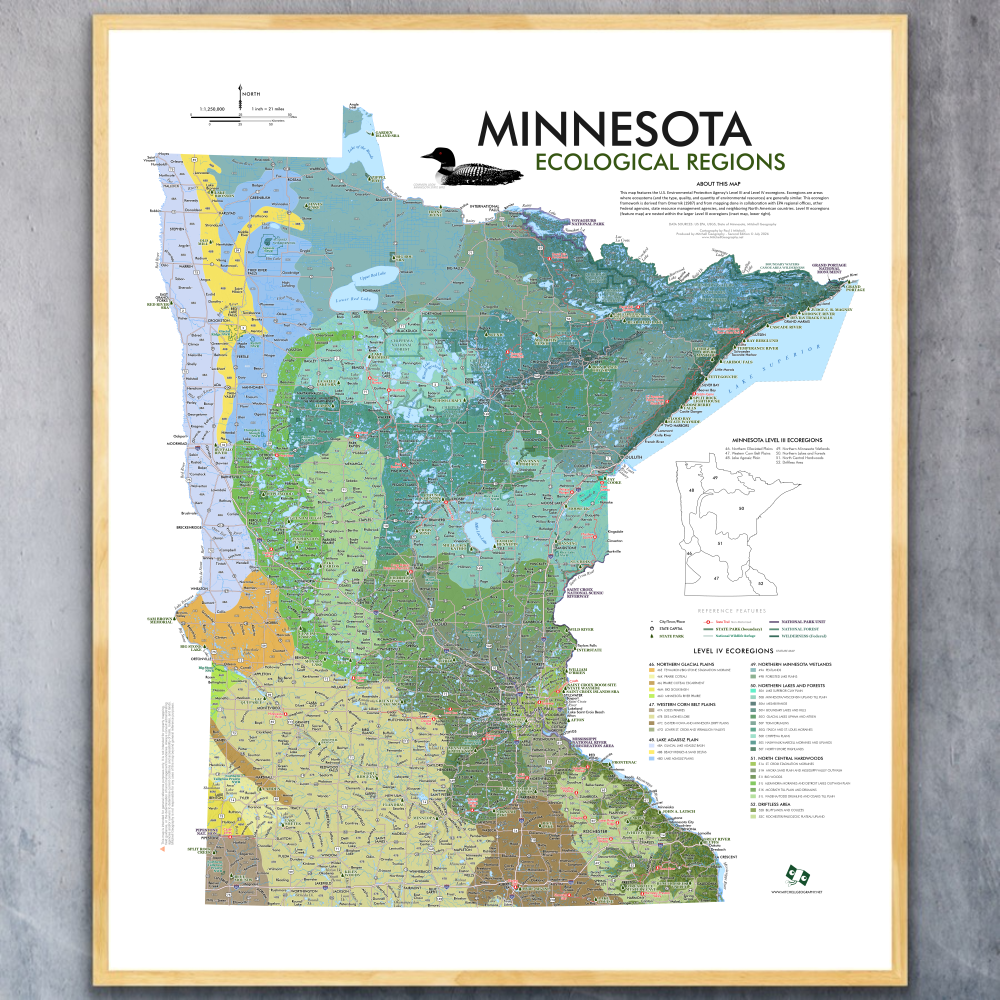 Image 1 of 8
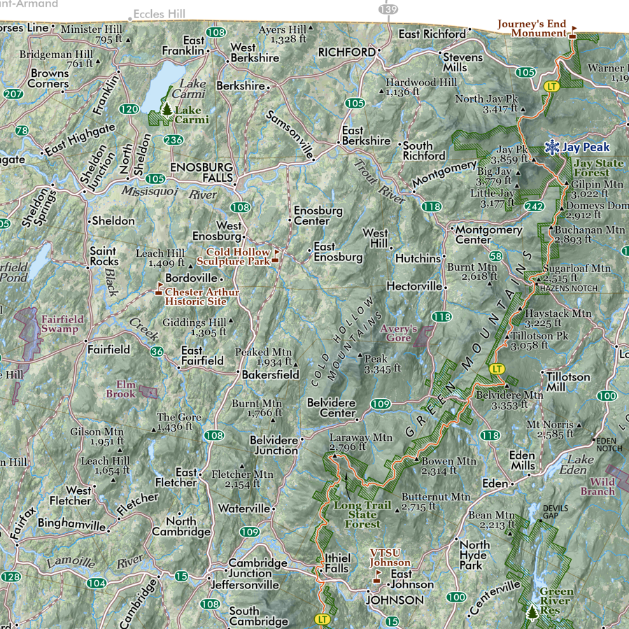
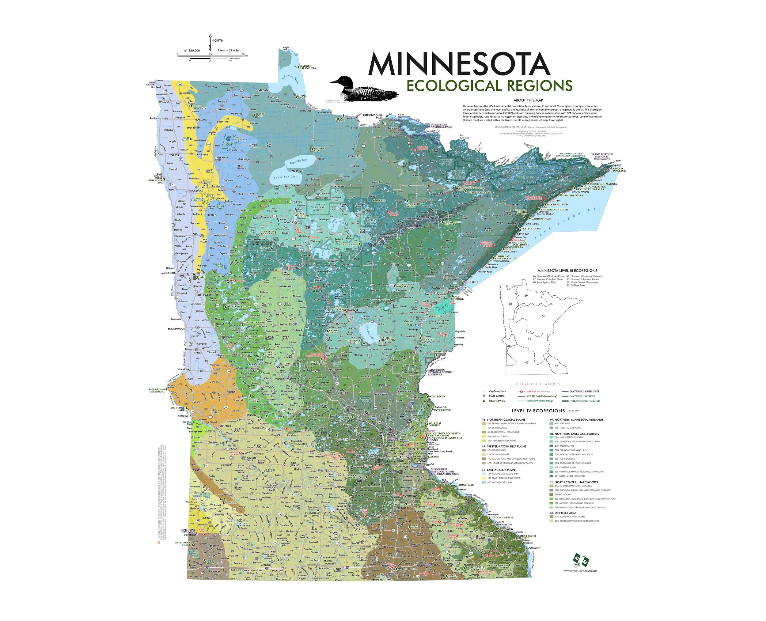 Image 2 of 8
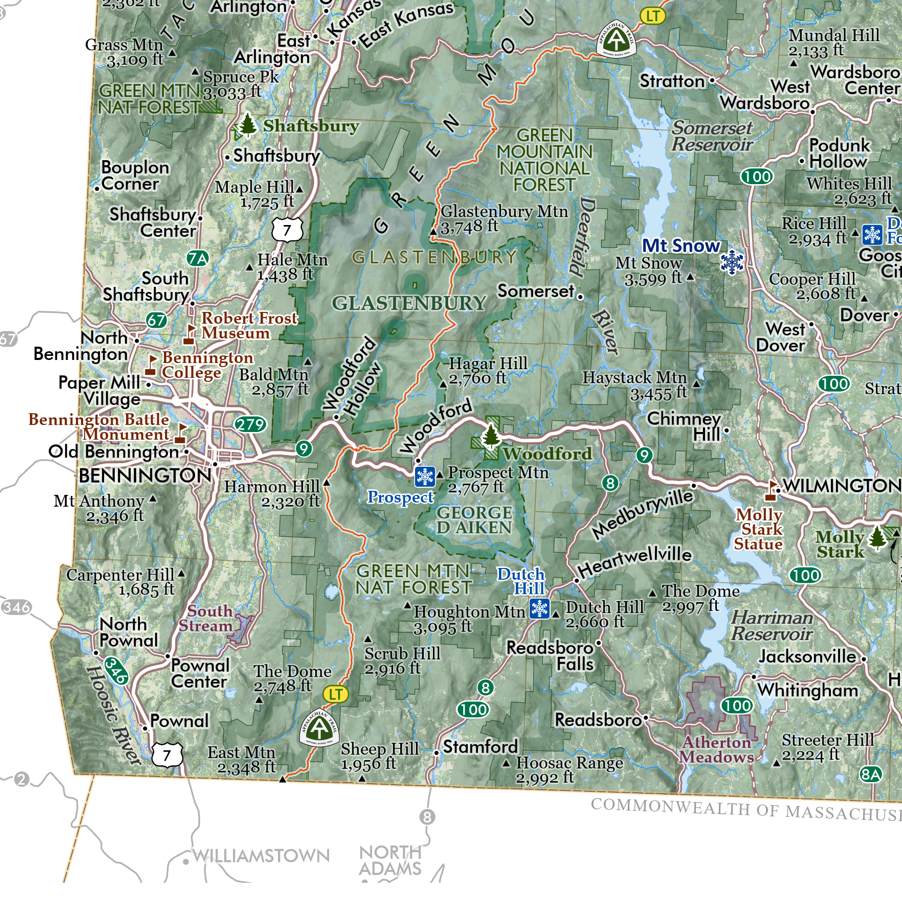
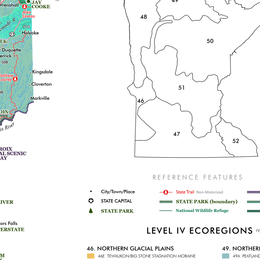 Image 3 of 8
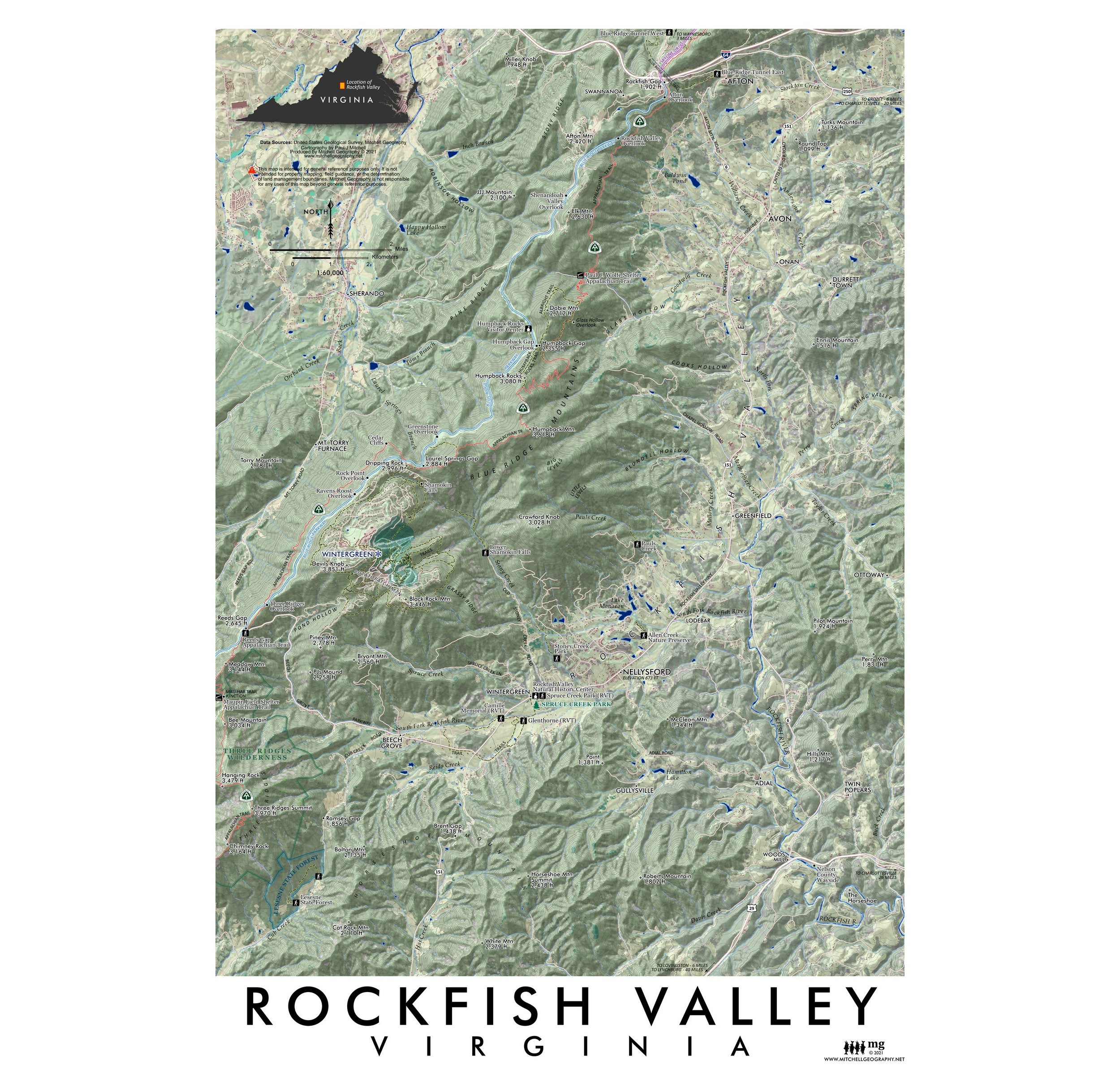
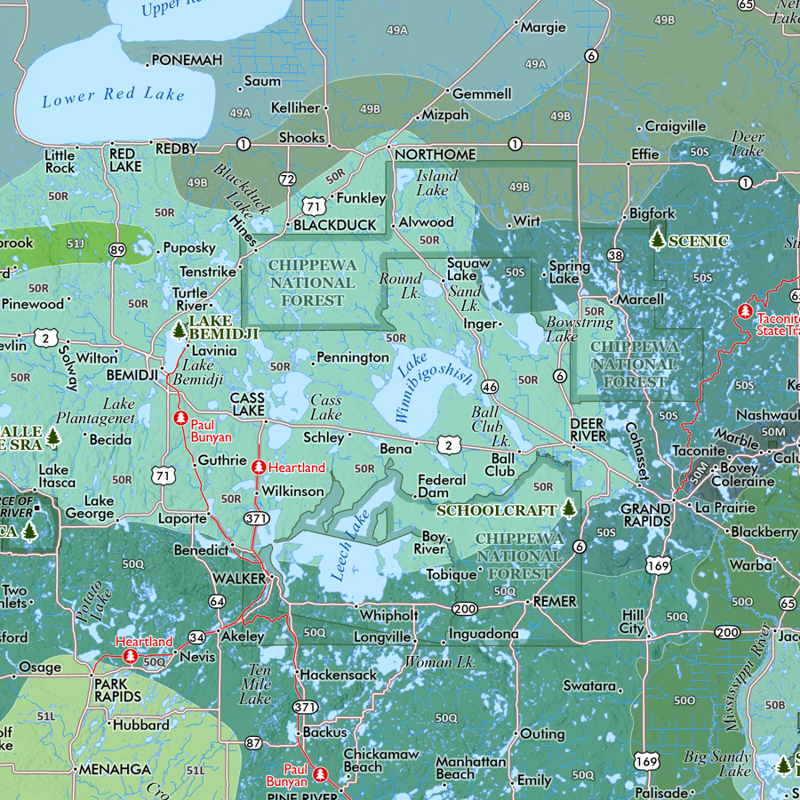 Image 4 of 8
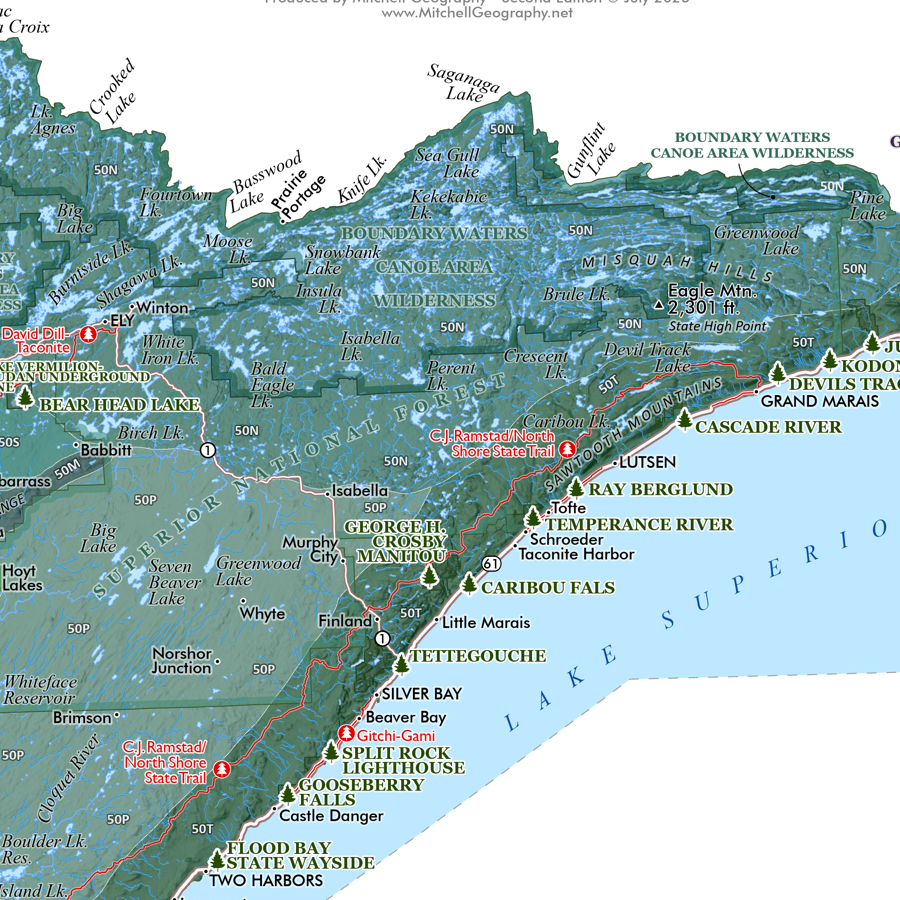 Image 5 of 8
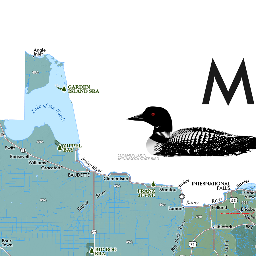 Image 6 of 8
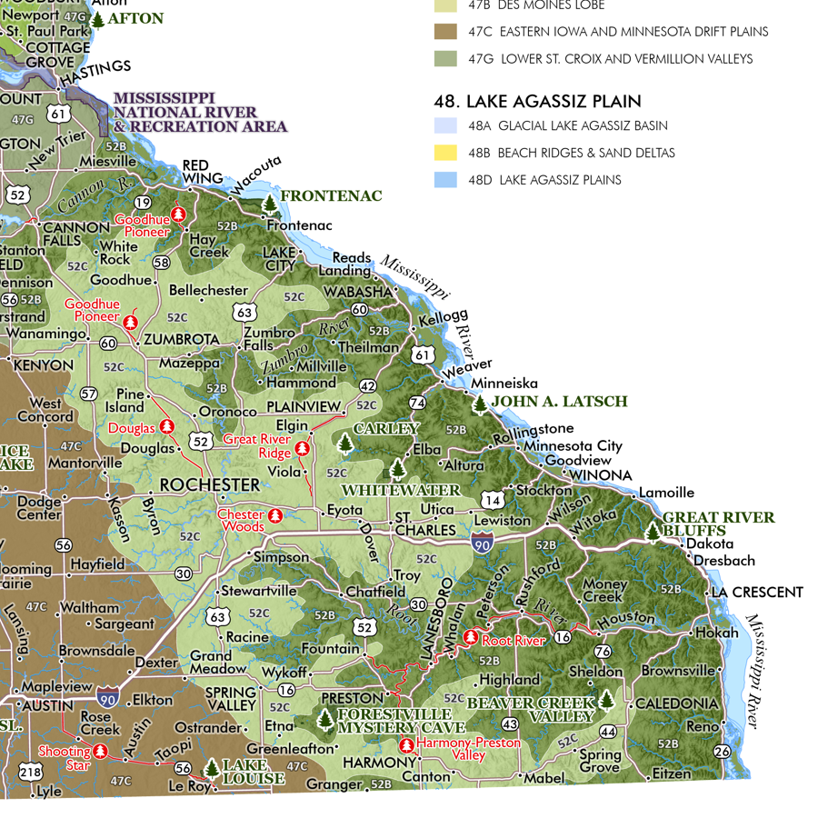 Image 7 of 8
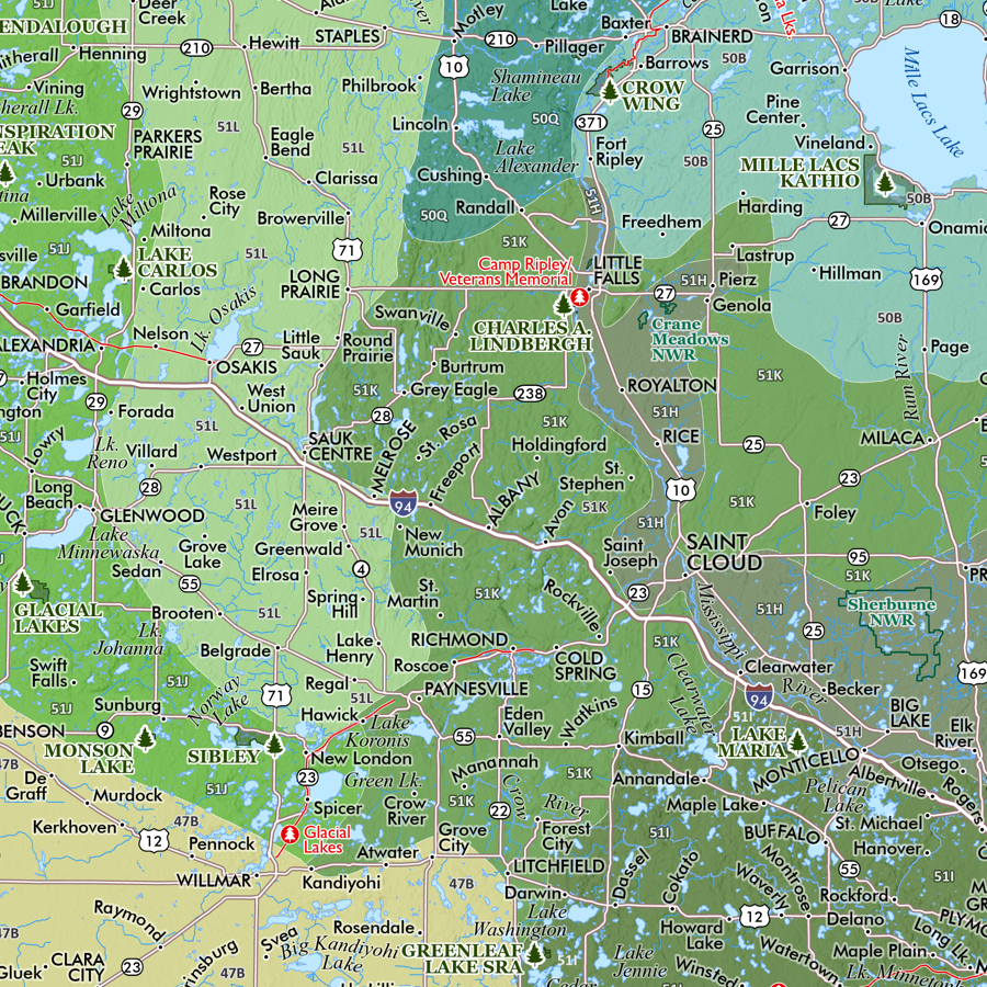 Image 8 of 8