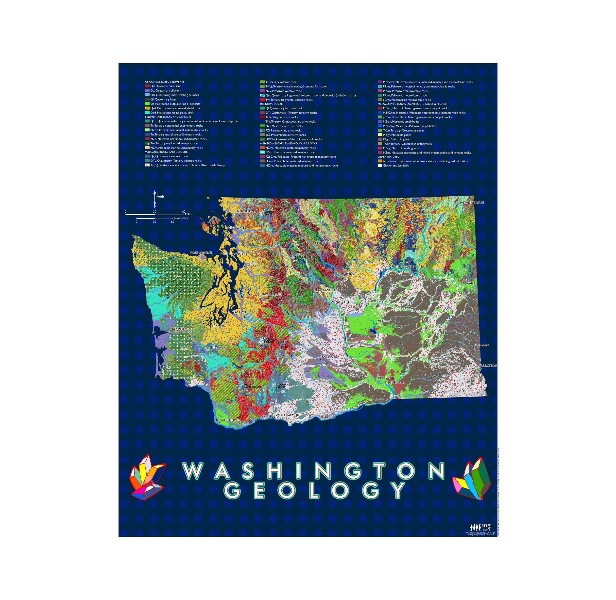
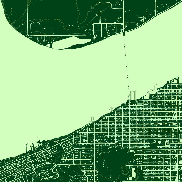
Image 1 of 5
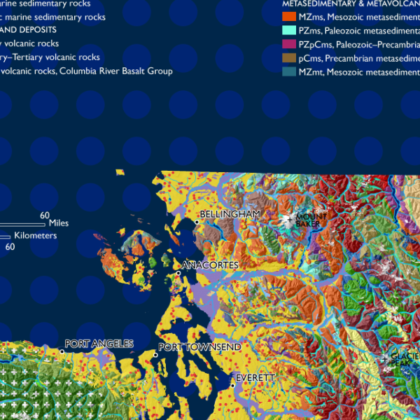
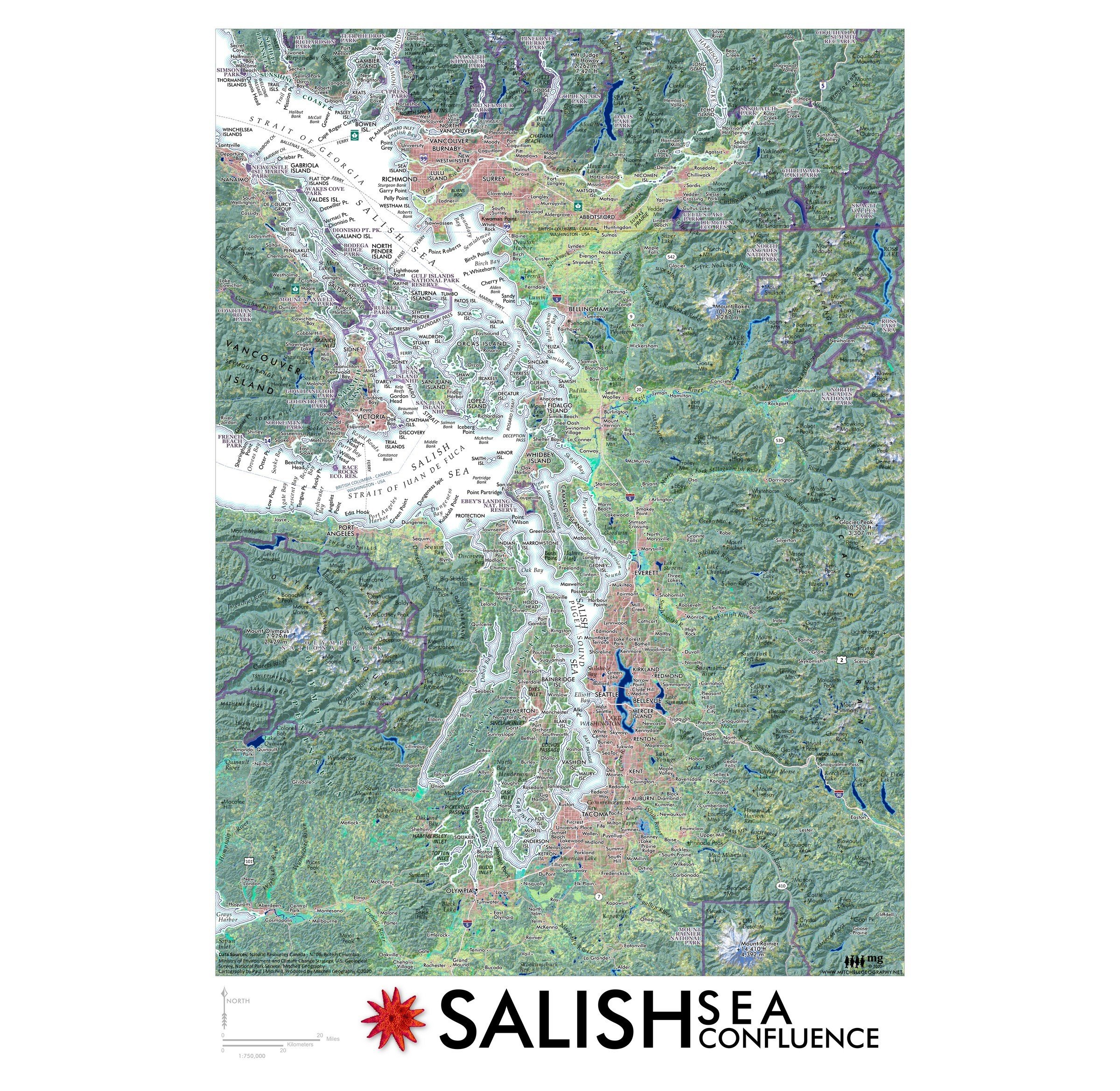
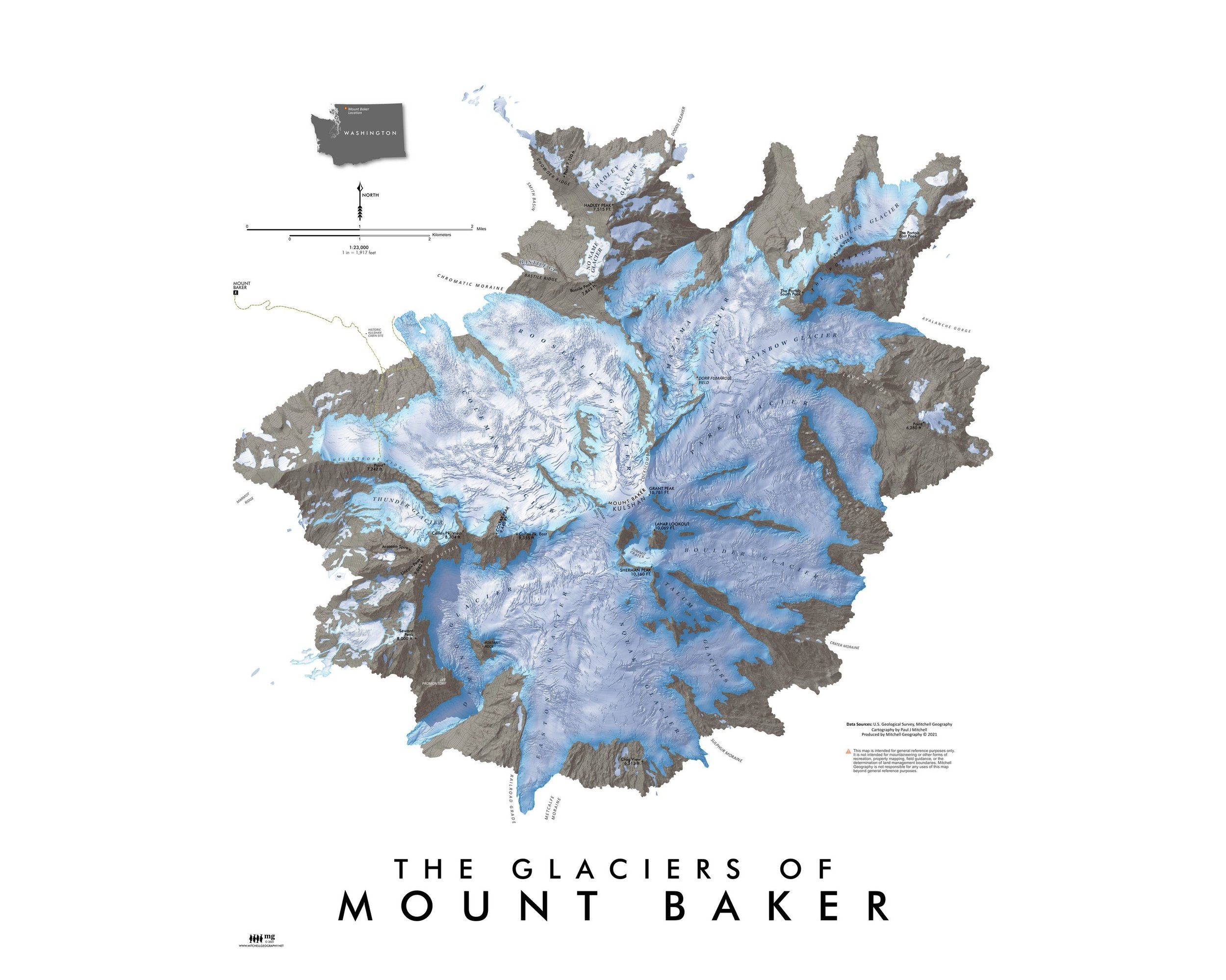 Image 2 of 5
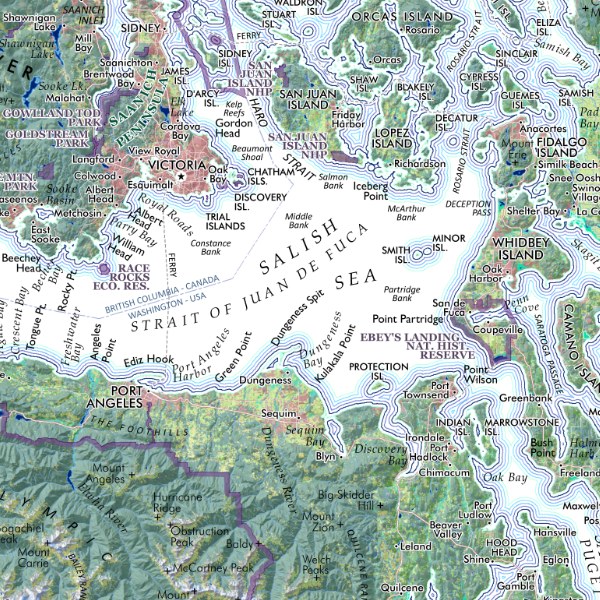
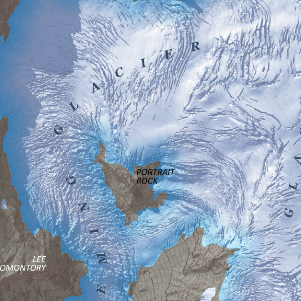 Image 3 of 5
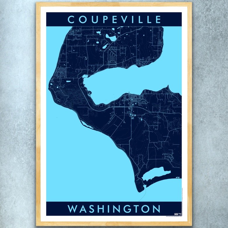
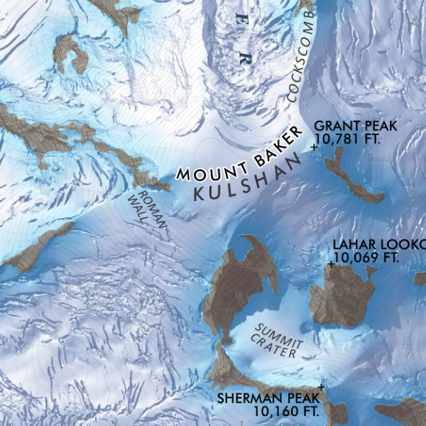 Image 4 of 5
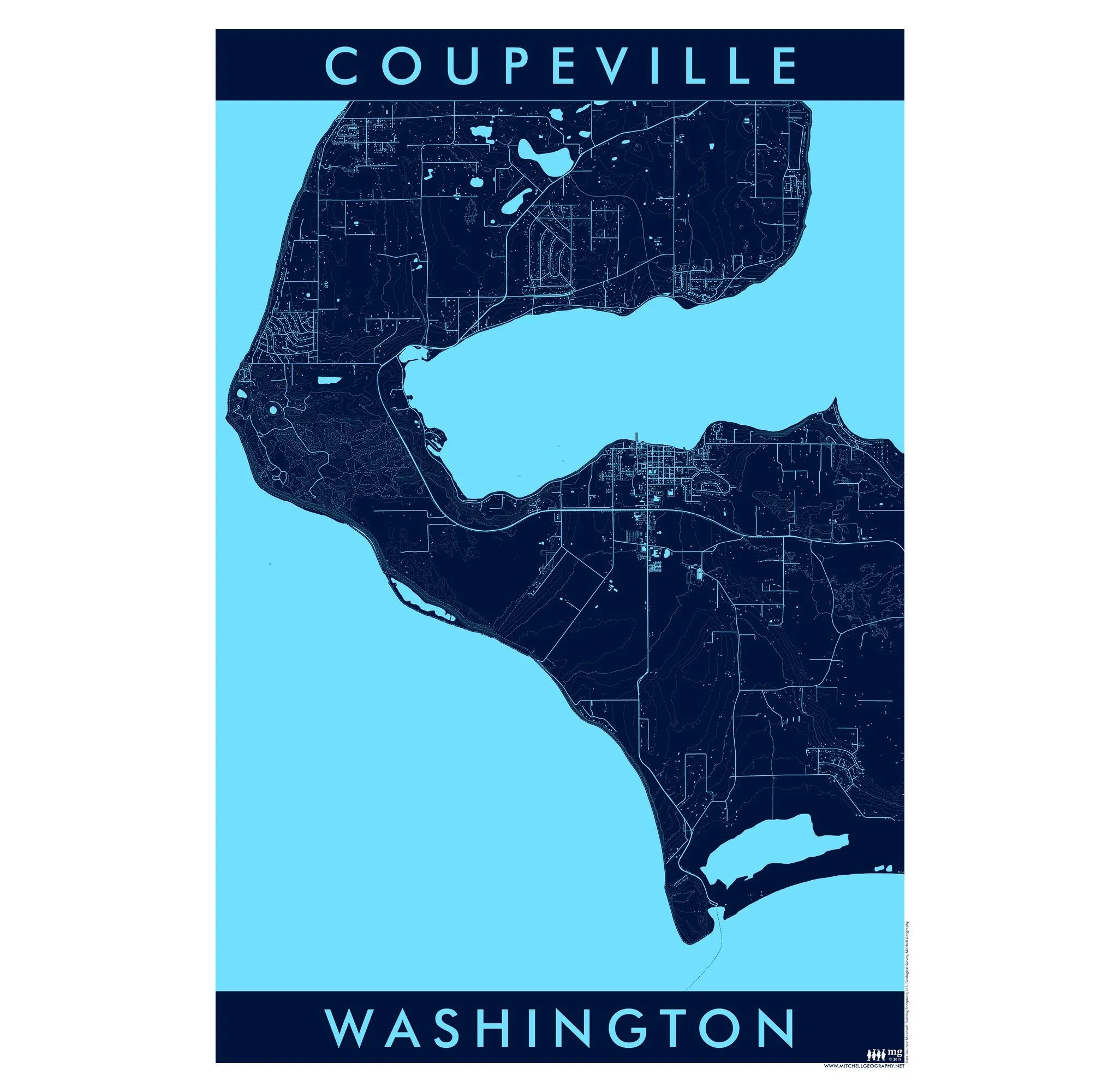
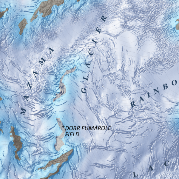 Image 5 of 5
1:23,000
20 inch by 24 inch flat wall map, printed on heavy fine paper; shipped rolled.
Mount Baker, Washington. Feature map of Mount Baker/Kulshan's massive glaciers and alpine landforms. Making use of a 3 foot resolution Lidar derived terrain model, this map displays in rich detail a recent snapshot in time of Baker's glacial extent, icefall, endless crevasses and bergschrunds. Ridges, moraines, and sub-peaks are also labeled for reference.

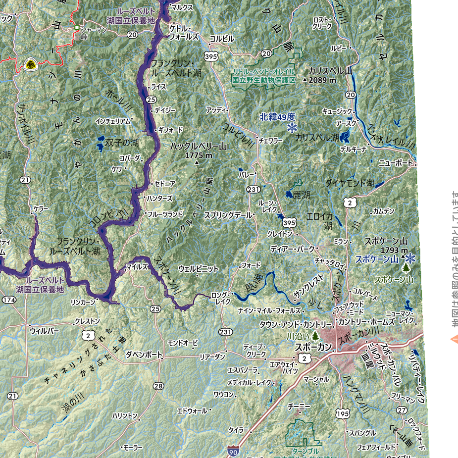
![Washington [Japanese language] (24 in x 20 in)](https://images.squarespace-cdn.com/content/v1/64dfe5c447627a1ab4b29d07/1694699282568-VV2KAVQ0SIU2BF6VIE2J/WA_JA_framed.JPG)