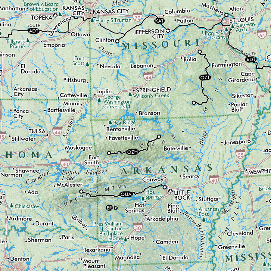
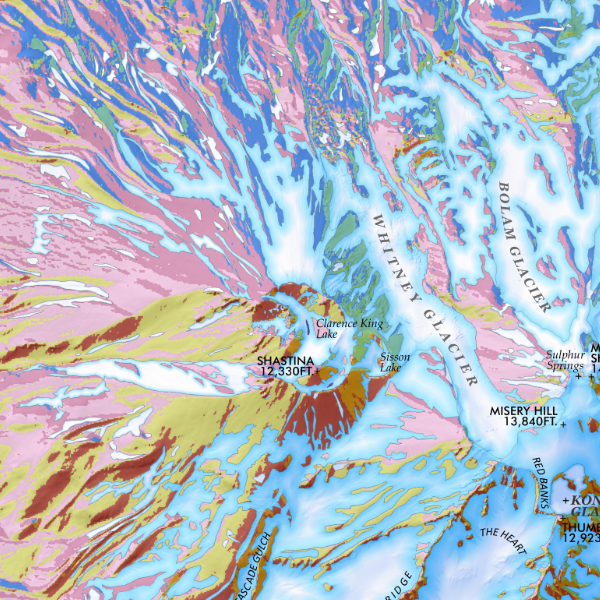
Image 1 of 3
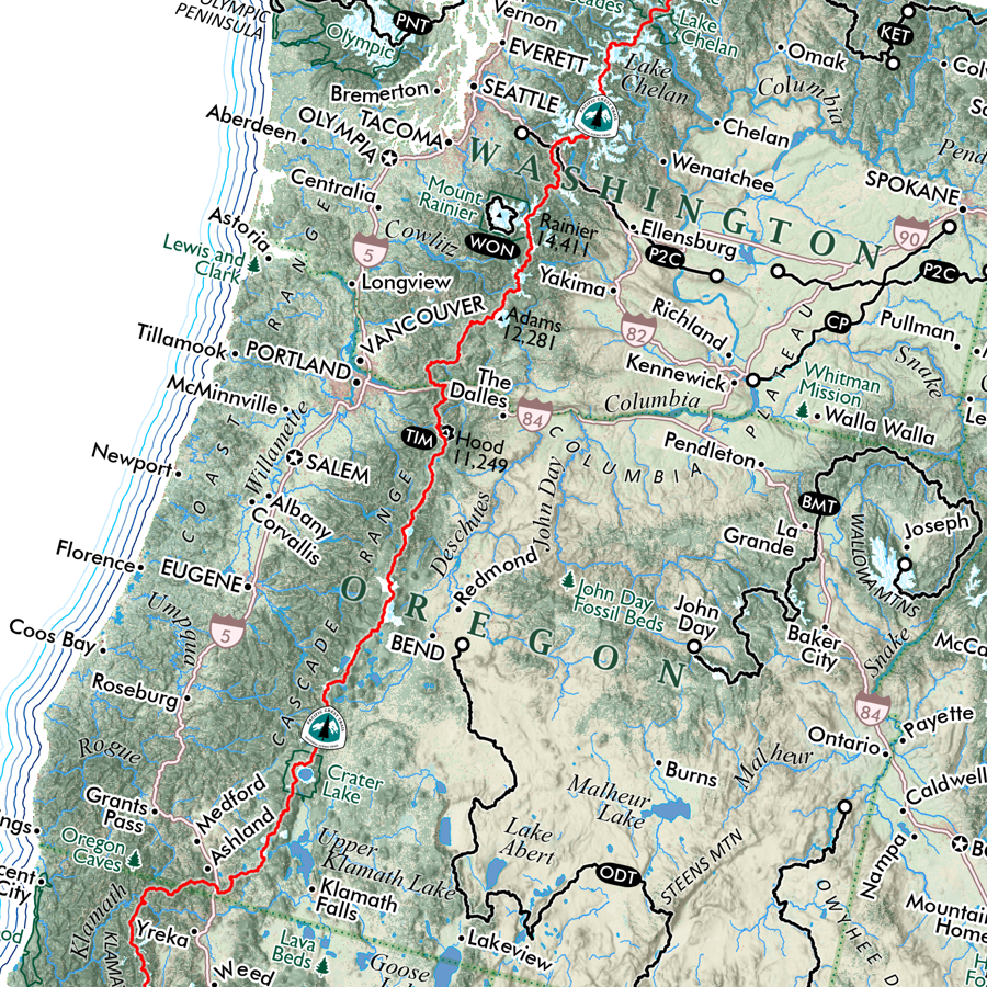
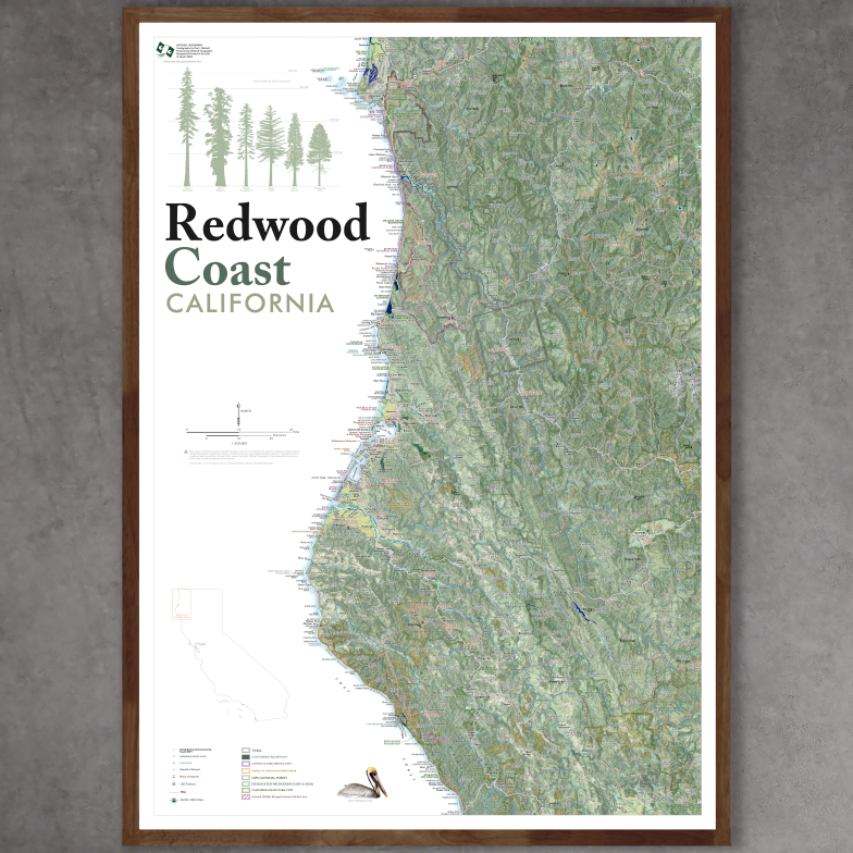
 Image 2 of 3
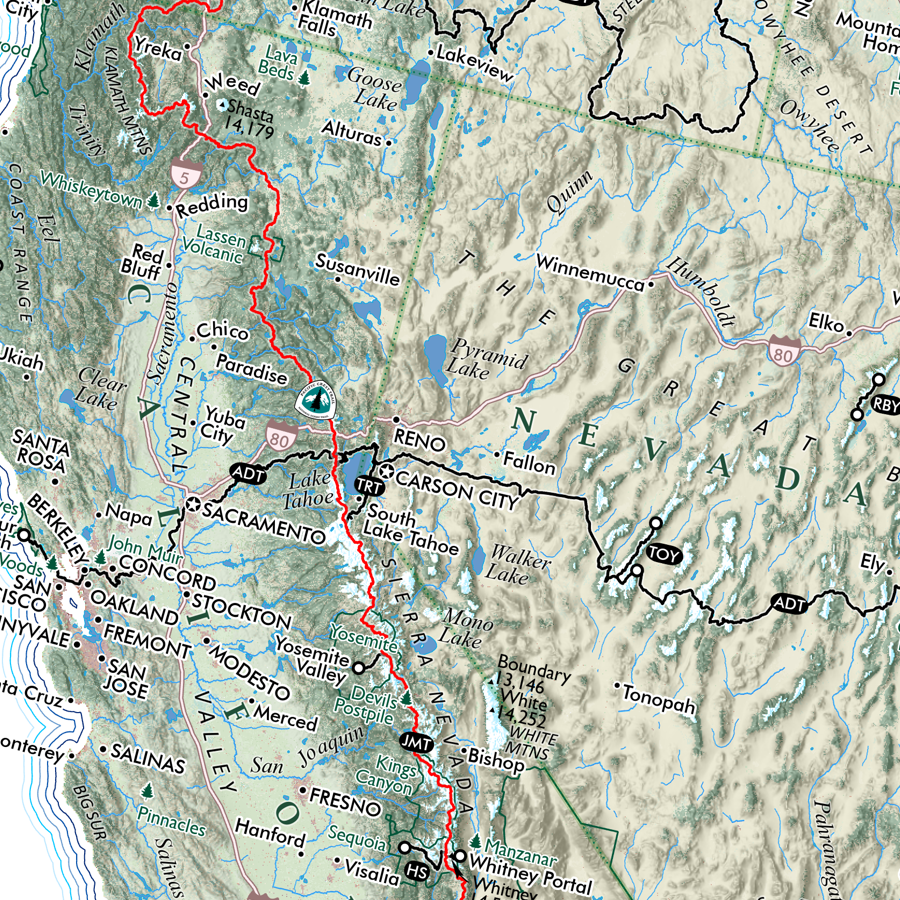
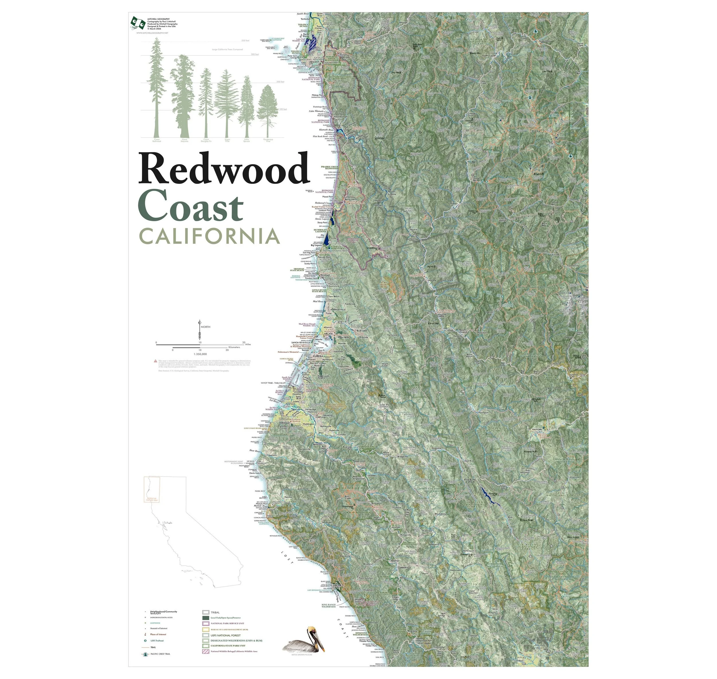
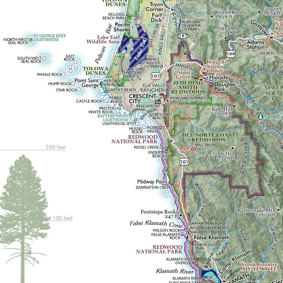
 Image 3 of 3
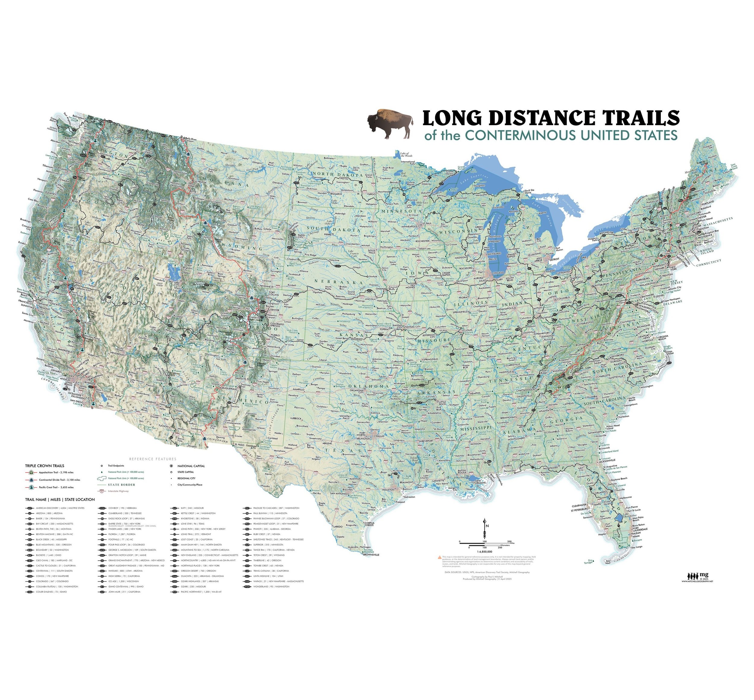
13 inch by 19 inch flat wall map, printed on heavy fine paper. Packed and shipped flat.
Oceans of the world. Elemental map of the five oceans, with labels and reference names in the lower left corner. This is primarily an art map, attractive for it’s shape and the exceptional rarity in print use of Goode’s Homosoline ocean world map projection. One may recognize the land version of Goode’s Homosoline projection in which the oceans are split while the pseudo equal area panels center upon the continental land masses. These projections were more popular 30 or 40 years ago before we trended toward square column based projections that seem to coincide with our increased screen time.