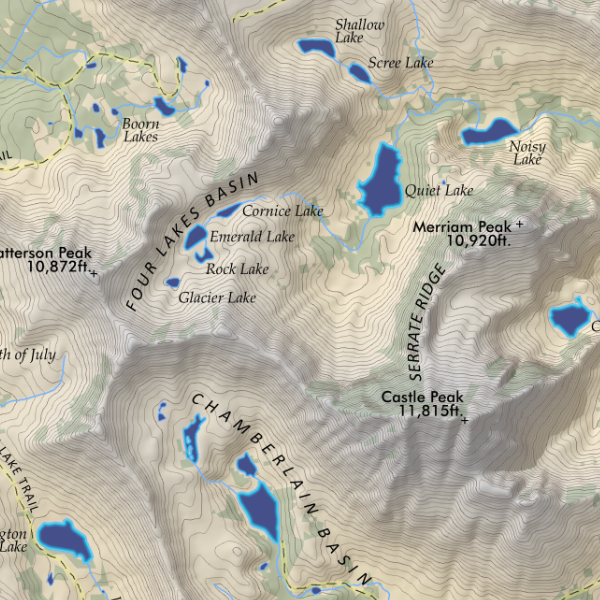
 Image 1 of 3
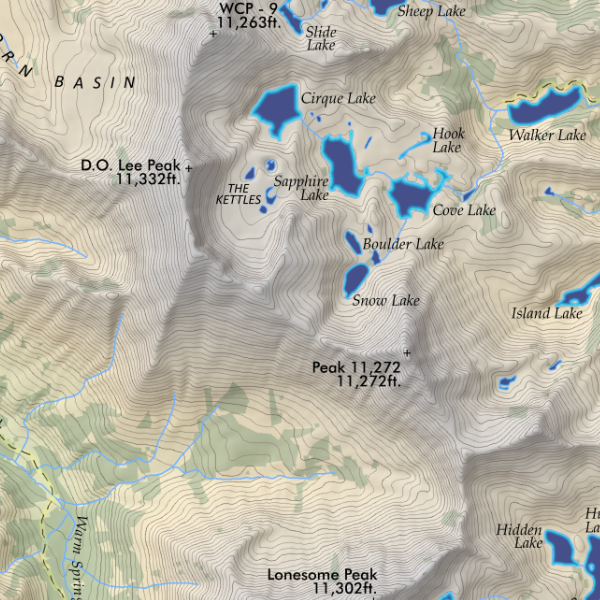
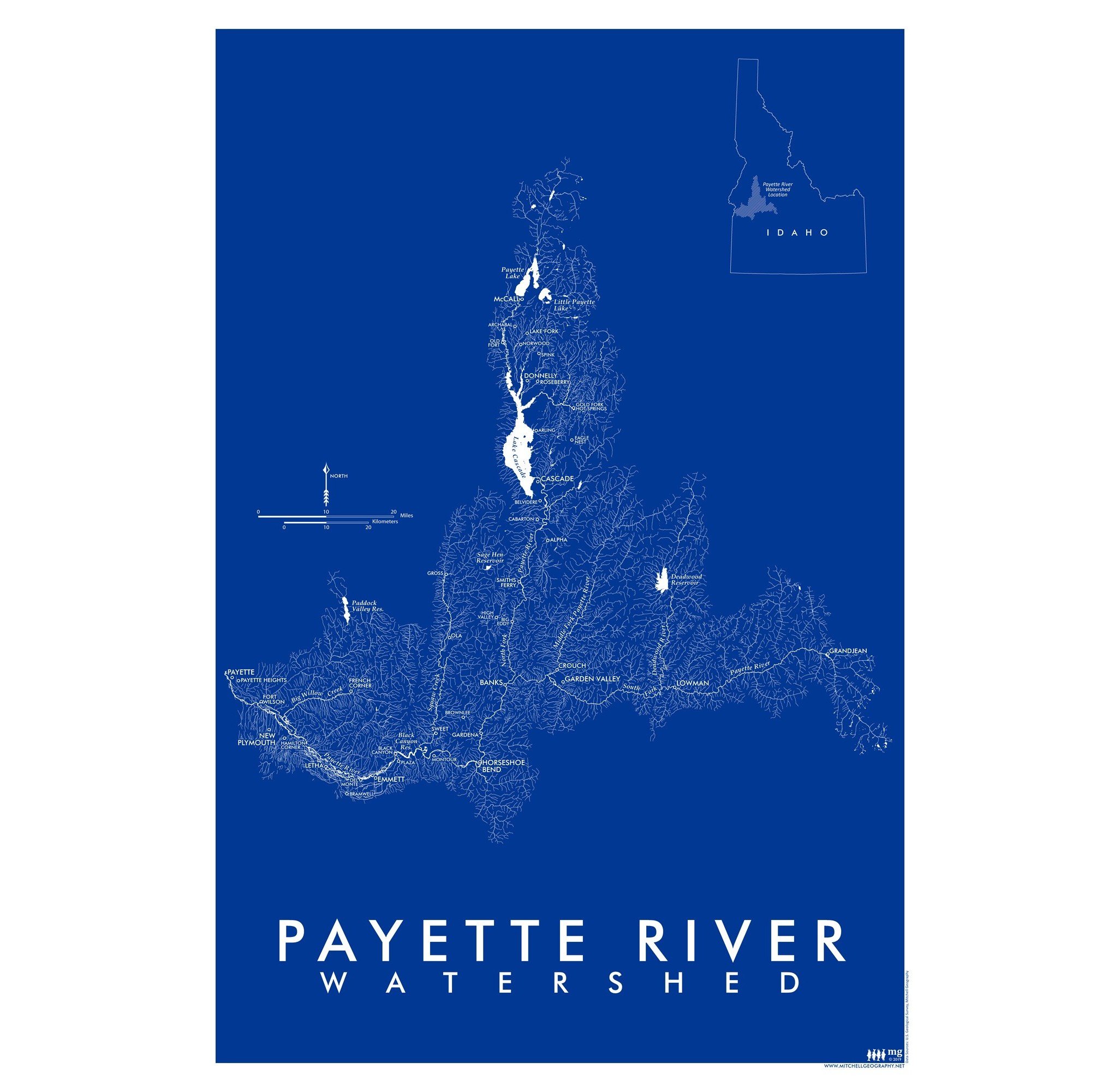 Image 2 of 3
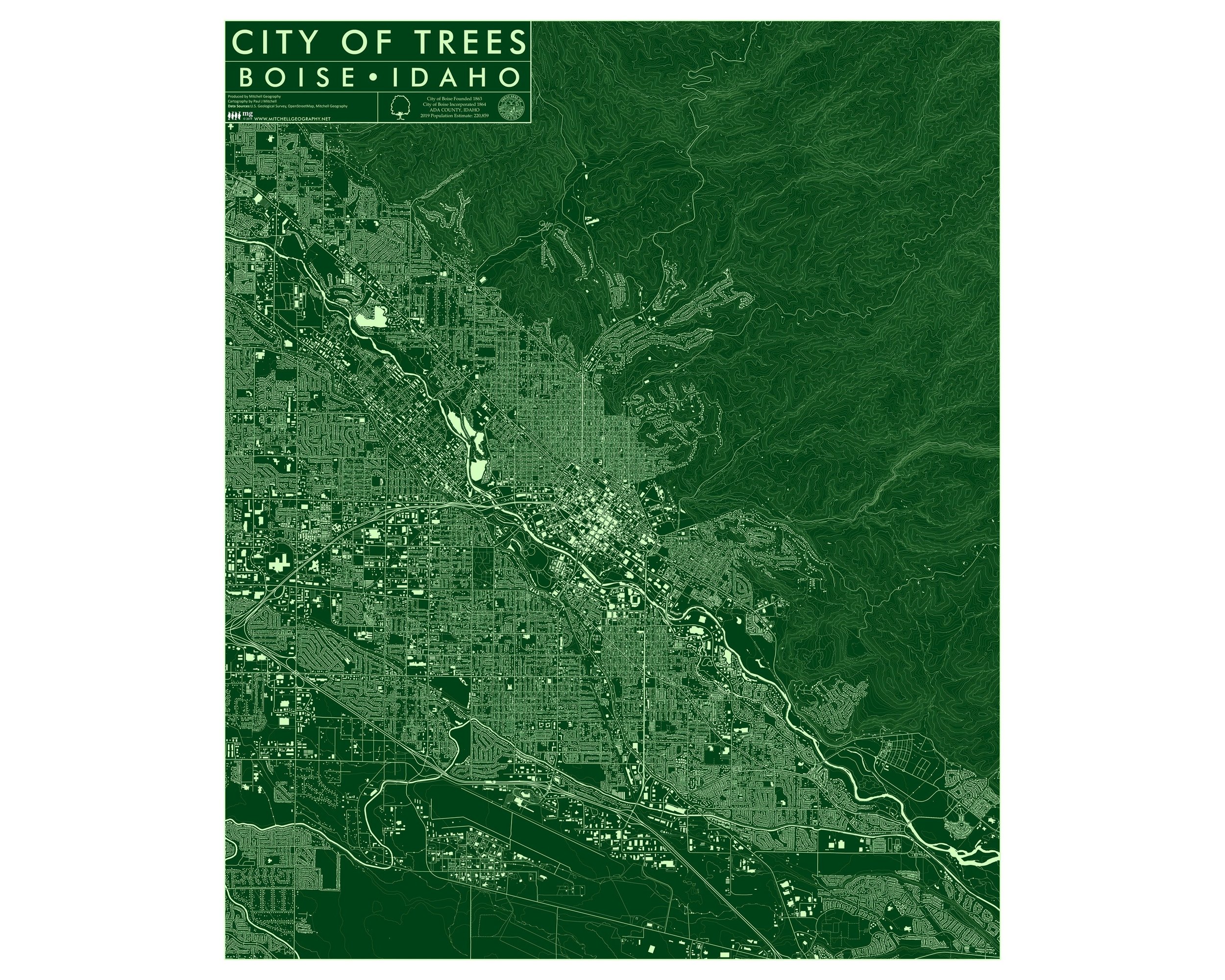
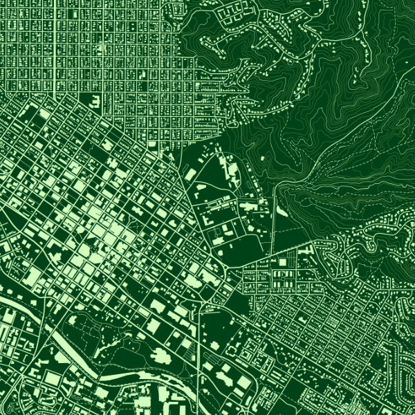
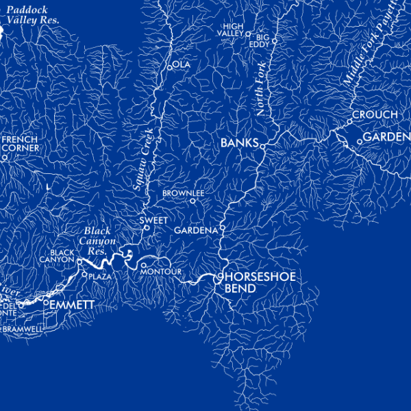 Image 3 of 3
13 inch by 19 inch flat wall map, printed on heavy fine paper. Shipped rolled or flat, order volume dependent.
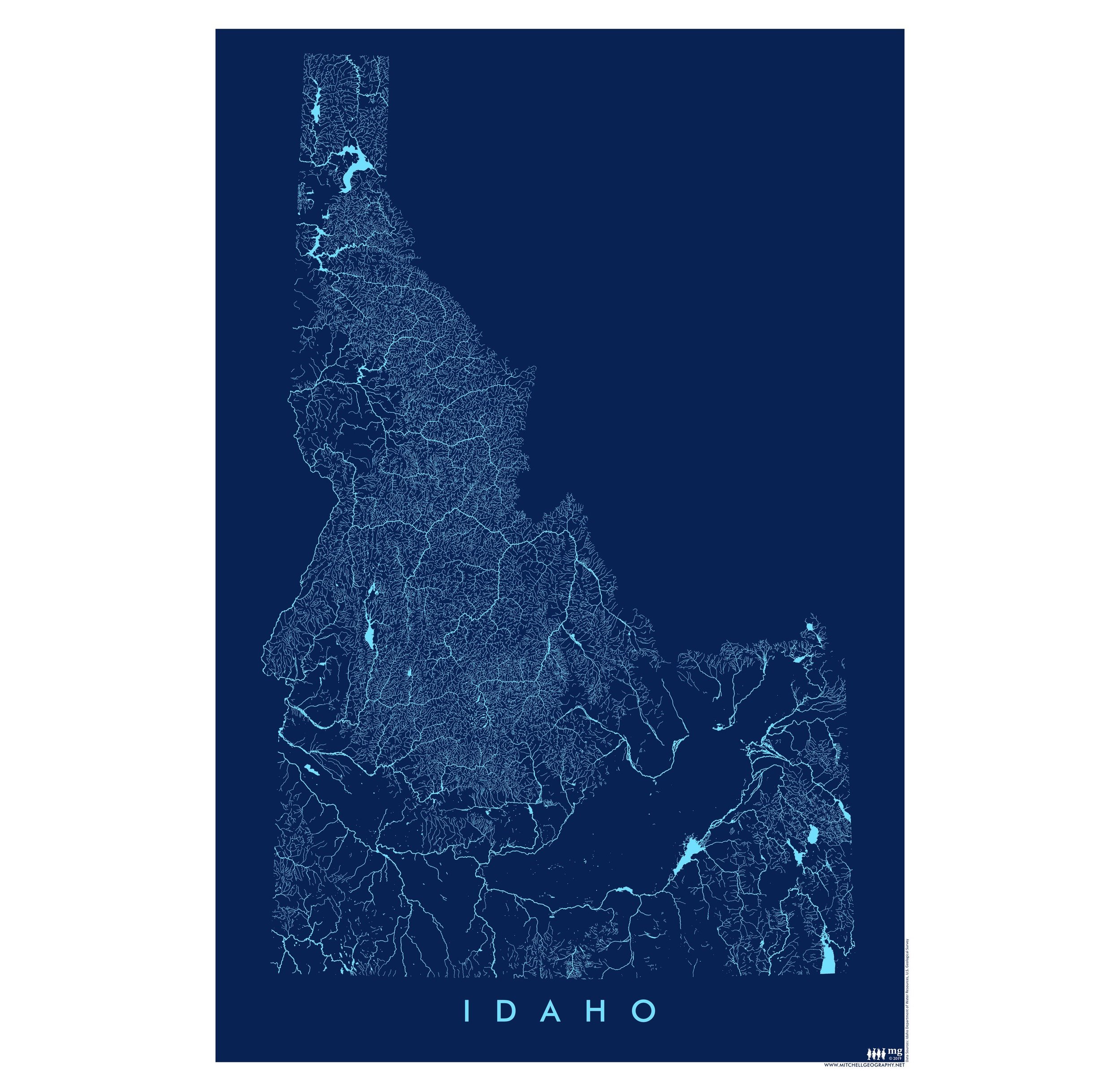
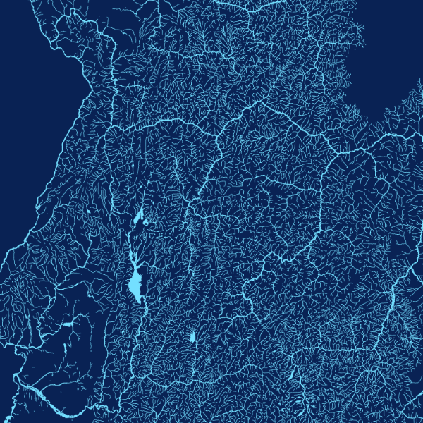
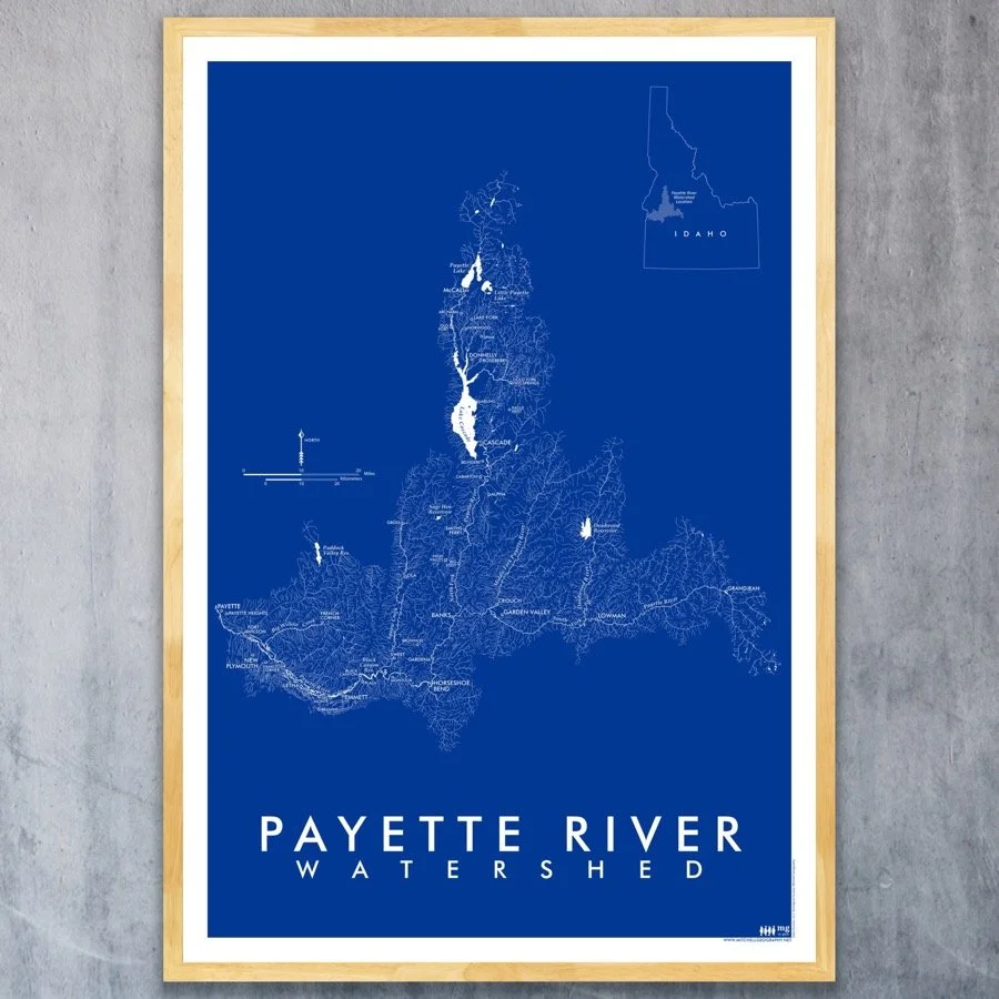
Payette River Watershed Idaho. Vintage inspited, blue monochrome of the Payette River watershed in Southwestern Idaho… featuring all rivers and tributaries with line weight assigned according to stream order. Place names are also included for reference.
13 inch by 19 inch flat wall map, printed on heavy fine paper. Shipped rolled or flat, order volume dependent.
Payette River Watershed Idaho. Vintage inspited, blue monochrome of the Payette River watershed in Southwestern Idaho… featuring all rivers and tributaries with line weight assigned according to stream order. Place names are also included for reference.