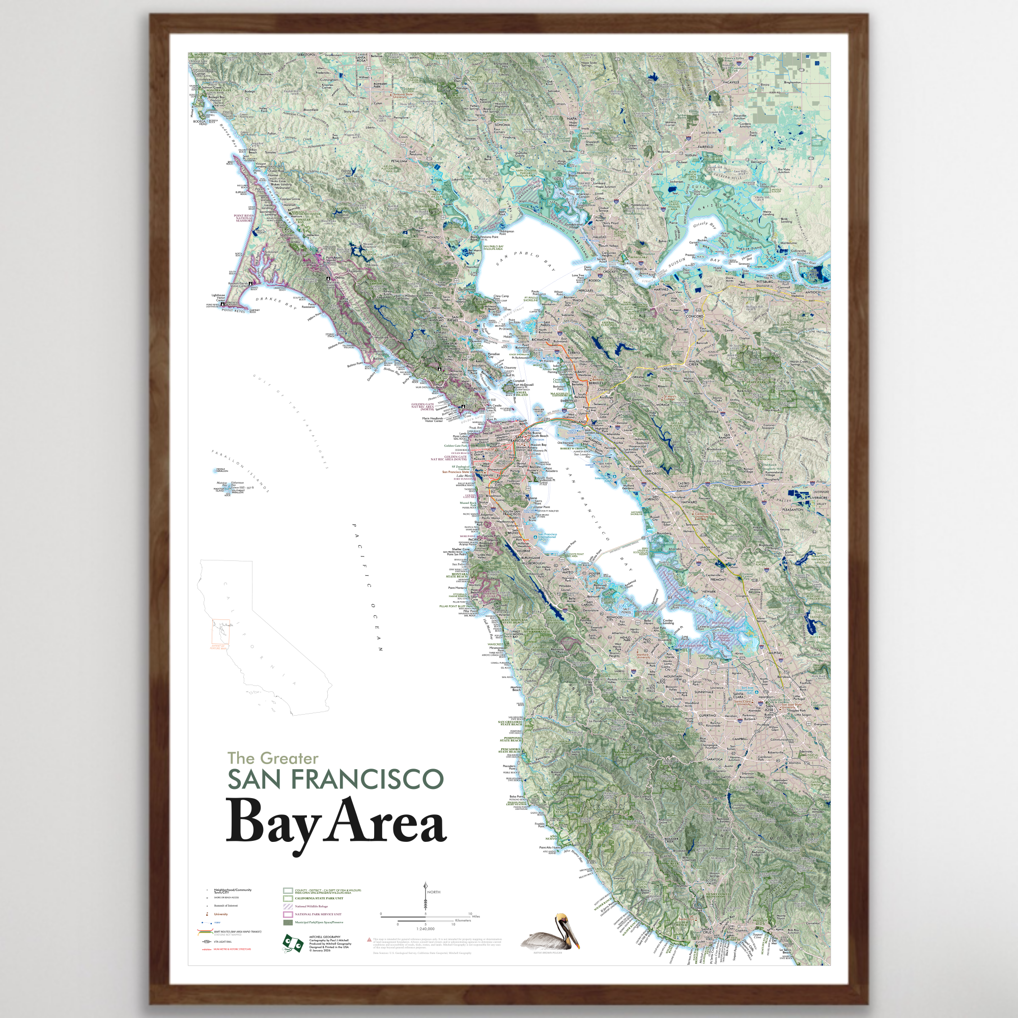
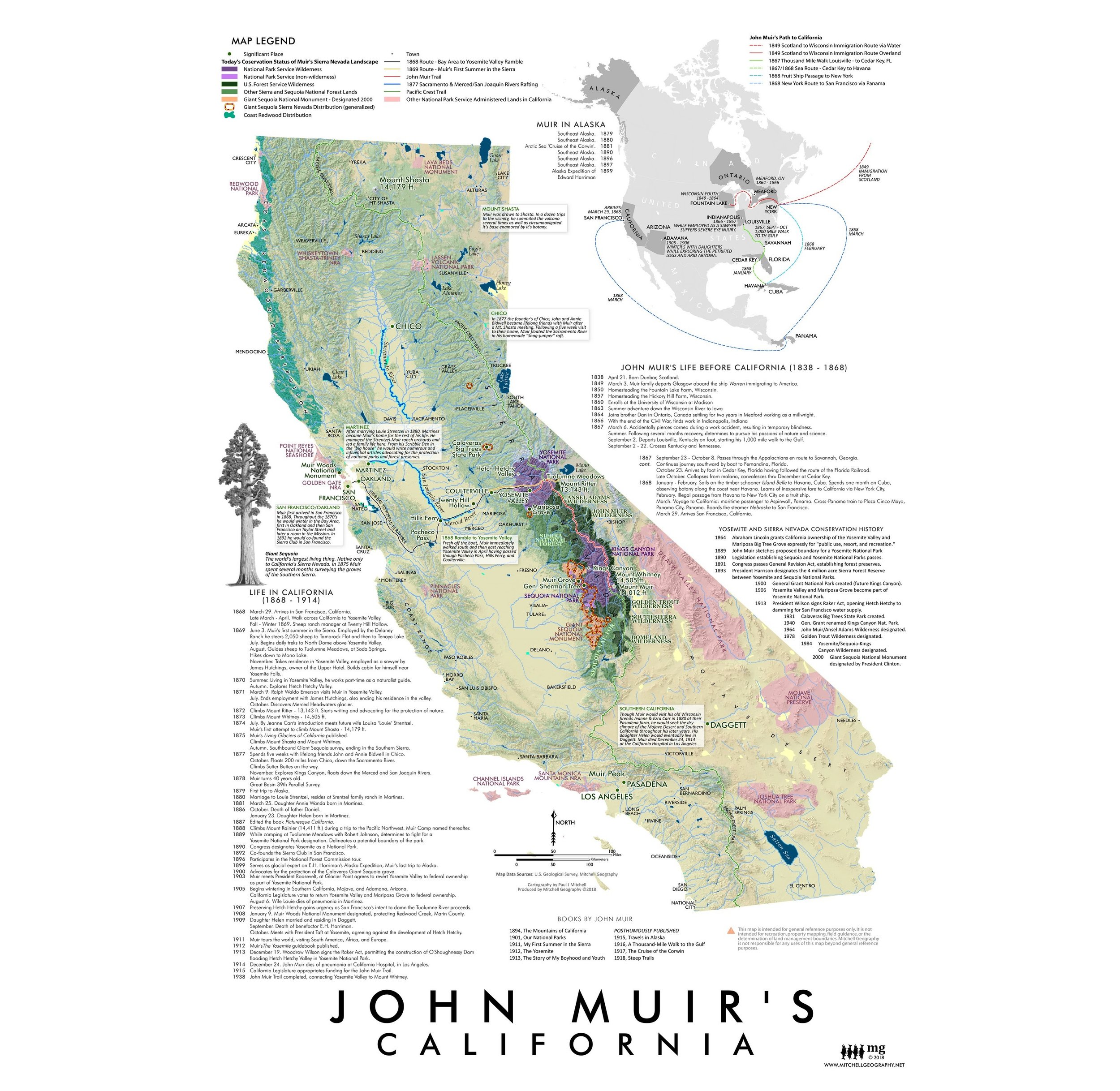
Image 1 of 4
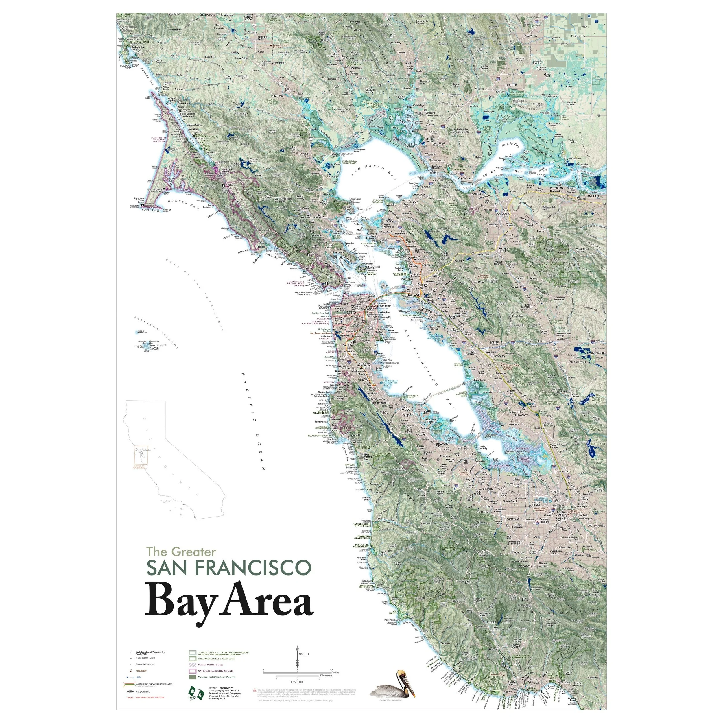
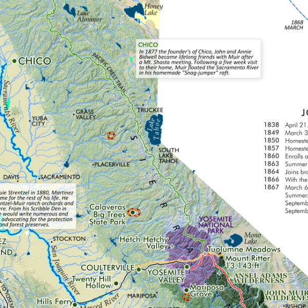
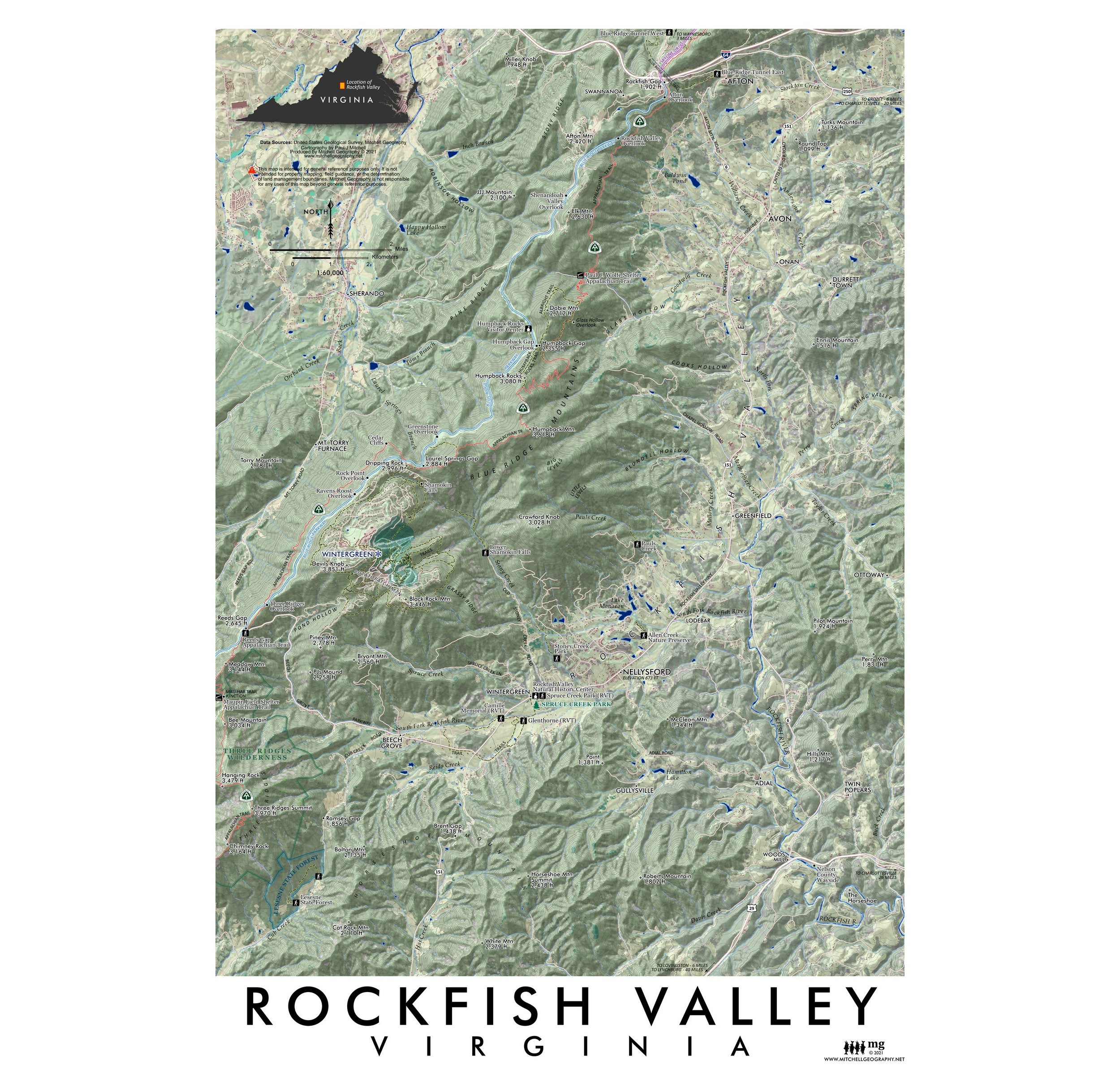 Image 2 of 4
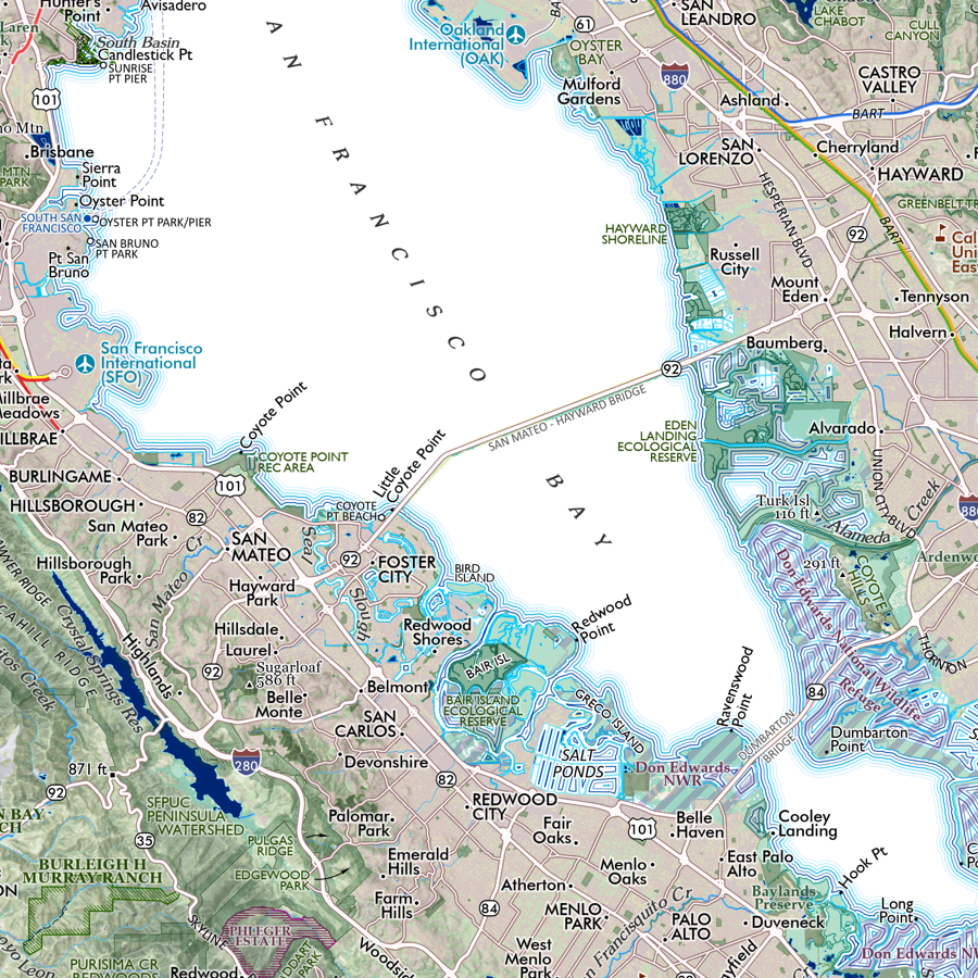
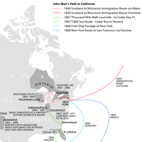
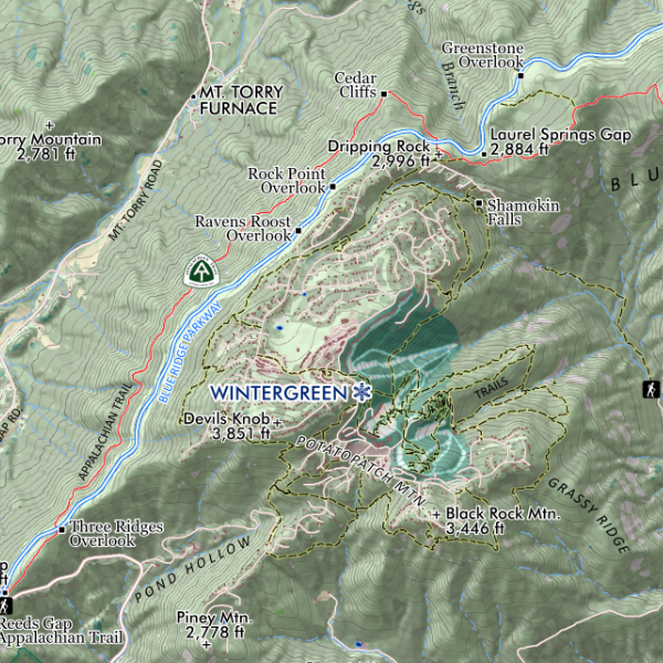 Image 3 of 4
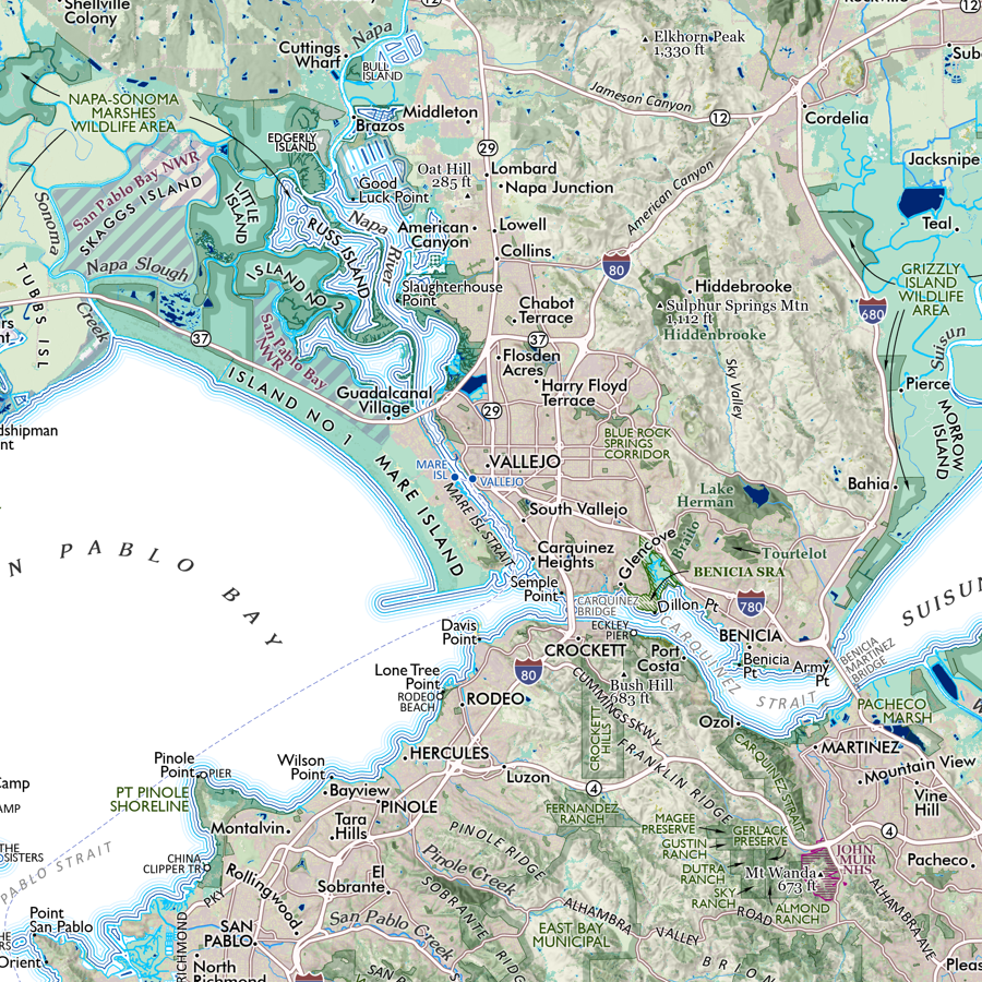
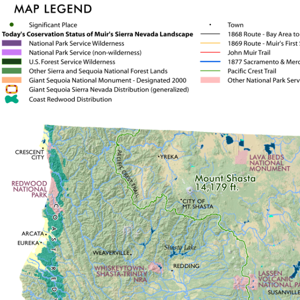
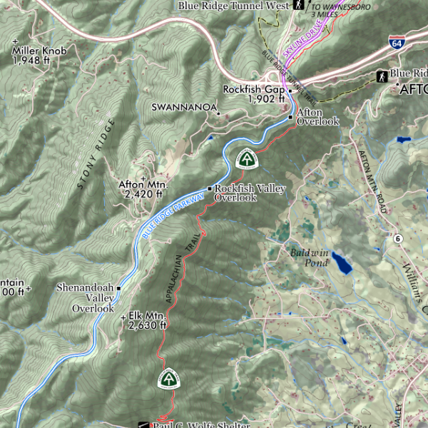 Image 4 of 4
1:60,000
13 inch by 19 inch flat wall map, printed on heavy fine paper. Packed and shipped flat.
Rockfish Valley, Virginia. Map extent goes from Rockfish Gap in the north to Three Ridges peak and Brent Gap in the south, covering Afton, Nellysford, Wintergreen and other communities in between. Features trails, the Blue Ridge Parkway, summits, gaps, parkway outlooks, and many other features of interest including the adjacent Lesesne State Forest south of and the recently Blue Ridge Tunnel rail-trail beneath Rockfish Gap.


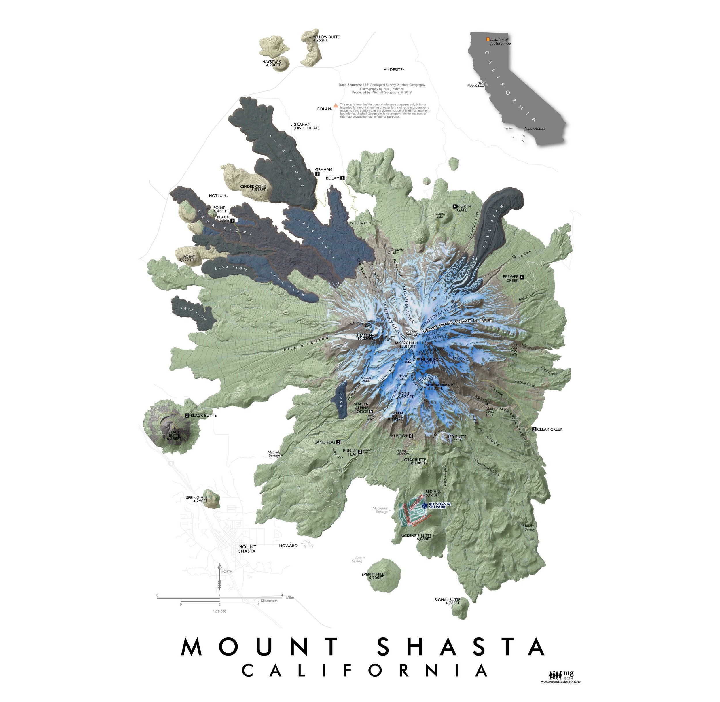
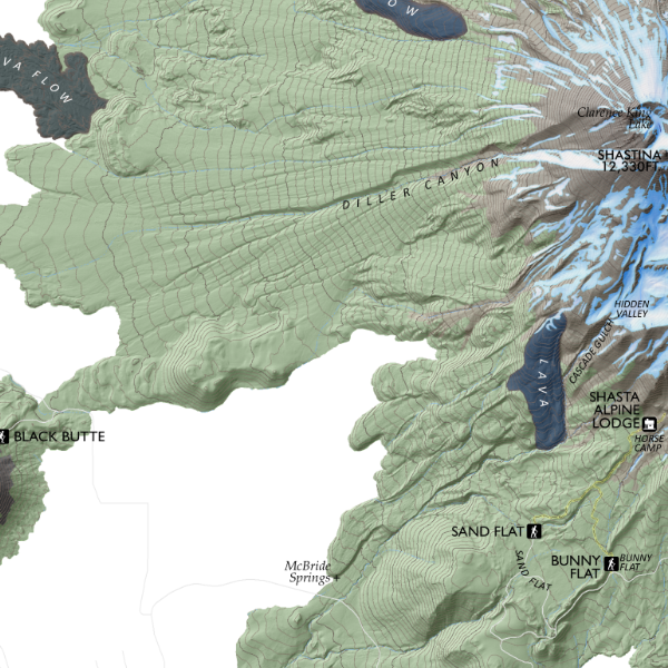
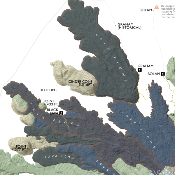
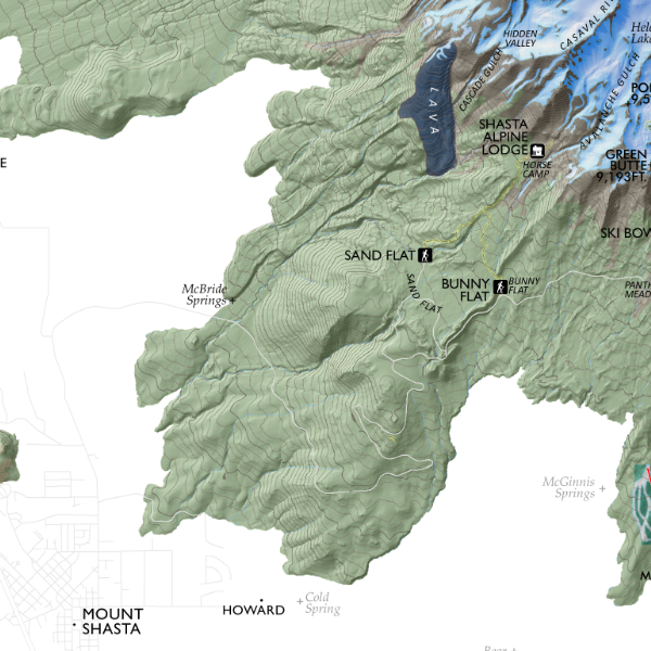
![Mount Shasta [California] (19 in x 13 in)](https://images.squarespace-cdn.com/content/v1/64dfe5c447627a1ab4b29d07/1695043610630-IP3HJXGI31ZW28EVU10V/Shasta1319_framed.JPG)