PRODUCT IS A DIGITAL DOWNLOAD ONLY. Map is designed to be printed at 36 inches in width and 52 inches in height.
File Format: Adobe Acrobat PDF only.
You are responsible for printing set-up and associated printing costs. Download is licensed for personal use only, not licensed for commercial reproduction and re-selling.
1:42,000 - 36 inch x 52 inch - Made in 2017
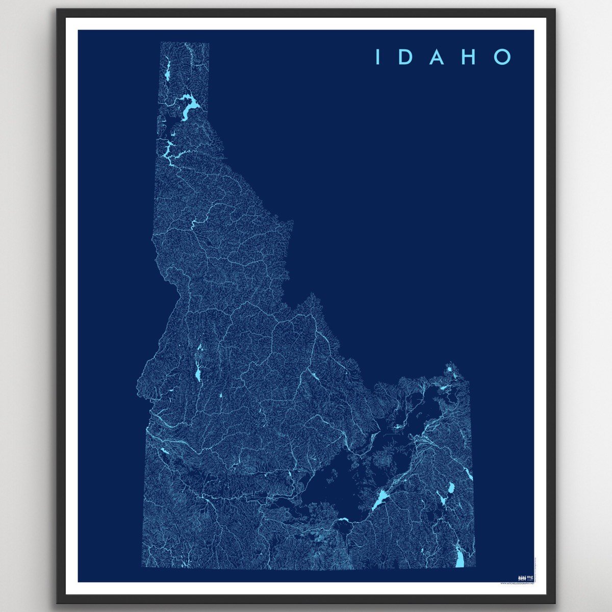
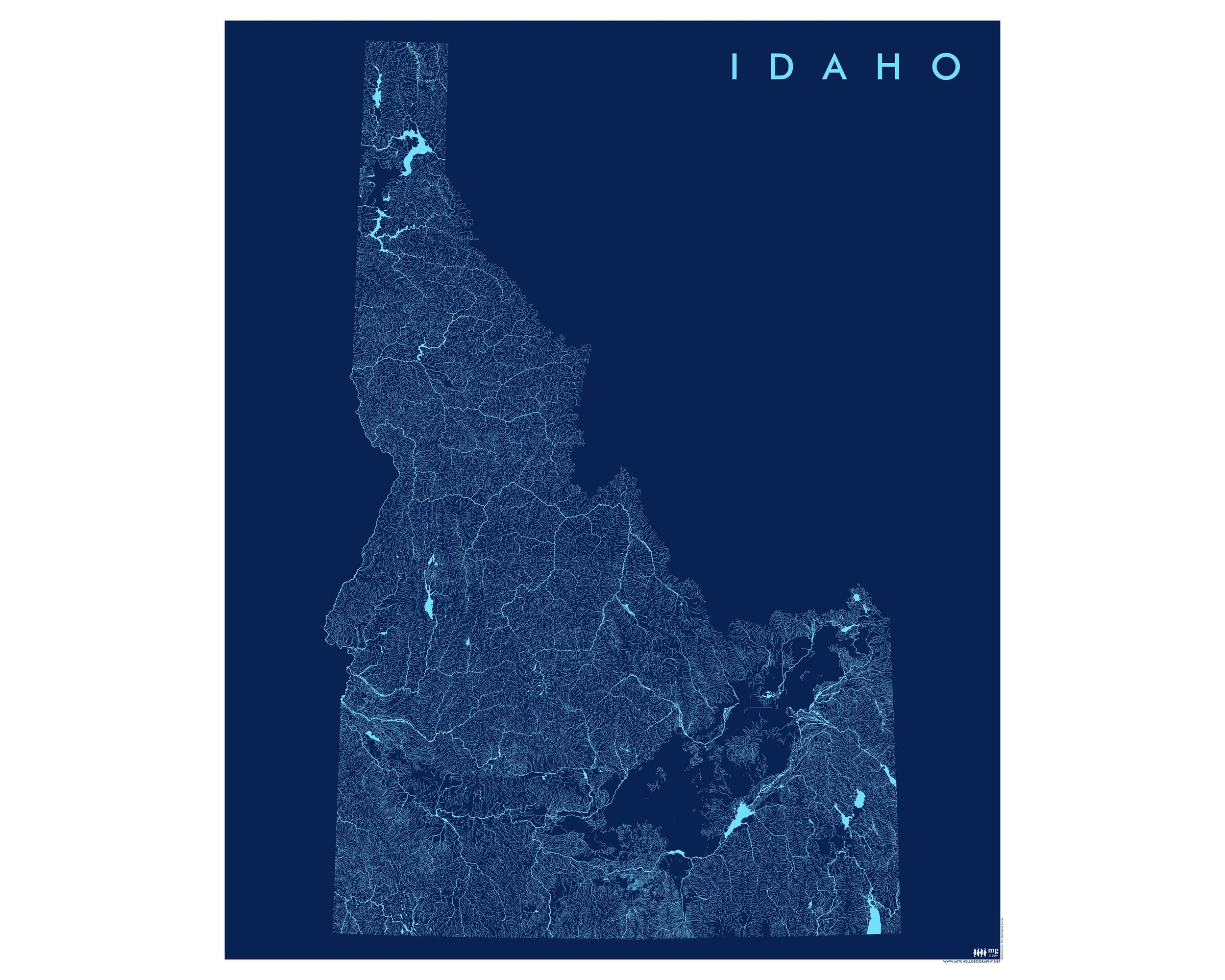
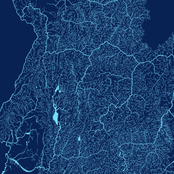
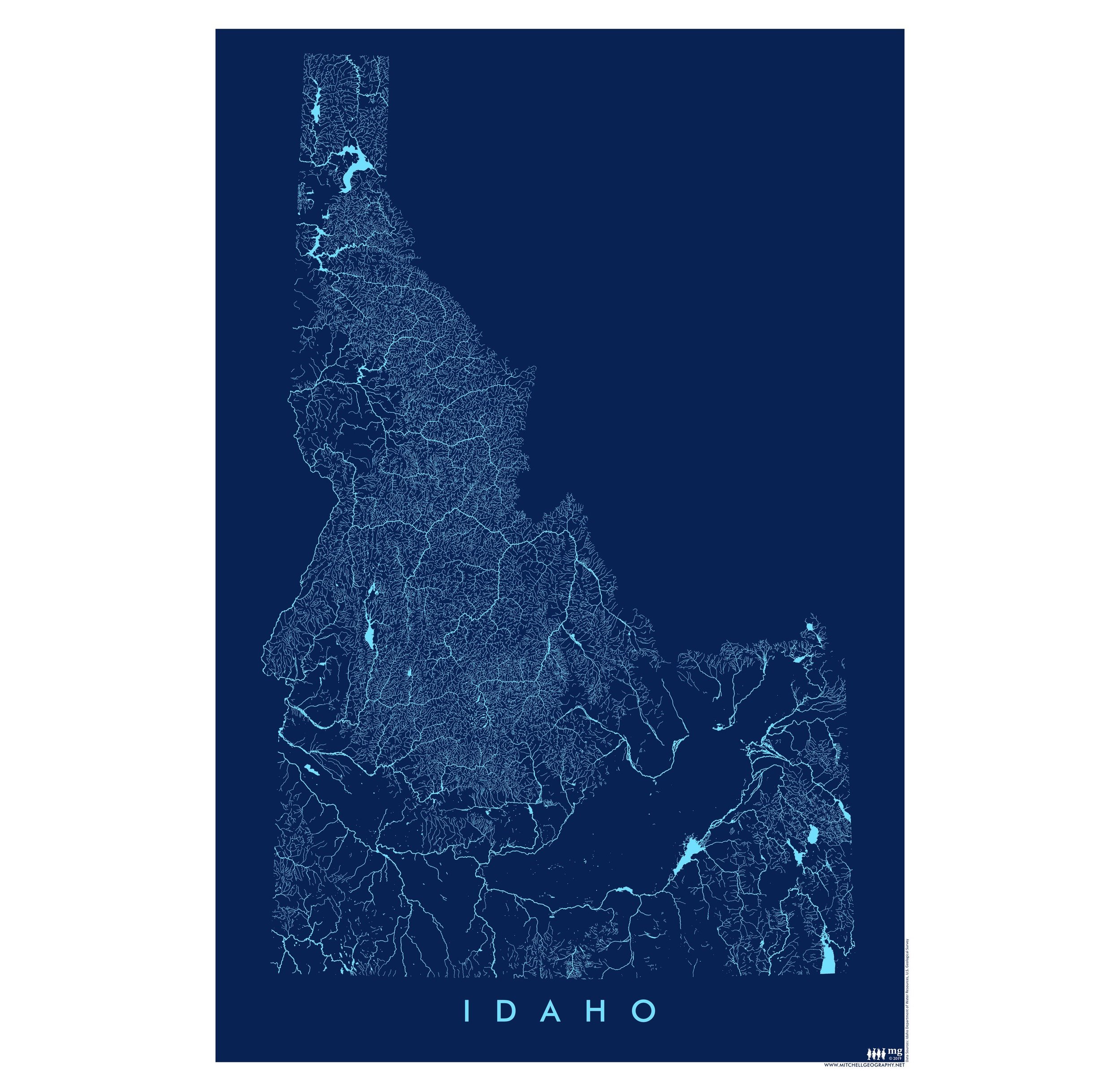
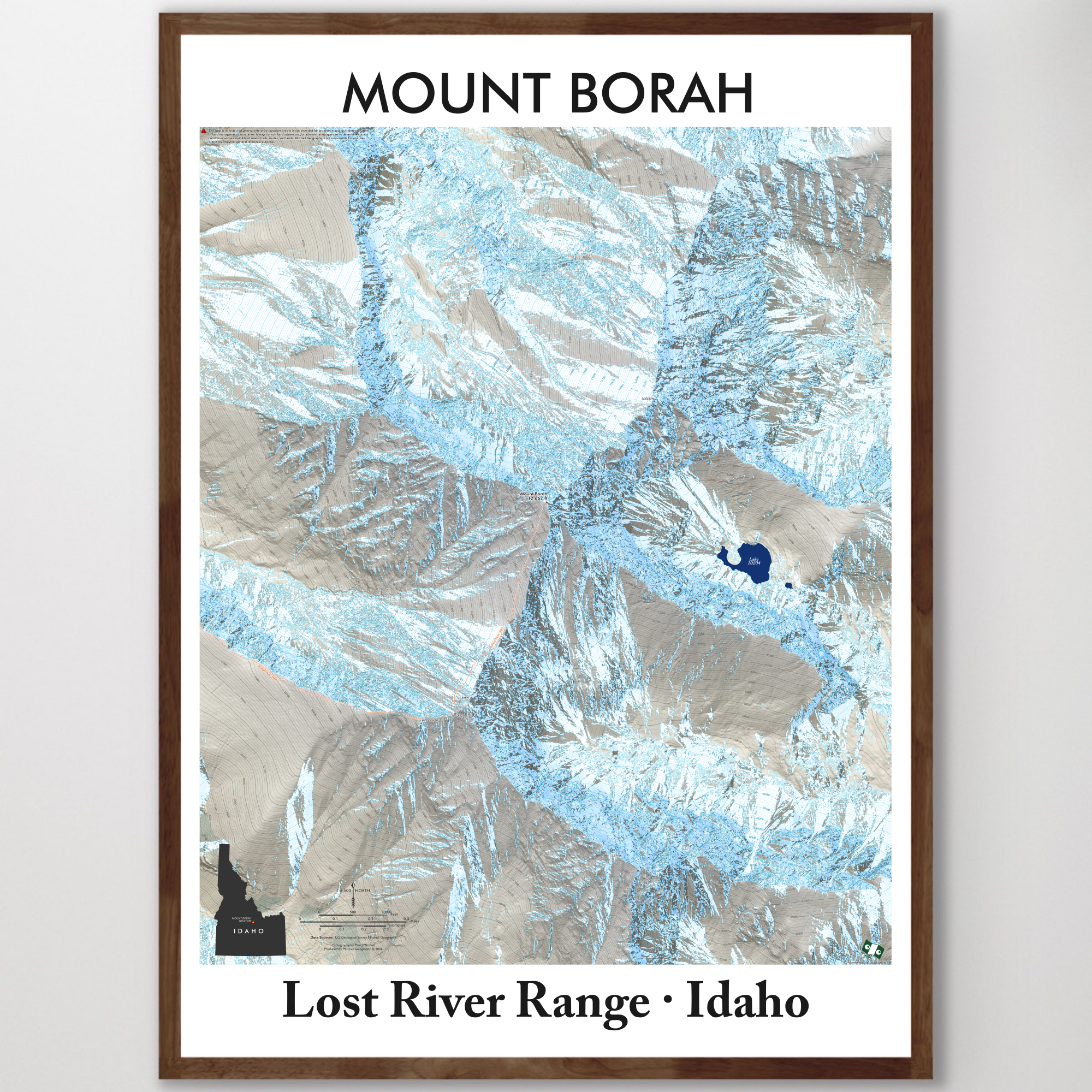
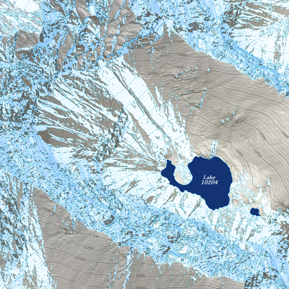
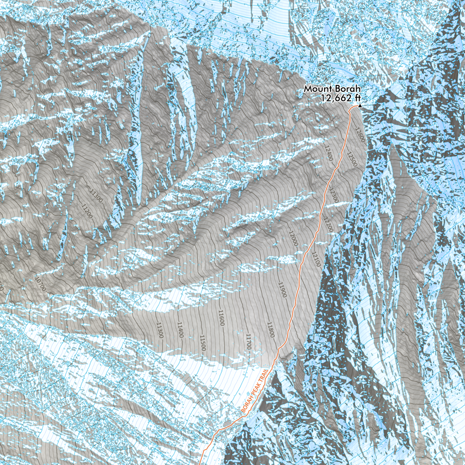
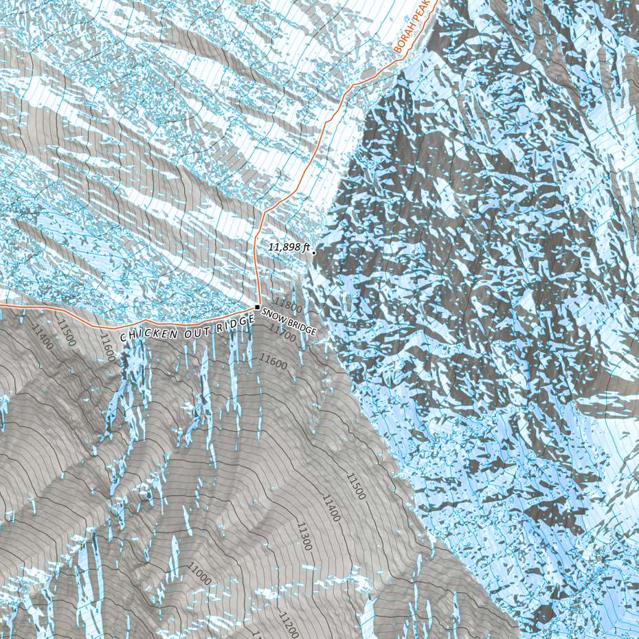
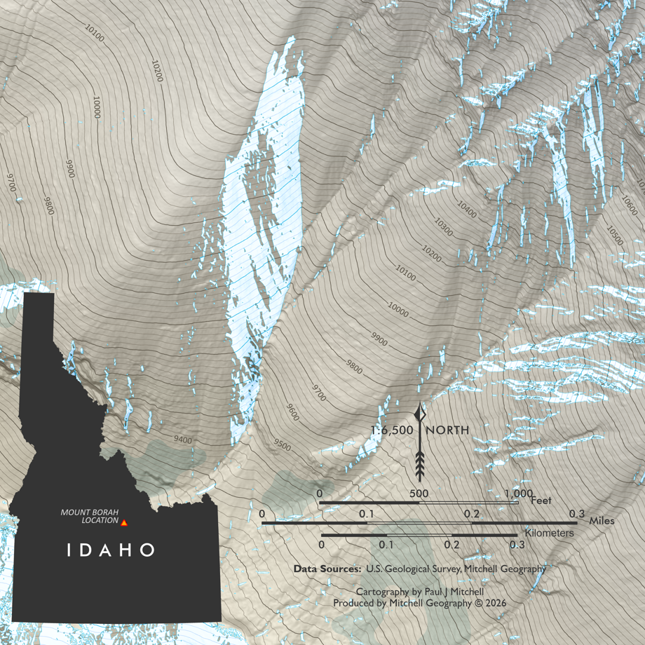
Sawtooth Wilderness, Idaho. My most detailed large format map of the Sawtooth Mountains in Central Idaho. The digital download may be used to print a large format wall map of Idaho’s renowned Sawtooth Mountains, with an extent that includes the entire Federally designated US Forest Service administered Wilderness Area. Featuring official trails, USFS trailheads, campgrounds, adjacent lodges, familiar non-commercial hot springs, seasonal lodging, i.e. backcountry hut/yurts (i.e. SVT and SMG), lake spot elevations in every upper basin, summit, spire, landform place names, and a vast majority of the provincial alpine names. USFS spot elevations are also included across the map extent.
A smaller hard copy map is also available.
PRODUCT IS A DIGITAL DOWNLOAD ONLY. Map is designed to be printed at 36 inches in width and 52 inches in height.
File Format: Adobe Acrobat PDF only.
You are responsible for printing set-up and associated printing costs. Download is licensed for personal use only, not licensed for commercial reproduction and re-selling.
1:42,000 - 36 inch x 52 inch - Made in 2017
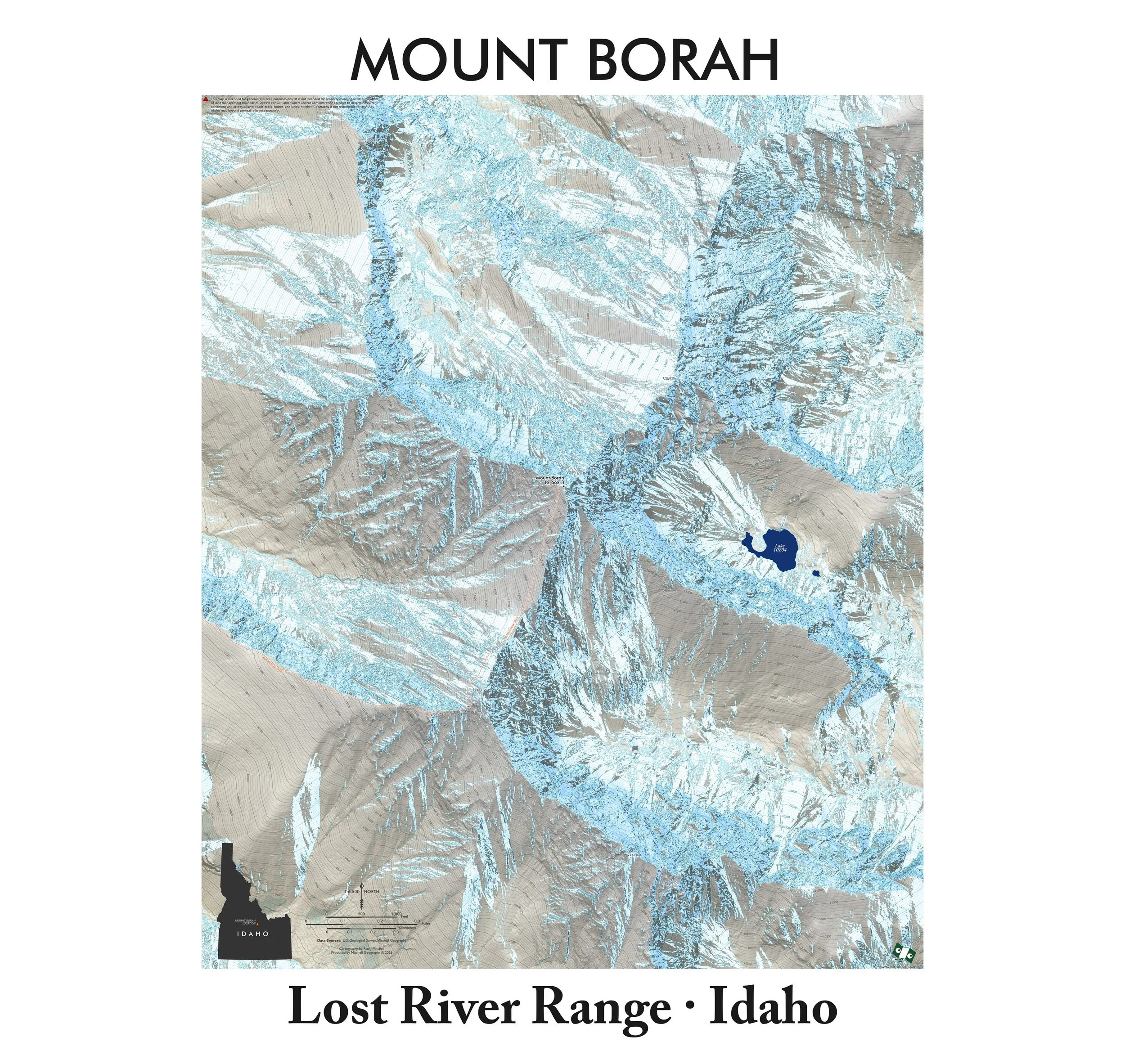
Sawtooth Wilderness, Idaho. My most detailed large format map of the Sawtooth Mountains in Central Idaho. The digital download may be used to print a large format wall map of Idaho’s renowned Sawtooth Mountains, with an extent that includes the entire Federally designated US Forest Service administered Wilderness Area. Featuring official trails, USFS trailheads, campgrounds, adjacent lodges, familiar non-commercial hot springs, seasonal lodging, i.e. backcountry hut/yurts (i.e. SVT and SMG), lake spot elevations in every upper basin, summit, spire, landform place names, and a vast majority of the provincial alpine names. USFS spot elevations are also included across the map extent.
A smaller hard copy map is also available.

 Image 1 of 7
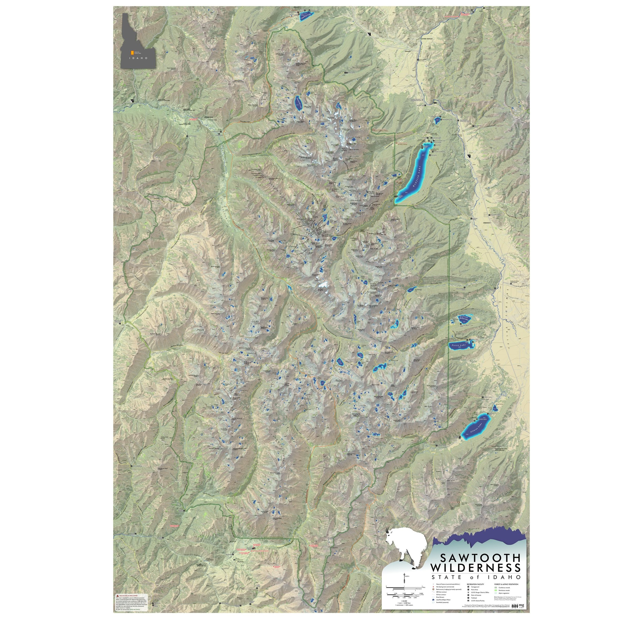 Image 2 of 7
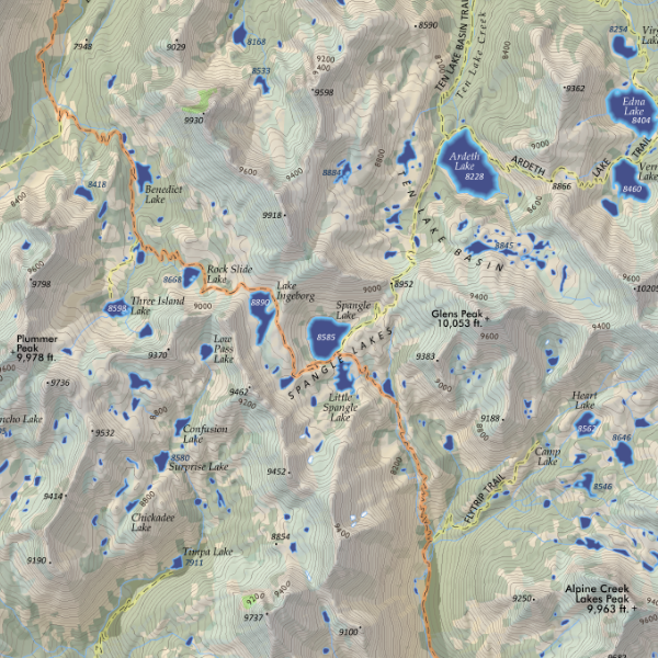 Image 3 of 7
 Image 4 of 7
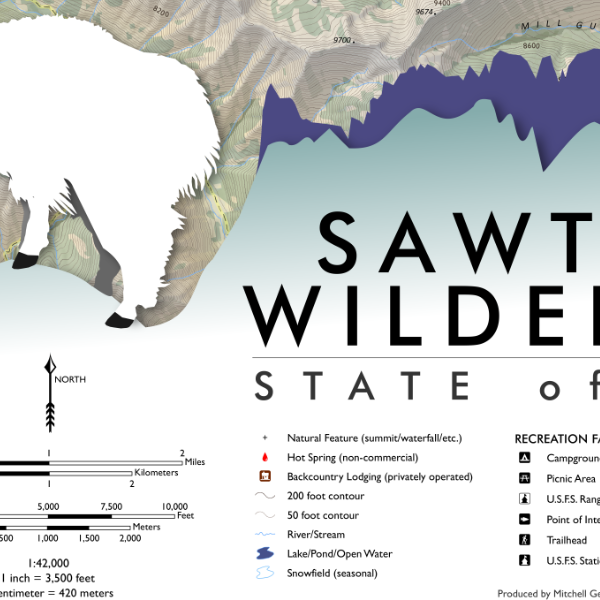 Image 5 of 7
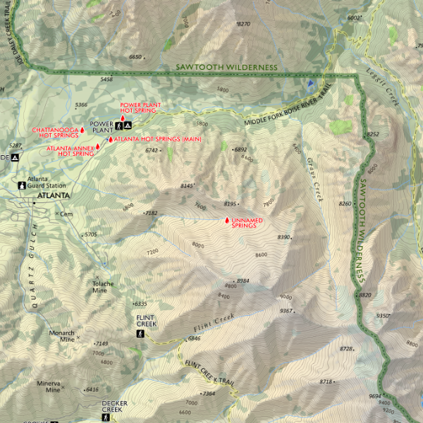 Image 6 of 7
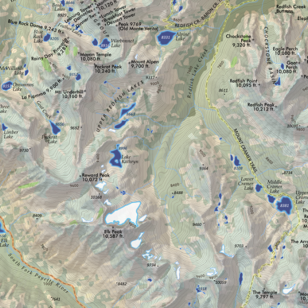 Image 7 of 7