1:2,000,000
24 inch x 20 inch — flat wall map, printed on a heavy fine paper — shipped rolled.
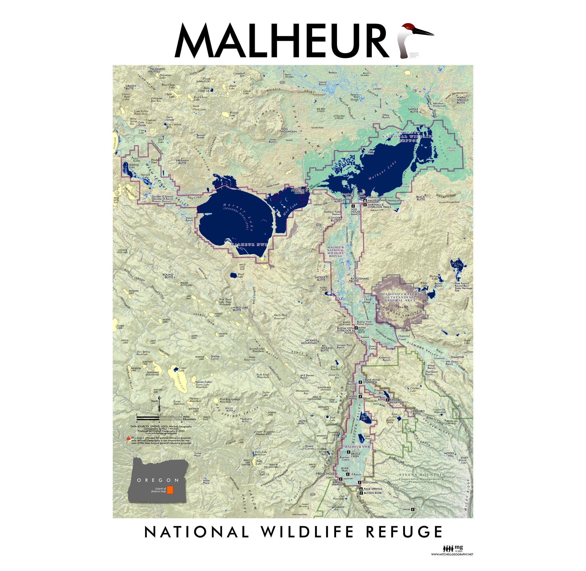
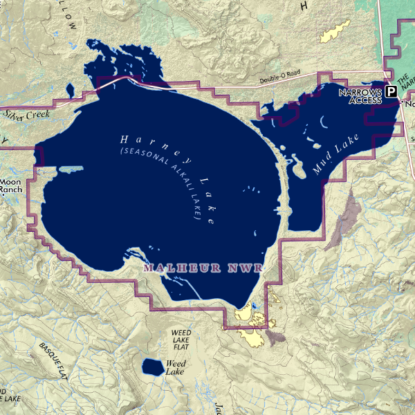
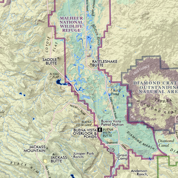
Pacific Northwest region map. A regional representation of the Pacific Northwest states with an emphasis upon land cover, land use and terrains — this is a “general purpose reference map” in which broad landscapes and land uses may be interpreted. National parks, reservations, long distance wilderness trails (i.e. PCT, CDT, PNWT, ICT), major Columbia Basin/BPA dams, most alpine ski areas, cities & places, prominent summits, landforms, highways, and hydropgraphy are labeled for reference. This is more an administrative Pacific Northwest map in scope covering the entire US area of the Columbia River watershed and a vast northwestern extent from the Bridger Range and the Greater Yellowstone area in the east to the West Coast, and a southern edge that captures Shasta and the most northern stretch for the Wasatch and then up to Canada in the North. Washington, Oregon, Idaho are entirely included along with western Montana, a sliver of western Wyoming, and the northern sections of California, Nevada, and Utah. National parks, reservations, long distance wilderness trails (i.e. PCT, CDT, PNWT, ICT), places, prominent summits, landforms, highways, and hydrography are labeled for reference.
1:2,000,000
24 inch x 20 inch — flat wall map, printed on a heavy fine paper — shipped rolled.
Pacific Northwest region map. A regional representation of the Pacific Northwest states with an emphasis upon land cover, land use and terrains — this is a “general purpose reference map” in which broad landscapes and land uses may be interpreted. National parks, reservations, long distance wilderness trails (i.e. PCT, CDT, PNWT, ICT), major Columbia Basin/BPA dams, most alpine ski areas, cities & places, prominent summits, landforms, highways, and hydropgraphy are labeled for reference. This is more an administrative Pacific Northwest map in scope covering the entire US area of the Columbia River watershed and a vast northwestern extent from the Bridger Range and the Greater Yellowstone area in the east to the West Coast, and a southern edge that captures Shasta and the most northern stretch for the Wasatch and then up to Canada in the North. Washington, Oregon, Idaho are entirely included along with western Montana, a sliver of western Wyoming, and the northern sections of California, Nevada, and Utah. National parks, reservations, long distance wilderness trails (i.e. PCT, CDT, PNWT, ICT), places, prominent summits, landforms, highways, and hydrography are labeled for reference.

 Image 1 of 12
 Image 2 of 12
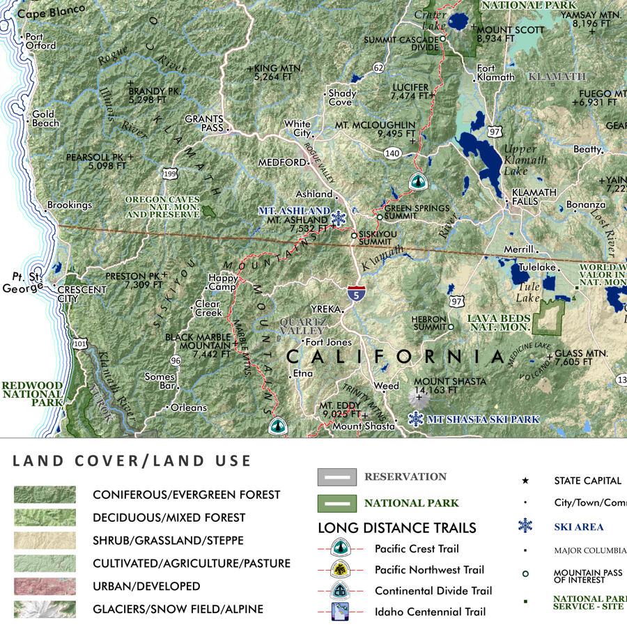 Image 3 of 12
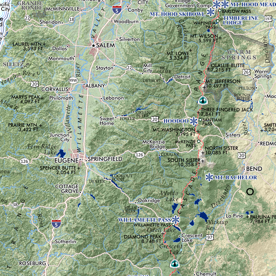 Image 4 of 12
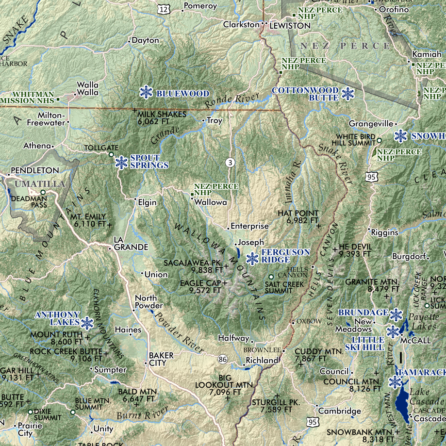 Image 5 of 12
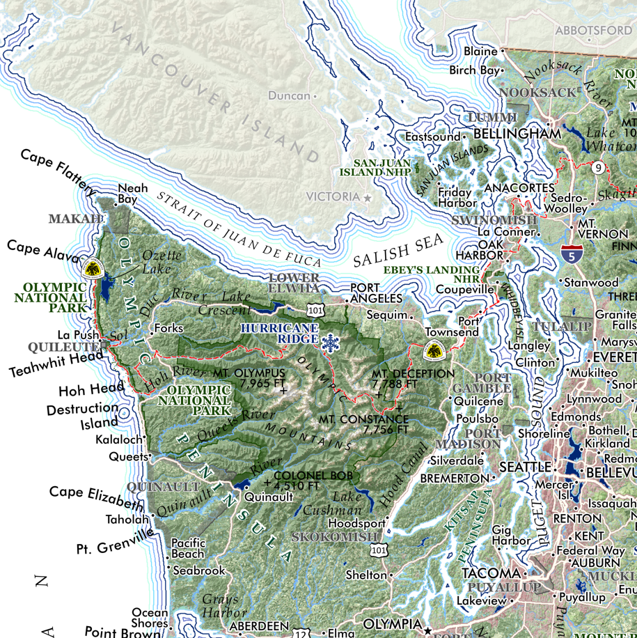 Image 6 of 12
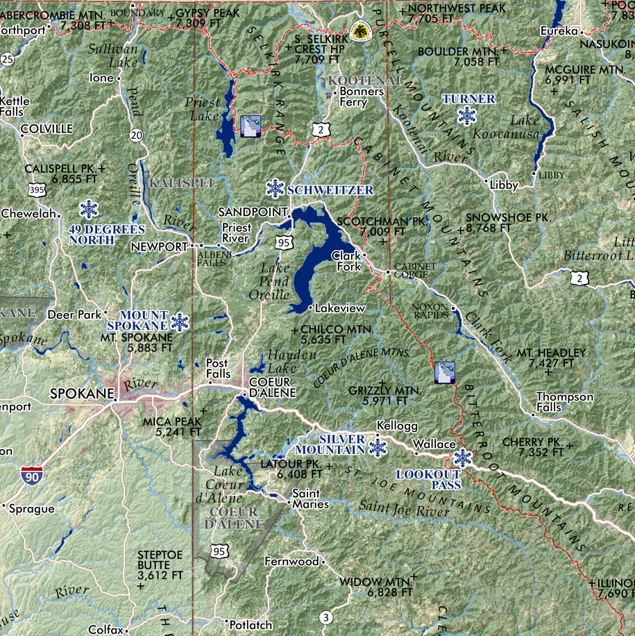 Image 7 of 12
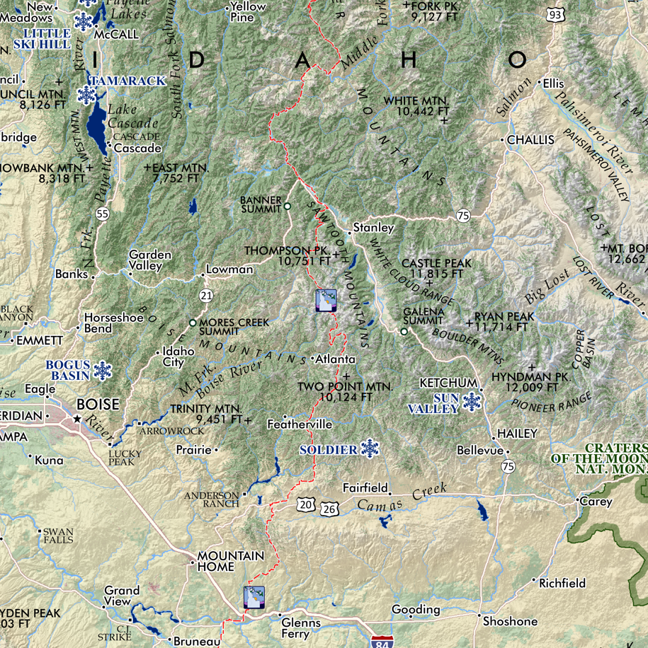 Image 8 of 12
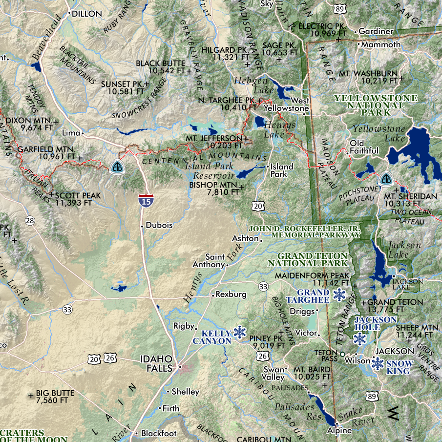 Image 9 of 12
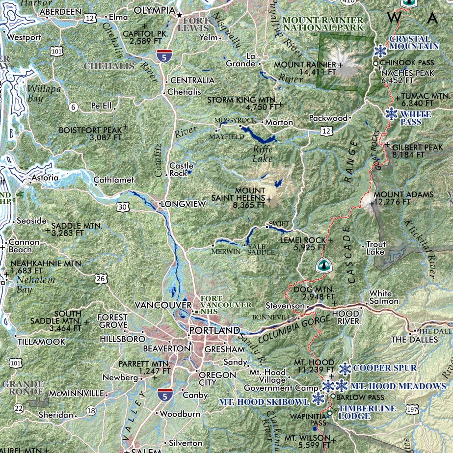 Image 10 of 12
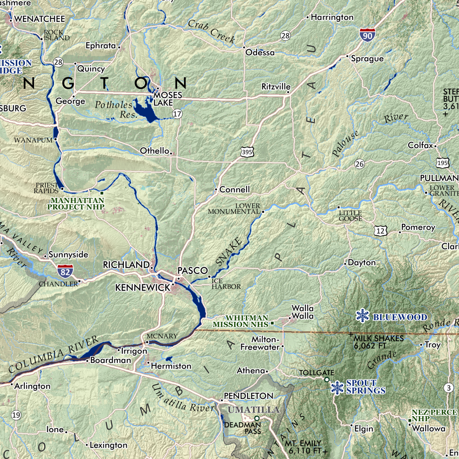 Image 11 of 12
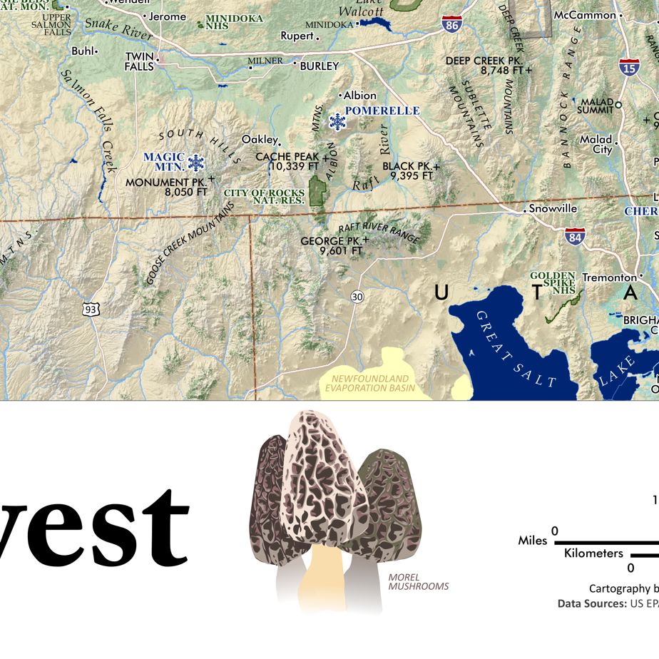 Image 12 of 12