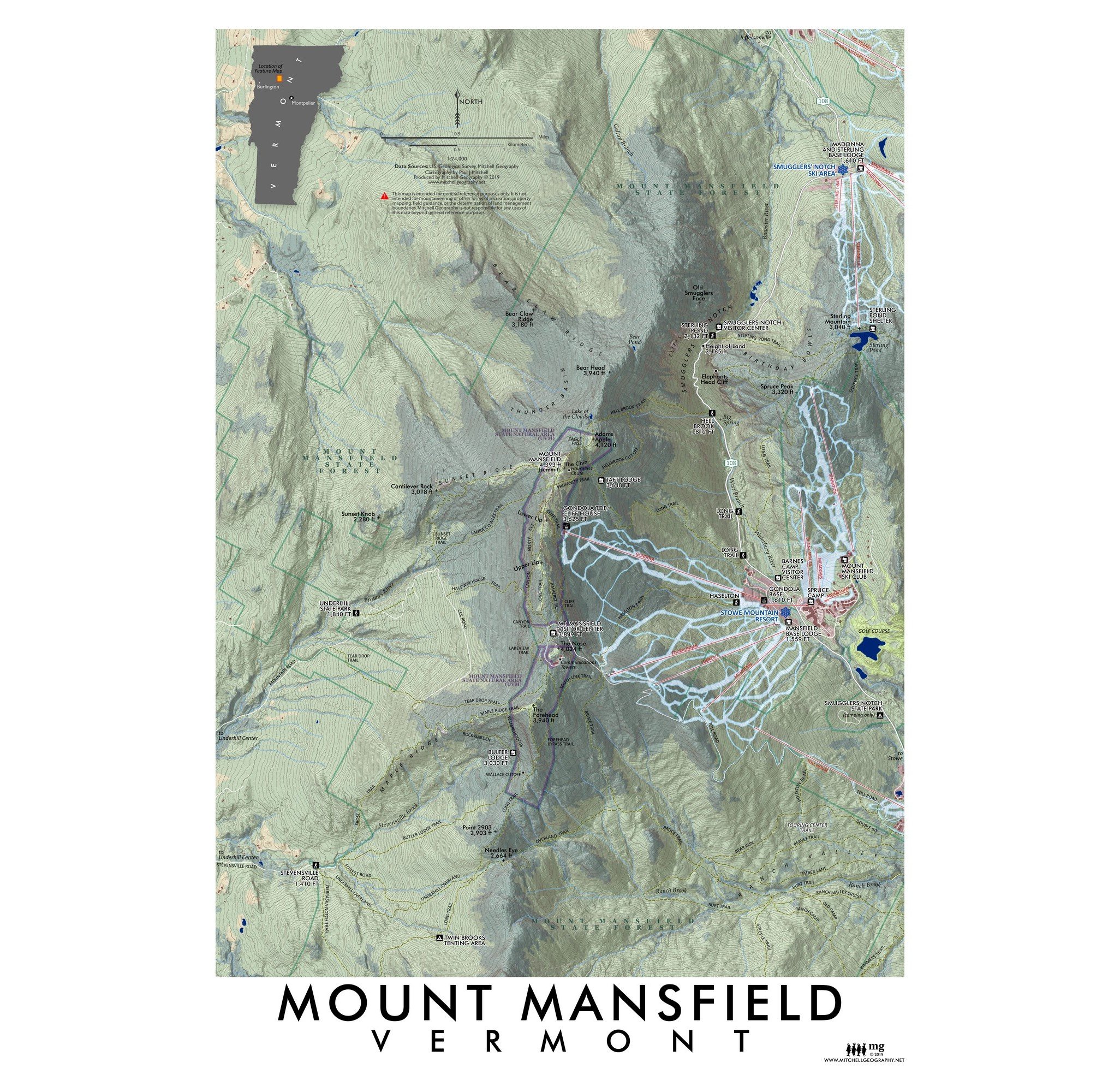
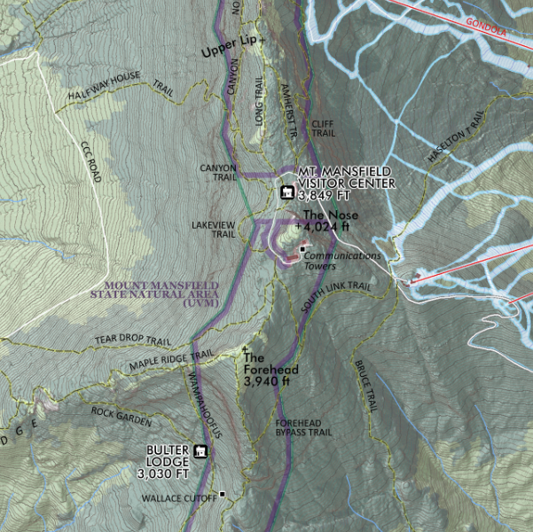
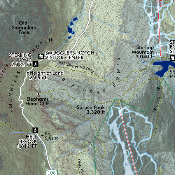
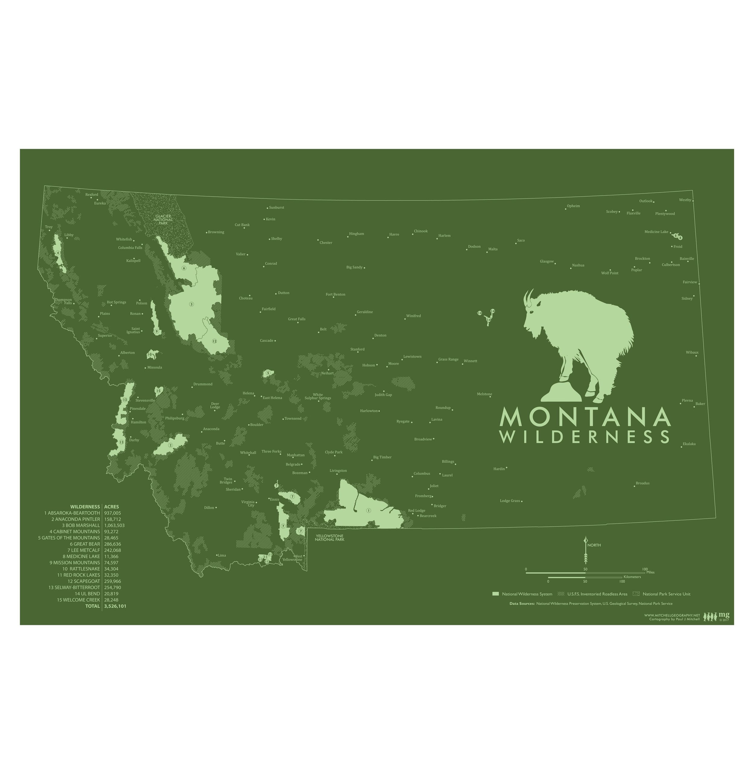
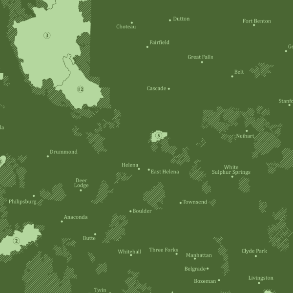
1:6,850,000
28 inch (width) by 20 inch (height) flat wall map, printed on a heavy fine paper. Shipped rolled within a 21 × 3 inch shipping tube.
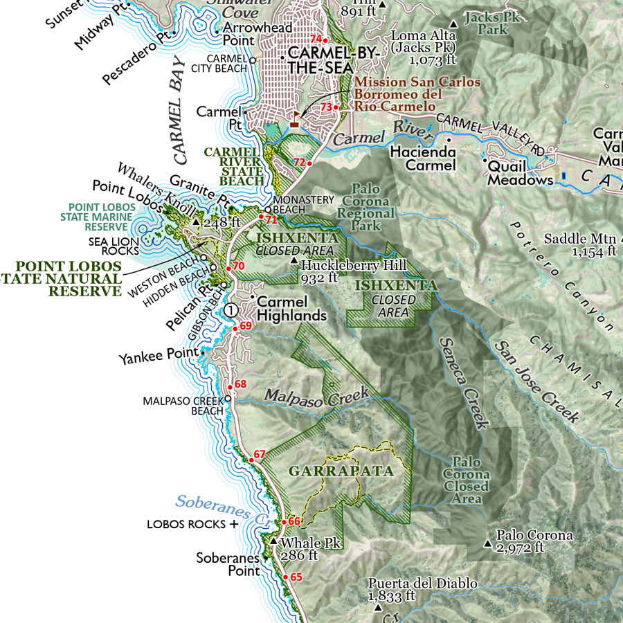
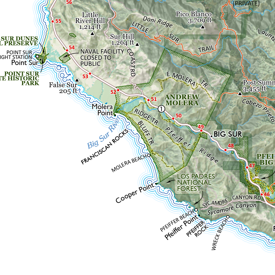
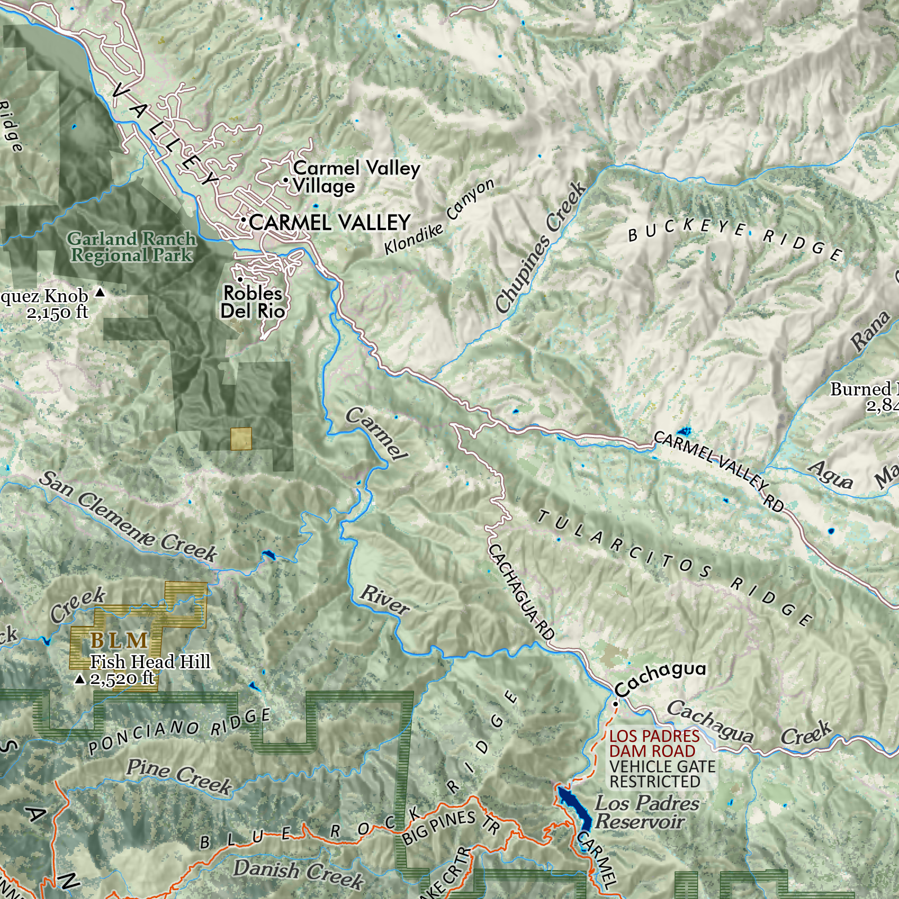
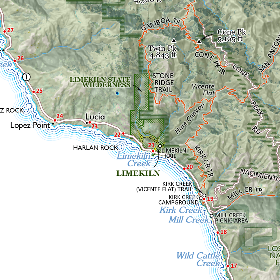
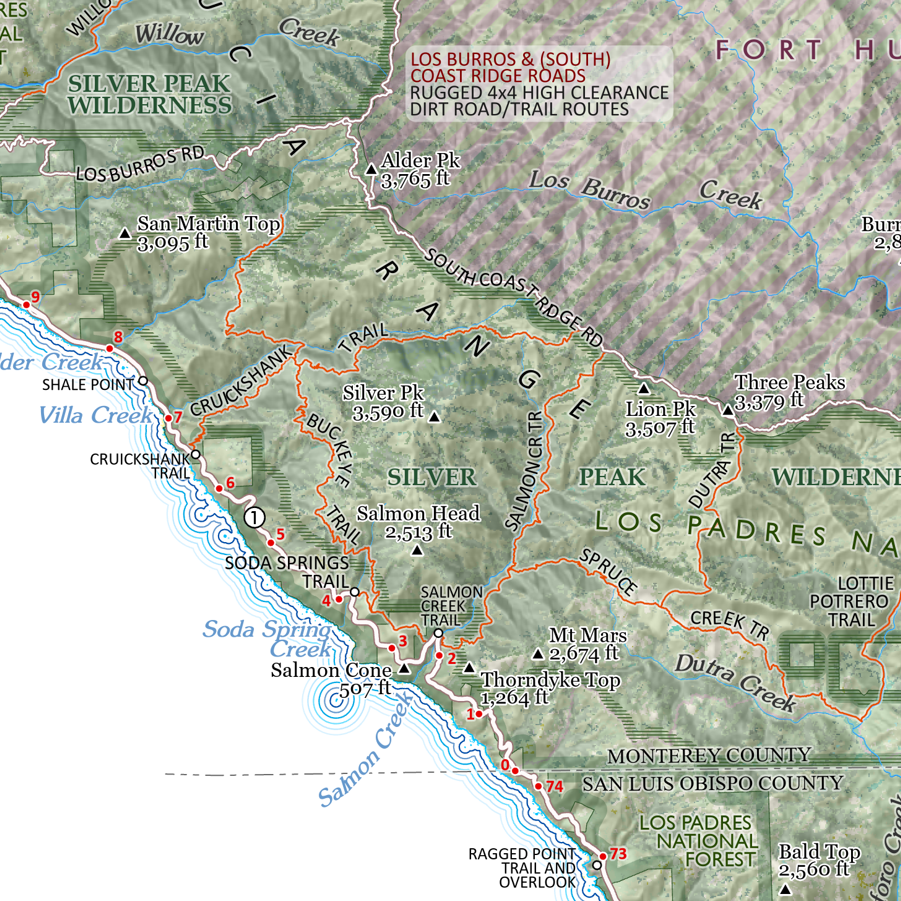
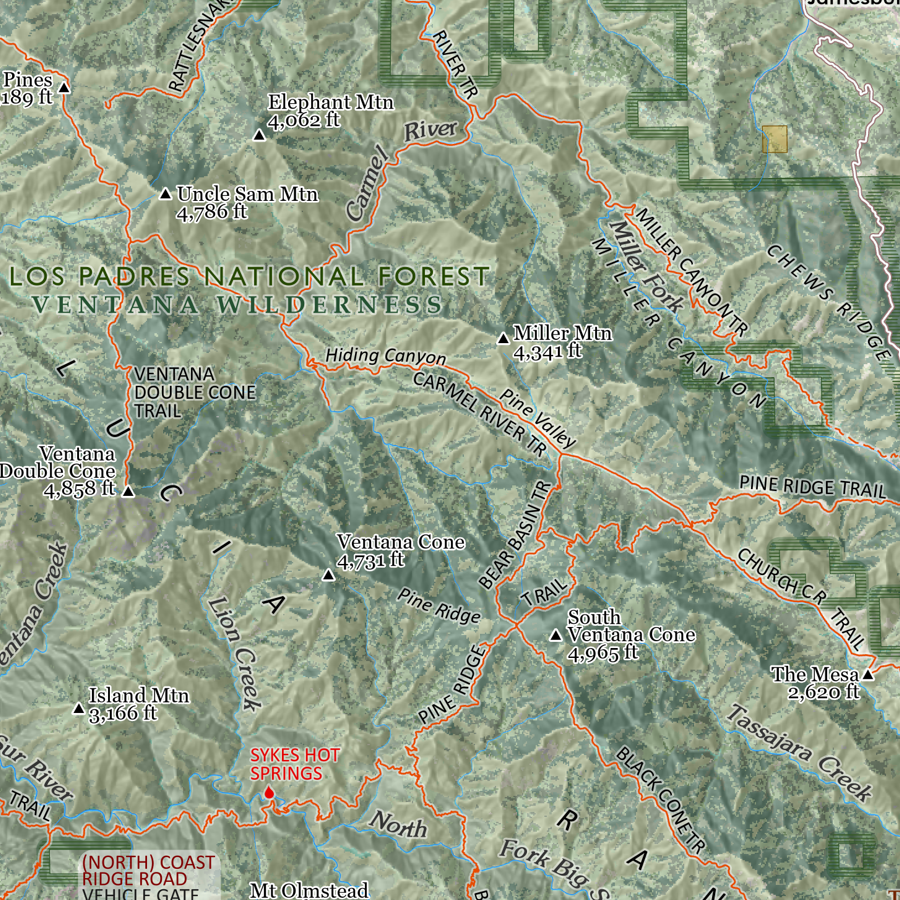
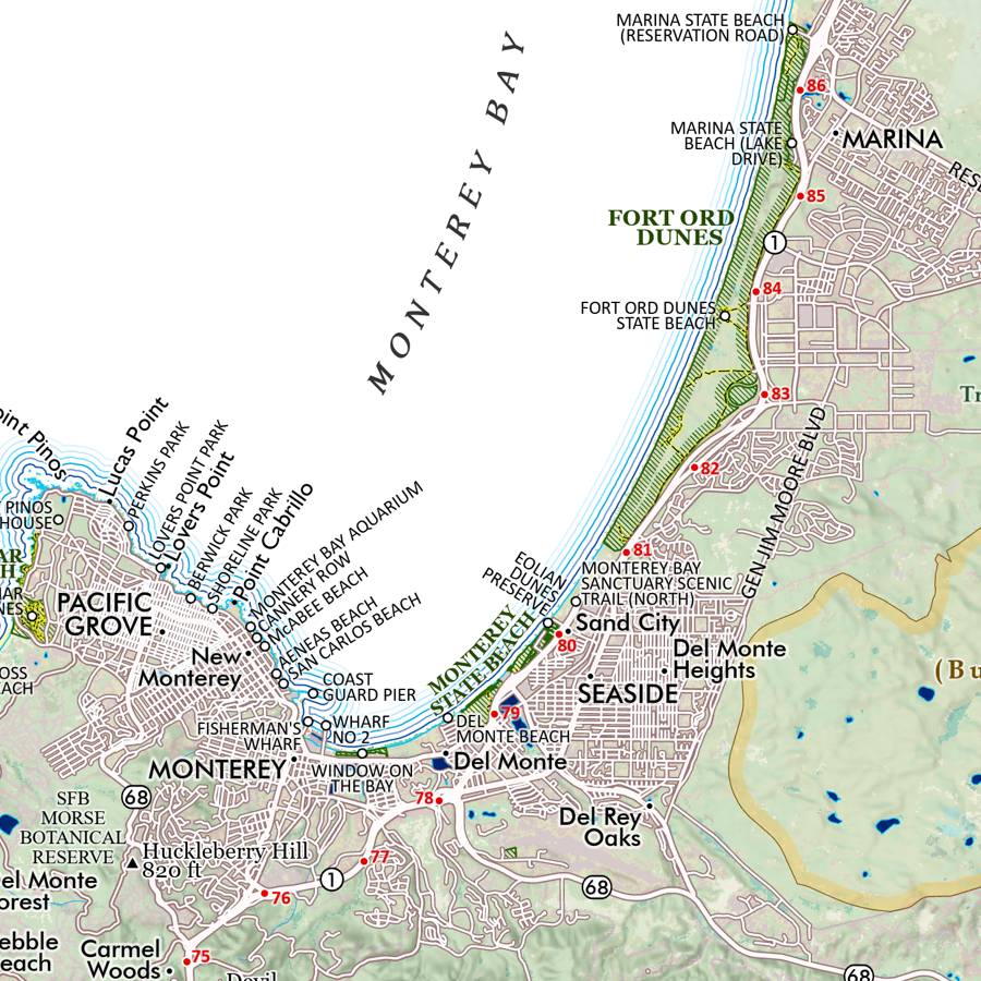
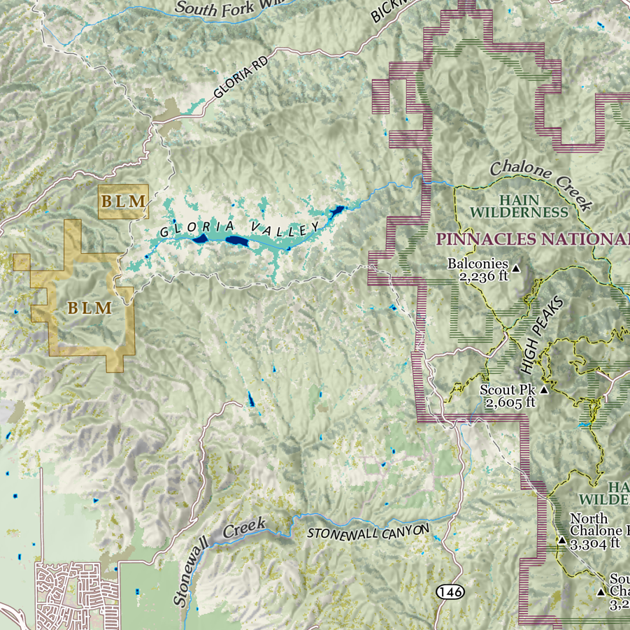
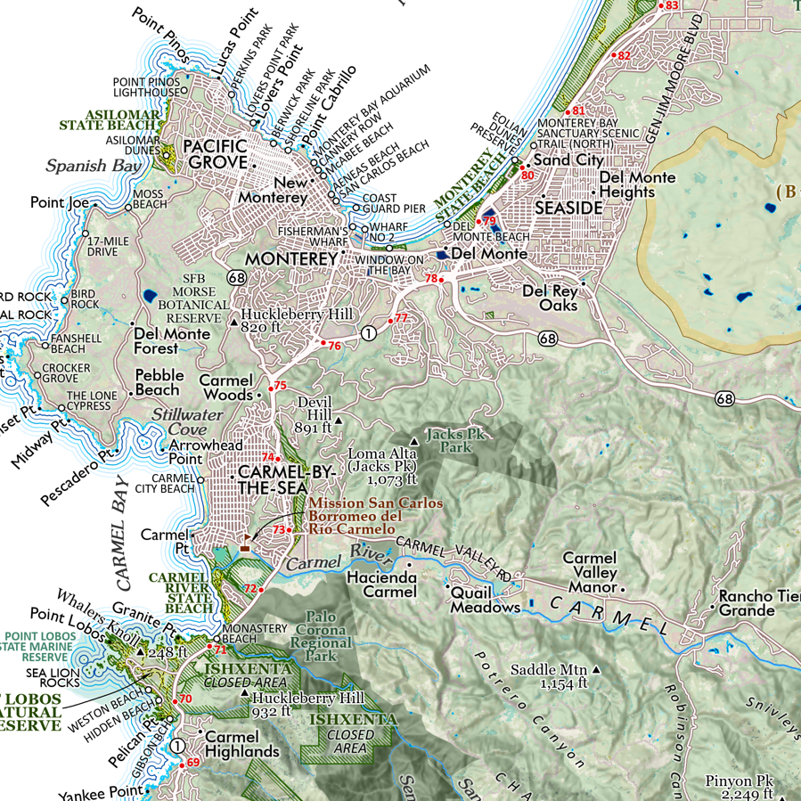
Snow Depth & Ski Planner for the conterminous United States - Year 2026 version. This is a map for the conterminous US and a personal calendar/planner/record keeper for your ski season; featuring the average snow depth in mid-March for the 20 winter seasons from 2004 - 2023 and an overlay of 439 ski areas (private ski resorts are not included). The ski areas range from large destinations, to small local hills, and operations with special seasons and accessibility - from Alabama to Washington state. Major cities and capitals, interstate highways, national parks, surface hydrology, and prominent summits are labeled for reference.
PLAN AND RECORD YOUR SKI SEASON
Cross out your ski days on the daily micro calendar for 2026 — then summarize your monthly and annual ski days in the tally column.
Check-off the ski areas you visit throughout the year.
Turns-All-Year: record your monthly selections in the Year Round Skiing note space.
Frame it up at the end of the year.
MORE ABOUT THE SNOW DEPTH DATA
This map presents the average value of snow depth modeled for March 15th from the 19 year period of 2004 thru 2023. The mean was calculated by Mitchell Geography from data produced by the NOAA National Weather Service's National Operational Hydrologic Remote Sensing Center (NOHRSC) SNOw Data Assimilation System (SNODAS). SNODAS is a modelling and data assimilation system developed by the NOHRSC to provide the best possible estimates of snow cover and associated variables to support hydrologic modelling and analysis. NOHRSC products are gridded data sets for the continental United States at 1-km spatial resolution and 24-hour temporal resolution. SNODAS models are run each day, with analysts deciding whether or not to use remote sensing and ground based observations (e.g. SNOTEL) to update the snow water equivalent state in the model.
Data Citation: National Operational Hydrologic Remote Sensing Center. 2004 -2023. Snow Data Assimilation System (SNODAS) data products at NSIDC. Boulder, CO: National Snow and Ice Data Center. Digital media.
1:6,850,000
28 inch (width) by 20 inch (height) flat wall map, printed on a heavy fine paper. Shipped rolled within a 21 × 3 inch shipping tube.
Snow Depth & Ski Planner for the conterminous United States - Year 2026 version. This is a map for the conterminous US and a personal calendar/planner/record keeper for your ski season; featuring the average snow depth in mid-March for the 20 winter seasons from 2004 - 2023 and an overlay of 439 ski areas (private ski resorts are not included). The ski areas range from large destinations, to small local hills, and operations with special seasons and accessibility - from Alabama to Washington state. Major cities and capitals, interstate highways, national parks, surface hydrology, and prominent summits are labeled for reference.
PLAN AND RECORD YOUR SKI SEASON
Cross out your ski days on the daily micro calendar for 2026 — then summarize your monthly and annual ski days in the tally column.
Check-off the ski areas you visit throughout the year.
Turns-All-Year: record your monthly selections in the Year Round Skiing note space.
Frame it up at the end of the year.
MORE ABOUT THE SNOW DEPTH DATA
This map presents the average value of snow depth modeled for March 15th from the 19 year period of 2004 thru 2023. The mean was calculated by Mitchell Geography from data produced by the NOAA National Weather Service's National Operational Hydrologic Remote Sensing Center (NOHRSC) SNOw Data Assimilation System (SNODAS). SNODAS is a modelling and data assimilation system developed by the NOHRSC to provide the best possible estimates of snow cover and associated variables to support hydrologic modelling and analysis. NOHRSC products are gridded data sets for the continental United States at 1-km spatial resolution and 24-hour temporal resolution. SNODAS models are run each day, with analysts deciding whether or not to use remote sensing and ground based observations (e.g. SNOTEL) to update the snow water equivalent state in the model.
Data Citation: National Operational Hydrologic Remote Sensing Center. 2004 -2023. Snow Data Assimilation System (SNODAS) data products at NSIDC. Boulder, CO: National Snow and Ice Data Center. Digital media.

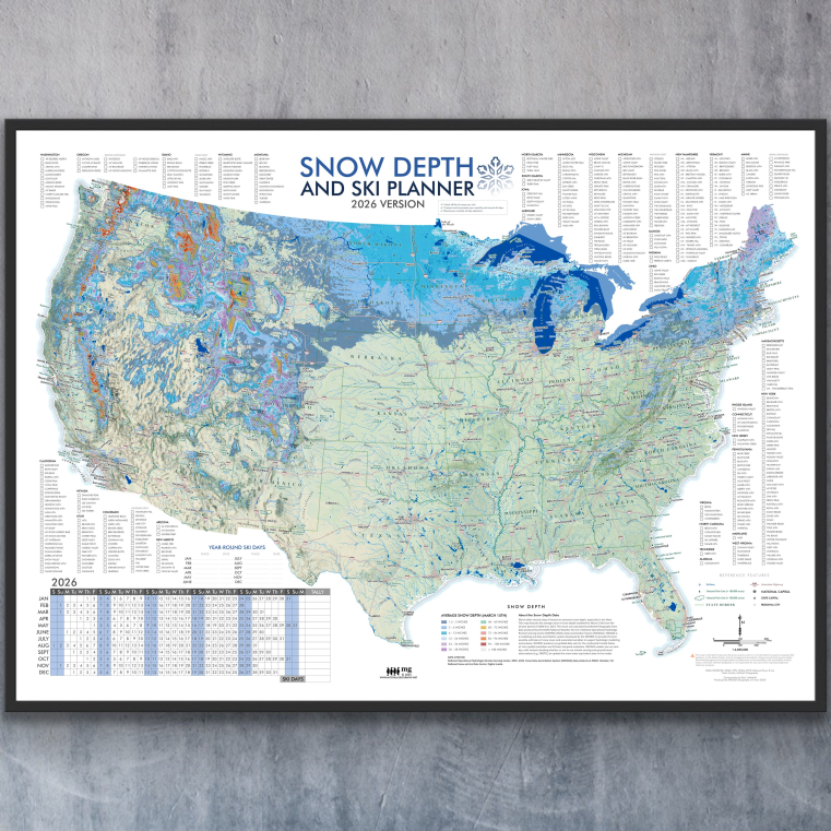 Image 1 of 13
 Image 2 of 13
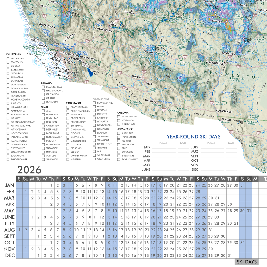 Image 3 of 13
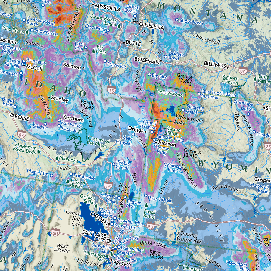 Image 4 of 13
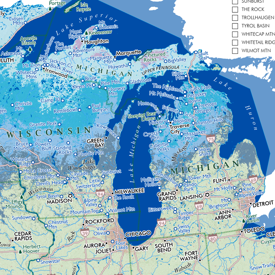 Image 5 of 13
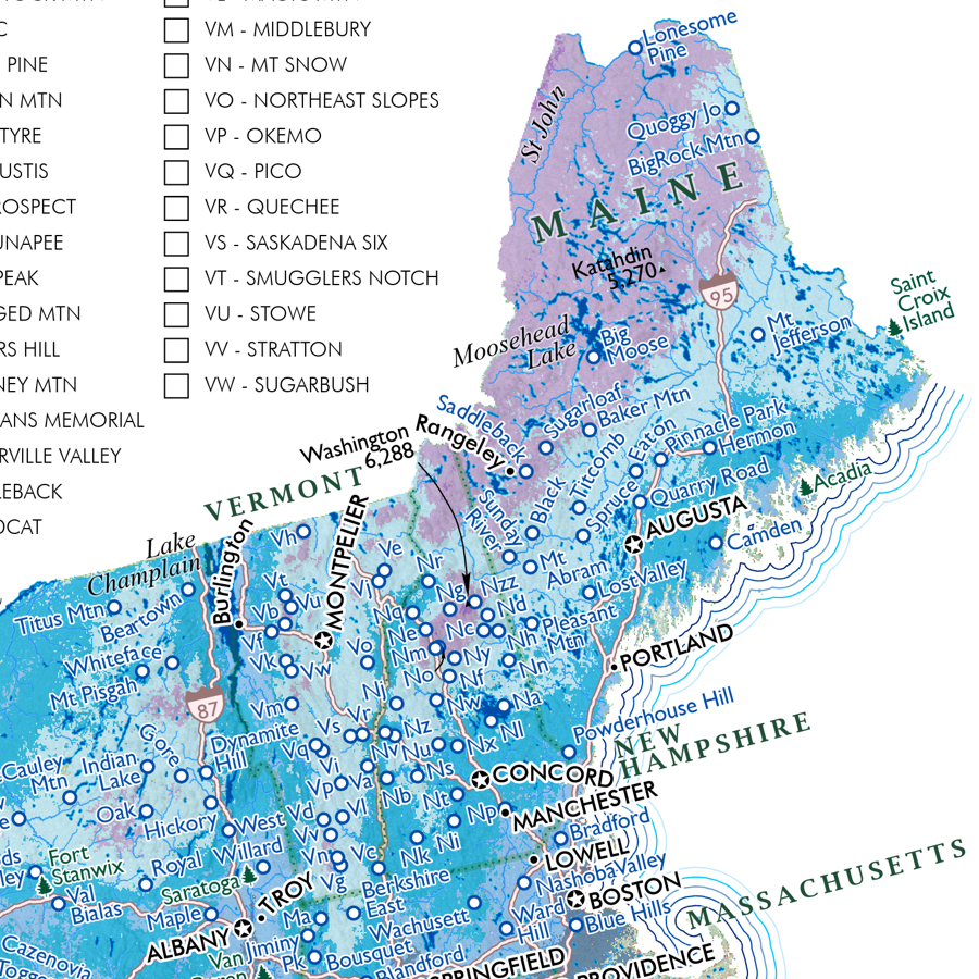 Image 6 of 13
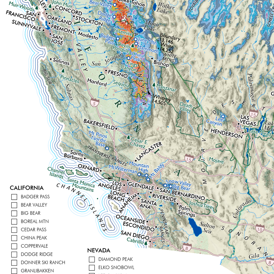 Image 7 of 13
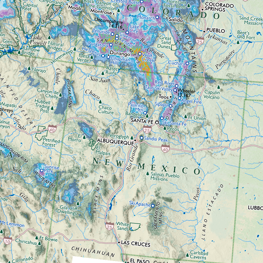 Image 8 of 13
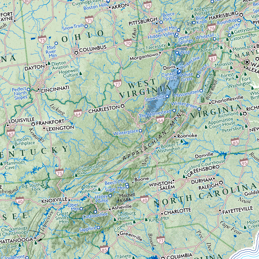 Image 9 of 13
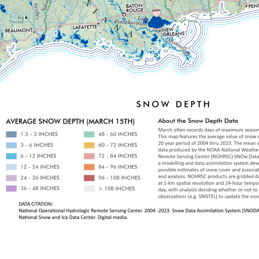 Image 10 of 13
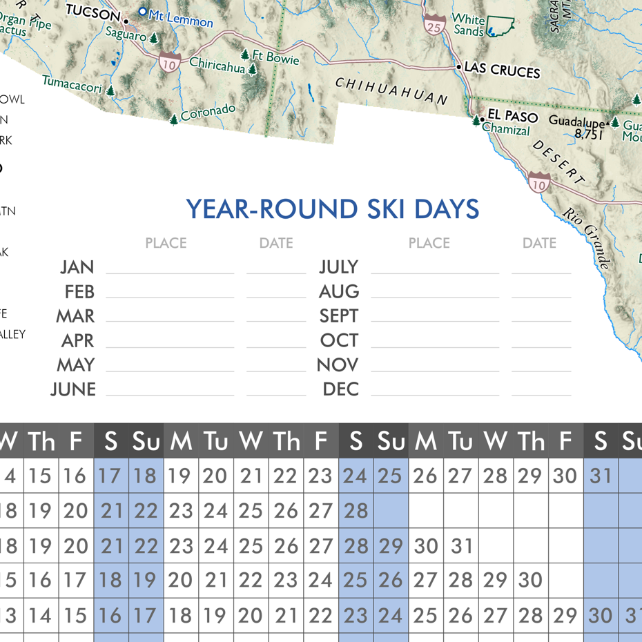 Image 11 of 13
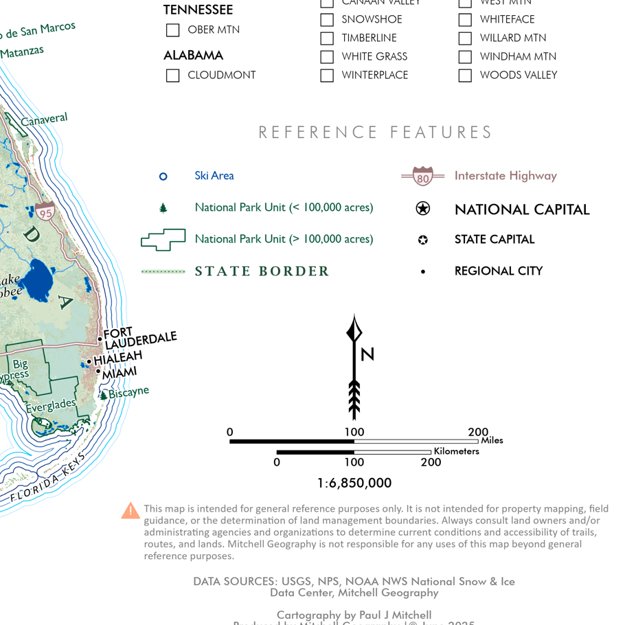 Image 12 of 13
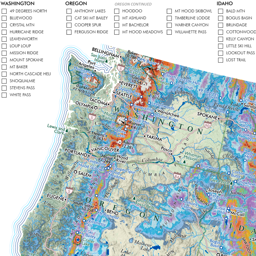 Image 13 of 13