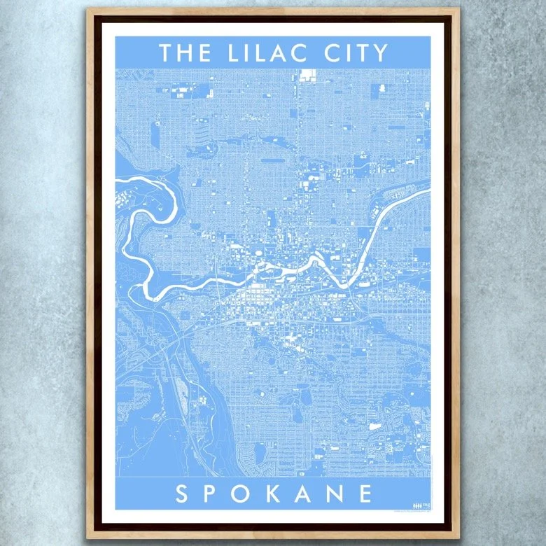
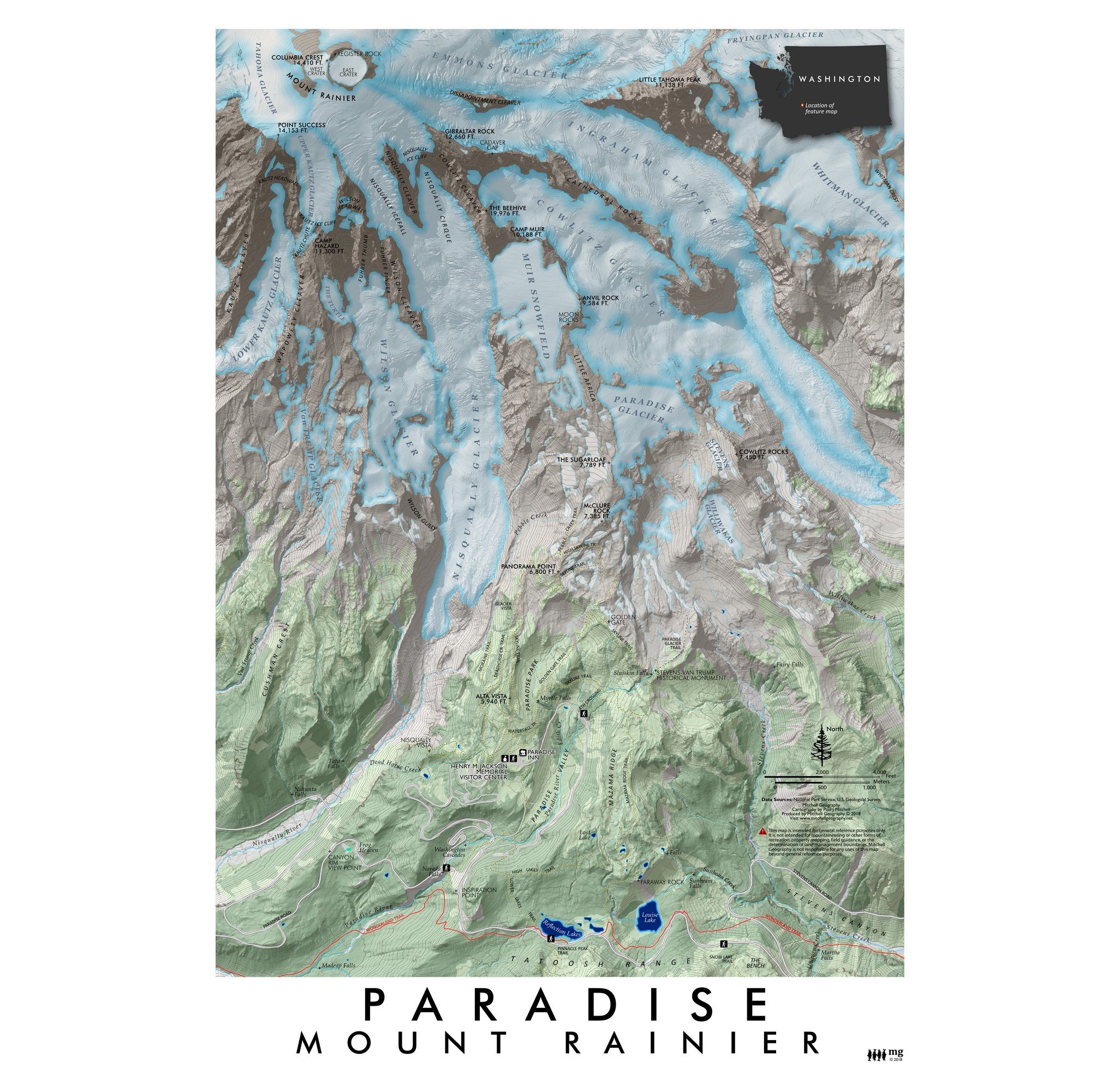
Image 1 of 3
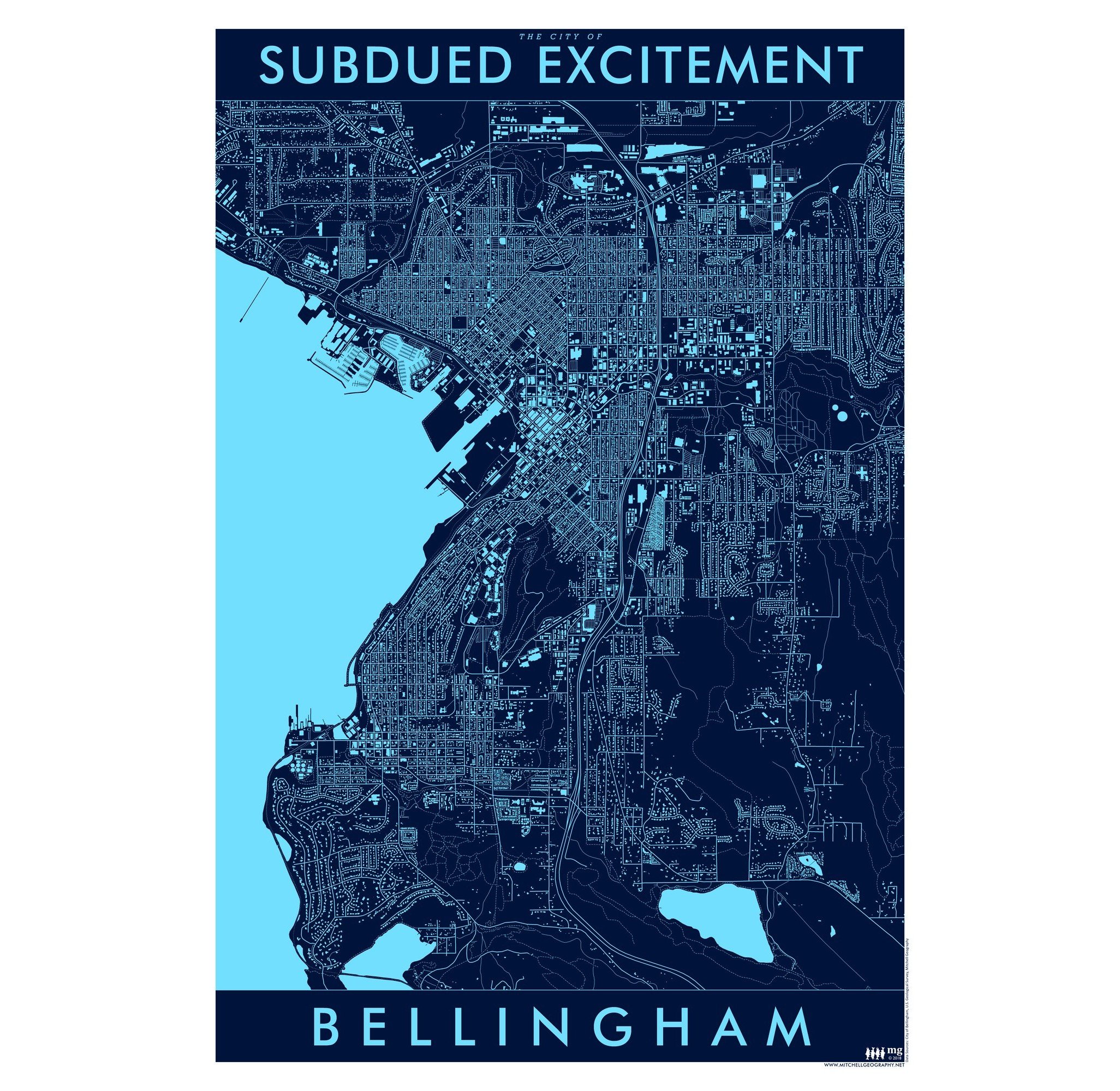
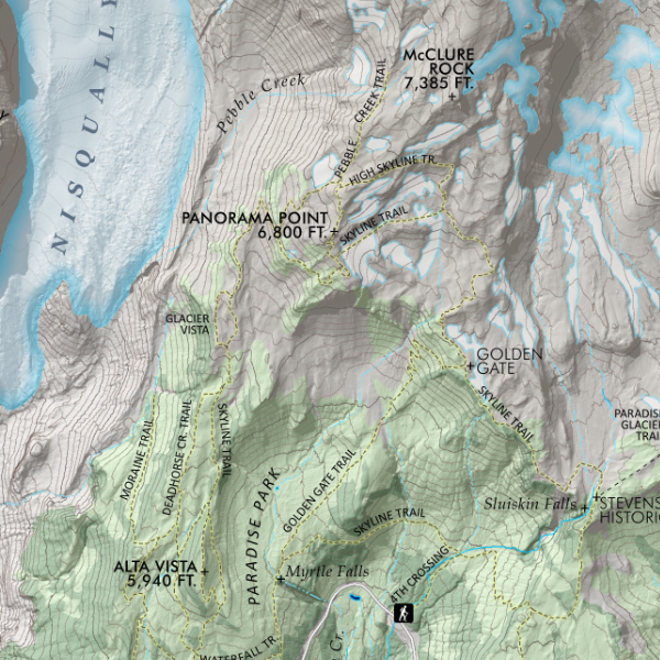
 Image 2 of 3
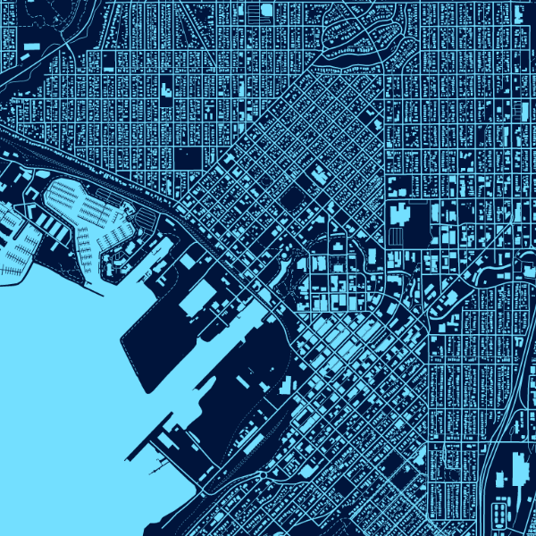
 Image 3 of 3
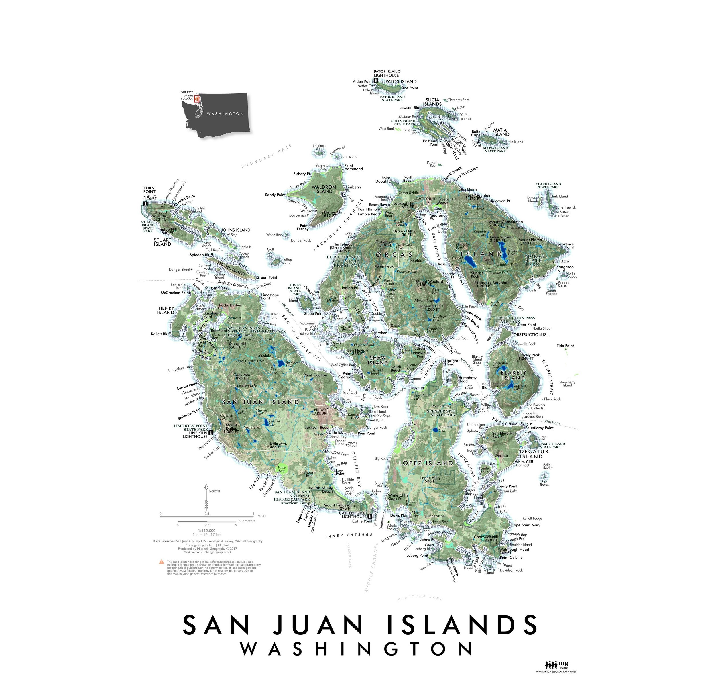
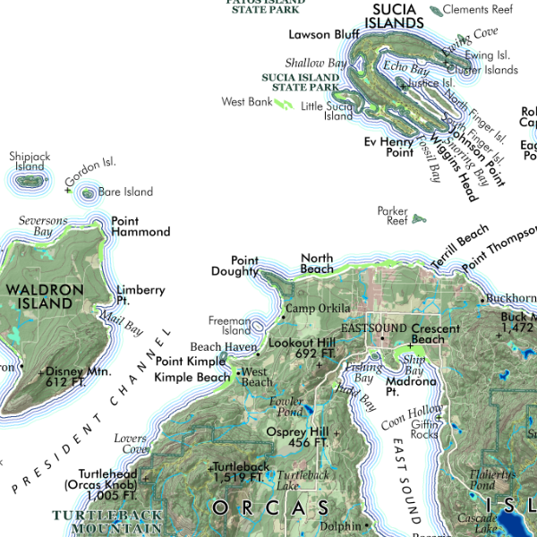
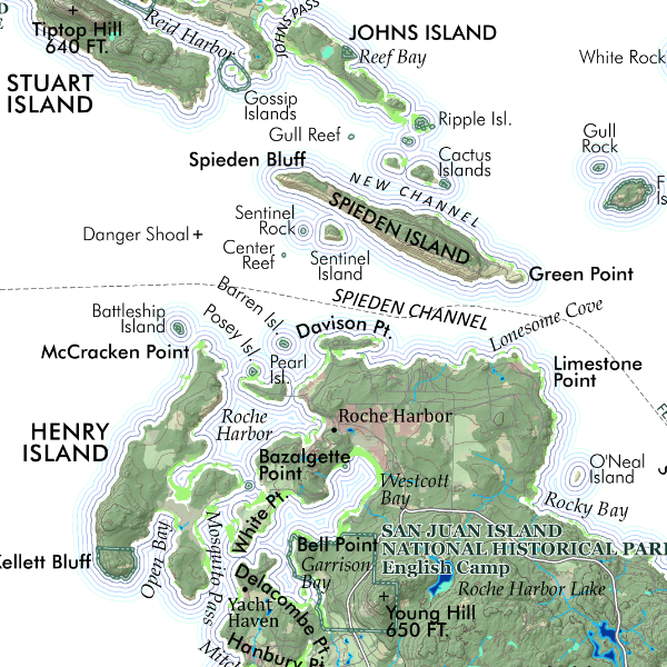
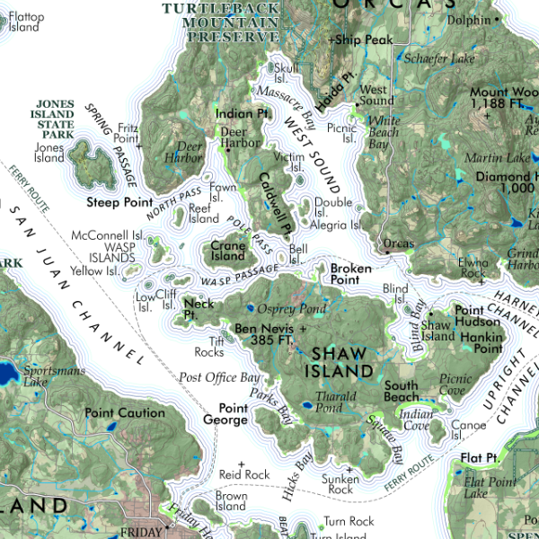
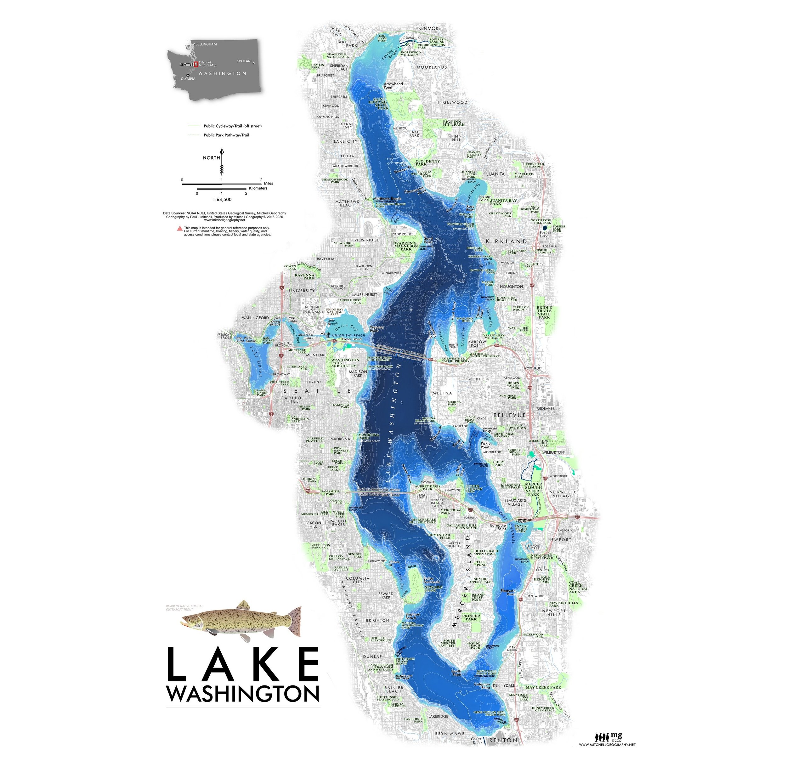
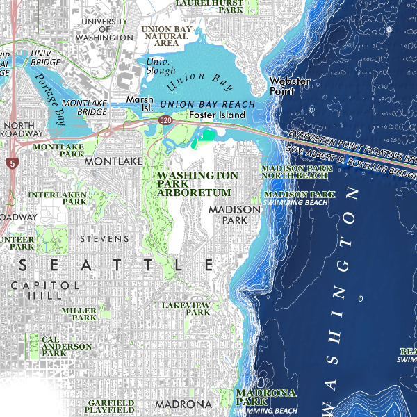
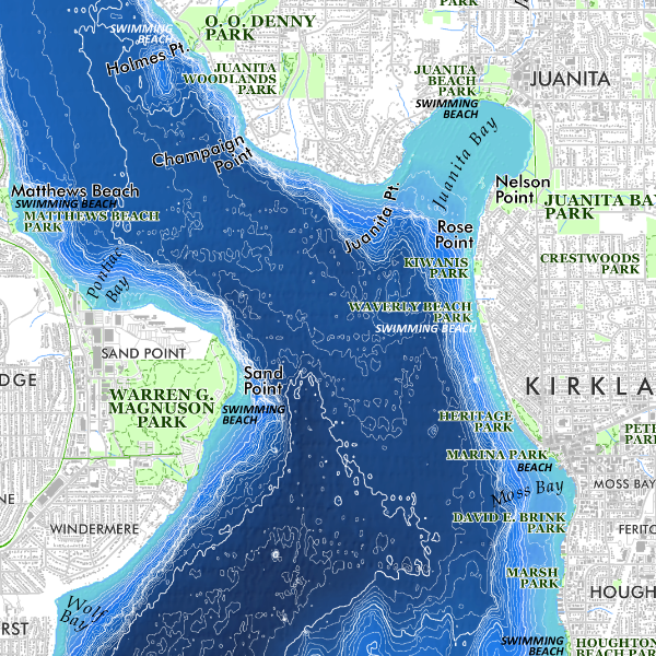
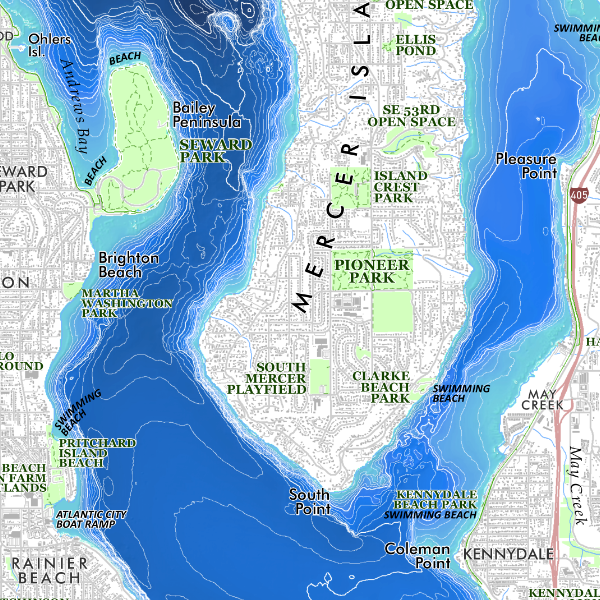
24 inch x 20 inch — flat wall map, printed on a heavy fine paper — shipped rolled.
Washington Rivers. Detailed surface hydrology of Washington - depicting surface hydrology including rivers, streams, lakes and reservoirs, and glaciers (in white). Line weights applied by increasing stream order.
24 inch x 20 inch — flat wall map, printed on a heavy fine paper — shipped rolled.
Washington Rivers. Detailed surface hydrology of Washington - depicting surface hydrology including rivers, streams, lakes and reservoirs, and glaciers (in white). Line weights applied by increasing stream order.