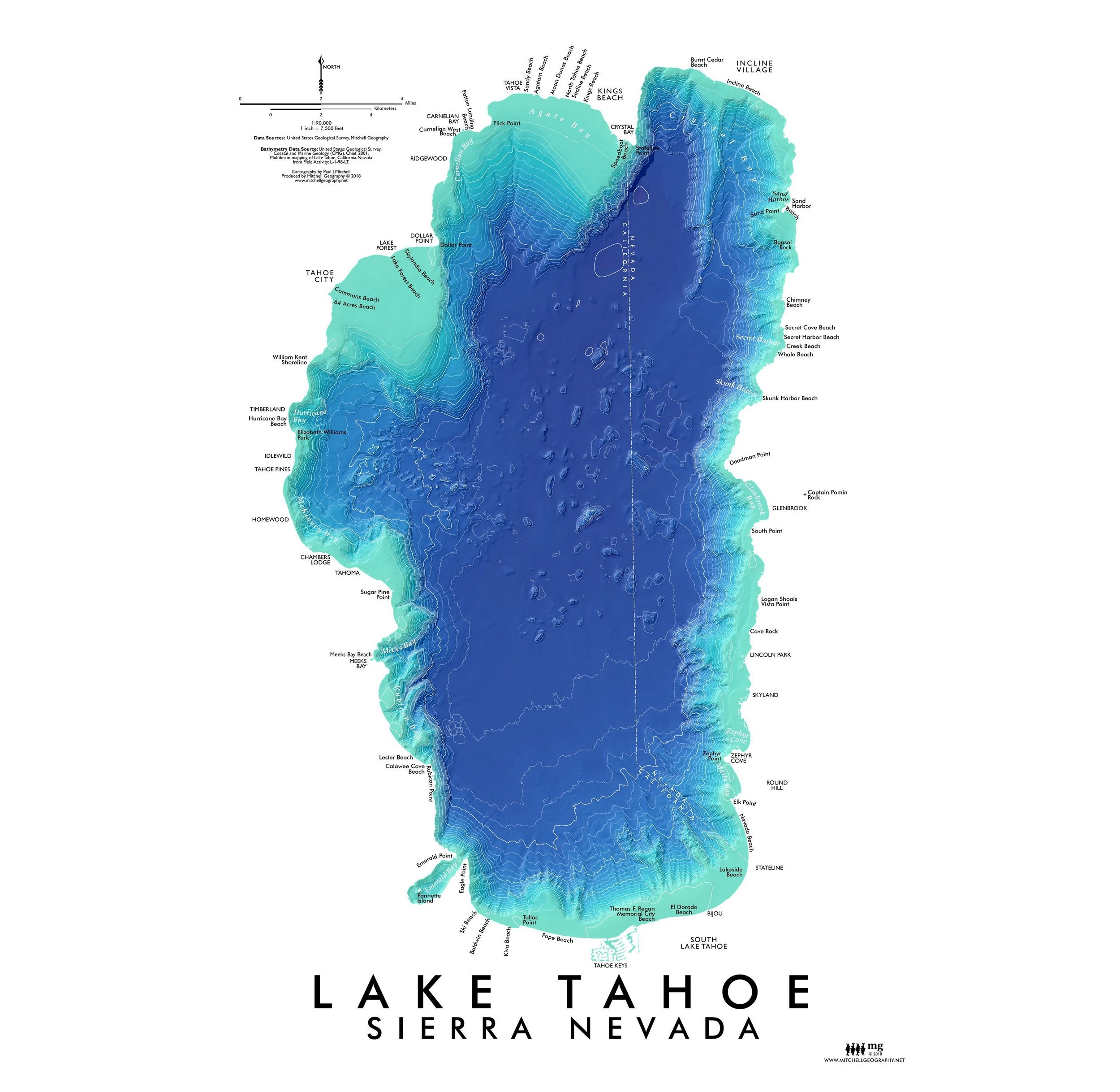
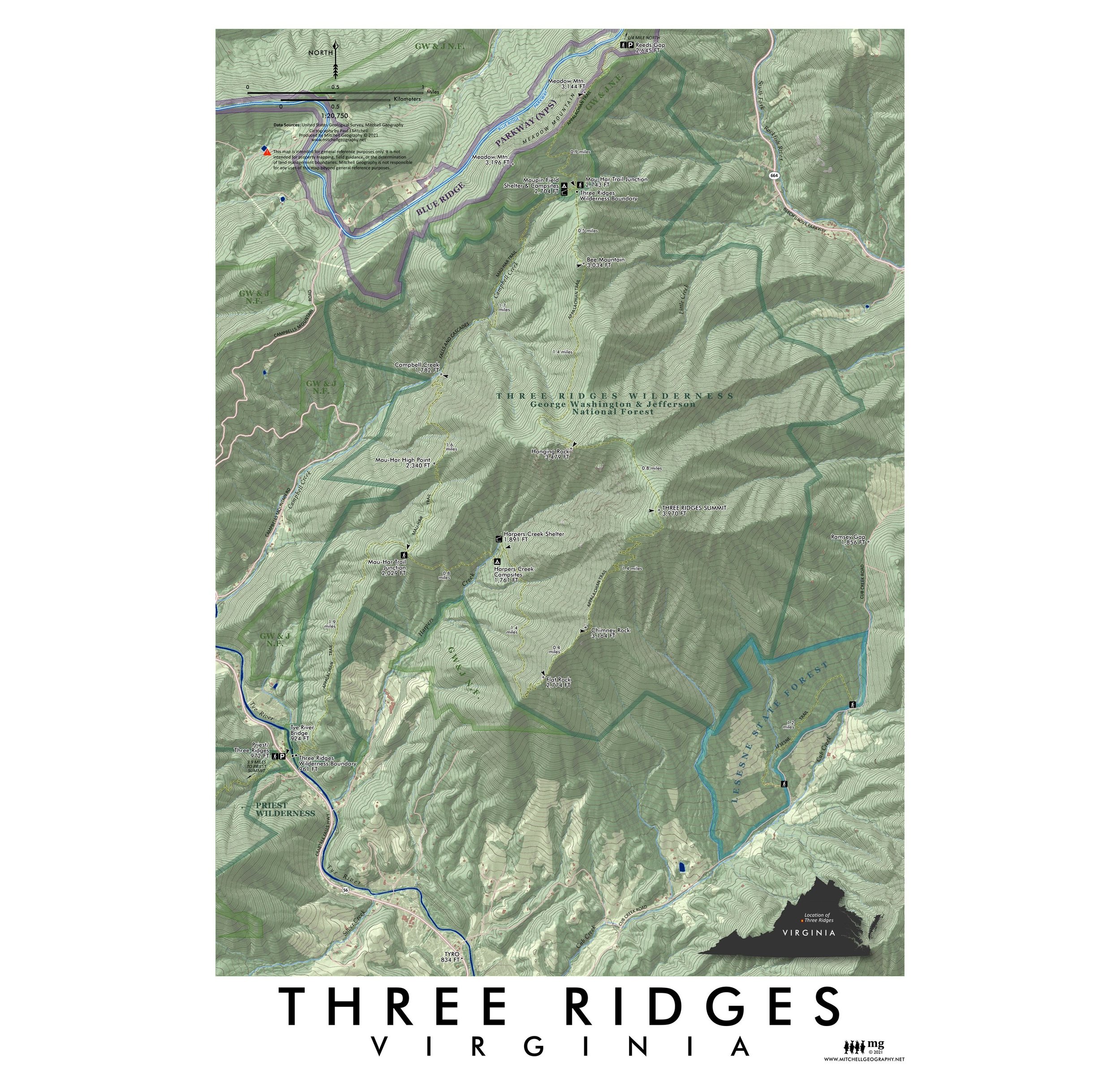
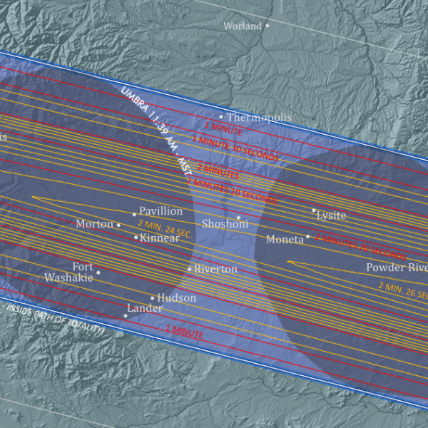
Image 1 of 3
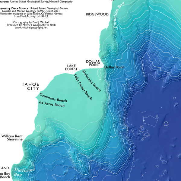
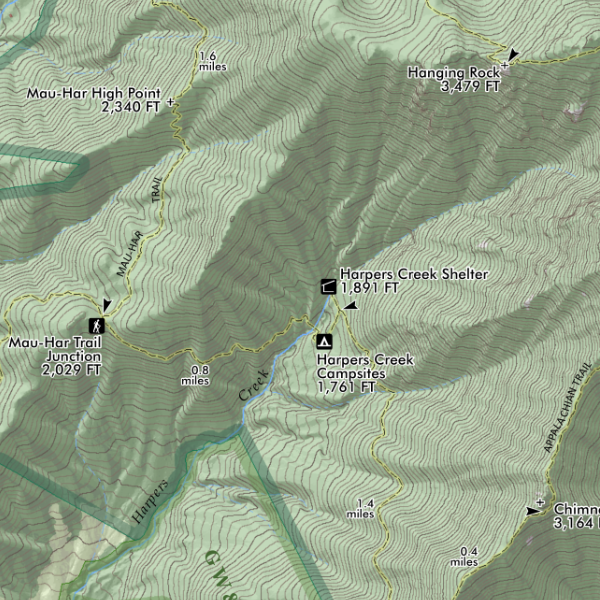
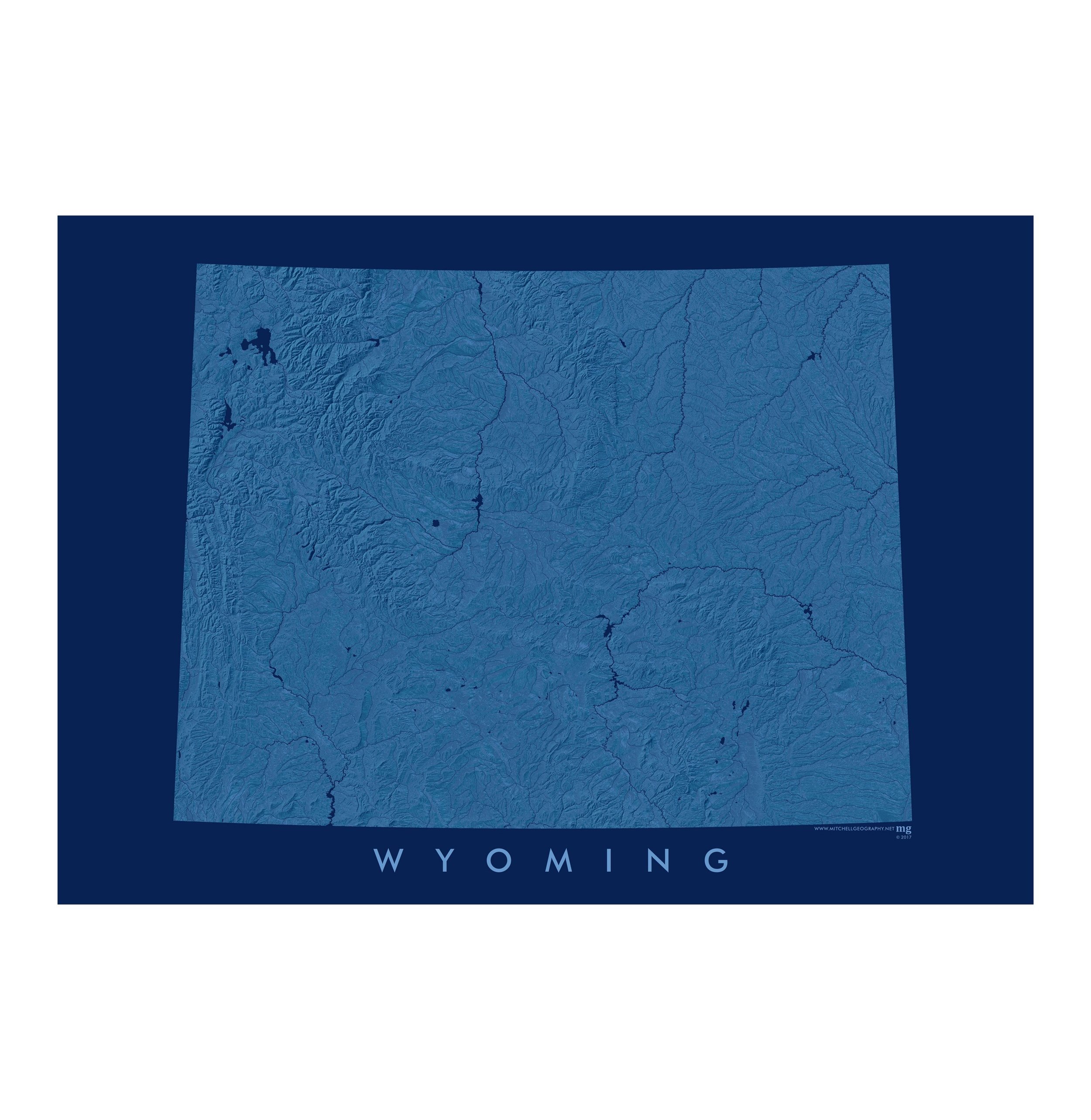 Image 2 of 3
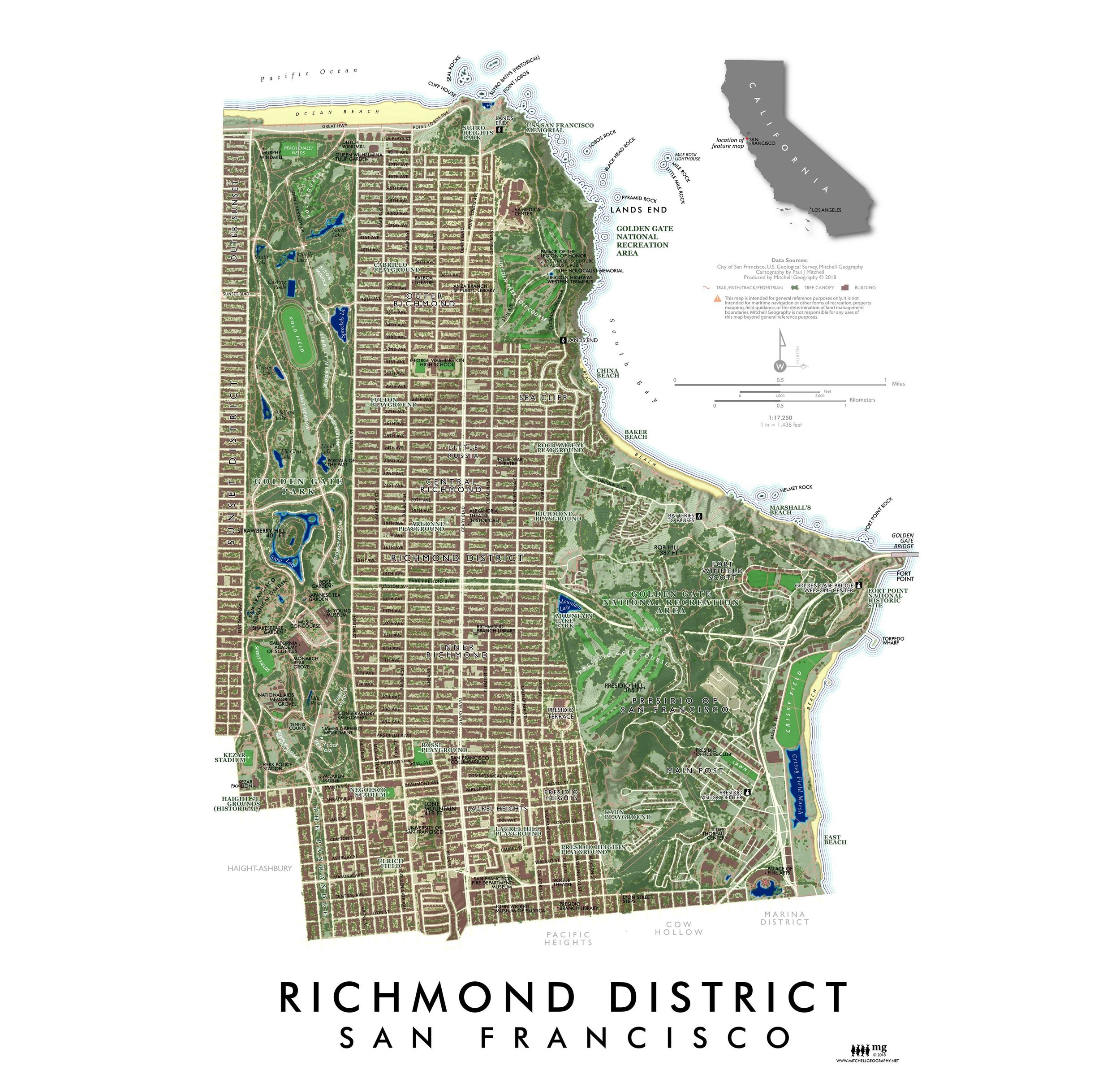
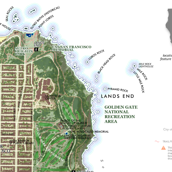
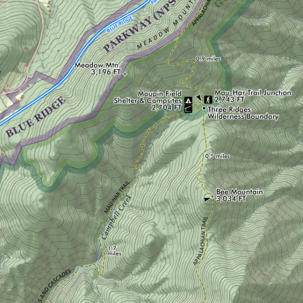
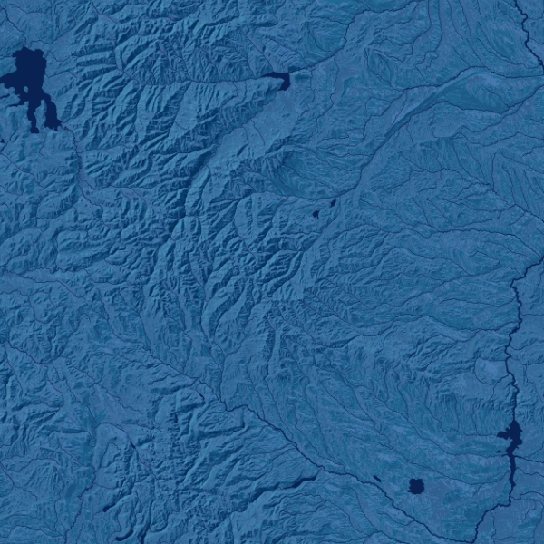 Image 3 of 3
13 inch by 19 inch flat wall map, printed on heavy fine paper. Packed and shipped flat.
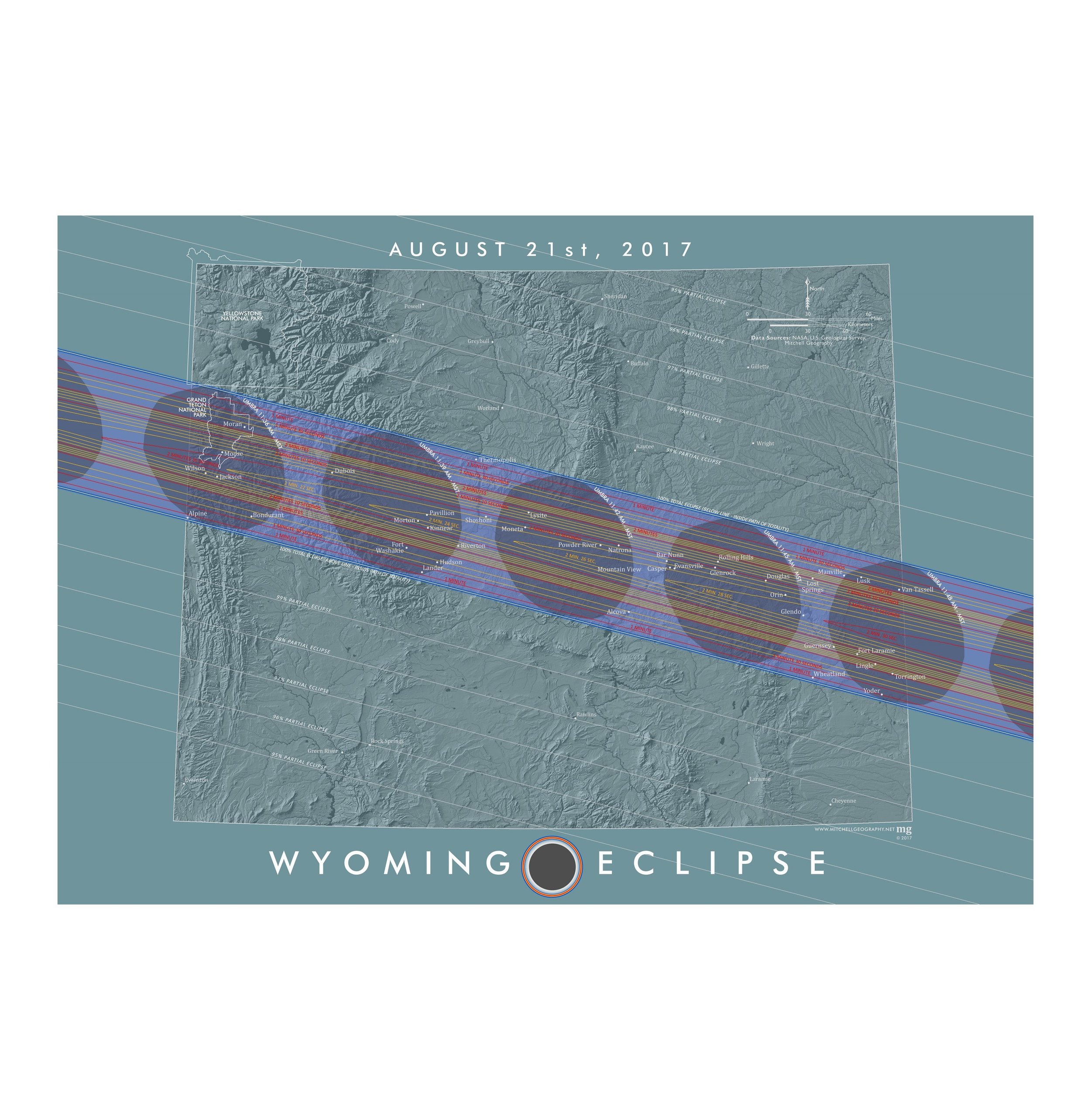
Wyoming. A tasteful blue monochrome representation of Wyoming's terrain, drainage, and landforms.
13 inch by 19 inch flat wall map, printed on heavy fine paper. Packed and shipped flat.
Wyoming. A tasteful blue monochrome representation of Wyoming's terrain, drainage, and landforms.