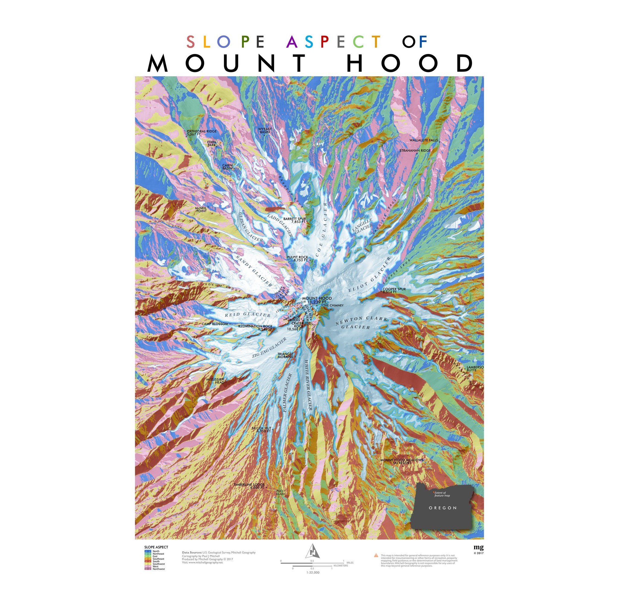
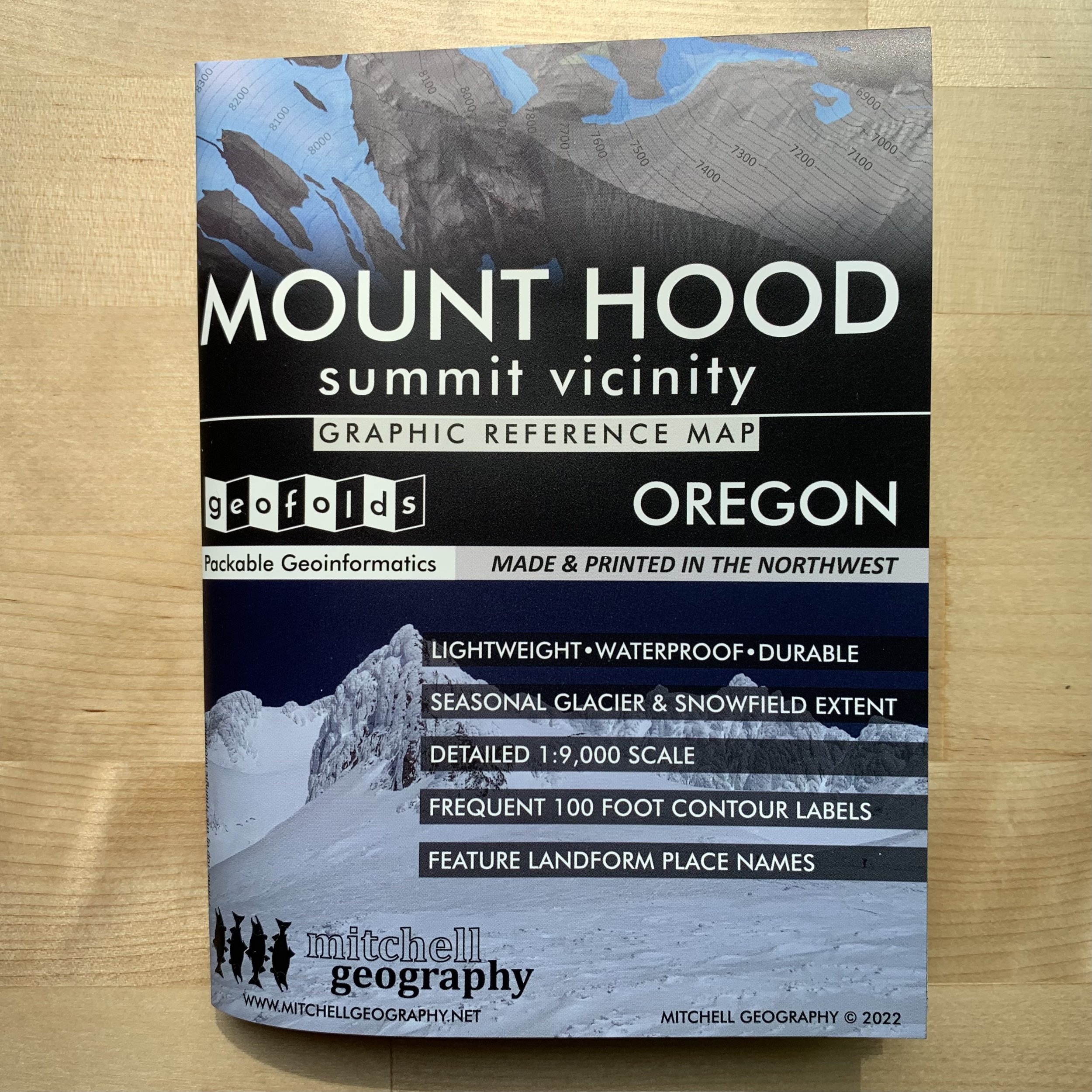


Mount Hood Summit (GEOFOLD)
1:9,000
Mount Hood Summit GEOFOLD (folding map). Two sided waterproof and tearproof, lightweight, packable folded map. Printed on French made POLYART biodegradable synthetic paper. Folded 4.5 x 6 inches, unfolded 12 x 18 inches. Shipped in mailer envelope, uninsured, by USPS stamped mail.
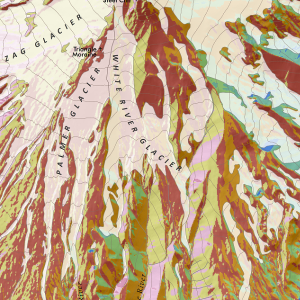
Derived from my 2022 feature map of Mount Hood’s summit vicinity (generally depicting elevations over 7,500 ft). Based upon Oregon DOGAMI’s detailed LiDAR elevation model, my visually prominent mid-summer seasonal glacier and snowfield extent is derived at 1:2,000 from the same LiDAR model and corrected to current aerial imagery. Landforms and provincial feature names of chutes, faces, snowfields, etc are included. Frequent 100ft elevation contours are labeled across every major snowfield and glacier. The north and south sides (i.e. front and back of sheet) overlap the high summit area for adequate coverage.
The full-size 24 x 20 inch flat wall version is also available.