Bridger Range Montana (24 in x 28 in)
1:72,500
18 inch by 24 inch flat wall map printed on heavy fine paper. Shipped rolled.
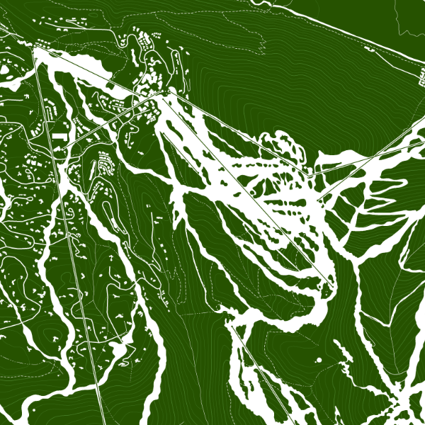
Bridger Range, Montana. Map of the Bridger Range just northeast of Bozeman, Montana — featuring trails, named and provincial summits, canyons, streams, and other landform features. Nice detail of the alpine ski runs at Bridger Bowl Ski Area as well.
1:72,500
18 inch by 24 inch flat wall map printed on heavy fine paper. Shipped rolled.
Bridger Range, Montana. Map of the Bridger Range just northeast of Bozeman, Montana — featuring trails, named and provincial summits, canyons, streams, and other landform features. Nice detail of the alpine ski runs at Bridger Bowl Ski Area as well.