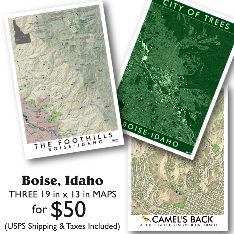
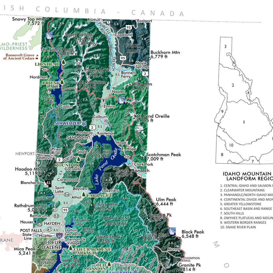
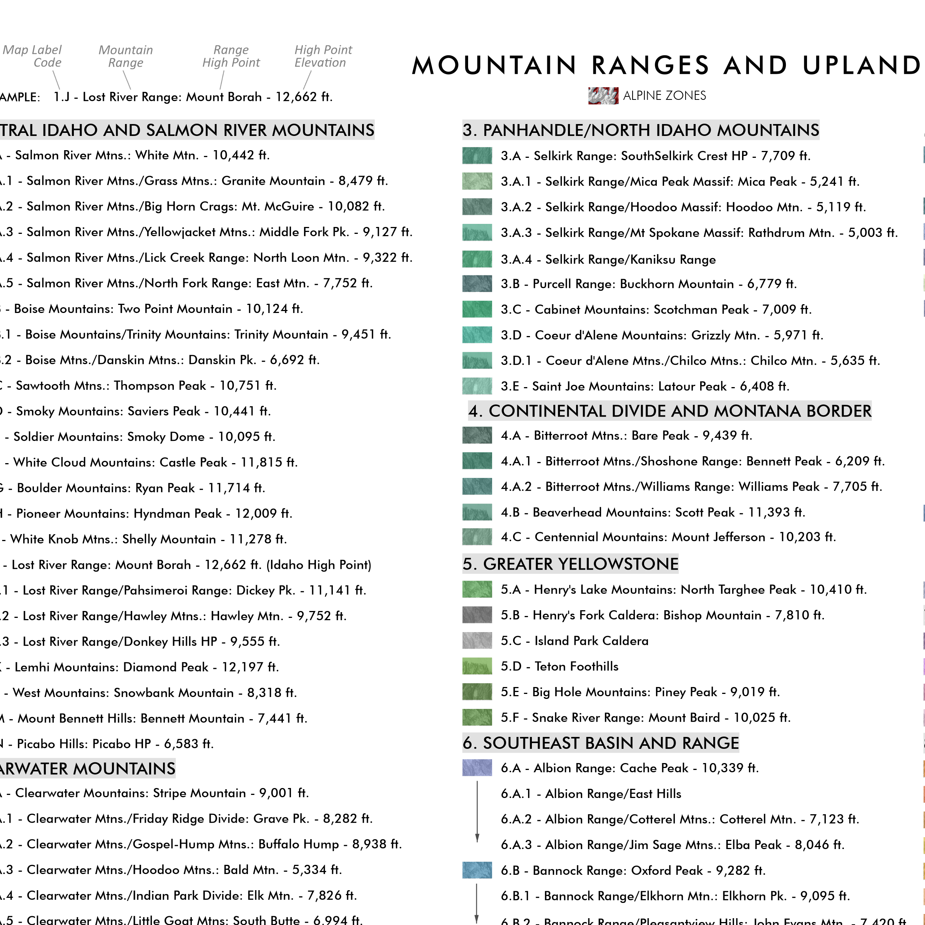
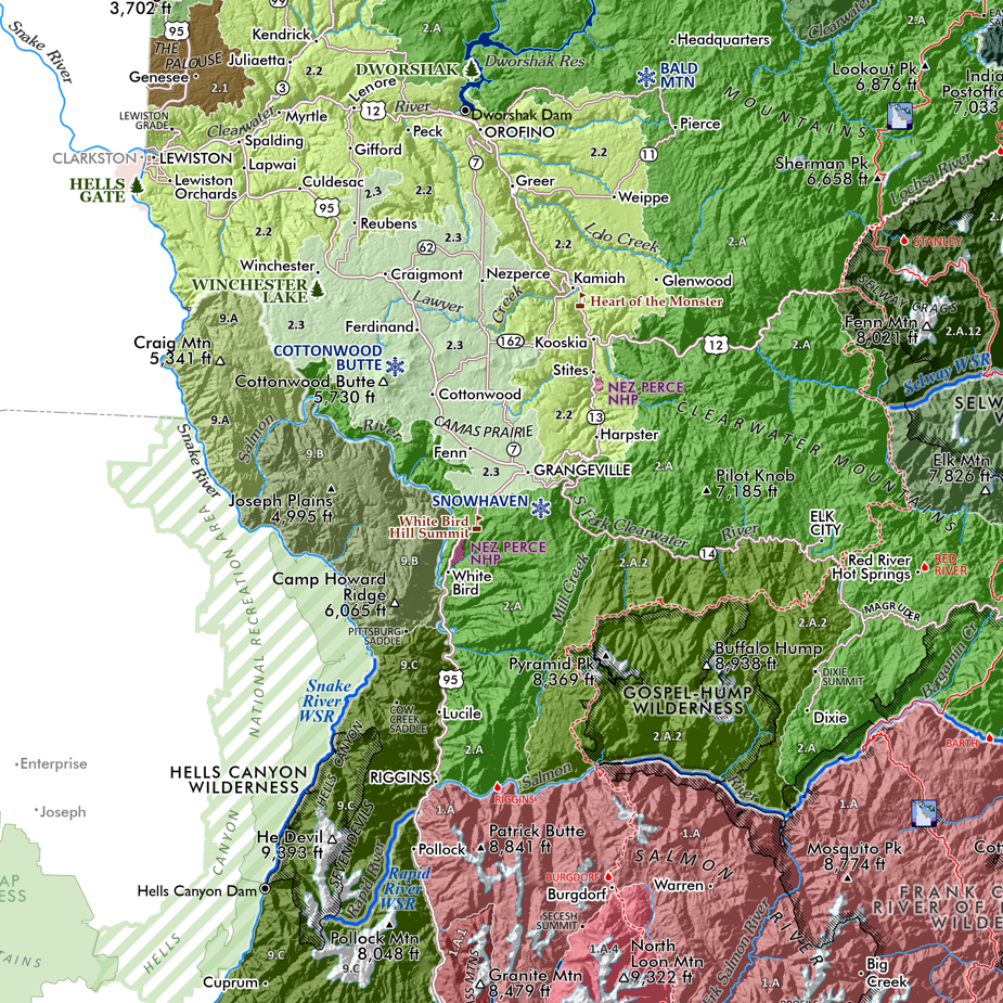
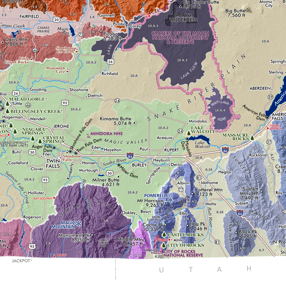
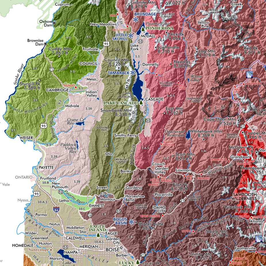
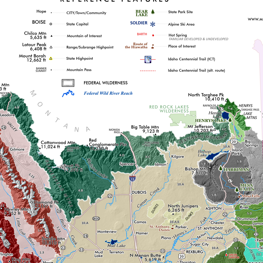
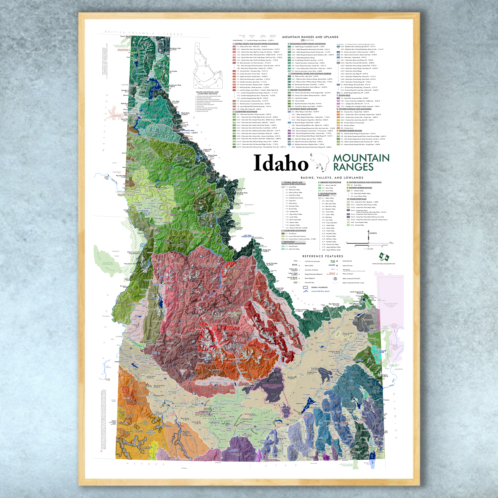
13 inch by 19 inch flat wall map, printed on heavy fine paper. Packed and shipped flat.
Camel’s Back & Hulls Gulch Reserve - Boise, Idaho. One of our most beloved park and Foothills access sites in Boise — this map features Camel’s Back Park, Camel’s Back Reserve, and Hulls Gulch Reserve (all City owned lands), along with adjacent popular trails which are located on easements. Basically this map covers the stretch of land from Camel’s Back to the Kestrel/Red Cliffs loop, and lower Hulls Gulch (including the Grove area, Chickadee Ridge, Red Fox Trail, 8th St, etc). Trails, trailheads, elevations at trail points, and trail segment miles are all included for reference.

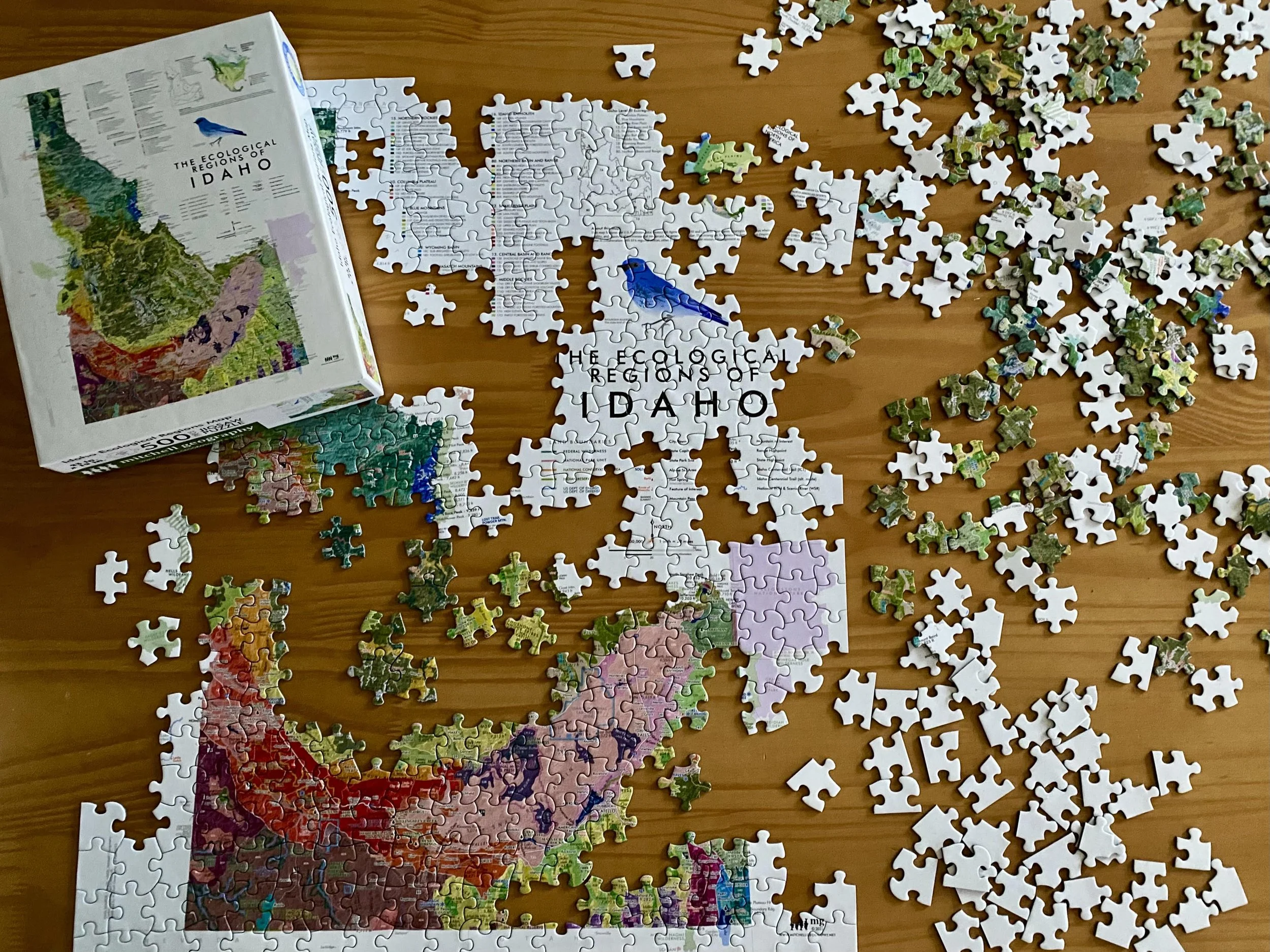
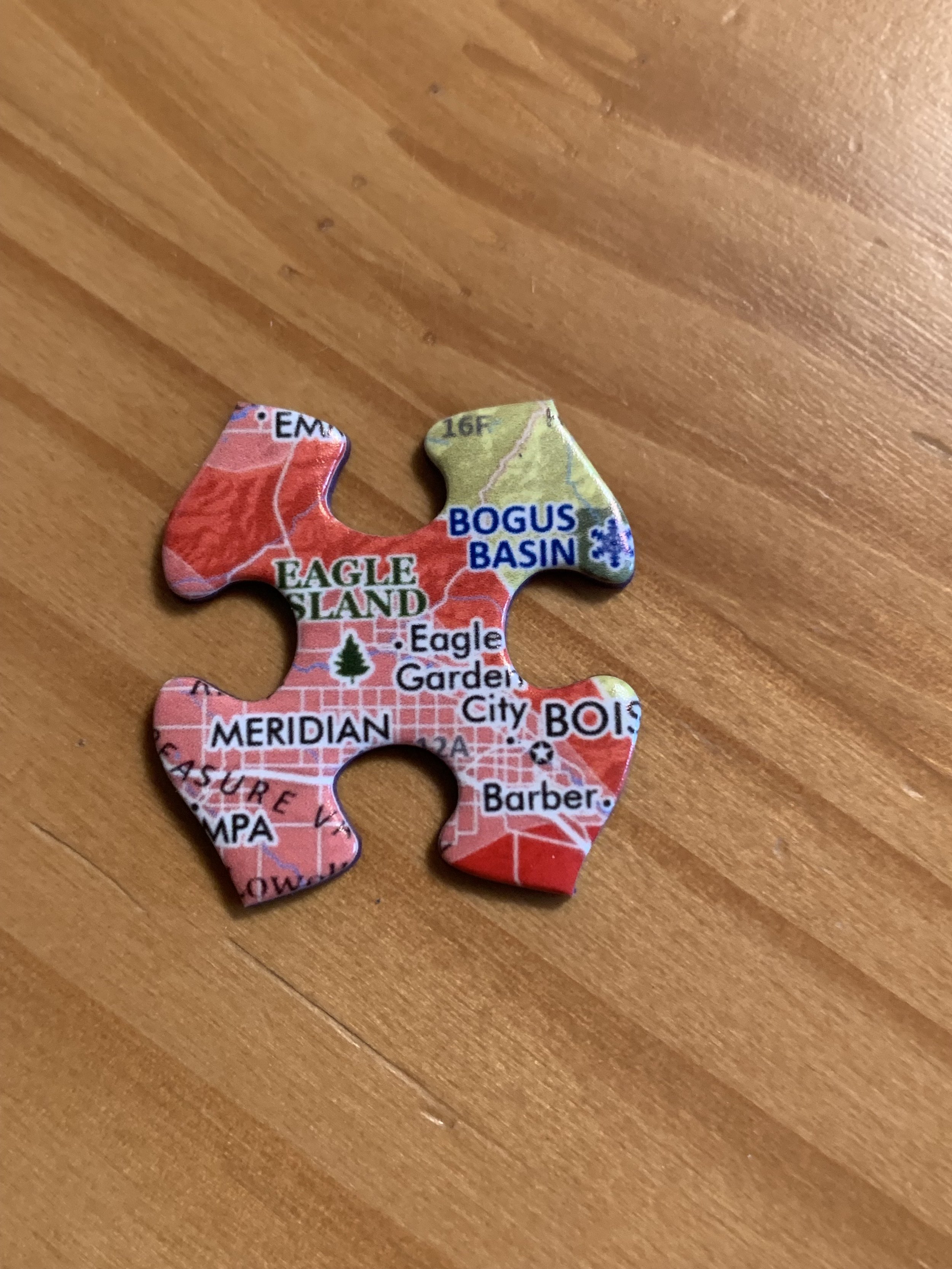
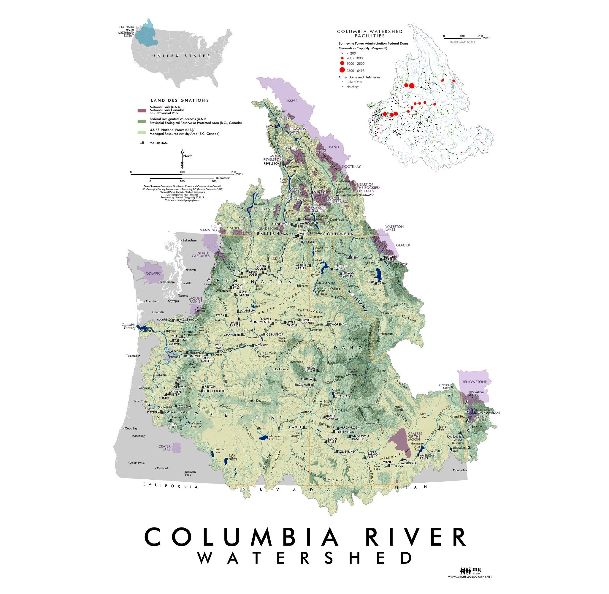
 Image 1 of 5
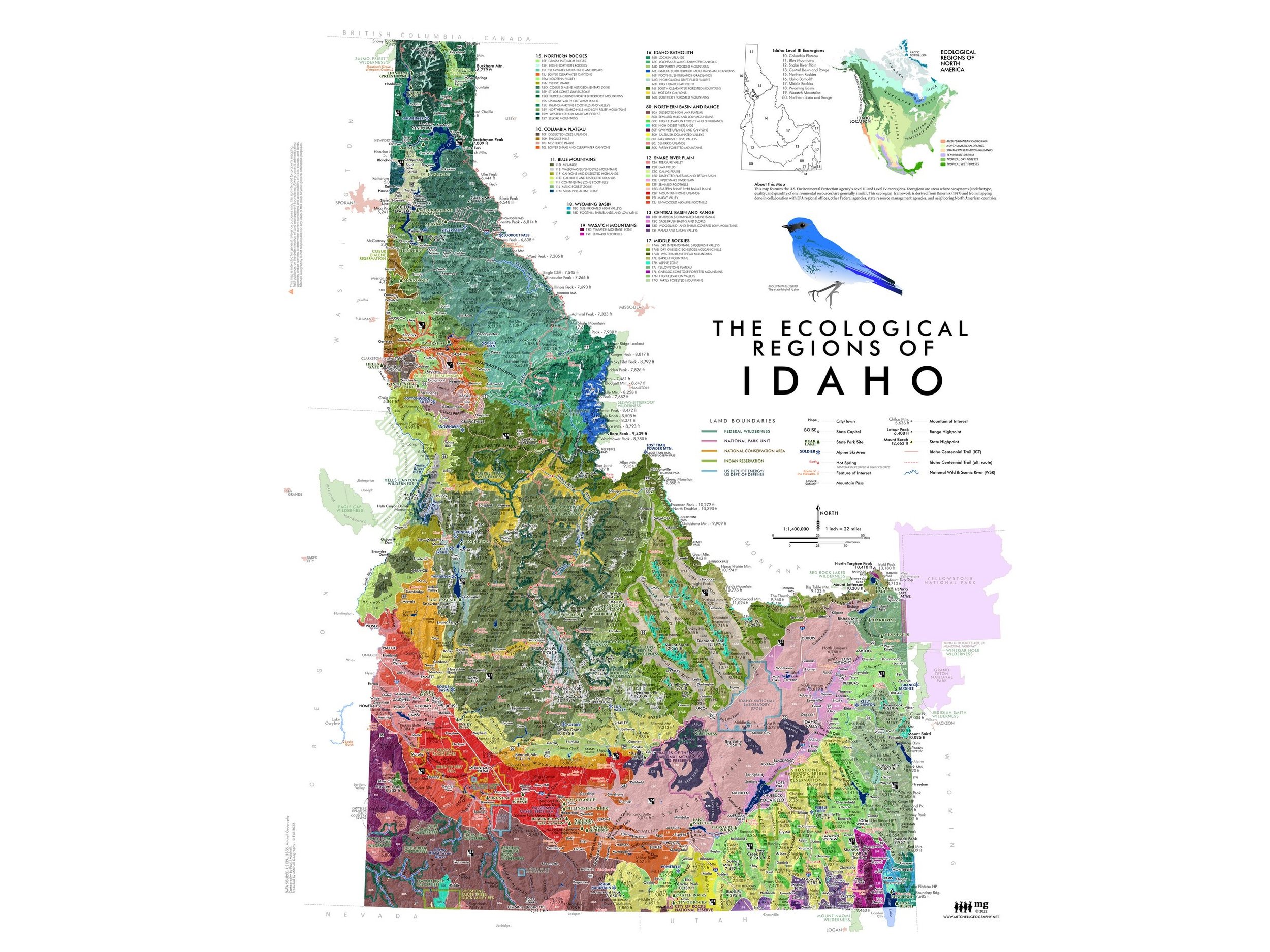
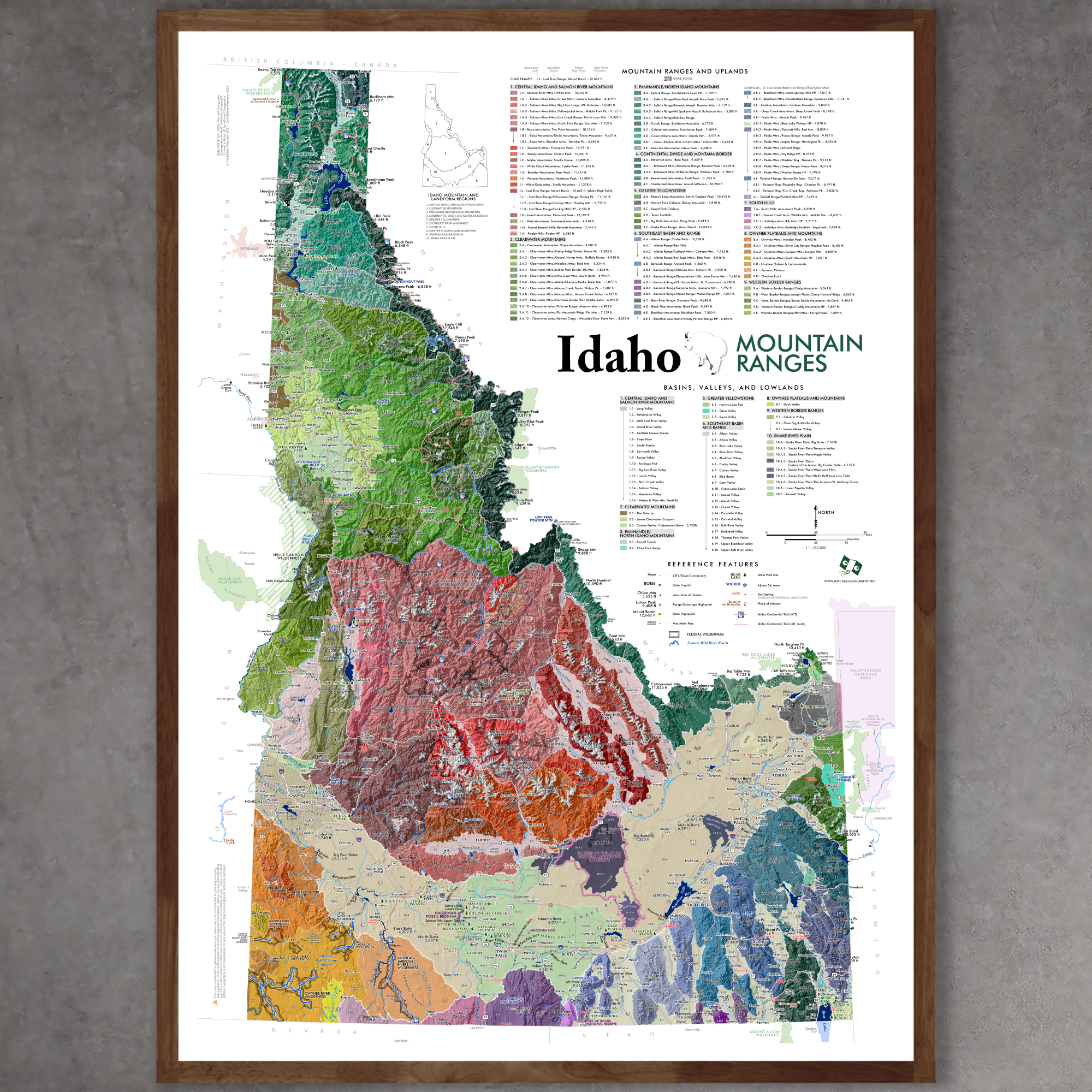
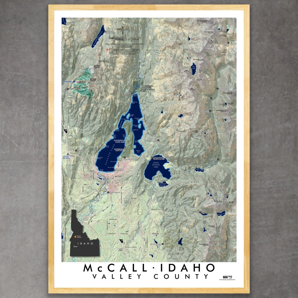
 Image 2 of 5
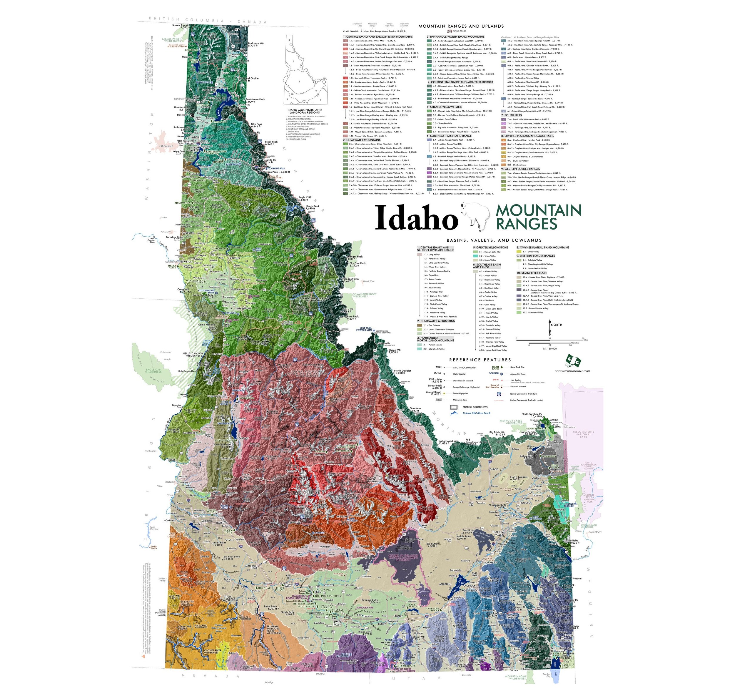
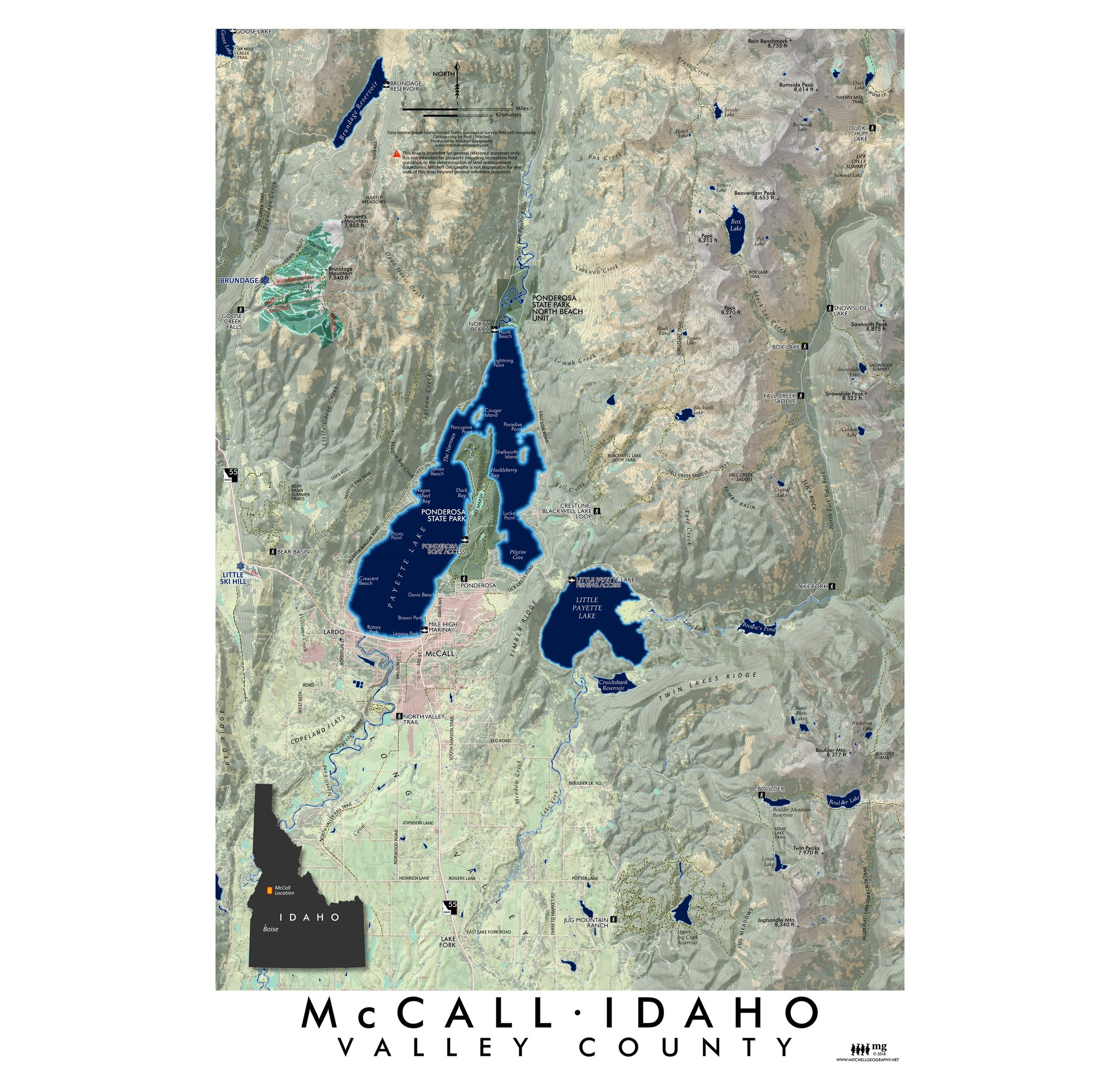
 Image 3 of 5
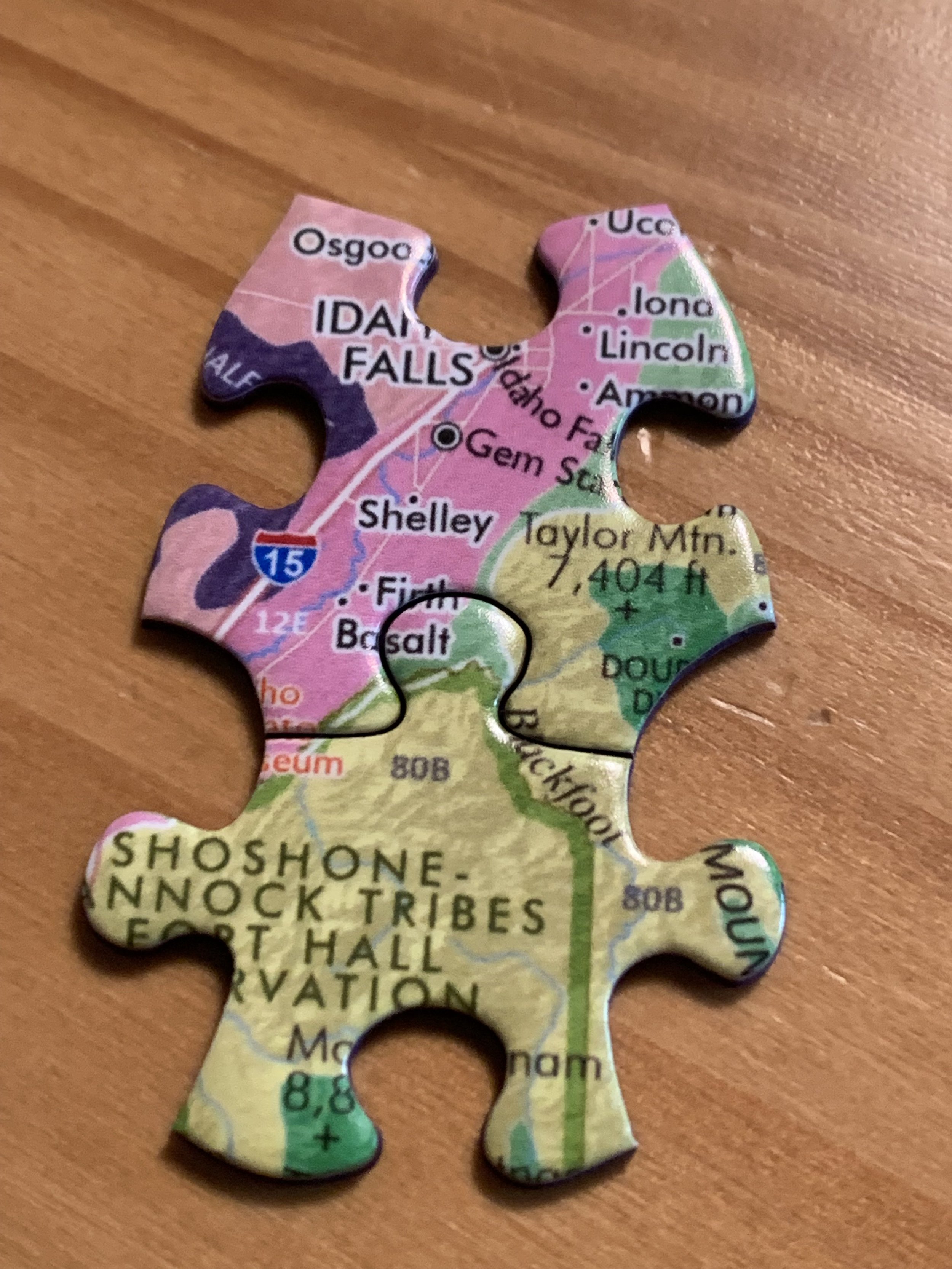
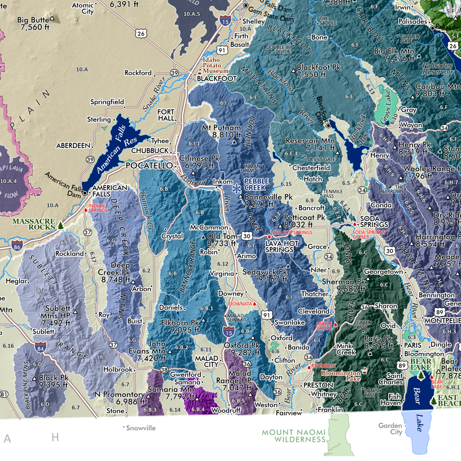
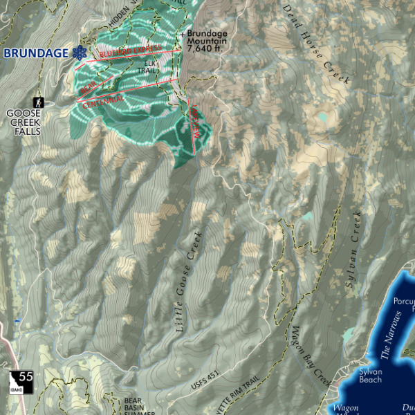
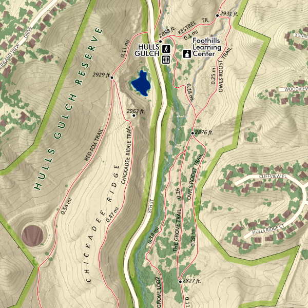 Image 4 of 5
 Image 5 of 5