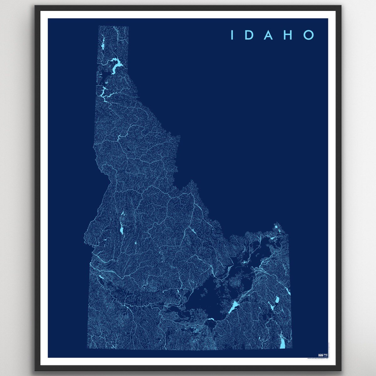
1:1,400,000
20 inch x 24 inch — flat wall map, printed on a heavy fine paper — shipped rolled.
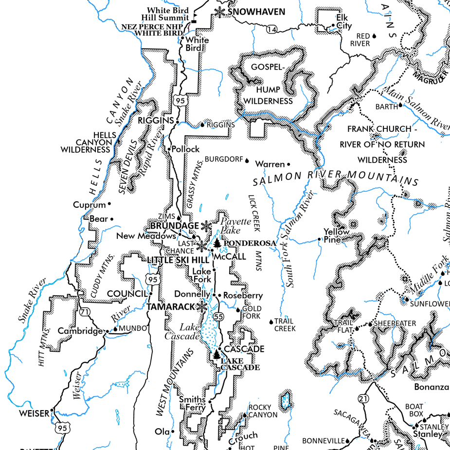
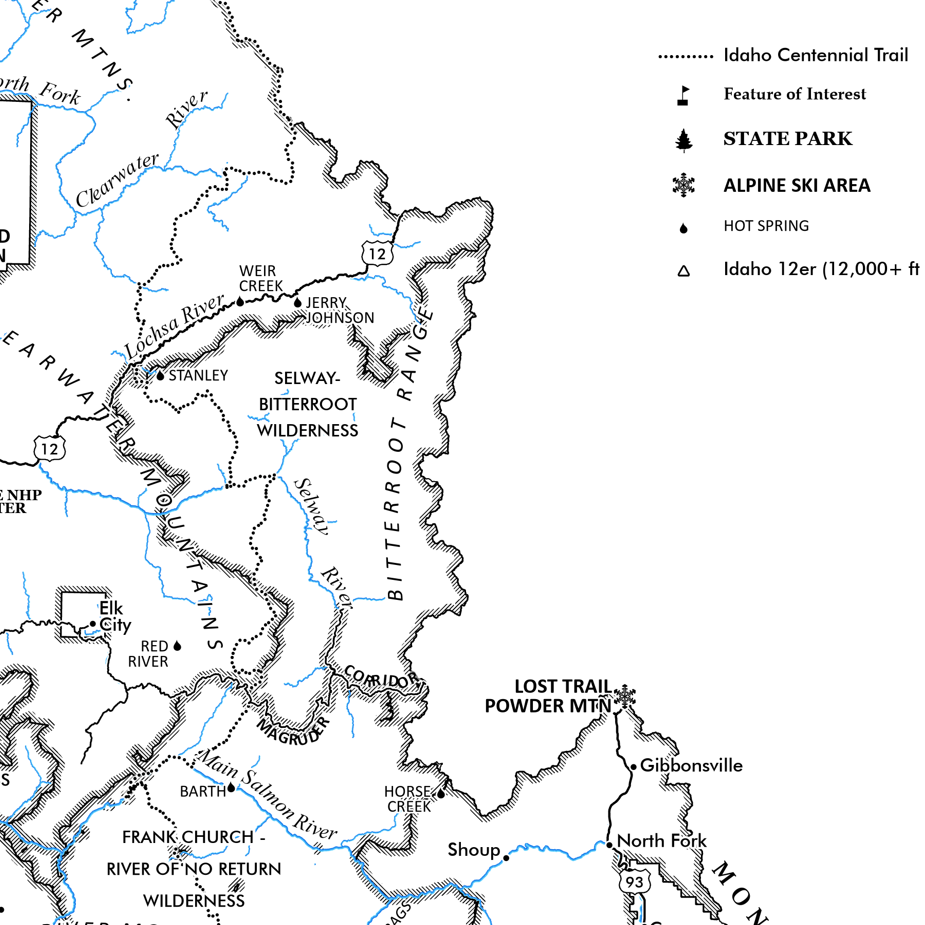
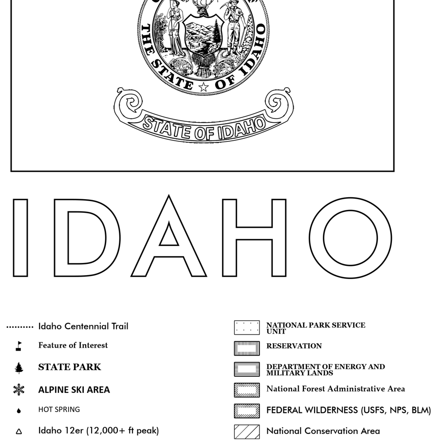
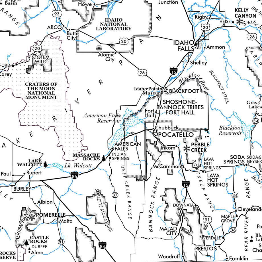
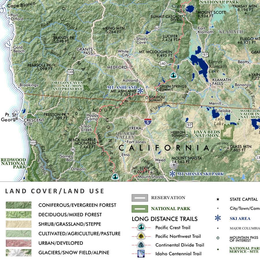
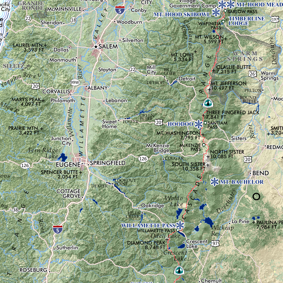
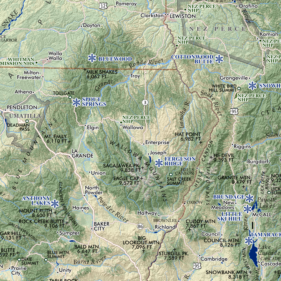
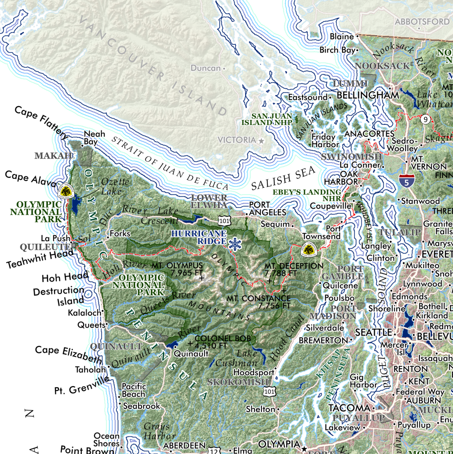
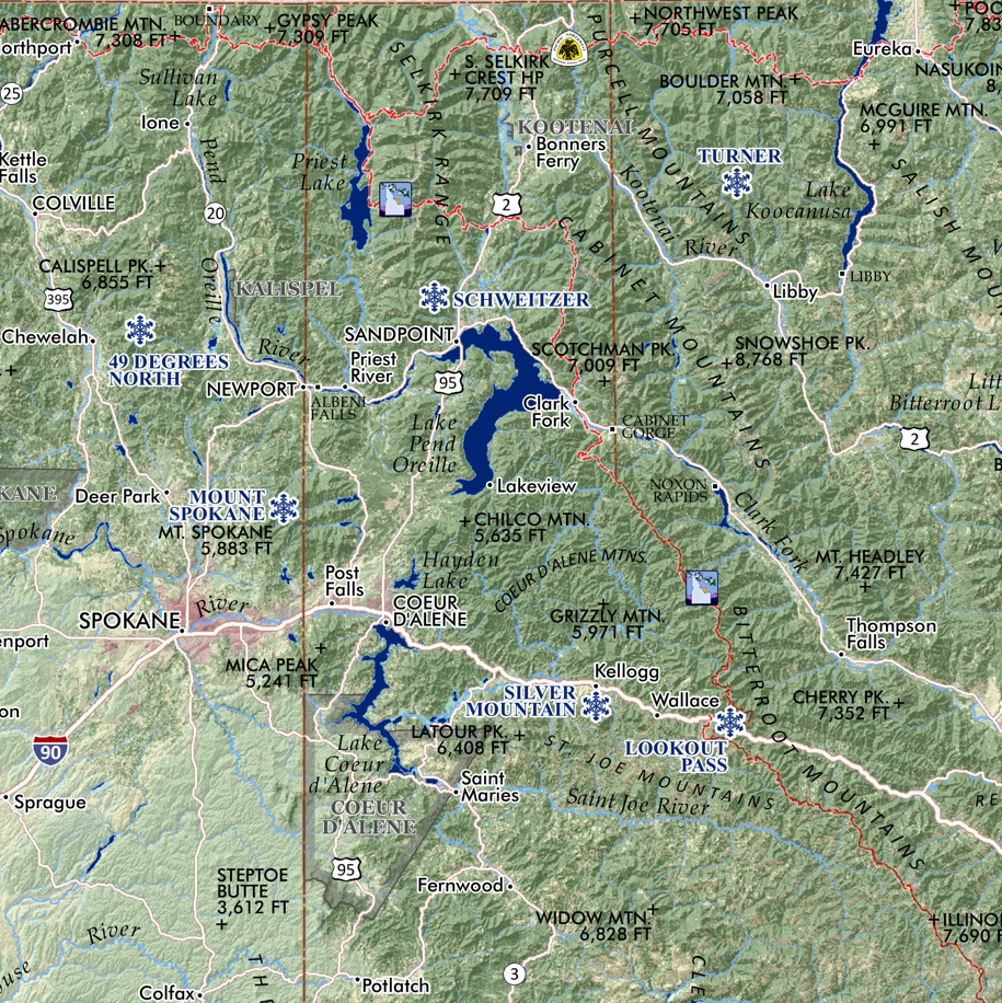
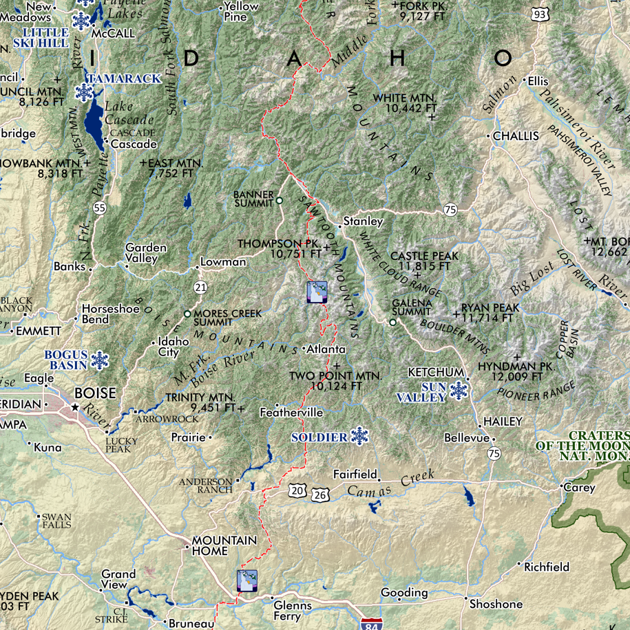
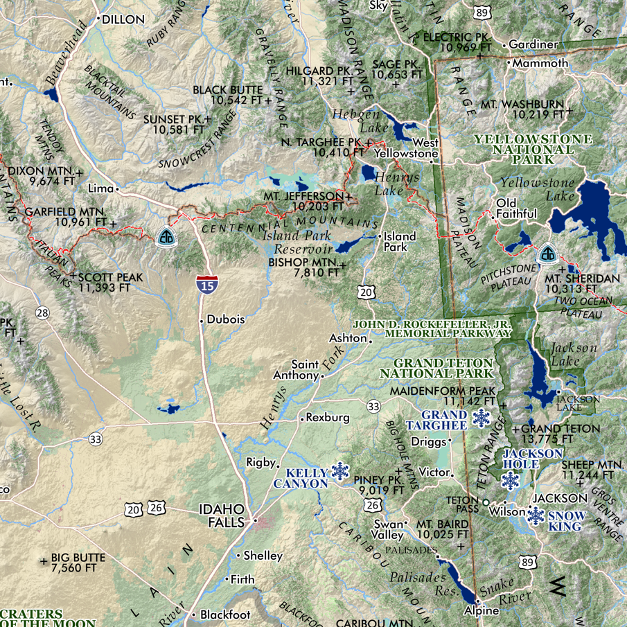
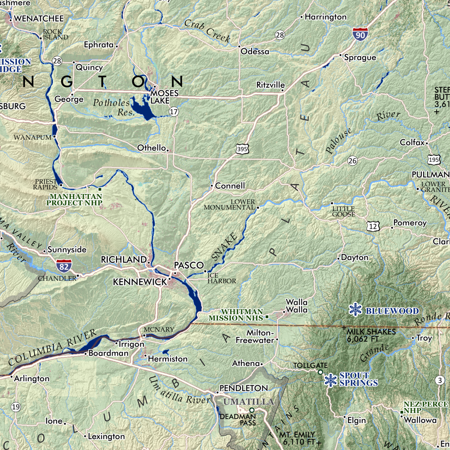
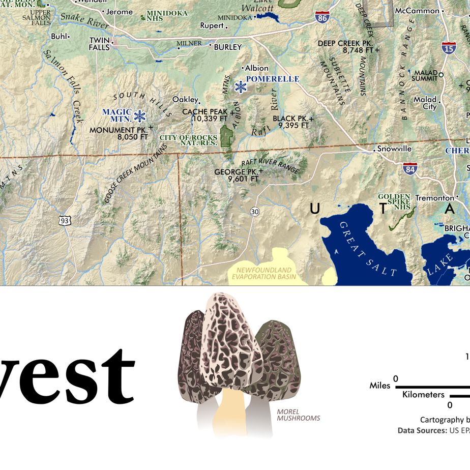
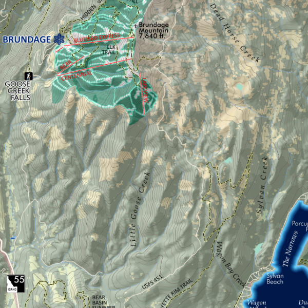
Idaho Mountain Ranges and Landforms map. Featuring Idaho’s many mountain ranges, named sub-ranges of any significance — all delineated, colored and keyed to a detailed legend that identifies range and sub-range high point names and elevations in feet. Other uplands, plateaus, basins, valleys, and lowlands are also classed and keyed within the legend. Also included for reference: towns, cities, places, special features, hot springs (only the familiar ones thou, not your favorite secret ones!), alpine ski areas, state park sites, wilderness areas (with a subtly hashed boundary line), national park sites, wild and scenic river segments, the Idaho Centennial Trail Route, and a nice rich terrain and hillshade.
*June 2022 print errata corrections update: Chinese Peak in the Pocatello Range has been correctly labeled.
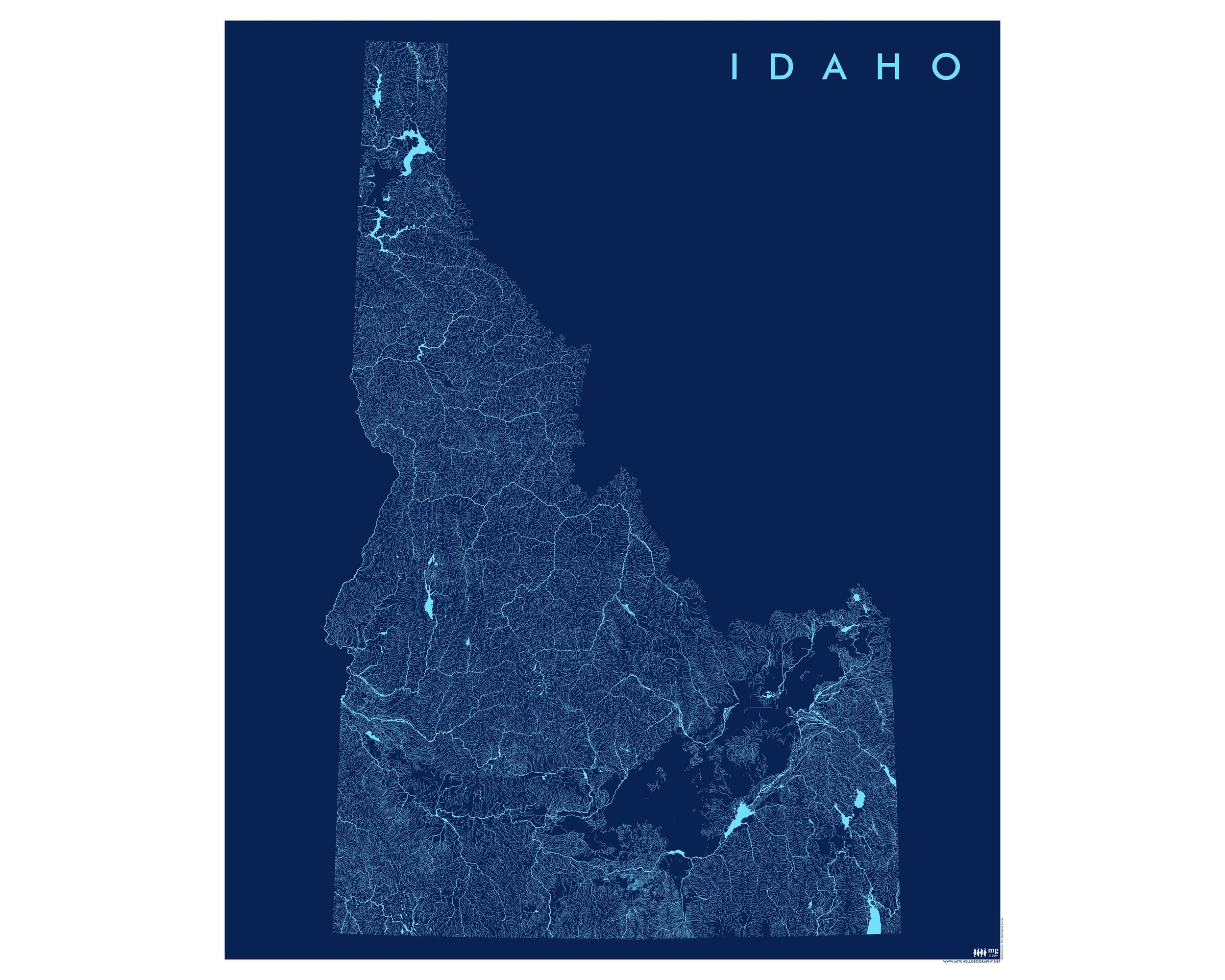
1:1,400,000
20 inch x 24 inch — flat wall map, printed on a heavy fine paper — shipped rolled.
Idaho Mountain Ranges and Landforms map. Featuring Idaho’s many mountain ranges, named sub-ranges of any significance — all delineated, colored and keyed to a detailed legend that identifies range and sub-range high point names and elevations in feet. Other uplands, plateaus, basins, valleys, and lowlands are also classed and keyed within the legend. Also included for reference: towns, cities, places, special features, hot springs (only the familiar ones thou, not your favorite secret ones!), alpine ski areas, state park sites, wilderness areas (with a subtly hashed boundary line), national park sites, wild and scenic river segments, the Idaho Centennial Trail Route, and a nice rich terrain and hillshade.
*June 2022 print errata corrections update: Chinese Peak in the Pocatello Range has been correctly labeled.

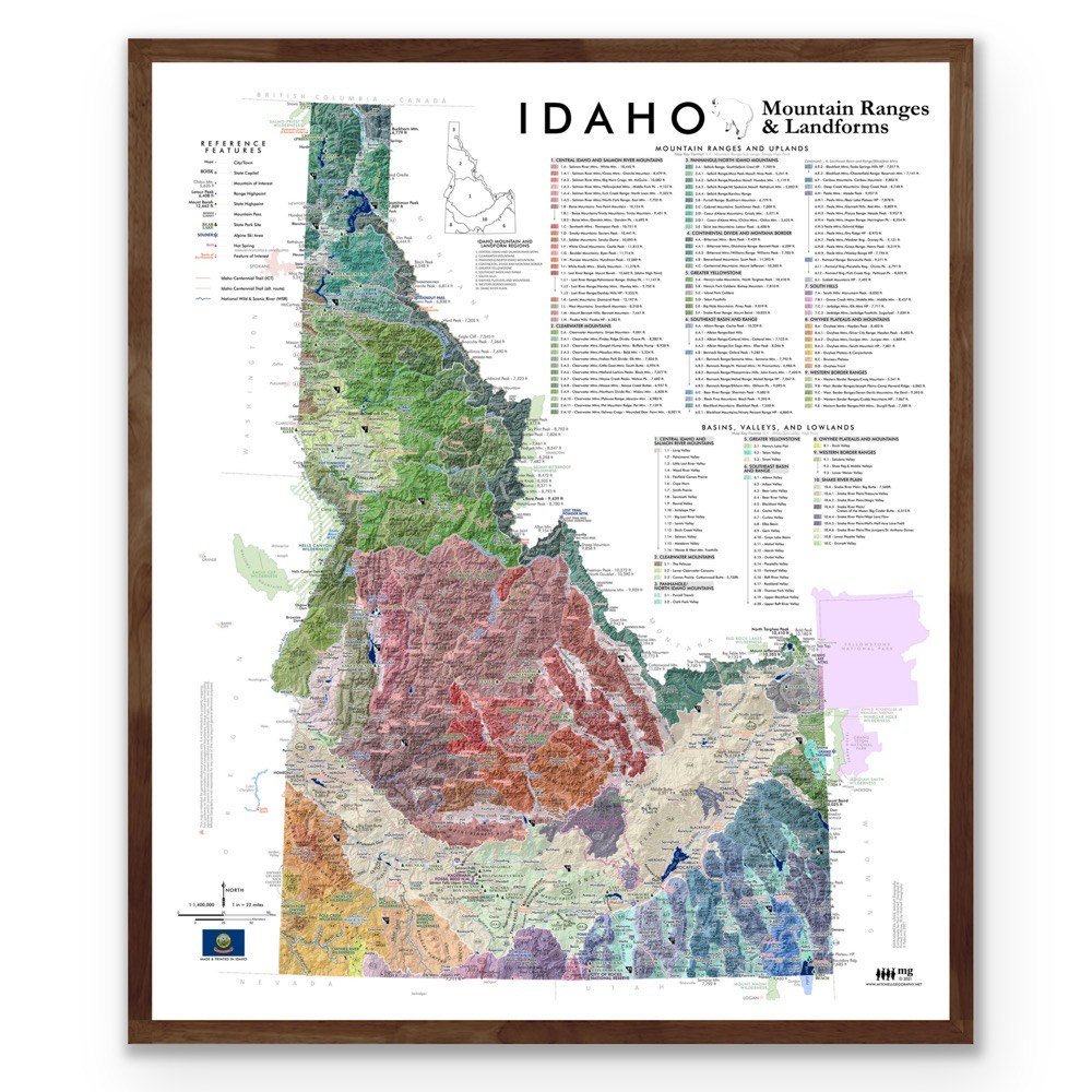 Image 1 of 11
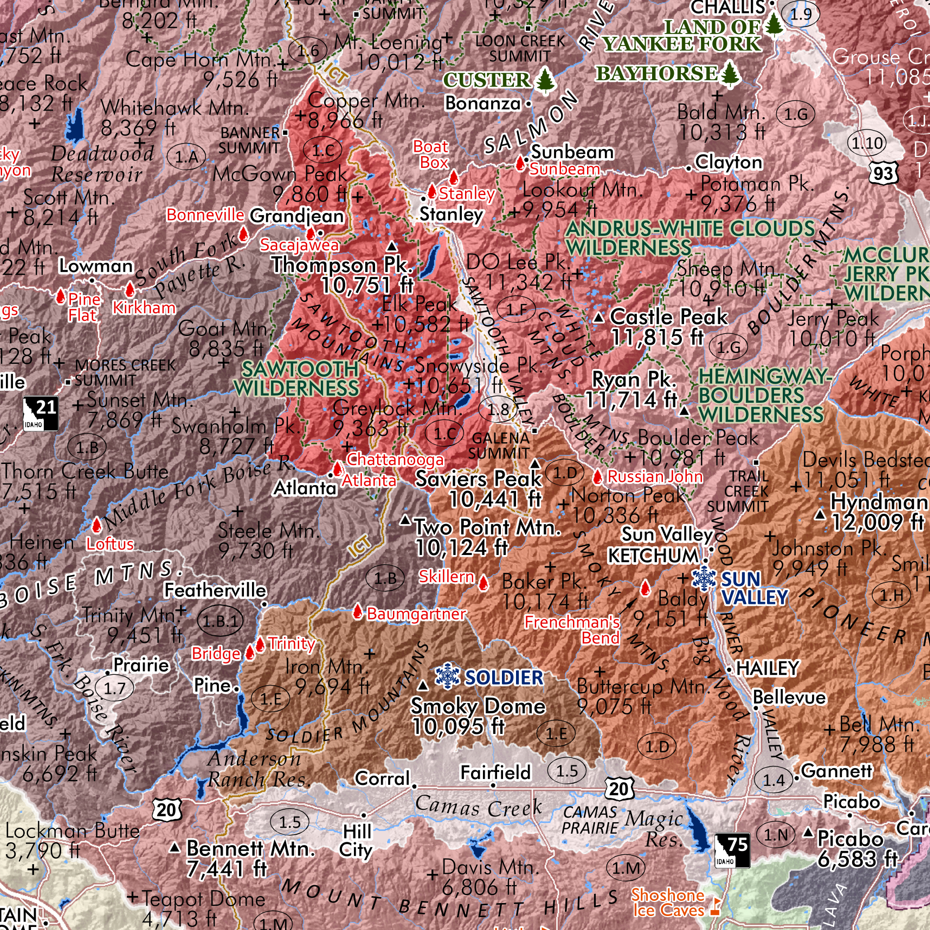 Image 2 of 11
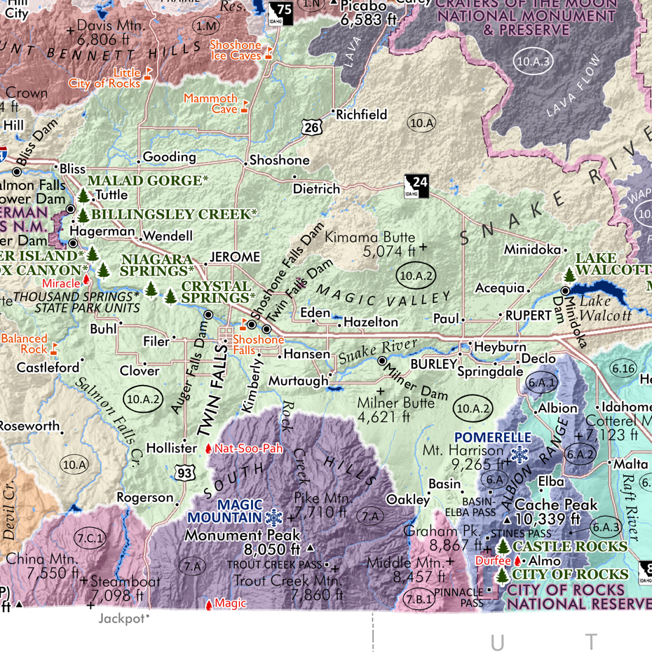 Image 3 of 11
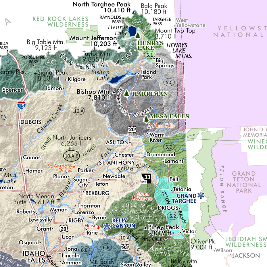 Image 4 of 11
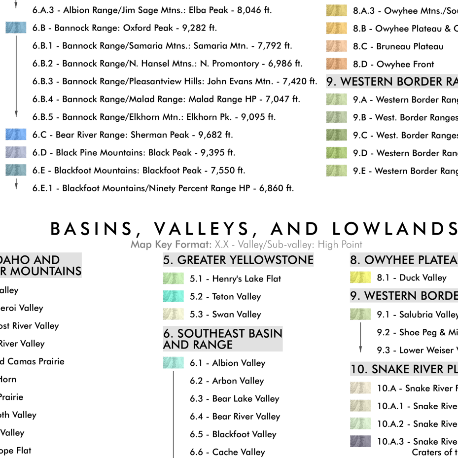 Image 5 of 11
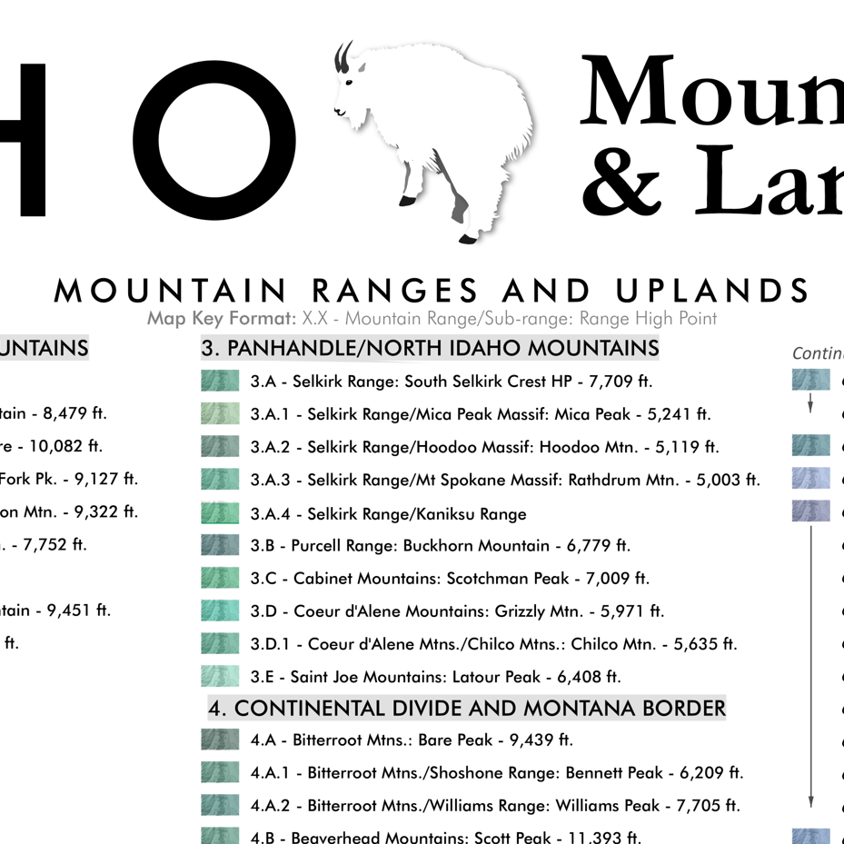 Image 6 of 11
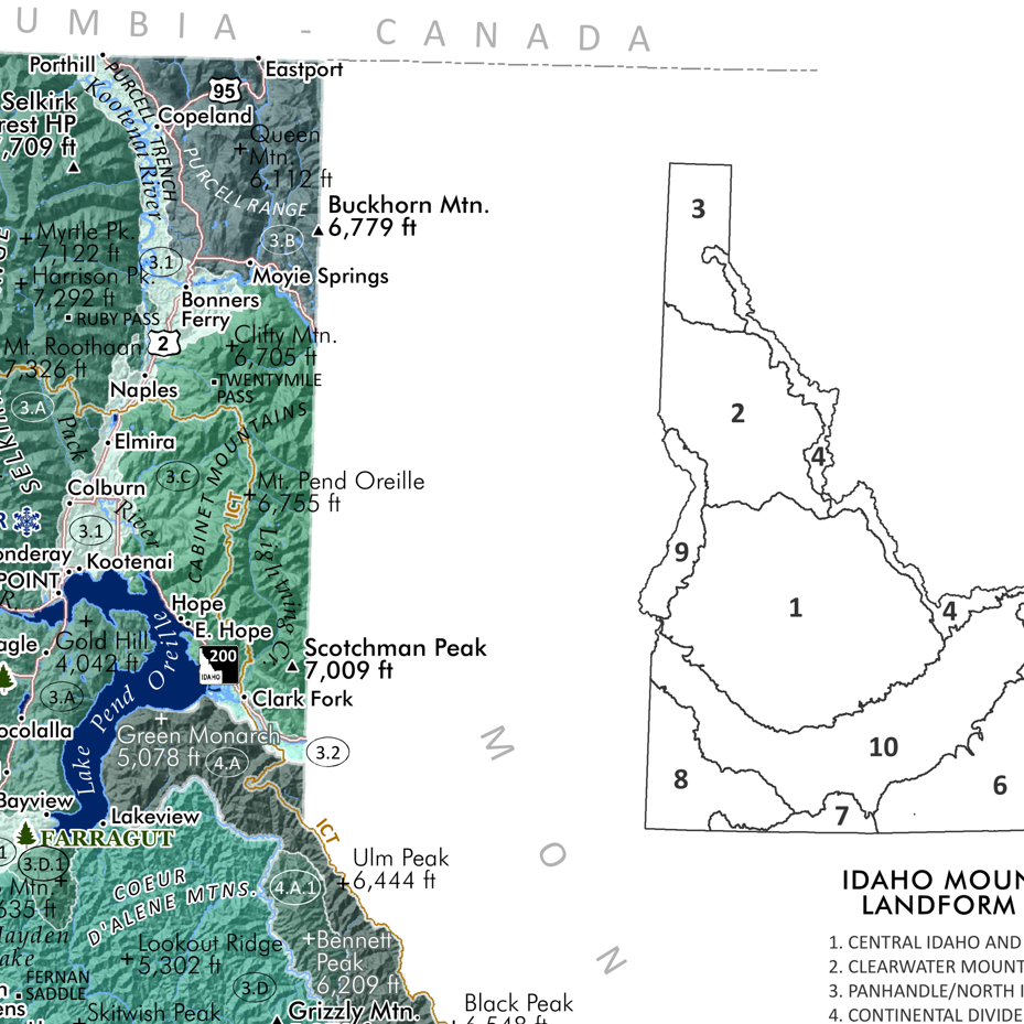 Image 7 of 11
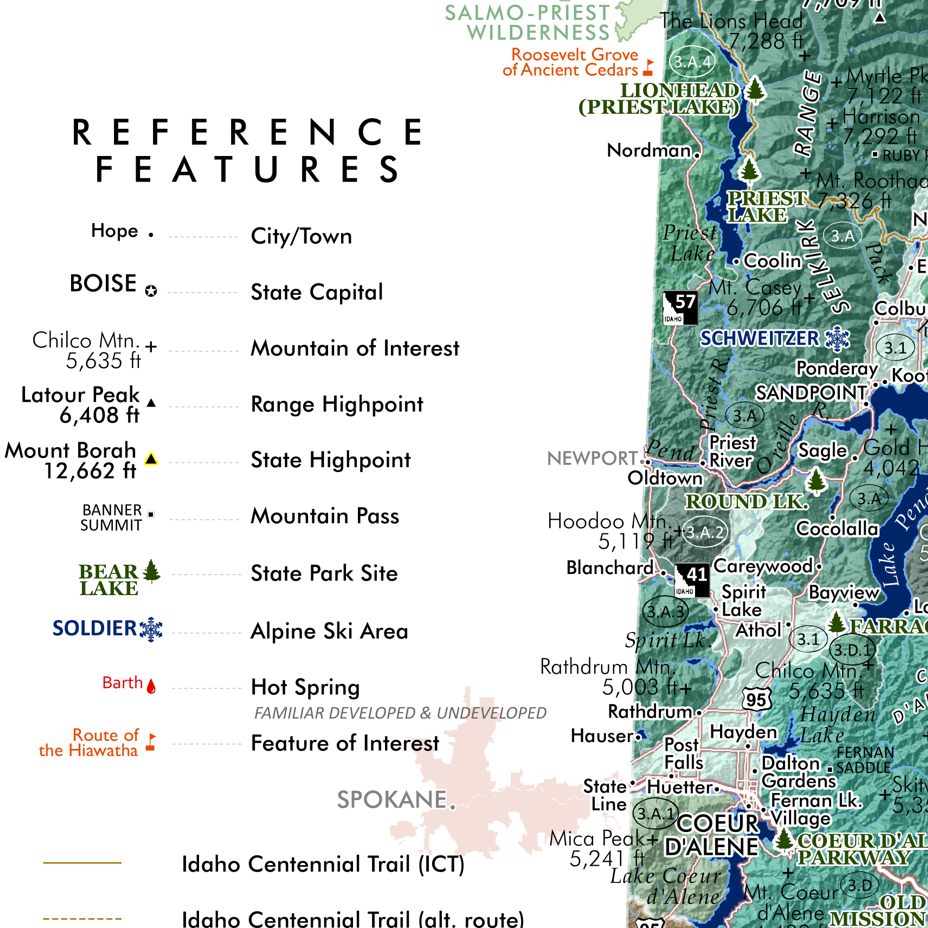 Image 8 of 11
 Image 9 of 11
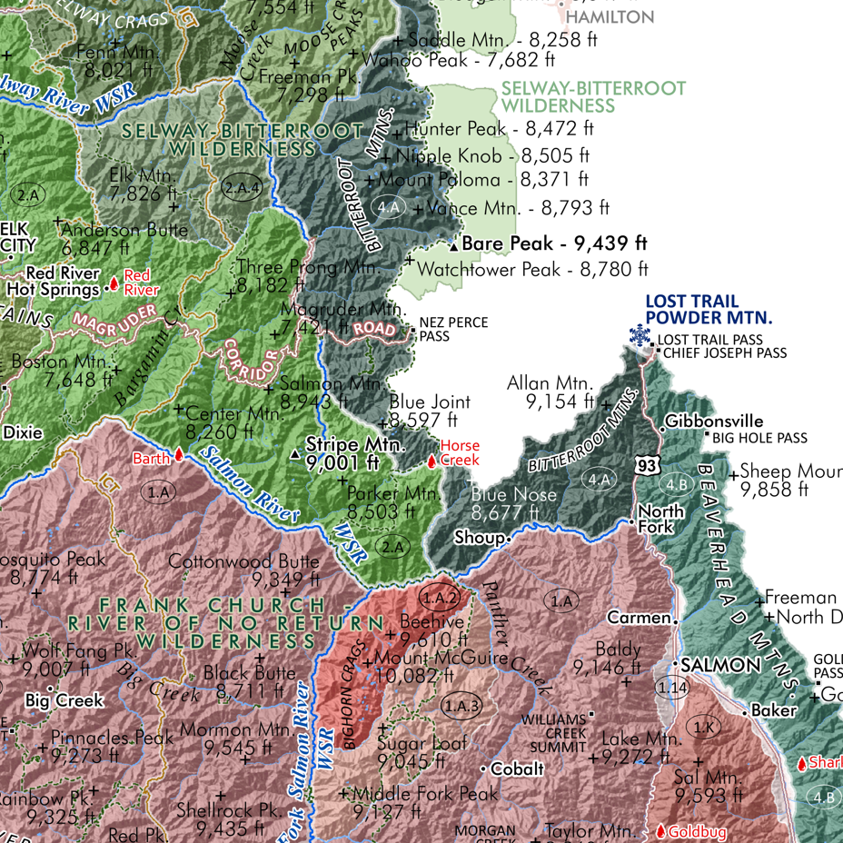 Image 10 of 11
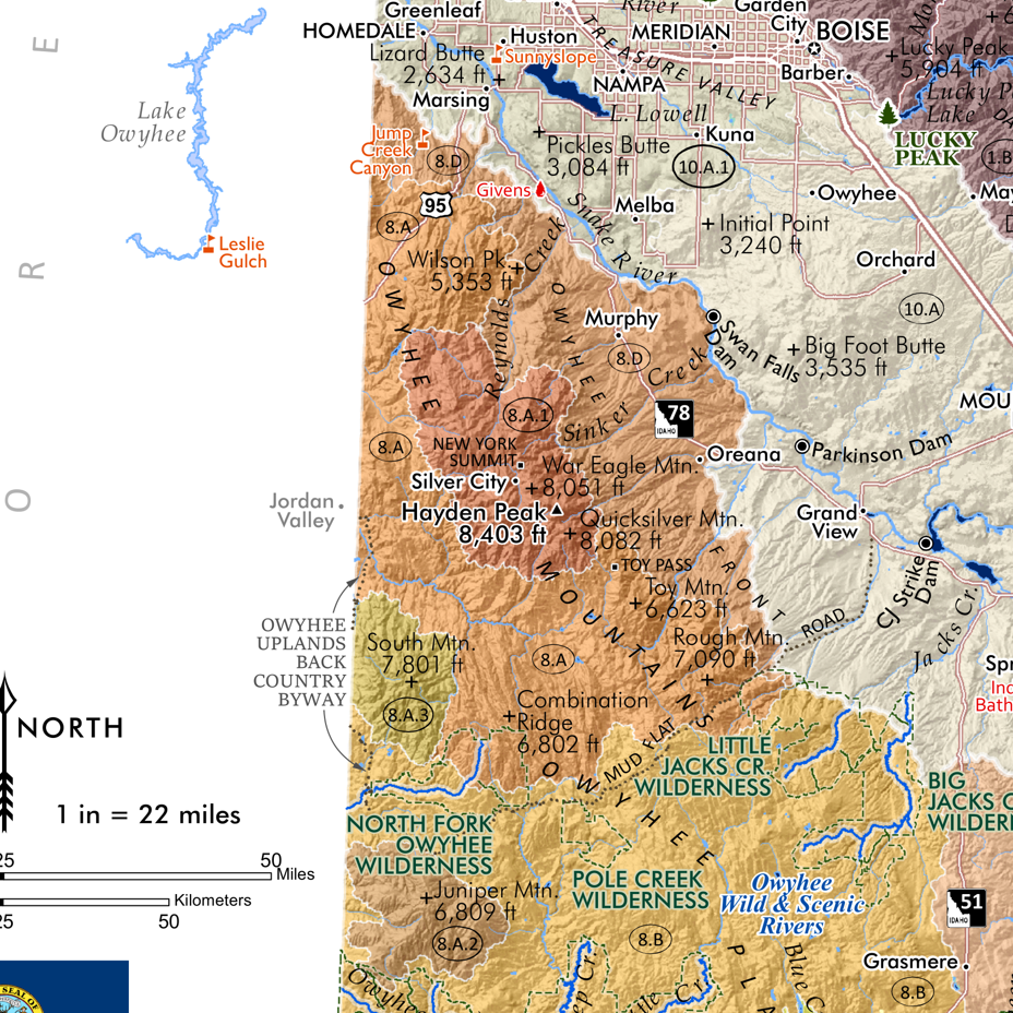 Image 11 of 11