Lake Pend Oreille
13 inch by 19 inch flat wall map, printed on heavy fine paper. Shipped rolled or flat, order volume dependent.
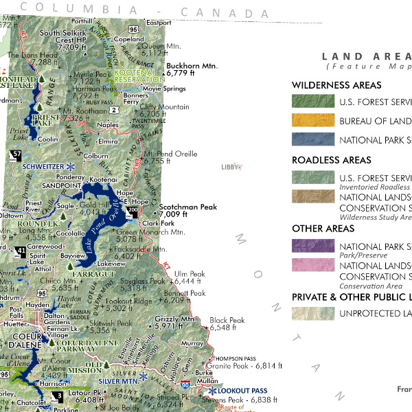
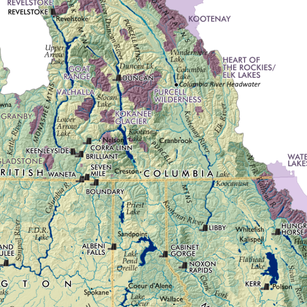
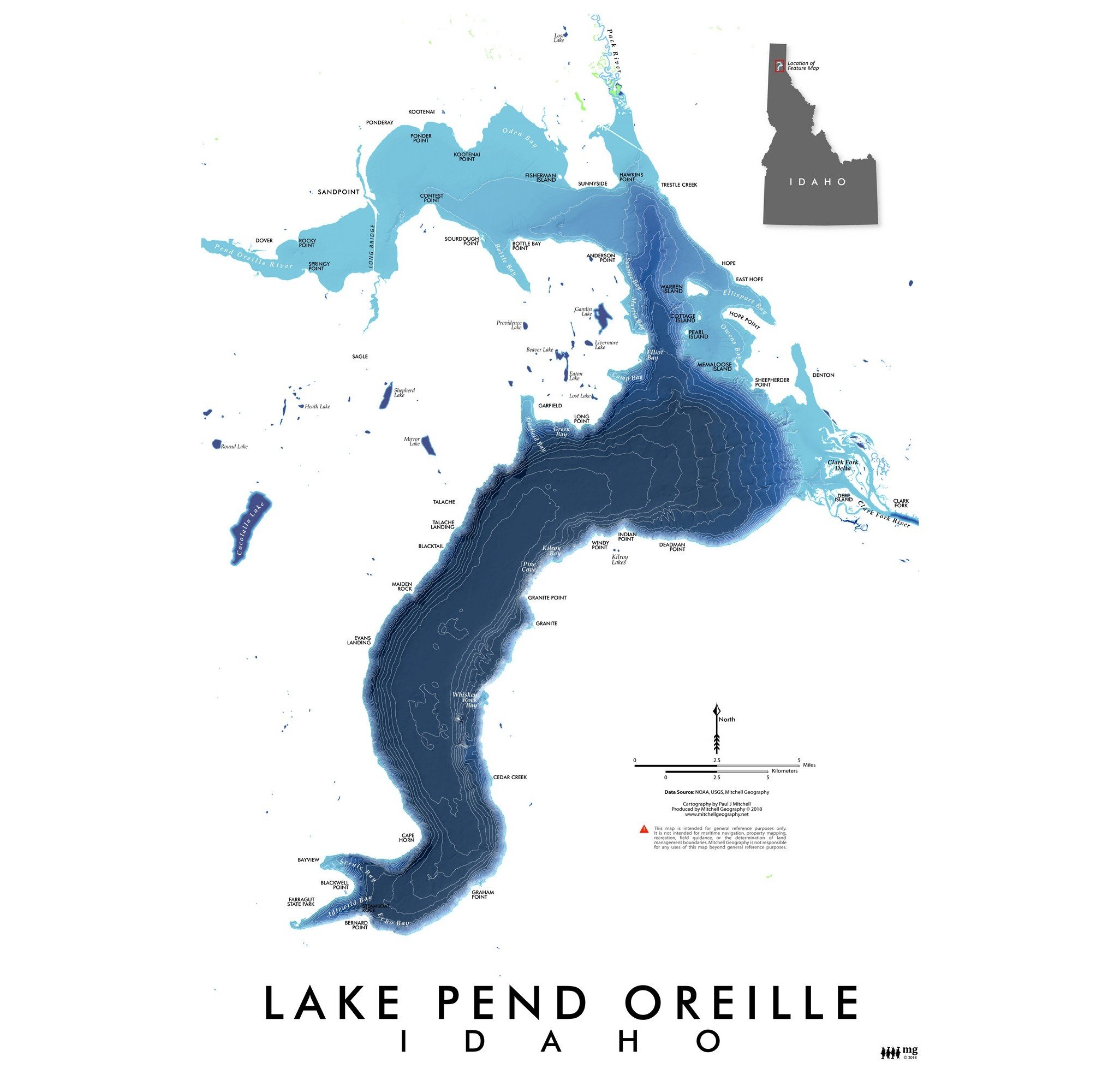
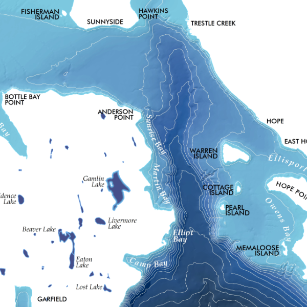
Lake Pend Oreille, Idaho. Idaho's largest lake, is shown in this colorful bathymetric representation! Capes, Bays, primary rivers, islands, and shoreline communities are included for reference of this North Idaho panhandle beauty.
13 inch by 19 inch flat wall map, printed on heavy fine paper. Shipped rolled or flat, order volume dependent.
Lake Pend Oreille, Idaho. Idaho's largest lake, is shown in this colorful bathymetric representation! Capes, Bays, primary rivers, islands, and shoreline communities are included for reference of this North Idaho panhandle beauty.