13 inch by 19 inch flat wall map, printed on heavy fine paper. Packed and shipped flat.
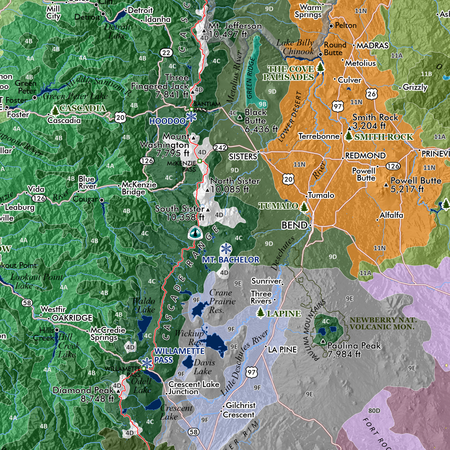
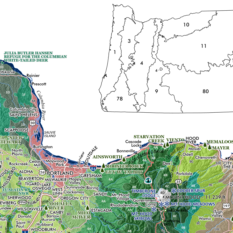
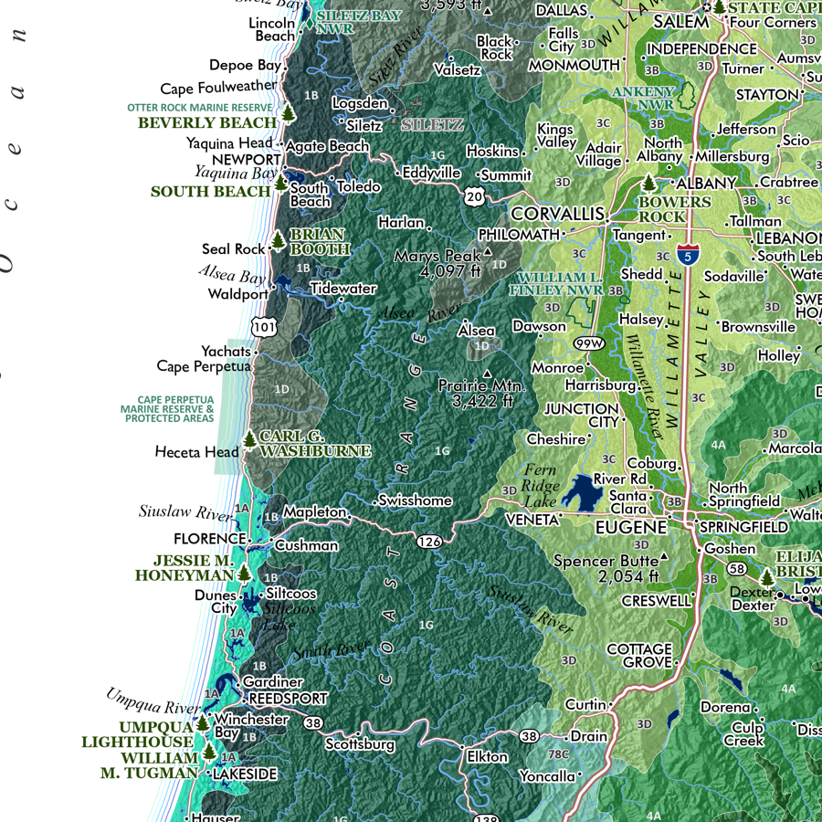
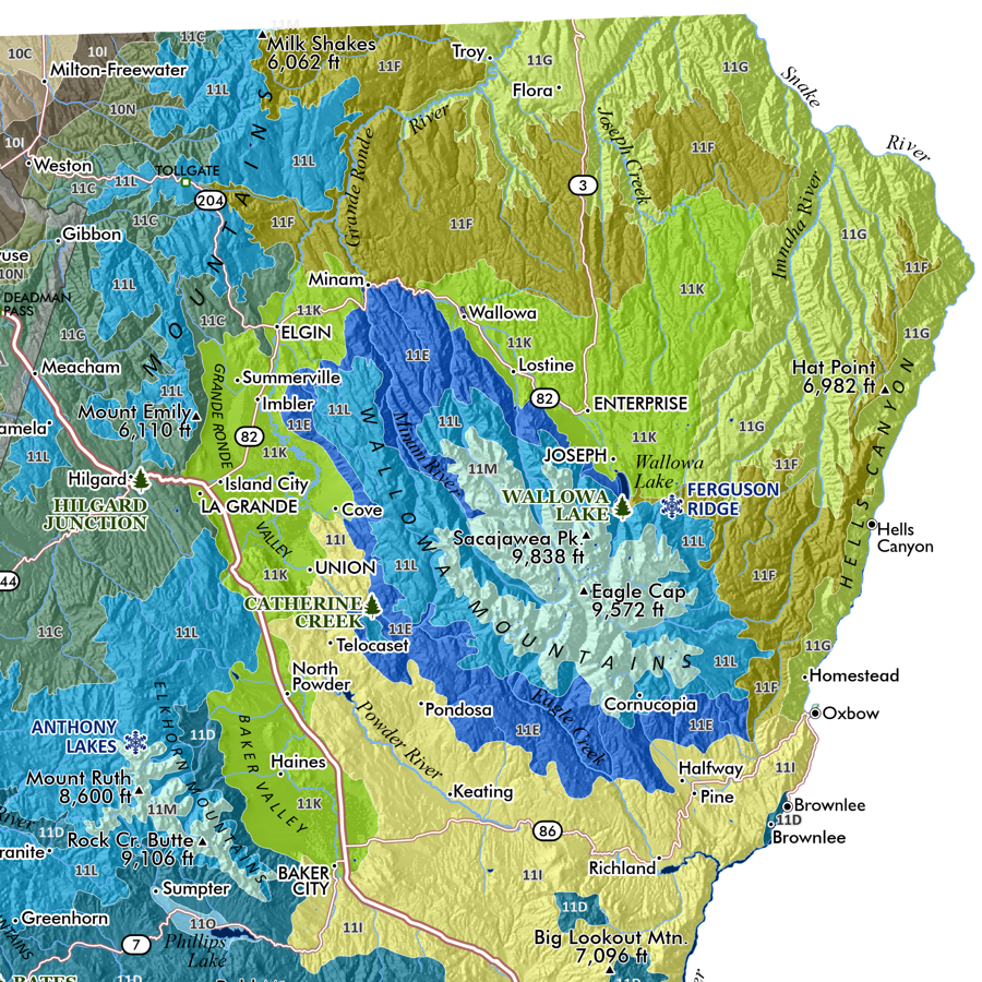
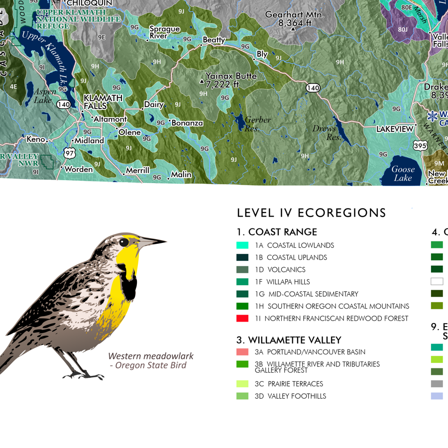
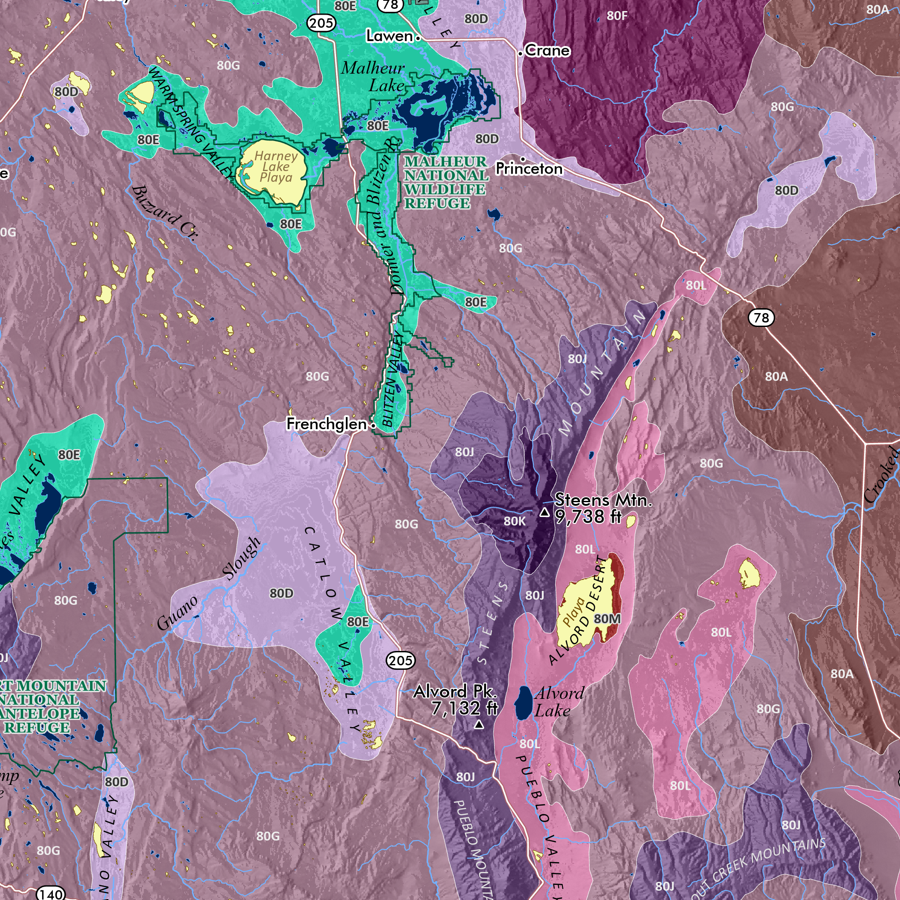
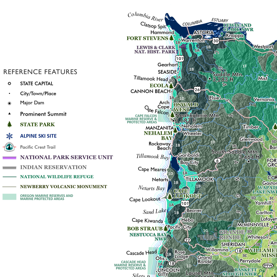
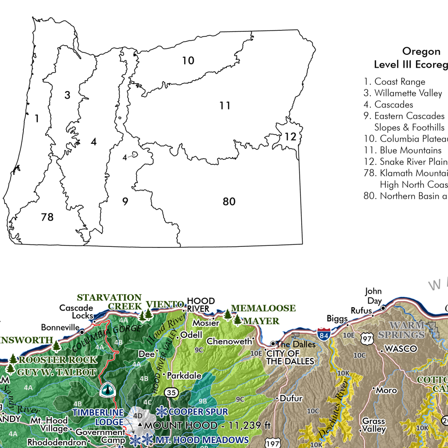
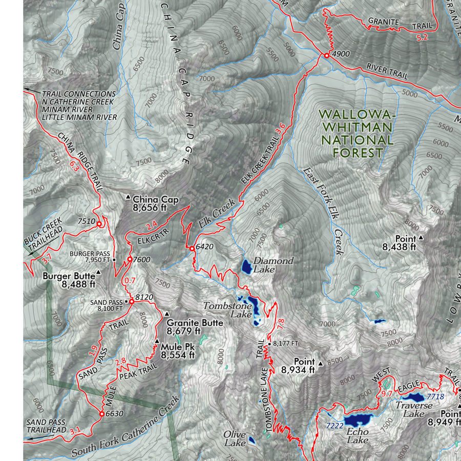
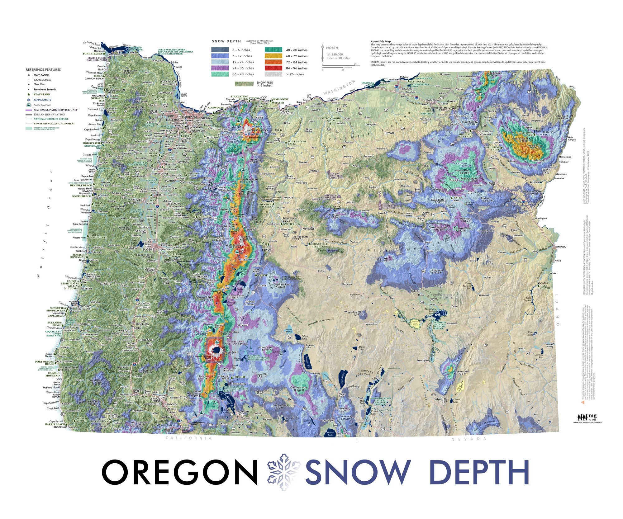
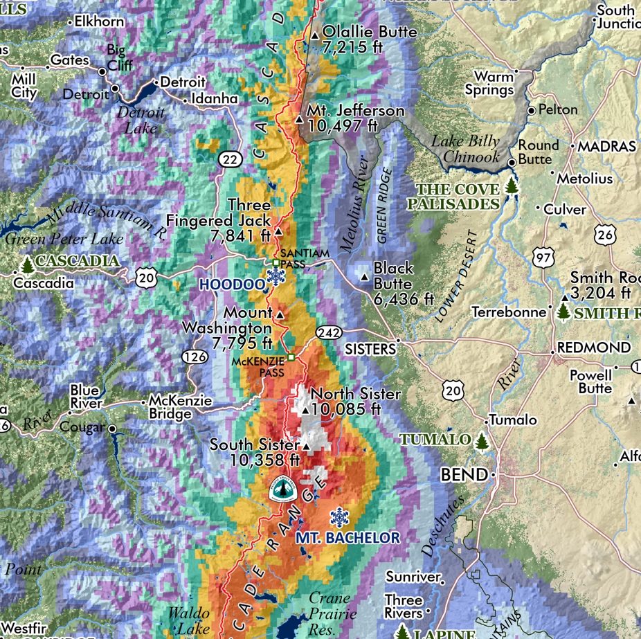
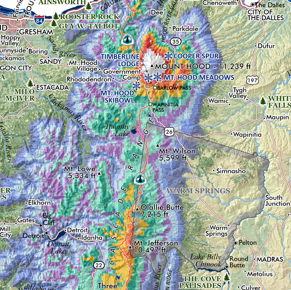
Columbia River Watershed, US & Canada. This is a smaller wall map - featuring the multi-jurisdictional and bi-national Columbia River basin (USA-Canada), across all contributing American States and British Columbia (as well as the endorheic basins of Oregon which the USGS treats within the same hydrologic region as the rest of the American Columbia Basin - as opposed to the Great Basin). Feature map includes primary land designations of national parks, wilderness/ecological areas, and national forest equivalents cross-walked between the states and B.C. Place names, major rivers, and major dams are mapped and labeled for reference. Inset facilities map locates the Bonneville Power Administration’s federal hydro-electric dam system by megawatt capacity, alongside other dams and fish hatcheries.
13 inch by 19 inch flat wall map, printed on heavy fine paper. Packed and shipped flat.
Columbia River Watershed, US & Canada. This is a smaller wall map - featuring the multi-jurisdictional and bi-national Columbia River basin (USA-Canada), across all contributing American States and British Columbia (as well as the endorheic basins of Oregon which the USGS treats within the same hydrologic region as the rest of the American Columbia Basin - as opposed to the Great Basin). Feature map includes primary land designations of national parks, wilderness/ecological areas, and national forest equivalents cross-walked between the states and B.C. Place names, major rivers, and major dams are mapped and labeled for reference. Inset facilities map locates the Bonneville Power Administration’s federal hydro-electric dam system by megawatt capacity, alongside other dams and fish hatcheries.

 Image 1 of 8
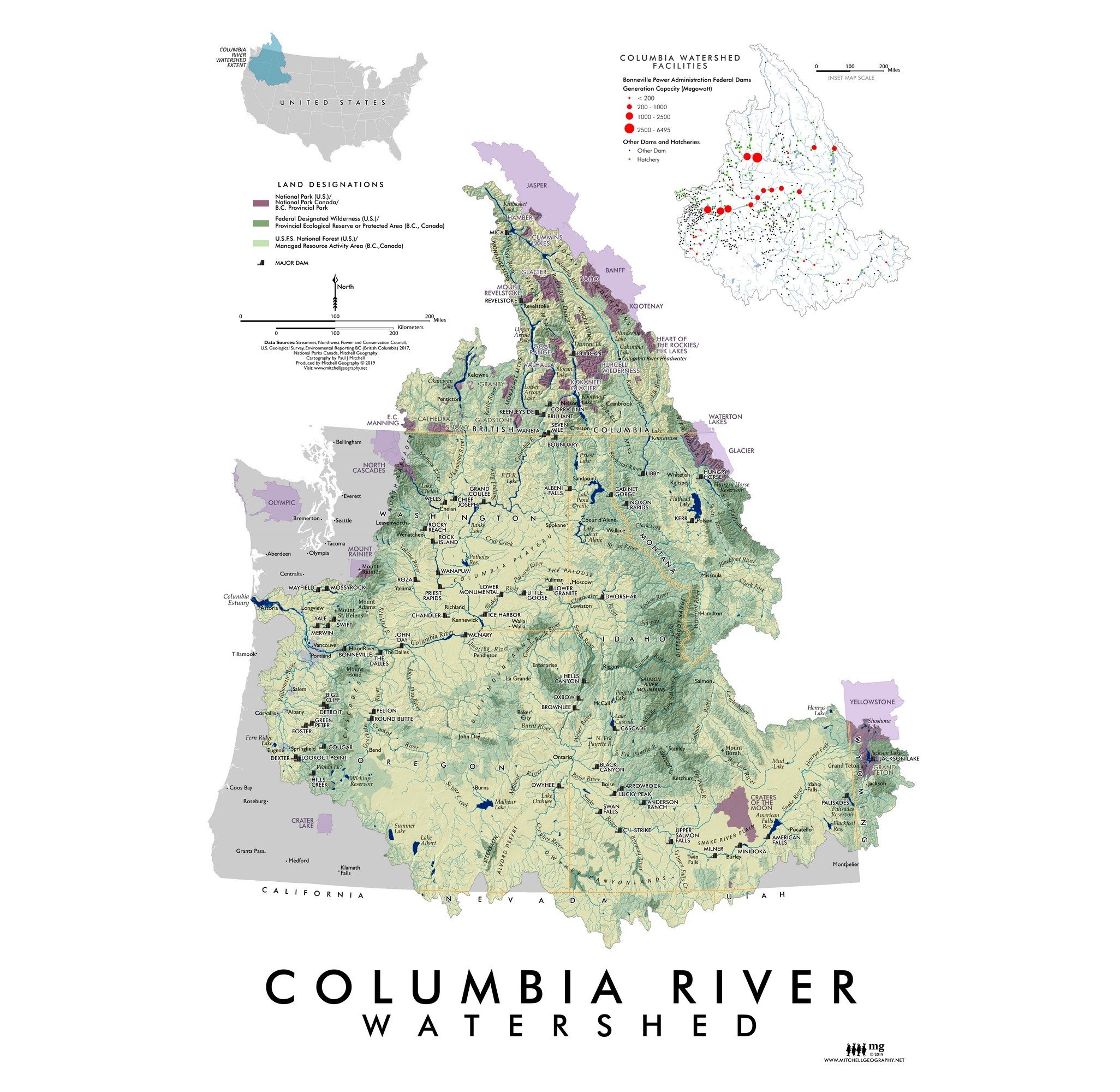 Image 2 of 8
 Image 3 of 8
 Image 4 of 8
 Image 5 of 8
 Image 6 of 8
 Image 7 of 8
 Image 8 of 8