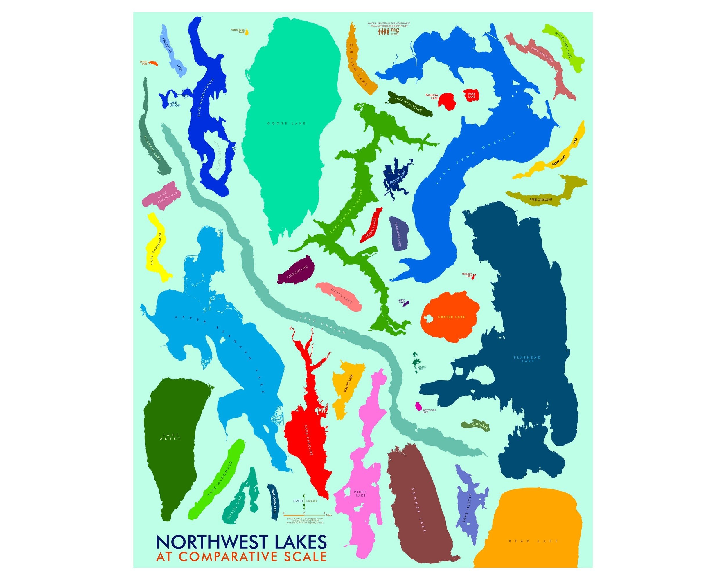
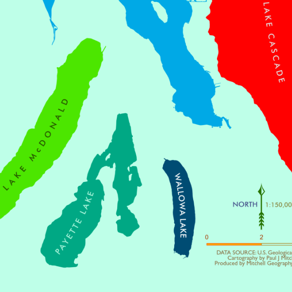
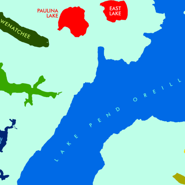
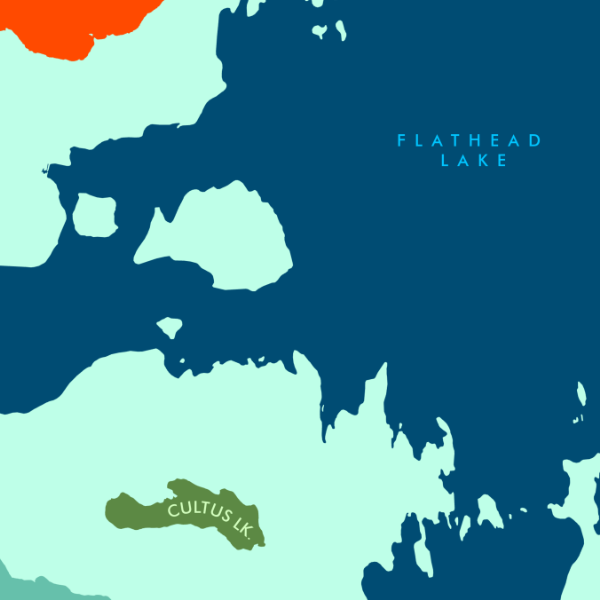
Mount Rainier Slope Aspect (19 in x 13 in)
13 inch by 19 inch flat wall map, printed on heavy fine paper. Packed and shipped flat.
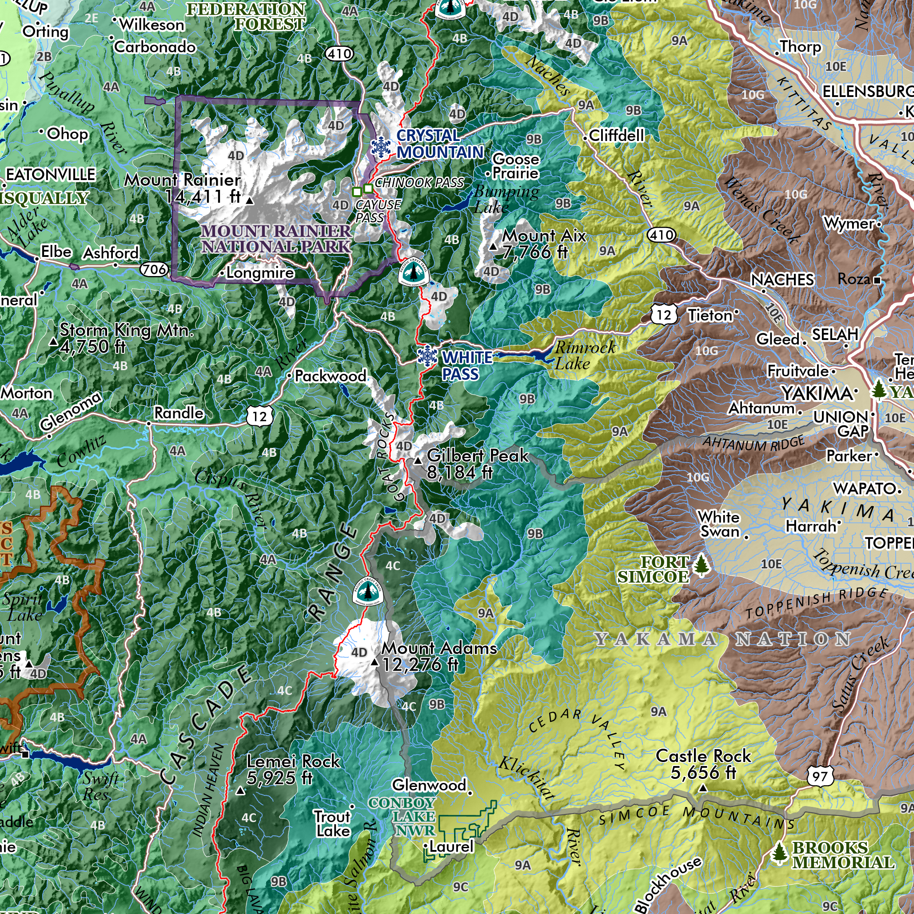
Mount Rainier, Washington. A colorful slope aspect representation of Washington’s iconic landmark, Mount Rainier. Slope aspect mapped with 1-meter USGS Lidar mapped glaciers, immediate features, and summits labeled.
A larger 24 x 20 inch Rainier Slope Aspect map is also available.
13 inch by 19 inch flat wall map, printed on heavy fine paper. Packed and shipped flat.
Mount Rainier, Washington. A colorful slope aspect representation of Washington’s iconic landmark, Mount Rainier. Slope aspect mapped with 1-meter USGS Lidar mapped glaciers, immediate features, and summits labeled.
A larger 24 x 20 inch Rainier Slope Aspect map is also available.