1:1,100,000
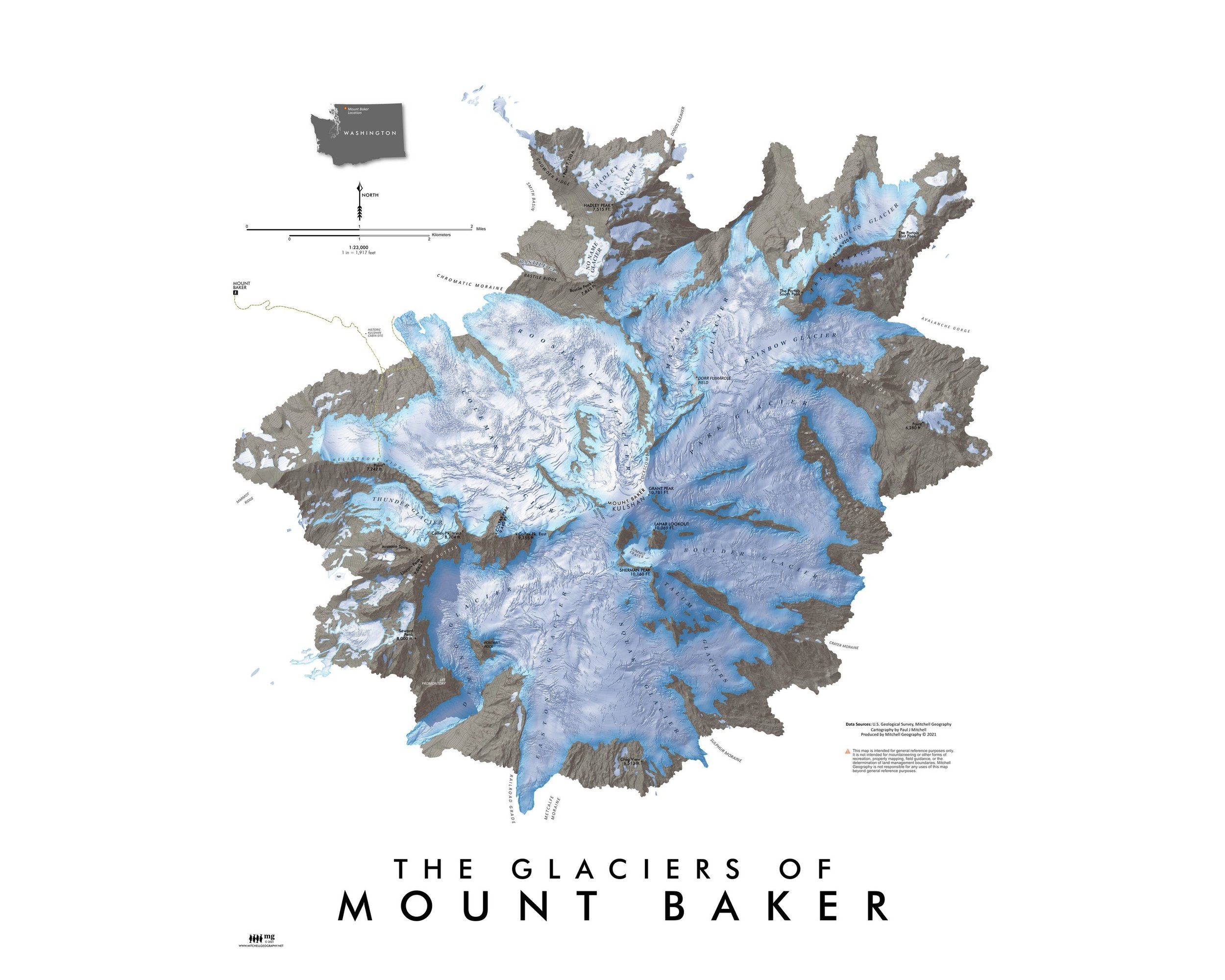
20 inch x 24 inch — flat wall map, printed on a heavy fine paper — shipped rolled.
A jigsaw puzzle version at the same scale is also available.
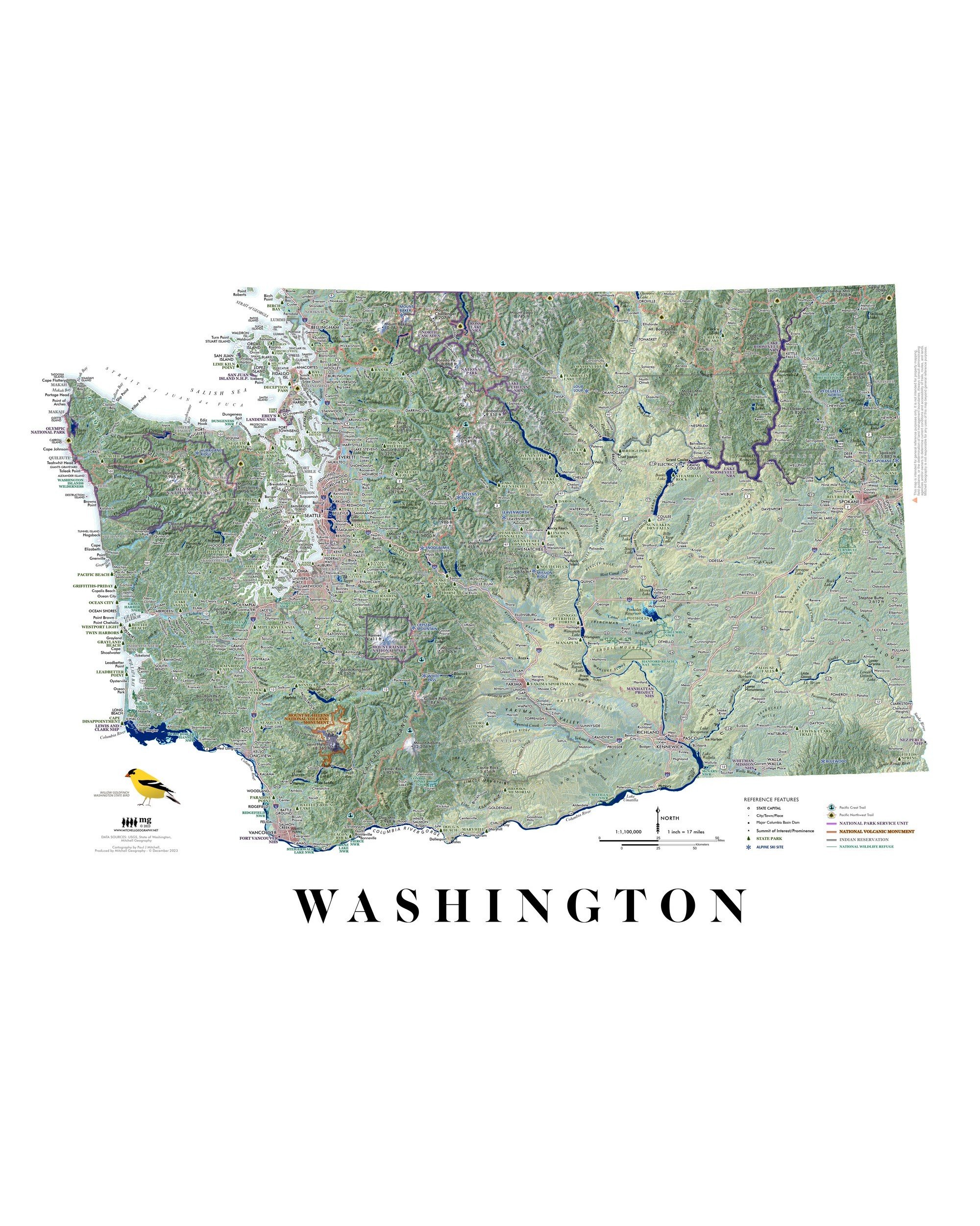
Washington Ecological Regions map. A re-symbolization of the EPA's Level IV ecoregions for the landscapes of Washington. Includes inset Washington Level III reference map for context. Level IV classes are symbolized and listed individually in the key for the feature map. Detailed reference labels includes cities/towns/places, state parks, alpine ski areas, highways/major roads, prominent summits of interest, landforms of significance, National Park units, Indian Reservations, and National Wildlife Refuges. The Pacific Crest Trail and Pacific Northwest Trail are also featured.
1:1,100,000
20 inch x 24 inch — flat wall map, printed on a heavy fine paper — shipped rolled.
A jigsaw puzzle version at the same scale is also available.
Washington Ecological Regions map. A re-symbolization of the EPA's Level IV ecoregions for the landscapes of Washington. Includes inset Washington Level III reference map for context. Level IV classes are symbolized and listed individually in the key for the feature map. Detailed reference labels includes cities/towns/places, state parks, alpine ski areas, highways/major roads, prominent summits of interest, landforms of significance, National Park units, Indian Reservations, and National Wildlife Refuges. The Pacific Crest Trail and Pacific Northwest Trail are also featured.

 Image 1 of 9
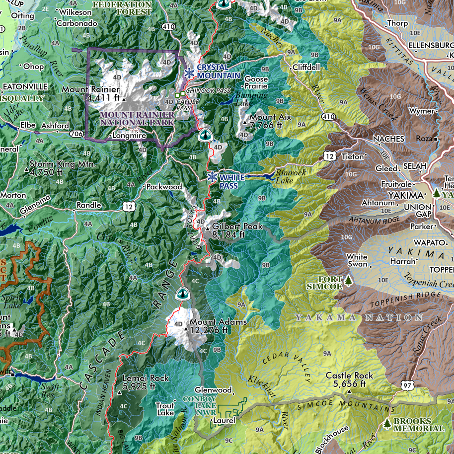 Image 2 of 9
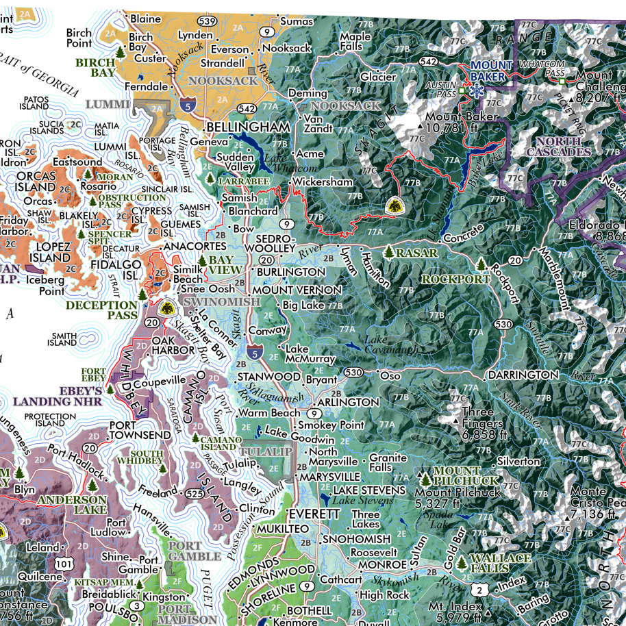 Image 3 of 9
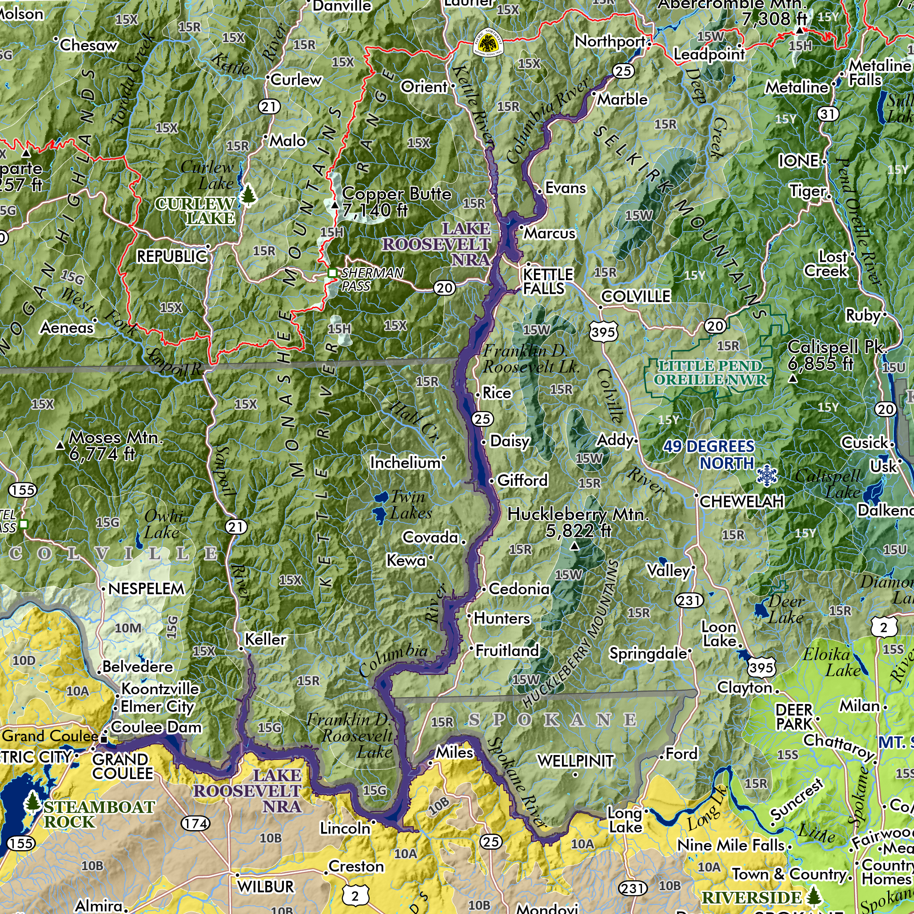 Image 4 of 9
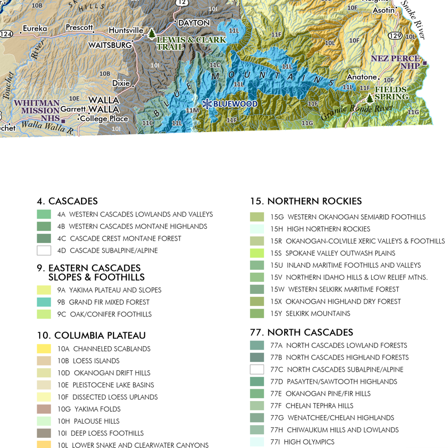 Image 5 of 9
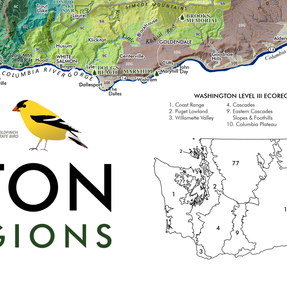 Image 6 of 9
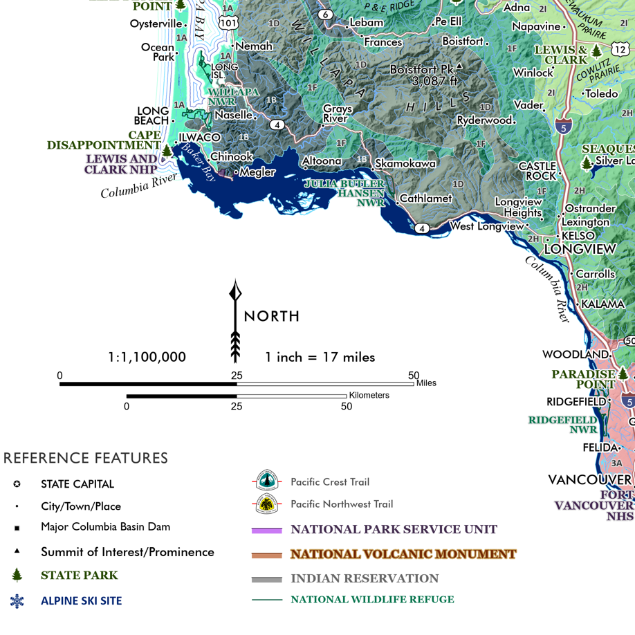 Image 7 of 9
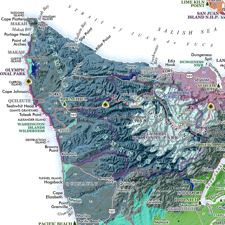 Image 8 of 9
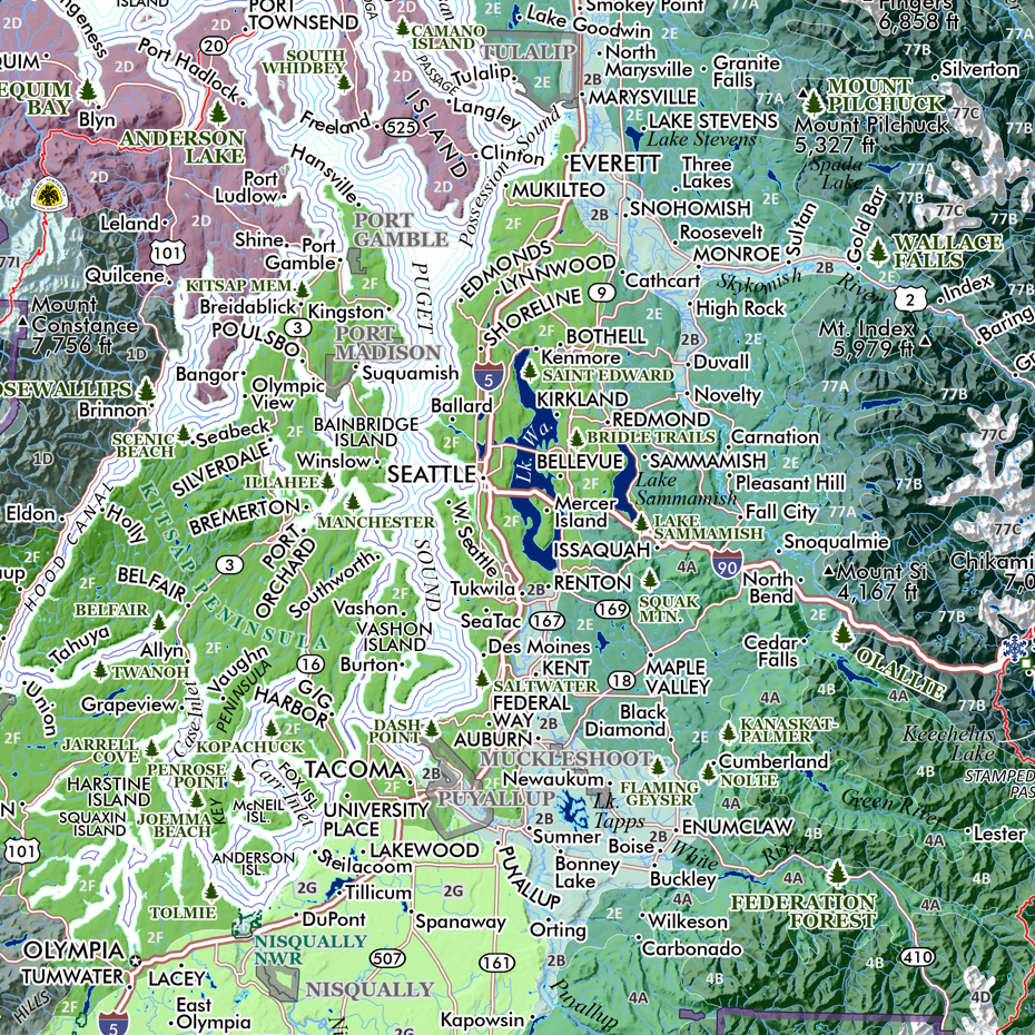 Image 9 of 9