Image 1 of 4
 Image 2 of 4
 Image 3 of 4
 Image 4 of 4
1:750,000 // 1 inch = 12 miles
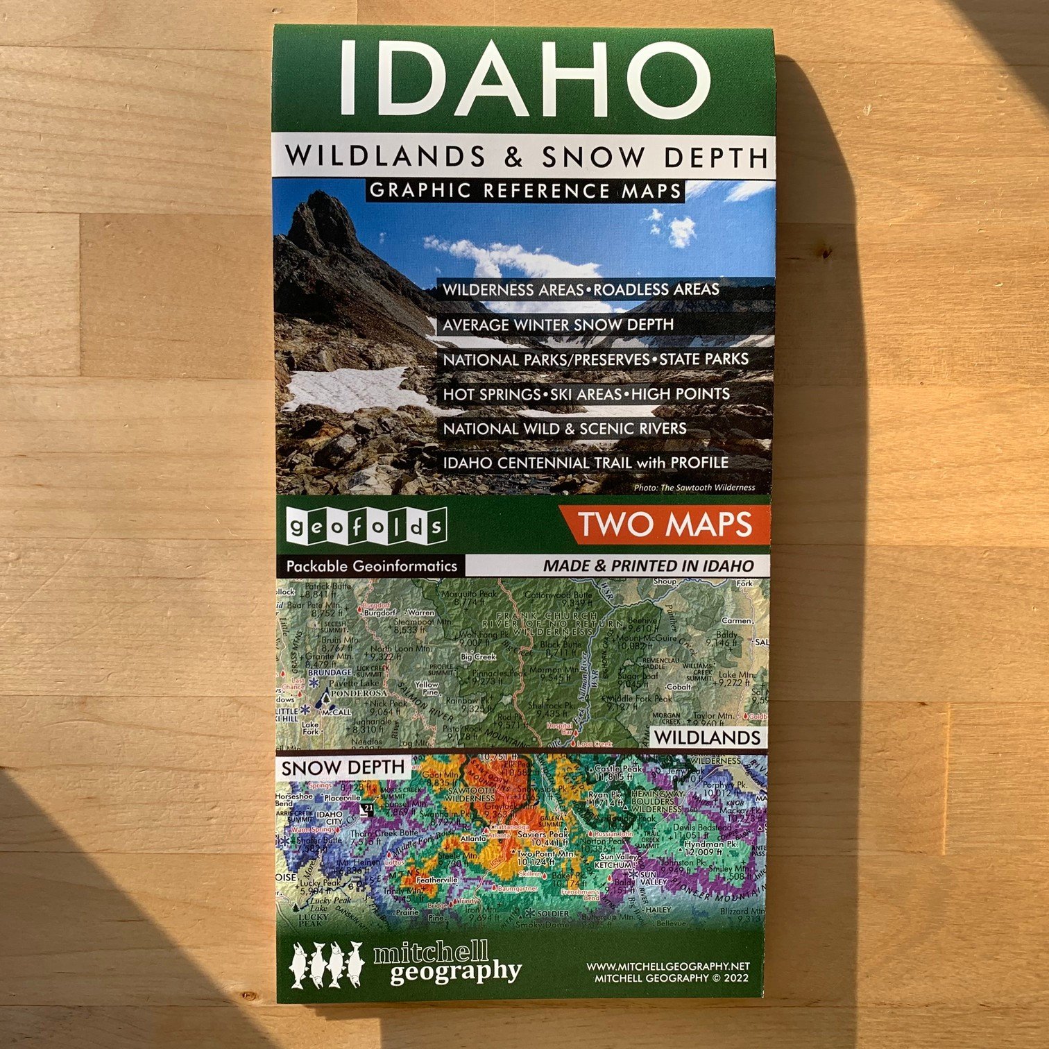
Two sided waterproof and tearproof, lightweight, packable folded map. Printed on French made POLYART biodegradable synthetic paper. Folded 4.5 x 6 inches, unfolded 12 x 18 inches. Shipped in mailer envelope, uninsured, by USPS stamped mail.
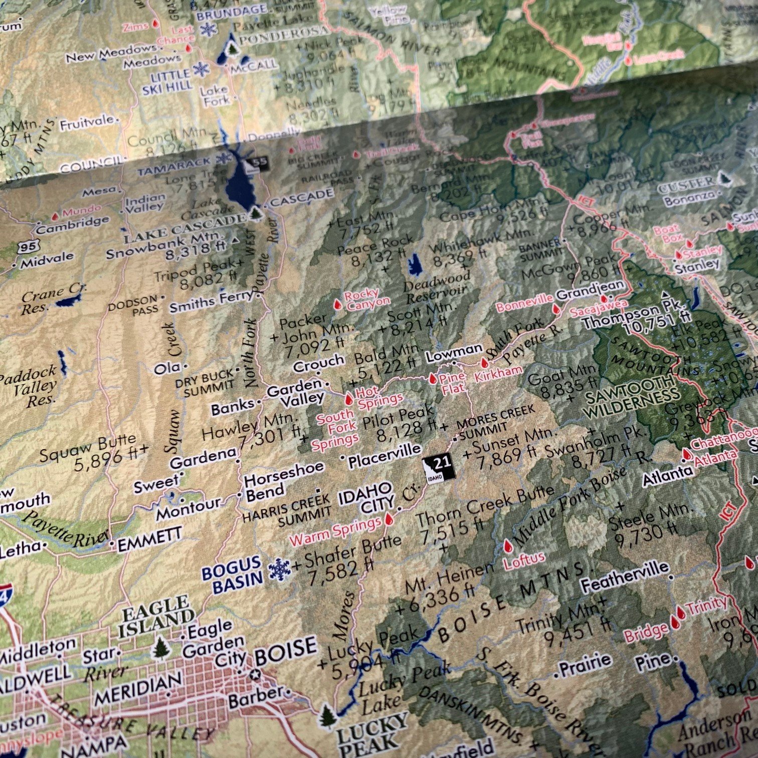
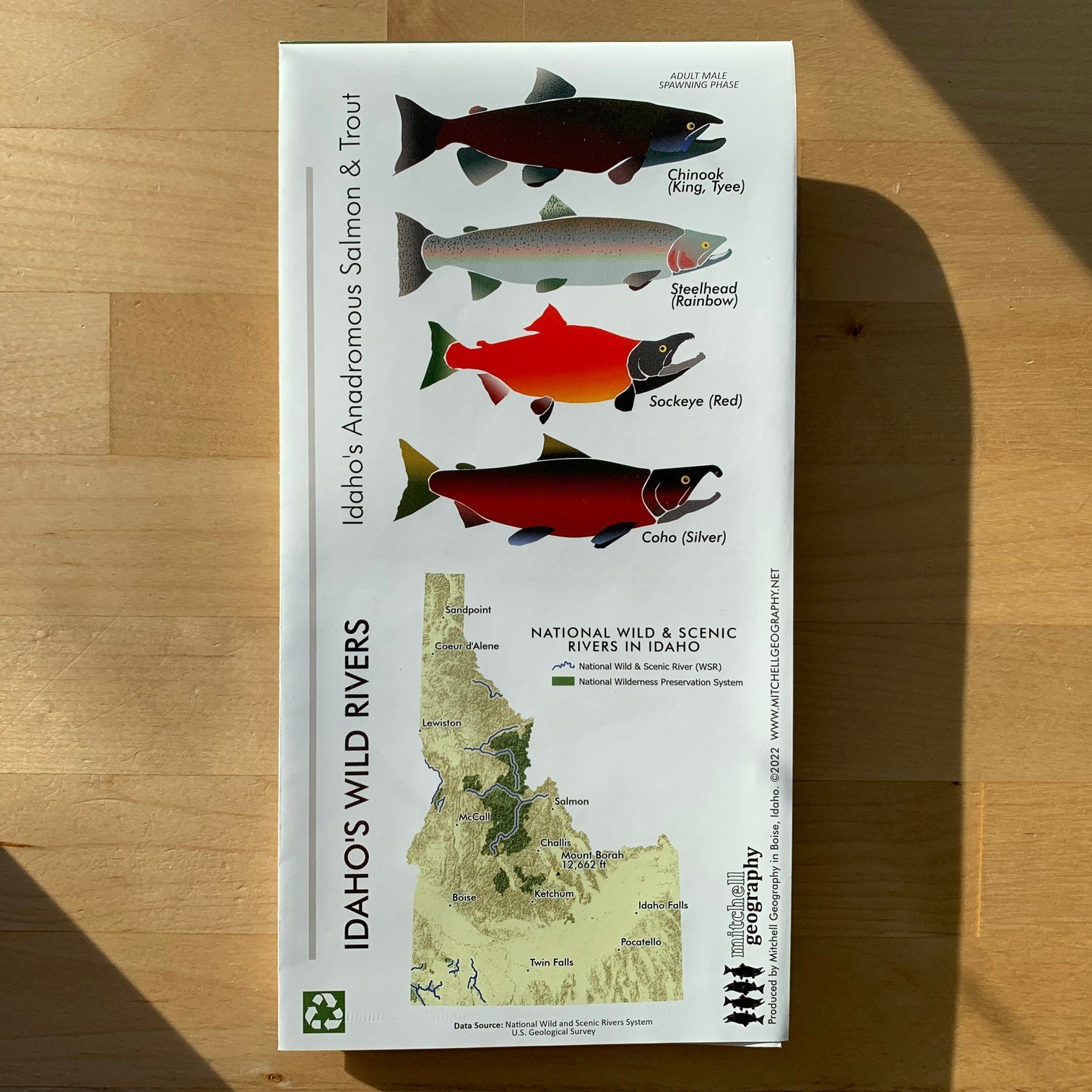
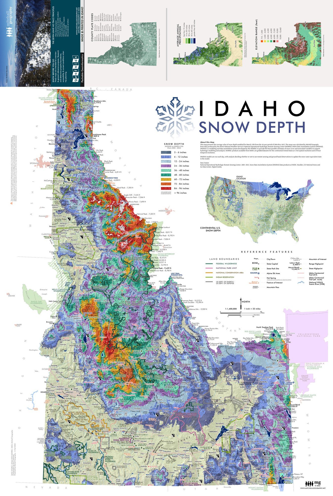
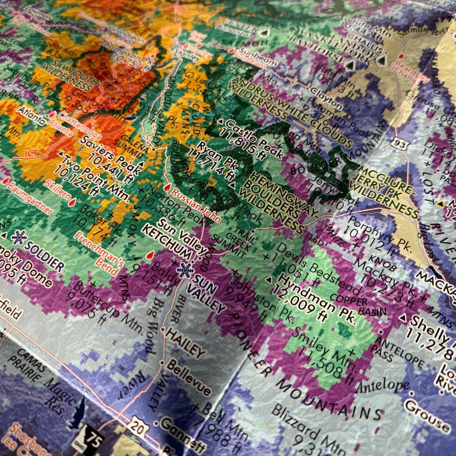
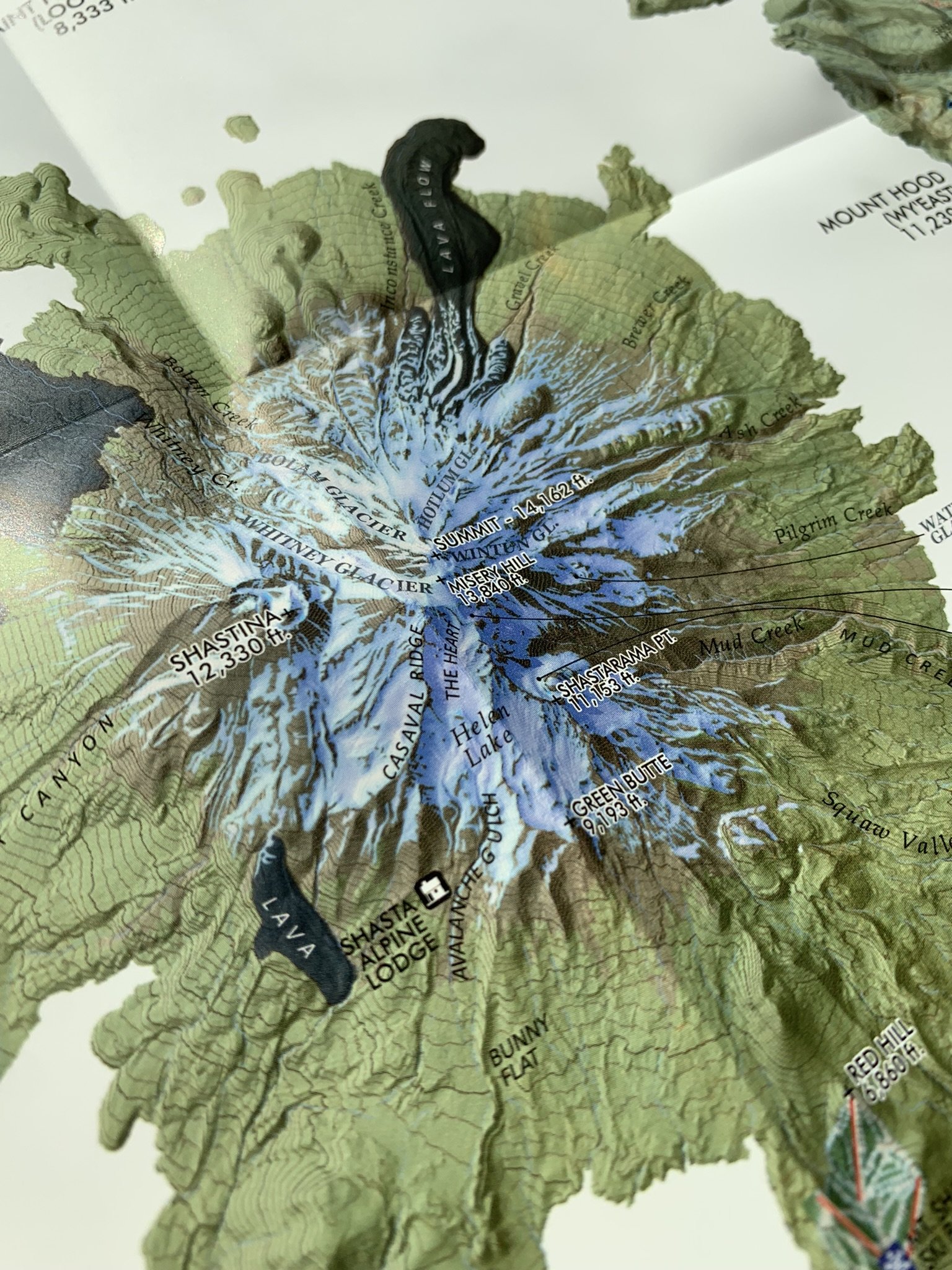
Salish Sea folding map. Detailed overview map of the Salish Sea region, comprised of the Strait of Georgia, Strait of Juan de Fuca, and the Puget Sound. Place names, cities, prominent landforms, and national/provincial parts are labeled and delineated as scale permits.
A full-size 24 x 20 inch flat wall map version is available clicking here.
1:750,000 // 1 inch = 12 miles
Two sided waterproof and tearproof, lightweight, packable folded map. Printed on French made POLYART biodegradable synthetic paper. Folded 4.5 x 6 inches, unfolded 12 x 18 inches. Shipped in mailer envelope, uninsured, by USPS stamped mail.
Salish Sea folding map. Detailed overview map of the Salish Sea region, comprised of the Strait of Georgia, Strait of Juan de Fuca, and the Puget Sound. Place names, cities, prominent landforms, and national/provincial parts are labeled and delineated as scale permits.
A full-size 24 x 20 inch flat wall map version is available clicking here.