Image 1 of 4
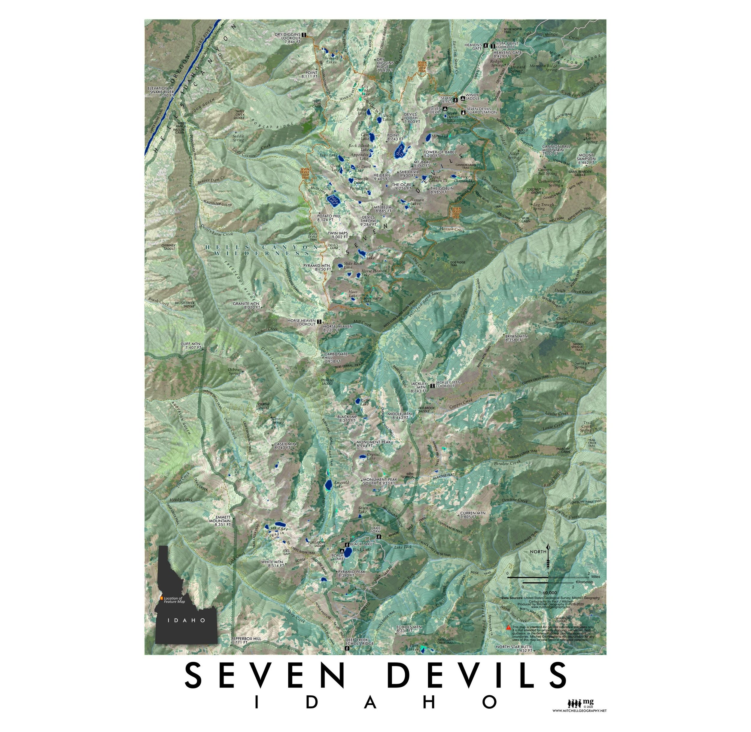 Image 2 of 4
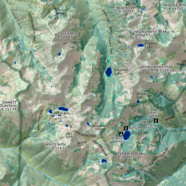 Image 3 of 4
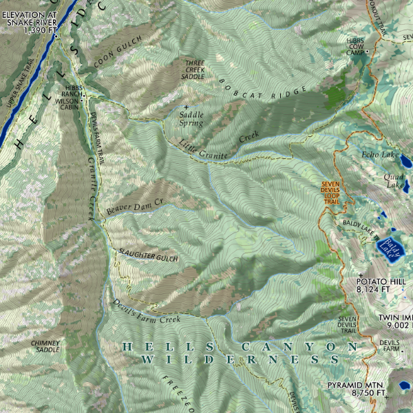 Image 4 of 4
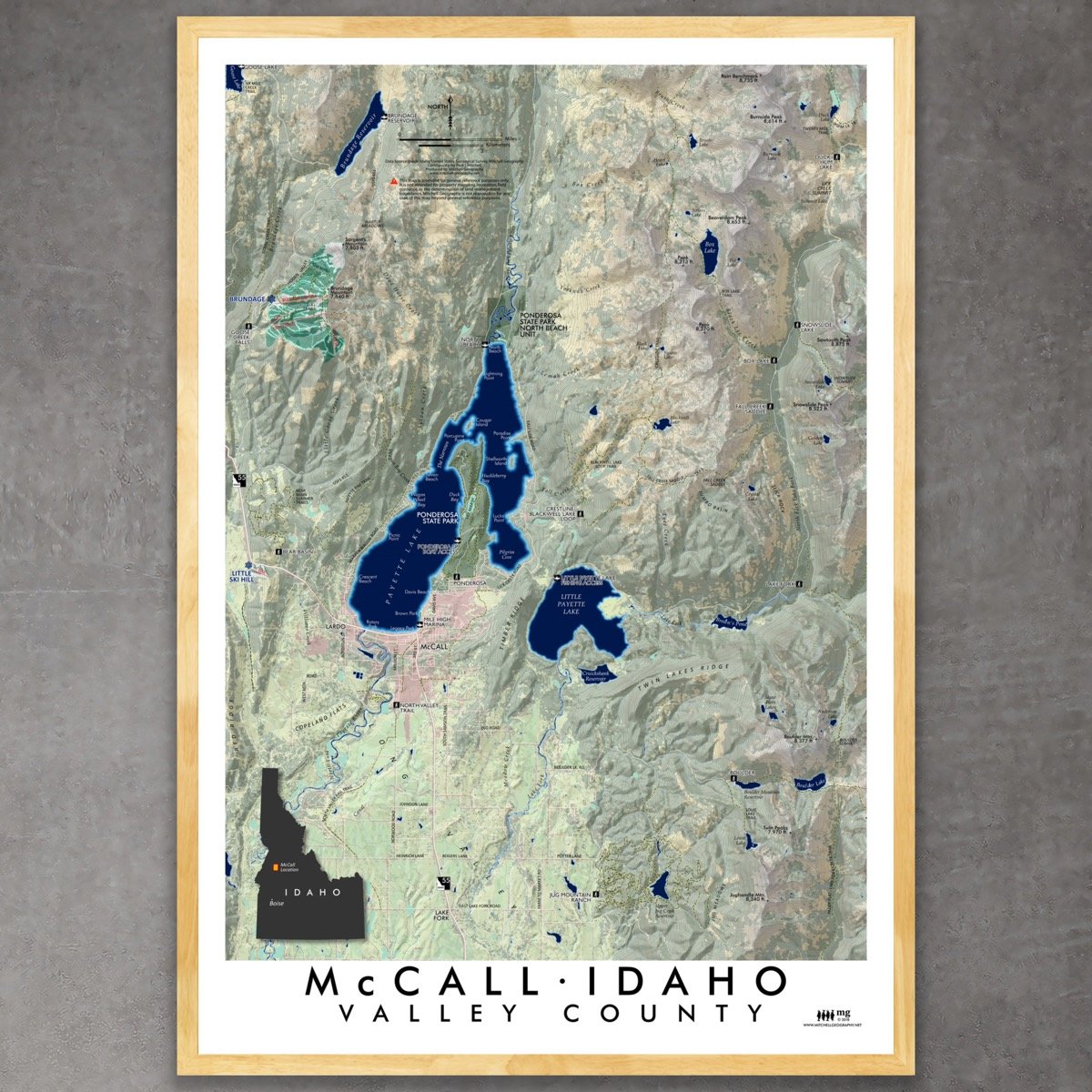
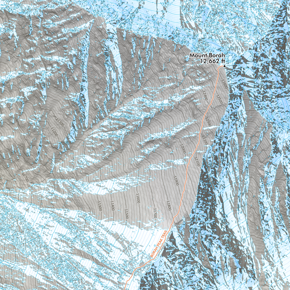
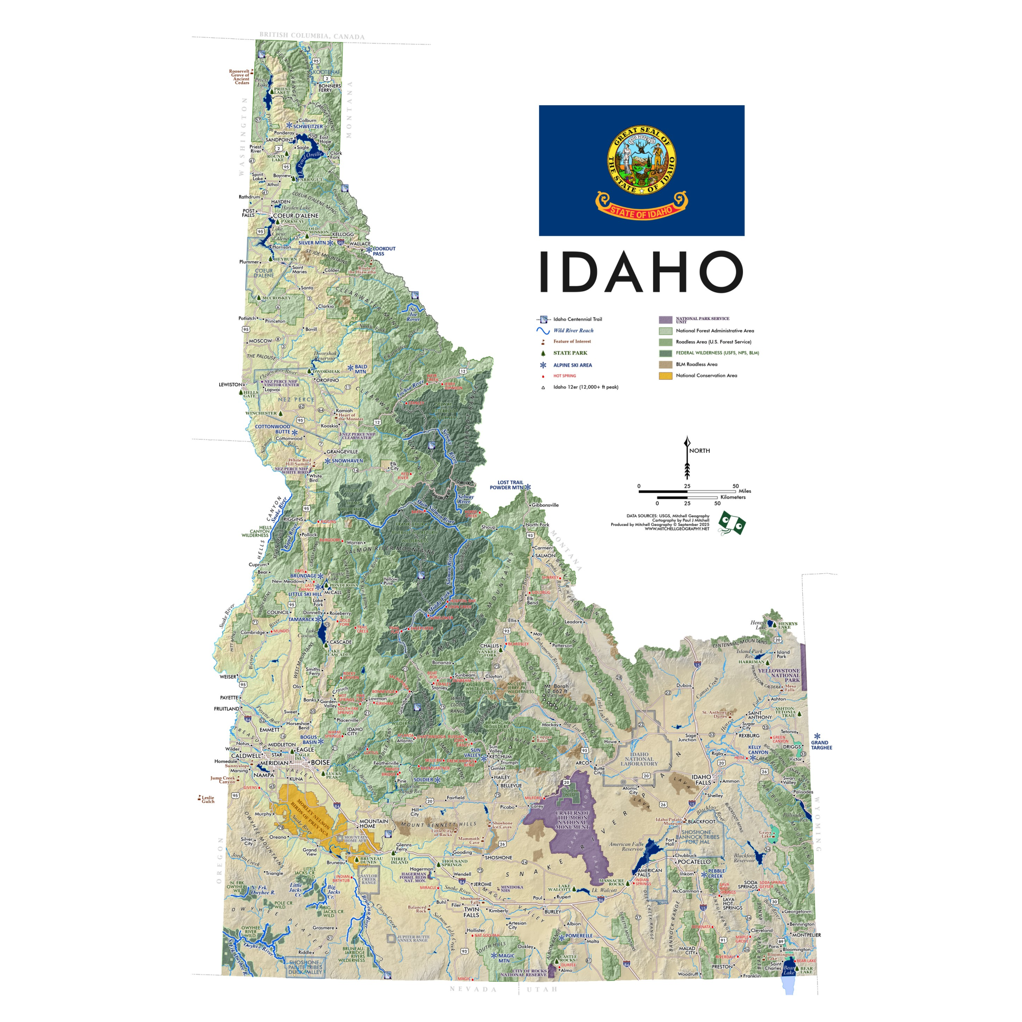
1:60,000
13 inch by 19 inch flat wall map, printed on heavy fine paper. Packed and shipped flat.
Seven Devils, Idaho. Feature vicinity map of Idaho’s Seven Devils range from Heaven’s Gate in the north to the Black Lake access in the south. Place names, peaks, passes, streams, lakes, fire lookouts/former lookouts, and trails are labeled for reference. The Seven Devils Loop Trail is symbolized in orange for identification.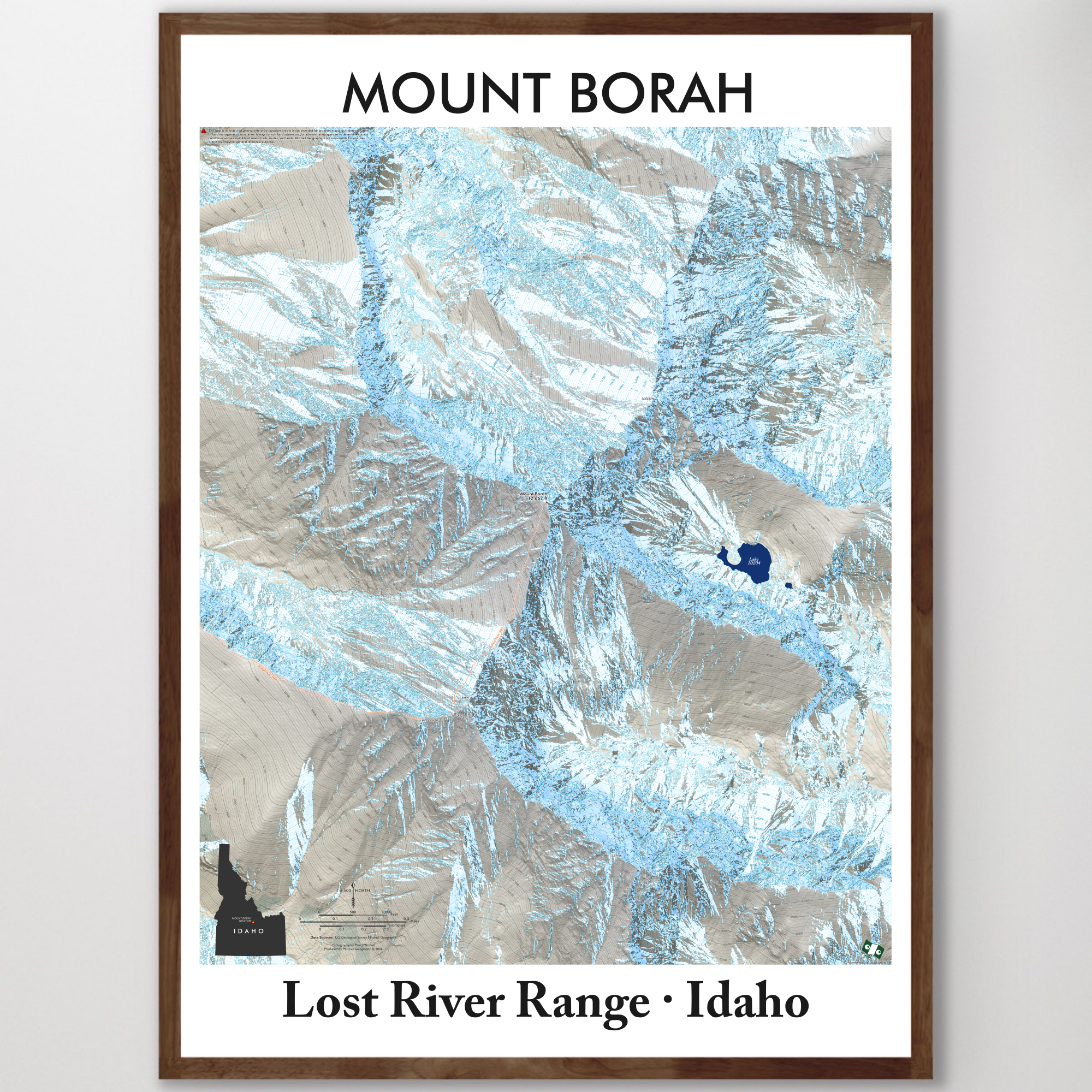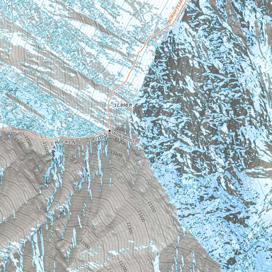