


Upper Colorado River Watershed (19 in x 13 in)
13 inch by 19 inch flat wall map, printed on heavy fine paper. Packed and shipped flat.
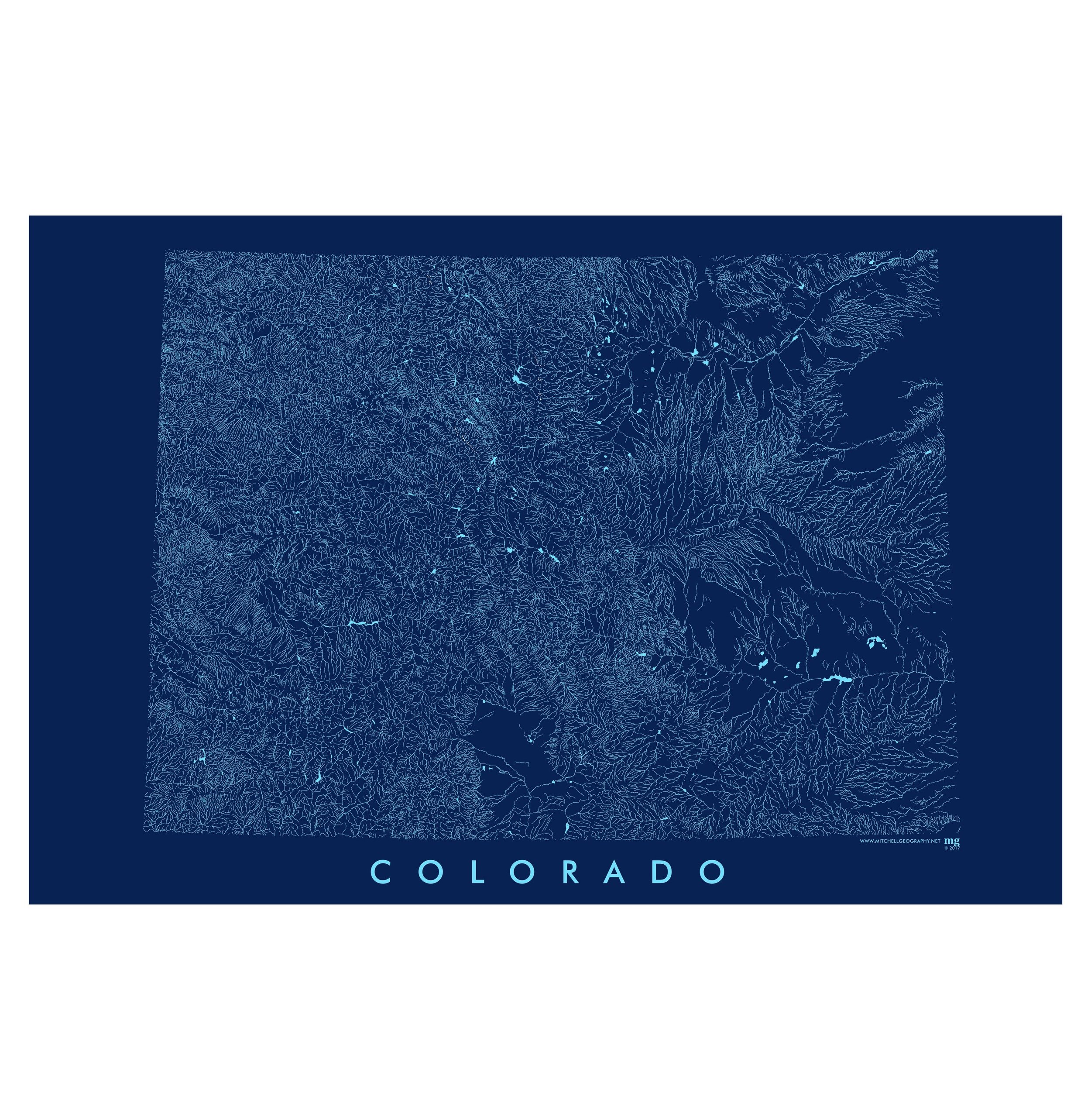
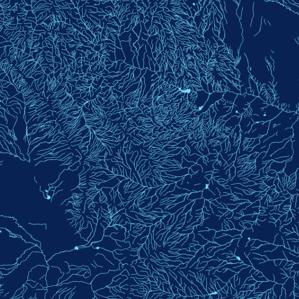
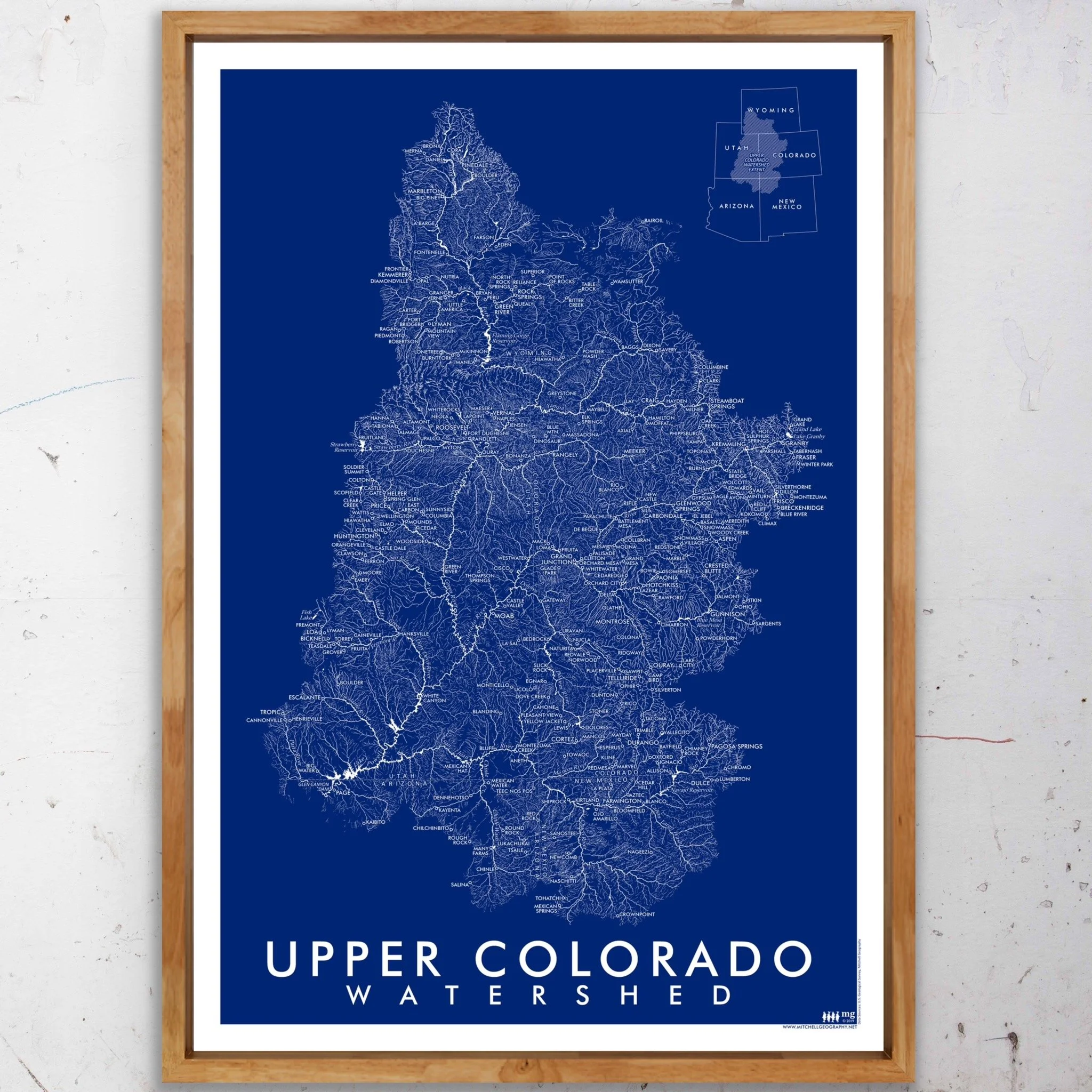
Upper Colorado River Watershed. Vintage inspired blue monochrome map graphic of the Upper Colorado Watershed’s surficial hydrology. Perennial rivers/streams and Strahler class 5/6/7 features are symbolized with solid lines, while ephemeral and intermittent water features are hashed. Populated places, major hydrologic features, and state boundaries are labeled for reference and orientation.
13 inch by 19 inch flat wall map, printed on heavy fine paper. Packed and shipped flat.
Upper Colorado River Watershed. Vintage inspired blue monochrome map graphic of the Upper Colorado Watershed’s surficial hydrology. Perennial rivers/streams and Strahler class 5/6/7 features are symbolized with solid lines, while ephemeral and intermittent water features are hashed. Populated places, major hydrologic features, and state boundaries are labeled for reference and orientation.
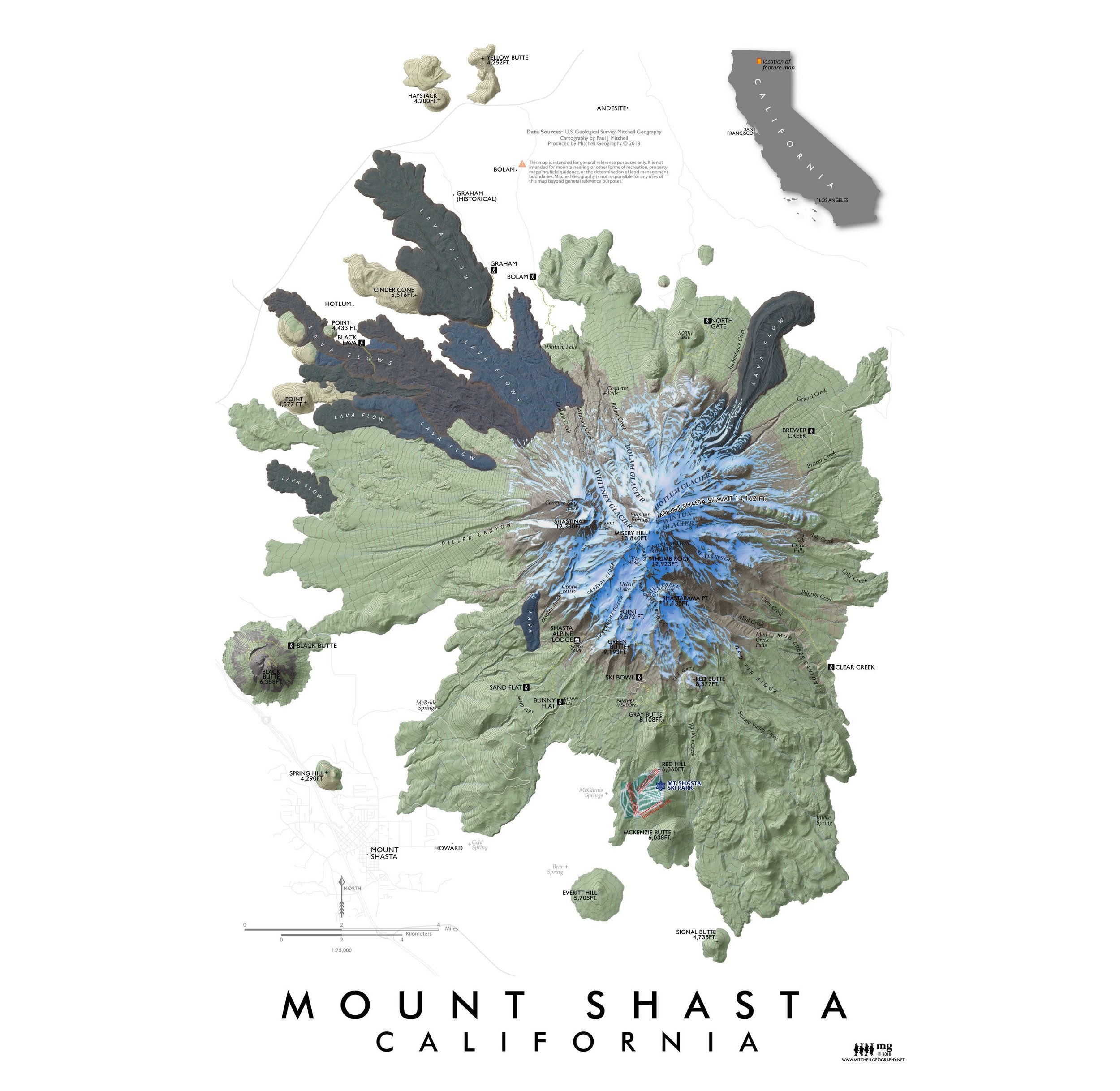
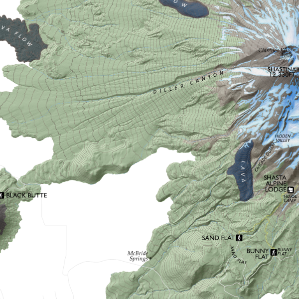
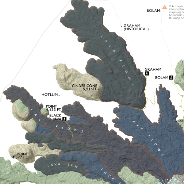
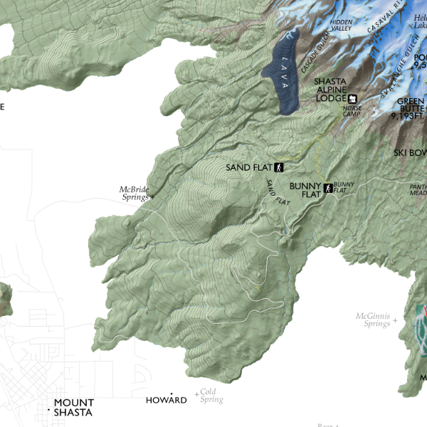
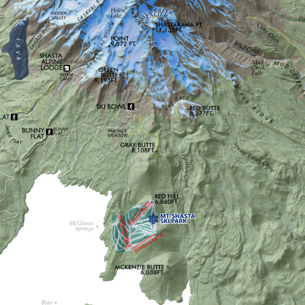
![Mount Shasta [California] (19 in x 13 in)](https://images.squarespace-cdn.com/content/v1/64dfe5c447627a1ab4b29d07/1695043610630-IP3HJXGI31ZW28EVU10V/Shasta1319_framed.JPG)