Image 1 of 3
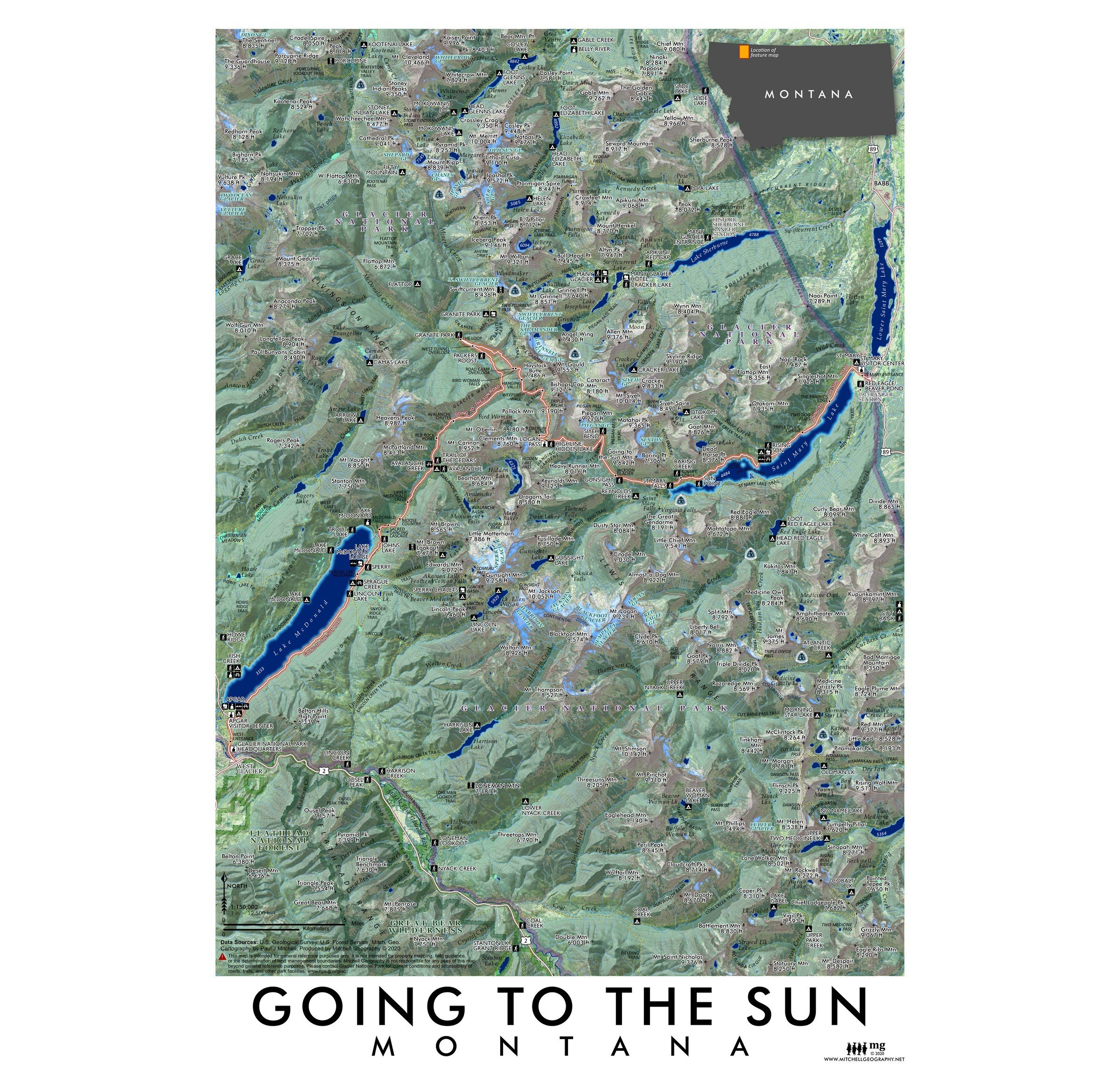 Image 2 of 3
 Image 3 of 3
1:150,000
13 inch by 19 inch flat wall map, printed on heavy fine paper. Packed and shipped flat.
Going to the Sun, Montana. Feature vicinity map featured around the Going-to-the-Sun Road corridor thru Glacier National Park. Adjacent lands including Lower Saint Mary Lake, the northern tip of the Great Bear Wilderness are also included. Trails, trailheads, park features (lookouts, visitor centers, ranger stations, lodges/hotels), roadside sites, glaciers, hydrology, cliffs, Continental Divide, Continental Divide Trail route, and other landform/reference features are labeled as scale permits. The Apgar, Lake McDonald, Saint Mary Lake, Lake Sherburne, Many Glacier, and western end of Two Medicine Lake are included within the extent of the map.

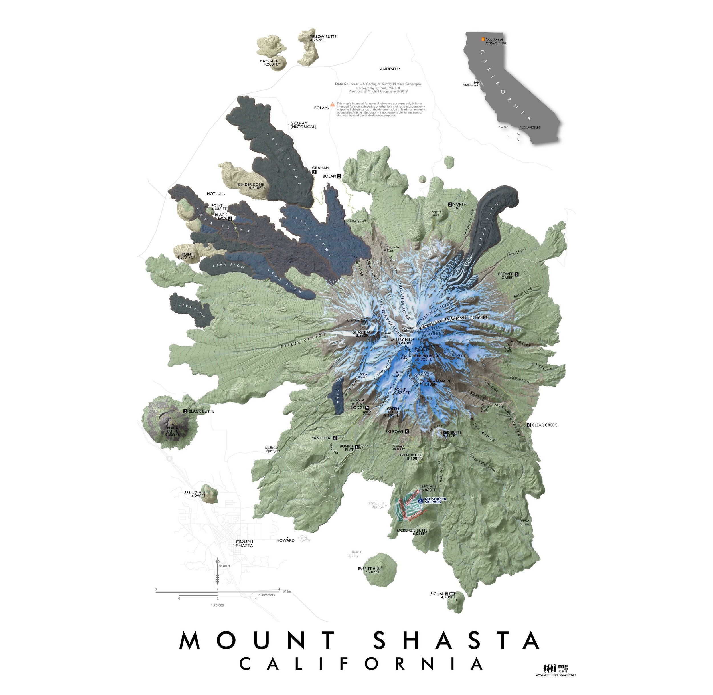
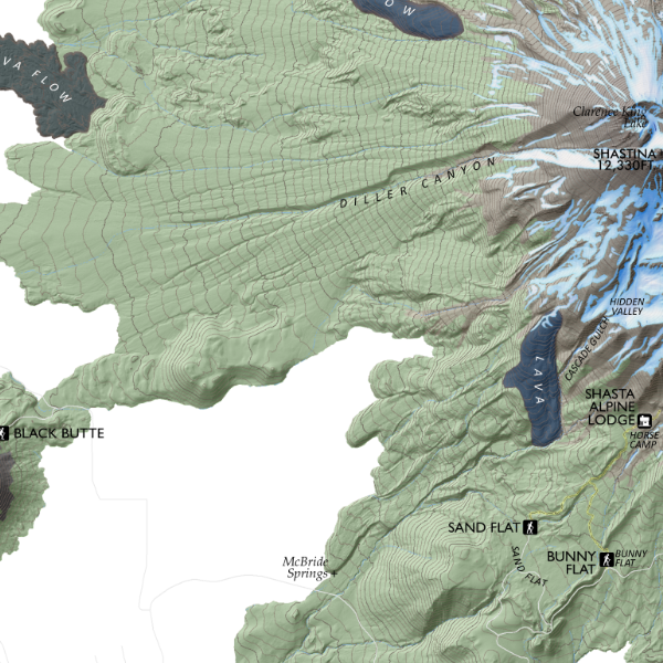
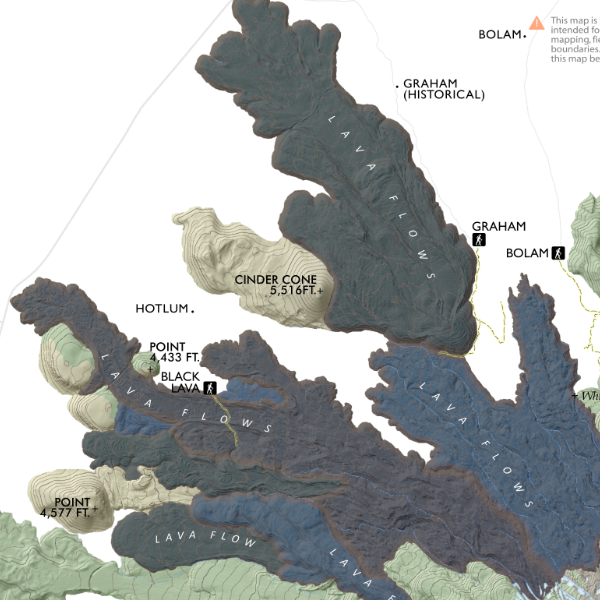
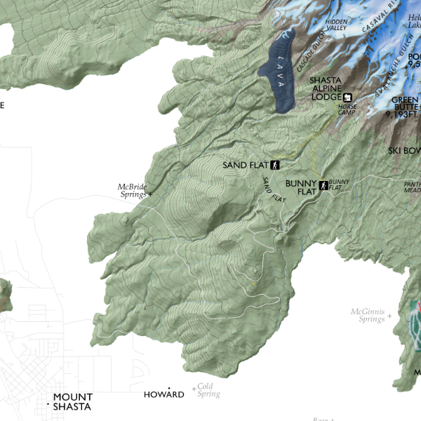
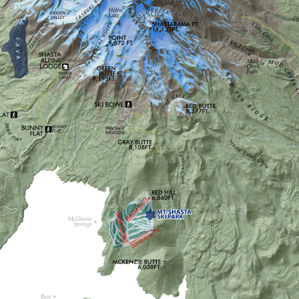
![Mount Shasta [California] (19 in x 13 in)](https://images.squarespace-cdn.com/content/v1/64dfe5c447627a1ab4b29d07/1695043610630-IP3HJXGI31ZW28EVU10V/Shasta1319_framed.JPG)