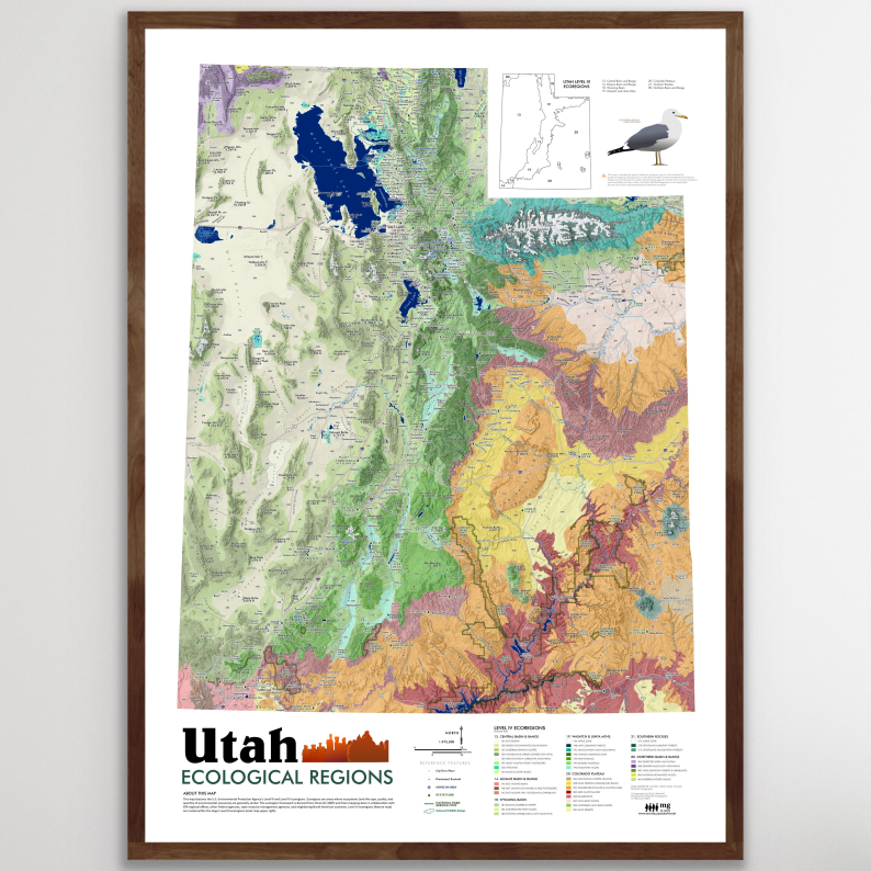
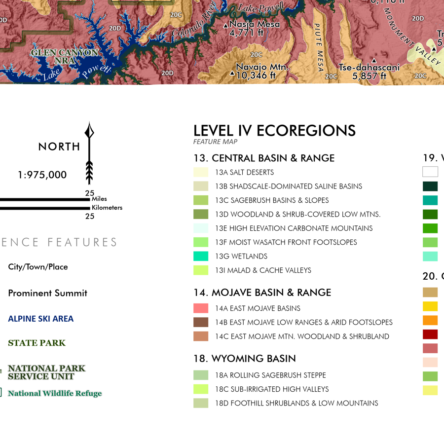
Utah Ecological Regions (28 in x 20 in)
1:975,000
28 inch x 20 inch — flat wall map, printed on a heavy fine paper — shipped rolled.
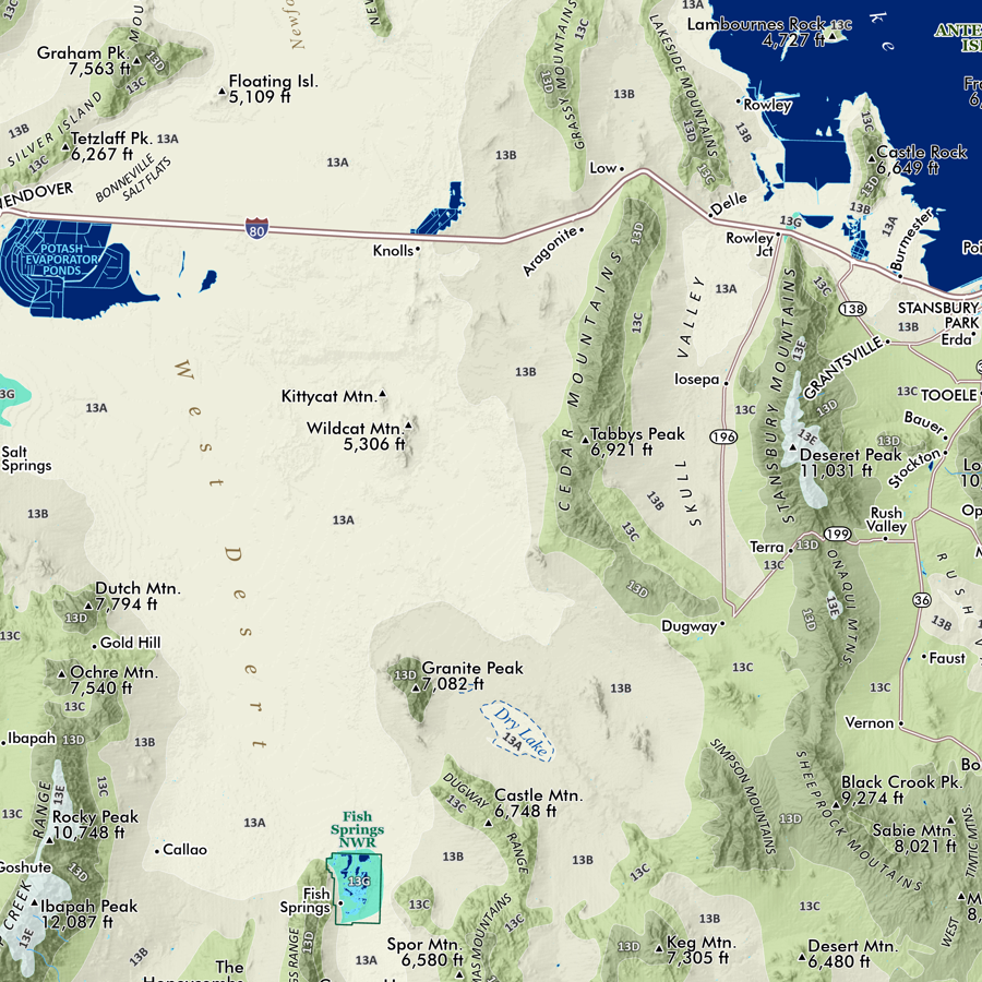
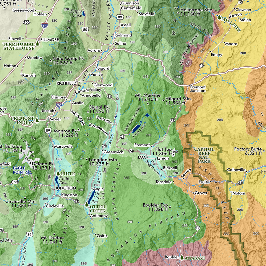
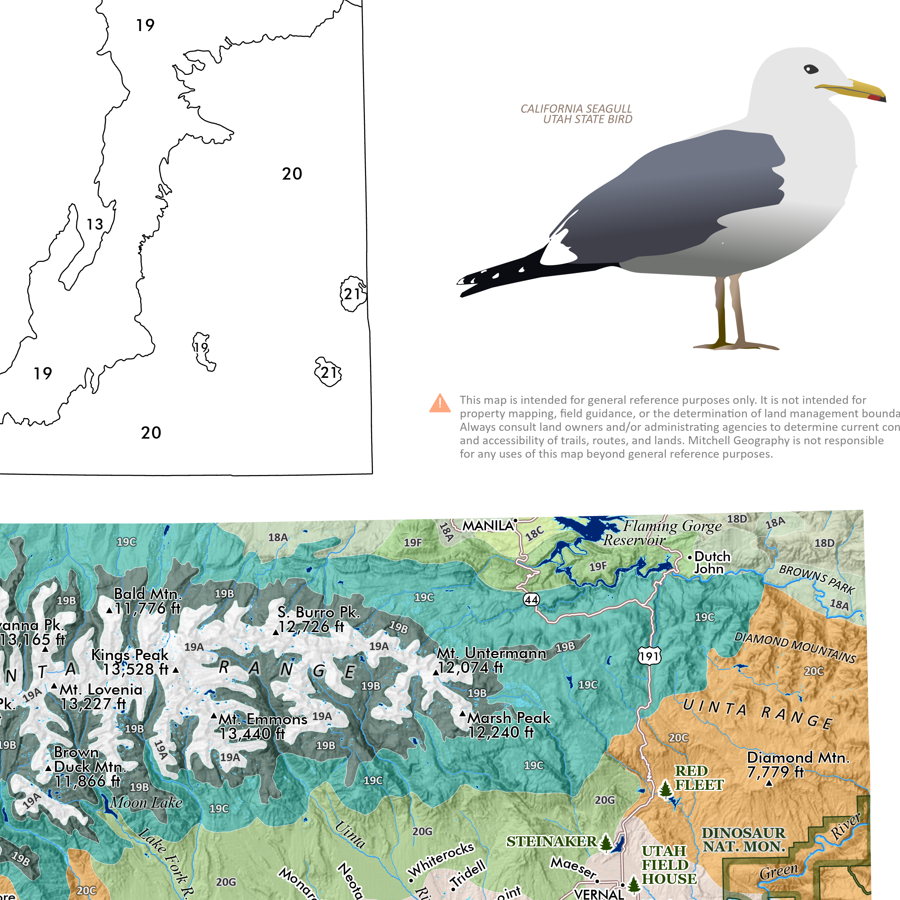
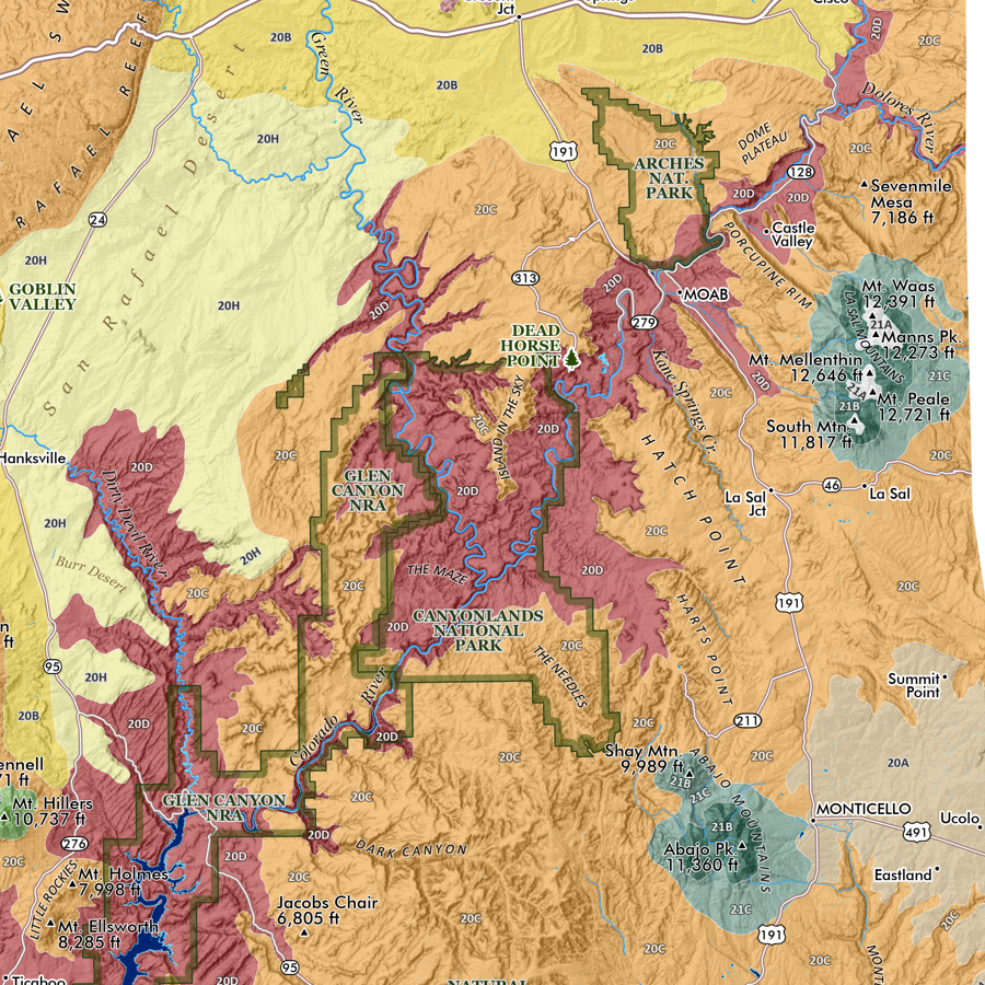
Utah Ecological Regions map. A re-symbolization of the EPA's Level IV ecoregions for the landscapes of Utah. Includes inset Utah Level III reference map for context. Level IV classes are symbolized and listed individually in the key for the feature map.
Reference features include:
City/Town/Community place names
Prominent Summits and High Points
State Parks
Alpine Ski Areas
National Park Service Units (NPS managed National Parks and National Monuments)
National Wildlife Refuges
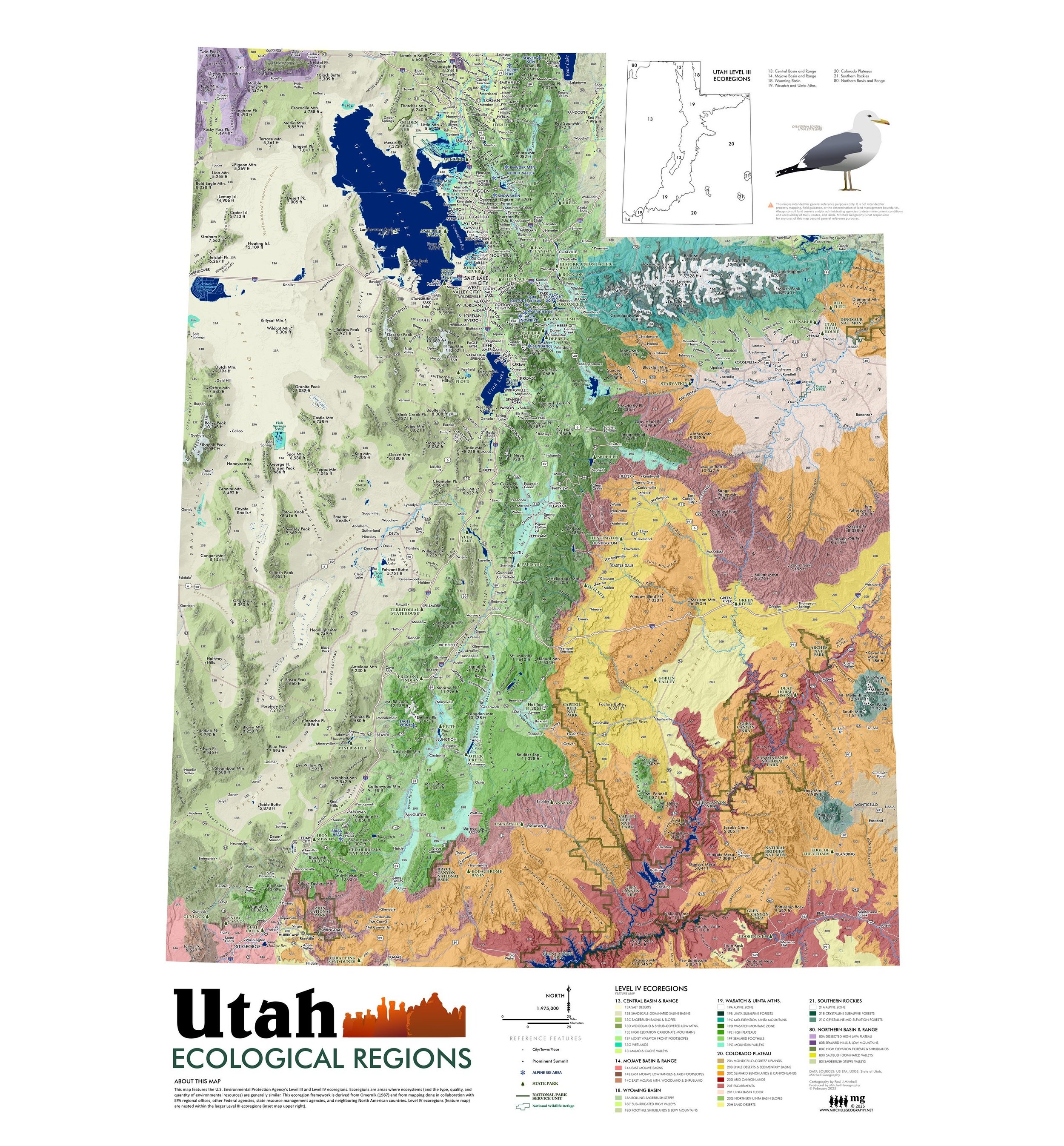
1:975,000
28 inch x 20 inch — flat wall map, printed on a heavy fine paper — shipped rolled.
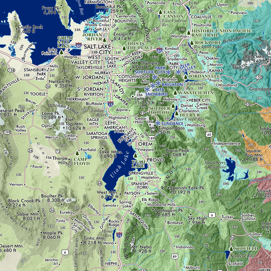
Utah Ecological Regions map. A re-symbolization of the EPA's Level IV ecoregions for the landscapes of Utah. Includes inset Utah Level III reference map for context. Level IV classes are symbolized and listed individually in the key for the feature map.
Reference features include:
City/Town/Community place names
Prominent Summits and High Points
State Parks
Alpine Ski Areas
National Park Service Units (NPS managed National Parks and National Monuments)
National Wildlife Refuges
1:975,000
28 inch x 20 inch — flat wall map, printed on a heavy fine paper — shipped rolled.
Utah Ecological Regions map. A re-symbolization of the EPA's Level IV ecoregions for the landscapes of Utah. Includes inset Utah Level III reference map for context. Level IV classes are symbolized and listed individually in the key for the feature map.
Reference features include:
City/Town/Community place names
Prominent Summits and High Points
State Parks
Alpine Ski Areas
National Park Service Units (NPS managed National Parks and National Monuments)
National Wildlife Refuges


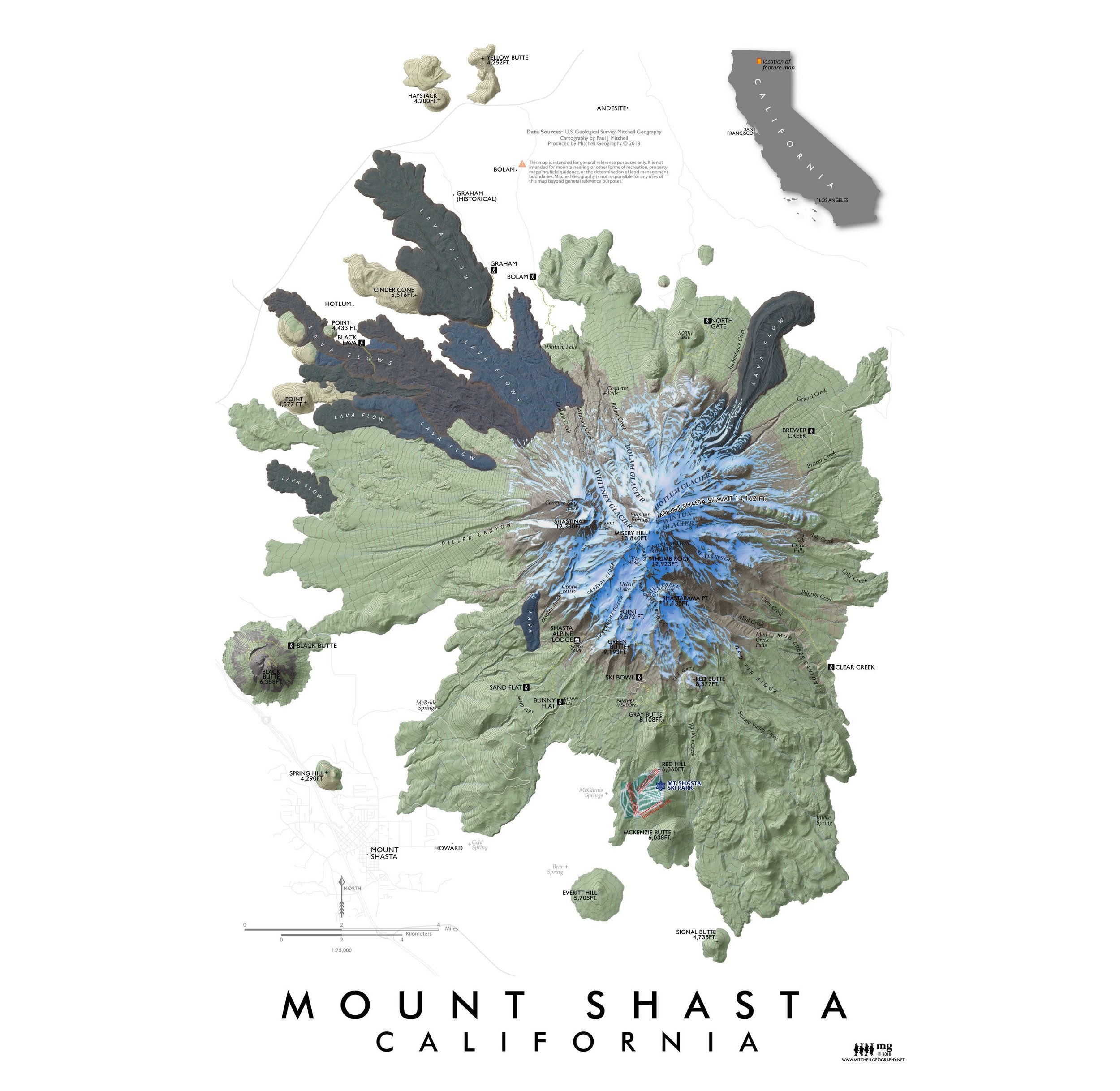
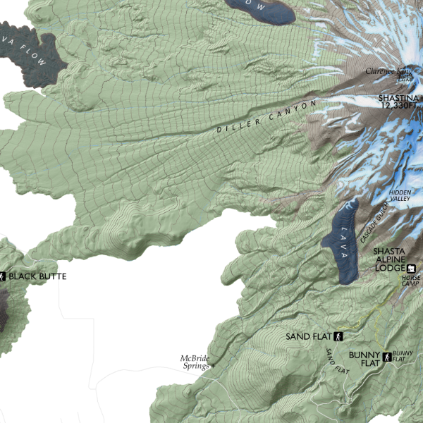
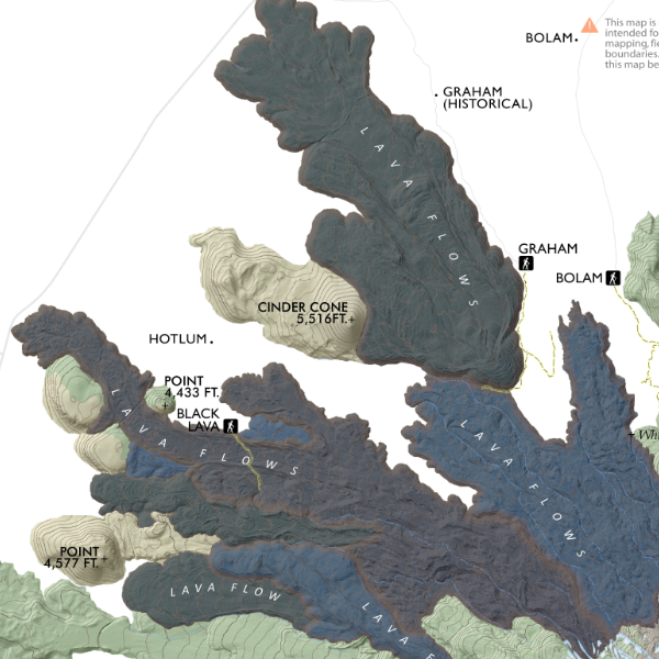
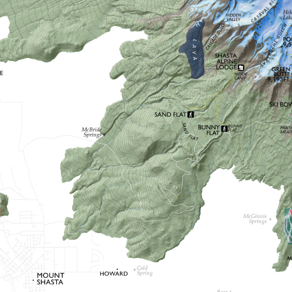
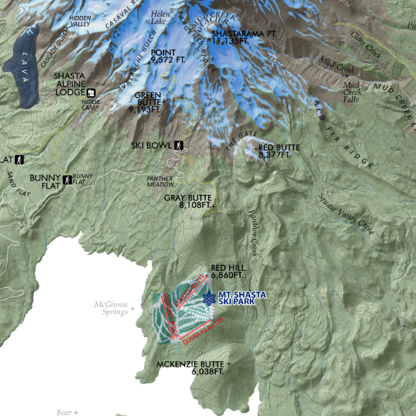
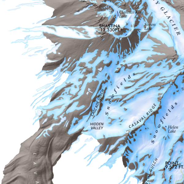
![Mount Shasta [California] (19 in x 13 in)](https://images.squarespace-cdn.com/content/v1/64dfe5c447627a1ab4b29d07/1695043610630-IP3HJXGI31ZW28EVU10V/Shasta1319_framed.JPG)