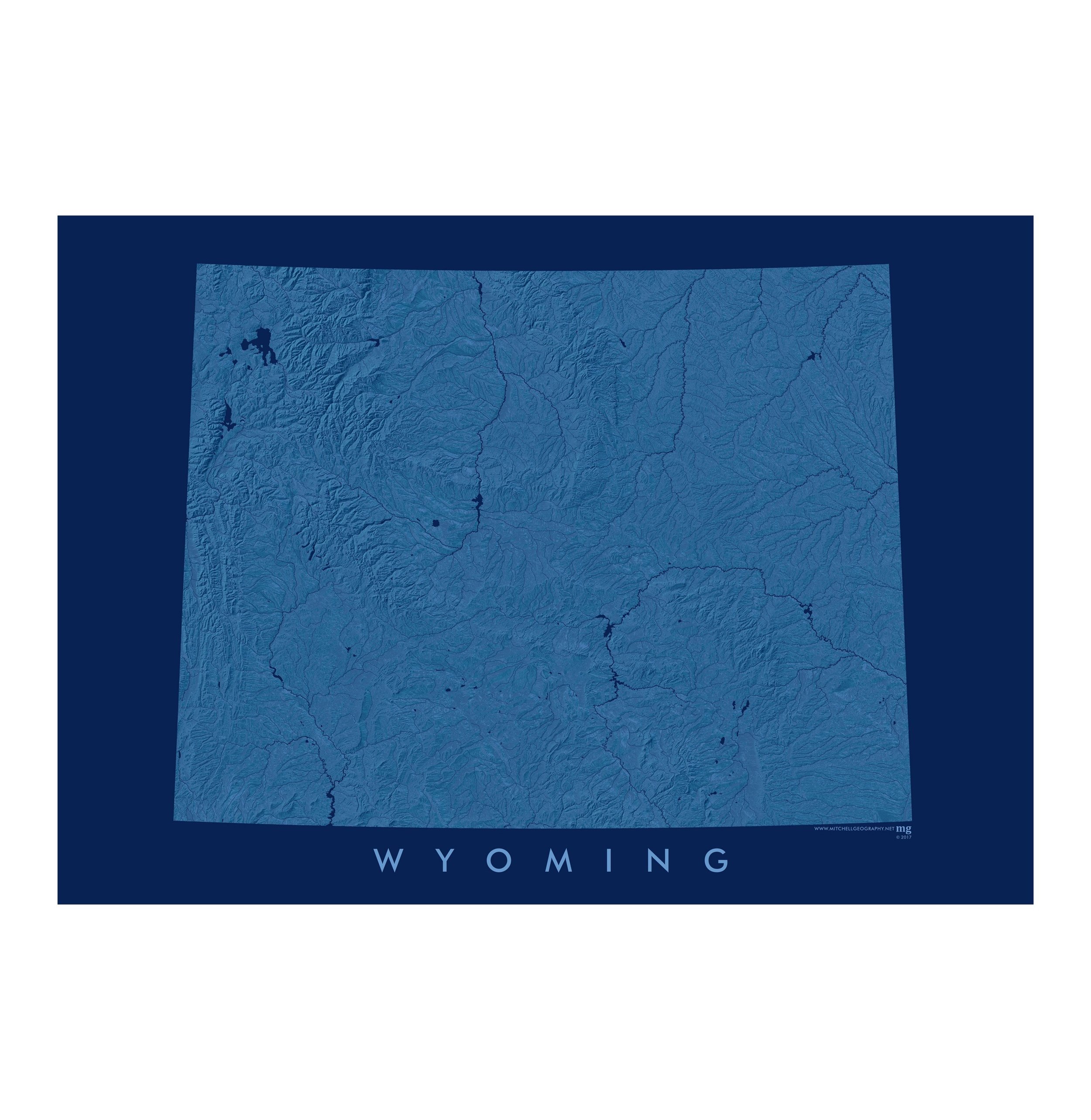
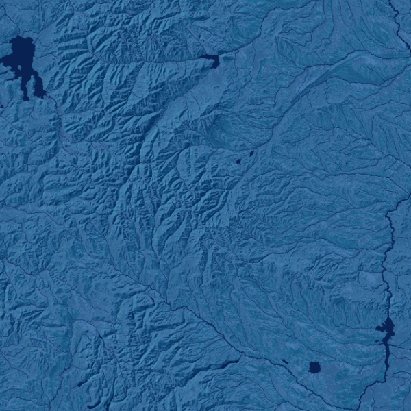
1:38,000
20 inch by 24 inch flat wall map, printed on heavy fine paper, shipped rolled.
Brooklyn, New York. The extent of this general reference map includes the entirety of Brooklyn and portions of: Manhattan, Queens, Hudson County NJ (e.g. Jersey City, Hoboken) and a small point of Staten Island. The map features neighborhood labels, parks (large & prominent parks are labeled), building footprints, the MTA subway system with labeled stations, street network, lidar derived shaded relief, squares/triangles, ferry landings/stations, beaches, park trails, special features (as scale and space permits), and the Gateway National Recreation Area park units (e.g. Governors Island, Jamaica Bay NWR, Fort Tilden, Breezy Point).
Please note that due to the scale of this map and the density of the street network, many but not all streets are labeled. As well please consider that small fonts are utilized to label some features (again due to density and scale). Labels were placed with hierarchy and prominence.

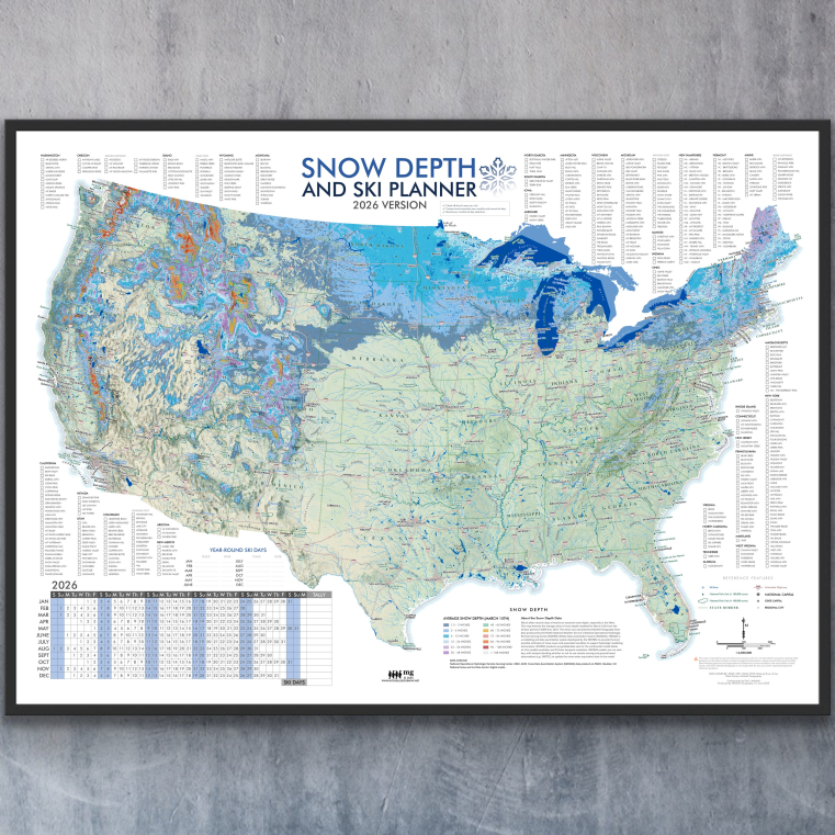
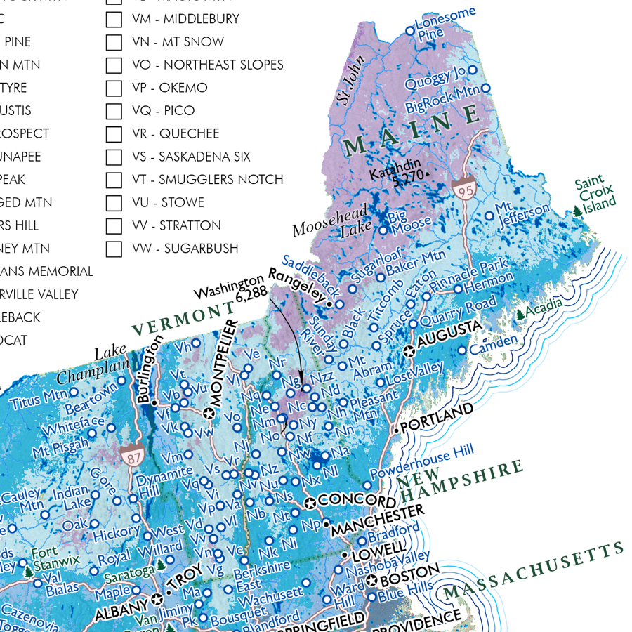
 Image 1 of 6
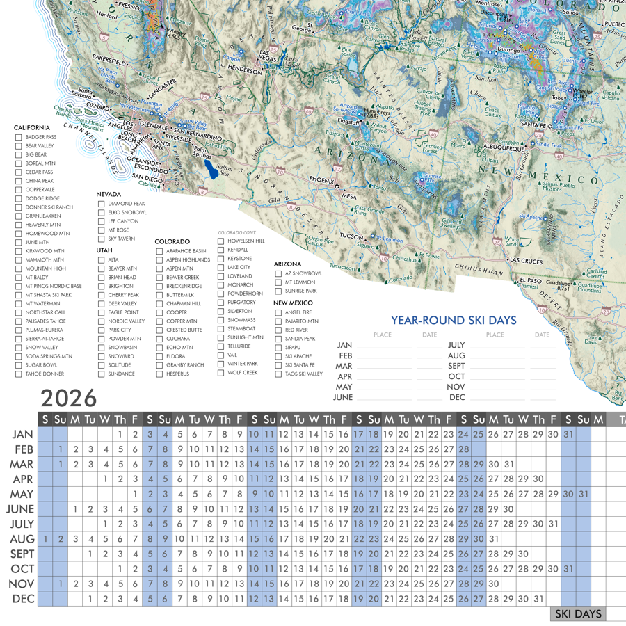
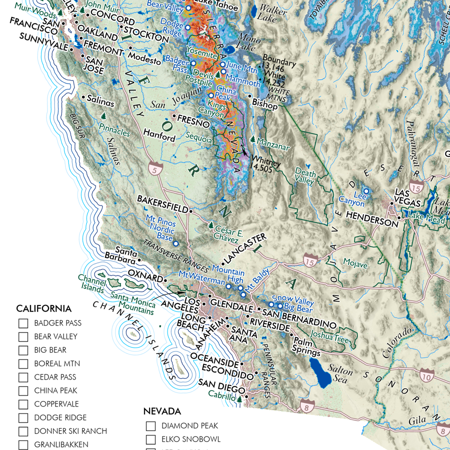
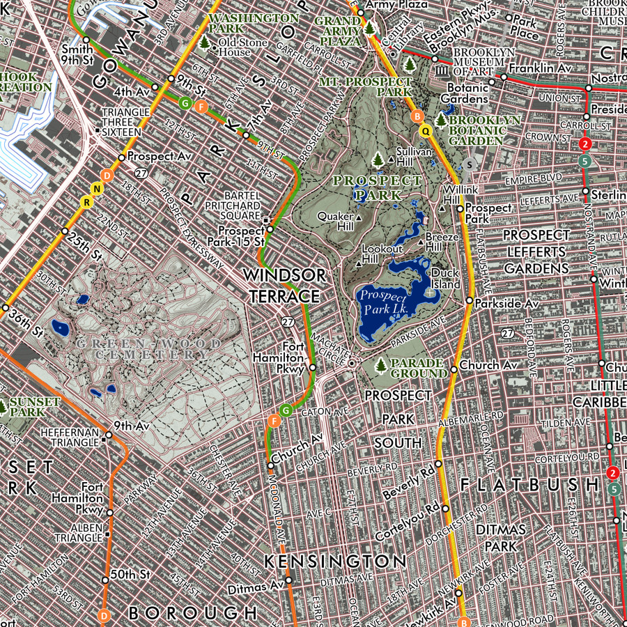 Image 2 of 6
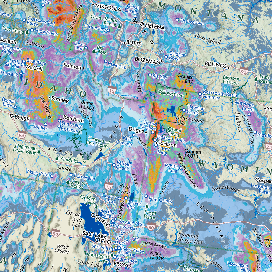
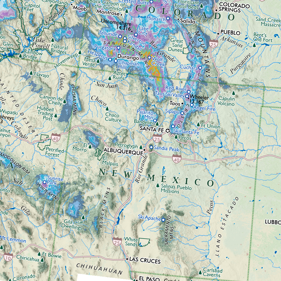
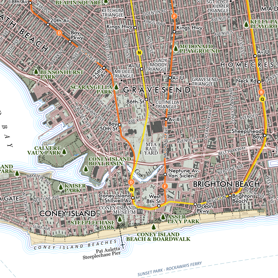 Image 3 of 6
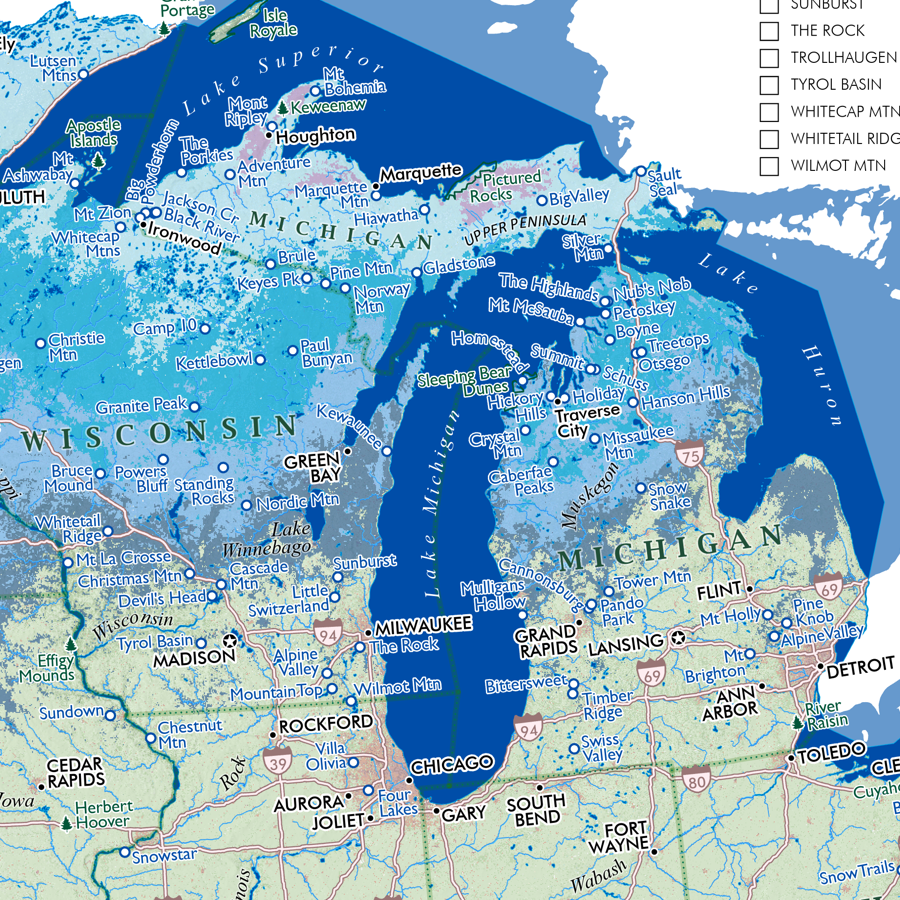
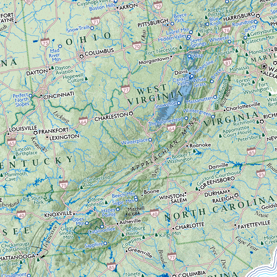
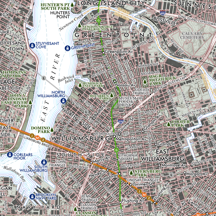 Image 4 of 6
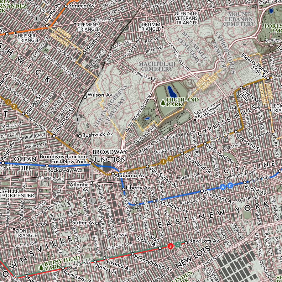 Image 5 of 6
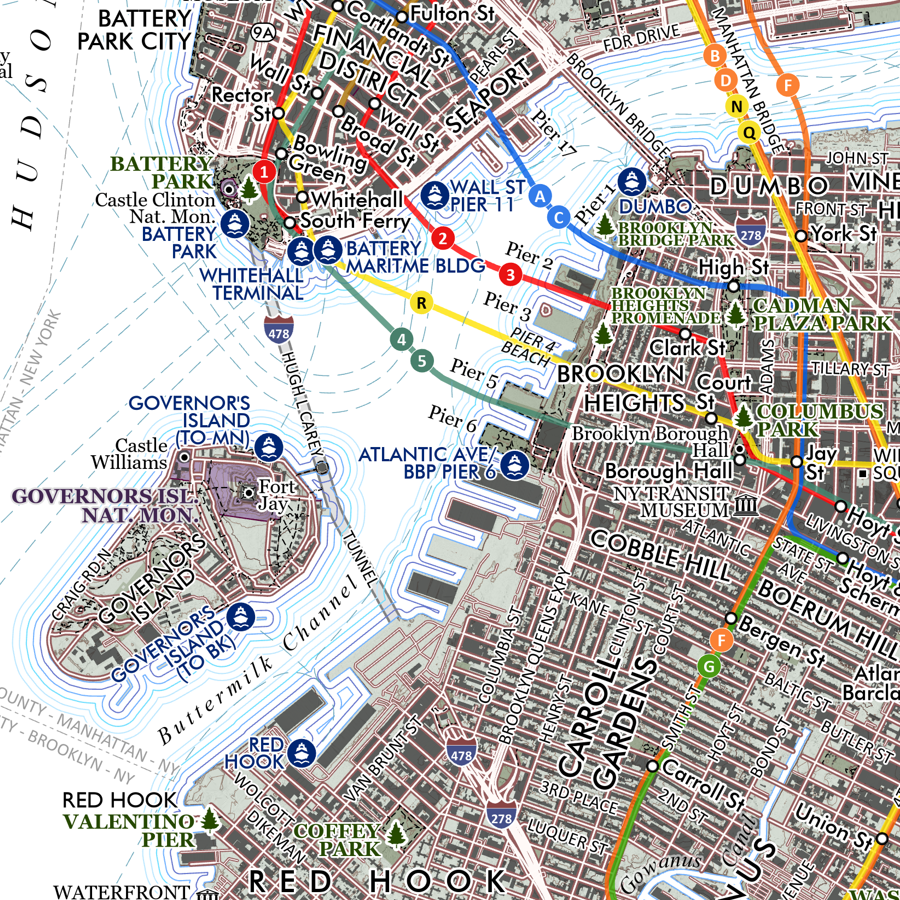 Image 6 of 6