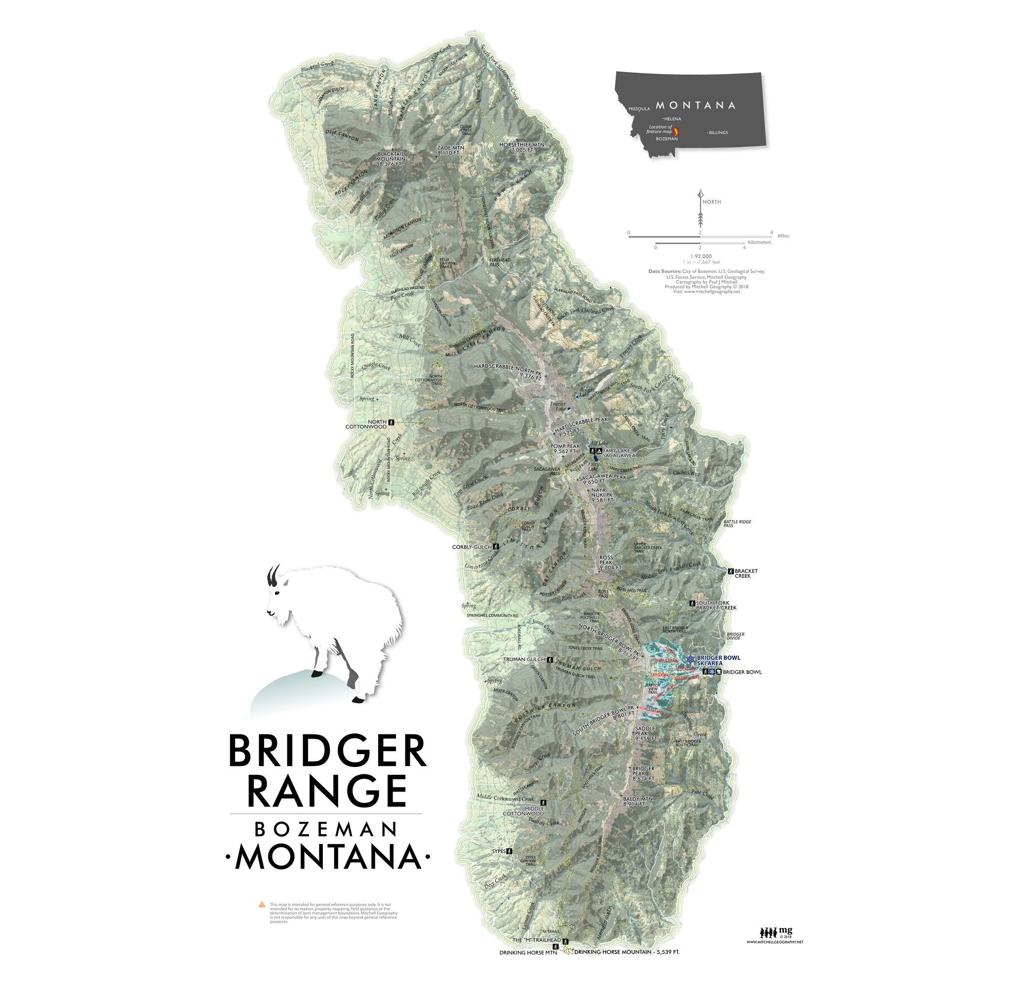
Bridger Range (19 in x 13 in
1:92,000
13 inch by 19 inch flat wall map printed on heavy fine paper. Packed and shipped flat.
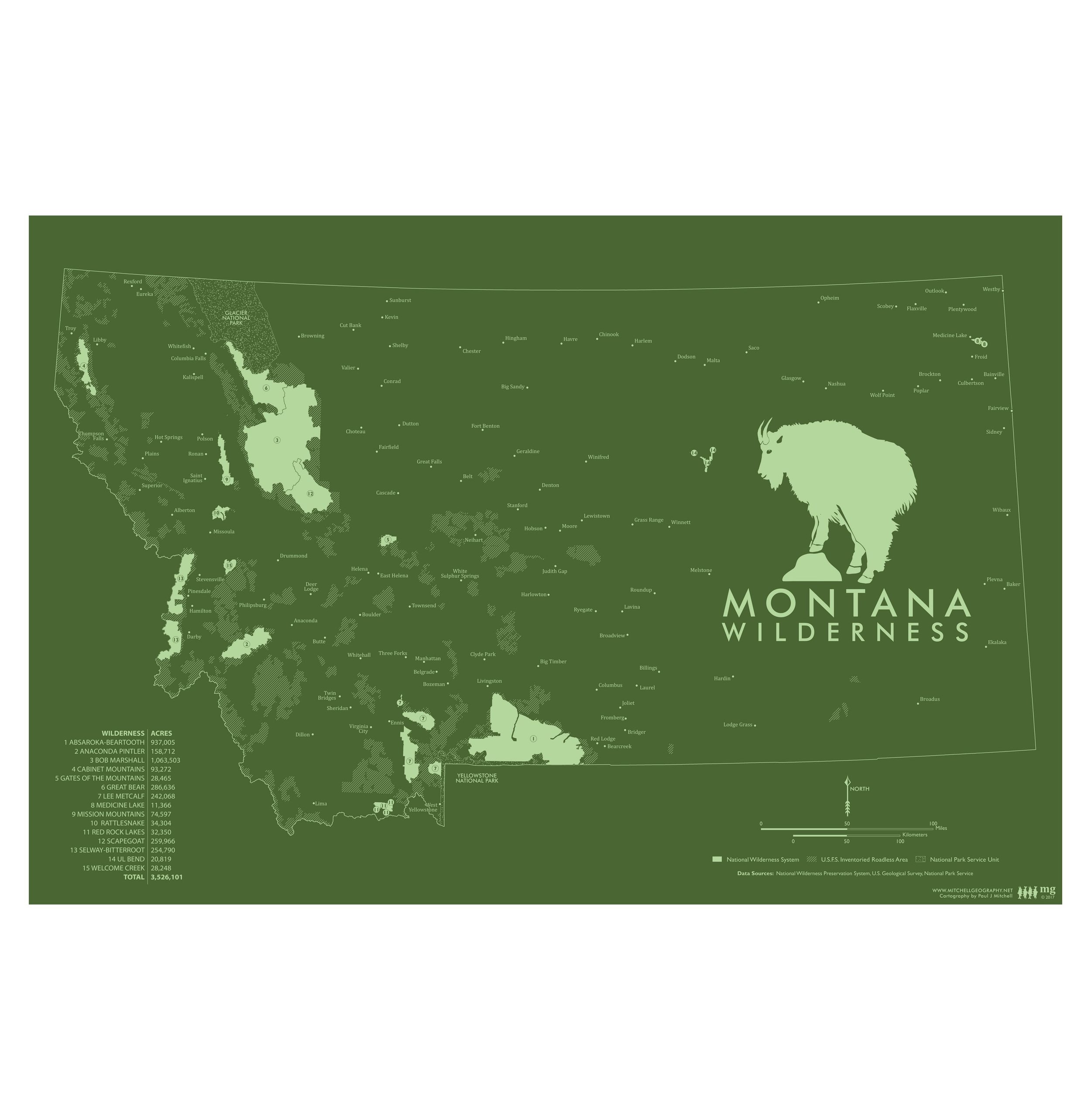
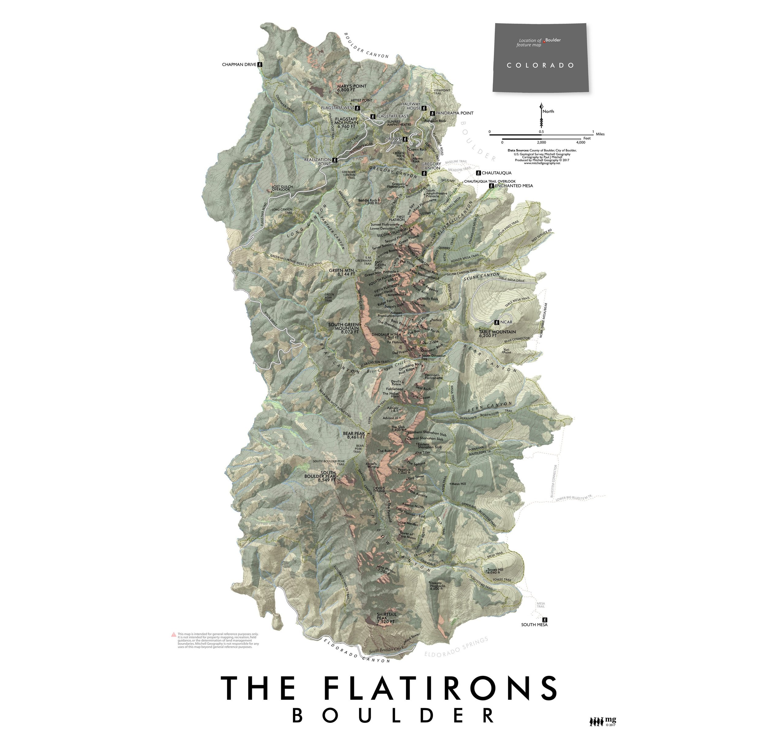
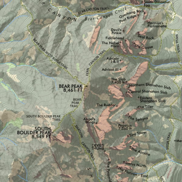
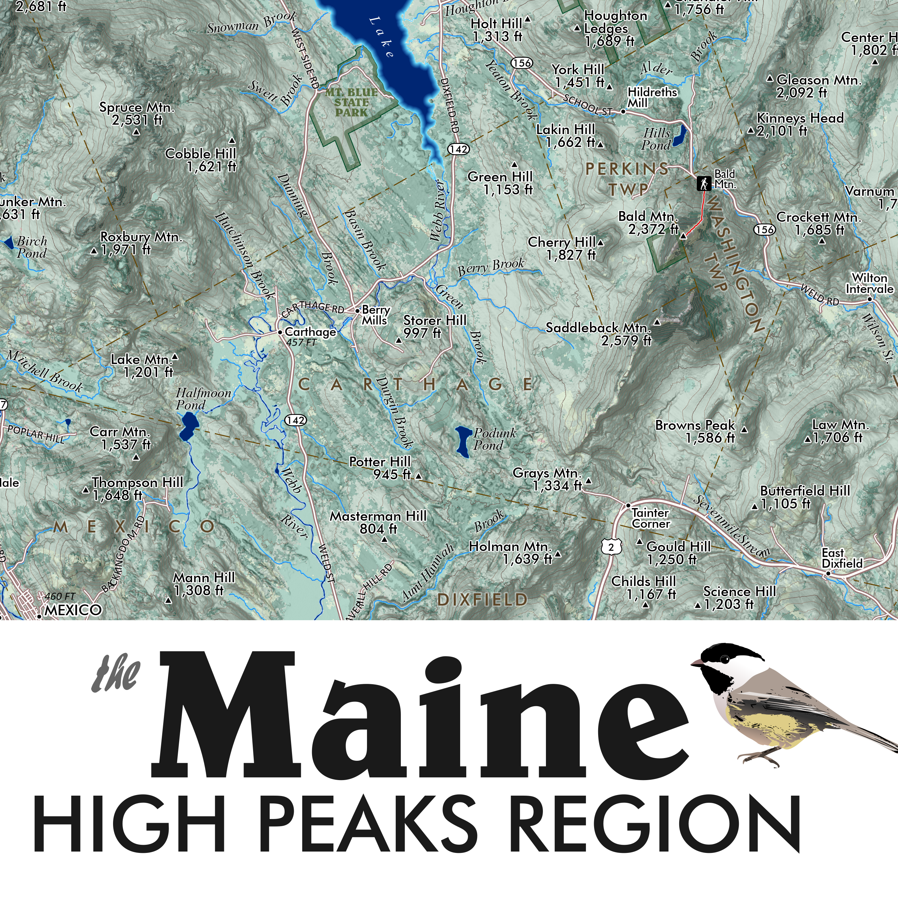
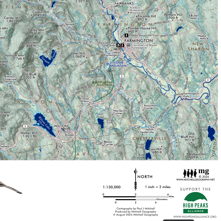
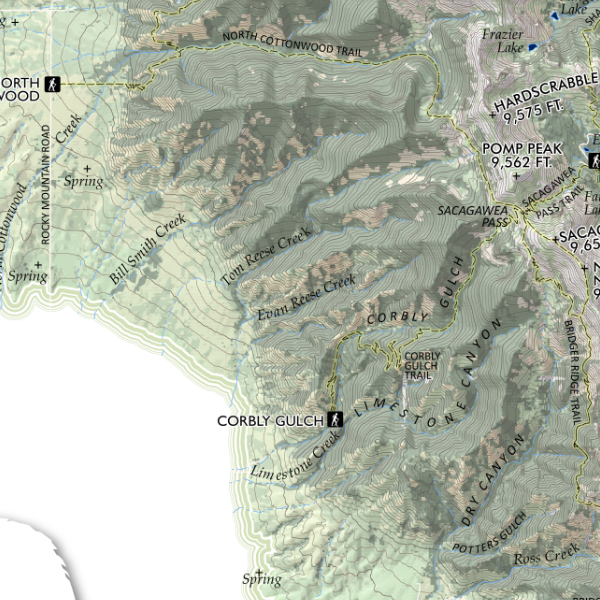
Bridger Range, Montana. Map of the Bridger Range just northeast of Bozeman, Montana — featuring trails, named and provincial summits, canyons, streams, and other landform features. Nice detail of the alpine ski runs at Bridger Bowl Ski Area as well.
1:92,000
13 inch by 19 inch flat wall map printed on heavy fine paper. Packed and shipped flat.
Bridger Range, Montana. Map of the Bridger Range just northeast of Bozeman, Montana — featuring trails, named and provincial summits, canyons, streams, and other landform features. Nice detail of the alpine ski runs at Bridger Bowl Ski Area as well.