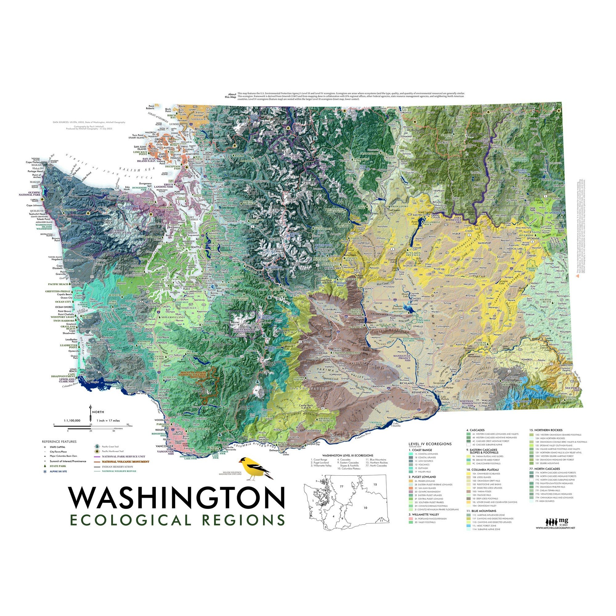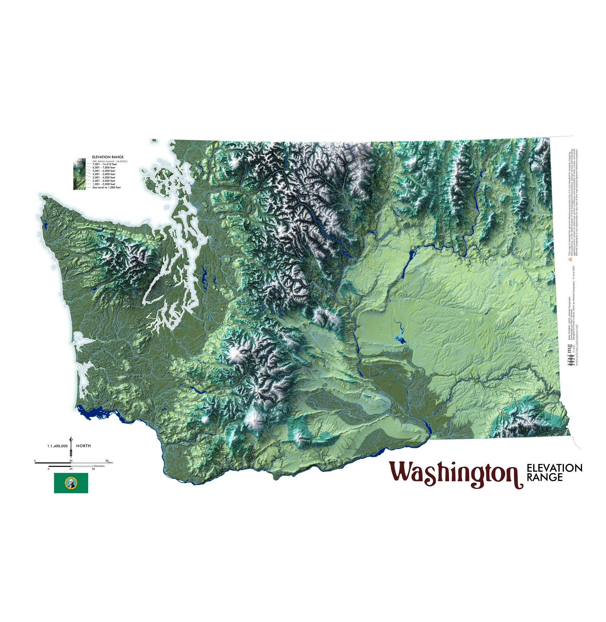
Washington Elevation Range
1:1,400,000
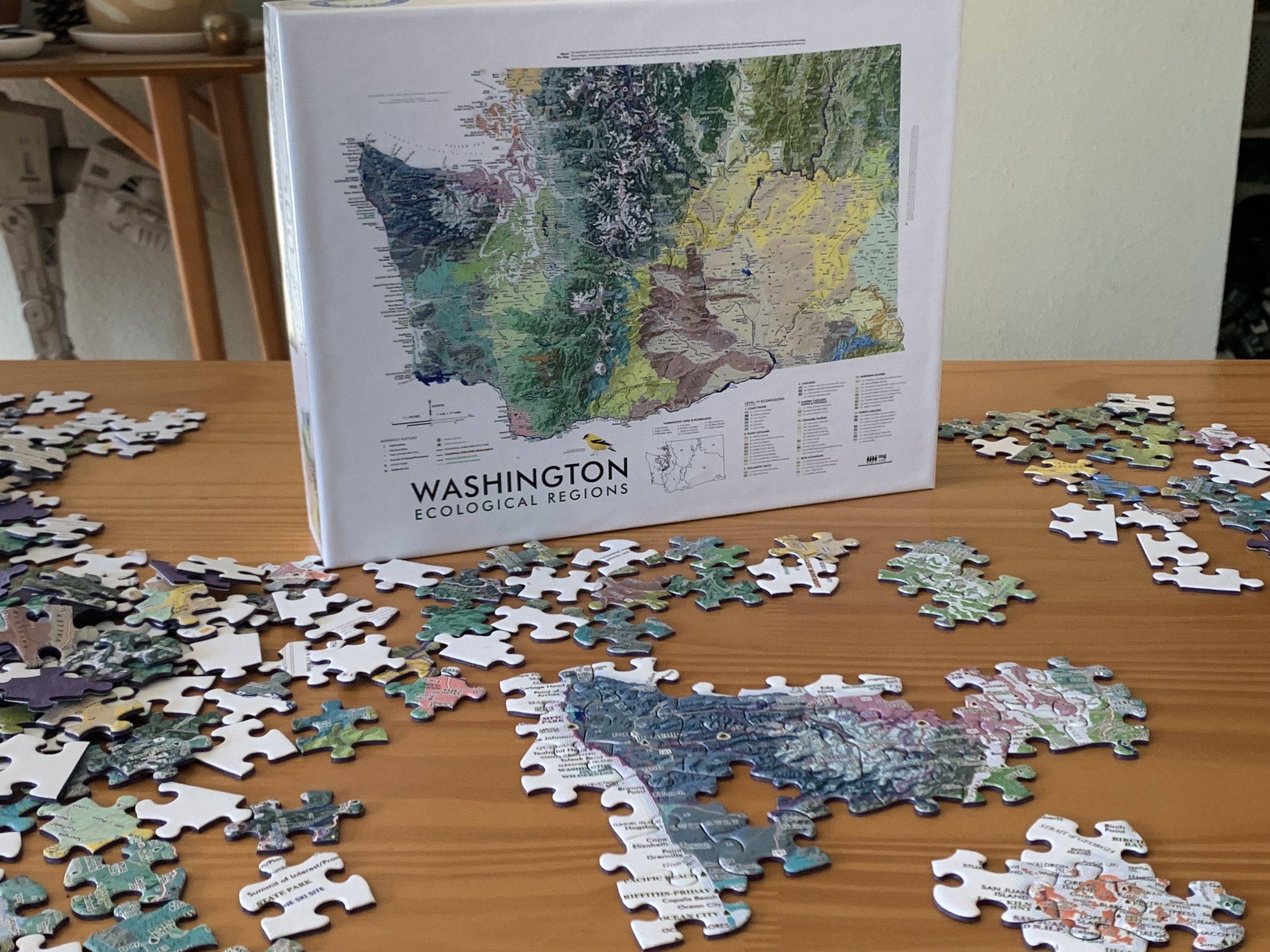
19 inch x 13 inch flat wall map (landscape format), printed on heavy fine paper. Shipped rolled or flat, order volume dependent.
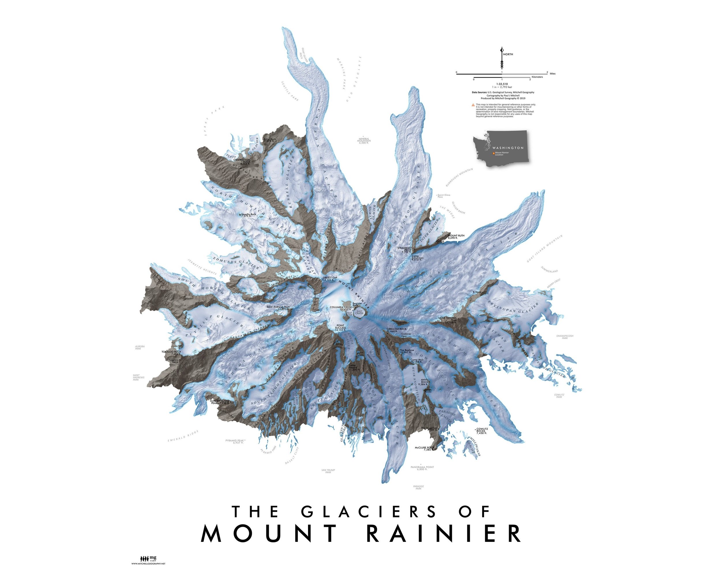
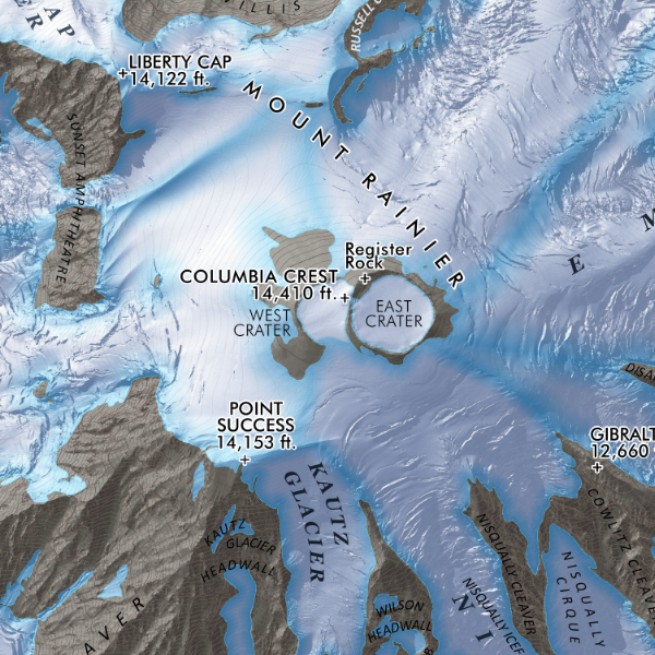
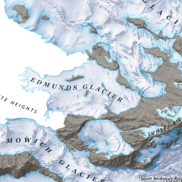
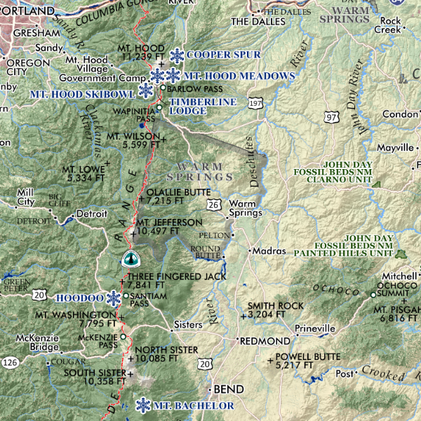
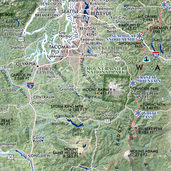
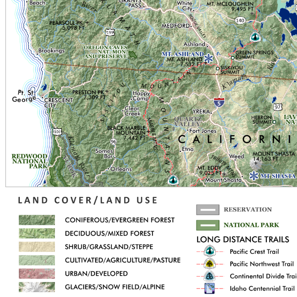
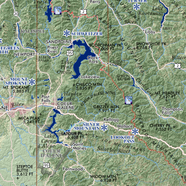
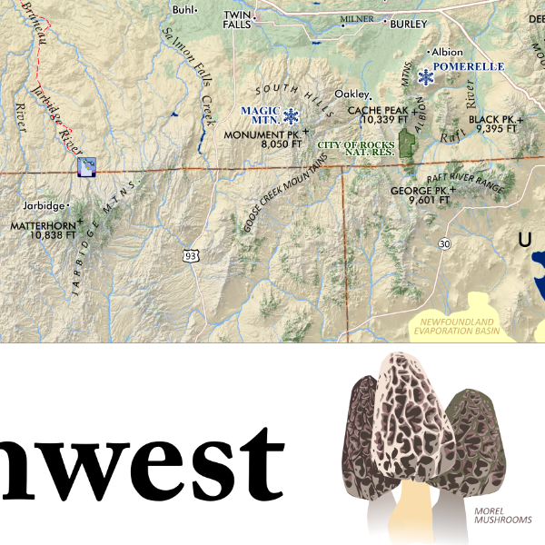
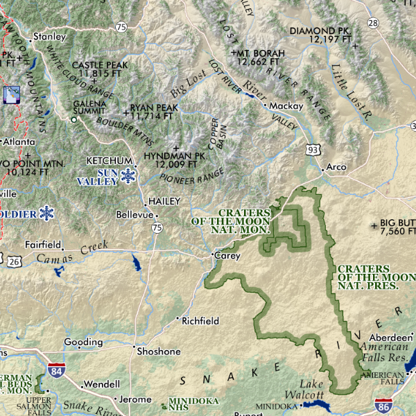
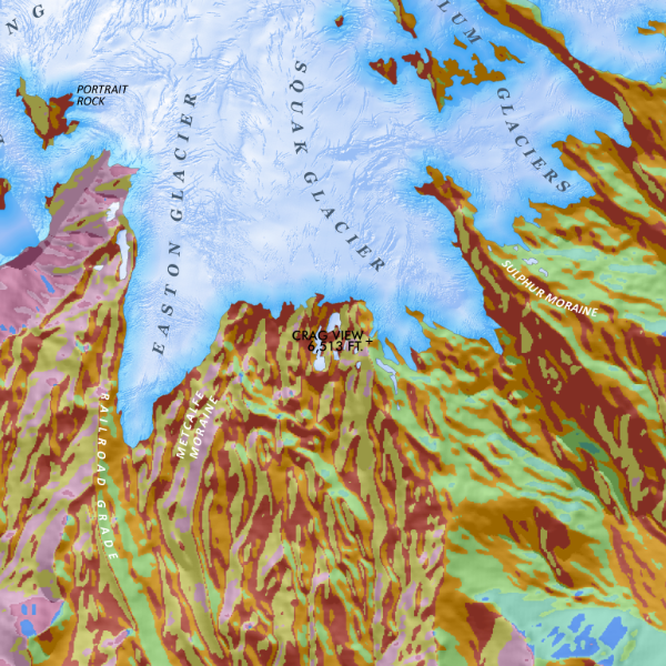
Washington State Elevation Range. Colorful elevation range map — elevation classes are at 1,000 foot intervals from sea level to 7,000. Greater than 7,000 through 14,410 on Mt. Rainier is treated as the alpine summit elevation class. Surface hydrology and a tasteful coastal vignette are also included for spatial reference.
1:1,400,000
19 inch x 13 inch flat wall map (landscape format), printed on heavy fine paper. Shipped rolled or flat, order volume dependent.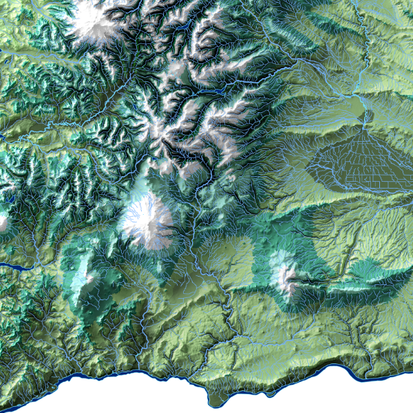
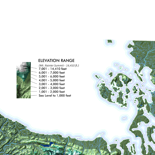
Washington State Elevation Range. Colorful elevation range map — elevation classes are at 1,000 foot intervals from sea level to 7,000. Greater than 7,000 through 14,410 on Mt. Rainier is treated as the alpine summit elevation class. Surface hydrology and a tasteful coastal vignette are also included for spatial reference.