

Wild Rogue River (19 in x 13 in)
1:97,500
13 inch by 19 inch flat wall map, printed on heavy fine paper. Packed and shipped flat.
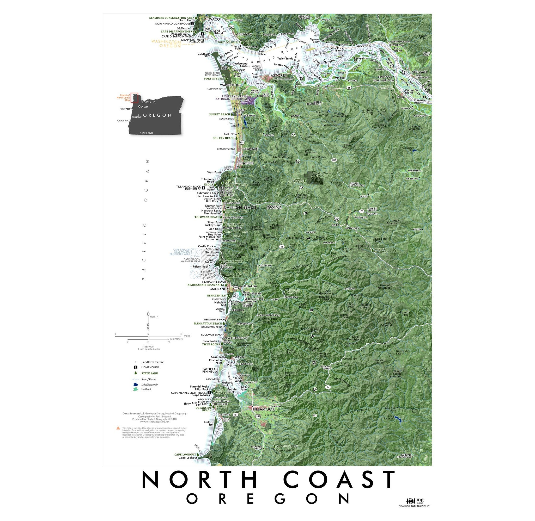
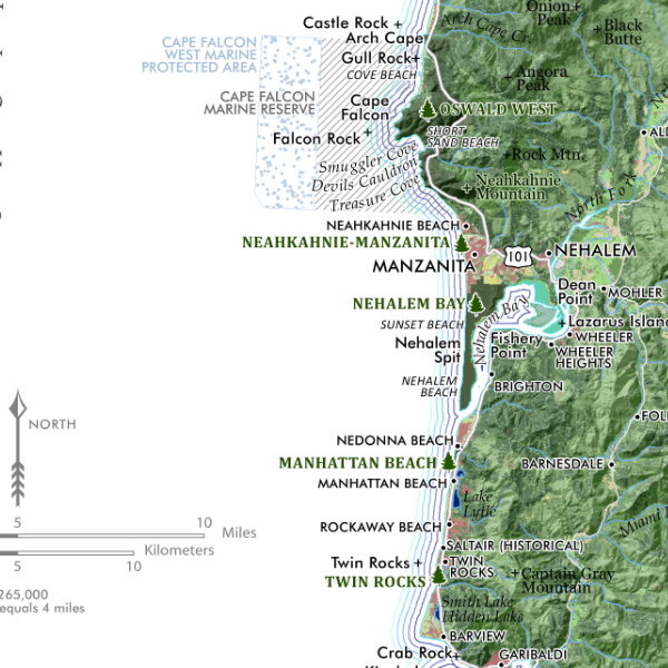
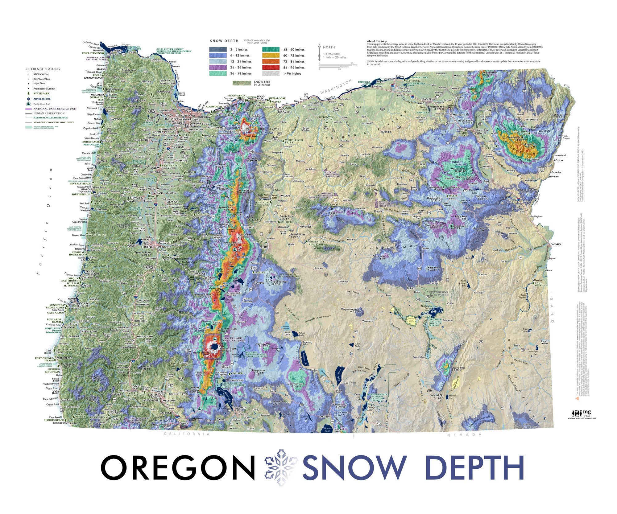
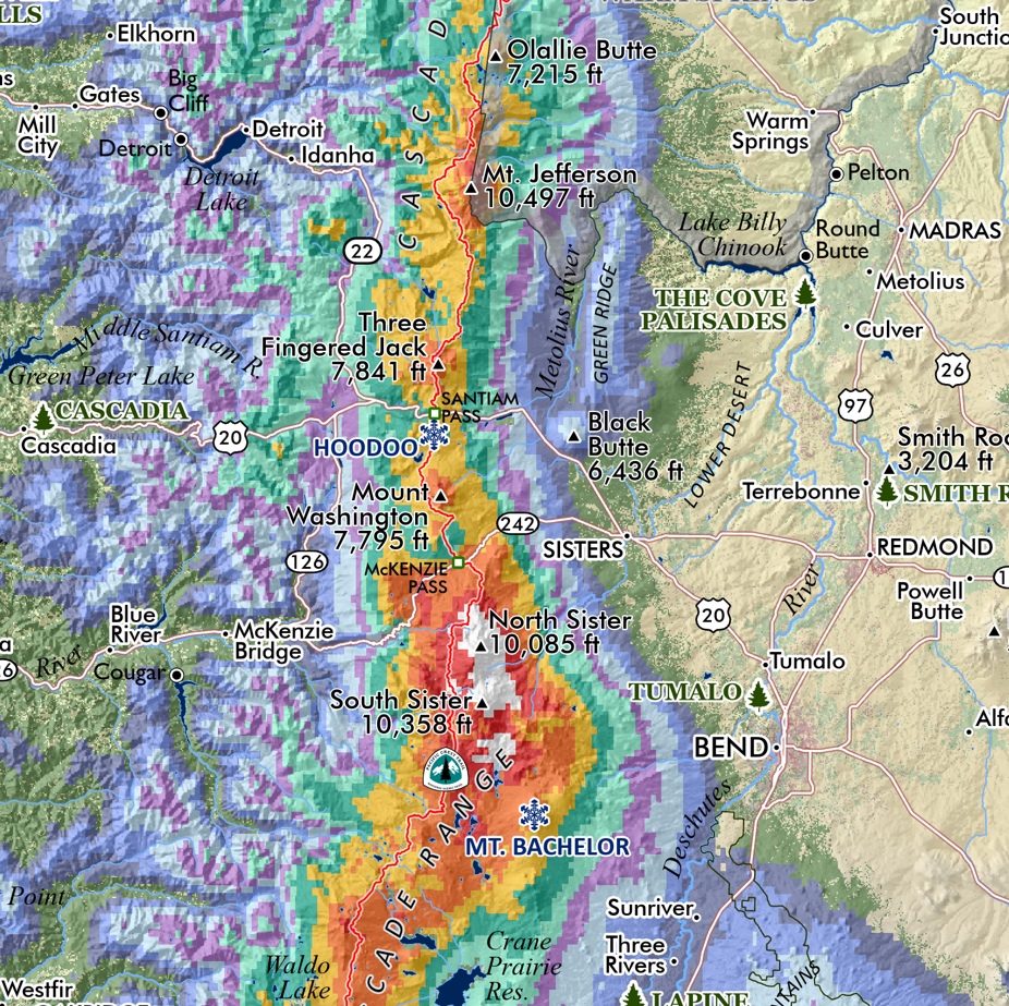
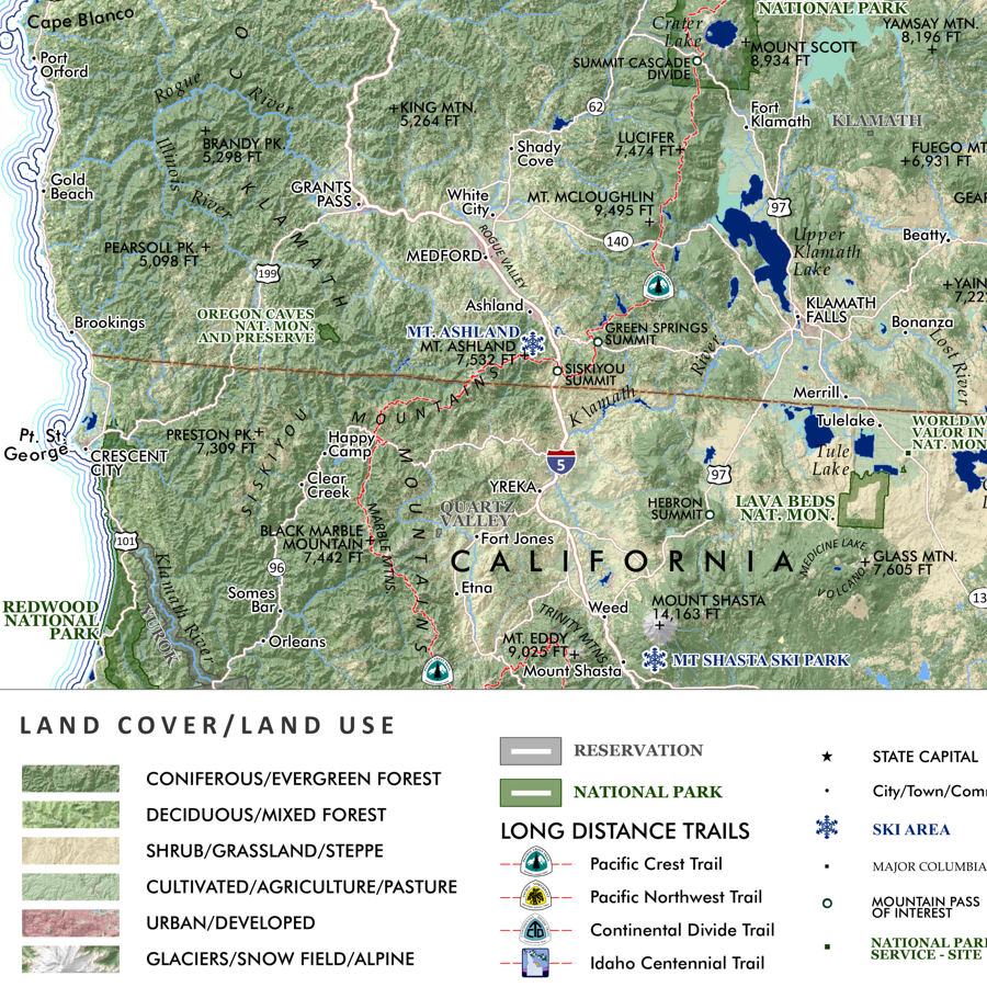
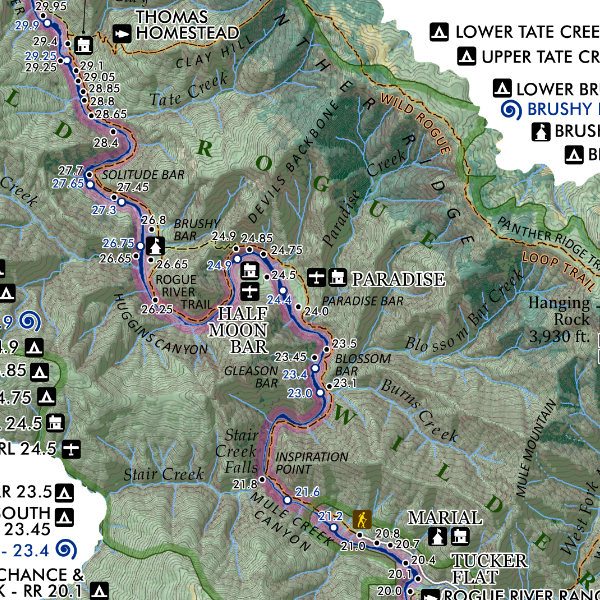
Wild Rogue River, Oregon. Feature wall map of the federally designated Wild section of the Rogue River, and the 8 or so miles upstream from Galice to the put in at Grave Creek. River features, features of interest such as campsites, lodges, etc. are included for reference. Hiking Trails including: Rogue River, Wild Rogue Loop, Panther Ridge, and Rainie Falls and designated hiking campsites are also included.
1:97,500
13 inch by 19 inch flat wall map, printed on heavy fine paper. Packed and shipped flat.
Wild Rogue River, Oregon. Feature wall map of the federally designated Wild section of the Rogue River, and the 8 or so miles upstream from Galice to the put in at Grave Creek. River features, features of interest such as campsites, lodges, etc. are included for reference. Hiking Trails including: Rogue River, Wild Rogue Loop, Panther Ridge, and Rainie Falls and designated hiking campsites are also included.