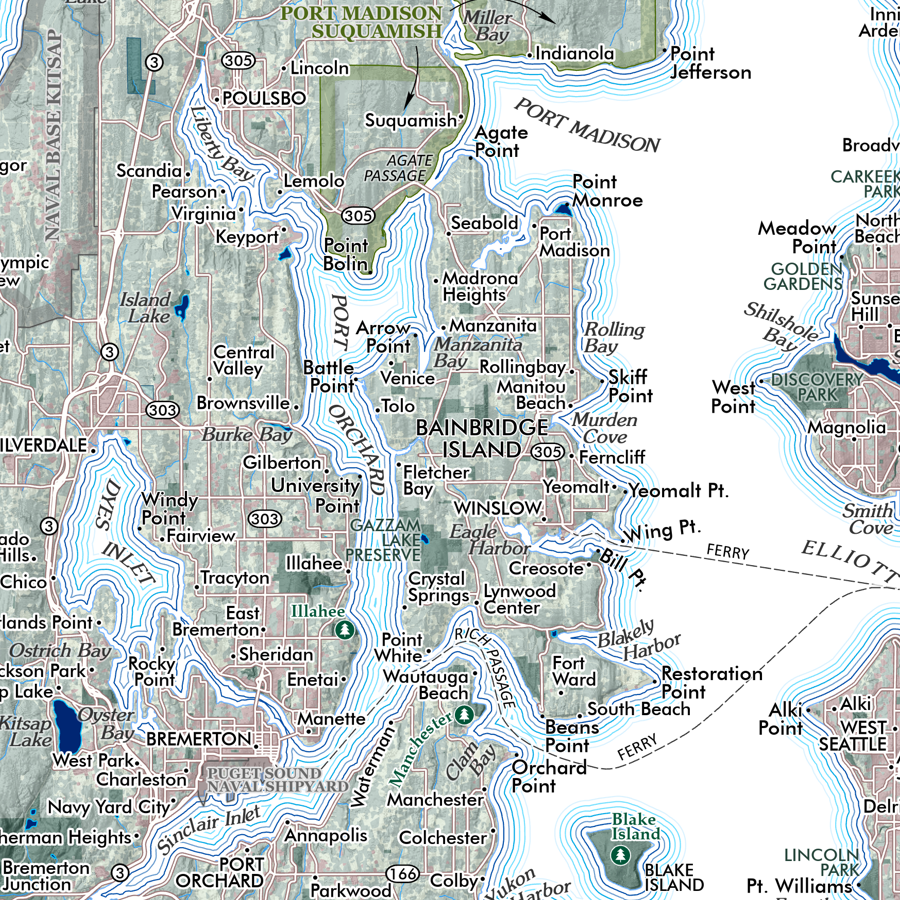
 Image 1 of 3
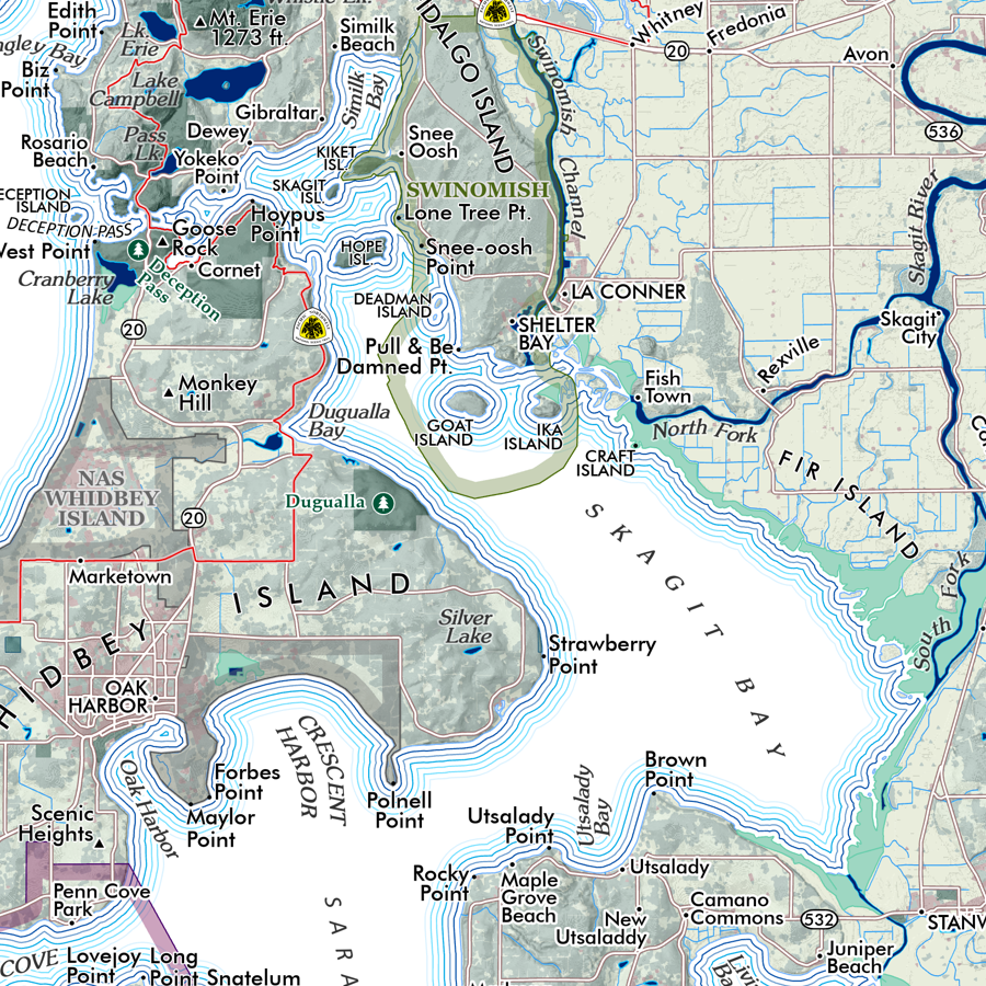
 Image 2 of 3
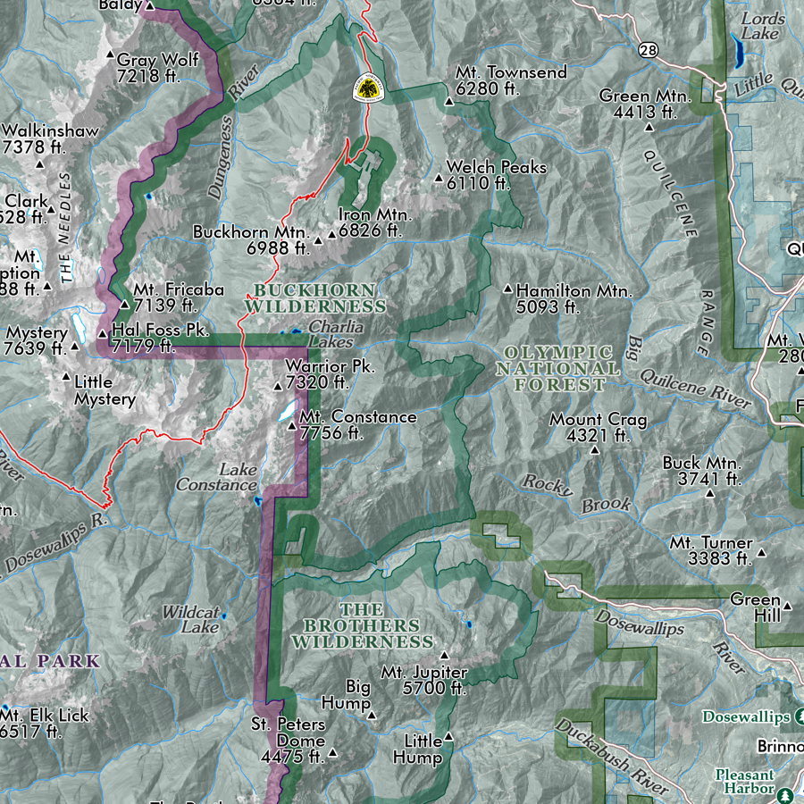
 Image 3 of 3
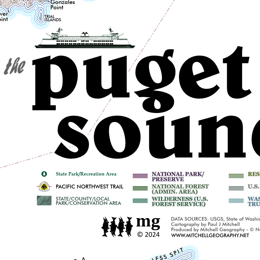
1:27,750
13 inch by 19 inch flat wall map, printed on heavy fine paper. Packed and shipped flat.
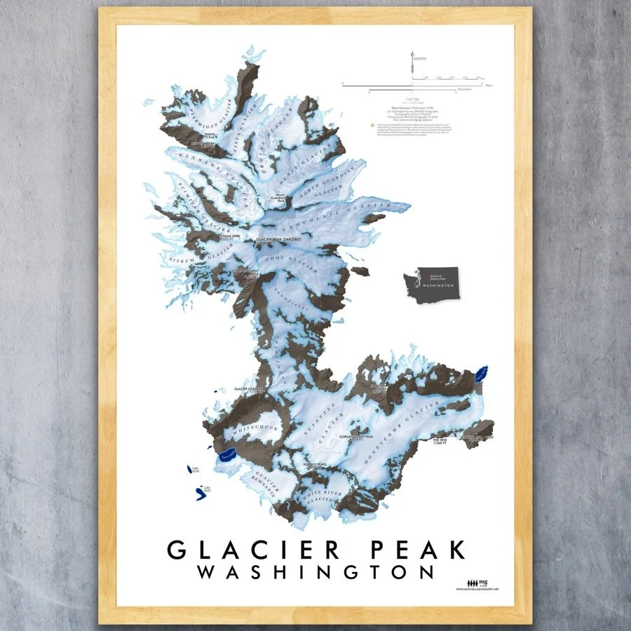
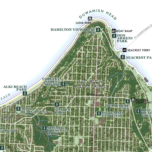
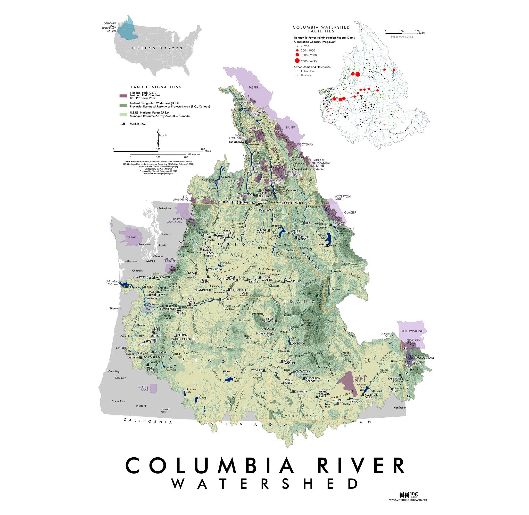
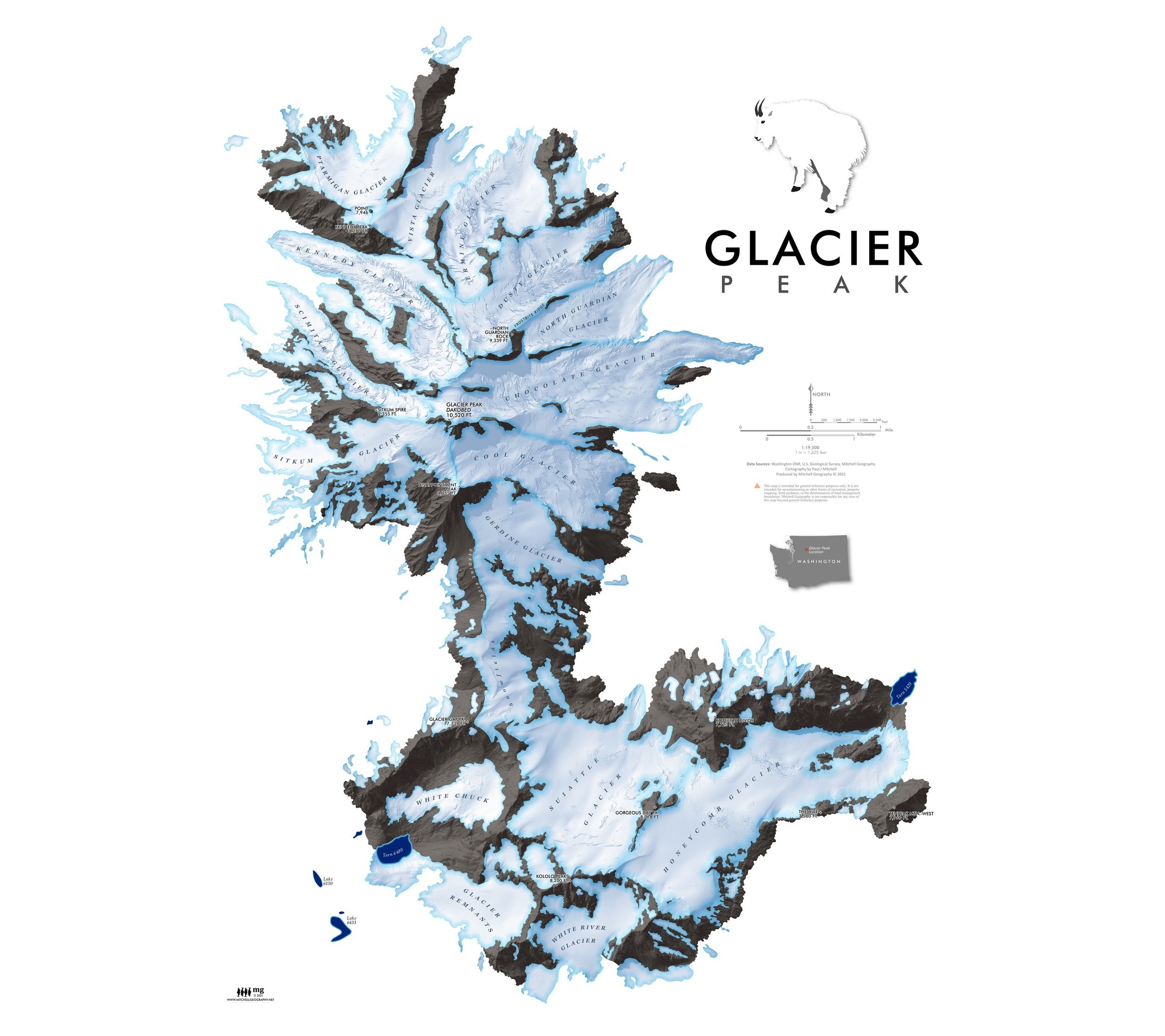
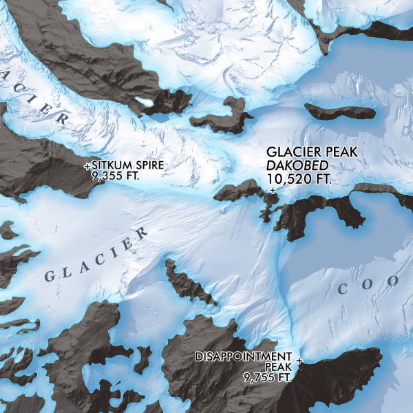
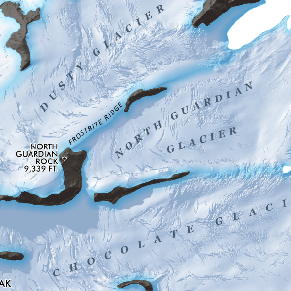
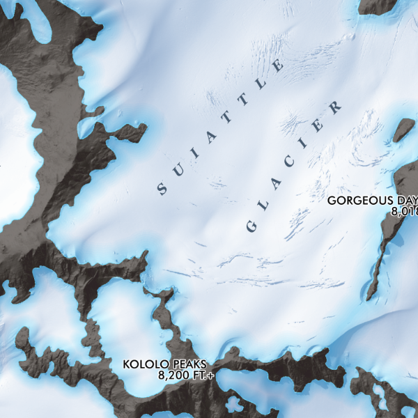
Glacier Peak, Washington (13 x 19 inch version). Feature map of the alpine landscapes of Glacier Peak south to the Kololo Peaks, including the glaciers, large snowfields and glacier remnants delineated with Washington State’s DNR published 3 foot lidar bare earth model.
1:27,750
13 inch by 19 inch flat wall map, printed on heavy fine paper. Packed and shipped flat.
Glacier Peak, Washington (13 x 19 inch version). Feature map of the alpine landscapes of Glacier Peak south to the Kololo Peaks, including the glaciers, large snowfields and glacier remnants delineated with Washington State’s DNR published 3 foot lidar bare earth model.


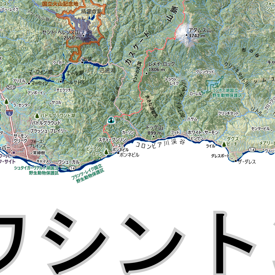
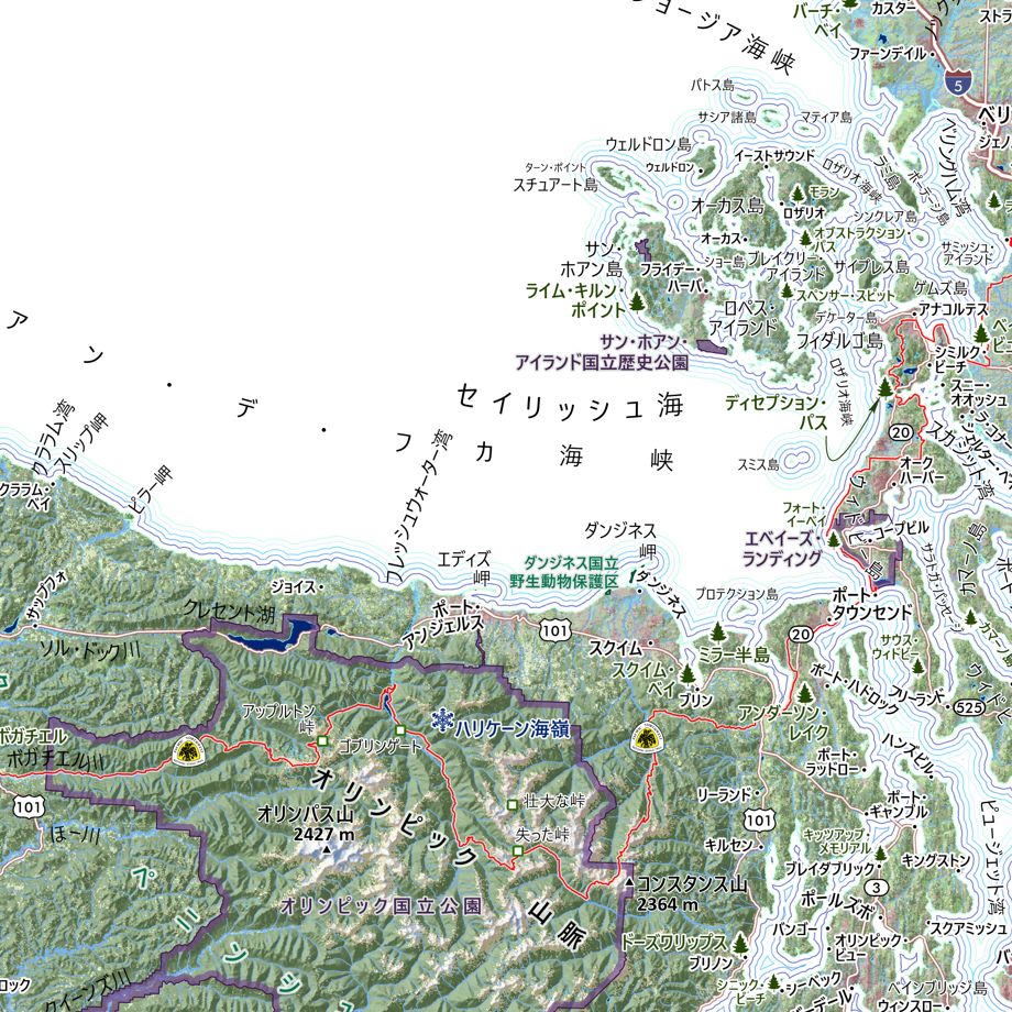
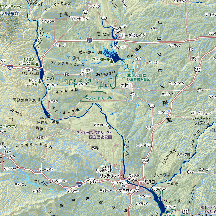
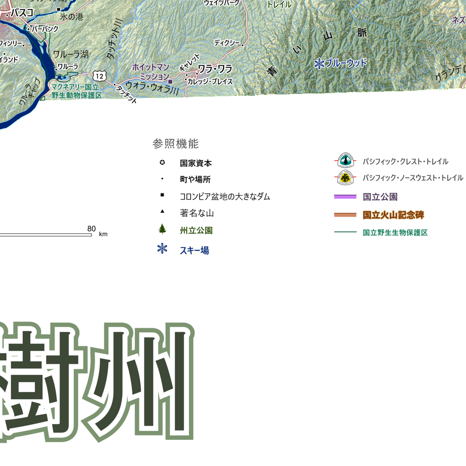
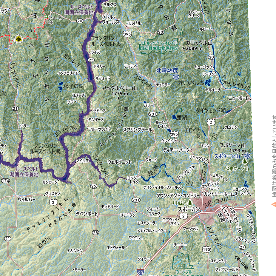
![Washington [Japanese language] (24 in x 20 in)](https://images.squarespace-cdn.com/content/v1/64dfe5c447627a1ab4b29d07/1694699282568-VV2KAVQ0SIU2BF6VIE2J/WA_JA_framed.JPG)