Mt. Mansfield Vermont (19 in x 13 in)
1:24,000
13 inch by 19 inch flat wall map, printed on heavy fine paper. Packed and shipped flat.
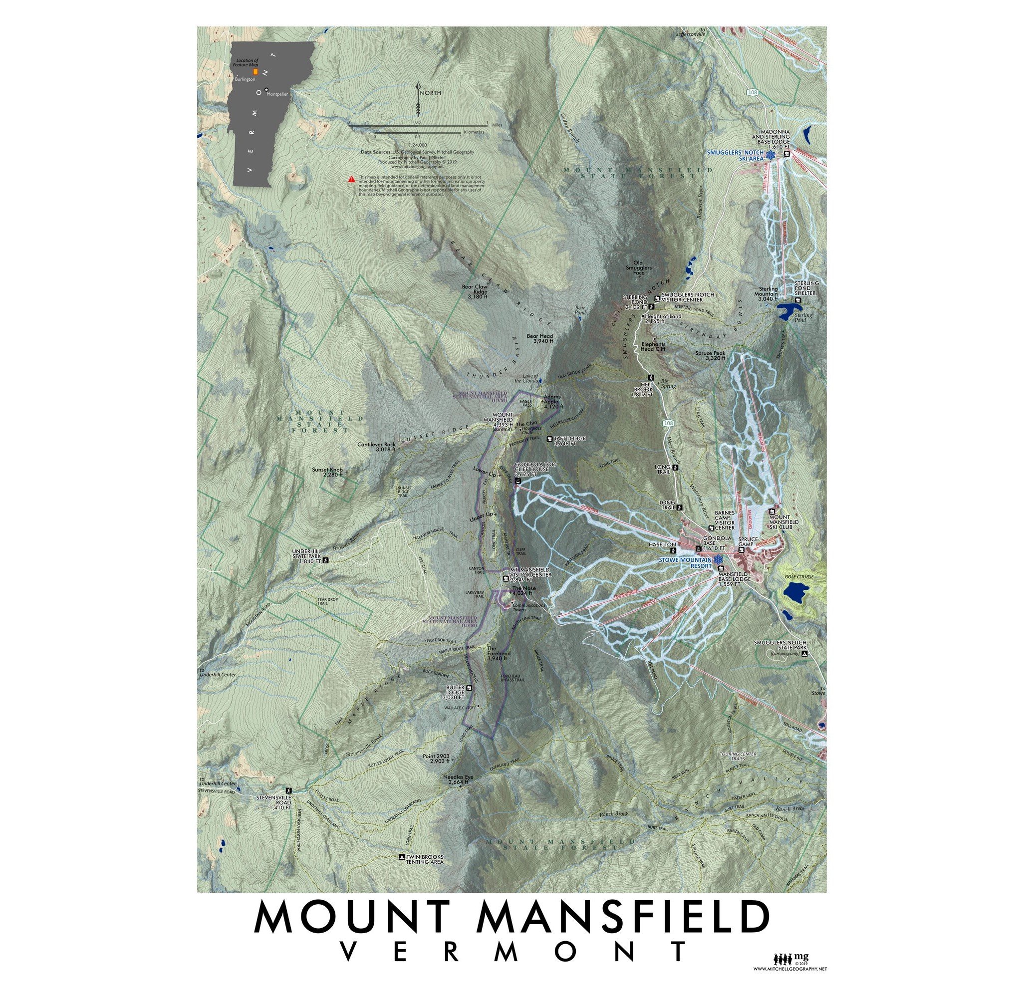
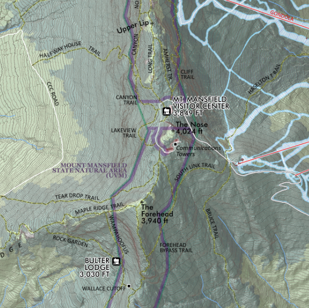
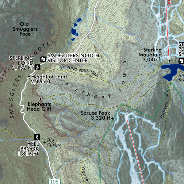
Mount Mansfield, Vermont. Feature map of Vermont’s highest alpine topped summit, and the adjacent Smugglers Notch vicinity. Trails, hiking access points, ski slopes, huts and lodges, and other places of interest are included and labeled.
1:24,000
13 inch by 19 inch flat wall map, printed on heavy fine paper. Packed and shipped flat.
Mount Mansfield, Vermont. Feature map of Vermont’s highest alpine topped summit, and the adjacent Smugglers Notch vicinity. Trails, hiking access points, ski slopes, huts and lodges, and other places of interest are included and labeled.